You are using an out of date browser. It may not display this or other websites correctly.
You should upgrade or use an alternative browser.
You should upgrade or use an alternative browser.
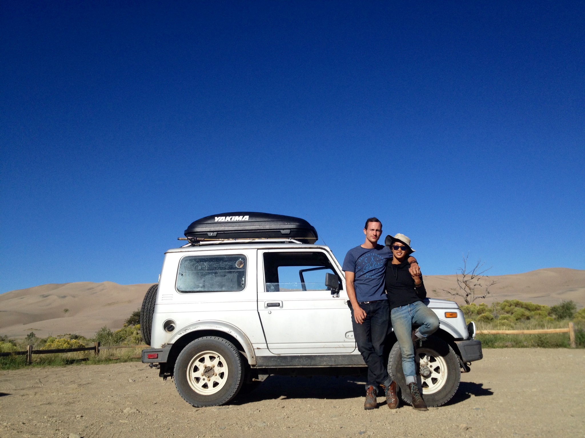
Trans America Trail in a stock Suzuki Samurai Tin top
- Thread starter houndofmeath
- Start date
But the official start is in TN (Tellico)? Has a section been added?
The original TAT starts in TN. Other people have added a route that runs from New York State down to TN. There is also an alternate west end. Instead of going up to Oregan, you can cut south past Las Vegas and run to Los Angles.
houndofmeath
Observer
http://arrowswest.com/2014/09/18/side-trip-to-the-great-dunes/
We are actually pretty close to done the trip, just SUPER behind on blogging. We need our own antenna for cell phone and wireless service or something. Check it out though! updating as much as possible!
We are actually pretty close to done the trip, just SUPER behind on blogging. We need our own antenna for cell phone and wireless service or something. Check it out though! updating as much as possible!
Scott Brady
Founder
Love the tin top. Good work. Proof the vehicle does not need to big or expensive for an incredible adventure!
utherjorge
Observer
Is there a good website to see simply what the route is south out of New York? My Google-**** is weak, and I couldn't find anything but a store to buy maps.
https://sites.google.com/site/gpskevin/tat-in-google-maps
At the bottom of the page you will see the New York and LA sections. If you click on them, they open the google map of the trail.
At the bottom of the page you will see the New York and LA sections. If you click on them, they open the google map of the trail.
houndofmeath
Observer
Thats the one! ^ I still would recommend buying the real maps from Sam though for the rest. Theres a lot more to them, and supporting it is always great. So we ran over a railroad spike while traveling on an old railroad grade in oregon. Don't wanna travel without another spare considering my luck so we're holed up a day. Gives us plenty of time to add to the blog! Yay!
houndofmeath
Observer
New one!
https://arrowswest.wordpress.com/wp-admin/post.php?post=667&action=edit&message=6&postpost=v2
Colorado is wild.
https://arrowswest.wordpress.com/wp-admin/post.php?post=667&action=edit&message=6&postpost=v2
Colorado is wild.
mtnbike28
Expedition Leader
Warning - says I am not allowed to edit this page.
New one!
https://arrowswest.wordpress.com/wp-admin/post.php?post=667&action=edit&message=6&postpost=v2
Colorado is wild.
houndofmeath
Observer
trrryyyyyyy thiiiisssssss?
http://arrowswest.com/2014/09/27/co...we-say-to-the-god-of-the-mountains-not-today/
Sorry about that!
http://arrowswest.com/2014/09/27/co...we-say-to-the-god-of-the-mountains-not-today/
Sorry about that!
jrnottarts
New member
Great read! How many miles did you cover per day? We are looking to do OK to OR but have no idea how much time it will take. Most of the estimates I've found are for motorcycles. :/
Hondarider
Adventurer
Colorful prose...improbable vehicle...breathtaking photos. All the ingredients of an outstanding trip report. I'm jealous. Thanks for sharing.
Forum statistics
Members online
- Diamond Jim
- Beowulf
- 38snubby
- Steamgauge24
- catronro
- Antwon412
- yondermountain
- Rallyroo
- mark5280
- Bergger
- Walrus
- McCarthy
- YukonMontanaTannerTrapper
- spurious
- Hoss1
- Cabrito
- enve77
- Gabe357
- red9xs
- spicoli6677
- ExploreBackcountry
- onthego
- pytheas
- EPO
- Randall Dee
- cyrusa
- gluceth
- 85_Ranger4x4
- Montana Cruiser
- jonyjoe101
- Jku1030
- Whitelotus369
- IdaSHO
- code3lg
- altitudewrench
- driveby
- jbtradingco
- TCM
- IdahoTider
- Squish69877
- WanderingBison
- pedalwrench
- Deerhunter13171820
- claymond
- Obsessed2findARuggedHybid
- grungeisdead
- CJD
- MTNWest
- PiggyBoys3
- Oldpilot1968
Total: 647 (members: 73, guests: 574)