Yetti’s Pacific North West Exploration & Expeditions Picture heavy

Pacific Northwest yetti

Expedition Medic
Of course, picture with the Ambulance. And the “mini guppy”

With enough power, anything will fly apparently...

IMG_20230924_113010_524.jpgIMG_20230924_115746_275.jpgIMG_20230924_115824_031.jpgIMG_20230924_120529_082.jpg


"The Mini Guppy, or "MG", was built with a swing-tail to facilitate cargo loading. It was powered by the original Pratt & Whitney R-4360 Wasp Major piston engines, enabling it to carry a maximum load of 32,000 pounds (14,500 kg), and cruise at 250 mph (400 km/h). Its cargo bay was 18 ft (5.5 m) in diameter, and a maximum of 91 ft 6 in (27.9 m) long, with a 73 ft 2 in (22.3 m) constant section. "
Vhttps://en.wikipedia.org/wiki/Aero_Spacelines_Mini_Guppy


This is also only about 15 mins away from the Tillamook Creamery. Always worth the stop. Enjoyed some wonderful dairy products, cheese curds, burgers, and ice cream. Then it was miles and smiles time.

https://www.tillamook.com/


Rainy all the way home.
 

AbleGuy

Officious Intermeddler
Great pics, thanks for posting.

Next time you go roaming in the opposite direction (SW) make sure to include a stop and see at the wonderfully curated Pima Air Museum im Tucson, along with the requisite visit to the huge, nearby airplane ”boneyard.”
 

YetiX

Active member
We have been to both the beach where you took the pups and driven past the museum. I've always wanted to stop at the museum but it seems we're always on our way somewhere when we pass by and don't have time to stop. Next time!
 

Pacific Northwest yetti

Expedition Medic
Great pics, thanks for posting.

Next time you go roaming in the opposite direction (SW) make sure to include a stop and see at the wonderfully curated Pima Air Museum im Tucson, along with the requisite visit to the huge, nearby airplane ”boneyard.”
AbleGuy, never knew that place was there. Its on my list now!! Seems like a great place to check out, + aircraft boneyard; whats not to like?!
I was in that area a few years ago when I had Deployment teams there.

X2 on Rockaway and the air museum.
Yeah, it was a nice little town. There were some other places on my list down there, Cape Meares, the Elk Flats trail, and Devils cauldrin. One of these days Ill just spend a few weeks on the coast and see all the things.

We have been to both the beach where you took the pups and driven past the museum. I've always wanted to stop at the museum but it seems we're always on our way somewhere when we pass by and don't have time to stop. Next time!
Right? There are a lot of times I drive by and say " next time" Especially when I was on contract. Truth is, there is a lot to see and only so much time. Maybe when we have string theory figured out and can walk through dimensions and time that will change. :p
The beach was just an afterthought as I did not want to drag a " not happy" 13yr old niece on a 4-mile hike in the rain. That would bugger it for everyone. So the Elk Flats trail was out.


And thanks all of you for your contribution. It’s always nice to know folks are interested.


I am starting to write down some of my more interesting work stores, from the remote and emergency services world. Just to have those, as some of them are still fresh ish in my mind. I don’t know if they will ever be used for anything. But its nice to have the option.
 

Pacific Northwest yetti

Expedition Medic
I have started to go through this thread, for perspective. And to fix the spelling and grammar errors. As well as fixing some of the photos that needed it.

I realized, I never did much on my time in Colombia.

Time Travel, Dec 2017

Colombia,

1st post, can be found here.


The Running From Monday Blog, is no longer up. So info that was once there is lost. We all piled into Kps single cab and away we went.

This will probably mostly be just pictures, and captions.

What google captured, you can guess a route-ish from these. As well as the Google Maps saved places.


Capture 2017.PNGCapture Dec google timeline 2017.PNG
I am going back through google photos, and FB to recover some of these.

I got to be a passenger princess for this trip, My brother driving, his wife in the middle and me in the passenger seat. We camped mostly with me hanging up a hammock between the FWC and a tree most nights. And most days we were moving. As I only had so much time off, and it’s a small space.

A tie out for your dogs outside one of the small stores,

IMG_20171207_101431.jpg
 

Pacific Northwest yetti

Expedition Medic
December 2017: I am not sure how long I had been up at that point, probably a long time.

27748333_2001934986714844_1752261133709501512_o.jpg

Spent a few days in Medellin, a beautiful city with so much History.

We used the tram to get to the main area from where the truck and camper were. I think* Al Bosque


We walked down to a bus stop, and then to the tramway. Lots of hills, and the Tram and view was not a bad one.

25299852_1976861735888836_455604094013815728_o.jpg25351889_1976863435888666_6621894442449924642_o.jpg

I don’t have many pictures of the tram, as they have been lost to time, technology, or maybe I was too dumb and young to appreciate it.

Medellin, is Colombia’s second largest city. With 2.569 million in 2020.

“Medellín is the capital of Colombia’s mountainous Antioquia province. Nicknamed the “City of Eternal Spring” for its temperate weather, it hosts a famous annual Flower Festival. Modern metrocables link the city to surrounding barrios and offer views of the Aburrá Valley below. Sculptures by Fernando Botero decorate downtown's Botero Plaza, while the Museo de Antioquia displays more of the Colombian artist’s work. “ * google


25310973_1976861979222145_868037325869854626_o.jpg

Above, is Taylor and Myself enjoying the view and people watching in the square.
25311247_1976863262555350_4205865440366860992_o.jpg25351962_1976863225888687_4687312787092847580_o.jpg25358548_1976863279222015_6852701245076954236_o.jpg

Plaza Botero, and the 23 sculptures by Fernando Botero. He is known for a specific look, the statues were cool to see.

https://medellinguru.com/plaza-botero/
 

Pacific Northwest yetti

Expedition Medic
December, 2017


We visited the lakes District and El Peñón de Guatapé.

The lakes district was beautiful, reminded us a lot of lake of the Ozarks in Missouri.
“The Rock of Guatapé (Spanish: El Peñón de Guatapé)[1][2] (Tahamí language: Mojarrá) is a landmark inselberg in Colombia. It is located in the town and municipality of Guatapé, Antioquia.[3] It is also known as The Stone of El Peñol, or simply La Piedra or El Peñol (La Piedra de El Peñol),[2] as the town of El Peñol, which borders Guatapé, has also historically claimed the rock as their own and thus has led to different names for the site.
The landform is a granitic rock remnant that has resisted weathering and erosion, likely as result of being less fractured than the surrounding bedrock. The Peñón de Guatapé is an outcrop of the Antioquia Batholith[3] and towers up to 200 meters (656 feet) above its base. Visitors can scale the rock via a staircase with 708 steps built into one side. There is an entrance fee of 25,000 Colombian pesos in order to climb to the top of the rock.”


We did climb, the steps and checked out the view.

27907714_2001930780048598_1875295901165545335_o.jpg
We stopped at a little place next to the road on the way down, after all we had all worked up quite an appetite.


FB_IMG_1601737960738.jpgFB_IMG_1601737970971.jpgFB_IMG_1601737974962.jpg

My Brother Kp and I.
FB_IMG_1601737978458.jpgFB_IMG_1601737982035.jpgFB_IMG_1601737987883.jpg
 

Pacific Northwest yetti

Expedition Medic
December, 2017. Lakes District, Colombia


I am going to try and not share any pictures that I already have, no promises though.

They were doing some paragliding, over the lakes district. Unfortunately, It was not going to fit in the schedule on this day. With plans to do some cave diving/hiking/spelunking/and rafting all in one shot the next day.

FB_IMG_1601736741956.jpg

Its always nice to have things named after you ^^
image-2017-12-07-15-32-07.jpg


This was the camping spot right after the Rock.
image-2017-12-07-15-32-44.jpgimage-2017-12-07-15-34-18.jpg

Kp trying his hand at ( hand line) fishing, No dice today.
image-2017-12-07-16-36-52.jpg
 

Pacific Northwest yetti

Expedition Medic
December, 2017. Somewhere in Colombia.


We continued down Routa 60, heading south toward Bogota. Curvy mountain roads, and tiny towns. Coffee at every gas station, they would bring it out on a little tray when we filled up.


We had a plan to do some rafting, hiking as well as splunking.


Rio Claro, Reserva Natural Canyon Del Rio Claro.


You have to use a service, and we choose Aventura y Naturaleza Rafting Río Claro Doradal

https://maps.app.goo.gl/w7c5u3SQ6L8BV8STA


We found a spot to camp less than a mile down the road, I don’t remember the name. It was backed by the river, and had a large lot. With a few other locals camping. This would allow us to walk to the start, then when the raft goes by before the take out, we could just jump out. Was a good plan that worked well.


image-2017-12-09-05-51-37.jpgimage-2017-12-09-05-53-32.jpgimage-2017-12-09-05-59-08.jpgimage-2017-12-09-05-59-26.jpgimage-2017-12-09-05-59-51.jpg

This is a 360 view
P_20171209_055503_PN.jpg


It was a great camp spot, the bugs were horrible though. I ended up not putting my bug net around the hammock that night, and never made that mistake again. I was not shy with the bug goop either. We spent a few nights here.
image-2017-12-09-06-07-28.jpg
 

Pacific Northwest yetti

Expedition Medic
December, 2017 Rio Claro Colombia


Colombia, has a pretty healthy middle class compared to many other Latin American countries. So the locals are pretty active with tourista things. With something like 28% of the population being middle class. And 50% or so in the United States.

”In Colombia the numbers are different. A household can be considered middle class if it earns between US$300 and US$850 per month, which is US$10 and US$29 per day. Any household earning anything more that this is considered high class and will be located on the top 10% of the richest in Colombia.”

* https://en.wikipedia.org/wiki/Middle_class_in_Colombia#:~:text=In Colombia the numbers are,of the richest in Colombia.

1 USD = 4,082.185049 COP Sep 28, 2023 08:22 UTC


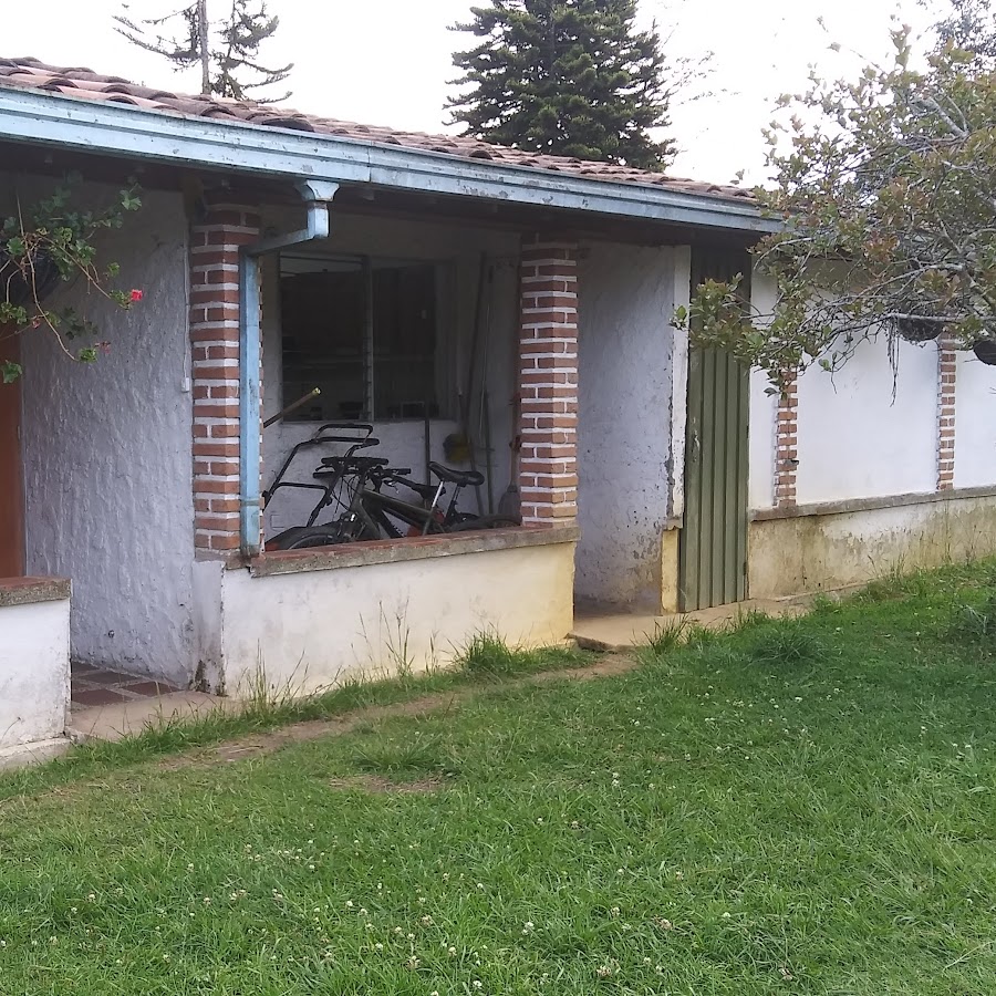
It is Jungle, so when it rains we would all pile into the FWC and play cards. My Eno Double nest sleep system also worked, very well. And when mixed with the fly and bug screen was a good place to relax, and read or watch movies that I had saved on my tablet.

DSC_0007.JPG


The next morning,
We geared up, and kind of geared down. As we were limited to what we could bring. They did not want any shoes that don’t close. So No flip flops. I ended up buying some water shoes there. And still use them to this day. They also did not really want anyone to bring phones. Although we snuck ours in with ID(s) in a small dry bag.

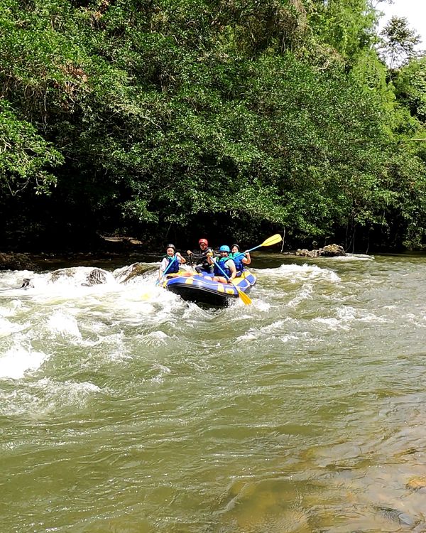
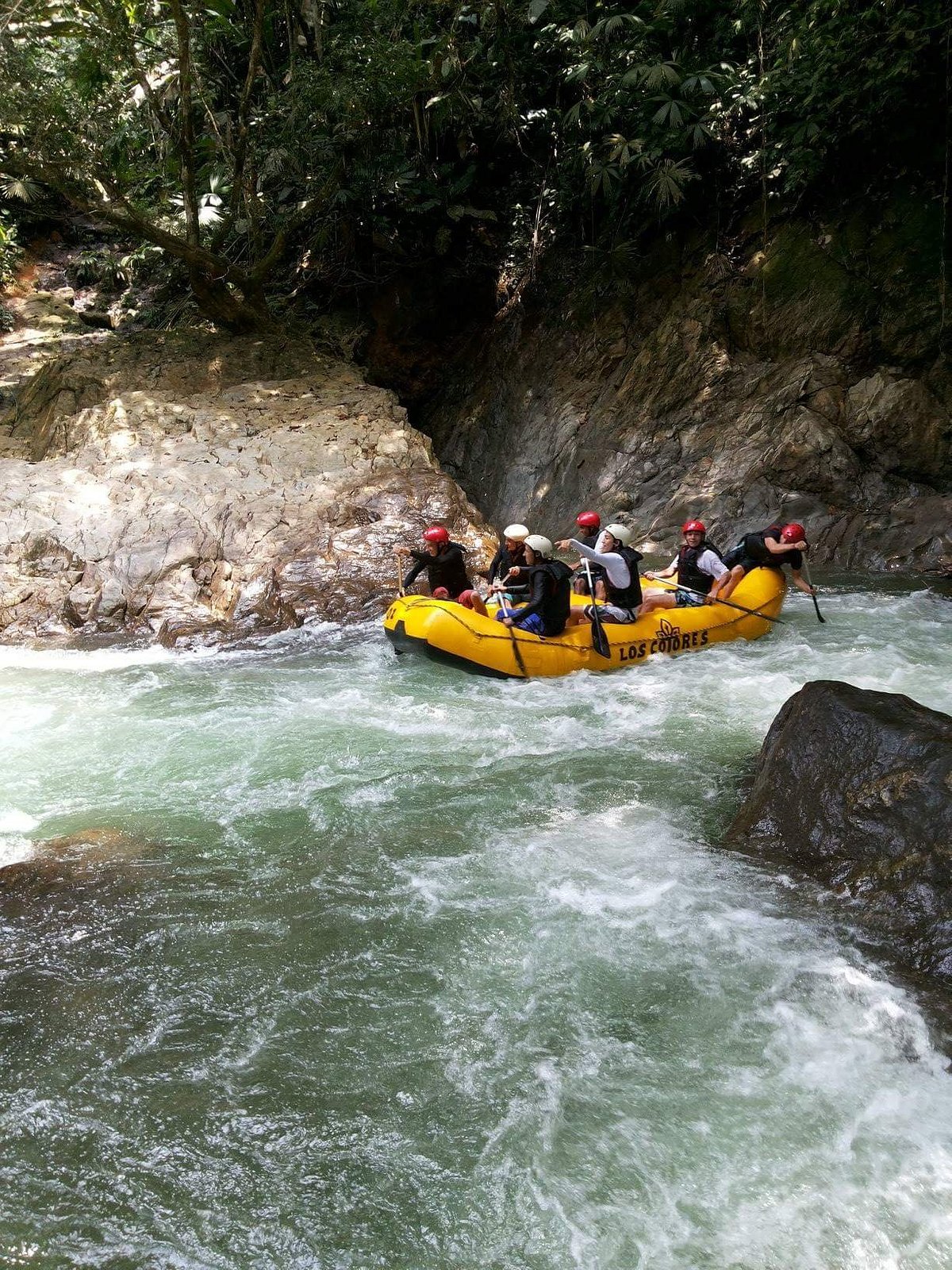
For a reason lost to time, : All the pictures from the go pro have never been found. So no pictures, *any posted for this were re appropriated off of google.*


https://www.google.com/search?sca_e...0KHcWHDE8Q0pQJegQIDRAB&biw=1920&bih=931&dpr=1


We signed some waivers, and then the guide did a very long safety talk, that I understood none of. But judging by the others in the group, it was done will with humor.

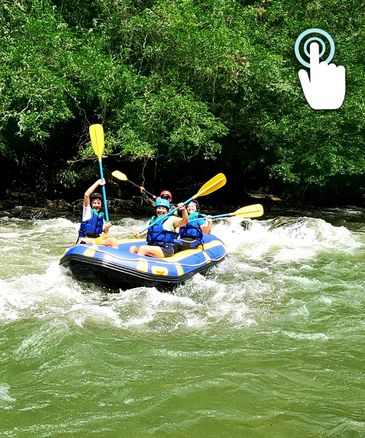
We began the hike, maybe ¾ mile, in a well-used jungle trail, and scramble/ steep climb another 1.4 mile up rocks after crossing the river, on a small suspension bridge. Passing where folks we jumping off a water fall, from a cave into the river. Where we would end. This particular group was mostly 20, somethings. And what looked like some college bros trying to impress the ladies in the group. With things like, tripping each other on the trail, hitting each other with branches, and trying to get their buddies to place their hands in holes with scorpions and big ass spiders. Once we passed them on the narrow trail, it went much better.


2021-01-01.jpgacti004-663x590.jpgacti016-663x590.jpgcaption.jpgImagen5.png


On a side note, none of the ladies seemed impressed. The guide stopped often to take pictures of everyone with his camera.

It may be worth noting, that I can’t swim. Well I can’t float…. I have spent time on rivers, and running white water and haven’t died yet. I wonder if anything was important in the 45min long trail side safety briefing.

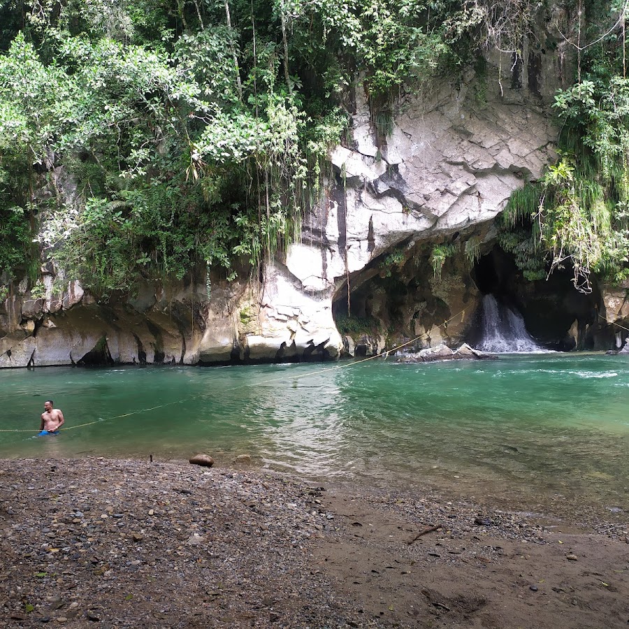
However, my family knows that, and we all had to have life jackets on. We eventually hike away from the river and over a hill, that opens up to a large cave mouth. We all put on our life jackets, and helmets. And strap on our personally provided head lamps. I do love my black diamond head lamps, they are great. And into the dark we go.

Most places I was able to touch or grab on to something. It was very pretty inside, toward the end: there was a plunge, where we jumped off a waterfall into a deep pool, it was probably only a jump of 10 feet or so.

I tightened my gear” Chin to chest, arms crossed with nose pinched. Jumped, making sure to cross my ankles. It took about 23 Mississippi’s to pop back up. And Kp and Taylor probably thought I had died, as they both grabbed an arm from each side when I popped up. And I had bruises for a week. All was well.

To finish the tour, you can jump from the cave mouth, into the river. Or slide down, and then grab one of the ropes and pull yourself back across the river.


The guide again took pictures and videos of all of us as we did the things.
 
Last edited:

Pacific Northwest yetti

Expedition Medic
December 2017, Rio Claro Colombia.


I did not know this at the time, but the caves reminded me a lot of the marble caves in Patagonia: I would be riding a motorcycle too a year later. : Life can sure be funny at times.

We still had to go back to the trail head, and buildings. Making sure we got hooked up with the rafts, which were to be our ride home on the river.

We all signed the paper being passed around with our numbers, and whats app info. However, none ever came.

* We later learned the guides, were doing the pictures for tips on the side* We just missed that bit of info, unfortunately it was years later when talking to other travelers that we learned how that system was working.


The raft group was small. Myself, brother, and sister in law. W/ the guide, and 3 generations of local ladies. A grandma, her daughter, and her daughter. The youngest being late teens? The two other ladies sure enjoyed teasing her, and the gringos in the raft.

It’s a tame raft trip, I don’t really remember anything I would consider rapids. But there were probably some 1’s and 2’s.

I was on the right front, My brother the left front. Guide middle on the rear. With the Grandma directly behind me. I am not sure where Taylor and the other two ended up in relation.

I do remember, how I learned Left and Right in Spanish. As every time I got it wrong, the Abuela behind me would laugh, and ********** me lightly with her paddle. She also loved to try and push the other two ladies with her into the water, or into the gringos. None of it seemed mean, it was all quite playful. We just played along. Talking is overrated.

Izquierda= Left

Derecha = Right.

We all had a great time, with lots of teasing and embarrassing one another. It was a really fun group.

rs=w:365,cg:true


Once we got to the take out, we helped them load the raft. And tried to explain we were staying there. I think they eventually got it, when we walked up to the truck and camper and unlocked it.

rs=w:600,cg:true,m


rios-y-aventuras.jpg


* Please note, pictures in this post were from a google search on the location*
 

Pacific Northwest yetti

Expedition Medic
December, 2017. Colombia.

Next up is: Catedral de Sal de Zipaquirá
This was also the end of my time in country, as I had a flight out soon. We stayed at a hotel in Bogota. And had some great pizza at a famous place I dont remember. We all ate well, and had a good time. And with the exchange rate of 4000:1, it was very cheap. Right now, I am not remembering much about my flghts out.


“The Salt Cathedral of Zipaquirá is an underground Roman Catholic church built within the tunnels of a salt mine 200 metres underground in a halite mountain near the city of Zipaquirá, in Cundinamarca, Colombia. “

https://en.wikipedia.org/wiki/Salt_Cathedral_of_Zipaquirá


It is pretty touristy, and plays toward that. However, it’s still impressive, in History, size and function.

https://www.tripadvisor.com/Attract...aquira-Zipaquira_Cundinamarca_Department.html


25352061_1976863582555318_5317355834114830064_o.jpgFB_IMG_1601737350264.jpg

The Enterance ^
IMG_20171211_061637_panorama.jpg

^ The view from the rest area, we camped at the night prior.
IMG_20171211_125220.jpg

I am not sure, why I took this picture. The Lat and Long place it outside the entrance to the Cathedral. Colombia has no shortage of mountains. And this was my Original Suunto Core.
IMG_20171211_131119.jpgIMG_20171211_130012.jpg
 

Pacific Northwest yetti

Expedition Medic
Unfortunately, many of the pictures of the signage, did not turn out. Due to tricky lighting and all signs being behind glass.


The shrines, and crosses started as a way for miners to pray on their way to work, then a church was put in: So workers could work on Sundays.


IMG_20171211_104355.jpg


IMG_20171211_111006.jpgIMG_20171211_111024.jpg


The two pictures above, are of a reflecting pool, looking down into the water.

* ^
IMG_20171211_111200.jpgIMG_20171211_111208.jpgIMG_20171211_121248.jpgIMG_20171211_123038.jpgIMG_20171211_123046.jpgIMG_20171211_123147.jpgIMG_20171211_123313.jpg
 

Forum statistics

Threads
186,051
Messages
2,881,445
Members
225,825
Latest member
JCCB1998
Top