toddz69
Explorer
Last week an old Bronco buddy called to tell me he had traded his 911 Turbo for a new FJ and was eager to get out on the trails again. I had been wanting to run FR18, known to long-time central AZ backcountry explorers as "Red Creek", for a long time and with the trail's impending closure, we decided to venture out to test the FJ and see some great country as well. We were joined by our friend Doug, another Bronco buddy, and his nephew Andrew, riding Polaris quads instead of Doug's Bronco.
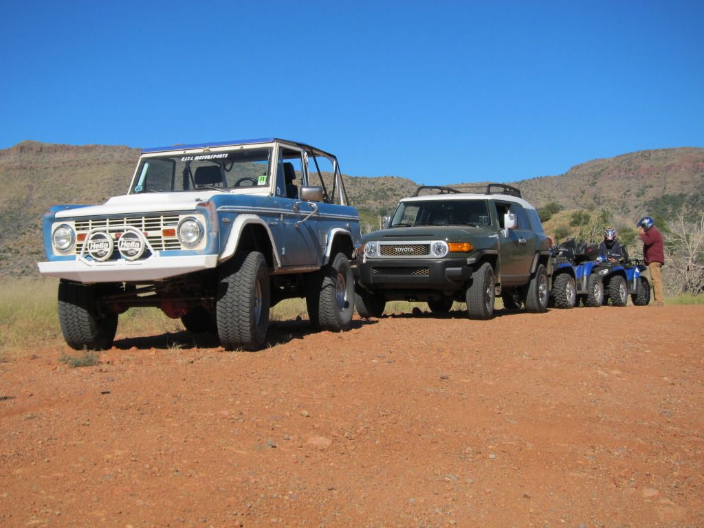
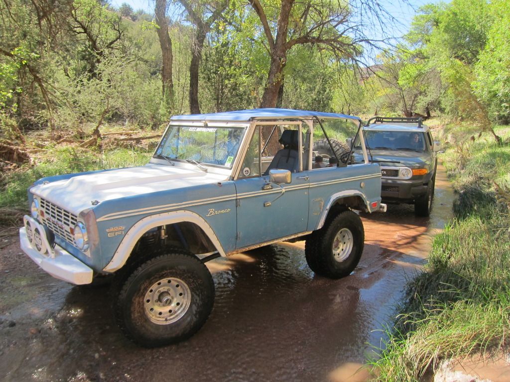
This was our vehicular lineup, staged on Bloody Basin Road (FR269), just east of I-17.
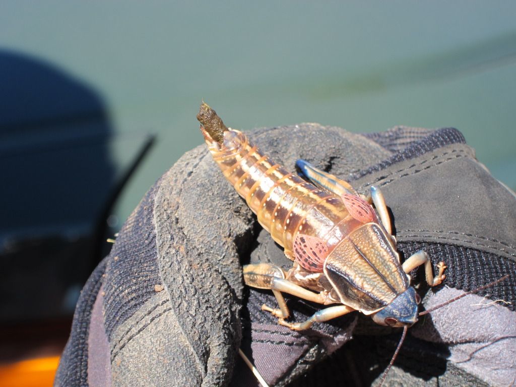
I'm not a fan of quads, but on today's run they proved to be quite handy once we reached the actual trail of interest. The trip east was rather uneventful, with the usual scourge of heavy dust nearly non-existent due to a fairly heavy rainfall a day or two earlier. We passed numerous hunting groups glassing far-away hills looking for game. At one point we stopped for a break and temporarily detained this small animal. Note what's coming out the back of this beast - apparently humans aren't the only ones that are scared xxxx-less.
One highlight on FR269 is cresting over the pass and seeing this beautiful view of Bloody Basin in front of you:
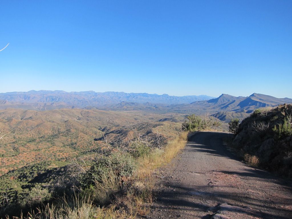
Bloody Basin draws its name from a skirmish between some Apaches and U.S. soldiers at Turrett Peak in 1873. In earlier times, the Hohokam had a presence in this area as well.
I depended on my memory (dangerous) to find the right turnoff for the trail and since I hadn't run it in probably 12 years or more, we did make one wrong turn which cost us a 45 minute delay. Thankfully, I think I was the only one crabby about it and after some backtracking we found the correct turnoff.
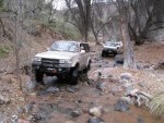
Traveling a few miles north on FR18 north of FR269, the descent into Red Creek is suddenly upon you and aired down tires and low range are the order of the day.
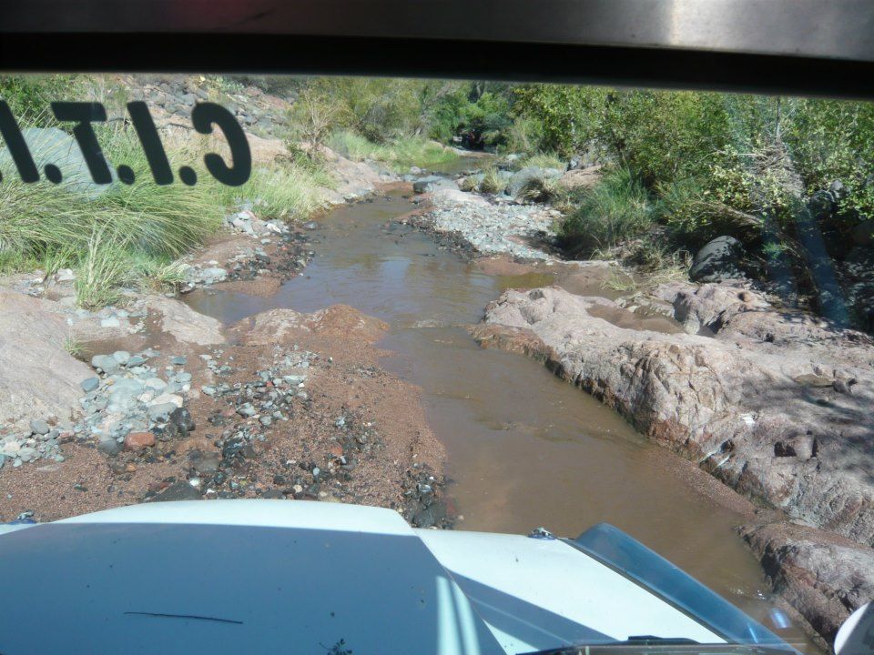
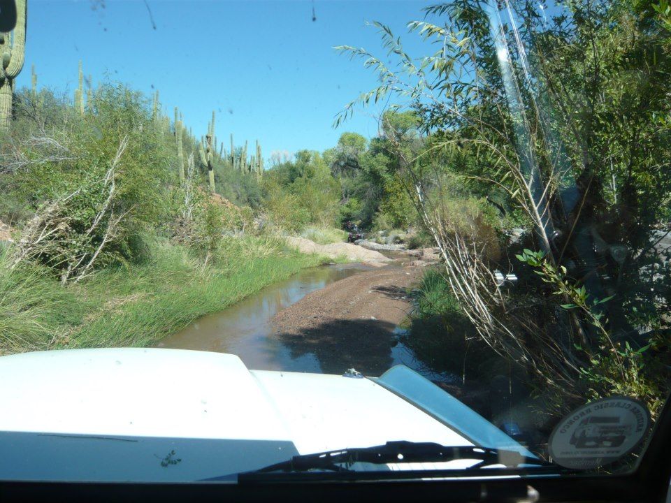
Shortly after dropping into the creek, your trail looks like this:
Here the quads came in handy, as the aforementioned rains had obliterated some of the route a day or two earlier. We sent them on ahead to check trail conditions as the Bronco and FJ lumbered on behind. After about 100 yards of crawling down the creek, Alex wisely decided to park the FJ and jumped in with me for the the rest of the day. Not worrying about clearance or paint eases one's mind.
From here, the trail continued east, in and out of the creek, with more water in our path than I've ever encountered on previous trips.
Here are a few cell phone photos from the route.
Unfortunately, from here to the river, we just drove and didn't get out to take pictures. The order of the day was plenty of brush, tight turns, and a few slippery pools that were deeper than I expected. Unfortunately, full-size vehicles just don't fit on this trail very well. Anything larger than a JK would have some challenges.
The trail itself is probably 4-5 miles long in the creek.
The rewards at the end, where Red Creek empties into the Verde River, are some great views of the Verde, beautiful camping spots in the trees, and plenty of areas to explore. Much of the surrounding area is wilderness.
The Verde:


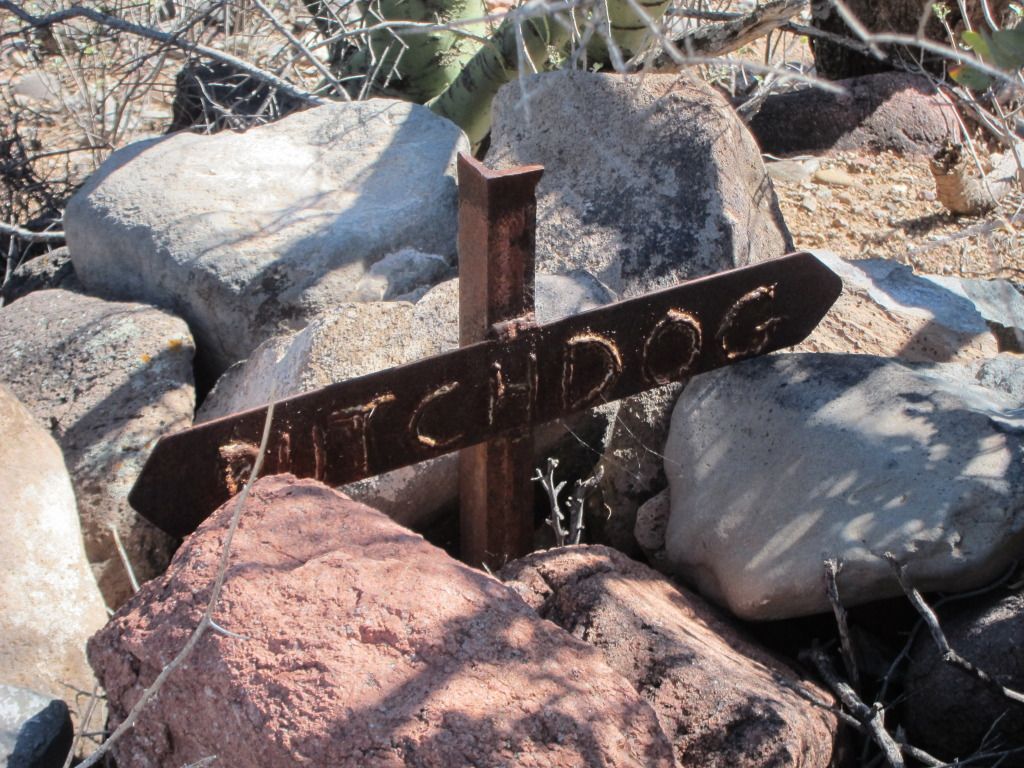
I climbed a nearby hill to find some old grave markers I remembered finding years ago. I couldn't find them amongst the abundant Native American diggings on the hill but I did find this interesting grave:
On a nearby mesa is, of all things, a remote airstrip (you can find videos on youtube of pilots landing there). Much to my surprise, there was a plane parked at the strip when we were there. I'd never seen one there before:

An overhead shot of our group:

I was pleasantly surprised to find the trail in the condition I did. It appears to have escaped the ravages of heavy ATV/4 wheel traffic which has worn down many of our trails in AZ in the past decade. Whether its relative remoteness, frequent 'erasure' due to water flows, or some other factors at play contribute to it, I'm certainly glad to see that it appears to be remain rather wild and remote.
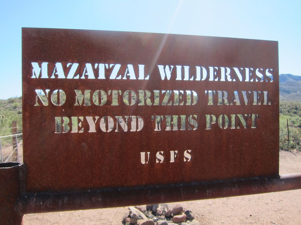
I don't know when the Tonto National Forest will officially "close" it, but I'd like to lead an ExPo run on it sometime later this year or early next year if folks are interested. It'll be a long day trip from the Phoenix/Prescott areas.
Anyone interested?
Todd Z.
This was our vehicular lineup, staged on Bloody Basin Road (FR269), just east of I-17.
I'm not a fan of quads, but on today's run they proved to be quite handy once we reached the actual trail of interest. The trip east was rather uneventful, with the usual scourge of heavy dust nearly non-existent due to a fairly heavy rainfall a day or two earlier. We passed numerous hunting groups glassing far-away hills looking for game. At one point we stopped for a break and temporarily detained this small animal. Note what's coming out the back of this beast - apparently humans aren't the only ones that are scared xxxx-less.
One highlight on FR269 is cresting over the pass and seeing this beautiful view of Bloody Basin in front of you:
Bloody Basin draws its name from a skirmish between some Apaches and U.S. soldiers at Turrett Peak in 1873. In earlier times, the Hohokam had a presence in this area as well.
I depended on my memory (dangerous) to find the right turnoff for the trail and since I hadn't run it in probably 12 years or more, we did make one wrong turn which cost us a 45 minute delay. Thankfully, I think I was the only one crabby about it and after some backtracking we found the correct turnoff.
Traveling a few miles north on FR18 north of FR269, the descent into Red Creek is suddenly upon you and aired down tires and low range are the order of the day.
Shortly after dropping into the creek, your trail looks like this:
Here the quads came in handy, as the aforementioned rains had obliterated some of the route a day or two earlier. We sent them on ahead to check trail conditions as the Bronco and FJ lumbered on behind. After about 100 yards of crawling down the creek, Alex wisely decided to park the FJ and jumped in with me for the the rest of the day. Not worrying about clearance or paint eases one's mind.
From here, the trail continued east, in and out of the creek, with more water in our path than I've ever encountered on previous trips.
Here are a few cell phone photos from the route.
Unfortunately, from here to the river, we just drove and didn't get out to take pictures. The order of the day was plenty of brush, tight turns, and a few slippery pools that were deeper than I expected. Unfortunately, full-size vehicles just don't fit on this trail very well. Anything larger than a JK would have some challenges.
The trail itself is probably 4-5 miles long in the creek.
The rewards at the end, where Red Creek empties into the Verde River, are some great views of the Verde, beautiful camping spots in the trees, and plenty of areas to explore. Much of the surrounding area is wilderness.
The Verde:
I climbed a nearby hill to find some old grave markers I remembered finding years ago. I couldn't find them amongst the abundant Native American diggings on the hill but I did find this interesting grave:
On a nearby mesa is, of all things, a remote airstrip (you can find videos on youtube of pilots landing there). Much to my surprise, there was a plane parked at the strip when we were there. I'd never seen one there before:
An overhead shot of our group:
I was pleasantly surprised to find the trail in the condition I did. It appears to have escaped the ravages of heavy ATV/4 wheel traffic which has worn down many of our trails in AZ in the past decade. Whether its relative remoteness, frequent 'erasure' due to water flows, or some other factors at play contribute to it, I'm certainly glad to see that it appears to be remain rather wild and remote.
I don't know when the Tonto National Forest will officially "close" it, but I'd like to lead an ExPo run on it sometime later this year or early next year if folks are interested. It'll be a long day trip from the Phoenix/Prescott areas.
Anyone interested?
Todd Z.
Last edited: