Kiddmen57
Supporting Sponsor
It always seems to be last minute. Thursday the 11th, a couple of co-workers decided to run the Gap Friday night, camp, and get home by noon on Saturday. I'd had the itch to get out since it had been a couple months dealing with the transmission on the jeep. With new transmission in and working, I really wanted to get out. I called the boss and got the OK. I was still humming and hawing about it, since it meant leaving her home alone with the baby overnight, which I try not to do to her (keeps me in good standing). That night I put the sleeping bag, camp chair, and a pad in the back of the jeep not knowing 100% if I would be heading out after work. Since my mom comes over on Fridays to watch the kiddo, I head home for lunch and decided to pack a cooler with food and beverages. I would be going after work. As I leave to go back to work, I notice the rear passenger tire on the jeep is considerably low. There is a sizable screw in the tire. Off to the local Discount Tire. After what seemed like an eternity waiting with the jeep in the bay, I get it back. It must have been a rather difficult spot as they even mentioned it took them longer than usual (about 1 hour total time). Now back to work for a couple hours before heading out into the northern foothills of the Catalina's.
We had decided to run the Gap in reverse. Charleau Gap runs between the towns of Catalina and Oracle, Az in the foothills of the Catalina Mountains. It is one of two go to trails in the Tucson area. Most groups will run the Gap from Catalina to Oracle, or from Catalina, to the halfway point, and return back to Catalina. Oracle is about an hour from Tucson which means a long drive after leaving the trail. For this reason we headed out to Oracle after work. This would put us 40 minutes closer to Tucson and the rest of our weekend.
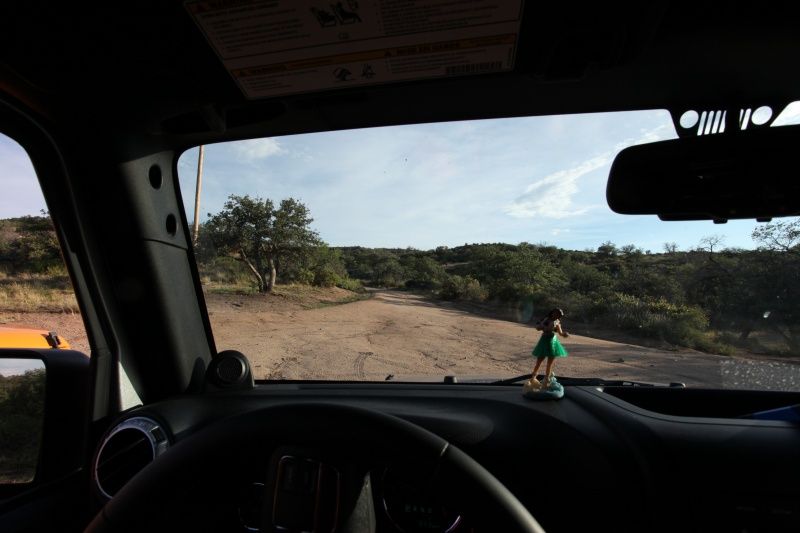
The organizer of this mini run has printed directions off of another forum to get us to the trail head. Lets just say the directions were no good. It had been years since I had done the full trail, and had done it from Catalina to Oracle as a passenger. Luckily, Google Earth on the iPhone allowed me to get us to the trail head, and past the initial maze of dirt roads on the Oracle side.
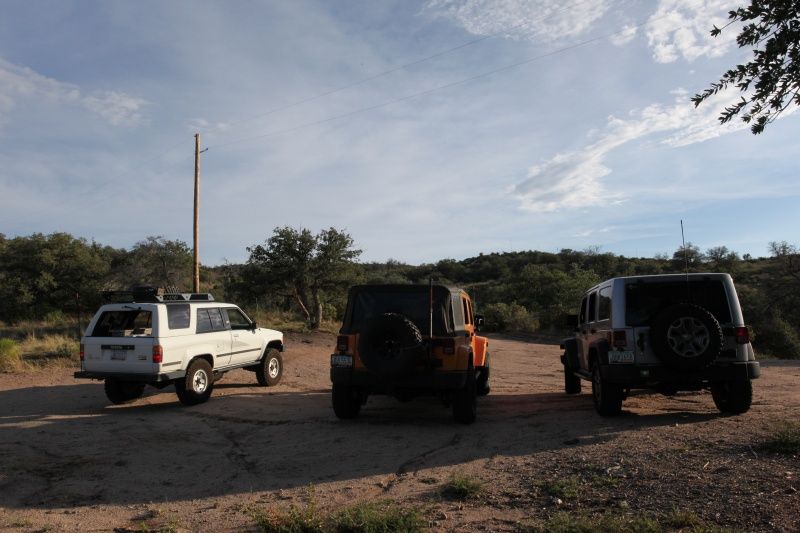
Airing down at the trail head:
My trusty inclinometer and offroad companion:
It was already late in the afternoon, and we had a few hours of trail ahead of us until camp.
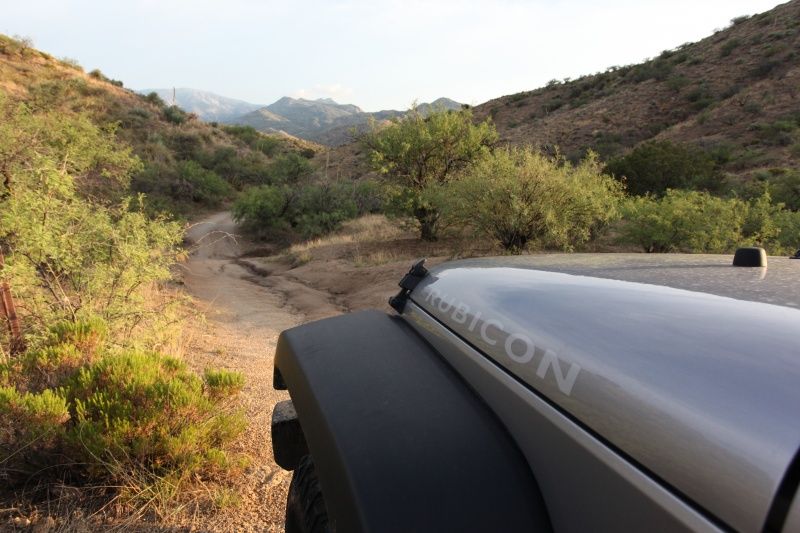
The trail starts out as mild service roads. with recent storms in the area, some ruts had developed since the last maintenance was performed. Even with temps hovering in the low 100's this area is just beautiful this time of year.
Heading off into the canyons:
In the group were two JKU's (Yours truly in Billet and Andrew in Dozer), with Don in the 89 4Runner. My Rubi is stock except for sliders. The 4Runner and Dozer JK are both on 33's with mild lifts. All three vehicles had no issues running the trail. I did manage to catch the skid plates quite a bit, but never struggled to make anything. This trail had been bull dozed back in 2012 and certainly still showed the effects of that. To say the least, this trail is not what it used to be. The creek still poses the greatest challenge. You are essentially driving in a rocky creek bed, bouncing over rocks of all sizes. Unfortunately, even with the recent storms, there was no water in the creek. NONE. Usually there are sections where you are driving blind, unable to see the creek bed and hoping you don't bash a diff. Not so this time. Even the "car wash" which is typically 20+ inches of water was dry.
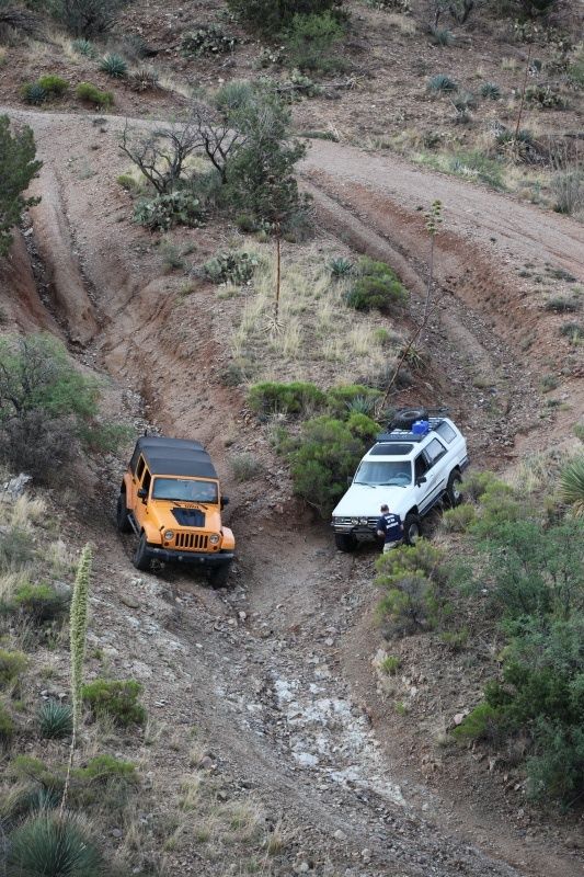
3 lines, each fun and rutted out:
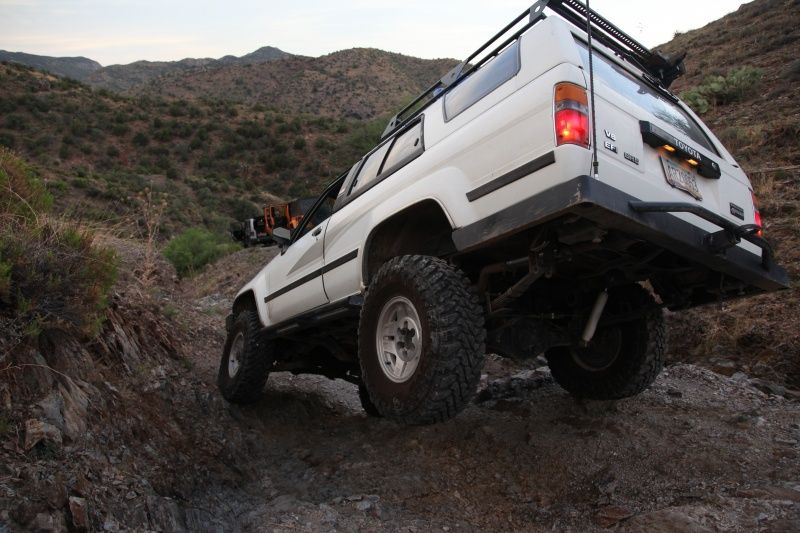
4Runners are a bit less flexy than JK's, coupled with a bit of the wrong line and....
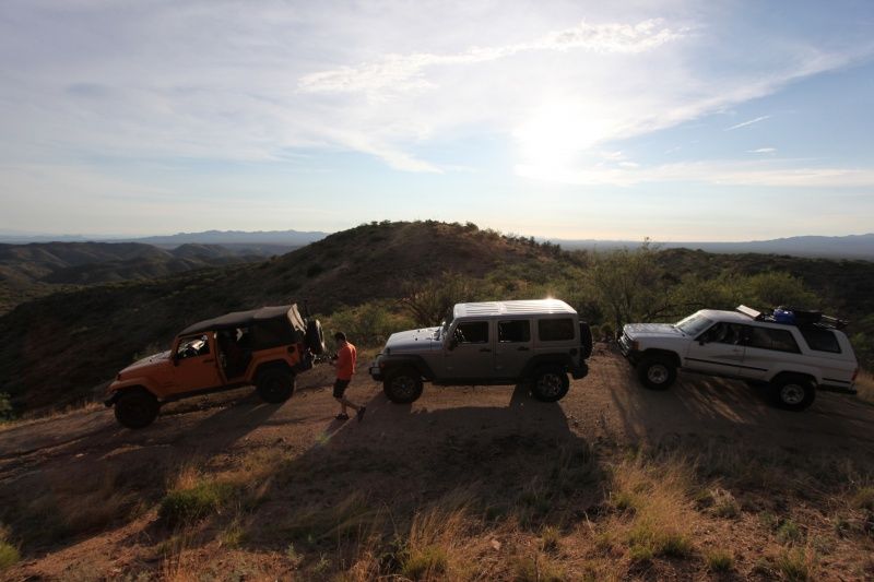
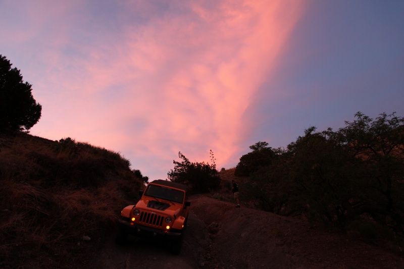
The sunset out here was gorgeous

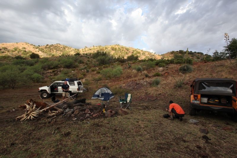
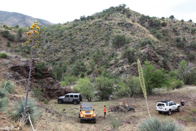
Soon it was just too dark to take pictures. We ran through half of the creek area in the dark. At some point in the past few years, a bypass for an area known as "the Step" must have been created. I was in the lead, and stayed on what I considered the main trail. In the night we bypassed the step, and the one bypass I knew of altogether. Eventually we reached a nice flat spot above the creek with an already established fire ring. We stopped, cooked some burgers, enjoyed a brew, and attempted to doze off to sleep. Lets just say that it does get cool enough out here this time of year, but not until about 3AM. It was humid and hot. In the morning we broke camp after a quick breakfast, and were back on the trail.
Camp:


Continued in part II
We had decided to run the Gap in reverse. Charleau Gap runs between the towns of Catalina and Oracle, Az in the foothills of the Catalina Mountains. It is one of two go to trails in the Tucson area. Most groups will run the Gap from Catalina to Oracle, or from Catalina, to the halfway point, and return back to Catalina. Oracle is about an hour from Tucson which means a long drive after leaving the trail. For this reason we headed out to Oracle after work. This would put us 40 minutes closer to Tucson and the rest of our weekend.
The organizer of this mini run has printed directions off of another forum to get us to the trail head. Lets just say the directions were no good. It had been years since I had done the full trail, and had done it from Catalina to Oracle as a passenger. Luckily, Google Earth on the iPhone allowed me to get us to the trail head, and past the initial maze of dirt roads on the Oracle side.
Airing down at the trail head:

My trusty inclinometer and offroad companion:

It was already late in the afternoon, and we had a few hours of trail ahead of us until camp.

The trail starts out as mild service roads. with recent storms in the area, some ruts had developed since the last maintenance was performed. Even with temps hovering in the low 100's this area is just beautiful this time of year.
Heading off into the canyons:

In the group were two JKU's (Yours truly in Billet and Andrew in Dozer), with Don in the 89 4Runner. My Rubi is stock except for sliders. The 4Runner and Dozer JK are both on 33's with mild lifts. All three vehicles had no issues running the trail. I did manage to catch the skid plates quite a bit, but never struggled to make anything. This trail had been bull dozed back in 2012 and certainly still showed the effects of that. To say the least, this trail is not what it used to be. The creek still poses the greatest challenge. You are essentially driving in a rocky creek bed, bouncing over rocks of all sizes. Unfortunately, even with the recent storms, there was no water in the creek. NONE. Usually there are sections where you are driving blind, unable to see the creek bed and hoping you don't bash a diff. Not so this time. Even the "car wash" which is typically 20+ inches of water was dry.
3 lines, each fun and rutted out:

4Runners are a bit less flexy than JK's, coupled with a bit of the wrong line and....

The sunset out here was gorgeous


Soon it was just too dark to take pictures. We ran through half of the creek area in the dark. At some point in the past few years, a bypass for an area known as "the Step" must have been created. I was in the lead, and stayed on what I considered the main trail. In the night we bypassed the step, and the one bypass I knew of altogether. Eventually we reached a nice flat spot above the creek with an already established fire ring. We stopped, cooked some burgers, enjoyed a brew, and attempted to doze off to sleep. Lets just say that it does get cool enough out here this time of year, but not until about 3AM. It was humid and hot. In the morning we broke camp after a quick breakfast, and were back on the trail.
Camp:


Continued in part II
Last edited:


