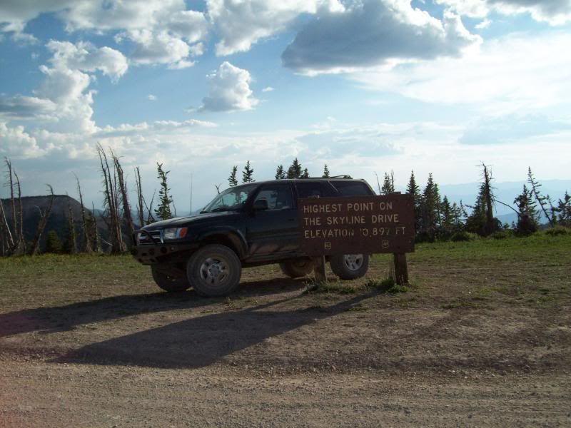
Skyline Drive/Great Western Trail – Tucker to Salina, Utah 120 miles of dirt roads.

ttora4runner

Expedition Leader
Skyline Drive/Great Western Trail – Tucker to Salina, Utah 120 miles of dirt roads.

**Full Report to follow**

My route -
SkylineDrive-GWT1.jpg

SkylineDrive-GWT2.jpg
 

ttora4runner

Expedition Leader
Trip Report

Having run the Northern portion of Skyline Drive up here in Bountiful I decided it was time to run the central portion of the trail system that runs from Tucker rest area to Salina, Utah. I wouldn't have known that this portion or the very southern portion of this trail system existed if it wasn't for some fellow members of this forum and others for the help.

The original plan was to leave at 5am to catch the start of the trail just as the sun was rising but work though a wrench into those plans and I was unable to leave till 1030 and was at the trail head at 1230 pm (which was okay since I need the $$)by the time I got back to pavement it was 820pm.

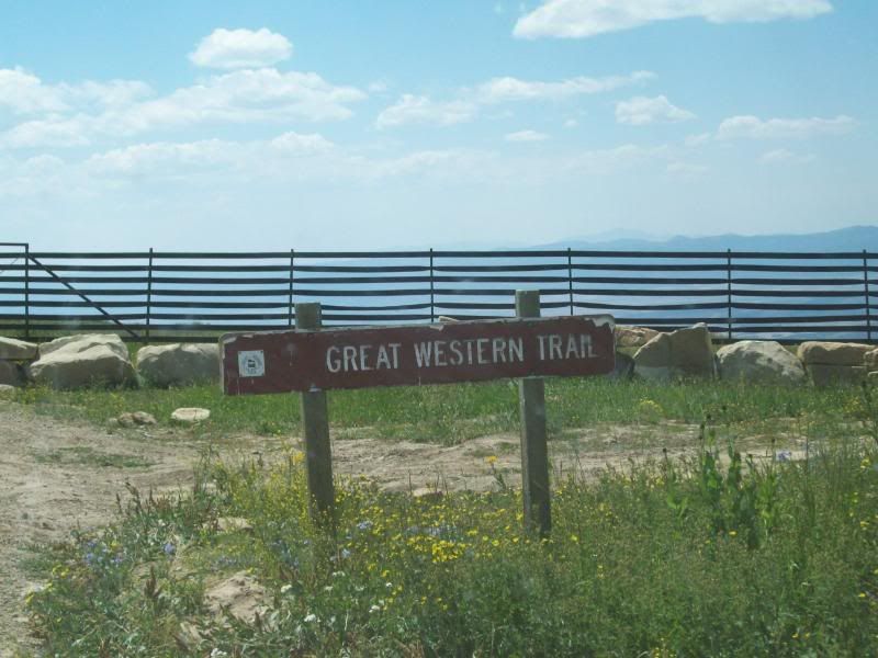
The trail system I found was broken up into 3 sections divided by a US 31. Access to the southern portion could've been taken by asphalt or dirt (still had to hit asphalt for a few miles to reach the dirt). I opted for the dirt.

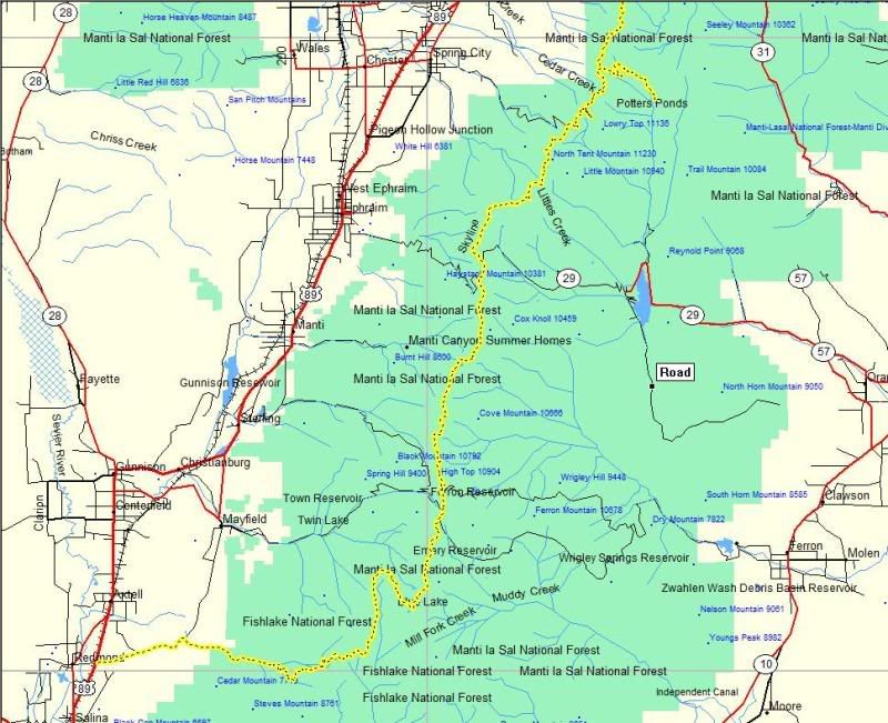
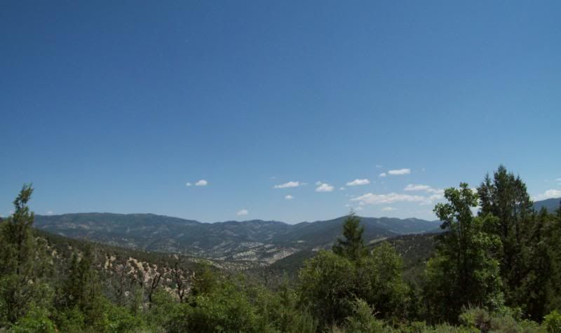
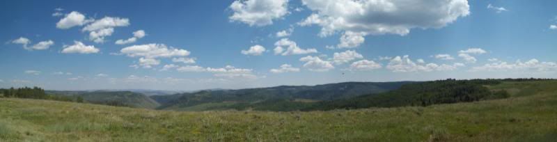
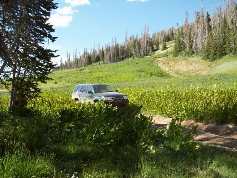
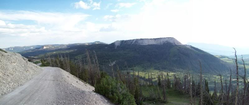
The northern portion of the trail starts at the former Tucker rest stop which has been taken over by hwy construction equipment and trailers. The scenery along this stretch was great, the first section winded though pines and aspens along a dirt road that eventually turned into a gravel road though grass lands and forest as you progressed higher. The grasslands were filled with purple and yellow flowers more than what you see along the Northern trail system. ATV and vehicle was scattered along the way and what I assume to be hunting campsites were setup or in the progress of being setup. As you got closer to US 31 traffic picked up some.

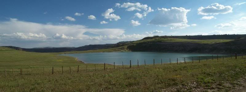
The central section was a bit confusing as a wrong turned lead me to Fairview Lake. A quick turn around lead me back up a rutted dirt stretch of road then to a short gravel section before hitting US 31 once again and a quick mile jaunt down the asphalt to Southern portion of the trail.

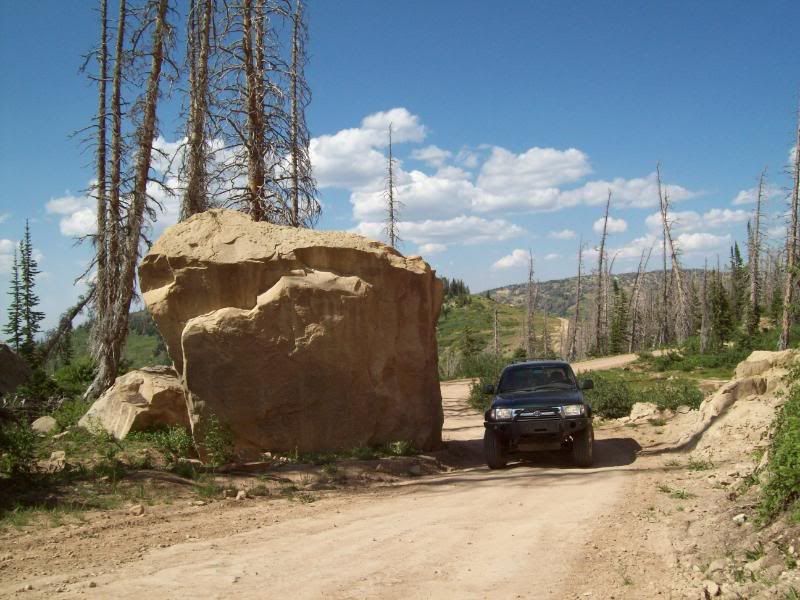
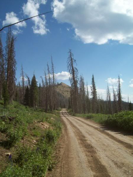
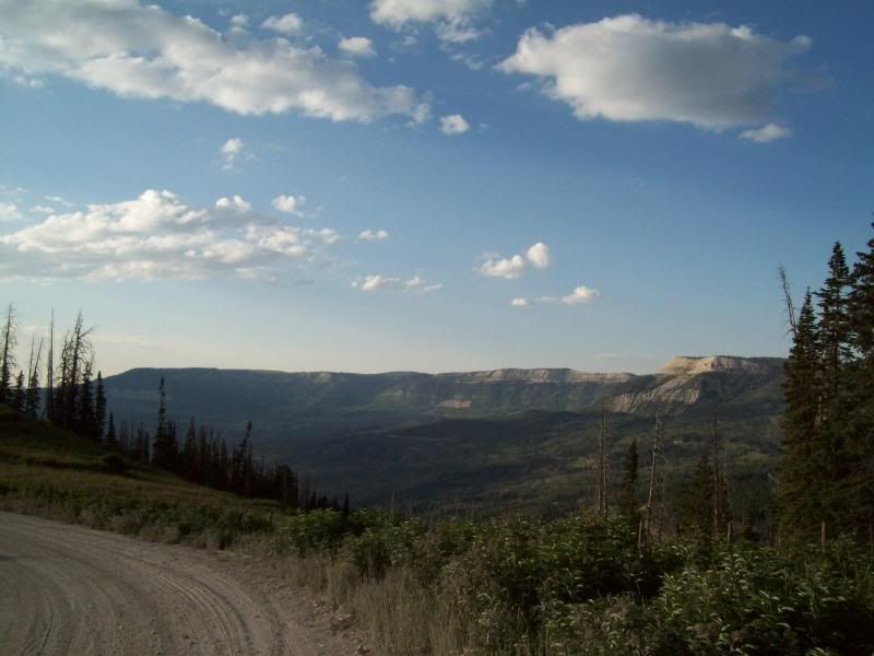
The southern portion of the trail system was the longest stretch of trail. The first two you could easily maintain a good click this section not so. The first portion of this is more less maintained as a sign down the way indicates that the trail isn't maintained past this point which helped to deter a minivan and a Mitsubishi Mirage. The sections following where a mix of dirt, rocky areas and gravel roads (mainly where the trail lead to a city). Along the way you past though forest, boulder strewn sections of roads, grasslands and self-roads that provided views as far as you could see but would be a pain in the rain.

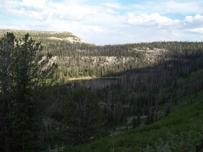
ATV tracks and side trails filled this area which lead down to resivors/ponds or down to established campgrounds. Avoid venturing off the ATV tracks even if they are wide enough for a vehicle or you might find yourself tipping on three wheels in a mud hole.

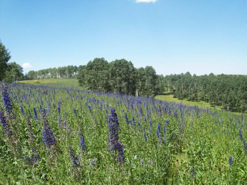
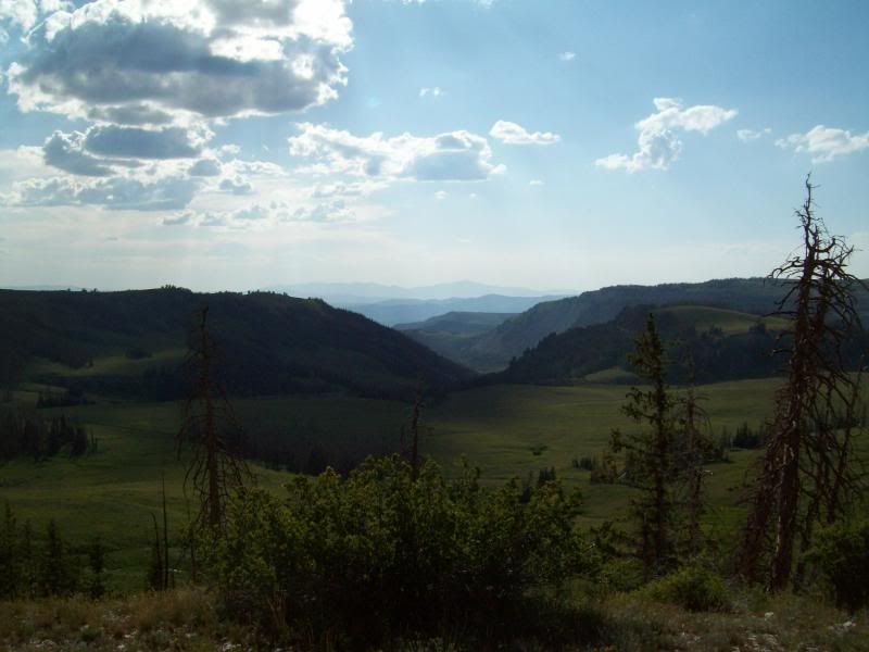
Unfortunately, do to a time constraint that I had the portion of the trail past the 12 Mile Canyon Campground required some Baja speed on my part to get back to hwy to get an prior arrangement I had so I was unable to enjoy the scenery like I had been. The final miles back to main road wound though aspen trees, grasslands, lakes/ponds and red rock outcroppings.

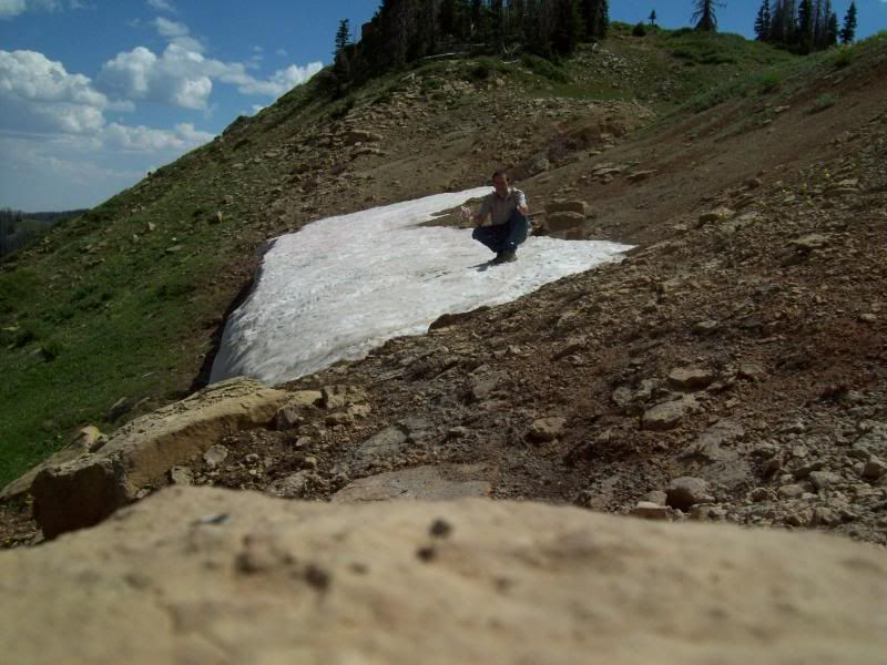
Overall, this trip is going to require a extended say to explore some of the side roads and visiting the lakes scattered throughout.


One close call occurred on this trip: coming around a single lane blind corner (S type turn)myself and a olive color Defender 90 about collided head on:Wow1:. There was just enough room that he went to one side and I went to another only to bend the stupid retractable radio antenna on my 4runner.
 

ttora4runner

Expedition Leader
Northern portion of this trail system

From the start
100_0314.jpg


100_0324.jpg

That which was the purple-nish (just a small portion)
100_0346.jpg


100_0350.jpg


100_0351.jpg


100_0352.jpg


100_0366.jpg


100_0382.jpg


100_0392.jpg

End of the Northern portion
100_0400.jpg
 

ttora4runner

Expedition Leader
Middle portion
100_0403.jpg


Southern portion (I have the most photo's from here)
The start
100_0413.jpg


100_0419.jpg


Terracing by the Forest Service that took place back in the 50's
100_0436.jpg


100_0441.jpg


100_0450.jpg

Had to play in the snow
100_0457.jpg


100_0464.jpg

Tried to be artistic with this photo
100_0467.jpg


100_0476.jpg
 

ttora4runner

Expedition Leader
100_0566.jpg


100_0574.jpg


100_0587.jpg


Highest point along Skyline drive, it's crazy to think that Imogene Pass in Colorado is a 2200' higher than this.
100_0604.jpg


100_0607.jpg


100_0612.jpg


100_0619.jpg


Need to come back and camp here:campfire:
100_0633.jpg


Final view, it's hard to believe that I was along that ridge line a couple of hours ago
100_0644.jpg


The rest of the photo's can be found here (there's around 200 )
http://s162.photobucket.com/albums/t257/wormholegamma/Skyline Drive 8-1-08 GWT/

It may not be the best trip report or the best photo's but I hope you all enjoyed viewing.

So who is up for some camping/exploring, maybe some fishing??
 

rambrush

Adventurer
Very nice!!

A couple of weeks ago coming back from Montana we cut over from Nephi took the 28 road south to Siguird caught the 24 to the 62 down to Otter Creek Resevoir caught the 22 down to Bryce Canyon then on over to Panguitch into Cedar Breaks NM into Cedar City and then south to Vegas. That was a great detour from taking the 15 south..
 

Skylinerider

Adventurer
Nice trip! FYI, that "old cabin" is the Seely Creek Guard Station. Built in 1907-08. I stayed there over the 17-20th of July.

034.jpg


041.jpg


037.jpg


Oh, and that warning should be taken very seriously, especially the part about the road turning to slime in wet weather.
 
Last edited:

scarysharkface

Explorer
I am consistently in awe of the beauty of that part of the world. And the flowers just "pop" against everything else. You guys are gonna ruin me with these stunning vistas. :drool:

John
 

ttora4runner

Expedition Leader
Nice trip! FYI, that "old cabin" is the Seely Creek Guard Station. Built in 1907-08. I stayed there over the 17-20th of July.

Ya, I was wondering what it was.

There's a warming cabin along the northern portion near fish creek that I ran into just right off the road.
 

Vermejo

Adventurer
A very in-depth report! Amazing scenery you have documented and as always - good pics. I’m going to crawl back under my desert rock now.
 

Moody

Needs to get out more
Great photos.

Have the bugs gone away for the most part up there? I need to squeeze in one more trip before I am back to school...
 

ttora4runner

Expedition Leader
Great photos.

Have the bugs gone away for the most part up there? I need to squeeze in one more trip before I am back to school...

The times that I got out and ventured around I really didn't notice too many bugs. When does school start back up?

I'm planning to return up there at the end of the month for a little camping over the weekend. There's a thread already about that trip.
 

Forum statistics

Threads
189,845
Messages
2,921,494
Members
233,030
Latest member
Houie
Top