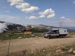
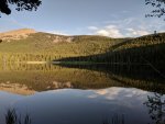
With some good weather on tap for the weekend, and a Friday chock full of meetings, I was itching to get out. So Friday night, after a quick mtb bike ride, I grabbed some food, a 6 pack, biking & running/hiking gear, and a tank of fuel and left town. I had never climbed Laramie Peak so I headed there first. About 50 miles on pavement, then ~70 or so on dirt. I found the area striking; the mountains are rugged with a lot of impressive granite. I saw this sign, which made me laugh.

Saturday I made my way up the mountain, encountering snow around 8000'. The views were mostly obscured by trees, but a few lookouts provided some views.

By 9000' it was unsupportive, miserable post holing with a looming storm. I pressed on longer than I should have, hoping for a switch to supportive snow, but it did not happen.
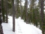
So the summit will have to wait. I returned to the truck, and looked at a few maps, selecting the more obscure route along FS roads through the mountains to reach I-25 and go to Glendo State Park for excellent mtb trails. I was apparently the first vehicle to go through this season, as there were countless downed trees. A group in SxS's was traveling the same road, and helped move many trees before passing me. The area had a large fire some years ago, so there are many weak trees..
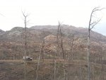
After some time, the group turned around, and mentioned the road terminates on private property, just a few miles ahead. The oldest in the group strongly urged caution if I decided to continue on the road. I assumed it was because I was solo in a full size truck on a rough road with a slide in camper, 80+ miles from pavement. My maps all showed the FS road reaching the county road so I continued on. It was an adventure and I wanted to know what was ahead! Beyond the end of the SxS tire tracks, there were several downed trees. One I could only move with the aid of a strap, as I had left my chainsaw at home.

Shortly after this, a sign signified the end of USFS Land. A few hundred yards later, the intent of the private land owner was made clear: Do Not Proceed. I thought of the sign from the morning..

So, I turned back. Getting a little low on fuel, I was unsure of the wisdom of the choice. But, I didn't want to be charged for trespassing, or worse, shot at. Ranchers of Wyoming tend to take trespassing seriously, and if they decide a FS road on their property is no longer open, it is closed.
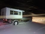
Backtracking in the dark, I camped above a canyon after climbing out of it. This would be a bad place to be in a big rain event: no way my open diff's and AT tires could claw their way back out in the mud. Some old ruts suggested this is a real possibility. Not to mention the 30" deep creek crossing would likely swell to snorkel depths.
After many uneventful miles, I found the reason so few had been in the area yet this season.

A short section of a snow drift separated the west side of the range from the more populous east. So, I dug a track out, then drove through easily. Old drifts don't punch through like fresh drifts: no way I'd have made it through without digging, chained up or not.

After that, it was another 40+ miles on dirt, somewhere along the way I left the county. Then I reached the state park, rode some of my favorite mtb trails, aired the truck tires back up, and took the pavement home. Albany County is massive; and a great place to call home.


