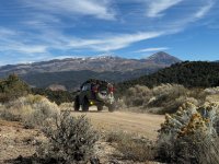
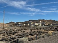
2000+ Miles Exploring the Great Basin

OTG_1

Well-known member
Day 9: Ward Mining District to Lunar Crater
With the wind howling the night before, and Ely's reputation for having one of the coldest climates in the lower 48, we were prepared for subfreezing temps into the low 20s. But the bitter cold temperatures we were expecting, never came to fruition. It wasn't warm per se, but if it did dip down to freezing, it was only for an hour or two. By the time the sun began rising over the Basin Ranges, temps ascended into the 40s and then 50s pretty rapidly.

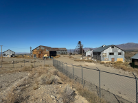
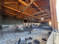
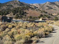
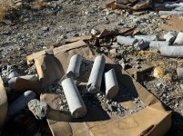
Our first order of business was to check out the remaining buildings at the old Ward Mine. An old warehouse had seen better days as it's aluminum corregated roof was beginning to cave in. The old warehouse stored thousands of core samples, many of which are still neatly organized and labeled in hundreds of cardboard boxes within the warehouse. It's pretty cool to pick up one of these core samples samples, and then to imagine that it was extraced out of the earth several thousand feet below us-- who knows if this is true, but it makes a great story! The one thing that is certainly a bit concerning, and this seems to be a constant within the extraction of minerals, metals, and other resources, is that these mining companies can simply just leave all this crap here! While some of the old mining relics give a sense of novelty, it's not difficult to see why so many mining companies have such bad environmental track records. We always harp on folks who don't clean up their camp, well it seems the mining industry at large never got the message :/

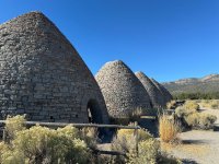
After our quick tour of the remnants of the old Ward Mine, we headed back down the mountain to the massive stone charcoal kilns that were used to separate silver from the mined ore. The impressive kilns stood about 30 feet tall. It was said that it took 6 acres of juniper and bristlecone to fill one of the kilns with charcoal. Local tribes like the Shoshone and Paiute relied on the harvesting of Pinyon pine seeds as one of their major food sources, and as miners and settlers cut down the juniper and pinyon woodlands, unsurprisingly, it became a major source of contention between native groups and the settlers who were encroaching on their ancestral lands.

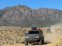
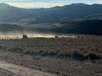
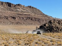
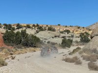
But we had a lot of mileage to make, so soon enough we were back in our rigs and kicking up a smokescreen of desert dust. We wrapped through a series of canyons near Red Mountain. For a few miles, it felt as if we were in southern Nevada or southern Utah. The rocks looked like weathered greenish and red sandstone, but after some quick research, the surrounding mountains are a limestone escarpment, while Red Mountain is actually of volcanic origain. Either way, Red Mountain and the surrounding landscape was pretty cool!

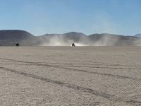
Eventaully we made our way to the Lunar Crater backcountry byway. I'm not sure what it is, but I absolutely love driving though and camping next to cinder cone fields. And this valley was filled with cinder cones-- take away the sagebrush cloak and throw in some creosote bush for good measure, and you'd think you were in the Mojave National Preserve, which has an amazing cinder cone field (and fantastic places to camp as well!). We made a beeline to the lunar playa. This was a pretty substantial playa, probably a couple of miles in length and perhaps a half mile wide, and the dried lakebad was super tightly packed. So we did what boys do. We ripped around the playa kicking up more dust, raced each other, and managed to capture some pretty crazy video footage as well.

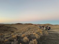
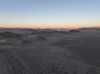
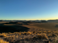
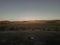
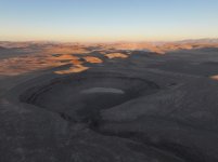
While our original plans had been to push on north of the lunar crater, upon arriving at the crater, I just couldn't resist proposing this as our camp for the night. The crater sits high above the surrounding cinder cone basin, making its home on the backside of a volcanic hill. We took a side spur which led to an impressive camp at the lip of the crater that also had an amazing view of the cinder cone fields and the lunar playa several miles off in the distance. A warm breeze pushed up an over the crater-- I knew we had to camp here for the night!
AP1GczO83hPVZPw4yeILn7nAMeLJ3Jno.jpg
The core sample warehouse at the old Ward mine.
AP1GczMbthlyi2ZDc1d3QeuYILreiFmN.jpg
The massive charcoal kilns used to heat up the ore and extract silver from the Ward Mining district.
AP1GczM4ffVKWTiHQOdEhydEDYxUzu2J.jpg
The massive charcoal kilns used to heat up the ore and extract silver from the Ward Mining district.
AP1GczOvYhwfXcnLOOSPw4jn9yM_67eN.jpg

AP1GczOriNHSXvzSHsXTrNua402b0KR8.jpg
This section of wavy green and red rocks near Red Mountain had us feeling like we were in Gold Butte National Monument in southern Nevada.
AP1GczOCxolDPzKKUtD395VWqrWiB1y.jpg
Racing across the Lunar Playa

AP1GczM7ApYW5uImqk9k8s8HKPKhG_0X.jpg
The Lunar Crater was definitely in my top 3 campsites for the trip!
AP1GczOGabJ3MYqvX8NiMkz7Th8eau5H.jpg
Looking over the cinder cone fields.

AP1GczPdk3FdoAQe2q4DP55uZaA9ybcS.jpg
Can you spot the Lunar playa in the distance?
AP1GczPQN_Ew6WwbvxnrRGlqEgZOr_qe.jpg
If you blow this image up, you might be able to see our group. Imagine this is a baseball diamond, our camp sits at around where the first basemen would position himself-- lightly left of first base.
 

OTG_1

Well-known member
Day 10: Lunar Crater to Diana's Punchbowl

It was a rather mild night camping next to the Lunar Crater. The group awoke to blue skies without a cloud in sight. I took the opportunity to climb the hill overlooking the crater. As I raced up the hill with Shasta trying to beat the rising sun, it was clear the hill provided the perfect vantage point overlooking the crater, cinder cone fields, and the wide-open expanse of the Great Basin that surrounded us. I would not have minded camping at the crater for another day, but we had more trail to cover!

Our first stop of the day would take us to the Project Faultless test site. In 1968, the military used this location (along with others scattered throughout the Great Basin) as a nuclear test site. The test yield of one megaton caused substantial damage to the surrounding land, including the creation of new faults and significant ground displacement. Talk about a blast-- it's absolutely insane that we humans develop weapons that have the potential to end life on Earth as we know it.

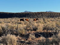
Continuing our journey, we finally began to encounter wild horses. You'd think 1,000+ miles into our trip we'd have seen dozens of wild horses at this point-- hope! We saw maybe 2-3 before this beautiful trio, and in the coming days, we probably encountered another 3 or 4 dozen wild horses. The route would eventually take us to the old mining town of Eureka (Nevada), but before making it into town we stopped at an old mine just outside of the town limits. Other than a number of historic buildings, there wasn't a whole lot going on in Eureka, so we decided to mingle with the locals while grabbing a bite to eat at the Owl Club.

Upon finishing lunch, we climbed up the hill to the old Ruby Hill ghost town. Unfortunately, the old mine is mostly fenced off but many of the old buildings still remain. The hills surrounding Eureka are littered with dozens of old mines and prospects. I wouldn't mind going back and spending an entire day exploring the area. As our convoy zoomed between two towering mountain ranges, the sun began to sink lower, and we weren't coming across any suitable camp sites. Finally, we decided to head to one of the waypoints of our planned route for the day and over to Diana's Punchbowl-- score! There was a big flat clearing at the base of a small hill.

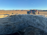
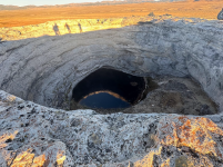
Scott drove his Bronco atop the hill and began yelling for us to come up. We were all setting up camp and most likely thinking about a cold libation, so our eventual trek up the small hill may have been a bit more delayed than Scott would've preferred. But upon reaching the top of the hill, we could see a massive hole of maybe 40-50' across that was emitting steam. Diana's Punchbowl! About 15' below, a pool of hot water slowly released bubbles. The punchbowl is known as a travertine dome, a type of limestone that built up from the mineral-rich water over the centuries.

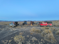
After the novelty of the punchbowl wore off, we headed back down the hill and began settling into camp. It was another magnificent night beneath the horizons as billions of stars and other celestial objects illuminated the night sky.

AP1GczPupd0H86js66uMUwWK9MUKB1FP.png
Sunrise overlooking camp and the Lunar Crater.

AP1GczNk-hjZi-cDqjPqqMyWTgvEiKZn.png
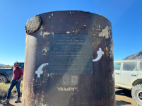
Project Faultless nuclear test site. Despite its name, it actually created new faults from the massive underground nuclear blasts.

AP1GczP09nYrl-jLTQsOOb83RYlIX1tQ.png
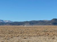
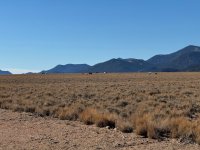
While the sea of sagebrush is a constant throughout the Great Basin, the mountains have their own distinct geology had characteristics.

AP1GczMhw7hnFySd2OXIoaVXVKzL5ur3.png
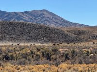
It took 10 days before the Wild Horses really started to show up!

AP1GczOYIAN_z8TYulicX1c3Ymx6OEZL.png
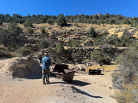
Remants of one of the many old mines just outside of Eureka, NV.

AP1GczMHlx7QpFduhFiDICZF9bbIEC9I.png
Eureka, Nevada, not Utah this time!

AP1GczOKKIyZQ5a9-mNKBLe1cn2O3ELZ.png

AP1GczPlinxHkV666vY47Rl8cAvyH7tP.png
We took full advantage of the restaurant at the Owl Club.

AP1GczPR9hEEnmcm4FnvHXeAoInUPAeP.png
Ruby Hill mine and ghost town overlook Eureka.

AP1GczMcJIZurWQv1P9UTmQhLm4UllL4.png
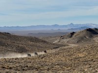
Great Basin topography with the obligatory vehicle dust of course!
 

Rubiconx1

New member
Thanks for a Great video!!

I’ve been looking at this trip in March/April 2025 at the end of our winter trip, and the video was a huge help. Jarbidge mountains are likely out because of snow concerns, and the Bruneau River Canyon is out because I will be driving an Adventure RV on an F550 4x4 chassis and towing the jeep, and the canyon is just too tight for our rig. Not sure if there are other areas that will not be passable with our setup, but I will just deal with them when presented.

Now I just need to finish retiring so I have every day of the week to enjoy the adventure…
 

OTG_1

Well-known member
Thanks for a Great video!!

I’ve been looking at this trip in March/April 2025 at the end of our winter trip, and the video was a huge help. Jarbidge mountains are likely out because of snow concerns, and the Bruneau River Canyon is out because I will be driving an Adventure RV on an F550 4x4 chassis and towing the jeep, and the canyon is just too tight for our rig. Not sure if there are other areas that will not be passable with our setup, but I will just deal with them when presented.

Now I just need to finish retiring so I have every day of the week to enjoy the adventure…

I'm guessing you'll need to reroute around Kingston Canyon through the Toiyabe Range as well. There is a snow bypass posted in our route guide that goes around the northern end of the Jarbidge Range that skips the higher elevation. The problem is, even as you depart Jarbidge, the track still climbs pretty high, over 8k feet I believe, so perhaps just to loop south of the Jarbidge Range via lower elevation trails. Please share a trip report if you do make the trip, and smart call skipping Bruneau River with an F550. Aside from the narrow two track, you'd be picking up gobs of pinstripes, especially if you have a sizable habitat on your chassis!

I'll probably make an article submission to OJ for this adventure in the next month or so, we'll see what happens! 😬
 

Rubiconx1

New member
I'm guessing you'll need to reroute around Kingston Canyon through the Toiyabe Range as well. There is a snow bypass posted in our route guide that goes around the northern end of the Jarbidge Range that skips the higher elevation. The problem is, even as you depart Jarbidge, the track still climbs pretty high, over 8k feet I believe, so perhaps just to loop south of the Jarbidge Range via lower elevation trails. Please share a trip report if you do make the trip, and smart call skipping Bruneau River with an F550. Aside from the narrow two track, you'd be picking up gobs of pinstripes, especially if you have a sizable habitat on your chassis!

I'll probably make an article submission to OJ for this adventure in the next month or so, we'll see what happens! 😬
Thanks for the great information. I just found the OTG site and will be joining so I have all of the GPS tracks I need. We spend about 4 months during the winter in the southwestern US, so hoping to run some of the Arizona and Nevada routes this year, with Idaho/Washington/Oregon/Montana tracks during the spring and summer. We normally spend 3 weeks in Moab rock crawling in our jeep and spend most of our four months during the winter boondocking, so adding designated routes will be enhancing our current overlanding adventures. The modifications in January to our Thor magnitude will just make it much more capable for overlanding so we don’t have to constantly switch to the jeep when we leave well groomed dirt roads.

Since we will be running a very unique rig on these routes, I will be posting trip reports, as well as videos to my forgthecouch YouTube channel so our kids and grandkids can come along with us on the adventures.
 

OTG_1

Well-known member
Thanks for the great information. I just found the OTG site and will be joining so I have all of the GPS tracks I need. We spend about 4 months during the winter in the southwestern US, so hoping to run some of the Arizona and Nevada routes this year, with Idaho/Washington/Oregon/Montana tracks during the spring and summer. We normally spend 3 weeks in Moab rock crawling in our jeep and spend most of our four months during the winter boondocking, so adding designated routes will be enhancing our current overlanding adventures. The modifications in January to our Thor magnitude will just make it much more capable for overlanding so we don’t have to constantly switch to the jeep when we leave well groomed dirt roads.

Since we will be running a very unique rig on these routes, I will be posting trip reports, as well as videos to my forgthecouch YouTube channel so our kids and grandkids can come along with us on the adventures.

Check out the Gold Butte ADV Route, a hidden gem in the American Southwest. And if you do a bit of research, there's a nasty shelf road that will allow you to jump over to the Grand Parashant NM and head over to the North Rim.
 

OTG_1

Well-known member
Day 11: Diana's Punchbowl to Stokes Castle

It wasn't until our 10th day that we really began to encounter the wild horses that Nevada is famous for, and in day 11, they were out in spades. Now, there are some folks who argue that wild horses aren't native to North America, which is only partially correct. There were indeed wild horses that had crossed over from Eurasia during one of the many ice ages where Beringia was exposed. In fact, horses had been in North America for millions of years, long before humans ventured across the Behring Strait. It wasn't until the pleistocene (about 12,000 years ago) that humans hunted them to extinction. I tend to be of the opinion that they are a natural part of the desert landscape, even if they aren't of the same subspecies, we should let them roam these vast wide open spaces. Needless to say, we encountered herd after herd after herd. Some were perhaps 3-4 horses, while others were well over a dozen. In fact, we came across so many horses in this valley, that I dubbed it Wild Horse Valley. And as you can see from the photos below, some of the larger herds decided to gallop and create a mini-stampede of sorts upon seeing our presences. This was definitely one of the more remote sections along our journey, so I got the sense that human and vehicle encounters were far and few between for these wild creatures, who seemed to be mildly disturbed by our presence, even when we had well over 300 meters between us.

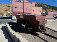
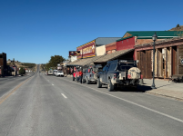
Finally we reached the southernend of the valley and were able to cut across a rather easy pass through the the Monitor Range. As I'm studying the map of our track of the day, I realised there's a place between the Toquima and Monitor range called Horse Heaven, that seems pretty accurate based on our experience! Crossing through the Toquima range, we passed through the living ghost town of Manhattan. These living ghost towns are a bit odd, as you see evidence that people live there. Reasonably well kept vehicles parked outside, various political banners (it was election season), gardens, etc. But no one seems to be out and about. You'd think with a small convoy of vehicles passing through, someone might peak through their curtains, but there were absolutely zero signs of any interest for the town's residents. We snapped a few photos along main street and continued along our way.

We were no paralleling the Arc Dome wilderness of the Toiyabe range. The Toiyabes are definitely one of the more rugged basin ranges, and I'd say they were right up there with the Snake Range (Wheeler Peark / Great Basin NP) in terms of their impressiveness. As we jumped back on the highway, I wondered what Kingston Pass would be like traveling through the Toiyabes, and it didn't disappoint. Much of the Toiyabes are inaccessible to vehicles due to the rugged terrain and wilderness, but Kingston Canyon was definitley one of my favorite parts of the Great Basin Heritage Trail. And looking at the number of folks camping in the backcountry, it certainly wasn't a secret to folks in Nevada or the surrounding states of Idaho or Utah. The deep canyon was filled with mud puddles, a product of the recent snow that had below through a few days before.

As the group climbed higher, we reveled at the high peaks several thousand feet above. Finally, we crested the summit and begin working our way down to the neighboring basin. And that's when we encountered a stretch of about 100 yards of snow and ice on a rather steep and precarious section of the trail. It seemed this section of the trail, tucked deep within the canyon didn't get much sunlight, so the ice was stubornly sticking around. Shu made it through no problem, then I was up next in Big Blue, the 5 ton hulking ram. On right 2/3 of the trail was solid ice and snow, while a small section on the left was clear of ice/snow, but that also happened to be right on the lip of where the road dropped off precariously to the mountain slope below. I took it slowly, my heart racing. Every so often, the truck would lurch and slip left a foot or so. This happened maybe half a dozen times, and it was friggin scary! Finally I made it through the icy section and breathed a huge sigh of relief. The other guys, in their much lighter and more agile vehicles made it through with minimal slippage.

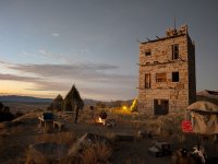
We zoomed over to Austin to fill up on fuel, but with daylight being in short supply, we zoomed up to Stokes Castle in hopes of securing camp for the night. Upon our arrival, nothing indicated we couldn't camp here. And after speaking with a local resident who does a bit of volunteer caretaking at the castle, he informed us we could gladly camp there. I ensured him we'd leave the place better than we found it. It was a relatively mild night. We enjoyed our new neighbor, the noble yet abaonded Stokes Castle as we took advantage of the nearby fire ring.

More on Stokes Castle
Stokes Castle is a three-story granite tower located near Austin, Nevada. Built between 1896 and 1897 by Anson Phelps Stokes, a wealthy businessman and mine developer, the castle was intended to be a summer home for his family. Inspired by a medieval tower he admired in Italy, Stokes commissioned the construction of this unique and extravagant structure using locally sourced granite. Despite its grandeur, the Stokes family only used the castle for a short time before selling their mining interests and leaving the area. Today, Stokes Castle remains a prominent landmark in the region and serves as a reminder of the area's rich mining history and the opulence of the silver boom era.

AP1GczMxkfTeHuRRSsuLWZ7486bI55GY.jpg
Camp among the sagebrush basin near Diana's Punchbowl.

AP1GczNXXiPucYESN-zDaBaUAT_c_ZLw.jpg
There they go!

AP1GczN55mcfHXBPJ72ULnXarH41uHid.jpg
These guys definitely wanted us to keep our distance.

AP1GczPkjz3KUUXHEVfx_cKplC5kZLQL.jpg
This herd was absolutely incredible.

AP1GczOJ5P85KRKwJRNQZngIUrxgu_Mf.jpg
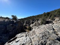
Little Grand Canyon. It seems we didn't find the main canyon, but rather a smaller finger of it.

AP1GczM6bjrt_atZHjVoxYsX0_fezzve.jpg
One of the historic buildings in Manhattan.

AP1GczOCHCKQZEL_XpDlw8tidUwcTiyR.jpg
Arc Dome Wilderness, Toiyabe range.

AP1GczPna9X0Yn3zCRDN1n5MDc8ZPcQS.jpg
Working our way through the Toiyabe Range.


AP1GczPxlpDdDWl7D94uPtBNdShqNzB2.jpg

AP1GczPi4_q6lMJe1epwsP7ro2eW59ey.jpg
Camp at Stokes Castle.
 

OTG_1

Well-known member
Day 12: Stokes Castle to Walker Lake
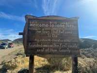
Since we were camping at elevation, we had anticipated a cold night. But it turned out to be rather mild camping next to Stokes Castle. Since we'd rolled into Austin so late the previous day, we packed up camp and headed back into town to snap a few photos and videos. About 15 minutes later, we were back on the road again, this time following a dirt track through the mountains that would take us through another living ghost town, Ione. It's a bit strange. You see vehicles parked out and about and various other signs of life, but we never once saw a single resident, not even a pet dog or cat while driving down "main street".

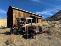
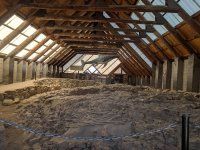
Back on another stretch of dirt, the convoy began climbing a hill when we noticed a sign pointing to Berlin Ichthyosaur State Park. I wasn't sure if I wanted to pay the entrance fee to the state park, but upon pulling up to the ranger kiosk, we could tell the old Berlin Ghost Town had numerous buildings, many in great shape. After seeing the state of the ghost town, we decided to pay the meager entrance fee of something like $8. We perused the hillside where a series of mostly restored buildings sat. Some in better shape than others, but the highlight was definitely the old mill which still houses the original mining equipment. While Nevada has long been famous for its silver production, it's also a major producer of gold, and gold ore was once plentiful in Berlin. After spending about half an hour wandering around the old town site, we decided to jump in our vehicles and head up the hill to check out the Ichthyosaur, which was housed in a giant hall. Unfortunately, no tours were scheduled and no one was staffing the exhibit hall. We were left snapping photos through a couple of windows. The ground here was once part of the sea bed, and the fossils of a giant marine dinosaur (Ichthyosaur) remain embedded within the exposed rock.

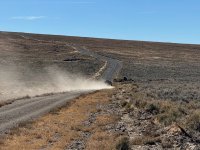
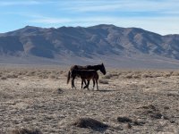
But the show must go on, so once again we were winding through the mountains on another dirt road. As we made our way back towards the greater Reno area, the track spit us out onto what I can only describe as a dirt highway. It was nearly 70' wide and seemed to be graded on a regular basis. We kicked it into high gear kicking up a massive dust plume behind our vehicles. About 100 yards off of the road, I could see a pair of horses slowly walking towards the road. I slowed down and that's when I noticed it was a mare and her foal. Given how skittish the horses had been around our vehicles, this mama horse didn't seem to mind us one bit. She calmly approached with the foal crossing the road in front of my vehicle about 25 yards away. I snapped a number of photos and videos of the beautiful chocolate-espresso pair. I'm sure by this time next year, the foal will be almost as big as his/her mama!

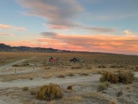
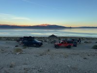
We begin getting closer to the highway, but it didn't seem like there were many great options for camping, so we pushed on. Shu checked ioverlander and suggested we head towards Walker Lake for camp. Now that we had a destination in mind, we picked up the pace intent reaching camp. As we climbed through a series of jagged hills and mountains, a massive mining operation came into view. It looked like it was still active, but a quick google search showed this mine had been inactive for a number of decades. Perhaps the owners are holding out hope that it would return to its hey day one day soon-- who knows! After striking out on a couple of dispersed camping areas along the Walker Lake Shore, we opted to take advantage of one of the developed campgrounds. We ended up finding a nice site that was big enough for our 4 vehicles, no neighbors, and a fantastic view overlooking Walker Lake. It was a relatively warm breezy night, featuring another sublime sunset.

Only one day left to go!

AP1GczOy-kJcyTu4r0J-6YmA8G9G_e5R.png
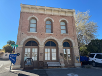
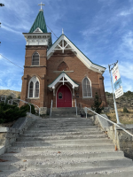
Beautiful church in Austin.

AP1GczNjNfoLu8a9ajU_mfVJriD15fcn.png
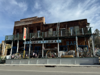
A colorful building that claimed to be "open", but that certainly wasn't the case.
AP1GczPPC6U-gnsQqbuPDp9HzEQ8LQau.jpg

AP1GczMPGX5wFZNRN44OiH3GtoSqE8Kw.jpg
Somewhere atop this hill is Berlin Ichthyosaur State Park.

AP1GczPYCDkE2Fgh8X_RUYfhqAg6da2h.jpg
Berlin ghost town.

AP1GczNCPn3yACkCvEWF26kzybOnkRt1.jpg
The old mill in Berlin.

AP1GczPtICW9AJbpJsWoRPKvg7SA4xrw.jpg
Exhibit hall showcasing the Ichthyosaur fossils within this ancient sea floor.

AP1GczPflEZW0Lm2EGTgpexXA3usW1O3.jpg
Shot of Scott's bronco on 40s, with what I believe is the Toiyabe range in the distance.
AP1GczNn0Nz0Thja7LM24vjRYlK6eqeU (1).jpg
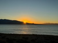
We passed this massive mine, which is no longer active but still well preserved

AP1GczOY3vfIGBwXrxSbWrYiFYo84E3k (1).jpg
 

OTG_1

Well-known member
Day 13, Final day on the trail
Walker Lake to Gardernerville
Total Miles Traveled: 2,110


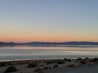
It's as if the God's had planned the sunrise, knowing this would be our final day on the trail. Looking at the map, we'd veered off the main track by a dozen or so mile's with our decision to camp at Walker Lake, but looking at what remained, at least the dirt segment, it would be an abbreviated day with less than 50 miles to explore. At this point, myself, Shu, Shierei, and Scott remained. Rolando had departed before we reached the Utah Border, and Pete had left a few days earlier, need to return to work. Since this was our last day together, we took our time packing up camp, especially since it was such a beautiful morning. The highway above us hummed with early morning traffic, which we'd soon join. We hit the highway south, making a quick stop in Hawthorne for fuel.
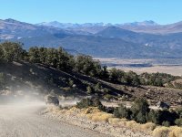
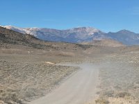
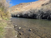
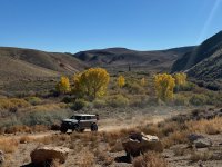
On dirt once again, the rugged snow capped peaks of the Basin and Range's most western mountains came into view. We were now exploring the Walker River watershed, with the old ghost town of Bodie just over the mountain. It's an area that's beautiful, with streams and rivers snaking through the sagebrush covered mountains along with the occasional poplar and aspen scattered about. There's some fantastic camping opportunities along the Walker, and it seems like the locals were taking advantage of the mild weather, as we passed many occupied campsites even though it was a weekday. It's definitely an area I'd like to go back and do a bit more exploring, especially with warmer temperatures.

After departing the Walker River behind, we did a brief stint on highway 395 that would take us to Hwy 89 via Monitor Pass towards Leviathan Mine. Since Scott hadn't joined the group until reaching Eureka, Utah, he opted to head north back to do a few days of exploring in the Jarbidge Range. It was now down to Shu, Shierei and myself.

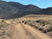
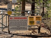
We pushed on making our way around Monitor Pass which would bring us into the only portion of the trail that traverses California. The trails here were tighter, and a bit rockier. There were a few sections that even required 4-low, which is seldom required on the Great Basin Heritage Trail. As we worked our way around the mountain, we came to a well secured gate, apparently the road to the massive Leviathan Mine, which was the largest Sulphur producing mine in the US from 1953 to 1962.

Not far beyond the gate the road parallels a rugged canyon that was scorched by a wildfire. Looking at the underbrush, I'd guess that fire happened within the last 3-4 years, at the tail end of the massive drought that California was going through. The dirt finally met the pavement. We celebrated our accomplishment, giving each other high fives and taking a few selfies as tokens of the adventure. We aired up, continued along the pavement through Gardernerville and then over the Sierra to our homes in northern California.

AP1GczOGawyX6p8krAQTz3b2j_rZrcgg.jpg
Another beautiful, but our final sunrise in the Great Basin, at least on this trip.

AP1GczM1bVM0d-V3uVnyoEOA4BPgPNtF.jpg

AP1GczOp3OMtpXqpXfF7i0PLq-4dvPQq.jpg

Bodie ghost town is somewhere on the other side of these mountains.

AP1GczMKQUQSEsMa5Z71eGhZTNakiB6U.jpg
East fork of the Walker River.

AP1GczNFyW87u36s5LjzKtn8hJ-z1ktx.jpg
Beautiful fall colors near the East Fork Walker.

AP1GczPcwnGVPZynGHc_LsCfe63RGr0y.jpg
Circa Monitor Pass.

AP1GczPAqV-WwNfsNYZhV1GrYDadhjvE.jpg
Almost there!

AP1GczPwAO9nUGz7btAAiY8Nkcj0tlzV.jpg
The Leviathan Mine was America's largest producer of sulphur for most of the 1950s and early 60s.

AP1GczNGYiciQOJdDejAVROk58_XJG_B.jpg
We'd eclipse 2110 miles as we made our way along the remaining bits of pavement.

AP1GczPC6Iyx1uO0pCZyQecQIotgk1dj.jpg
Shu, Shierei and myself, celebrating our accomplishment. The only 3 to start and finish the GBHT!
 
Last edited:

AbleGuy

Officious Intermeddler
This was a really engaging, first rate thread for us armchair bound adventurers to enjoy.

Thank for putting so much effort into sharing a thoroughly well written, interesting and well illustrated backroad travelogue.

I’m stuck at home right now from knee replacement surgery and will be quarantined for @ 6 weeks with no driving allowed, and yet I’ve still been able to vicariously experience your detailed exploration of an area I’ve never had the pleasure of seeing firsthand.

👍🏻
 
Last edited:

Forum statistics

Threads
188,257
Messages
2,904,612
Members
229,805
Latest member
Chonker LMTV
Top