Backroadexploration
Observer
Skyline Drive is often called the spine of Utah. The road runs roughly 100 miles from Tucker just off of Highway 6 to I70 in central Utah. Overall the due to the high elevation of the road it’s only possible to run the entire trip in the deep summer or fall after the snow starts to melt. I have driven portions of the trail multiple times over the past few years but I have not taken on the whole trail in one trip.
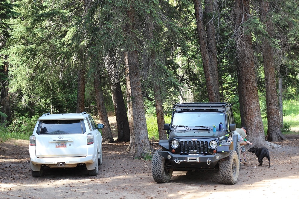
I headed out Thursday night to find a nice place to camp along the first section of Skyline Drive. This time of year the area is pretty popular as many people are trying to get out an enjoy as much of the Mountains in Utah as possible. The drive up Highway 6 is one of my favorites a mix of mountain beauty and a heavy dose of nostalgia from adventures long past. Just a few miles up the trail we found a really nice campsite with huge pine trees that provided a lot of shade and a soft base for our tent. I normally like to sleep in the rig but I wanted to try out a new 3 person backpacking tent to see how my boys (6) and (3) liked the tent compared to sleeping in the rig.
A night sitting around the campfire and roasting marshmallows while talking to my boys is my version of a perfect evening. Tired from a long day of work and heading to the mountains we retired early in anticipation of my brothers crew joining us in the morning for our adventure.
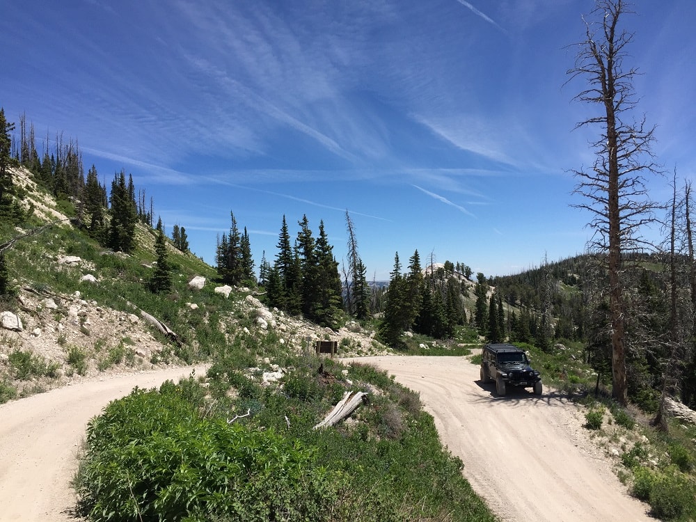
Just a few hundred yards from camp we had a nice little mountain stream that the boys liked to throw rocks into and made for a perfect morning activity while I made breakfast. My brother rolled in around 10 am and we let the kids play for a few minutes before heading out on the trail. Skyline drive is an easy trail most portions are very well graded and unless it rains or the snow just melted the trail is pretty tame. When wet things can get a lot more difficult, but we had dry roads the whole way. The first few miles are all climbing as you make your way onto the top of the mountain range. Once on top the trail seems to roll up and down along the ridge with gorgeous views on all sides. Along the main trail there are dozens of spurs that often lead out to peaks looking over the valley or head down the mountain toward some of the areas nice mountain lakes.
Eventually you hit pavement just above Fairview Canyon for about 10 miles before heading back on the dirt for the remainder of the trip. We found a nice spur trail leading up a hill to a nice mountain meadow where we made lunch and let the kids stretch their legs.
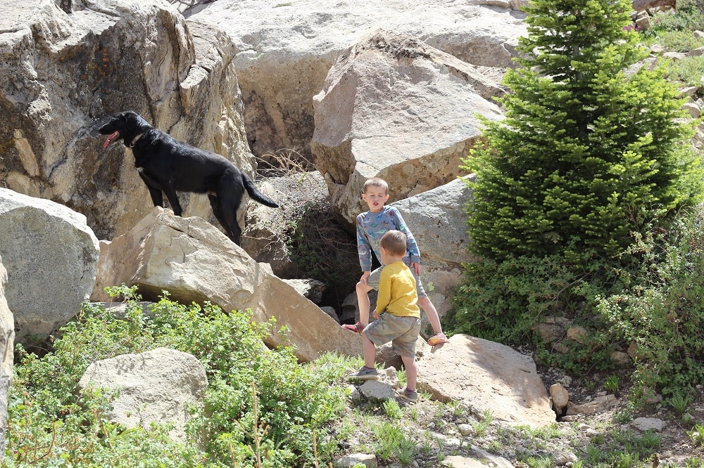
Back on the trail the next few miles are some of the very best of the trip. One section of the trail rides on the west face of the mountain with a steep drop on one side. My favorite section here is an area with massive boulders much larger than a rig that have fallen off the mountain over time and found themselves resting on the side of the mountain. We always stop here and let the kids get out and climb around on the rocks.
Last year we attempted a loop from Millers flat road past here and down Orangville road to Joe’s Valley reservoir. It was a rainy summer day and the road was soaked with mudd. We spent 12 hours navigating our way through some of the slickest mud I have ever had to deal with.
This year we cruised right through. There is a large Glacier just past Spring City Canyon that often blocks the trail making it impossible to pass in the early summer months. With a terrible winter and warm summer months we were optimistic that we would be able to get past. Sure enough we were able to get by without any issues. Our original plan was to stop on top of a peninsula and camp for the night but it was crazy windy. We found a trail to head down the mountain where we could find a nice place to camp for the night.
We ran into a small lake we didn’t know about called Pete’s Hole reservoir that had a nice campsite next to the lake. We quickly setup camp and started on dinner. Not long after setting up a DWR truck pulled up letting us know there had been a bear in the area that has been coming into peoples camps for food. A little nervous we made sure to secure our food well and drifted off to sleep thinking about a bear sneaking into camp while we were asleep.
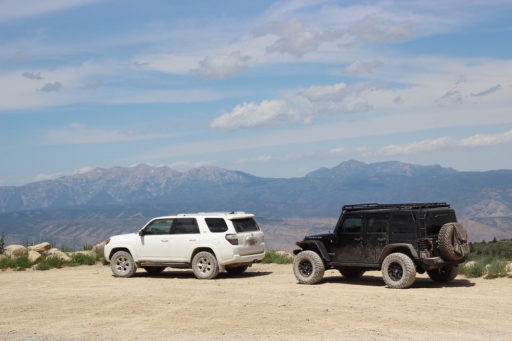
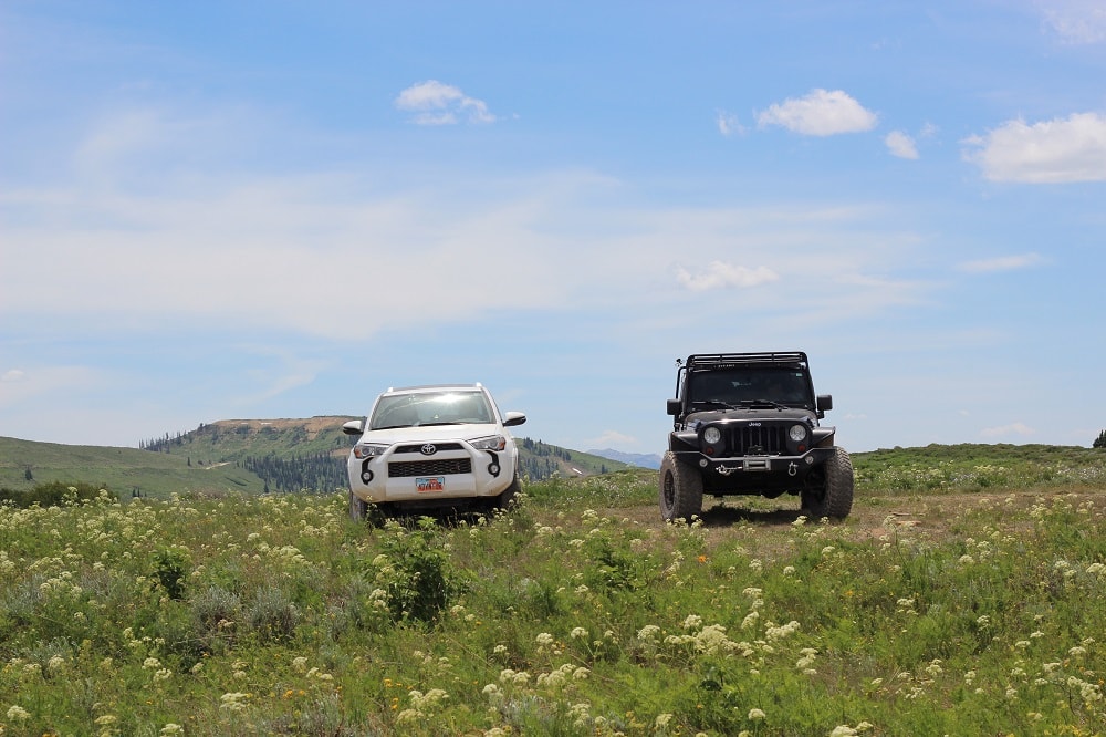
We woke up after a bear free night excited to hit the rest of the trail. After spending some time walking around the lake and making breakfast we started our way back up the trail towards Skyline Drive. Once back up top we found ourselves surrounded my incredible mountain flowers. This portion of the trail is on one of the wider parts of the mountain range and at times you feel like you are driving across the prairie rather than a mountain top. There are a bunch of places along the road to stop as you pull up next to a steep cliff looking down of the Manti La Sal Mountain Range.
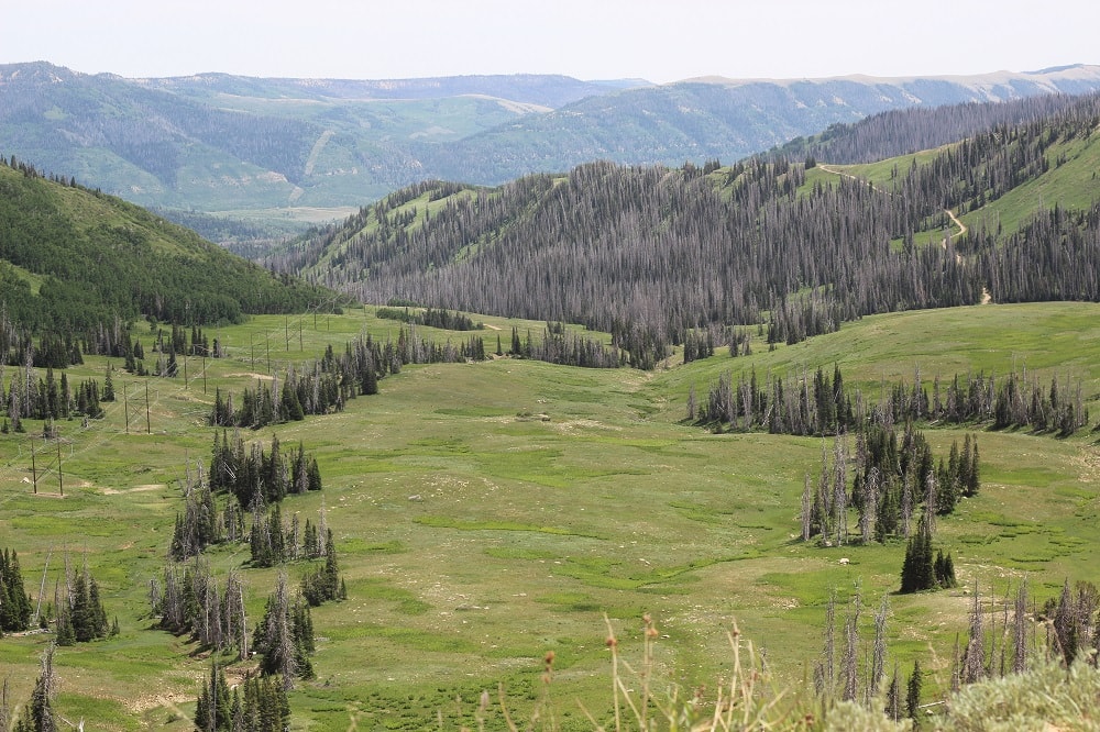
I love just how green it is this time of year, especially because I spend a lot of my time adventuring in the desert in Utah. Eventually the trail starts to drop off of the top of the mountains and you slowly make your way down towards Duck Fork and Ferron reservoir.
We found ourselves a nice place to make lunch and then drove the final 7 miles to the bottom of the canyon where the trail meets up with I70. The last portions of the trail are just as incredible as the rest beautiful aspen groves line the trail in many places, I am certain this trip would be just as beautiful in the fall once the leaves start to change. We hit pavement around 4 pm and had several hours of driving through some of my favorite small towns like Salina and Gunnison on our way back home. No doubt the trail can be ran in a day but with the kids we like to take a slower pace stopping frequently to get out stretch our legs and hike around, additionally I really think this is an area that deserves a slower pace to truly appreciate.
I headed out Thursday night to find a nice place to camp along the first section of Skyline Drive. This time of year the area is pretty popular as many people are trying to get out an enjoy as much of the Mountains in Utah as possible. The drive up Highway 6 is one of my favorites a mix of mountain beauty and a heavy dose of nostalgia from adventures long past. Just a few miles up the trail we found a really nice campsite with huge pine trees that provided a lot of shade and a soft base for our tent. I normally like to sleep in the rig but I wanted to try out a new 3 person backpacking tent to see how my boys (6) and (3) liked the tent compared to sleeping in the rig.
A night sitting around the campfire and roasting marshmallows while talking to my boys is my version of a perfect evening. Tired from a long day of work and heading to the mountains we retired early in anticipation of my brothers crew joining us in the morning for our adventure.
Just a few hundred yards from camp we had a nice little mountain stream that the boys liked to throw rocks into and made for a perfect morning activity while I made breakfast. My brother rolled in around 10 am and we let the kids play for a few minutes before heading out on the trail. Skyline drive is an easy trail most portions are very well graded and unless it rains or the snow just melted the trail is pretty tame. When wet things can get a lot more difficult, but we had dry roads the whole way. The first few miles are all climbing as you make your way onto the top of the mountain range. Once on top the trail seems to roll up and down along the ridge with gorgeous views on all sides. Along the main trail there are dozens of spurs that often lead out to peaks looking over the valley or head down the mountain toward some of the areas nice mountain lakes.
Eventually you hit pavement just above Fairview Canyon for about 10 miles before heading back on the dirt for the remainder of the trip. We found a nice spur trail leading up a hill to a nice mountain meadow where we made lunch and let the kids stretch their legs.
Back on the trail the next few miles are some of the very best of the trip. One section of the trail rides on the west face of the mountain with a steep drop on one side. My favorite section here is an area with massive boulders much larger than a rig that have fallen off the mountain over time and found themselves resting on the side of the mountain. We always stop here and let the kids get out and climb around on the rocks.
Last year we attempted a loop from Millers flat road past here and down Orangville road to Joe’s Valley reservoir. It was a rainy summer day and the road was soaked with mudd. We spent 12 hours navigating our way through some of the slickest mud I have ever had to deal with.
This year we cruised right through. There is a large Glacier just past Spring City Canyon that often blocks the trail making it impossible to pass in the early summer months. With a terrible winter and warm summer months we were optimistic that we would be able to get past. Sure enough we were able to get by without any issues. Our original plan was to stop on top of a peninsula and camp for the night but it was crazy windy. We found a trail to head down the mountain where we could find a nice place to camp for the night.
We ran into a small lake we didn’t know about called Pete’s Hole reservoir that had a nice campsite next to the lake. We quickly setup camp and started on dinner. Not long after setting up a DWR truck pulled up letting us know there had been a bear in the area that has been coming into peoples camps for food. A little nervous we made sure to secure our food well and drifted off to sleep thinking about a bear sneaking into camp while we were asleep.
We woke up after a bear free night excited to hit the rest of the trail. After spending some time walking around the lake and making breakfast we started our way back up the trail towards Skyline Drive. Once back up top we found ourselves surrounded my incredible mountain flowers. This portion of the trail is on one of the wider parts of the mountain range and at times you feel like you are driving across the prairie rather than a mountain top. There are a bunch of places along the road to stop as you pull up next to a steep cliff looking down of the Manti La Sal Mountain Range.
I love just how green it is this time of year, especially because I spend a lot of my time adventuring in the desert in Utah. Eventually the trail starts to drop off of the top of the mountains and you slowly make your way down towards Duck Fork and Ferron reservoir.
We found ourselves a nice place to make lunch and then drove the final 7 miles to the bottom of the canyon where the trail meets up with I70. The last portions of the trail are just as incredible as the rest beautiful aspen groves line the trail in many places, I am certain this trip would be just as beautiful in the fall once the leaves start to change. We hit pavement around 4 pm and had several hours of driving through some of my favorite small towns like Salina and Gunnison on our way back home. No doubt the trail can be ran in a day but with the kids we like to take a slower pace stopping frequently to get out stretch our legs and hike around, additionally I really think this is an area that deserves a slower pace to truly appreciate.