A Week in the Heart of the Appalachian Mountains: West Virginia & Pennsylvania

msoverland

Member
Basically all I wear in the summer unless its hiking boots

That's my brother shown in the pics though

Love it guys! Glad we could help. It was a true delight working for you and planning out your route. Can't wait to read the rest! :friday::friday::friday:
 

highlandercj-7

Explorer
Chestnut Ridge is an awesome little campground. It's owned and run by the County. My family and I stayed there in July. I hadn't been there in several years, needless to say I was amazed how much the new Manager has improved the place since the last time I'd been there. I hope you got a chance to check out the view from Coopers Rock while you were there. Can't wait to see more pics.
 

Morticon

Adventurer
Chestnut Ridge is an awesome little campground. It's owned and run by the County. My family and I stayed there in July. I hadn't been there in several years, needless to say I was amazed how much the new Manager has improved the place since the last time I'd been there. I hope you got a chance to check out the view from Coopers Rock while you were there. Can't wait to see more pics.

Im not sure we got the chance to check out Coopers Rock unfortunately. Do you have GPS co-ordinates? Would love to mark it in our files so we know where it is if we ever make it back down that way!
 

mortonm

Expedition Leader
We had smartly packed up all of our equipment and repacked the truck the night before. It just took us about 20 minutes to break down the tent and roll up the sleeping pads and bags Previous trips we had done more involved breakfasts (eggs, bacon etc) but decided this trip we would just eat on the run with cereal bars and fruit. This would save us likely close to an hour or time each morning and a lot of cleaning dishes, because no one likes cleaning dishes.

This morning would bring us south from our camp near Cheat Lake down towards the Cheat River. Even after a few trips into the Pennsylvania Wilds it was amazing how fast you can disappear in the bush in West Virginia, within minutes you go from paved road to gravel to isolation. We were pretty excited at this point as it was our first full day and our first day of exploration. Soon after starting there was a side track marked 4WD that went down to wonder falls (on the cheat river). We found the spot, and took a quikc look around make sure it was the right track and that it was open and passable as Mountain State Overland had mentioned some of the off shoots might be closed certain times of the year.

We found this old bridge we would soon be crossing after the visit to wonder falls


Saw our first deer of the trip (bad picture)


The track into Wonder Falls started off with a steep switchback, and a few rougher sections with a couple of puddles and some rocks to avoid.


Then it started to get a little rocky...


Tight to a drop off as well


mortonm

Expedition Leader
When we got to the end there were some people camping, they had a stock Hummer H3

You can technically drive out on these rocks but the path down was a little sketchy and muddy so we decided to pass


Water head to go over Wonder Falls


Worth the drive....


It probably took us about 20 minutes to drive down there, but it would take a little longer getting back. There is one washed out section that puts you pretty off camber (my gauge said 20+ degrees) sloping right towards the drop off. Having rained the day before it was a little slick, so with a little pucker factor and the back end sliding a bit towards the edge we got through without issues. Pictures do not do it justice to the angle, as always


Closer to the edge than it looks


A couple of smaller puddles with ruts in them, nothing special but it was day one and we were excited...


mortonm

Expedition Leader
Shortly we found our selves back at the old steel bridge across the cheat river, a mile or two upstream from Wonder Falls. Would have been a beautiful spot to have a nice camera...


Just around the corner there was a smaller water fall, a tributary of the Cheat River


Then we came out in to an open plain area with farms scattered across the landscape, this guy looked pretty calm until we got too close as we drove by, definitely doing his job!


mortonm

Expedition Leader
Our eventual goal for the end of the day was Black Water Falls, we would continue to work our way South towards the Monongahela National Forest as the day progressed.

We would cross the Cheat River several more times that day as it also meanered southwards


Nothing like feeling you are in the middle of nowhere on rough roads to come across a dude in a new Subaru


We were supposed to take a large loop through the Camp Dawson training area, but on the day we showed up the gate had been closed. We had two options, to go around on pavement and link up on the other side, or to take a 4wd track that we saw on the topo map. It was essentially a more direct route to where we needed to go, and there was no pavement


It wasn't that difficult of a trail, any 2wd truck or van with a little clearance would have no issue, but it eventually got pretty right. There was nowhere to turn around so we pushed forward. We didn't get a lot of pictures along this section as it paralleled the side of the mountain but we did come across one clearing.


We had to stop a few times to get the saw and axe out to remove over grown branches when it got really bad. We even ran into a quad and a few dual sports and they seemed to be pretty surprised we were on the road. It was a steep cliff to the drive side the entire drive and it was one lane (barely). We made it through and came out again to the Cheat river near the Rowlesburg bridge, there was some fairly important military action here during the Civil War.

The Baltimore and Ohio (B&O) Railroad crossed the Cheat River here. The confederates attempted to destroy the bridge and cut-off Union forces from reinforcements from the frontier states of Illinois, Ohio and Indiana


mortonm

Expedition Leader
After being is such tight quarters for more than hour, it was really nice to come out onto plain with more scattered farms. It was also nice to make some miles as the sun was started to move across the sky pretty quick.


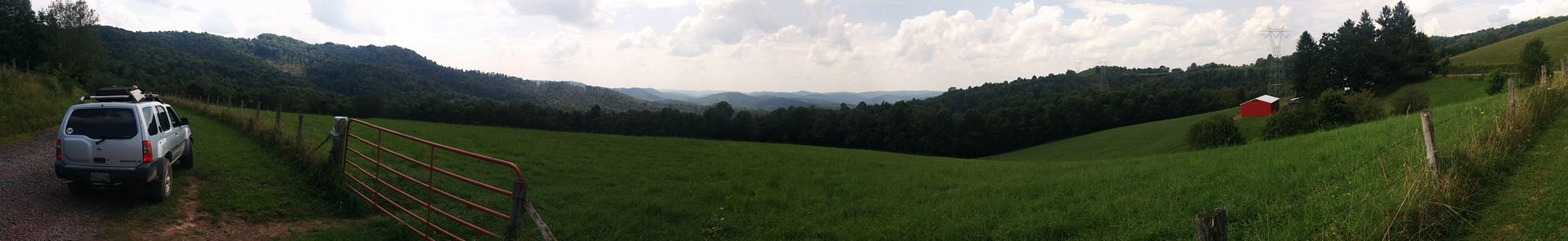
Pretty soon after we moved back into the hills, with some nice views


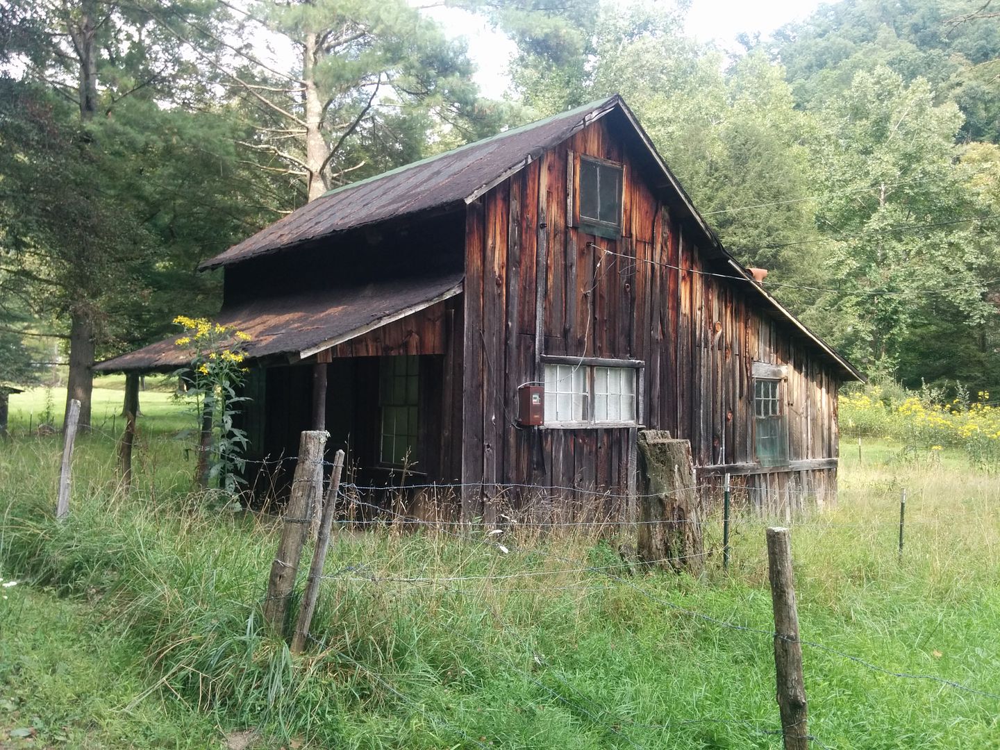
We stopped to take a picture of this cabin, I don't know why, I think it just seemed perfectly suited for where it was


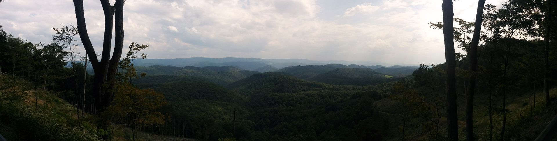
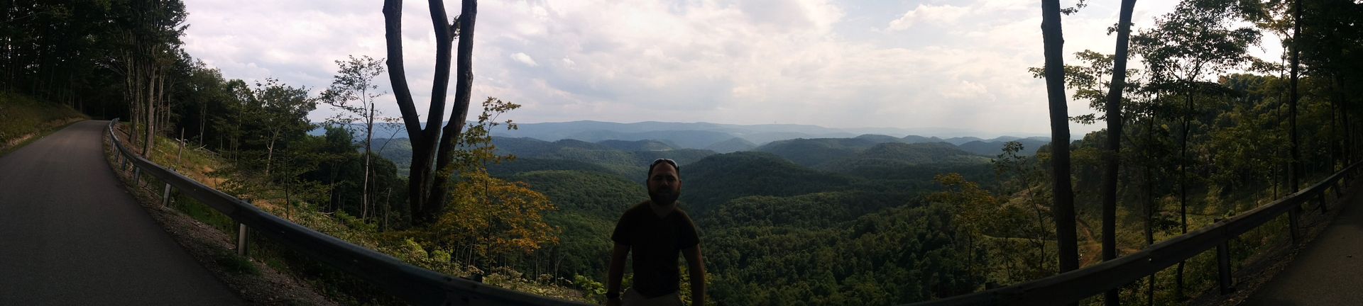
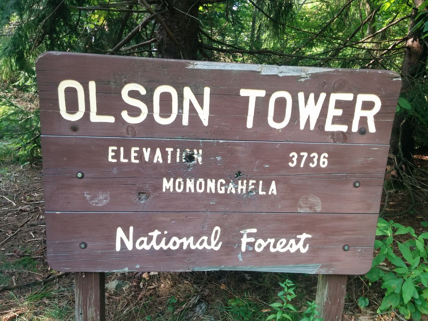
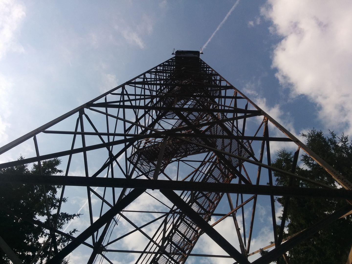
Our next stop took us to the Olson Fire Tower, this would be the highest point on the trip so far, and the highest we had been in any of our previous explorations


Neither my brother nor I are afraid of heights but 100 feet up on this tower and its hard not to feel a little weak in the knees


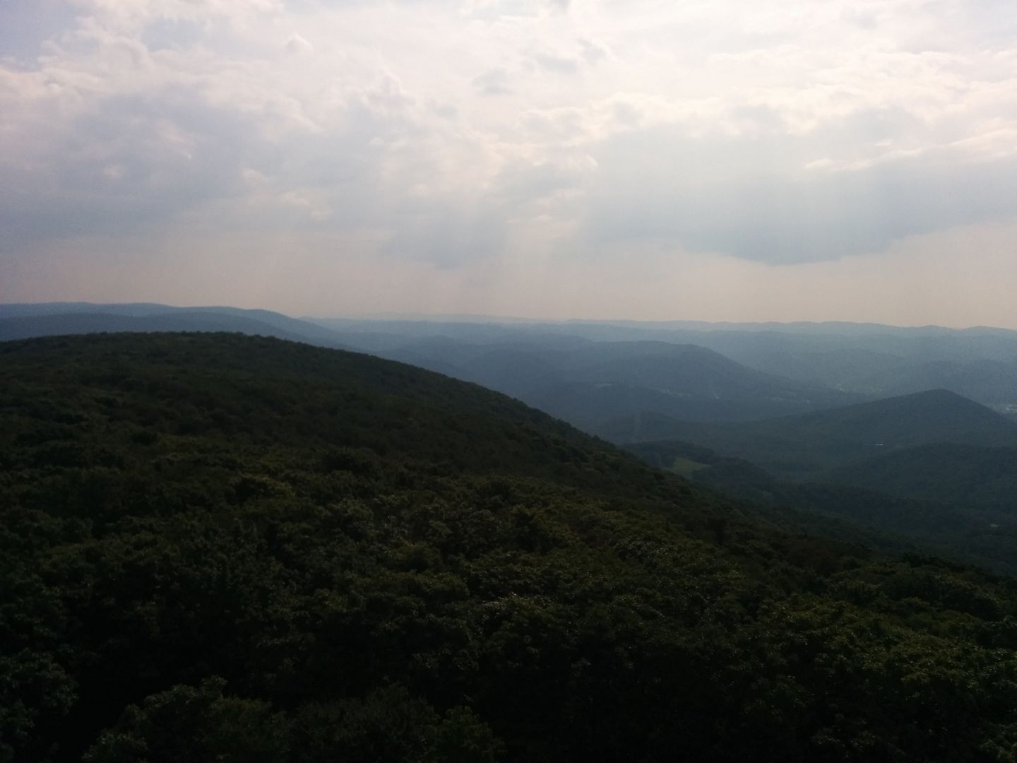
Great View of the countryside from up top
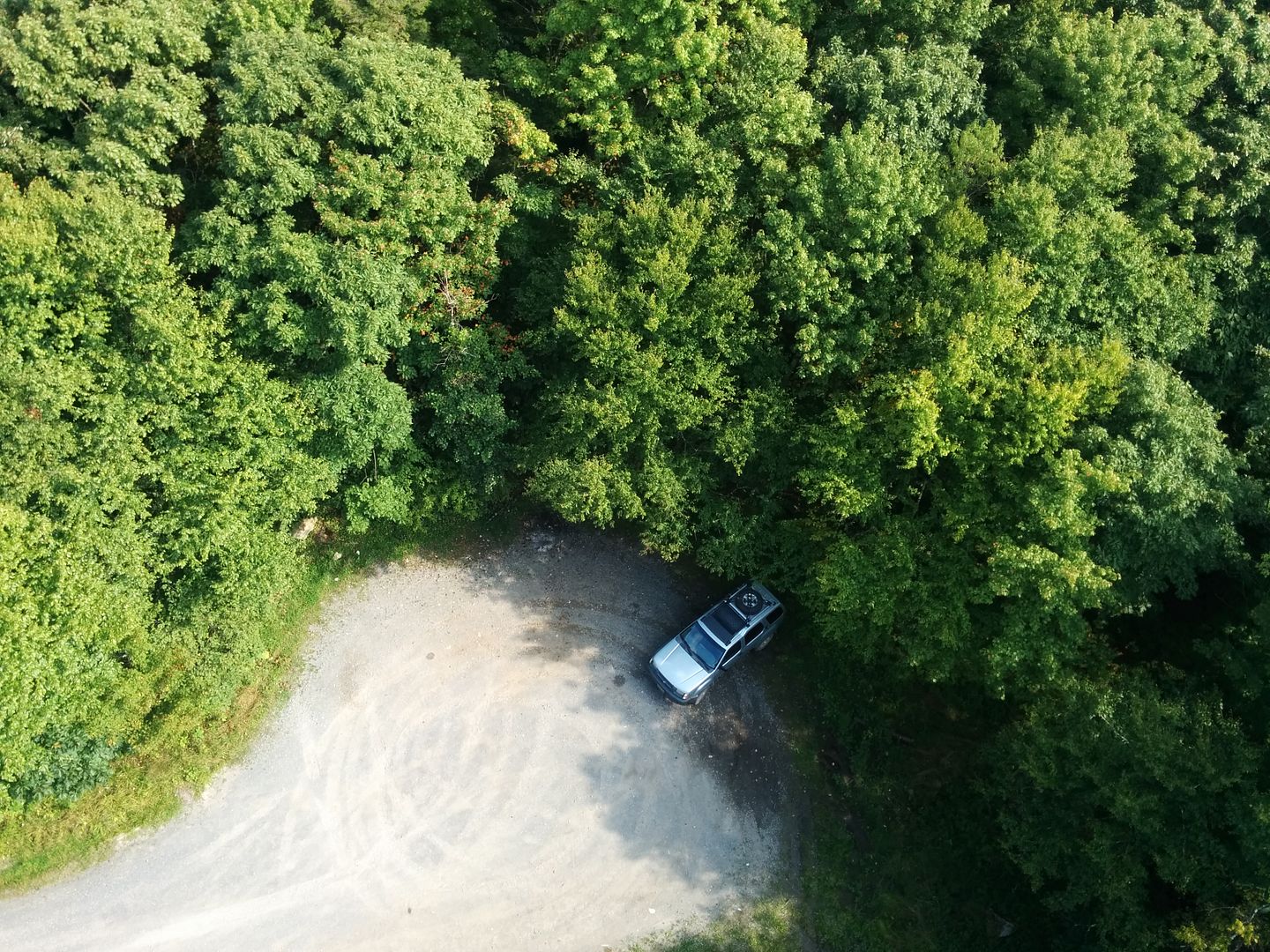


Straight down


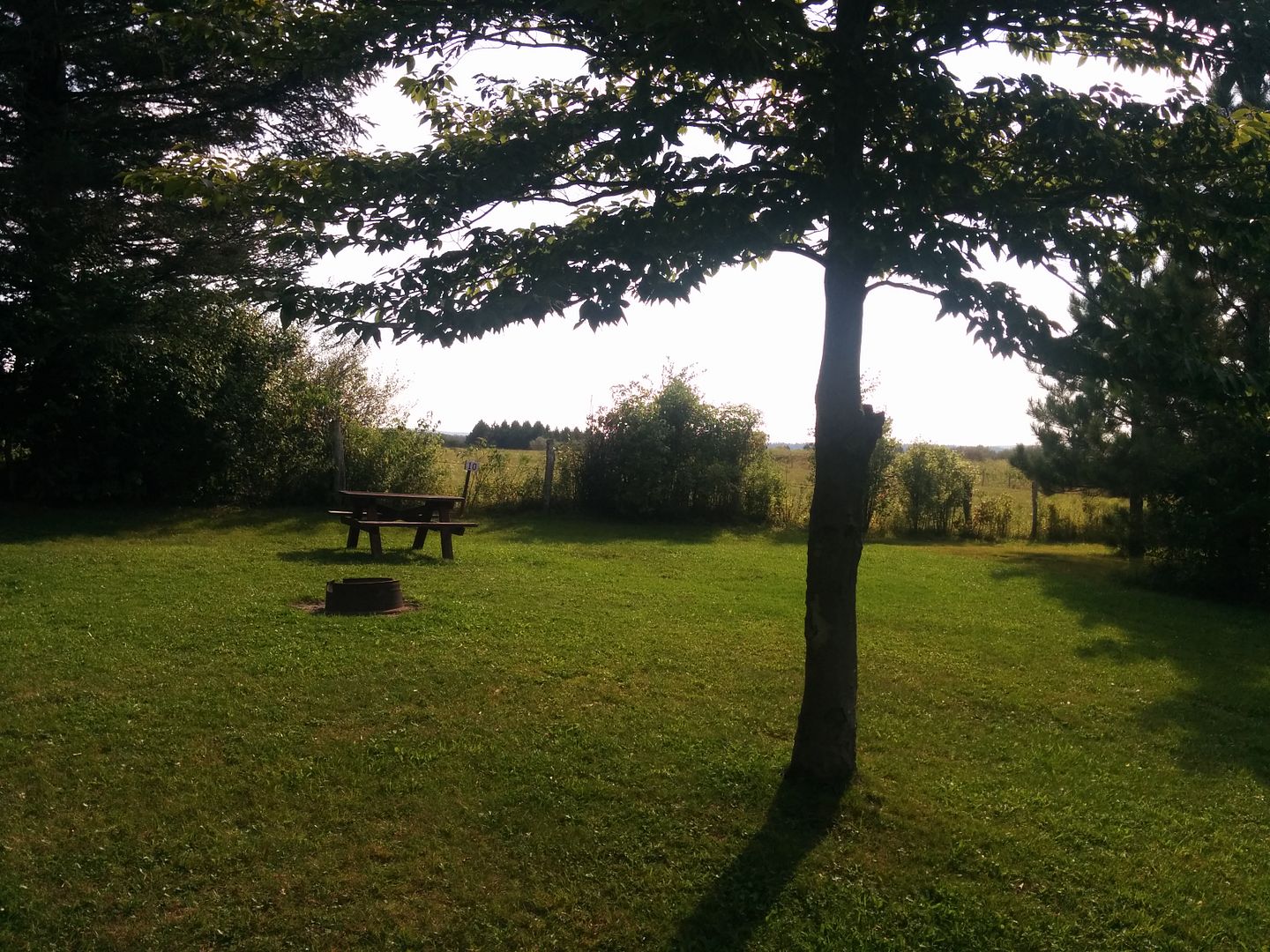
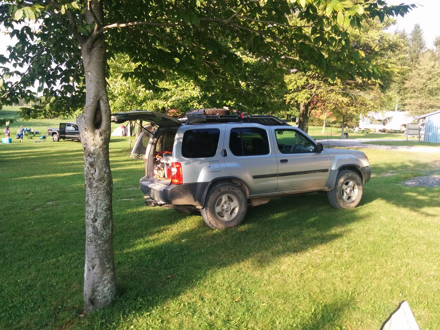
It wasn't long after the fire tower than we rolled into Blackwater Falls State Park, being the long weekend there weren't any campsites available. This ended up being a blessing in disguise, just down the road from the State Park was the Rest Rite Campground. It was mostly an RV type place but they had a few tent sites, $18 for the night? not too shabby, the bath-house was also quite clean. We picked the best setup and ditched our stuff to head to see the Falls before Dinner

Nice Site!


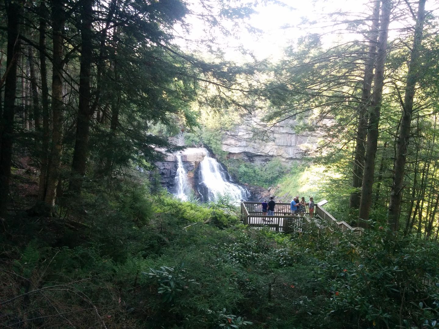
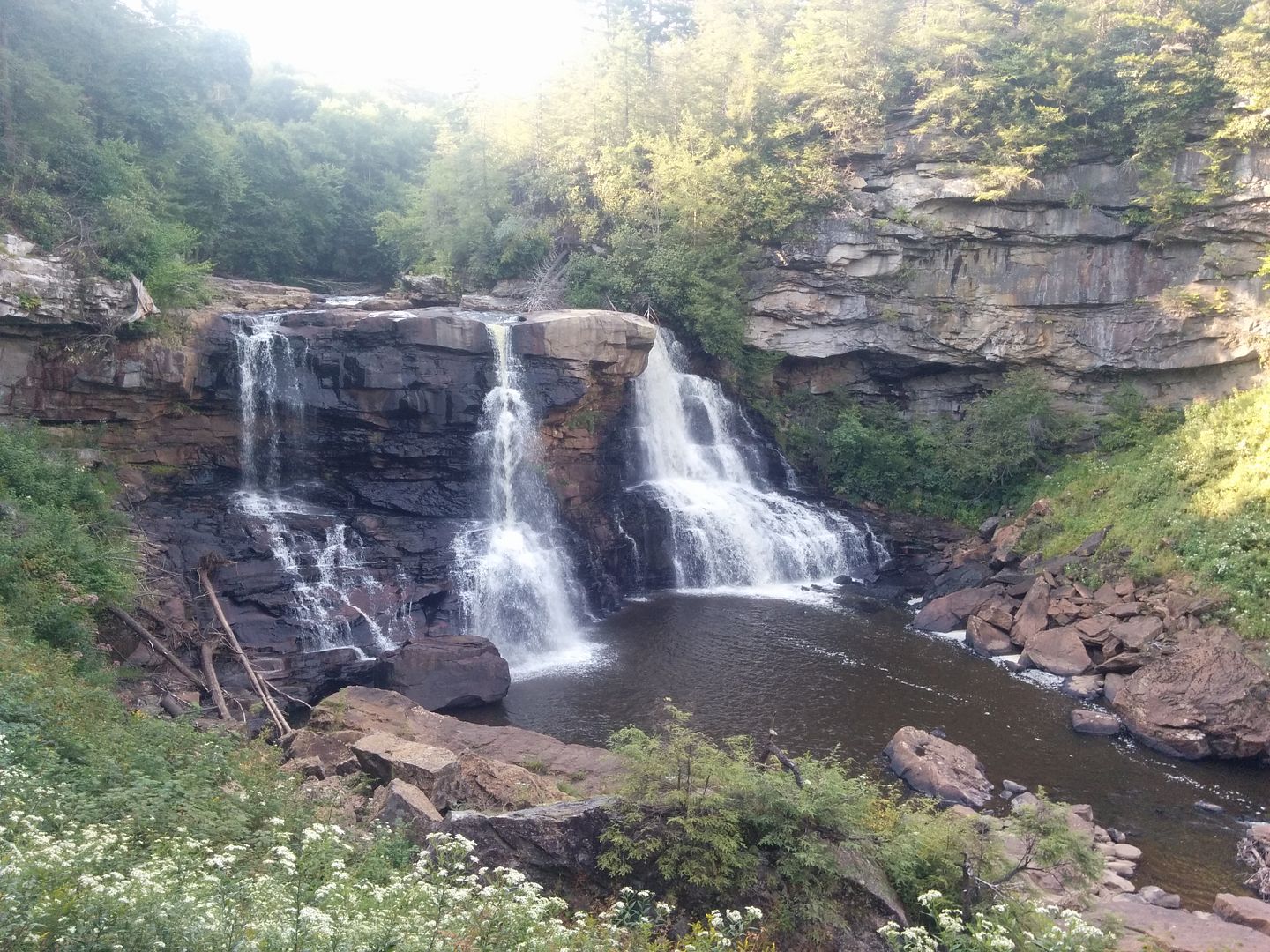
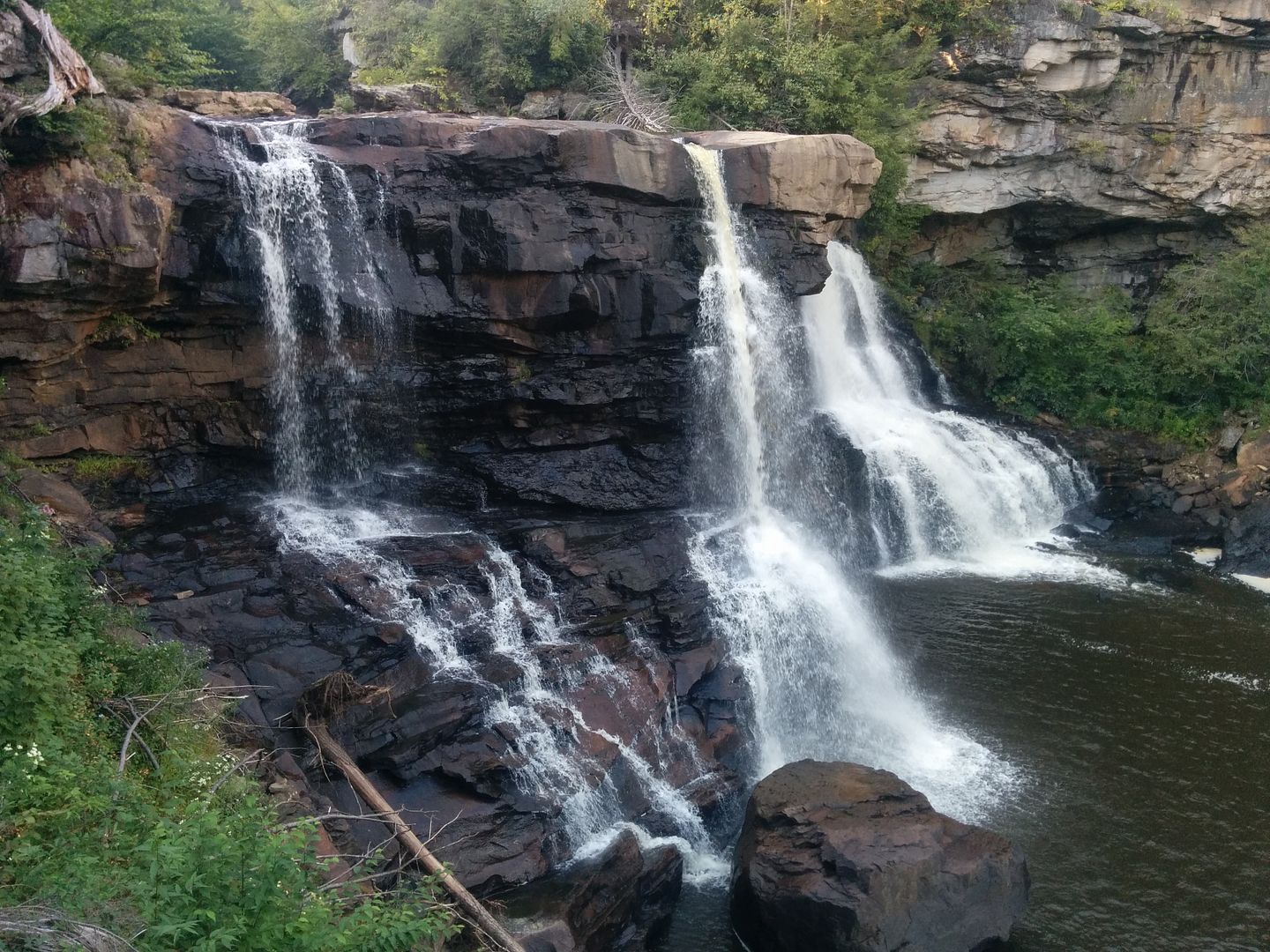
Blackwater Falls is absolutely worth a detour to see, especially in the Spring when I imagine the flow would be much higher! Its a quick 5 minute walk down some wood stair cases to the multiple viewing platforms.


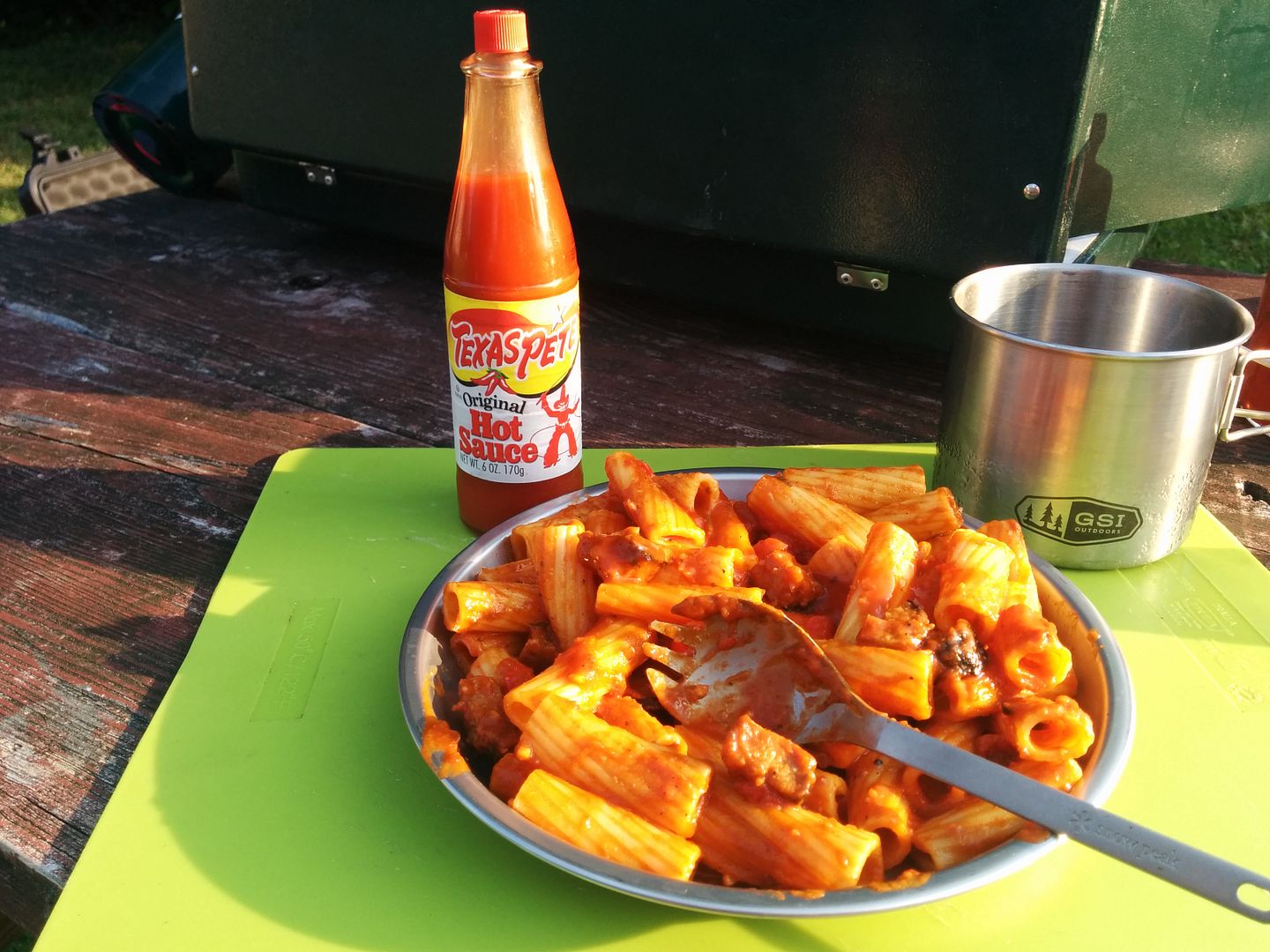
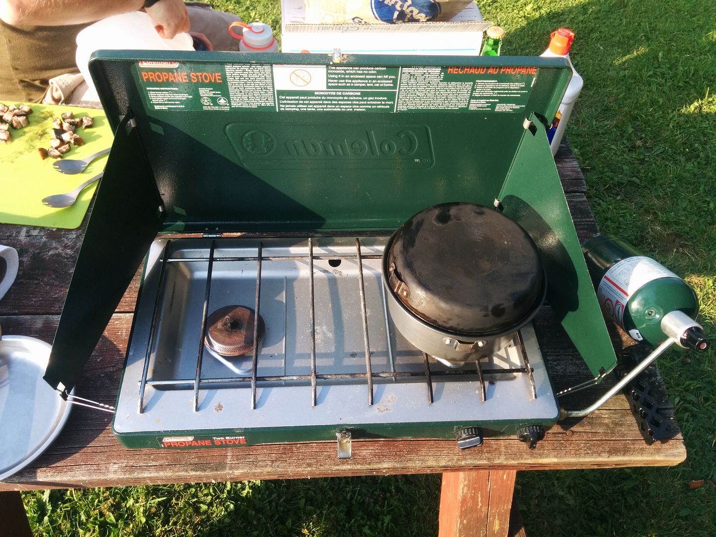
After the falls we headed back to the site for some dinner. We were just having simple pasta and tomato sauce with leftover sausages the night before.


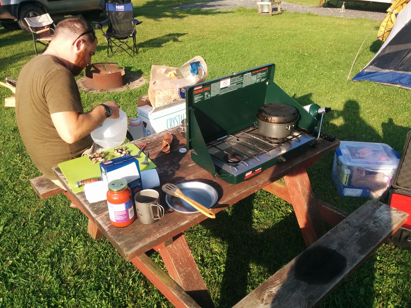
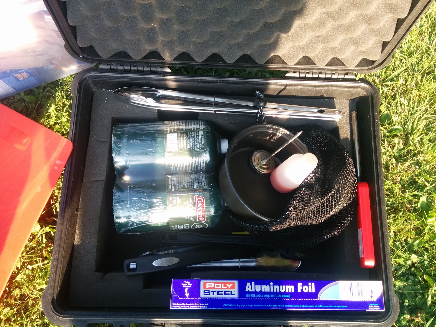
Our cooking setup consists of a coleman dual burner propane stove. Our pots and utensils are stowed away in a Pelican case when not in use. After a few trips it has been fine tuned and is working quite well.


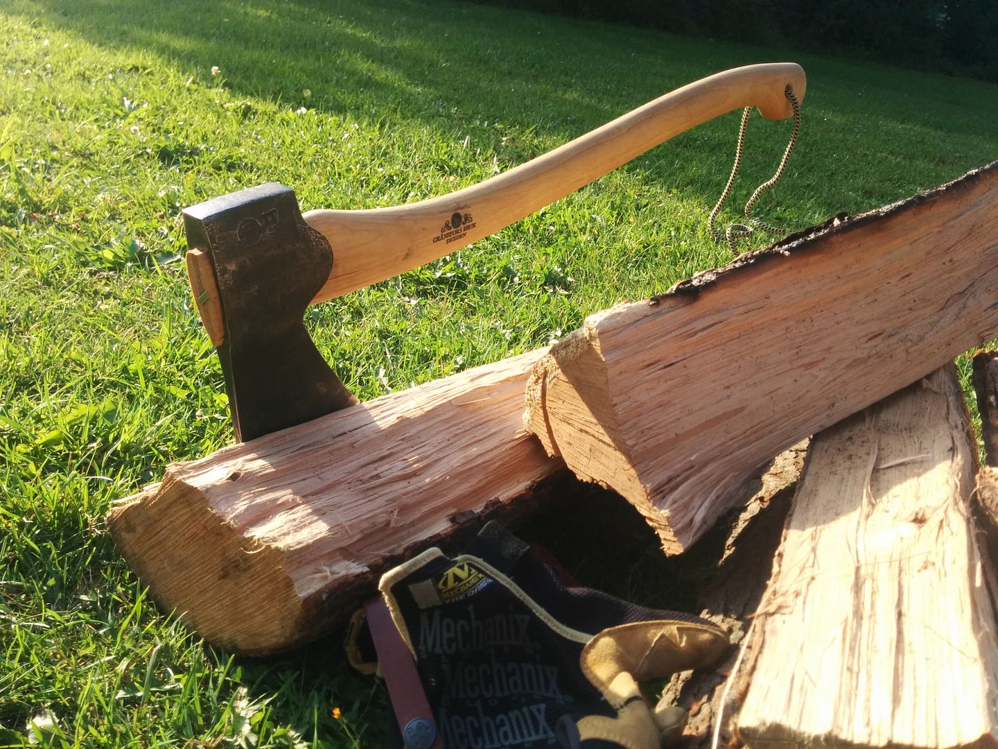
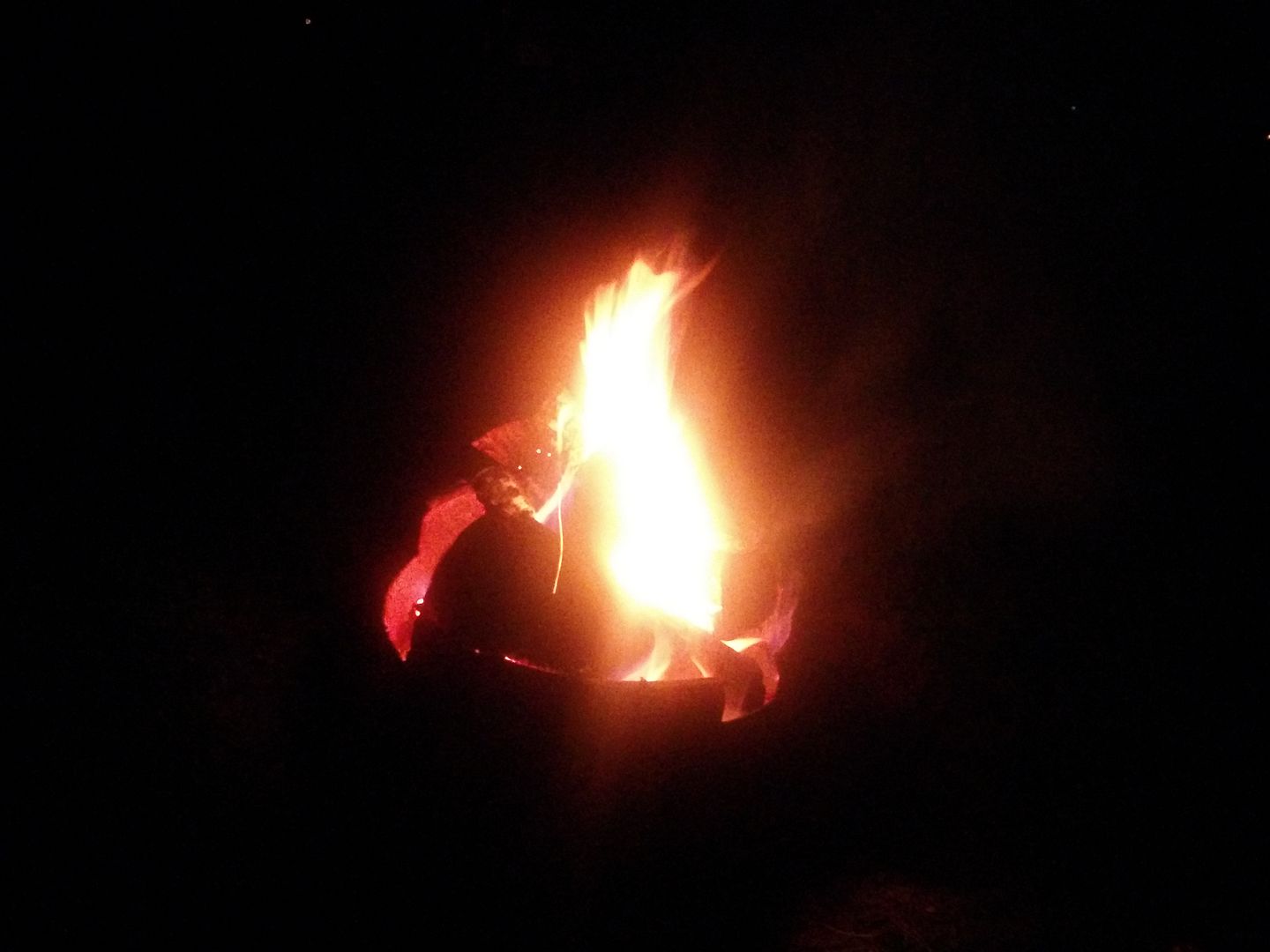
We split the remainder of the firewood in an attempt to get it to burn better tonight. Loving the new axe.


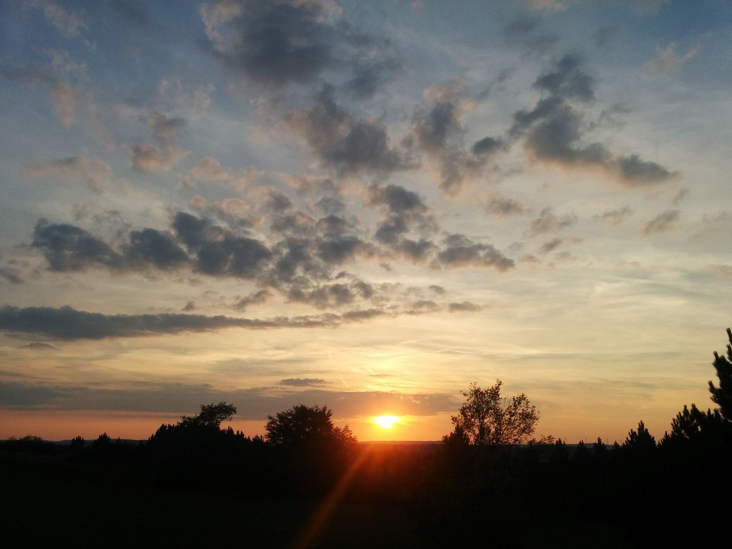
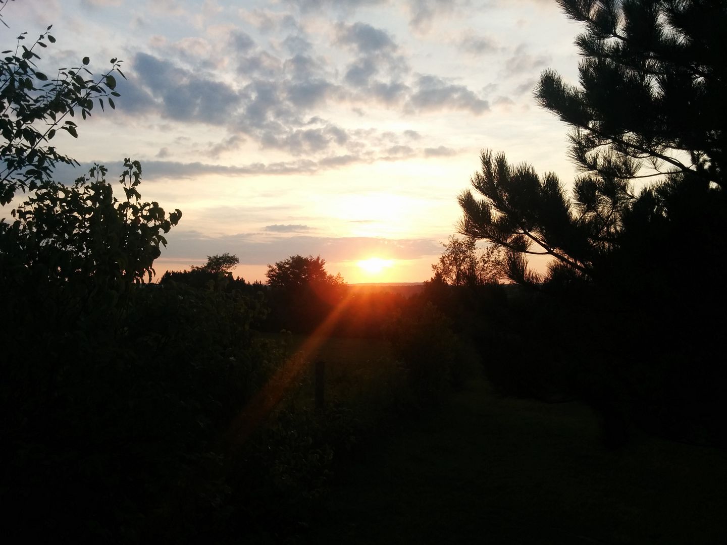
Sun going Down, beautiful clear night...


We had a real struggle getting it going with the wood we had, some nice West Virginian brought us a few nicely seasoned pieces of Ash, and that did the trick.


We went to bed thinking it would be a nice quiet night, there was a commotion sometime around 3AM, although my brother slept right through it. We were never quite sure but we think that a bear came into the site two over from ours and got into some food that was left out. A little unsettled we went back to sleep, Canaan loop road would be in the morning.
 

msoverland

Member
Heck yeah boys! Camp Dawson was closed eh? Sounds like you found a better road either way. That stretch through CD is pretty much just gravel anyway. We'll update the route - looking forward to seeing more!
 

mortonm

Expedition Leader
The next morning I was up fairly early, having not slept very well wondering whether that was indeed a bear two sites over. I was thinking about rolling over for another hours sleep when I looked up through the tent and saw a nasty cloud rolling in quick. It was a beautiful night so we had not even set up the fly of the tent. I quickly woke my brother up and we panic packed up the tent and sleeping bags. It literally started to downpour as we closed the hatch of the truck.

First on the schedule for the day would be Canaan Loop, its a 20 mile road that is nearby to the Blackwater Falls area. Most of it is just a nice dirt mountainside road, but there are a few miles of fairly rough terrain. We didn't really know what to expect as we had just seen some poor quality videos on youtube and heard some grumblings online that it wasn't very interesting.

This is a good start, literally right out the back of the State Park which is paved


We didnt get a lot of pictures, as it was still raining pretty hard, and some of them arent great quality.

There were a few larger creek crossings, but they were axle depth at the worst


It got pretty rough pretty quick, any stock 4WD vehicle would be fine, and any 2WD truck/SUV/van should be okay as well on a dry day. It was pretty slippery in the wet.


This is looking down slope, it doesnt look like much but this stopped our forward progress and we had to run at it a few more times to get up and over. The rock placement, slope and wet was just enough to stop my open/LSD axles.


Looking Up


I don't go mudding or rock crawling with my truck, but its been through some pretty rough terrain, this is the only this (so far) that I have failed to do on the first attempt.

As you leave the technical section, the road opens up into a graded dirt road, this was the sign going in the opposite direction of our travel


mortonm

Expedition Leader
The rain had almost stopped by the time we got to the graded section, it was a nice and misty morning


Nice little panoramic of the road in the fog. Note this is a 180 degree panorama shot, the road is actually straight


As you are leaving there is one last little side trail that has this creek crossing, we couldn't pass up the opportunity


Forum statistics

Threads
188,476
Messages
2,905,636
Members
230,428
Latest member
jacob_lashell
Top