You are using an out of date browser. It may not display this or other websites correctly.
You should upgrade or use an alternative browser.
You should upgrade or use an alternative browser.
A Week Plus on the Trans America Trail
- Thread starter mmbirtcher
- Start date
mmbirtcher
Observer
Here's a short video of the creek crossing in Oklahoma. Honestly it's more central than western so forgive me for that. A couple things I should note. I walked it before crossing to determine depth and "road" surface. It was to my waistband and I'm a bit shy of 5'10". The bottom was concrete (a low water bridge) with no washed out areas. There was absolutely no current. In the video the camera turns slightly to the left and back, which I believe was the back end floating if that's possible. The 4Runner has the multimode 4 Wheel drive with center a rear differential locks (the center saved the crossing I believe). At the end the air filter was only slightly damp at the bottom which I replaced at the next town. When I measured it later, the water was about 44" deep with a published wading depth of 27.5" + 2.5" of lift from the TRD tundra front suspension. It was, by far, the deepest crossing I've ever made successfully in the 4Runner. Nope, I don't have a RAI either. I believe this was the Bear Creek east of Newkirk. Enjoy the video!
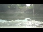
[video]https://youtu.be/AdE-1u_VJlA[/video]

[video]https://youtu.be/AdE-1u_VJlA[/video]
Last edited:
mmbirtcher
Observer
Our next day was a blur... We were on a mission to make camp in Mills Canyon that night, and for the most part, Oklahoma farm roads were compliant to my selected speed. Sections 23, 24, 25, then 26 landed us in Boise City where we detoured onto US 412 towards the Kiowa National Grasslands. The west end of Oklahoma had some muddy farm roads, not to mention some unexpected ruts that lead to damage to at least one of the rear shocks, so I'll be replacing those with some Bilstein 5100's like up front. Thanks to Mark at Fat Bob's garage for some phone based technical support and advice! The boys had been driving each about 25% of the time during the trip so far. They've gotten tons of experience that will be invaluable. :smiley_drive:
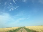
Flat land and big sky.

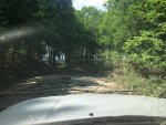
muddy. Muddy. MUDDY. Slippery, sticky, stinky, but not deep, mud...
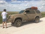
Luckily in this last picture, you can't see any of the 15-year-old boy artwork drawn in the mud on the 4Runner!

Flat land and big sky.

muddy. Muddy. MUDDY. Slippery, sticky, stinky, but not deep, mud...

Luckily in this last picture, you can't see any of the 15-year-old boy artwork drawn in the mud on the 4Runner!
Attachments
Last edited:
mmbirtcher
Observer
I don't think I'll ever drive the interstate again...
wagex
Adventurer
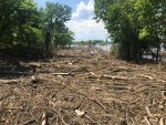
crazy how many people come through my little town... greetings from newkirk, oklahoma! you stayed the night across the street from my dad's house im guessing since its the only hotel in newkirk lol. unless you stayed at the casino. the flooding did stink it just cleared up this last week were you trying to go down silverdale lane or?
also if anyone else is planning to come through town, i can show you free places you can camp out by the river that are legal, or you can look on the corps of engineers website... but it would be cool to meet some of you guys lol. and my house is like 2 blocks off the trail if anyone needs some free wifi / power hookup or even an ice cold beer, always have some on tap.
also if anyone else is planning to come through town, i can show you free places you can camp out by the river that are legal, or you can look on the corps of engineers website... but it would be cool to meet some of you guys lol. and my house is like 2 blocks off the trail if anyone needs some free wifi / power hookup or even an ice cold beer, always have some on tap.
Last edited:
mmbirtcher
Observer
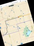
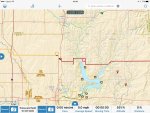
Well heck, @wagex, that would have been great! I wonder if there's a way to add member locations to some of those TAT and Continental Divide maps? I do plan on completing both over time as I approach retirement. This is a link of our approach to Newkirk (no idea if it works) https://www.gaiagps.com/public/io4ej7ALra2KPedUVHM5C6cc

wagex
Adventurer
ahh yep i live right off of first street on the west side of main street, small world!
looks like you ran into the low water crossing and turned back, i go though there regularly, but around the time you went through it was probably 6-8ft deep where the creek normally is. just this past weekend i was able to go through in our dodge journey it was about 18"
east of elgin was that a river crossing where you turned around? im going camping on copan lake in a couple weeks and was thinking of following this all the way to there. think il be coming from the other way, was it definitely too deep or just didnt want to risk it?
Last edited:
mmbirtcher
Observer
The last place we turned around was at Sweetwater Creek. Should be here: https://www.gaiagps.com/public/XEi3sInm7YJLTwuR9A1uJ3Wv
I believe this is where we made the crossing: https://www.gaiagps.com/public/bspzELAgoUxKAGRQKIRdu0X0
Although it may have been Little Beaver Creek. @Wagex, maybe you can help identify it from the vide clip.
And yes, we did turn around at Cedar Creek east of Elgin. https://www.gaiagps.com/public/OkkLTXwOSvyBpG3LgxnLdW2U
wagex
Adventurer
The last place we turned around was at Sweetwater Creek. Should be here: https://www.gaiagps.com/public/XEi3sInm7YJLTwuR9A1uJ3Wv
I believe this is where we made the crossing: https://www.gaiagps.com/public/bspzELAgoUxKAGRQKIRdu0X0
Although it may have been Little Beaver Creek. @Wagex, maybe you can help identify it from the vide clip.
And yes, we did turn around at Cedar Creek east of Elgin. https://www.gaiagps.com/public/OkkLTXwOSvyBpG3LgxnLdW2U
yep sweetwater creek was the one i was referring to first, sorry your trip is backwards for me
thanks! il probably be doing this exact section just in reverse but pulling my pop up camper. hopefully water is all receded by then it only has about 20" of clearance before it probably turns into a boat haha.
how do you like gaia maps? is it worth the $20? il probably be coming into an ipad before then and am looking at softwares to use.
mmbirtcher
Observer
Yeah Gaia has been great. They just upgraded their platform which they gave me free for like 4 years. I also use a Dual GPS puck that sits on the dash and goes for about $89. Bluetooth connection works great. I've been using an iPad Air2 with cellular, but I set it where it's only on wifi & Bluetooth to save any cell data charges. I just download the maps I need in advance. I have a 64G iPad so plenty of memory for maps. Haven't gotten a hard mount yet, that will be on my next car, probably a 100 TLC or LR3.
mmbirtcher
Observer

Getting into Kiowa National Grasslands in New Mexico. On our way to camp in Mills Canyon.
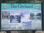
This was an orchard back in the early 1900's until it was destroyed by flooding.
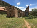
Old restored remnants of orchard buildings remain.
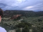
Pictures simply don't do this place justice. I'll have to get back there, but we were there the first of June or so, and it was starting to be a bit warm in the day. I think early to mid May might be a perfect time to camp and explore the dirt roads of the canyon. Beautiful place. I slept on an air mattress on my roof rack and had the best night sleep ever in the outdoors.
I should mention this isn't on the TAT. It's probably close to the GCDR route. We took a side trip to get here. The next post is back on the TAT.
Last edited:
mmbirtcher
Observer
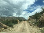
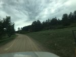
The fun, but not too challenging track out of Mills Canyon.
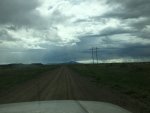
County Road 52 near Trinidad CO. Something funny we noticed about Trinidad was it seemed every other store front was a cannibus shop. Being near the state border I guess.
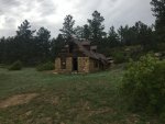
County Road 44 near Aguilar, CO. These old abandoned houses really fascinate me. I always wonder what the story is behind them and what happened for them to be abandoned.
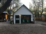
The I Love Lucy RV Park in Laveta CO. It was about 8pm on June 2 and we hadn't found a place to camp, so we pulled in here just to see about pitching a tent on a grassy spot. This building is the office that also has a nice common space with a wood stove that they fired up for us. Normally it wouldn't occur to me to camp somewhere like this by RV's but the woman who runs the place was great.
Attachments
Similar threads
- Replies
- 9
- Views
- 2K
- Replies
- 3
- Views
- 1K
- Replies
- 35
- Views
- 9K
- Replies
- 14
- Views
- 3K

