American Southwest Trip Report - June 2015

boyfester

Observer
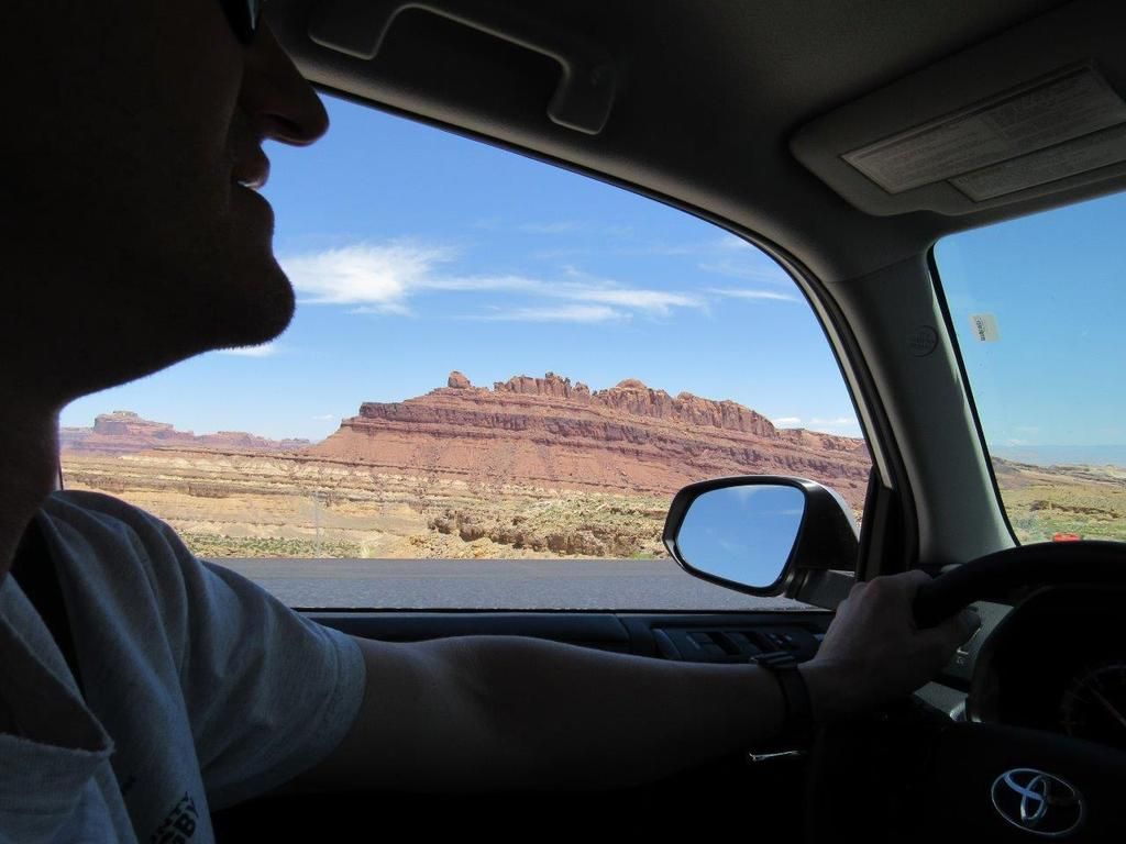
My son and I headed out from Orange County, CA to Denver, CO for my father-in-law's 80th birthday party. We split driving duties as we drove to Cedar City, UT. The next day, we headed to Canyonlands National park to check off one of my bucket list items - the White Rim Trail. Before reaching Canyonlands though I had heard of a couple of popular petroglyphs in the San Rafael Swell that I wanted to see and show my son: Head of Sinbad and Black Dragon. The petroglyphs in this area of Utah are supposedly some of the only native drawings of extraterrestrial and prehistoric life as the pictures look definitely alien like and the dragon looks like a pterodactyl.

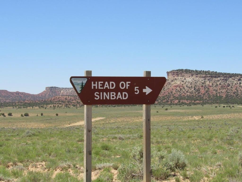
The road to the Head of Sinbad is off of I-70 and was pretty well marked with signs.


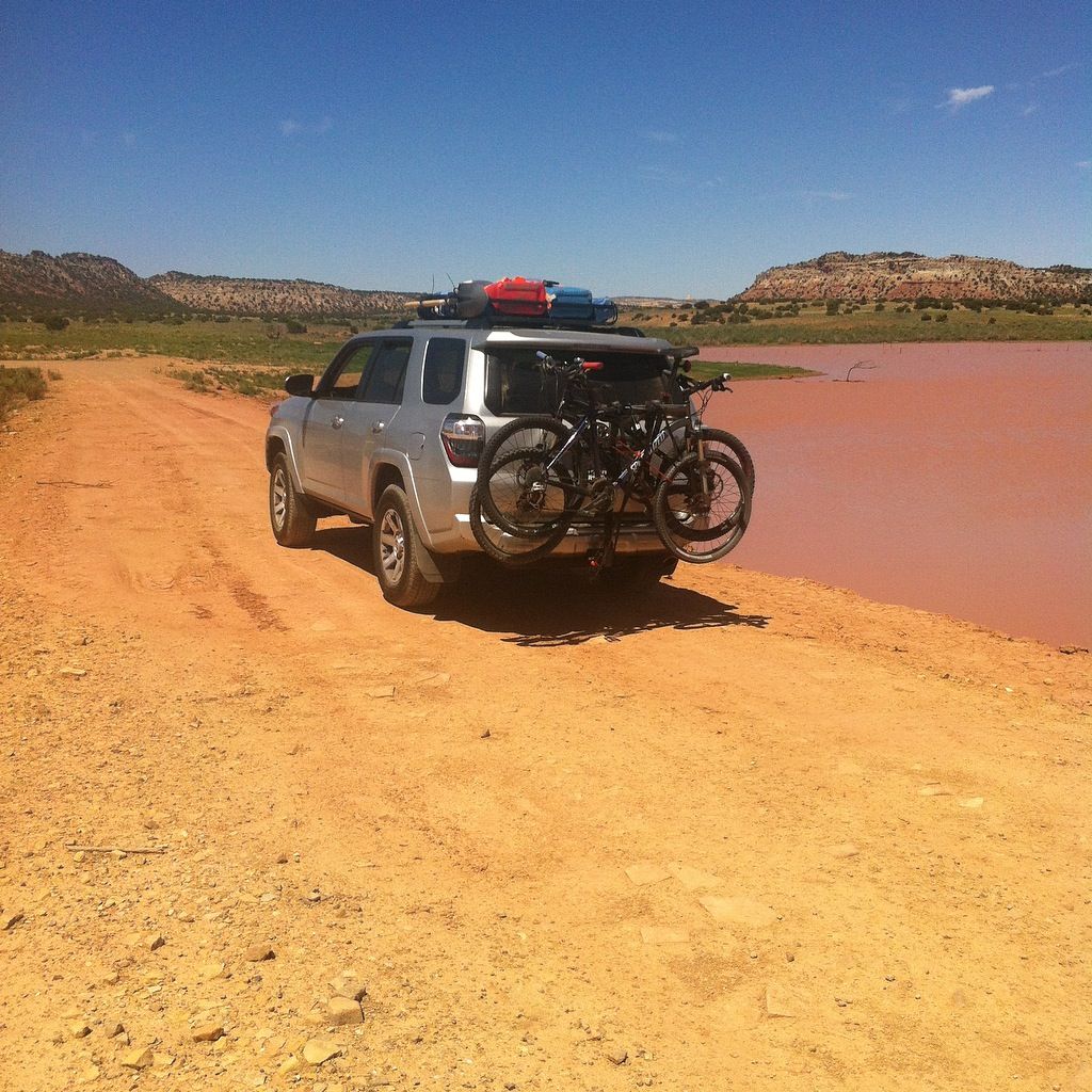
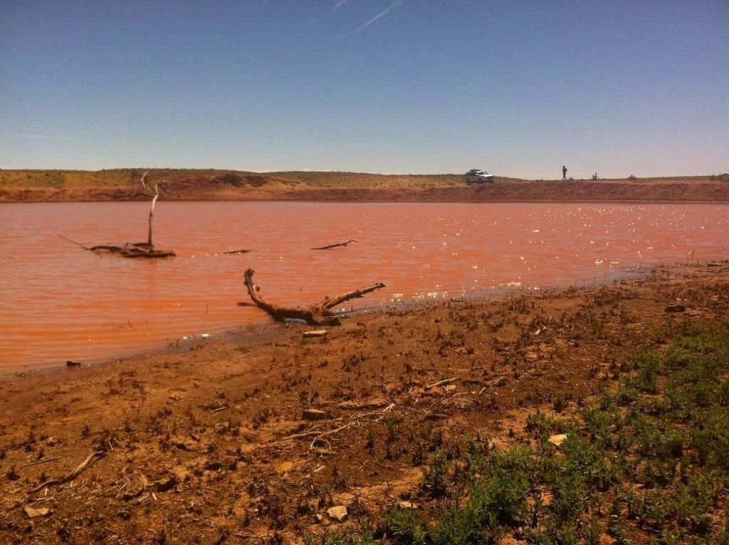
We came upon a reddish-brown pond called "State Pond" on the map. This was the last time our mtn bikes would be clean. I knew they were going to get dirty and dusty but I didn't want them on the roof since I couldn't see them and I wanted to minimize the wind resistance and noise.


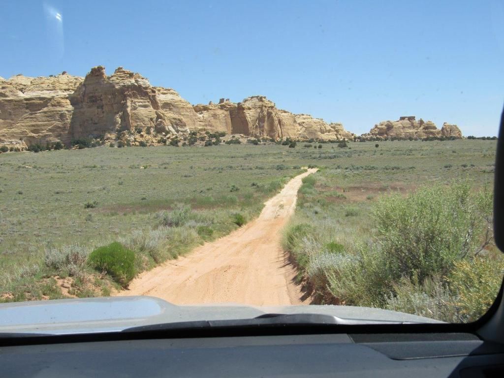
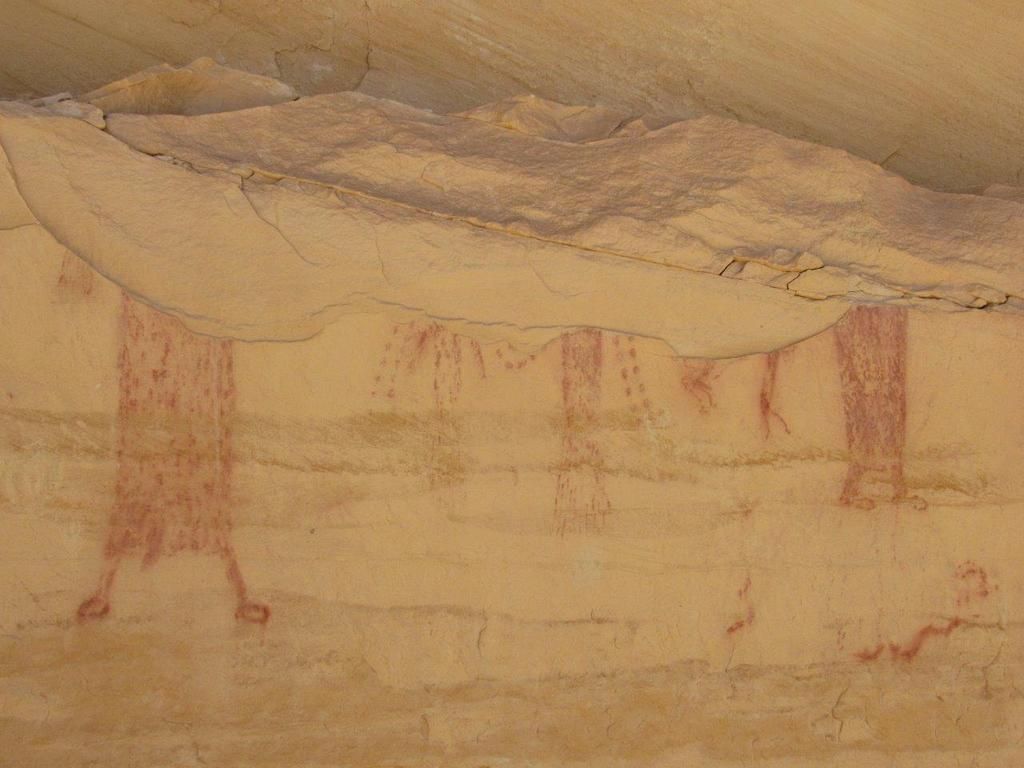
The Head of Sinbad is within Locomotive Rock (shown below). There were a few different trails to select from and no trail signs back here and so we ended up finding some other petroglyphs that were partially destroyed from weather. I had a picture of the Head of Sinbad from a hiking book and so I knew these weren't the correct drawings but it was still a shame to see art destroyed.


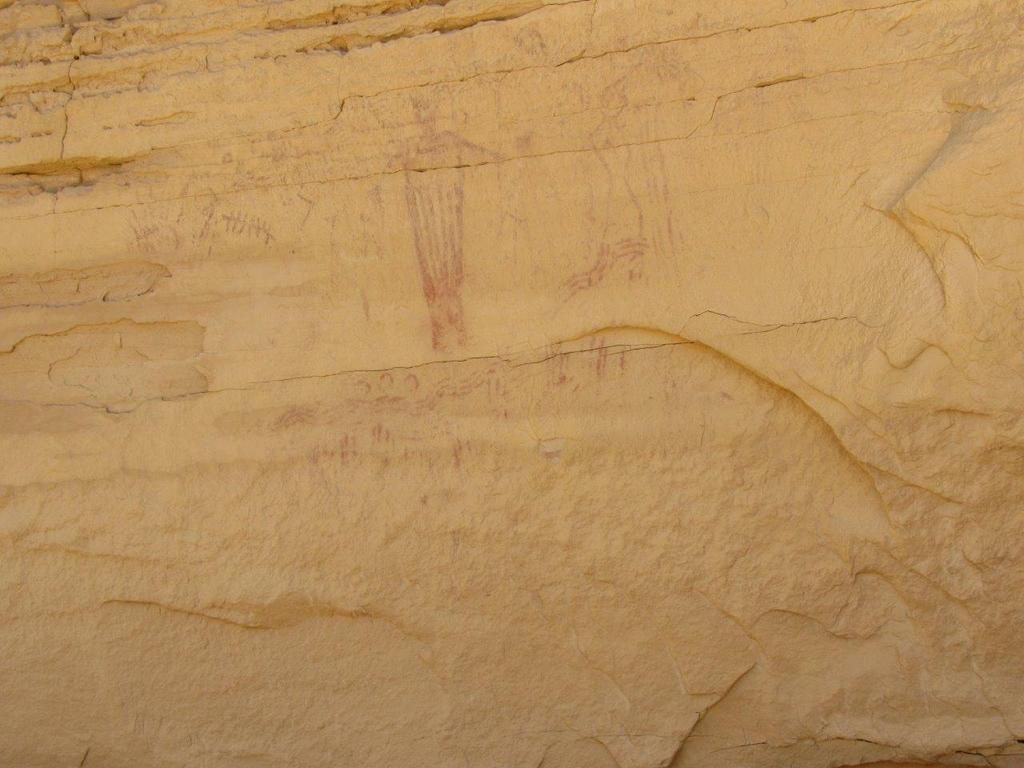
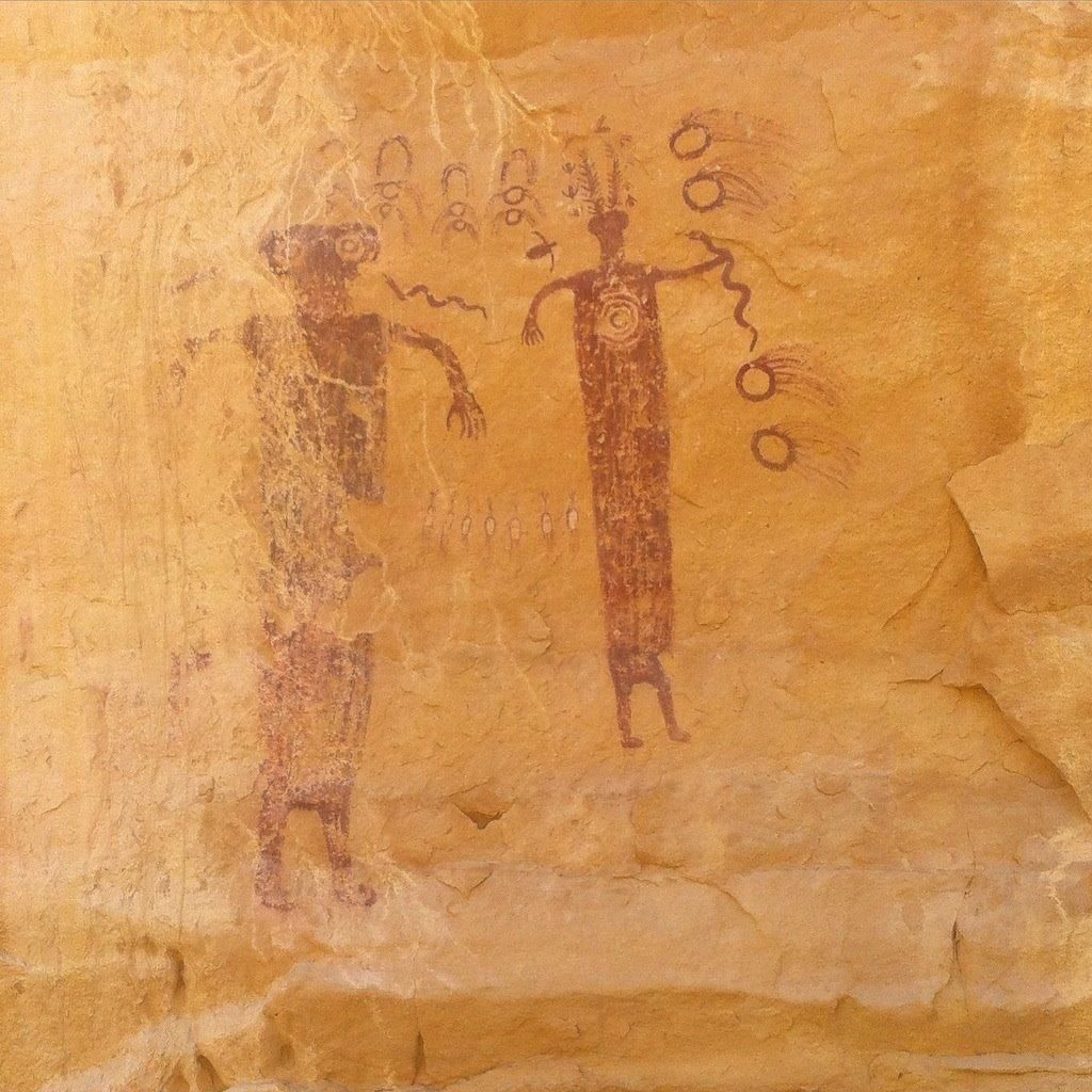
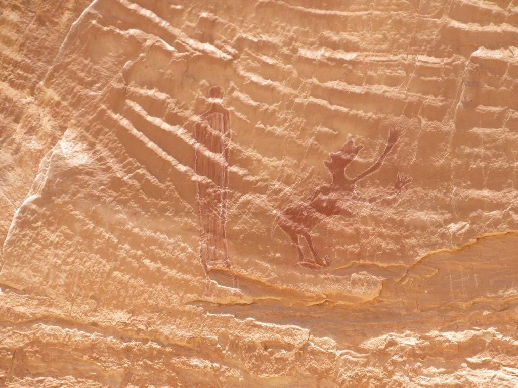
We backtracked and ended up finding the actual drawings of the Head of Sinbad. The ink was much darker than the previous ones. The drawings were about 10-15 feet high and appeared very alien-like.


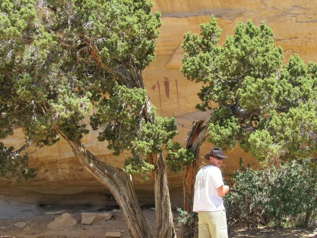
This is the Head of Sinbad plus some other works.


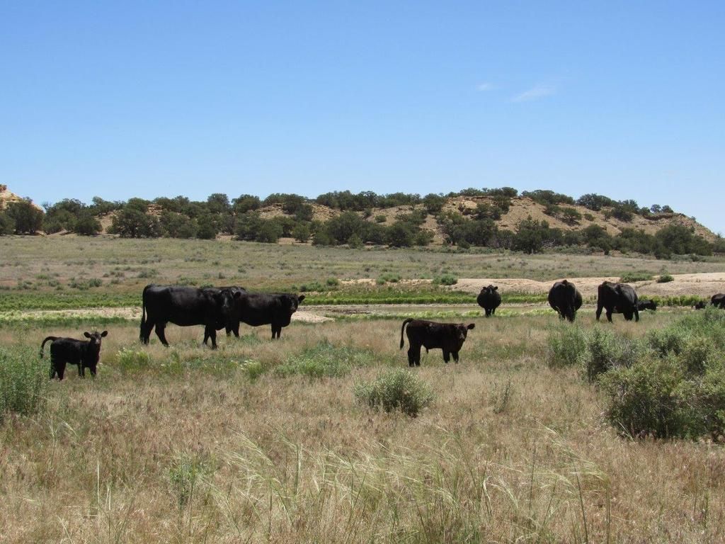
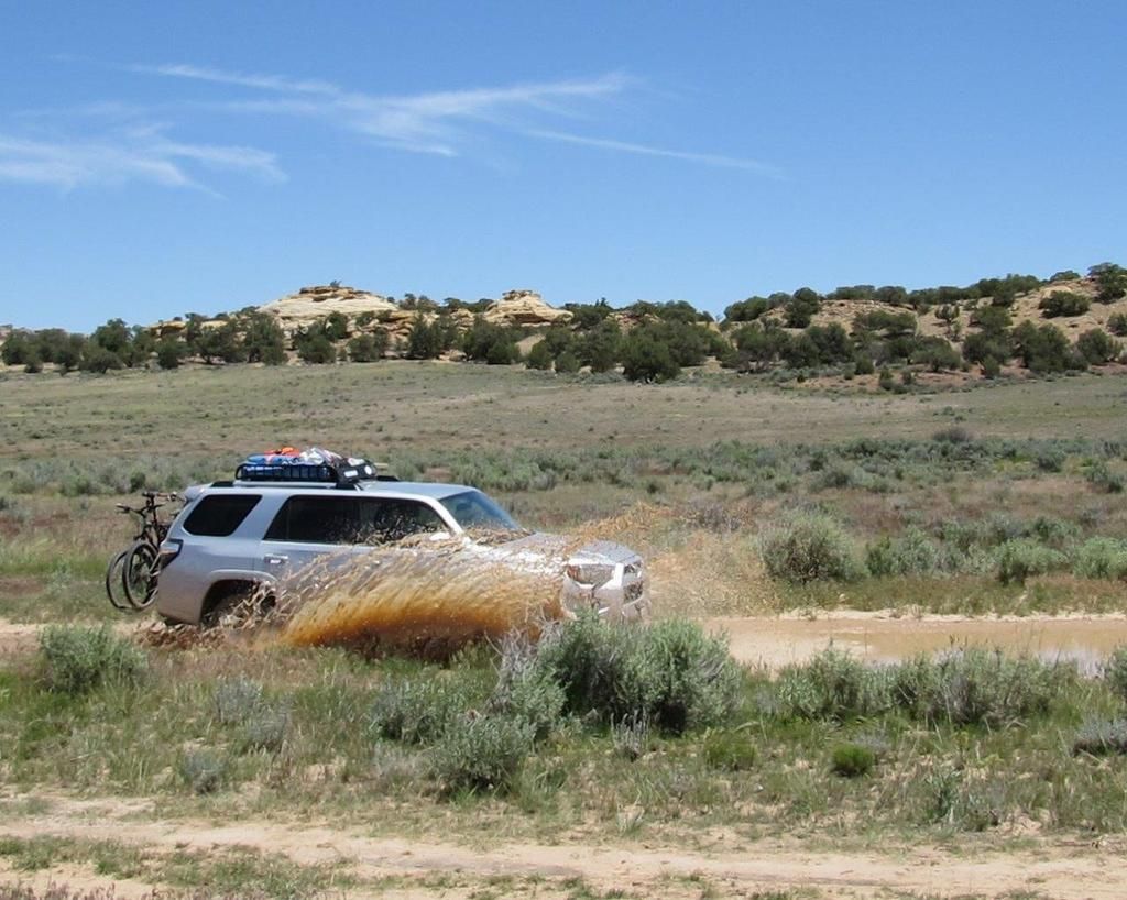
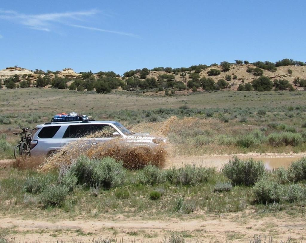
After that we headed back to the I-70 and found some cows along with some fairly large sections of water on the trail left over from the last rain. Unfortunately we had to stick to the muddy road and our mtn bikes got a helpful serving of fresh Utah mud. Kudos to my son on the great action shots!


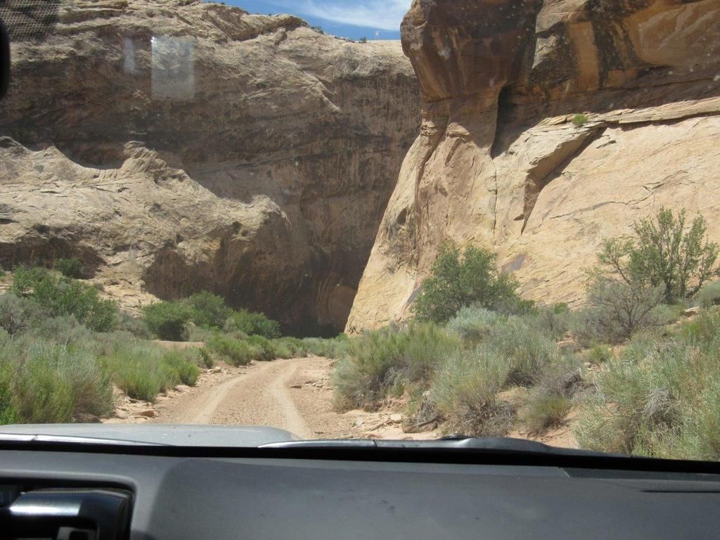
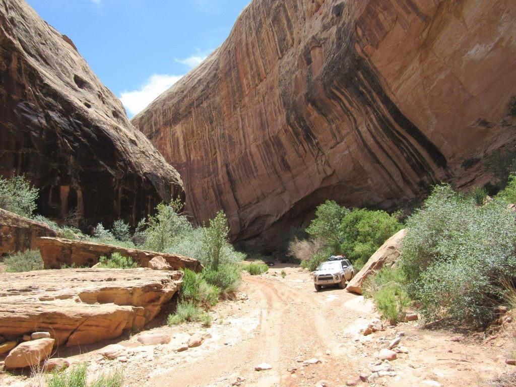
The exit to Black Dragon Wash is just after passing the huge "ship" rock at Mile Marker 147.


This is the entrance of Black Dragon Wash.


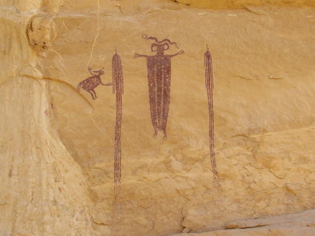
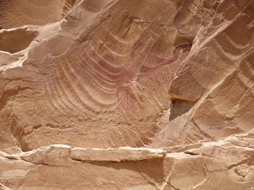
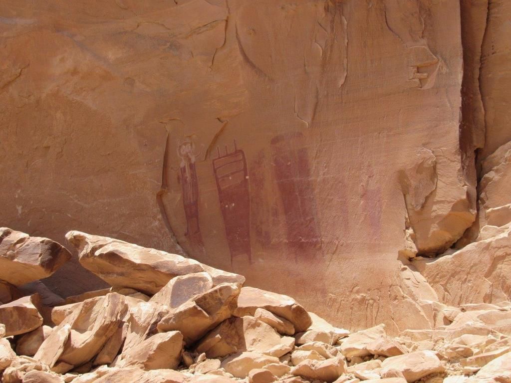
The infamous pterodactyl-like dragon petroglyph. This and other drawings are about 70 feet up the wall so a zoom lens is very beneficial unless you like to climb on loose shale.


boyfester

Observer
From there we headed to Canyonlands and filled up our truck and extra gas can in Green River as there were no gas stops from Green River to Moab and we'd be doing over 120 miles of slow-going 4WDing. These interesting foods were on the side of a gas station in Green River. Yum?


We chose to run the White Rim Trail in a counter-clockwise direction and started from Mineral Bottom. The switchbacks at the start were really cool! There was a truck pulling a trailer of canoes up the trail so we decided to wait for him to reach the top.


We spotted a Jeep coming up too. After that, we didn't see anyone else until the next day (Friday).


After descending the switchbacks we came to the start of the White Rim Trail and the entrance to Canyonlands NP near Point Bottom. Note there are two bikes on the back at the beginning of this trip. That wouldn't be the case at the end.


There is no room for error on this section of the road near Saddle Horse Bottom. I strongly recommend National Geographic's Trails Illustrated map of Canyonlands. It was informative and had loads of info about the trail.


We reserved a campsite at Hardscrabble which had a large tree and plenty of shade. I wasn't able to put up my $45 awning that I made since the spot was overly windy and plus we already had shade. I did use the PVC poles to set up our solar shower though.


Later in the afternoon after relaxing a little bit and unloading the truck, we drove further down the WRT to the Fort Bottom Ruins trail which leads to an old Indian tower and an abandoned cabin. The WRT proceeded upwards from the Hardscrabble campsites along a narrow shelf road that was moderately rocky. My son shot a picture of the sun's rays shooting directly onto our campsite below.


My wingman.


We parked the 4Runner at the base of this huge rock, which is called called Bighorn Mesa. The trail head said the trail was 1.5 miles but it sure felt like 3 miles as it ascended and descended many hills and traversed narrow ledges.


That's the tower ruins on top.


boyfester

Observer
We also spotted the weathered cabin near the valley floor of Fort Bottom. We didn't hike to it as the camera's zoom lens worked well enough and it was already starting to get dark.


After 30 minutes of hiking, we reached the tower ruins. There was supposed to be a log book but we didn't see anything.


It's recommended that you don't touch or step inside so I only extended my arm inside and shot a picture of Bighorn Mesa through one of the spaces in the wall.


When we got back to camp just before darkness came, we were in for a surprise. We were met with hundreds of mosquitoes! We searched frantically for the OFF bug spray while being eaten alive. We thankfully packed our mosquito nets for our heads but the rest of our bodies suffered until the OFF was found. What we found out was the bug spray worked terrific on the mosquitos but the horse flies in the area could care less. So we cooked dinner in 90 deg heat, ate through our head nets, took showers, and then jumped into bed. By keeping a light on outside of the tent, we were able to sneak into our tent without a single insect coming inside.
 

boyfester

Observer
The next day, the flies and mosquitoes were gone and we packed up for our larger leg of the White Rim Trail (over 70 miles). This is a photo looking towards Potato Bottom Basin. This section was a moderately rocky downhill but it was easy in low range.


Besides stopping to take pictures every few minutes of the beautiful scenery, we had to stop and make adjustments to the bikes on the back. The trail was so bumpy throughout the entire length you were never really able to get above the park's recommend speed limit of 15 mph. More than a few times, my home-made bike rack's two arms (which held up the bikes' frames) were bending downwards from the force of the bikes bouncing downwards. I kept having to bend the steel arms back upwards and I was worried that they'd fatigue and break permanently. As you'll see later in the trip, after the rear most bike fell off for the 3rd time, I finally removed it and threw it in the truck. By only having one bike on the rack, the moment arm was much shorter and didn't cause anymore bends in arms. Anyway, on with the show.

This is along the edge of Soda Springs Basin with Candlestick Tower in the back.


I even braved sitting on the edge to warm my toes as the wind blowing up the wall was a brisk 90 degrees.


This gives you a sense of how close the cliff edges are to the trail at times.


This was the most difficult section of the trail called Murphy Hogback. It wasn't difficult at all for our stock 4Runner. Our stock tires also handled the loose rocks easily. The view from the top of the Soda Springs Basin was incredible!


As I noted, the trail was really, really bumpy. None of the books that I had, including Charlie Wells' Moab book, noted that the trail was bumpy for the entire length. At one point in the corner of my eye I noticed my son holding onto a bag of pretzels with two arms as if he was holding onto a first born. I told him not to move and grabbed my iPhone. As soon as I grabbed it he knew what I was going to take a picture of and started cracking up. This is my son. Protect the food at all costs!


This is Monument Basin I believe.


This is where my patience ran out on my poor bike rack and I decided to put the other bike in the back of the 4Runner.


Washer Woman Arch and Monster Tower


Airport Tower is just above the Airport campsites.


Musselman Arch was pretty thin; only about 4 feet thick.


boyfester

Observer
We were nearing the end when the road became much easier and we started seeing more vehicles. The Shafer Trail portion of the WRT was really impressive and the views from the top are breathtaking!


Well, that was it. We left at 9:30am from our campsite and exited Shafer Trail at about 3:30pm. I think it took us about 8 hours to complete in total (counting the day before) and it was something I'll remember forever. If someone asks me to do it again, I'm not bringing mtn bikes and I think I'll air down my tires more to reduce the aggravating bumpiness. I was running 25 psi and think 20 psi may have made it more comfortable.

Anyway, all told, we saw 6 other 4WD vehicles, no motorcycles, and no mtn bikers. I thought we'd see more since the temperature really wasn't that hot. It sure was nice travelling along the numerous narrow shelf roads and not having to back up for someone else. Whenever we did see another vehicle, which was going in the opposite direction, there was always a place to get around each other.

------------------------------------------

Before heading to Moab for a late lunch, we decided to travel along Long Canyon Road which included a huge fallen boulder that you drive under. The road had hardly any bumps and we finished it in about an hour.


The entrance to Pucker Pass.


There was some nice shade under here.


We think this is Jug Handle Arch but we're not positive.


After that, we hit up Moab for a very late lunch at Zax' pizza parlor for all-you-can-eat pizza. My son didn't eat as much as I thought he'd eat. Apparently he had eaten too many pretzels.
 

boyfester

Observer
After a great trip from California to Denver and being able to spend some quality time with my wife's family, it was time to leave and head back home. Unfortunately I was without my wing-man son as he and our daughter were staying for a few more days in Denver and would be flying home later in the week. I also remedied our broken bicycle hitch rack (which broke along the White Rim Trail on the way to Denver) and was able to replace it with a very used and rusty Thule T2 rack that I purchased via Denver's Craigslist. Although rusty, dirty, and covered with a gazillion stickers, it was a sound rack and very sturdy. After re-loading up with fresh supplies as well as both mtn bikes, I left on 25 June and headed to Ouray. I had plans to drive the "easy" roads as per Charlie Wells' Colorado Trails book as I didn't have anyone to meet up with, even after posting my trip plans on the following forums: toyota-4runners.org, ultimateyota.com, expeditionportal.com, and toyota120.com. I did get great suggestions of roads and trails to hit along with a great website which gave weekly updates on trail conditions.

The trip to Ouray was beautiful! I decided to forgo Interstate 70 and took the scenic Hwy. 285.

This is Mt. Princeton coming into Buena Vista from Hwy. 24/285.


There was a huge reservoir in Curecanti National Recreation Area along Hwy. 50 fed by the Gunnison River. I took a bathroom break at Red Creek campground and took a quick drive along Red Creek Road (Rte. 723).


The hill behind me is named Tenderfoot Hill.


At the west of the reservoir are the Dillon Pinnacles which were a site to behold.


I reached Ouray, CO in the afternoon which was amazing. My motel had a great view of the amphitheater and a waterfall.


I found out that the sun goes down late in Ouray and so I took my first excursion to the Red Mountain Mining District. As you'll see from the pictures, there were mines everywhere along this pass. I don't know the names of all of them and I didn't take pictures of all of them either.


boyfester

Observer
The trail ends at Hwy 550 and then starts again a little further south but in between is the infamous Black Bear Pass Rd. The website (Ouray Scenic Jeep Tours & Jeep Rentals) noted that it was closed still but I decided to see how far I could go before having to turn around. It is rated "moderate" until after the pass where it is rated "difficult" at the "steps". I wasn't going to attempt any of that by myself anyway but was hoping to get a view of the steps in person. All of the youtube videos of it look insane.


I had to hug the snow on this section as it was a drop on the other side.


This was the end of the road as there was a huge snow drift covering the road.


Coming back down was also an adventure.


Once completed, I continued along the Red Mountain Pass road which was incredible. It climbed upwards and passed Longfellow Mine with a deep vertical shaft. I dropped a rock through the grate and didn't hear it hit bottom.


This gate was to a cabin you could apparently rent out. It didn't look too appealing, unless you like rustic cabins.


The road pressed on and got muddier by the minute from the snow melt. The ridge climbed over 12,000 feet at times offering incredible views!


I would love to see the snow plow that made this possible!
+


Brooklyn Mine


Once I exited the trail I headed south along Hwy. 550 back to Ouray. This is the remains of the Treasury Tunnel at the Idarado Mine.


This is Bear Creek Falls. After this I headed back to Ouray to get gifts for my wife and kids and to hit the Thursday night outdoor music festival and beer garden that was going on.
 

boyfester

Observer
The next day I planned to drive the Ophir Pass over to Telluride and the Last Dollar Road before continuing onto Canyon de Chelly in Arizona. When I was in Ouray the day before, I met some guys that were interested in doing Ophir Pass too and they recommended starting early since you didn't want to contend with people coming from the opposite direction. I concurred and so we left Ouray at 5:30AM the next day. It was nice to not be alone for once.

This is near the top of Ophir Pass at about sunrise. The snow plows sure did a good job up here. I wish they would have done Black Bear Pass too.


I decided to take my mtn bike as I wanted to try some trails in Telluride as there is a free gondola ride offering free downhill runs. Unfortunately, I was pressed for time and wasn't able to but it did give me a chance to test out the new bike rack on some trails.


At the top!


Now for the drive down. You can see the other guy's red Jeep behind me in the last picture. Speaking of that, I honestly saw lots of Jeeps in the Ouray parking lots but mostly Toyotas (4Runners, Tacomas, and FJs) and Nissans on the trails.


Lots of aspen trees and stream crossings near the end.


This is along a graded road called Ilium Road; connecting Ophir and Telluride. It allowed me to keep my tires aired down all the way to Telluride.


The Last Dollar Road to Ridgway did not disappoint. As promised in a couple of Colorado books that I own, this is a famous road to get pictures of aspen trees, flowers, landscapes, and cool fences.


This enduro rider was kicking back on a sweet viewpoint checking out the view. I would have driven to the top too but he was hanging out.


Flowers were in bloom as far as the eye could see.


More aspens. These were all leaning in the same direction.


Flowers and more zig-zag fencing.


boyfester

Observer
I finally reached Ridgway, aired up, headed back to Ouray, packed up, and headed south. This is at South Mineral Creek, just north of Silverton. This is a great spot for open camping as there are no designated spots.


On to New Mexico I went. I passed through Silverton and Durango and was getting excited to see Shiprock again. I came here in 2007 with my son and was blown away by this mammoth rock which protrudes 1700 feet out of the ground. You can see it from as far away as 50 miles. When you come around the corner and see it for the first time, it's amazing (to me at least).


Getting closer


Closer still. If this rock looks familiar to you, Michael Bay used it in the beginning of his Transformers movie where the soldiers are supposed to be in Iraq when they're attacked by a metal scorpion. When I saw that in the theaters, I was like, "That's not Iraq!"


I decided to stay back about a mile as it is sacred to the Navajo and I was in Navajo Nation now. In 2007 we drove right up to it. The large rocks shown next to it in the picture above are about the size of a house compared to a truck.

These volcanic ridges jut out from different sides of the rock and you can climb on them to get different perspectives.


Shooting in the opposite direction. The paved road goes right through the volcanic ridge.


I started getting desperate with other photo ideas as I didn't want to leave.


Happened upon a skull wired to a nearby fence which gave me some more options.


Anyway, I finally had to leave. This is the Thumb.


As I made my way into Arizona, I saw this butte up ahead with a lookout point and antennas on top. My map showed a dirt road going up and so I decided to go for it. It was sweet! No one was up there but there was a shelter with sleeping quarters plus the lookout station.


You guessed it. It gave me another couple of shots of Shiprock and the Thumb. This time I was over 2000 feet higher than it.


boyfester

Observer
My last night was in Chinle, AZ and then I was driving home the next day. Along the way to the Mummy Cave ruins at Canyon de Chelly, I came upon a lost and starving pit bull walking along the highway. I pulled over and gave him some food and water. He ate everything and was in bad shape with mange. I ended up forgetting about seeing Canyon de Chelly that afternoon and decided to rescue this dog and get him to a shelter, either tonight or in the morning on the way home. I made room for him in the back, placed a blanket down, and lifted him in. After a long search and with the help of the local police and my daughter back home searching for rescue shelters over the internet, I found someone who took in the dog. It was 10pm by the time I handed him off. As I found out that night, there are numerous feral dogs and cats in Chinle but I was super stoked that I was able to help out this one and I hope he's doing better now.


The next day I decided to get up early and see Canyon de Chelly after all. This is Spider Rock.


White House Ruins


At the visitor center the next day I found out that the Navajo believe dogs and cats are bad luck and they're not allowed in houses. When you get to Chinle, there are horses, cows, sheep, dogs, and cats walking around on paved and dirt roads. There are no fences between many of the farms so they're free to walk wherever they want. The larger animals are branded but they walk around freely.

This is the abandoned church where I dropped off the dog the night before. It was pretty eerie at night as there were no lights on in the entire area. I was pretty frightened knocking on people's doors at night.


On the way home near Flagstaff, I saw a pink 4WD tour bus. The back of it says Pink Jeep Tours | Sedona Tours, Scottsdale Tours, Las Vegas Tours, and Grand Canyon Tours. but this doesn't look like a Jeep to me.


And no trip is complete without stopping along Route 66 and some random town. This was in Ludlow where their claim to fame is Dairy Queen and an old cafe. Not to mention lots of trains and abandoned buildings.


chet6.7

Explorer
I am enjoying the pictures.
That pink tour truck looks interesting,was it a Dodge?
:clapsmileFor helping the dog.
 

unkamonkey

Explorer
X2 on helping the dog. I think yesterday, Jerryukonmontana posted about getting a dog out of someones car and taking it to a vet. Also a Pit bull and it looked like it had been a fighting dog. My brother and some friends were living in State Bridge CO. Somebody dumped off a Pit Bull and It became a challenge to get from your truck to your cabin. One morning Wolfy was backing out in his little PU and backed over the dog, suddenly, Wolfie was the dogs best friend. Neighbors dog would get off it's chain and run over to lay in my lap if I was out working on the Jeep. My parents found a Dachshund running loose in Santa Fe and couldn't find its owner. They brought it back to Denver. About 2 weeks later they talked to the owner and drove back to Santa Fe to to give the dog back.
 

Forum statistics

Threads
190,343
Messages
2,926,621
Members
233,712
Latest member
DanoWall
Top