Badlands Nat'l Park & Buffalo Gap Nat'l Grassland

TripLeader

Explorer
Part Thirteen [The Continuation of the Hike]
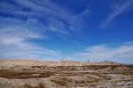
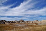
Going on farther.
P1160251.jpg
----------
P1160255.jpg
----------
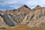
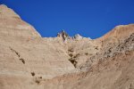
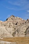
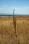
I reached the base of the of the high-point to which I had been hiking. I sat down on a low mound near it. I found a place that made a nice reclining seat. I ate my lunch and then took a 30 minute nap in the sunlight.
P1160256.jpg
----------
I got up and started on my way back to camp.
P1160258.jpg
----------
P1160259.jpg
----------
P1160260.jpg
----------
P1160261.jpg
----------
P1160263.jpg
----------
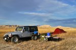
I started with preparations for dinner again. The hike had been just over six miles, according to my GPS.
P1160271.jpg
 
Last edited:

TripLeader

Explorer
Part Fourteen [Dusk on Grassland Road 7182]
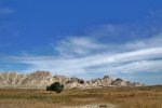
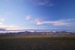
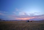
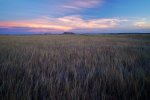
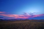
That night, there was some outstanding light as twilight approached.
P1160275.jpg
----------
P1160276.jpg
----------
This might be my favorite photograph from the trip. I felt it really captured the spirit of the vastness.
P1160282.jpg
----------
P1160283.jpg
 
Last edited:

TripLeader

Explorer
Great report so far! Looking forward to more! I live in Rapid City now and I am starting to plan trips like this.
Thanks. I would have had like to have more resources for planning this trip, but I ended up only using the these two maps.


map2.jpg


map.jpg
 
Last edited:

TripLeader

Explorer
Part Fourteen [Other Area Roads]
The next day I started off my explorations by driving down Bouquet Table Road from Highway 44.
P1160297.jpg

P1160287.jpg

P1160290.jpg
----------
After a couple or so miles, the road had a fence with a cattle guard gate and a no trespassing sign. The map showed it as the spot where the road entered the Indian Reservation. I turned around and headed back out.
----------
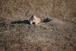
I drove north on Conata Road from Highway 44.There were a few primitive roads from it. This was one I explored. It took me to a prairie dog village and cattle pasture.
P1160307.jpg
----------
Conata Road took me back into the park. From there I headed to the town of Wall. There I stopped in the Grassland Visitor Center. I spoke with Ranger Lucinda about the area. She was very helpful.
----------
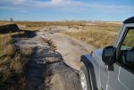
I then went and checked out Grassland Road 7118. It was a fairly short road. There was a stream-crossing with a fairly steep opposite side. I took it, but it was not suitable for longer wheel base vehicles. I met two men (a father and son, I think) there. They were setting out on a hike to bow hunt Mule Deer. This was the only photo I took while I was in the area.
P1160311.jpg
 
Last edited:

Maxcustody

Explorer
Great trip report and pictures. I have been thru the area several times on a motorcycle.....it is now on my list to explore in the jeep! Thank you.

Sent from my Roof Top Tent
 

XJINTX

Explorer
TripLeader, this is a trip that my wife and I have talked about for sometime. We have a jeep and expo trailer we could take. But our truck (F250) and 4wheelcamper setup is much more desirable for a long trip from TX. Do you think a full size F250 4x4 would be able to travel most off the beaten path roads?
 

TripLeader

Explorer
TripLeader, this is a trip that my wife and I have talked about for sometime. We have a jeep and expo trailer we could take. But our truck (F250) and 4wheelcamper setup is much more desirable for a long trip from TX. Do you think a full size F250 4x4 would be able to travel most off the beaten path roads?

I think a big pickup truck would be fine for most of everything that I saw. The only considerations I would have with it would be:

1. Water Crossings. Most of the water crossings that had been there for some time had rocks below the stream and were hard enough that I would not worry about getting stuck. One of the crossings I encountered had a sharp incline on the other side. I could see that if erosion had cut away the gradual rise, you might find a stream crossing or two that would be steep enough for a long wheel base vehicle to drag the underbelly or get high centered. But, if you did happen to get to a place like that, you could easily turn around. That is the benefit of the grassland is that you virtually always have plenty of space to get around.

2. Rain. It did not rain on me while I was there, but I can imagine that most of the primitive roads would get pretty messy in that event. I assume the park roads would be fine, it would be the fun grassland roads that could get sketchy.

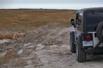
3. Some boggy sections of road. I came to a few places that seemed to sometimes be wet. Here is one example (of a photo to come later in the report).
P1160360.jpg

I was able to go around it. If you came to some similar places, you could make your own determination if you would want to try to go through or around. If it came to it, you would have the space to easily turn around. I'm sure there are others that could chime in with better info about the roads in wet conditions...
----------
All in all though, I would have no reservations about taking the truck with a camper in the bed to the Badlands. Although the park seemed to be in the off-season, I saw several of those setups while I was there.
----------
Another resource I was given (for free distribution) at the grassland visitor center was a forest service motor vehicle use map. It looks like this (but is obviously for Buffalo Gap instead).
vehicle use.jpg
It shows the roads in the grassland. Specific to Buffalo Gap, it also shows designated areas in the grassland that you are allowed to drive off the road and anywhere you wish to inside the area.
----------
On a related tangent, I like to read up on the history of a place before I go there. I did not do that for this trip, as I had actually been planning on going to Colorado, then ended up going to South Dakota at the last minute. After I finished reading The Martian, I bought Crazy Horse and Custer: The Parallel Lives of Two American Warriors by Stephen Ambrose. I'm almost finished with it now. The Indian Wars after the Civil War are a very fascinating part of American history to me. I recommend it if you enjoy learning about an area prior to a visit. I had read (and loved) another Ambrose book a few years back, Undaunted Courage. Its the story of Lewis and Clark, who also add to the history of the area.
----------
Related to those books, I had considered going to Wounded Knee, which was about 50 miles away or so. Unfortunately it did not work out for me.
 
Last edited:

TripLeader

Explorer
Part Fifteen [The Start of Old Quinn Road]
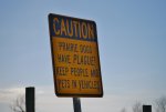
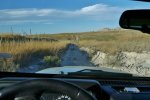
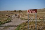
My next road I traveled was Old Quinn Road. I set off northbound from the Badlands Loop Road within the park. As I left, I noticed a sign, outside the park boundary, for incoming traffic. (There were prairie dogs all around.) I had seen a sign just like it in another place in the national grassland.
P1160314.jpg

P1160319.jpg
There was no sign like it in the park, even though there were numerous prairie dog villages there. Now, there were some informational kiosk-style signs near Roberts Prairie Dog Town within the park. I did not get out and read them, but if they had any warnings about the Plague on them, it certainly did not have the same bold format.
----------
As I continued on the road, the national park was within a fence to the west.
P1160316.jpg
----------
I liked what I saw as I kept driving.
P1160321.jpg
----------
Continuing down the road. The area to the east (the right side) became private property.
P1160323.jpg
----------
I continued down the road, with the park fenced off to one side, and private property on the other.
P1160325.jpg

P1160327.jpg
 
Last edited:

the matador

New member
TripLeader, this is a trip that my wife and I have talked about for sometime. We have a jeep and expo trailer we could take. But our truck (F250) and 4wheelcamper setup is much more desirable for a long trip from TX. Do you think a full size F250 4x4 would be able to travel most off the beaten path roads?
I have only been to the badlands when it's been dry, but my friends that have been out there when it's wet said the top crust is really slick and thin, and if you break through it then it turns into a sticky bog. So I think a heavier rig could have some difficulties.
 
Last edited:

ghostingrey

New member
Great thread and pics.

I live in South Dakota and spend a lot of time in Buffalo Gap. I can tell you that from experience that you do not want to attempt to drive of the FS roads if they are really wet. The high clay content in the soil turns it into a sticky mess called gumbo. Even dedicated mud tires have problems clearing the stuff it's so sticky.

So just drive with caution if its wet and be prepared to turn around if it starts to get sketchy.
 

ghostingrey

New member
It's tough to say as it's certainly possible for us to get snow as late as mid April. But that doesn't happen very often. By early to mid May you should be in the clear. Even if the roads are wet there will still be some dirt roads that you would be able to travel. You would just need to stay off the truly primitive two tracks. I was out there a few weeks ago and got lost for 15-20 minutes because I couldn't find the official ""road". The cattle trails were more used than it was. The tumbleweeds on the gates were 3-4 feet deep. I don't think anyone else had been out there months.
 

Forum statistics

Threads
186,639
Messages
2,888,357
Members
226,767
Latest member
Alexk
Top