You are using an out of date browser. It may not display this or other websites correctly.
You should upgrade or use an alternative browser.
You should upgrade or use an alternative browser.
Barefoot & Homeless at Last...Adventures of a Young Sasquatch
- Thread starter dieselbigot
- Start date
Gravel Slinger
Observer
Enjoy the report & pics - subscribed!
dieselbigot
Adventurer
Alright...been home for 2 weeks now and started remodeling my house...so I keep letting the completion of this damn thread slip!
We broke from the Luder's Creek camp under beautiful sunny skies and headed southeast to Del Norte. From the onset we had agreed to skip the New Mexico portion of the CDT and end back where I started in Durango...so this would be our last official day on the trail.
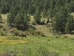
As I drove through the tree covered foothills and down to the plains west of Hwy 285, I saw a large bull moose with a cow in a farmers field and stopped to snap a few pics.
Last edited:
dieselbigot
Adventurer
dieselbigot
Adventurer
dieselbigot
Adventurer
Attachments
dieselbigot
Adventurer
Don't ask me what's going on with the upside down selfie...I tried to delete, but it won't let me 
dieselbigot
Adventurer
After a couple days in Durango, the Hanna's left to make their way back to CA while Brian and I agreed to extend a few more days to explore Hole in the Rock trail on the way home.
Brian had a hot date with a hippie chick girlfriend of his in Durango, so I headed west in solo mode to explore Valley of the Gods and the Moki Dugway before Brian and I would reconnect a couple days later.
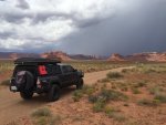
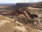
Brian had a hot date with a hippie chick girlfriend of his in Durango, so I headed west in solo mode to explore Valley of the Gods and the Moki Dugway before Brian and I would reconnect a couple days later.


dieselbigot
Adventurer
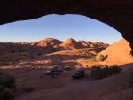
My campsite at the top of Moki Dugway was one of the highlights of my trip thus far. As I topped the duway heading north, I took the first dirt road to the left and drove down a few miles before taking another left onto an unmaintained trail that worked it's way across the top of the mesa.
Near the end of the line, and miles from any other human beings, I found this spot...

Near the end of the line, and miles from any other human beings, I found this spot...

dieselbigot
Adventurer
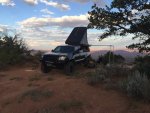
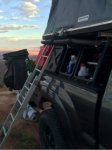
I made camp in the late afternoon and watched the storm clouds pass from the top of the mesa as I read under the protection of my awning. I will tell you one thing, after this trip the first thing I'm doing when I get home is figure out a way to mount a 270 degree awning on my truck. It's really my only complaint about this set-up is the super small footprint my awning has. The rest of the set-up with the Leitner Design rack and storage pods works absolutely amazing...



dieselbigot
Adventurer
The following morning I drove north on 261, then southwest on 276 to the marina at Halls Crossing UT where I would meet up with Brian. The plan was to head down the east side of Hole in the Rock trail and go as far as we could with our expo trucks. As we would soon discover, there are parts of this trail that become extremely sketchy...particularly without the benefit of large tires, low gears and dual lockers.
There are actually 3 Hole in the Rock trails in Utah and they are all very different. One is near the tourist trap off 191 about 40 minutes south of Moab. I've not done this one, but my understanding is while it provides some level of challenge, it's reasonable to do with most mildly built 4x4's. The second and third are actually one trail separated by what is now lake powell.


In the late 1870's, Mormon settlers forged this trail through some of Utah's most unforgiving terrain in an attempt to create a "shortcut" between Escalante and the Bluff UT. When they hit the waters of what was then the Colorado River, the wagons had to be lowered down a steep crevasse before floats transported them across the east side of the river before continuing on to Bluff. Because of the difficulty of the natural terrain, the route was abandoned a few years later.
Completion of the entire 180 mile trail is only possible via two out and back treks....One starts heading east out of Escalante and can be driven in your grandma's Prius (she may take some light trail damage)...the harder trail and the one we would explore is on the east side of powell. This is a 36 mile (one way) route where use of GPS is absolutely critical because after the initial 20 miles of gravel and boney trail you hit slickrock with virtually no trail markers.

There are actually 3 Hole in the Rock trails in Utah and they are all very different. One is near the tourist trap off 191 about 40 minutes south of Moab. I've not done this one, but my understanding is while it provides some level of challenge, it's reasonable to do with most mildly built 4x4's. The second and third are actually one trail separated by what is now lake powell.

In the late 1870's, Mormon settlers forged this trail through some of Utah's most unforgiving terrain in an attempt to create a "shortcut" between Escalante and the Bluff UT. When they hit the waters of what was then the Colorado River, the wagons had to be lowered down a steep crevasse before floats transported them across the east side of the river before continuing on to Bluff. Because of the difficulty of the natural terrain, the route was abandoned a few years later.
Completion of the entire 180 mile trail is only possible via two out and back treks....One starts heading east out of Escalante and can be driven in your grandma's Prius (she may take some light trail damage)...the harder trail and the one we would explore is on the east side of powell. This is a 36 mile (one way) route where use of GPS is absolutely critical because after the initial 20 miles of gravel and boney trail you hit slickrock with virtually no trail markers.

dieselbigot
Adventurer
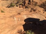
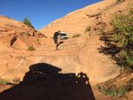
We wheeled in for about 4 hours until we started to get to the most challenging spots which are located just before a large clearing at the top of a mesa overlooking the big bend in the San Juan river. I was in the lead as we approached a steep multi-level rock waterfall with a 4'-5' drop at the bottom. I saw the drop, but had limited visibility. Regardless, I decided I could navigate it without scouting it out first...big mistake  . There were two lines to take as you came off this ledge, and because I couldn't see a damn thing, I ended up on the right line which offers a massive passenger side tire sucking hole. As I hit the bottom with my front bumper, the truck did what amounted to an "endo" pitching me quite nearly vertical. Now fully committed, I drug the rest of the truck through the line. By this time Brian had walked down to see what was up and began shaking his head in disapproving grin..."hey man...did you think to stop and check out this line before you plunged off this?"...."Ummm...naw, I thought I would just go for it". The result was the rear of my rig hanging off the top of the ledge by my tire carrier with both rear wheels about 12" off the ground. As I pulled through the bottom, my tire carrier crunched into my tailgate leaving my a little reminder that I should have gotten out.
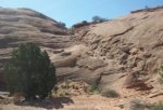
At this point I could still turn around and climb back up what I'd just come down using Brian's 80 diesel series as a winch point if needed...with no crawl gears in my manual transmission Tacoma it turned out I did need to winch...so it was decided that was the end of the line for us and we'd turn back and check out a few possible campsites we'd just passed. Trust me....these pictures don't do justice to how steep this was...
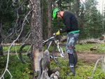
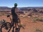
The next morning we pulled out the mountain bikes to venture out and ride up the rest of the trail. What we encountered after my infamous waterfall drop was a trail that degraded even further. The obstacles, ledges and exposed sheer drops between our camp and the top of the mesa were incredibly gnarly with huge pucker factor. Between Brian and I we've probably done Rubicon trail 50X + over the last 15 years...and I can't think of too many spots on Rubicon that looked sketchier and more exposed that a few portions of that trail. I'm glad we turned back when we did .
.
At this point I could still turn around and climb back up what I'd just come down using Brian's 80 diesel series as a winch point if needed...with no crawl gears in my manual transmission Tacoma it turned out I did need to winch...so it was decided that was the end of the line for us and we'd turn back and check out a few possible campsites we'd just passed. Trust me....these pictures don't do justice to how steep this was...


The next morning we pulled out the mountain bikes to venture out and ride up the rest of the trail. What we encountered after my infamous waterfall drop was a trail that degraded even further. The obstacles, ledges and exposed sheer drops between our camp and the top of the mesa were incredibly gnarly with huge pucker factor. Between Brian and I we've probably done Rubicon trail 50X + over the last 15 years...and I can't think of too many spots on Rubicon that looked sketchier and more exposed that a few portions of that trail. I'm glad we turned back when we did


dieselbigot
Adventurer
Boucher
Member
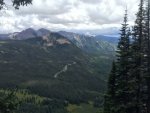
I left Durango Tuesday AM and headed for Silverton CO. Andy decided to blow off work and come with me for one night, then part ways Wednesday morning. We stopped in Silverton for lunch and a few supplies before heading up 550 to Mineral Creek. We nabbed a nice little campsite along the creek with some gorgeous mountain views. Since we had a late lunch we had both agreed that we would not need dinner. A few G&T’s later and about 8pm and it was decided that the NY steak I had in my fridge had to be cooked up. After dinner we started a nice big fire and debated the merits of G-Wagens vs. Land Cruisers. As the debate wore out we settled into the crackle of the campfire and the music of Matisyahu before the lure of our dual Maggiolina tents and 10,000ft elevation put us into slumber. I never seem to do well the first few nights at elevation…I can never seem to fall asleep, even with the babble of the stream in the background which usually puts me right out. Two storms came through last night and unfortunately I was awake for both of them. Apologies in advance for the sideways pics...there is no way to rotate them in the file management tool...
View attachment 356833View attachment 356834
I camped for a week and that same spot Awesome
Similar threads
- Replies
- 2
- Views
- 1K
- Replies
- 1
- Views
- 297
- Replies
- 33
- Views
- 6K

