California to Colorado and Back 2009

SCTaco

Observer
Every year my family and I travel from Santa Cruz, CA to Colorado Springs, CO and back. Our average trip length is about 2 weeks. There is so much to see between the two destinations it can be hard to decide on a route. After some research, including reading several trip reports from forum members, here is what we came up with this year.

Day 1: Santa Cruz to Tehachapi, CA.
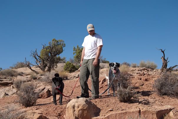
Visited with family and dropped our cats off for 2 weeks at grandma and grandpa camp. Tehachapi is a small mountain town between Bakersfield and Mojave. They live about 20 minutes from town in the foothills surrounded by majestic Oak trees. It’s not a bad place in the summer since there is almost always a breeze and is about 20 degrees cooler than the surrounding area.

Day 2:
Tehachapi, CA to Grand Staircase-Escalante National Monument, UT
We hit the road about 7 am and made camp about 7 pm. California Highway 58 took us to I-15 north through Las Vegas to Mesquite, NV. We stopped for a while and stretched our legs in Mesquite at a great little park that was dedicated to fallen US Solders. It was at this point that both my wife and I remembered that it’s good to stop along the way and we started to feel the stress of work start to slip away. Nothing like a half hour in the tall grass below a shade tree to help feed the soul.

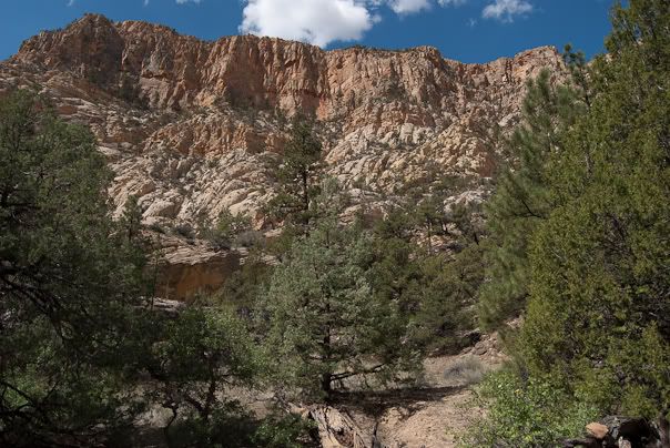
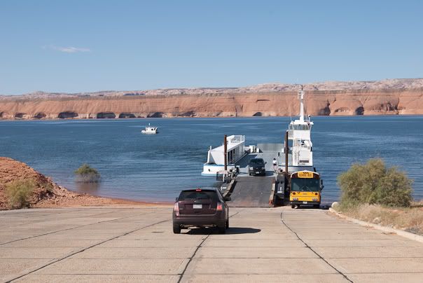
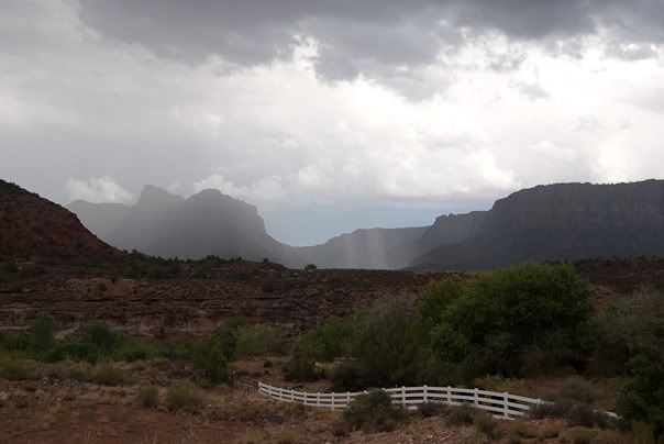
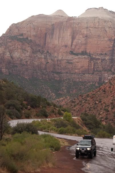
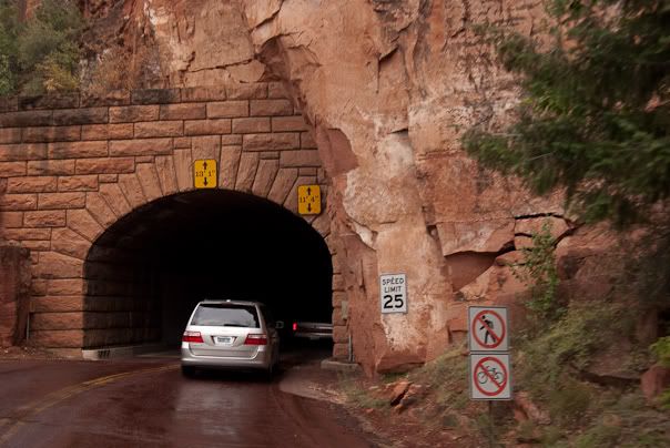
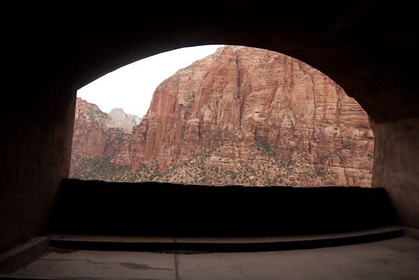
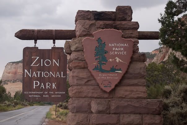
Next we arrived in Zion National Park. We just missed the majority of a huge downpour but still caught enough to feel refreshed. There were more people in the park than either of us expected for this time of year.

20090823-0001-Colorado.jpg

20090823-0003-Colorado.jpg

20090823-0008-Colorado.jpg

20090823-0013-Colorado.jpg

20090823-0017-Colorado.jpg

20090823-0033-Colorado.jpg

20090823-0039-Colorado.jpg

20090823-0044-Colorado.jpg


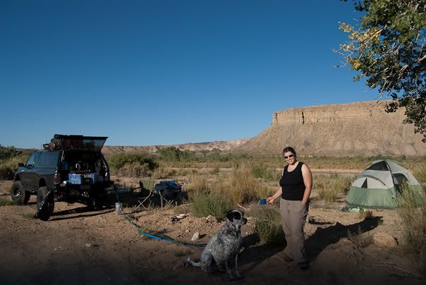
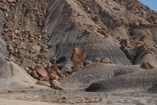
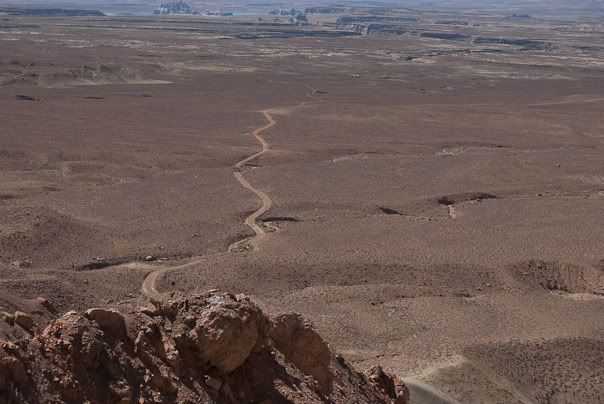
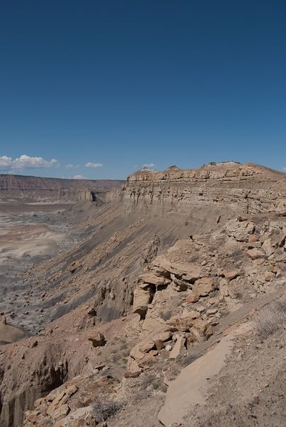
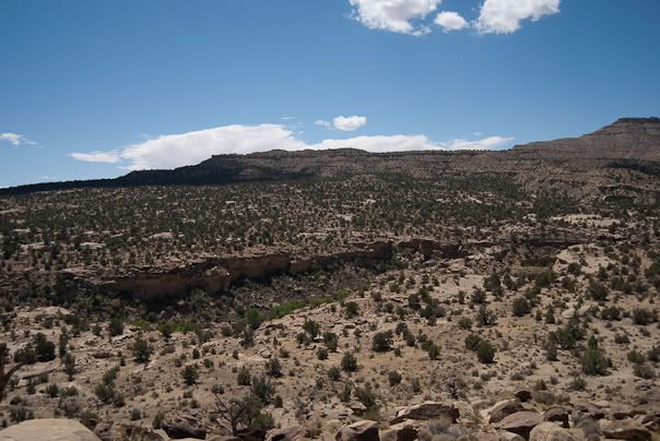
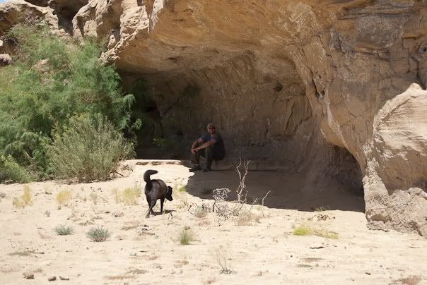
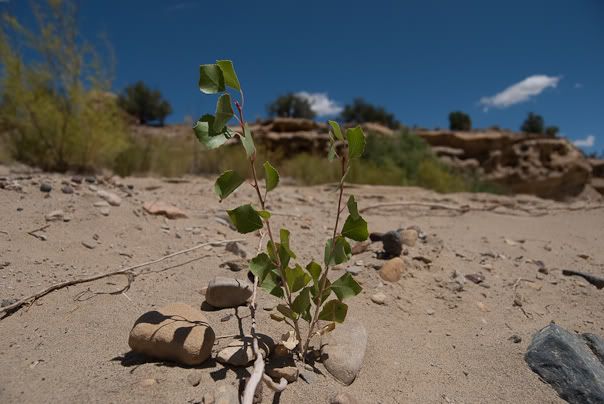
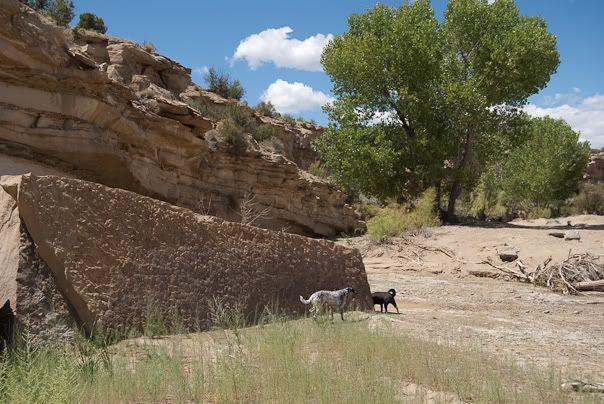
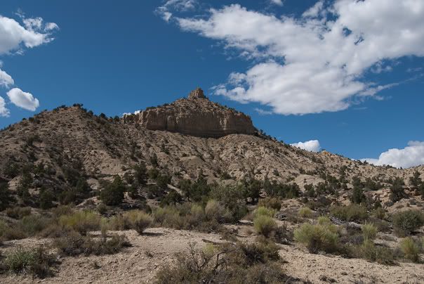
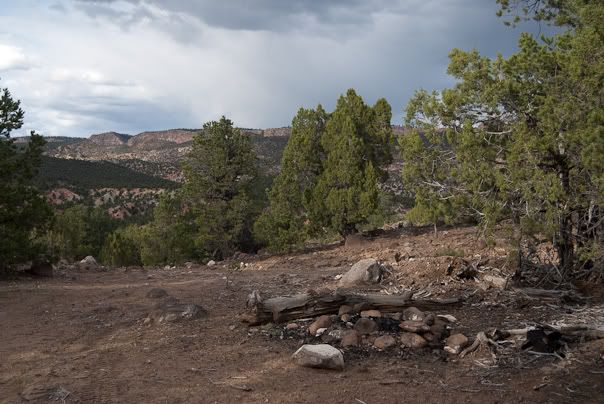
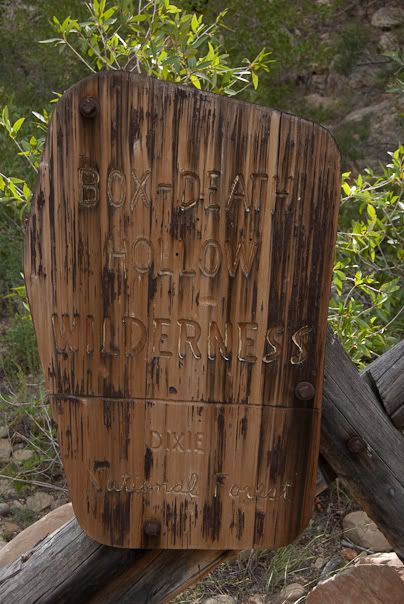
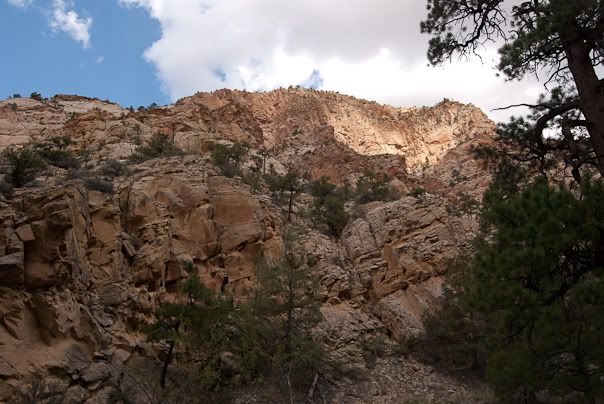
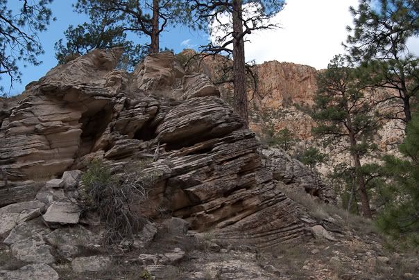
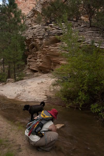
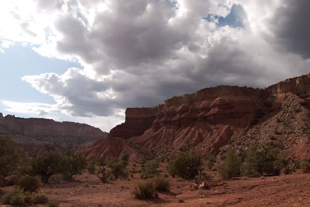
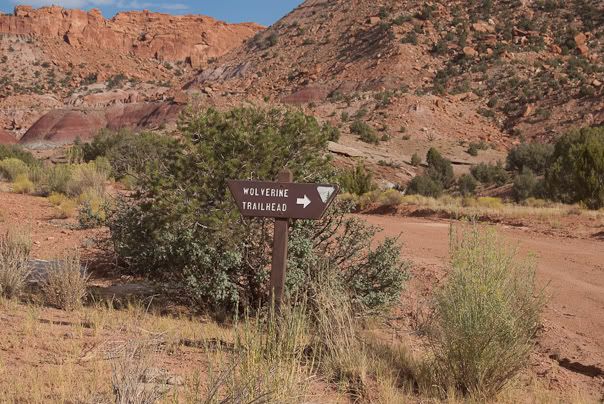
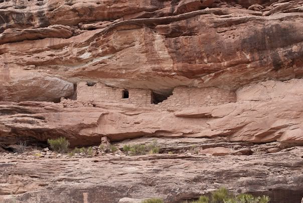
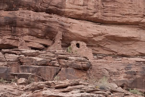
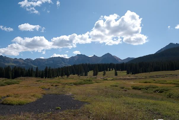
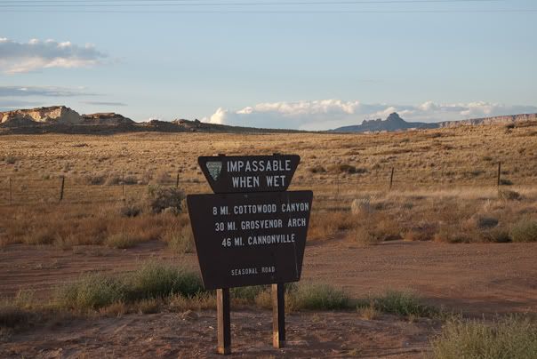
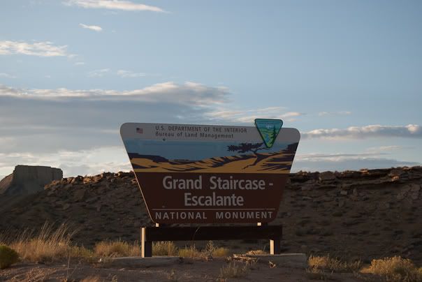
We took Utah Highway 9 east out of Zion and connected to US 89 east toward Escalante National Monument. The sun was sinking low so we decided to look for a campsite along Cottonwood Canyon Road. About 5 miles in from 89 you hit the river and this is where we pitched camp. There was a magnificent lightning storm that circled around the horizon most of the night. What a light show!
20090823-0047-Colorado.jpg

20090823-0048-Colorado.jpg
 

SCTaco

Observer
Day 3:
Grand Staircase-Escalante National Monument, UT
We woke up with the sun and felt rested. After breakfast a 30 second walk took us to the river. Our dogs, Bodhi and Henry, played in the water for an hour or so. The mud and sand had quicksand-like properties so we stayed on the hard pack and let the boys get dirty.

20090824-0057-Colorado.jpg

20090824-0065-Colorado.jpg

20090824-0067-Colorado.jpg

20090824-0072-Colorado.jpg

20090824-0076-Colorado.jpg

20090824-0077-Colorado.jpg

20090824-0083-Colorado.jpg


On the way back to the 89 we passed a guy in a passenger car who asked if we had rented our vehicle. I wonder how far down the track they tried to take their sedan?

A little while later we were at the BLM visitor’s center in Big Water, UT.

20090824-0108-Colorado.jpg

20090824-0109-Colorado.jpg
 

SCTaco

Observer
Day 3 cont:
This is where the southern end of Smokey Mountain Road starts. This is the longest trail in the area at a length of almost 75 miles. The views were excellent and we didn’t see another person all day. We stopped at the top of Kelly Grade for a snack and a photo op where we could see Lake Powell in the background.
20090824-0112-Colorado.jpg

20090824-0117-Colorado.jpg

20090824-0133-Colorado.jpg

20090824-0136-Colorado.jpg

20090824-0160-Colorado.jpg

20090824-0170-Colorado.jpg

20090824-0174-Colorado.jpg
 

SCTaco

Observer
Day 3 cont:
We also stopped for a while at another oasis a little over half way to the town of Escalante. The temperature was in the high 80’s but it still felt good to find some shade.

20090824-0176-Colorado.jpg

20090824-0179-Colorado.jpg

20090824-0184-Colorado.jpg

20090824-0197-Colorado.jpg

20090824-0200-Colorado.jpg

20090824-0201-Colorado.jpg

20090824-0205-Colorado.jpg

20090824-0216-Colorado.jpg

20090824-0220-Colorado.jpg
 

SCTaco

Observer
Day 3 cont:
Coasting into the town of Escalante, UT on fumes (really didn’t want to take the extra fuel off of the rack), we got gas and hit the food store. There was a great little park that provided us with a bench, clean restrooms, and a few shade trees to take the edge off of the summer afternoon. After a late lunch we headed north a few miles out of Escalante to the Box-Death Hollow Wilderness area. The next day we planned to hike “The Box” starting at the lower access point so we decided to camp near by.

There was a road not far from the trailhead that provides back road access to a nearby reservoir. The access road was a little washed out but with some careful spotting the truck made is across and we found a nice campsite. There were signs of a massive effort to address some drainage issues in the area. A few downed Manzanita trees provided plenty of firewood for the evening.
20090824-0222-Colorado.jpg

20090824-0223-Colorado.jpg

20090824-0224-Colorado.jpg

20090824-0226-Colorado.jpg
 

SCTaco

Observer
Day 4:
Grand Staircase-Escalante National Monument, UT
Next morning we stuffed our packs and hit the trail. There was a small crew taking water quality samples at the trailhead when we arrived. After signing in at the register we were on our way. The Box is a trail approximately 6.5 mile long that follows Pine Creek with Deep Creek connecting about 3 miles from the northern trailhead. There are approximately 50 creek crossings along the trail. We made it about 3.5 miles up the canyon before heading back down. There were some awesome looking rain clouds in the sky early in the hike. We and the dogs found this to be a great hike and highly recommend it!
20090825-0230-Colorado.jpg

20090825-0233-Colorado.jpg

20090825-0239-Colorado.jpg

20090825-0348-Colorado.jpg

20090825-0250-Colorado.jpg

20090825-0257-Colorado.jpg

20090825-0258-Colorado.jpg

20090825-0261-Colorado.jpg

20090825-0274-Colorado.jpg

20090825-0280-Colorado.jpg
 

SCTaco

Observer
Day 4 cont:
Once we made it back to the trailhead it didn’t take too much convincing that a dip in the large Pine Creek swimming hole was a good idea. After drying off we headed back into the town of Escalante and caught Utah Highway 12 to Boulder UT. I must say that the drive from Escalante to Boulder exhibits some of the most dramatic and awe inspiring landscape in the area. This drive is highly recommended!

Out of Boulder we took Burr Trail towards Bullfrog, UT traveling the Wolverine Loop Trail along the way. Here is where the journey got a little confusing. According to Peter Masse’s UT book the Wolverine Loop takes you by a bunch of petrified wood deposits. The scenery was beautiful and we kept looking for the petrified wood. The trail was well marked so I didn’t pay much attention to the GPS tracks until I looked down and noticed that the GPS waypoints given by Massey were gone! We finished the loop and made it back to Burr Trail where we made use of a primitive semi-used campsite. We figured that the BLM must have re-routed the road around the petrified wood field to prevent people from steeling pieces. If anyone knows if this is true please post up.
20090825-0354-Colorado.jpg

20090825-0360-Colorado.jpg

20090825-0365-Colorado.jpg

20090825-0384-Colorado.jpg

20090825-0387-Colorado.jpg

20090825-0395-Colorado.jpg

20090825-0398-Colorado.jpg

20090825-0409-Colorado.jpg
 

SCTaco

Observer
Day 5:
Grand Staircase-Escalante National Monument, UT to Cortez, CO
We were back on the Burr Trail after breakfast heading towards Bullfrog Crossing. There were some great views of some spectacular canyons along the way.
20090825-0406-Colorado.jpg

20090826-0414-Colorado.jpg

20090826-0425-Colorado.jpg

20090826-0431-Colorado.jpg

20090826-0433-Colorado.jpg

20090826-0437-Colorado.jpg

20090826-0450-Colorado.jpg

20090826-0461-Colorado.jpg

20090826-0463-Colorado.jpg

20090826-0468-Colorado.jpg
 

SCTaco

Observer
Day 5 cont:
We hit Bullfrog and waited a half an hour for the ferry. This would be the dog’s (and the trucks) first boat ride. Henry and Bodhi both did great! Once we reached the other side we took Utah HW 276 to 95 to Blanding.
20090826-0477-Colorado.jpg

20090826-0485-Colorado.jpg

20090826-0501-Colorado.jpg

20090826-0508-Colorado.jpg

20090826-0513-Colorado.jpg


From Blanding we drove through the Ute Mountain Indian Reservation to Montezuma Canyon Trail. Montezuma Canyon Trail started off in a fairly arid landscape but followed a stream the whole way. There were several cliff dwelling ruins that could be seen from the trail. The largest and best preserved set can be seen about half way along the trail.
20090826-0527-Colorado.jpg

20090826-0530-Colorado.jpg

20090826-0531-Colorado.jpg

20090826-0532-Colorado.jpg

20090826-0535-Colorado.jpg
 

SCTaco

Observer
Day 5 cont:
As the trail nears Utah HW 191 it passes some amazing farm land and several homes that have taken a page from the canyon’s early settlers by construction modern homes in the cliffs.

After a long day we got a room in Cortez, CO to clean up a bit and prepare for the next day.
20090826-0551-Colorado.jpg

20090826-0553-Colorado.jpg

20090826-0564-Colorado.jpg

20090826-0567-Colorado.jpg

20090826-0575-Colorado.jpg

20090826-0580-Colorado.jpg

20090826-0583-Colorado.jpg

20090826-0585-Colorado.jpg
 

SCTaco

Observer
Day 6:
Cortez to Ouray, CO
We left Cortez and headed towards Telluride via Lizard Head Pass. The view waiting to greet you at the top of Lizard Head Pass really let’s you know you have arrived in the mountains. After driving through Telluride we made our way to the base of Imogene Pass. We aired down and headed up the mountain. We were set to run Imogene for the first time in 2006 but my leaf pack was too soft for the load I was carrying so we took another route. Three years and a pack of custom Alcan’s later we were ready 
20090827-0586-Colorado.jpg

20090827-0590-Colorado.jpg

20090827-0595-Colorado.jpg

20090827-0600-Colorado.jpg

20090827-0606-Colorado.jpg

20090827-0608-Colorado.jpg

20090827-0610-Colorado.jpg

20090827-0617-Colorado.jpg

20090827-0632-Colorado.jpg
 

SCTaco

Observer
Day 6 cont:
After passing a few other vehicles we made it to the Tomboy mine site. There were several other groups there having lunch including a group of 4-5 vehicles all from IA. The average age in the group had to be about 65 or 70. Here are a few things we overheard:

“I want to go to Silverton but I want to take the hard road” – Lady age 65
“Let’s visit the new Whiskey distillery tonight” – Man age 70

This group was too funny. No ageism intended but we were really amazed that the average age of everyone we saw while traveling the San Juan trails had to be 60. I guess I shouldn’t be surprised since this is what I want to do more of when I retire too 
20090827-0647-Colorado.jpg

20090827-0648-Colorado.jpg

20090827-0655-Colorado.jpg

20090827-0678-Colorado.jpg

20090827-0690-Colorado.jpg

20090827-0707-Colorado.jpg

20090827-0717-Colorado.jpg
 

SCTaco

Observer
Day 6 cont:
We took some time to investigate a few spur roads on the other side of Imogene before connecting with Yankee Boy Basin.
20090827-0725-Colorado.jpg

20090827-0740-Colorado.jpg

20090827-0742-Colorado.jpg

20090827-0746-Colorado.jpg

20090827-0754-Colorado.jpg
 

SCTaco

Observer
Day 6 cont:
We took Yankee Boy to the sign warning all but small vehicles (I assume ATVs) to turn around and spent some time by the waterfalls.
20090827-0770-Colorado.jpg

20090827-0783-Colorado.jpg

20090827-0791-Colorado.jpg

20090827-0801-Colorado.jpg

20090827-0817-Colorado.jpg

20090827-0821-Colorado.jpg

20090827-0845-Colorado.jpg

20090827-0846-Colorado.jpg


Camp that night was made in one of the National Forest improved sites a few miles above the town of Ouray.
 

Forum statistics

Threads
189,885
Messages
2,921,877
Members
233,084
Latest member
Off Road Vagabond
Top