Can the iPad really be used as an out-of-signal range, off-road GPS device?

For the price of that GPS puck you can buy an Android table with the functionality built in. I use a Lenovo 7" tab A2 (there are newer ones out now) and for $100 it will get you everything you need including an SD card slot for adding maps. I use Back Country Navigator and Here (both off line) without issues.
I have the same tablet. Jt have not been very successful for my goals with it. I wanted to download largevarea say the western USA and spent a lot of time downloading I large chunks to a 128 gig sd card. I downloaded at zoo level 15 and my chunks were like 350,000 tiles. All looke. Ok but when using bcn it would allow only a detail level of about 9 to 11 I found out later that at least for Gaia there is alimit of 100,000 tiles . Why you ask would I do that well plans change . For example I bought my jlur in Idahowas going to drive through silver city and through some bad lands to northern Nevada but a big storm came in and I diverted through eastern Oregon.
The other thing is I lost my usb charger for it and the new one while working won’t stay hooked up.
So my question to you is how much. Have you downloaded at a time and did you have any. Zoom issues.?
 

plh

Explorer
I have the same tablet. Jt have not been very successful for my goals with it. I wanted to download largevarea say the western USA and spent a lot of time downloading I large chunks to a 128 gig sd card. I downloaded at zoo level 15 and my chunks were like 350,000 tiles. All looke. Ok but when using bcn it would allow only a detail level of about 9 to 11 I found out later that at least for Gaia there is alimit of 100,000 tiles . Why you ask would I do that well plans change . For example I bought my jlur in Idahowas going to drive through silver city and through some bad lands to northern Nevada but a big storm came in and I diverted through eastern Oregon.
The other thing is I lost my usb charger for it and the new one while working won’t stay hooked up.
So my question to you is how much. Have you downloaded at a time and did you have any. Zoom issues.?

Blast from the past, nearly 2 1/2 years ago. I'll need to check...
 
So I just discovered that you can iPad with some pretty good storage like 256g. My question for all of yiungaia users. Is : How much land coverage at the max detail down load will that cover. And is there any way to enlarge the memory on a newer iPad?
 

rayra

Expedition Leader
I don't know about the software you are referring to, but with the old Garmin software you could narrow down the geographical area which you loaded maximal data for, while keeping the basic road and topo data for the rest. Really cut down on the amount of storage you needed
 
On Gaia the max level you can download is 1:48000. Twice as big as a standard 7.5 min topo map the limit is 100000 tiles now what I do not understand is if when you load at that scale can you then. Zoom in further in a similar manner to a camera that has say a 3x optical zoom and a fifteen time digital zoom And what that does to the resolution. In most all of the soft ware I have tried topo USA , topo USA pro and bcn I think you are limited to 100,000 tiles so if you load at a high detail say zoom 15 the actual area you load is small. So it takes huge numbers of tiles like 300,000 tiles and then you can’t access it at what you loaded because the file is too large so you end up with a detail ( zoom level) of aboutb11 or 12 can someone please explain it?
 

shade

Well-known member
On Gaia the max level you can download is 1:48000. Twice as big as a standard 7.5 min topo map the limit is 100000 tiles now what I do not understand is if when you load at that scale can you then. Zoom in further in a similar manner to a camera that has say a 3x optical zoom and a fifteen time digital zoom And what that does to the resolution. In most all of the soft ware I have tried topo USA , topo USA pro and bcn I think you are limited to 100,000 tiles so if you load at a high detail say zoom 15 the actual area you load is small. So it takes huge numbers of tiles like 300,000 tiles and then you can’t access it at what you loaded because the file is too large so you end up with a detail ( zoom level) of aboutb11 or 12 can someone please explain it?
In the past, you could download a demo or basic version of Gaia for free. You might give that a try to get a better feel for it on your device.
 

ricardo

Observer
I ditch the Ipad route do to the lack of Torque pro access..

And I can not be happier, I run a samsung galaxy pro tablet Note ( with a integrated pen, 12.1" so freaking sturdy.. )

for my Motorcycle and for the cars sometimes a Nvidia shield tablet (amazing tablet with tons of graphics, game, casting features..

strange sometimes they used to work totally out of cell range no phone signal (latterly the hotspot is require) but they use to run just fine before for street use..
 

Sneaks

Active member
We have Garmins in our ambulances (rural Maine EMS), most of the time we tossed them on the dash out of the way and used our phones. Too slow to program an address, pain to update maps, and more than once a road that Garmin said to take ended nowhere - not good when you are trying to get to a diabetic emergency. We recently replace our old Toughbooks we used for run reports with iPads and mounts. We can use Siri to map the address quickly, but we now have integration of Google mapping with iamreponding app, it is a wonderful thing. I will be adding a mount in my Bus for my iPad after using it in the rescue units. I’ll keep my Garmin as a backup, just in case.
 

grogie

Like to Camp
I've got a Garmin in my Jeep, which works fine for city/highway navigation. I use their BaseCamp software to setup trip routes with multiple, day to day stops, including stopping for gas every 175 miles (which I use Google Maps satellite view to locate gas stations), then load the route to the Garmin. A bit of process, but that works okay. Yeah, Garmin maps are not always up-to-date, and sometimes it gets confused.

For off-road travel, I use Gaia on a GPS iPad mini to plan those routes, and track the trip, including Gaia on my iPhone when walking/hiking. Great thing with Gaia are all of the maps, and later going in and viewing the track with time travel, elevation, and adding geo-tagged pics.

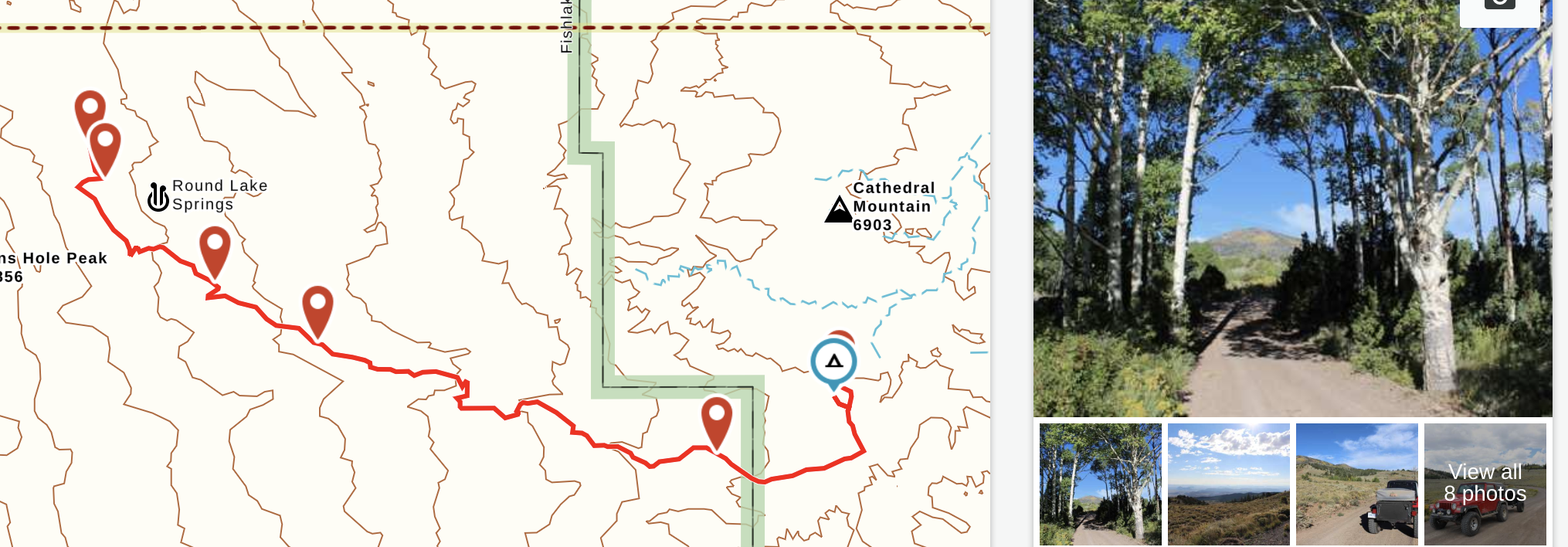
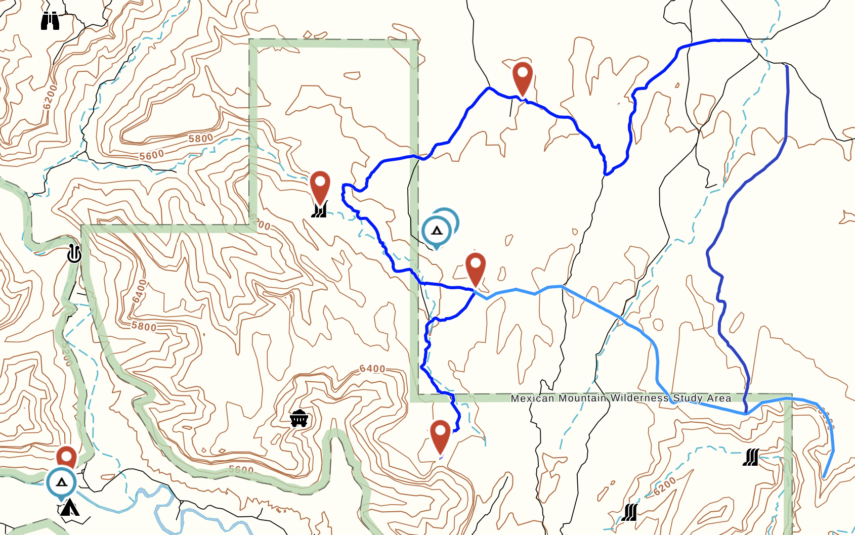
These are a couple of screen shots from my Gaia. The blue route are routes I'd like to drive, light blue to hike, and the red is a route I've driven (which was tracked), and then I added geo-tagged pics to. I also note camping spots I find, or places to stop. Very cool!

1FhauC.png


05bIha.png


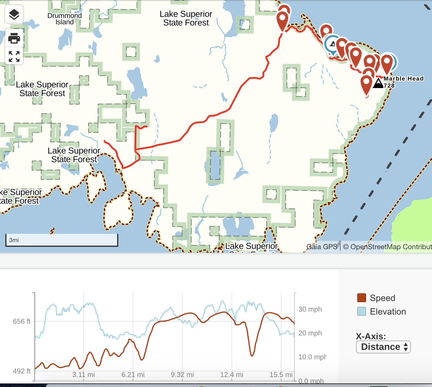
One more screen shot, this is when I rented an ATV on Drummond Island in the Michigan UP and used my mini iPad with Gaia to track the route. I noted some cool camping spots to return to, and you'll note that below it shows the trip details. I also added photos. This route is also public on Gaia. I really like using a mini iPad for this since it's easy to carry, in fact it fits into my camera bag. Plus I can load pictures on it, and link to my iPhone and upload off of it too.

kpIMml.png
 
Last edited:
So what iPad do you recommend for covering as much area as possible At as a large a scale as say zoom 15. If I understand it needs to have cell capabilities not just wifi? I see that you can get 512 gig and up to a tb but the prices are pushing a 1000
Thoughts?it seems like ltwould be less expensive to just buy a WiFi only and get a separate gps(blue tooth) receiver ? Lastly what about locked vs unlocked are there any benefits to using an unlocked one?
 
Last edited:

goFWD

New member
Is it possible to simply pair the iPad with an iPhone and use the phone's GPS, or is it a requirement to get a GPS/Cellular enabled iPad? (I want an iPad for other reasons, not just for mapping -- I understand some people like Android devices, I don't [have had plenty], so suggesting one is pointless.)
 
I come back to the same question how much memory is enough for the wester USA say Colorado and west.? I have this. Crazy fantasy that one day I am just going to take off and I know not where. Just go. For that day I would like to have as much asi can in terms of detailed. Coverage. Itriedthis with an128gig sd card on a Lenovo tablet. But found out that didn’t work to well I know that iPads don’t have memory slots. Is there a way to expand memory? On my older lowrance I had entire states on a card and could just swap cards CA did take 2 cards. Looking at the feed back on the Overlander and the explorist. Seems like they took the cheap way and fell flat So is 512 enough? Even used iPad are getting pricey with that much memory!
 

shade

Well-known member
I haven't tried it yet, but the Gaia's Download Along Route option seems to be a decent middle ground for conserving memory while still getting good offline coverage of an area - as long as you don't wander more than a few miles off of the downloaded route. Unfortunately, I really like to wander.

I see that Gaia continues to grow, which is good, but I wonder when Google will snap them or a similar company up. That could be a good thing for end users. If you haven't used Google Maps offline, give it a try. It's simple and fast, and I'd like to see that kind of useability come to a backcountry navigation app.
 

Forum statistics

Threads
188,342
Messages
2,905,813
Members
229,959
Latest member
bdpkauai
Top