Tucan viajero
Adventurer
Caracas to Cusco in 7 days. Day 4
Tuesday December 06, 2,011
From Castanho to S 05° 08’ 56,1’’ W61° 45’ 40,4’’ (Aristóteles, BR-319)
Distance: 233 miles (375 Km.)
Total Time: 15 hours and 35 minutes
Average Speed: 14.9 mph (24 Km/h)
Top Speed: 64.7 mph (104,1 Km/h)
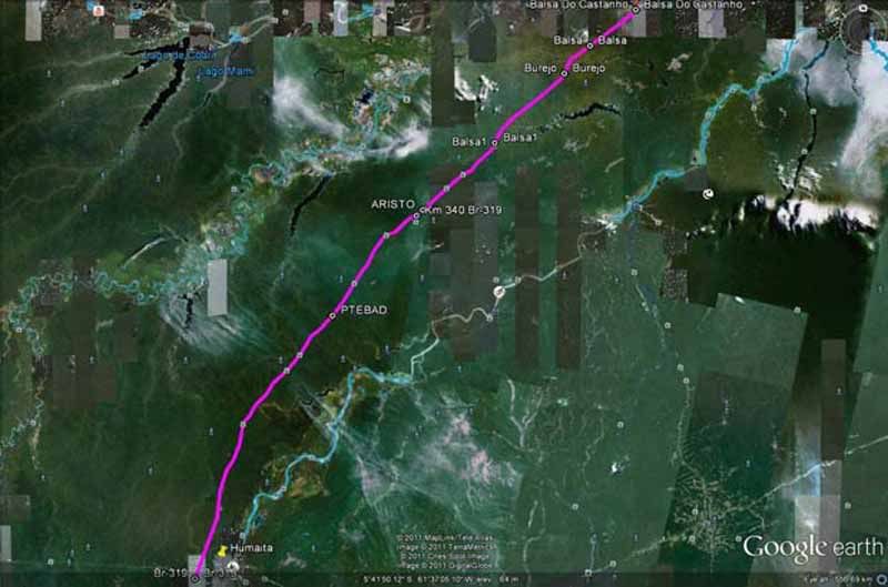
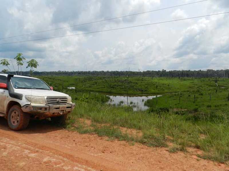
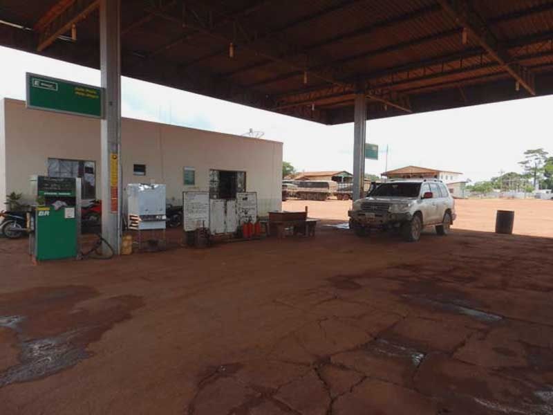
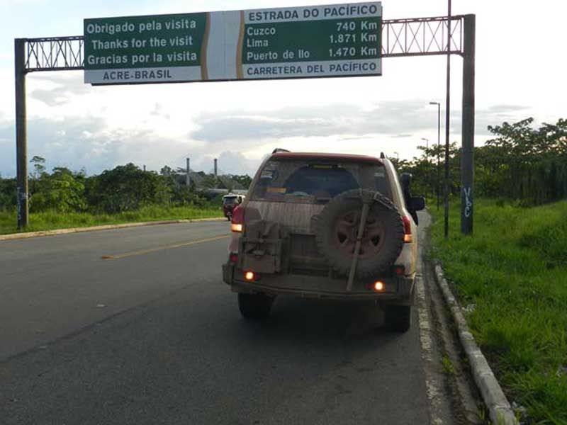
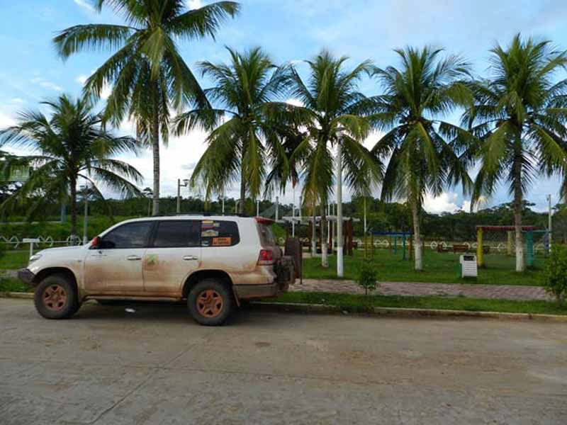
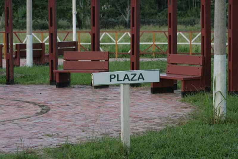
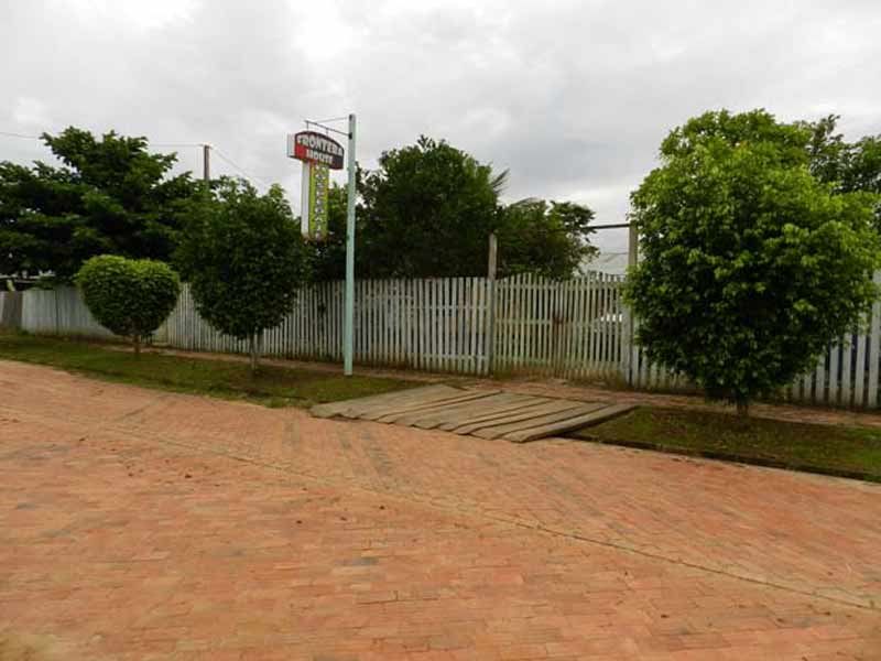
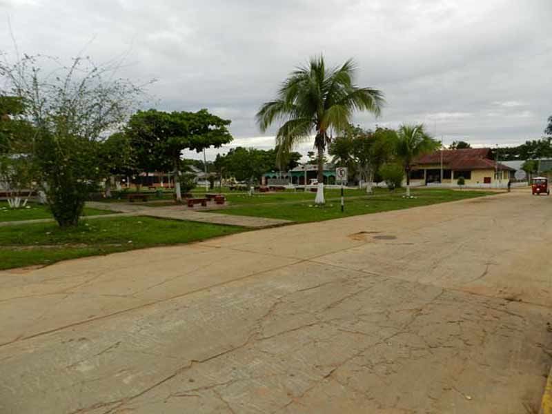
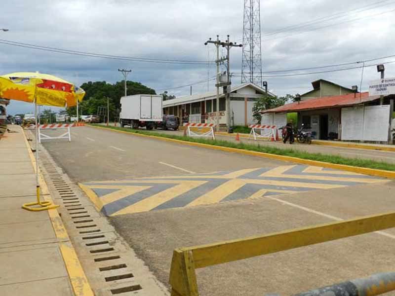
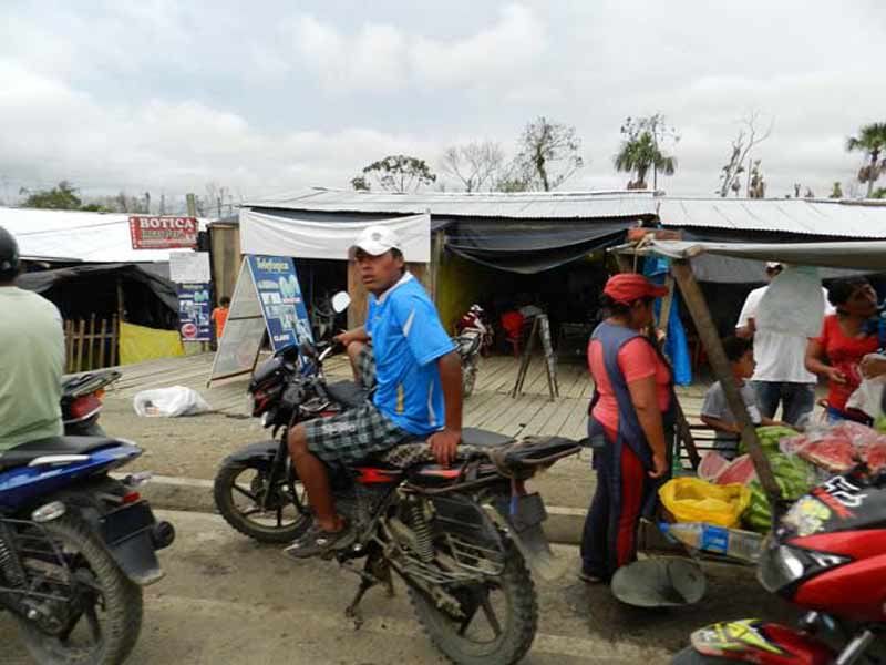
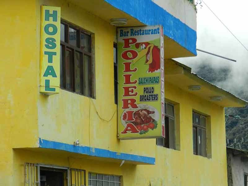
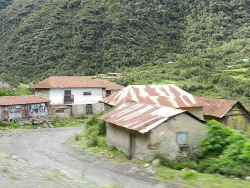
The town of Castanho is the doorway to the famous BR-319. At least for those approaching from the north.
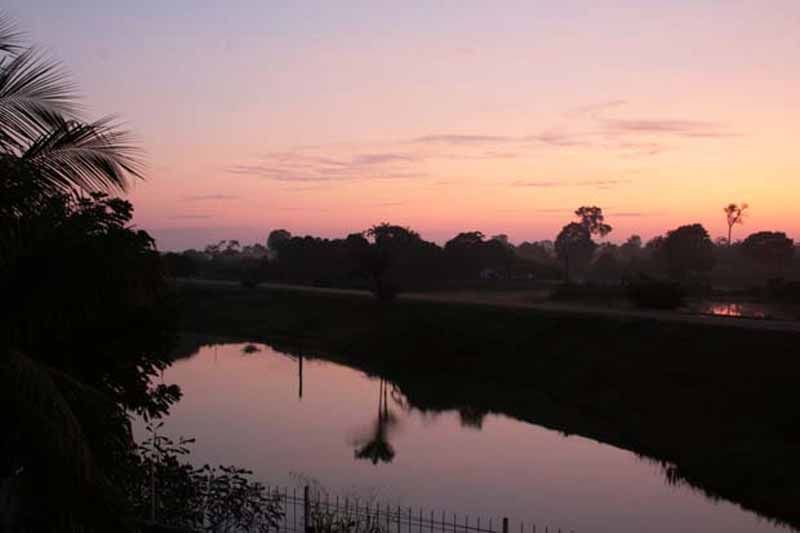
Sunrise in Castanho.
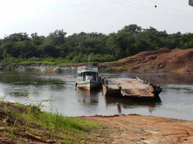
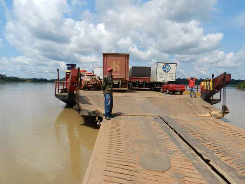
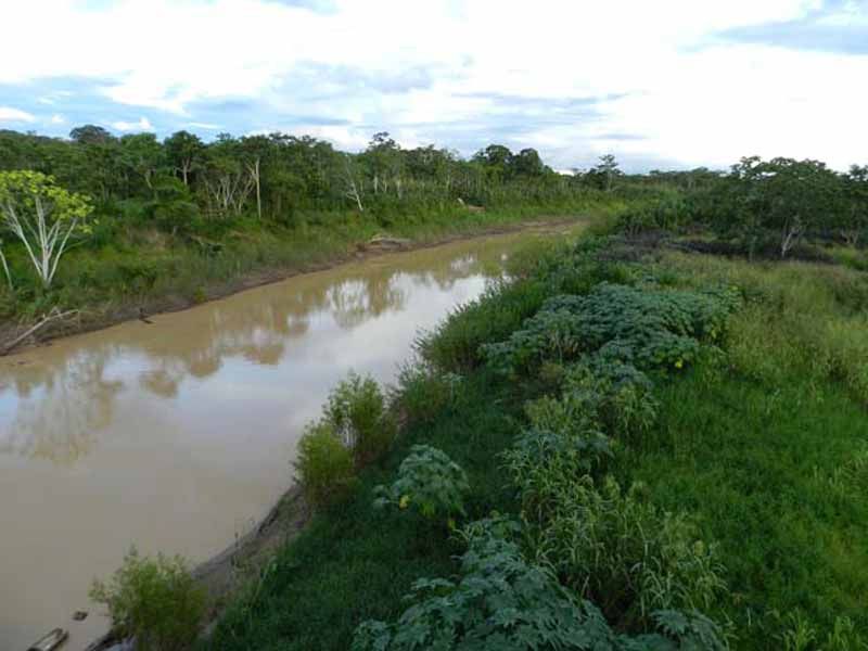
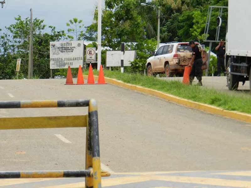
This is the first barge crossing once on the BR-319, about 45 miles away from Castanho. Here the skipper warned them that a few miles ahead, the road was interrupted by a large hole, and that there was no way to pass. Nevertheless, they had to cross the river and see the actual situation by themselves.
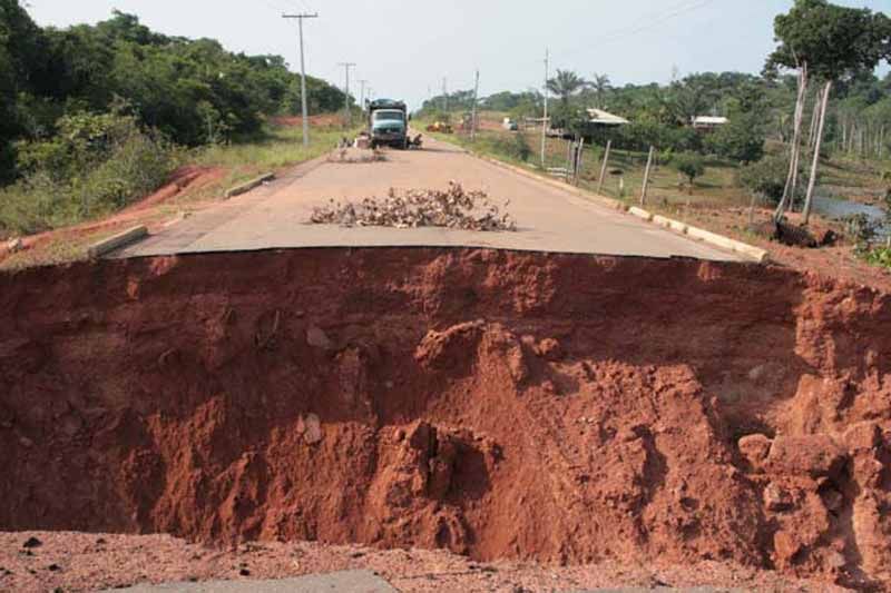
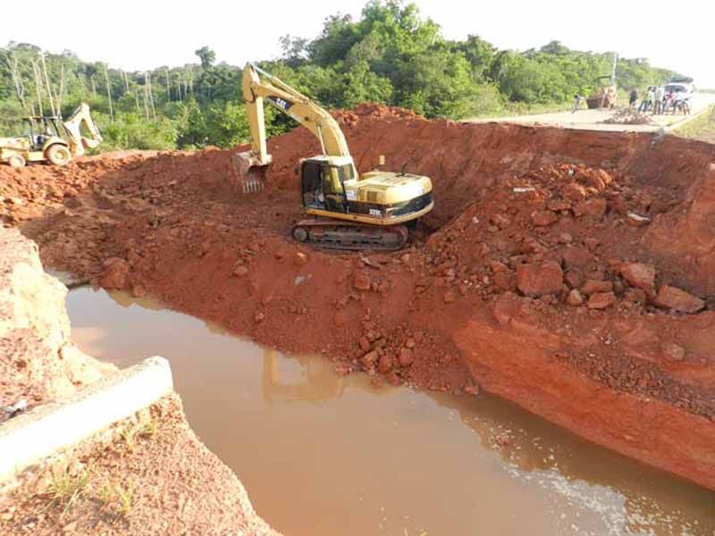
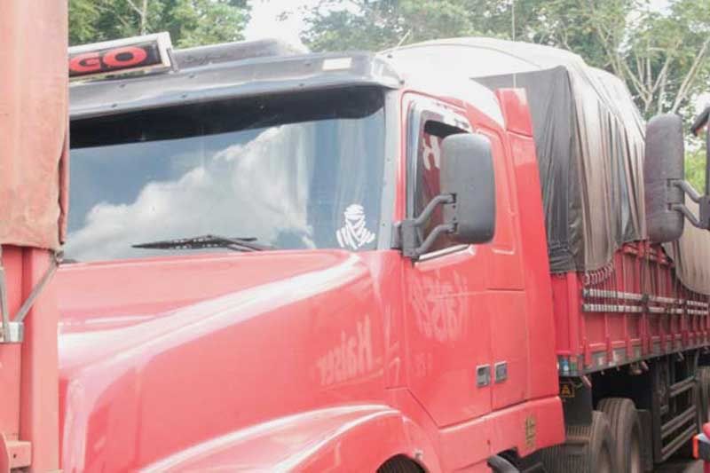
This is the “buraco” (hole in Portuguese), the barge captain had warned them about. The Tupana River had swept the road, and the people traveling in the Mercedes truck you can see in this photo, had already been here waiting for three days for the road to be repaired. Coordinates: S 04° 15’ 20,1’’ W60° 50’ 13,4"
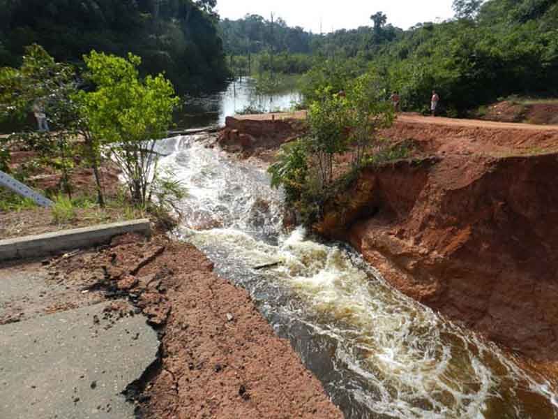
It isn’t nice at all to arrive here, so early in the morning and pleased of the progress made to this point, and be greeted by this obstacle that threatens the success of the trip.
After asking and talking to everyone they saw (this small part of the world is not known for its high population density), including an Embratel work squad about the situation, they concluded that most likely, the road could be repaired by that afternoon. They decided to return to Castanho, in order to reinforce their food and water supplies (you never know if another “buraco” can stop your progress for several days) and to inform the rest of the group about the setback.
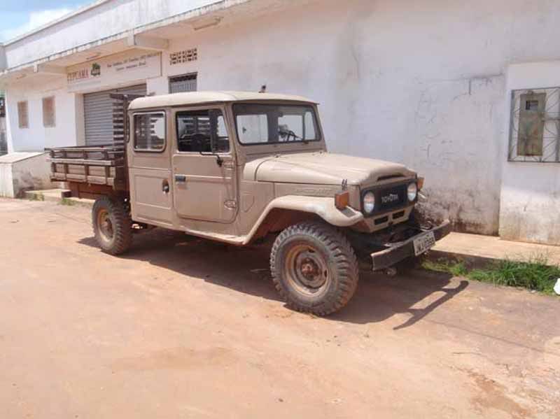
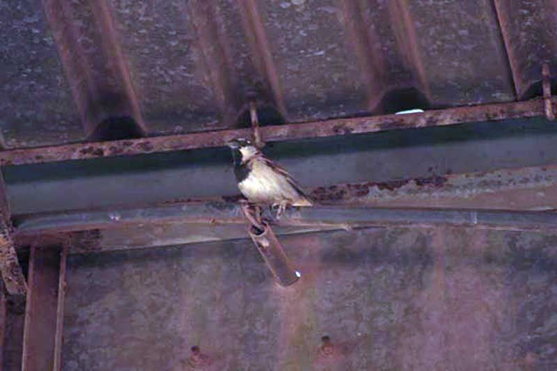
Back in Castanho, they could appreciate this specimen of an endangered species, since this time, compared with previous visits to Brazil, there were far fewer of them in sight.
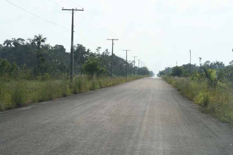
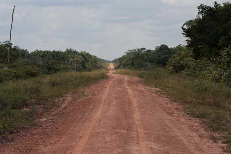
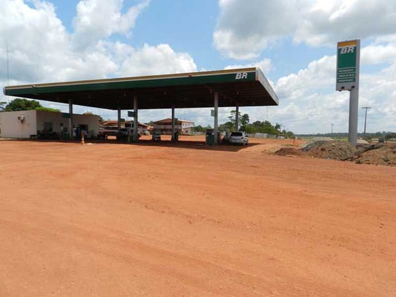
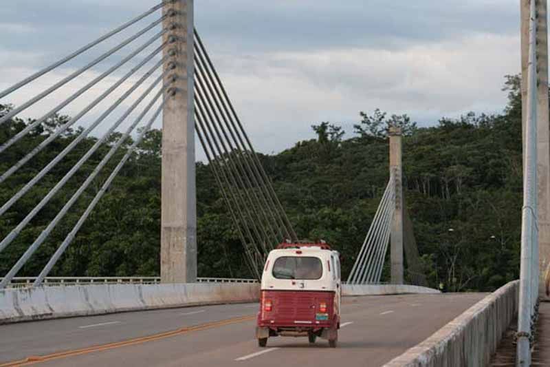
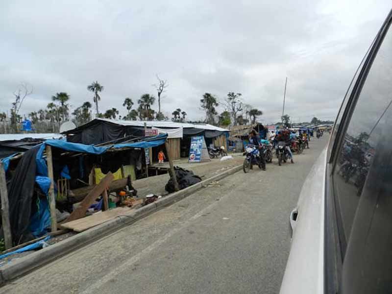
This is how the BR-319 starts from Castanho. Perhaps with the intention to fool the unwary
When they returned to the buraco, the works to provide an alternate path were already well advanced.
Late in the afternoon they could finally get through. This is where the real BR-319 starts a few miles south, but considering all the lost time (almost one day) it would be necessary to continue advancing during the night, despite how inconvenient that can be.
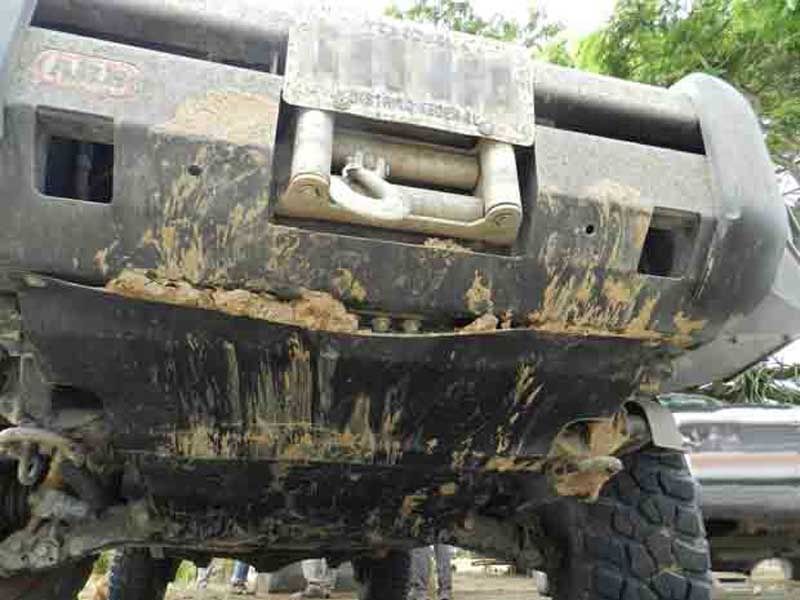
Driving at night during these trips is very inconvenient primarily for two reasons. Firstly, there are safety issues to consider. When undertaking a trip of this magnitude, and you are so far from everything that is familiar and known, it is necessary to take many additional precautions, which include taking utmost care of your vehicle. Under no circumstance we want to risk ruining a trip that cost so much to achieve because of some silly mistake.
Second, it doesn’t make any sense to organize an outing that will take you so far from home, and be unable to enjoy the views just because you are driving at night. The ideal thing to do, in order to be able to know and enjoy as much as possible the new places and scenery you’ll find on these trips, is to hit the road early in the morning and to stop a little before sunset.
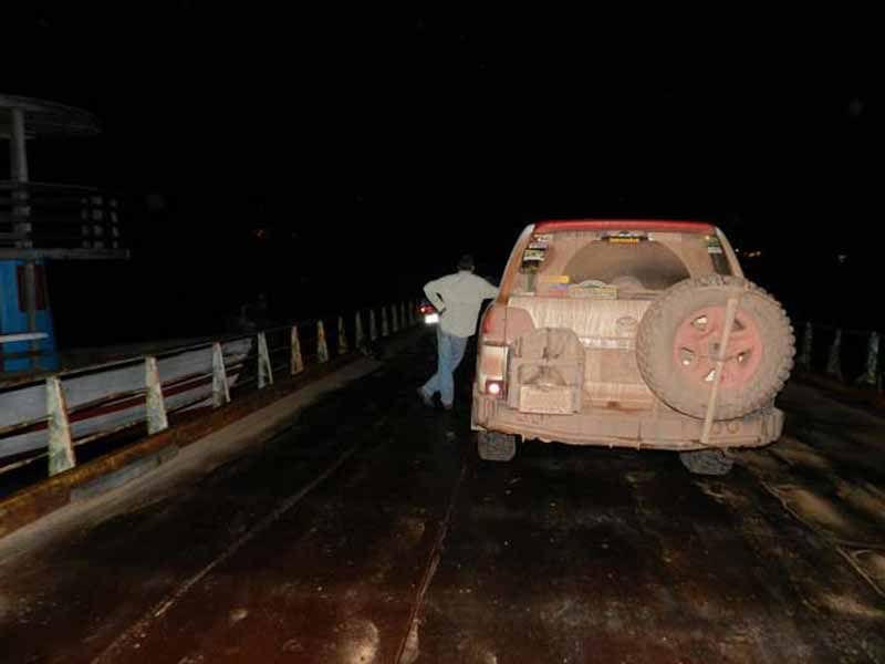
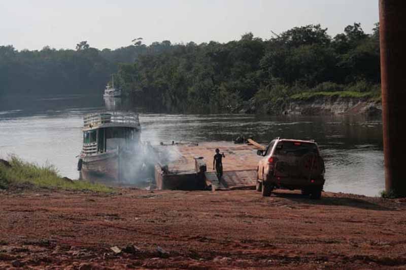
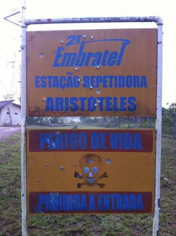
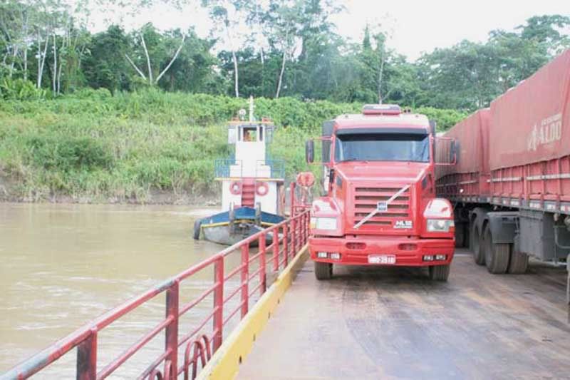
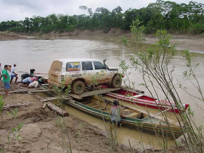
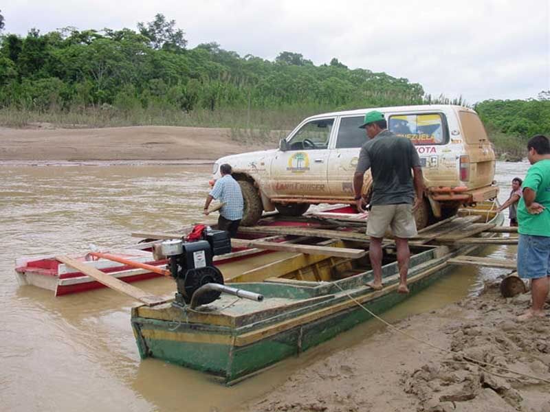
The second barge found in the BR-319, serves to cross the Igapó Açú River (Yes, the Land Cruiser in on the barge in this picture). Here they met a young Embratel worker traveling by bike to one of the company’s antennas, where he planned to spend the night. After talking for a few minutes, they decided that if they were to continue together, they could very well go a little further, until the next antenna named Aristotle.
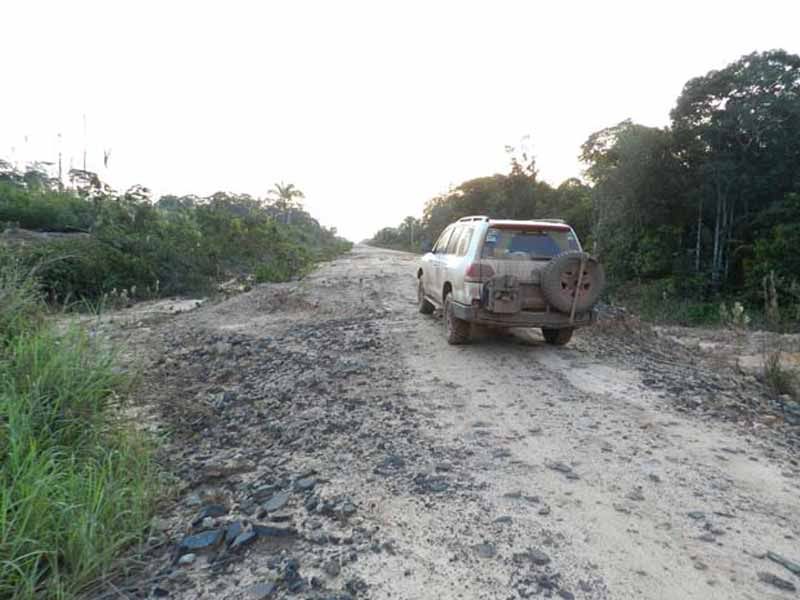
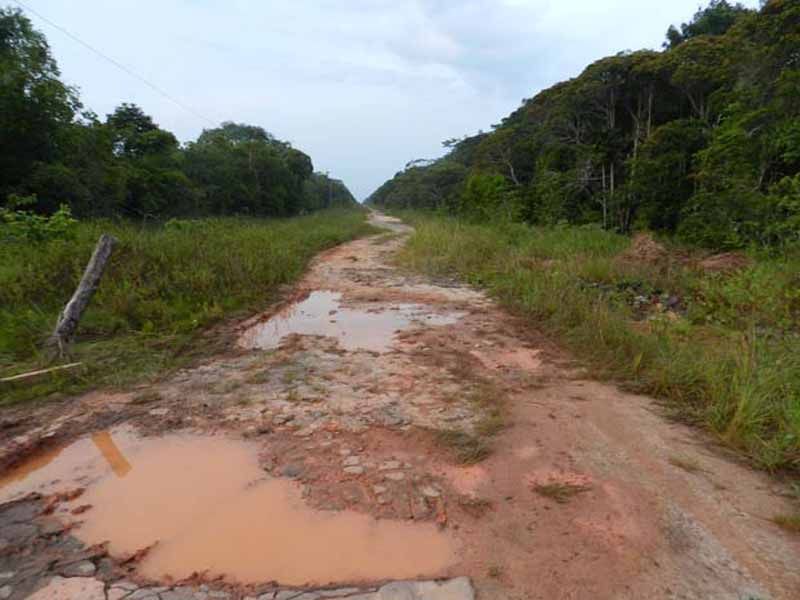
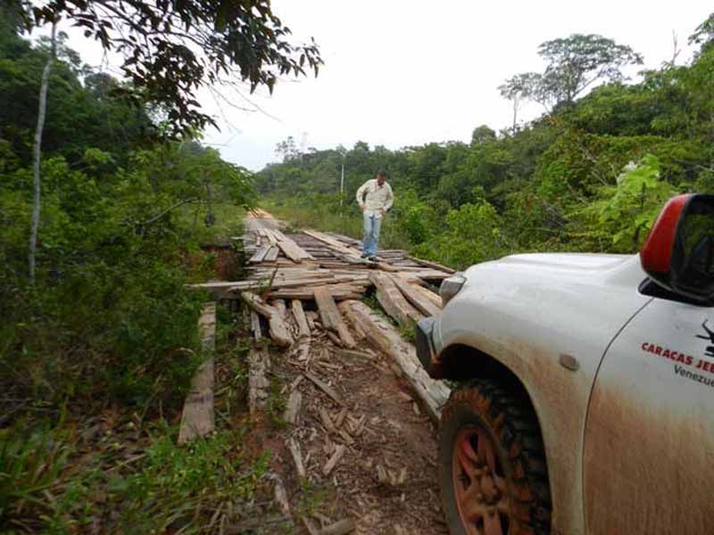
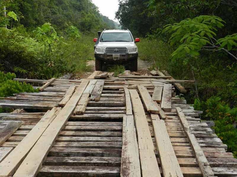
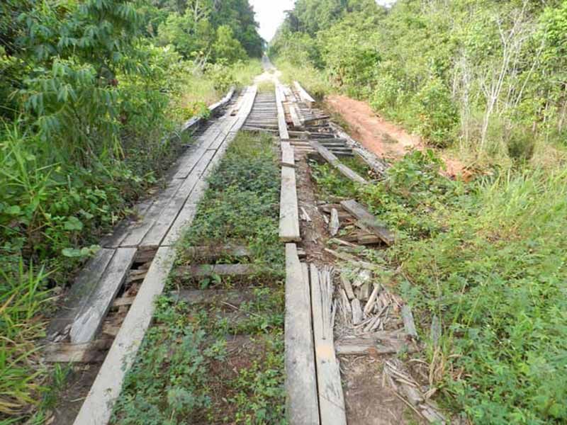
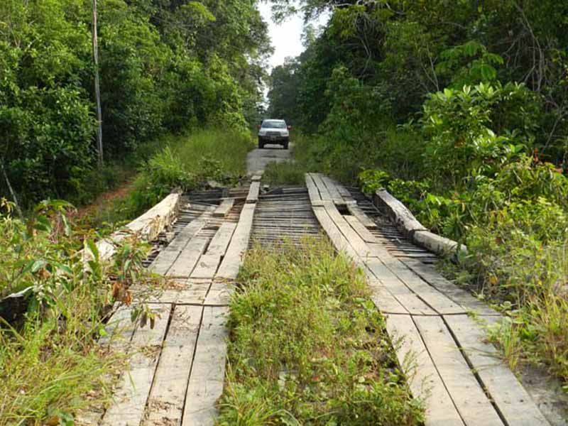
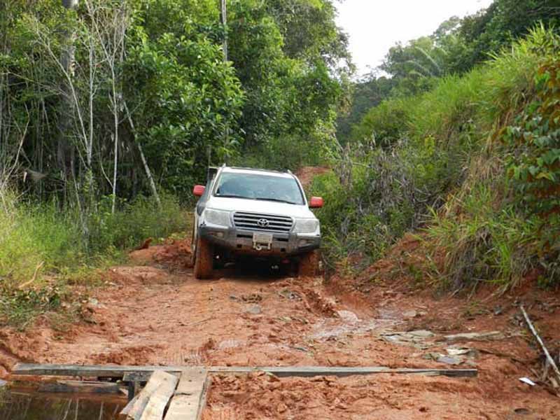
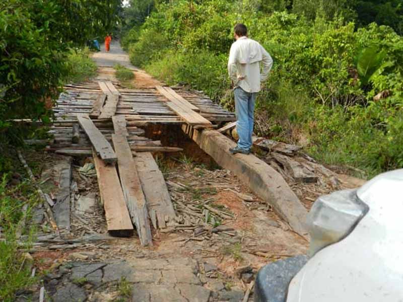
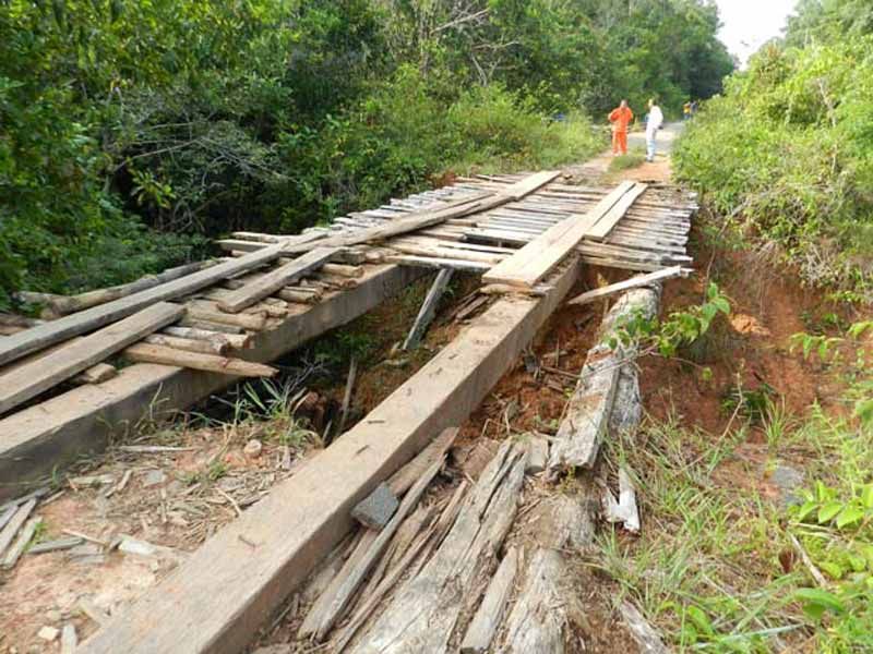
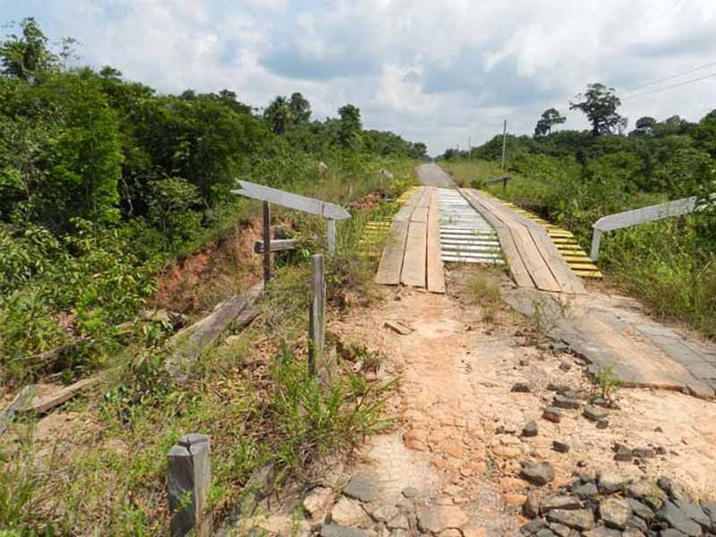
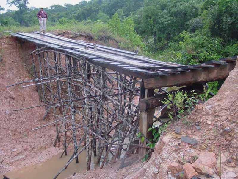
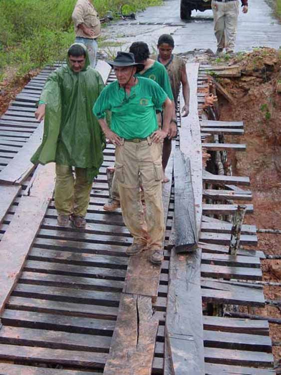
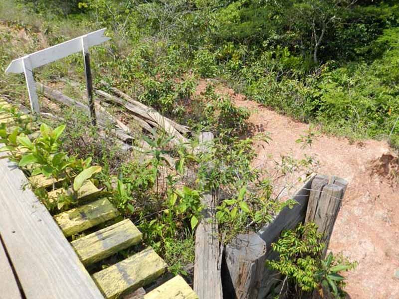
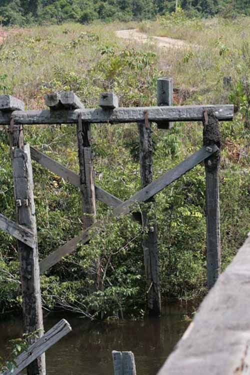
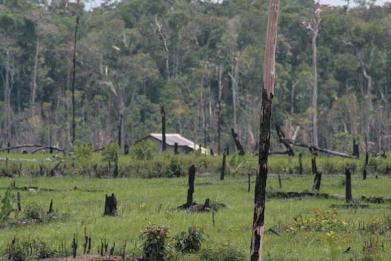
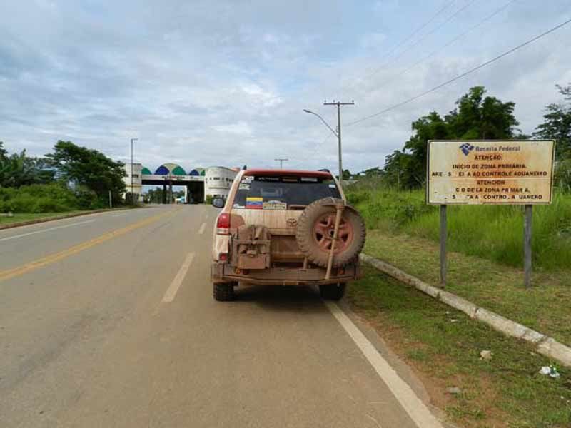
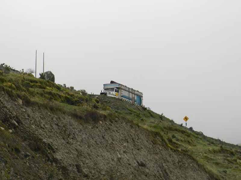
The BR319 linked Manaus (Amazonas) and Porto Velho (Rondonia) until it was declared impassable in 1,988. It was built between 1,972 and 1,973, and covers a total of 550 miles. When 4x4 aficionados talk about this road, they refer to a 290 mile stretch that starts about 55 miles south of Castanho and ends in the vicinity of Humaitá. This section is characterized by broken asphalt, which brutally punishes vehicles, great amounts of mud, and particularly for a large number of wooden bridges in varying conditions of conservation.
It seems that this playground will not last much longer. A few years ago, the Brazilian government began this road’s recovery works, which have been delayed by protests and other actions put forward by pro-environment supporters. But more likely, because of the need of a means of communication that is faster and more efficient than the river, this project will prove to be unstoppable. In fact, during this trip, the road work progress was evident.
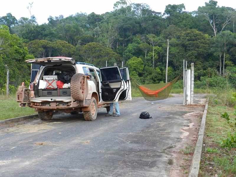
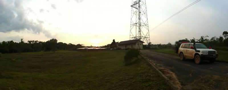
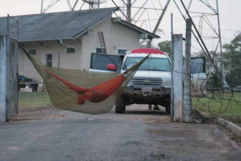
They arrived to Aristotle shortly after 2300hrs. The young biker went to sleep immediately, but not before leaving the antenna facilities gates open as a courtesy. Therefore, our travelers could spend the night over firm, clean ground, rather than on the muddy road. Dinner that night consisted of tuna sandwiches with “batatas fritas” (fries).
For additional photos of this day, please click here.
Tuesday December 06, 2,011
From Castanho to S 05° 08’ 56,1’’ W61° 45’ 40,4’’ (Aristóteles, BR-319)
Distance: 233 miles (375 Km.)
Total Time: 15 hours and 35 minutes
Average Speed: 14.9 mph (24 Km/h)
Top Speed: 64.7 mph (104,1 Km/h)
The town of Castanho is the doorway to the famous BR-319. At least for those approaching from the north.
Sunrise in Castanho.
This is the first barge crossing once on the BR-319, about 45 miles away from Castanho. Here the skipper warned them that a few miles ahead, the road was interrupted by a large hole, and that there was no way to pass. Nevertheless, they had to cross the river and see the actual situation by themselves.
This is the “buraco” (hole in Portuguese), the barge captain had warned them about. The Tupana River had swept the road, and the people traveling in the Mercedes truck you can see in this photo, had already been here waiting for three days for the road to be repaired. Coordinates: S 04° 15’ 20,1’’ W60° 50’ 13,4"
It isn’t nice at all to arrive here, so early in the morning and pleased of the progress made to this point, and be greeted by this obstacle that threatens the success of the trip.
After asking and talking to everyone they saw (this small part of the world is not known for its high population density), including an Embratel work squad about the situation, they concluded that most likely, the road could be repaired by that afternoon. They decided to return to Castanho, in order to reinforce their food and water supplies (you never know if another “buraco” can stop your progress for several days) and to inform the rest of the group about the setback.
Back in Castanho, they could appreciate this specimen of an endangered species, since this time, compared with previous visits to Brazil, there were far fewer of them in sight.
This is how the BR-319 starts from Castanho. Perhaps with the intention to fool the unwary
When they returned to the buraco, the works to provide an alternate path were already well advanced.
Late in the afternoon they could finally get through. This is where the real BR-319 starts a few miles south, but considering all the lost time (almost one day) it would be necessary to continue advancing during the night, despite how inconvenient that can be.
Driving at night during these trips is very inconvenient primarily for two reasons. Firstly, there are safety issues to consider. When undertaking a trip of this magnitude, and you are so far from everything that is familiar and known, it is necessary to take many additional precautions, which include taking utmost care of your vehicle. Under no circumstance we want to risk ruining a trip that cost so much to achieve because of some silly mistake.
Second, it doesn’t make any sense to organize an outing that will take you so far from home, and be unable to enjoy the views just because you are driving at night. The ideal thing to do, in order to be able to know and enjoy as much as possible the new places and scenery you’ll find on these trips, is to hit the road early in the morning and to stop a little before sunset.
The second barge found in the BR-319, serves to cross the Igapó Açú River (Yes, the Land Cruiser in on the barge in this picture). Here they met a young Embratel worker traveling by bike to one of the company’s antennas, where he planned to spend the night. After talking for a few minutes, they decided that if they were to continue together, they could very well go a little further, until the next antenna named Aristotle.
The BR319 linked Manaus (Amazonas) and Porto Velho (Rondonia) until it was declared impassable in 1,988. It was built between 1,972 and 1,973, and covers a total of 550 miles. When 4x4 aficionados talk about this road, they refer to a 290 mile stretch that starts about 55 miles south of Castanho and ends in the vicinity of Humaitá. This section is characterized by broken asphalt, which brutally punishes vehicles, great amounts of mud, and particularly for a large number of wooden bridges in varying conditions of conservation.
It seems that this playground will not last much longer. A few years ago, the Brazilian government began this road’s recovery works, which have been delayed by protests and other actions put forward by pro-environment supporters. But more likely, because of the need of a means of communication that is faster and more efficient than the river, this project will prove to be unstoppable. In fact, during this trip, the road work progress was evident.
They arrived to Aristotle shortly after 2300hrs. The young biker went to sleep immediately, but not before leaving the antenna facilities gates open as a courtesy. Therefore, our travelers could spend the night over firm, clean ground, rather than on the muddy road. Dinner that night consisted of tuna sandwiches with “batatas fritas” (fries).
For additional photos of this day, please click here.
")
")