SAS
Observer
My son had some buddies out from the east coast for a week (they're all 18-19 years old), and they wanted to undertake some adventure and camping. They made some day trips from our home in Colorado Springs but were really anticipating the off-road experience and some camping.
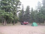
We started on Tuesday evening by driving to Medano Pass and camping near the trailhead. Wednesday morning we made breakfast and struck camp, and drove the pass into Great Sand Dunes National Park.

After playing around and climbing the dunes, we headed west via Highway 160 through Alamosa, Monte Vista, Del Norte, and South Fork to Highway 149 (Silver Thread Scenic Byway) to Creede, Lake City, and then on to Gunnison and Crested Butte.
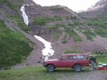
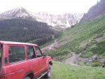
We fueled-up and took the western leg of Paradise Divide, and drove up Daisy Pass to camp near the "glacier". The views were fantastic at sundown, and even more so the next morning as the sun rose on the mountain peaks.
Thursday morning we had an ambitious plan to drive over Paradise Divide to Schofield Pass, drive down the "Devil's Punchbowl" and then view the Crystal Mill before returning to Crested Butte and hitting the highway for Buena Vista and attempt a late afternoon climb of Mount Antero (14,275' elevation).
Nature made our decision simple when we drove north/northeast over the Paradise Divide and found snow blocking the road a (relatively) short distance from the intersection with Schofield Pass. There were several snow drifts, but the greatest obstacle was a slide area (evidenced by lots of tree debris within the snow) that exceeded eight feet in height and probably twenty feet in width on the road.
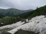
We decided at this point to turn and burn for Buena Vista and get on Antero near mid-day. Good thing, too, as I received a message later that day indicating the "Devil's Punchbowl" segment of Schofield Pass was blocked by a large rockslide; even had this snow not stopped us, the rockslide certainly would have!
The drive east on Highway 50 was uneventful. Having a little time to spare, I took the boys to see the Cruiser yard at Classic Cruisers (in Poncha Springs)--a spectacle for the Land Cruiser enthusiast! There were FJ40's, FJ55's, FJ60's and 62's, and even a few FJ/FZJ80s. Coincidentally, just minutes later when we stopped at the Hunger Junction (BBQ joint at Highways 50 and 285), Mica from Classic Cruisers pulls in and parks next to me--he's driving a Cummins 5.9L-converted FJ/HJ47 Troopy!
We finished lunch and sped up Highway 285 to Nathrop, Colorado and headed west toward St. Elmo on County Road 162. We found the Mount Antero trailhead marked with the "277" Forest Service sign, pulled off, locked-in the hubs, aired-down the tires, and began to creep up the rocky road. We encountered very little traffic, two hikers and one vehicle, before getting above treeline. Once here, the views really open up and one begins to see the scale of these mountains.
The road is very rocky but no obstacles were encountered which would prevent a stock 4x4 from making the approach. On the "lower switchbacks", the road is quite steep. The 2F was groaning and the wheels kept turning. We approached the "upper switchbacks", and were amazed with the panoramic views. We were also surprised to find a rolled Jeep Wrangler, which appeared to have only occurred that day or perhaps the prior day--though it is hard to tell. We stopped and cautiously approached the Jeep from the uphill side, just to verify that no one was inside. (Later, after descending the mountain, I contacted a friend who is a local and knows the 4x4 community and local USFS Ranger District well--he said the rollover was several days old, and he understood that a plan was organized to recover the Jeep as soon as Saturday).
We reached the end of the 4x4 road and parked, making preparations to climb the remaining 500 vertical feet to the summit. I estimate that it was approximately one mile from where we parked. The ascent was rocky and the wind was blowing! I estimate it was blowing 20-25mph with gusts around 40mph. Four of us plus my Black Lab, Sir Percival Blakeney, scrambled up the jagged ridge and loose rock. It took us about 30 minutes, but we reached the summit. Breathtakingly beautiful, we stood silently and just looked around.

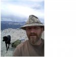
Anticipating that the wind was blowing a storm in, we scrambled back down the summit and began to drive the descent. The clouds actually broke and the sun shone upon us all the way into Buena Vista, where we grabbed an ice cream snack at K's and relaxed in the city park nearby. The drive home to Springs was pleasant, and we arrived at sundown. A perfect ending to a great adventure!
We started on Tuesday evening by driving to Medano Pass and camping near the trailhead. Wednesday morning we made breakfast and struck camp, and drove the pass into Great Sand Dunes National Park.


After playing around and climbing the dunes, we headed west via Highway 160 through Alamosa, Monte Vista, Del Norte, and South Fork to Highway 149 (Silver Thread Scenic Byway) to Creede, Lake City, and then on to Gunnison and Crested Butte.
We fueled-up and took the western leg of Paradise Divide, and drove up Daisy Pass to camp near the "glacier". The views were fantastic at sundown, and even more so the next morning as the sun rose on the mountain peaks.


Thursday morning we had an ambitious plan to drive over Paradise Divide to Schofield Pass, drive down the "Devil's Punchbowl" and then view the Crystal Mill before returning to Crested Butte and hitting the highway for Buena Vista and attempt a late afternoon climb of Mount Antero (14,275' elevation).
Nature made our decision simple when we drove north/northeast over the Paradise Divide and found snow blocking the road a (relatively) short distance from the intersection with Schofield Pass. There were several snow drifts, but the greatest obstacle was a slide area (evidenced by lots of tree debris within the snow) that exceeded eight feet in height and probably twenty feet in width on the road.

We decided at this point to turn and burn for Buena Vista and get on Antero near mid-day. Good thing, too, as I received a message later that day indicating the "Devil's Punchbowl" segment of Schofield Pass was blocked by a large rockslide; even had this snow not stopped us, the rockslide certainly would have!
The drive east on Highway 50 was uneventful. Having a little time to spare, I took the boys to see the Cruiser yard at Classic Cruisers (in Poncha Springs)--a spectacle for the Land Cruiser enthusiast! There were FJ40's, FJ55's, FJ60's and 62's, and even a few FJ/FZJ80s. Coincidentally, just minutes later when we stopped at the Hunger Junction (BBQ joint at Highways 50 and 285), Mica from Classic Cruisers pulls in and parks next to me--he's driving a Cummins 5.9L-converted FJ/HJ47 Troopy!
We finished lunch and sped up Highway 285 to Nathrop, Colorado and headed west toward St. Elmo on County Road 162. We found the Mount Antero trailhead marked with the "277" Forest Service sign, pulled off, locked-in the hubs, aired-down the tires, and began to creep up the rocky road. We encountered very little traffic, two hikers and one vehicle, before getting above treeline. Once here, the views really open up and one begins to see the scale of these mountains.
The road is very rocky but no obstacles were encountered which would prevent a stock 4x4 from making the approach. On the "lower switchbacks", the road is quite steep. The 2F was groaning and the wheels kept turning. We approached the "upper switchbacks", and were amazed with the panoramic views. We were also surprised to find a rolled Jeep Wrangler, which appeared to have only occurred that day or perhaps the prior day--though it is hard to tell. We stopped and cautiously approached the Jeep from the uphill side, just to verify that no one was inside. (Later, after descending the mountain, I contacted a friend who is a local and knows the 4x4 community and local USFS Ranger District well--he said the rollover was several days old, and he understood that a plan was organized to recover the Jeep as soon as Saturday).
We reached the end of the 4x4 road and parked, making preparations to climb the remaining 500 vertical feet to the summit. I estimate that it was approximately one mile from where we parked. The ascent was rocky and the wind was blowing! I estimate it was blowing 20-25mph with gusts around 40mph. Four of us plus my Black Lab, Sir Percival Blakeney, scrambled up the jagged ridge and loose rock. It took us about 30 minutes, but we reached the summit. Breathtakingly beautiful, we stood silently and just looked around.


Anticipating that the wind was blowing a storm in, we scrambled back down the summit and began to drive the descent. The clouds actually broke and the sun shone upon us all the way into Buena Vista, where we grabbed an ice cream snack at K's and relaxed in the city park nearby. The drive home to Springs was pleasant, and we arrived at sundown. A perfect ending to a great adventure!


