Continental Divide and Colorado BDR

velo47

Member
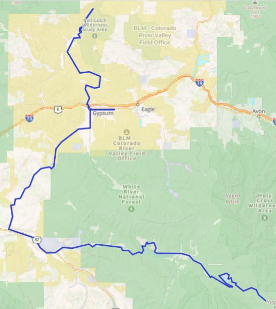
Day 15 – Ivanhoe Lake, CO to Red Dirt Bridge, CO – 115 miles
10356-albums1536-picture45398.png


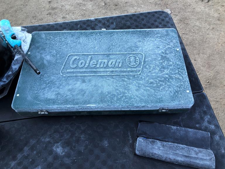
This was easily the coldest morning of the entire trip.
10356-albums1536-picture45559.jpg


The road down from Ivanhoe Lake follows an old railroad grade, and is a pretty easy drive. At Ivanhoe, a railroad tunnel was built in 1891 which essentially goes under Hagerman Pass, and ends just above Turquoise Lake on the Leadville side. It replaced the shorter Hagerman Tunnel, which at over 11,500 feet, was one of the highest tunnels ever built. The new Busk- Ivanhoe Tunnel allowed much easier rail traffic across the Continental Divide.

The tunnel was converted from a rail tunnel to an automobile toll tunnel in 1922, and renamed the Carlton Tunnel. It was abandoned in 1942 and collapsed in 1945. Beginning in 1921, the tunnel was also used to steal divert water from the western slope to the eastern slope. Water could still flow through the rubble, and the tunnel was repaired to a degree after the collapse. It is still used to divert water to this day. The eastern entrance to the tunnel is just above Turquoise Lake, but I missed it on the way up the pass.

We had to divert off the BDR and down Frying Pan Road due to a large wildfire at Sylvan Lake. The diversion took us by Ruedi Reservoir, where we used to sail when I was a kid, and down into Basalt. Onto Highway 82 and then up an over Cottonwood Pass (8,280 feet) to Gypsum, where we rejoined the BDR after getting fuel and supplies. This, obviously, is not the same Cottonwood Pass we traversed a few days ago.

In fact, there are 3 Cottonwood Passes in Colorado! Additionally, there are two Arapaho, Big Horn, Browns, Buffalo, Denver, Grassy, Hoosier, Muddy, Pawnee, Ptarmigan, Spring Creek, Squaw, Storm, Taylor, Narrows, and Windy passes, three Columbine, Red Mountain, San Francisco, Notch, and Yellow Jacket passes, four Gunsight, and Saddle passes, and six Ute passes, just to keep things confusing!

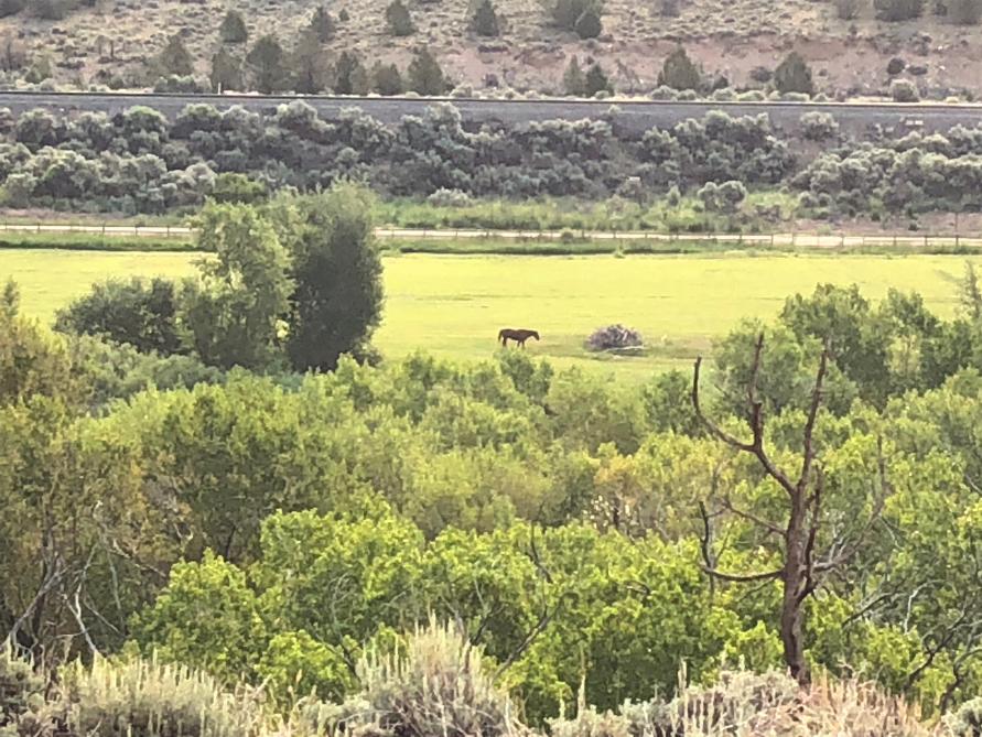
From Gypsum, we traveled north to the Colorado River, where we found a nice camp spot at Red Dirt Bridge. Bill noticed the rear seal on his Jeep was leaking, and changed it before dinner!
10356-albums1536-picture45560.jpg


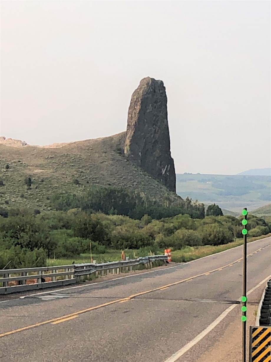
Today, the smoke from all the wildfires became really noticeable, and would get thicker throughout the rest of the trip. For this reason, I took fewer photos, as many of the cool vistas were obscured by smoke.


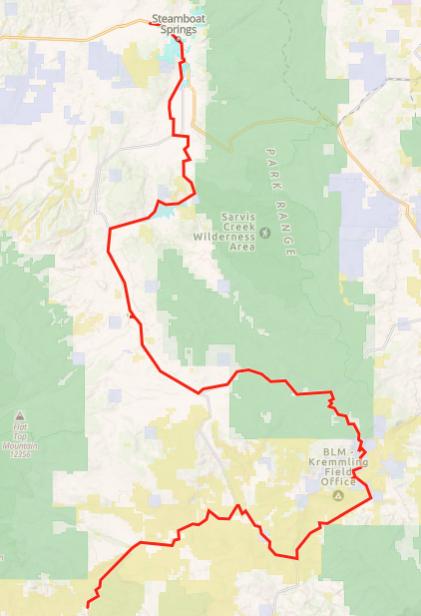
Day 16 – Red Dirt Bridge, CO to Steamboat Springs, CO – 115 miles
10356-albums1536-picture45399.png


We set off in the morning along the Colorado River, with a few diversions here and there. It was an enjoyable easy drive until I got a puncture just past the Radium Recreation Area. We plugged the tire and, once again, the compressor struggled to air it up. We continued a short way and met up with the motos, where Ardell noticed that the tire had a big bulge in the tread, apparently a delamination had occurred. We changed the tire, but not without a couple setbacks, including a failed Hummer H-1 scissor jack and a broken lug nut socket. The rest of the day I was a little nervous about the wheel, as we could not torque the lug nuts down to spec.
10356-albums1536-picture45561.jpg


At the intersection of Highway 134, we were forced to take a second detour due to wildfire activity. We took 134 to Yampa where we had a good late lunch at the Antlers Café & Bar. The Bearpaw Bakery next door was closing for a couple days and was having a half off sale on everything! Sweet!

We continued on to Stagecoach Reservoir, where we regained the BDR, continued into Steamboat and camped at the KOA so we could shower off! A good pizza dinner at How Ya Doin Pizza topped off the evening.


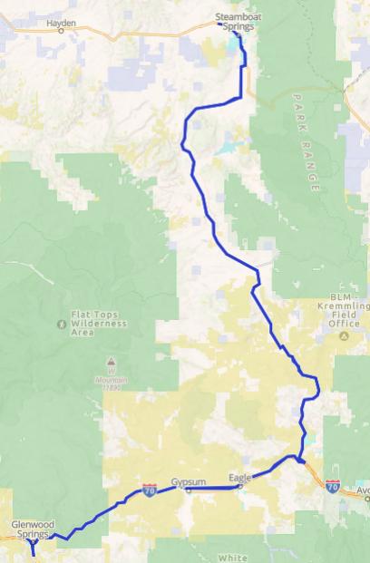
Day 17 – Steamboat Springs, CO to Steamboat Springs, CO – 235 miles
10356-albums1536-picture45400.png


The guys decided to take a rest day today. John had to work (ugh), he had a zoom call and needed wifi, and everyone was a little tired out. I took the opportunity to drive to Glenwood Springs to get a couple new front tires. I had hoped I would get one more trip out of them, but not so lucky.

I got up early and went to throw out some trash, and it was evident that a bear had made itself a midnight snack, trash everywhere. After taking to John when I got back, the bear had also visited the site next to them, but did no damage there.

It was a quick trip down to I-70 and west through Glenwood Canyon to the Springs, new tires, and back. Didn’t even get a soak at the hot springs.


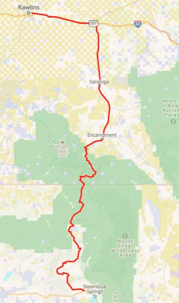
Day 18 – Steamboat Springs, CO to Rawlins, WY – 150 miles
10356-albums1536-picture45401.png


Today is the last day of the BDR. As we were packing up, we noticed that
Bill’s Jeep was leaking coolant. Bill figured out it was leaking at the heater core, so we made a trip to NAPA and he bypassed it in the parking lot. I think he can fix anything!

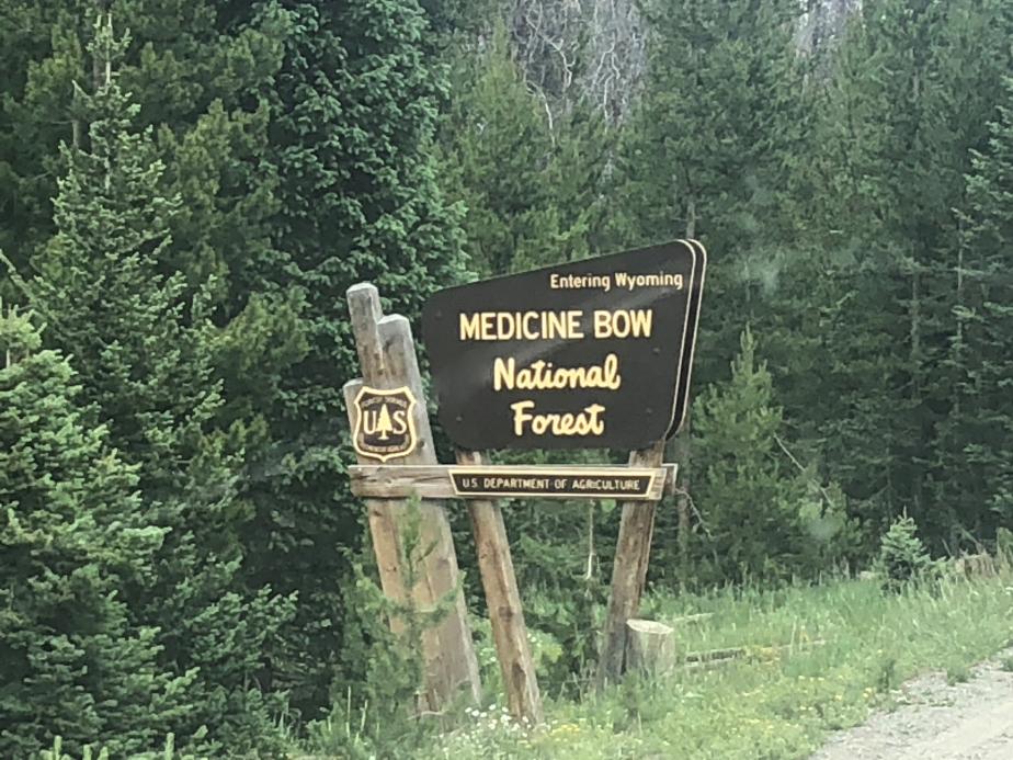
The day started out drizzly rainy as we made our way to the Wyoming border. At one point near the border, the route took off on a small two track that was essentially impassible for the bikes. We were discussing where to detour when a logging truck rolled up. The driver was mighty nice, and told us the best route to take, and roared off. Those guys drive fast in those big trucks!

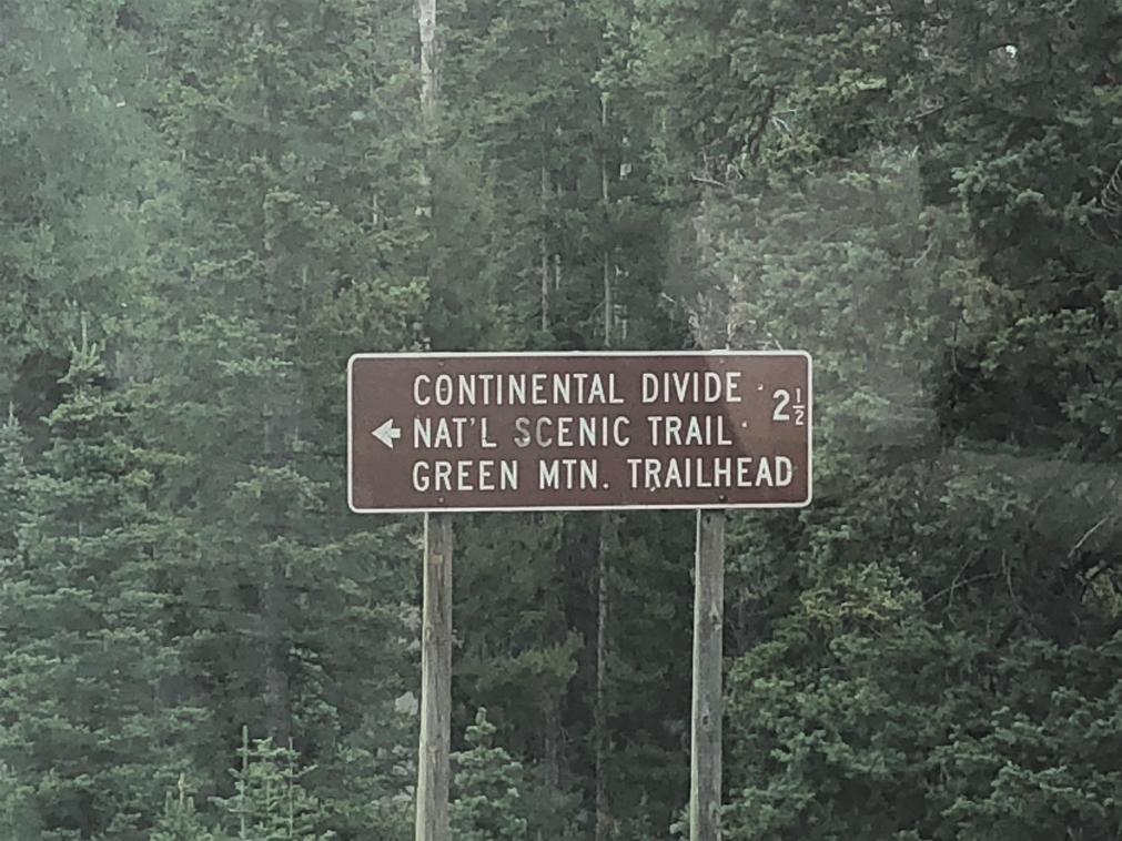
We crossed the border, and came to an intersection where we would split up.
10356-albums1536-picture45562.jpg


10356-albums1536-picture45563.jpg


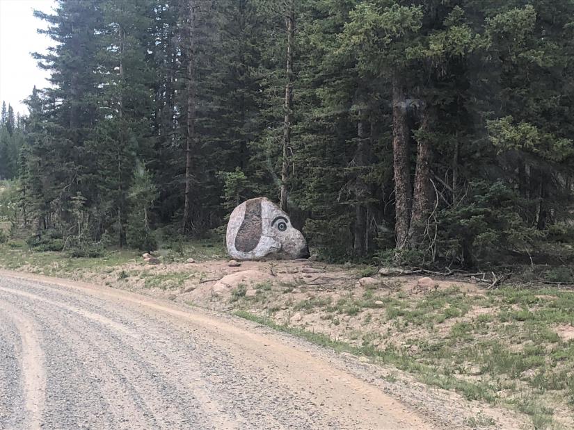
The others returned to Steamboat and ultimately back to Cortez and then Arizona. I continued north to Rawlins.
10356-albums1536-picture45564.jpg


10356-albums1536-picture45565.jpg


There I did laundry, had a good chicken fried steak at Buck’s Bar & Grill, and spent the night in a crappy motel.
 

velo47

Member
Sorry for the hiatus, I had to go to DC to see my mom.
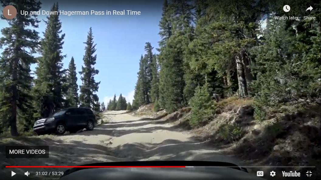
After I posted day 14, I was re-watching a couple of the videos that Larrie @Luinil Explorations posted that showed their CO BDR trip last September. Watching the Hagerman pass video, I noticed this car and immediately recognized it.

10356-albums1536-picture45585.png


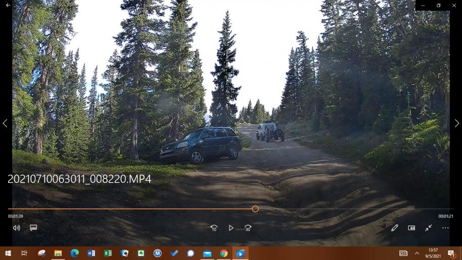
That same car was in the same place when we went over Hagerman in August of this year, almost a year later!

10356-albums1536-picture45587.png


The car was very near the top of the pass, and kind of precariously parked it seemed. It's funny that Bill remembered the car from our trip, and so did Larrie from his. It wasn't in a spot you'd expect, so it stuck in our minds. According to GAIA and OnX, there is no private land inholding or mining claim there.

The car sure didn't look as though it had been there all winter, and didn't look damaged or abandoned, but it seems to be in the exact same place.

So, what do you think? There all year? Just coincidentally in the same place? Mushroom hunter? Pot grow? Who knows?
 

velo47

Member
Day 19 – Rawlins, WY to Pinedale, WY – 235 miles

10356-albums1536-picture45402.png


Not him again!

10356-albums1536-picture45503.jpg


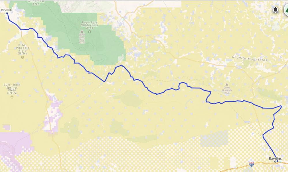
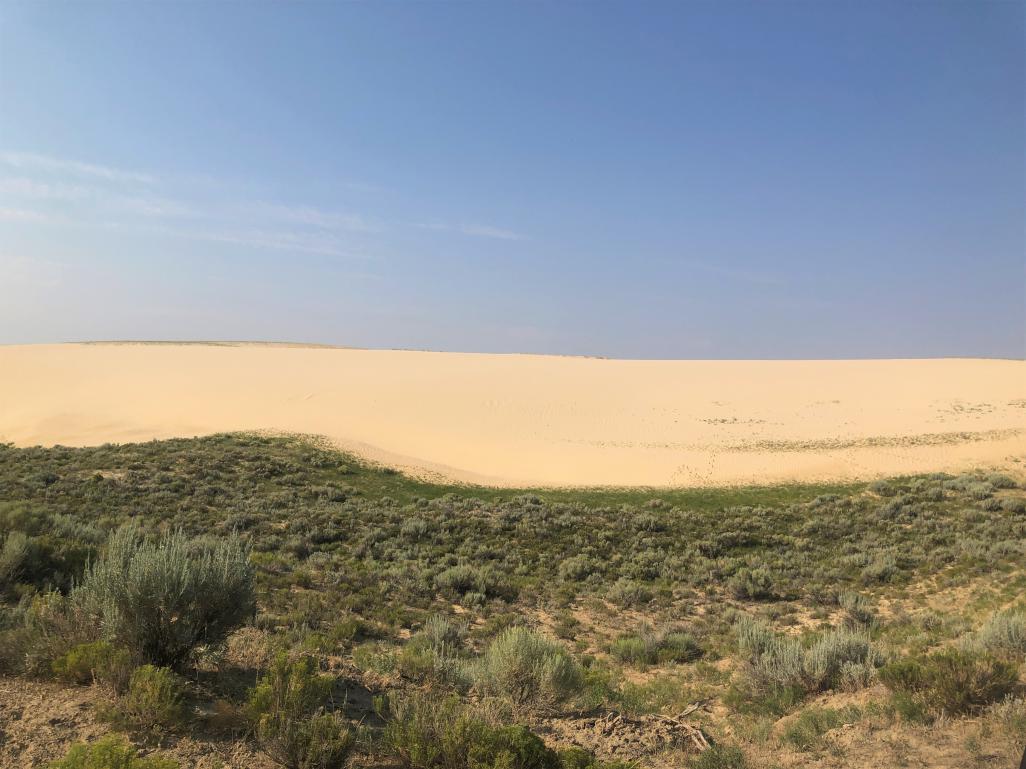
Out of Rawlins, I traveled North on the highway a few miles, and then turned east into BLM checkerboard. The trail loops around back to the west, by and through some sand dunes.

10356-albums1536-picture45566.jpg


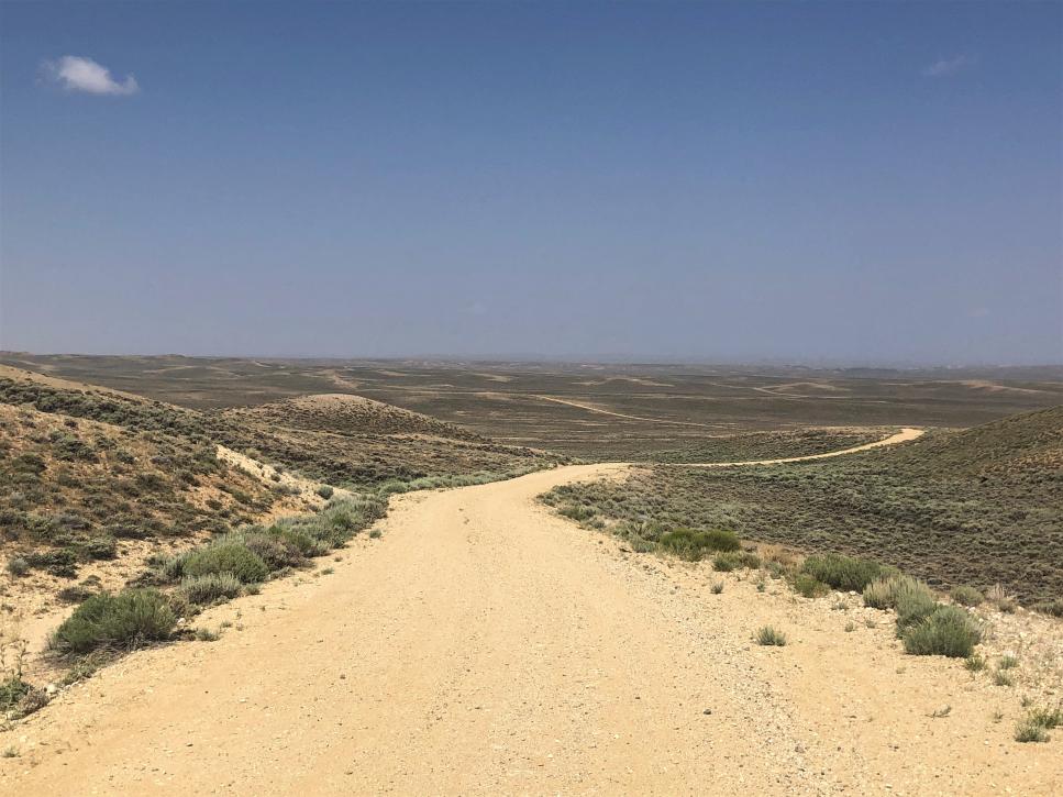
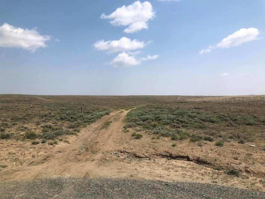
This is dry, rolling open country, perfect for Pronghorn, of which I saw a lot. Back across the highway and by the town of Barsoil and across a huge swath of BLM land towards South Pass City.

10356-albums1536-picture45567.jpg


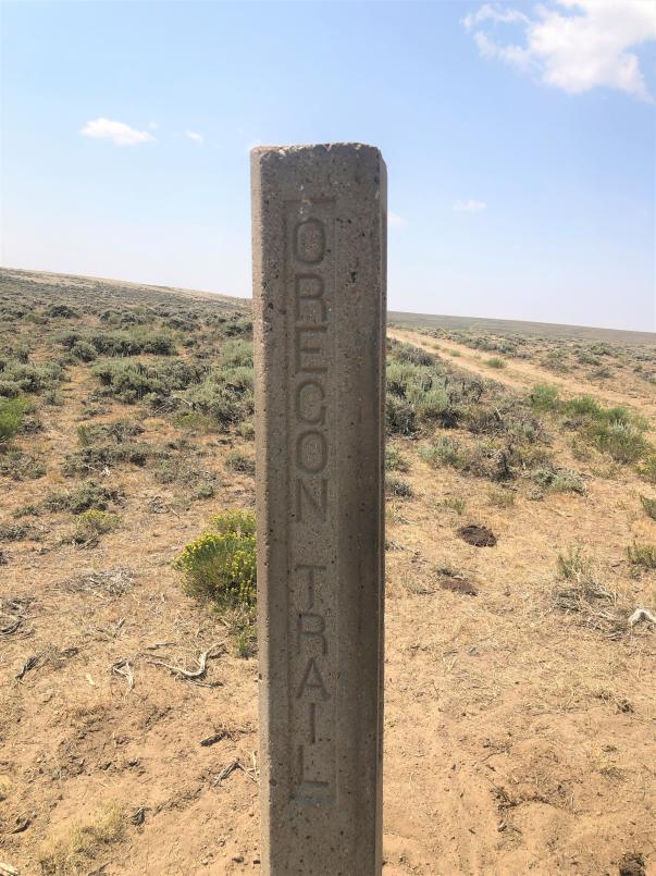
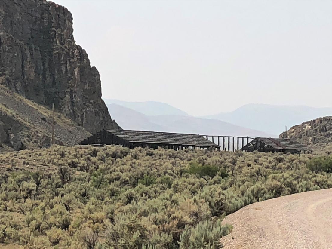
The track ranges from well-maintained ranch roads to two-tracks, none of which was too difficult, at least when it was dry. At one point, there was a non-descript marking the crossing of the Pony Express route, which I was on, and the Oregon Trail.
10356-albums1536-picture45569.jpg


10356-albums1536-picture45568.jpg


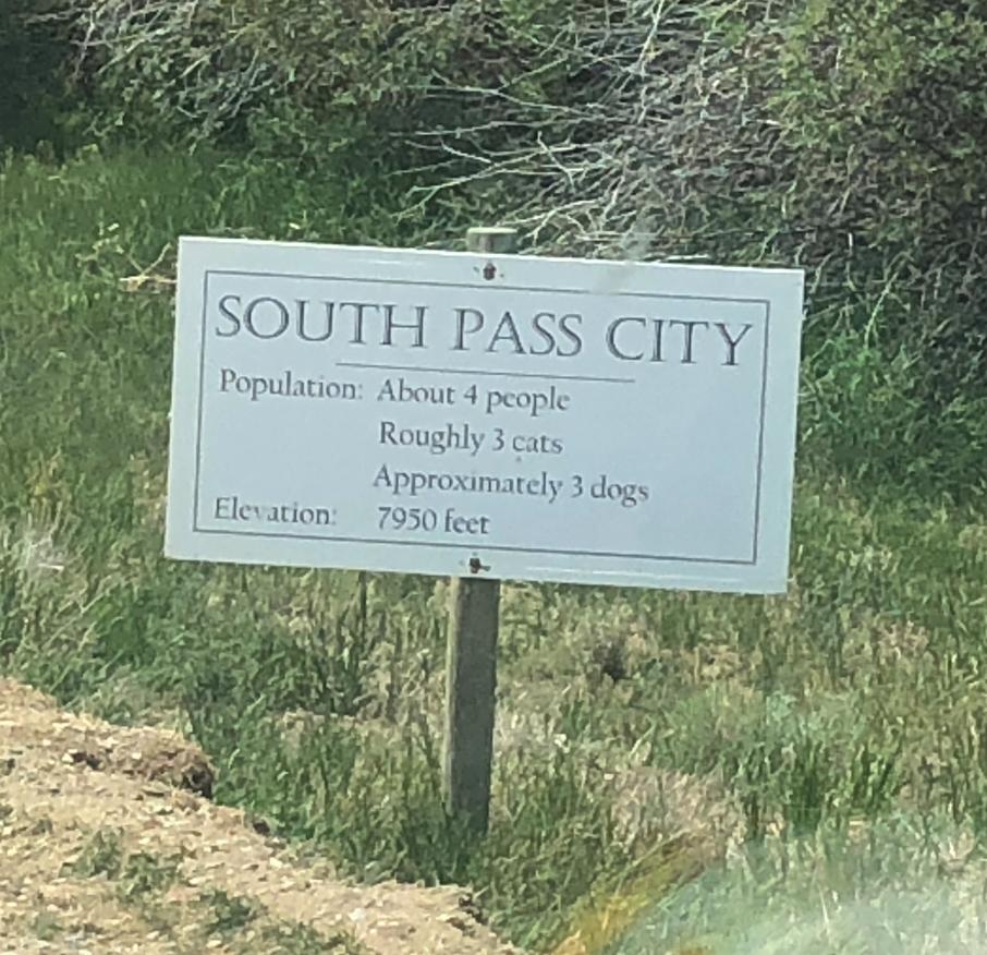
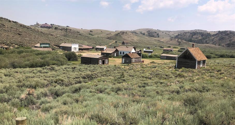
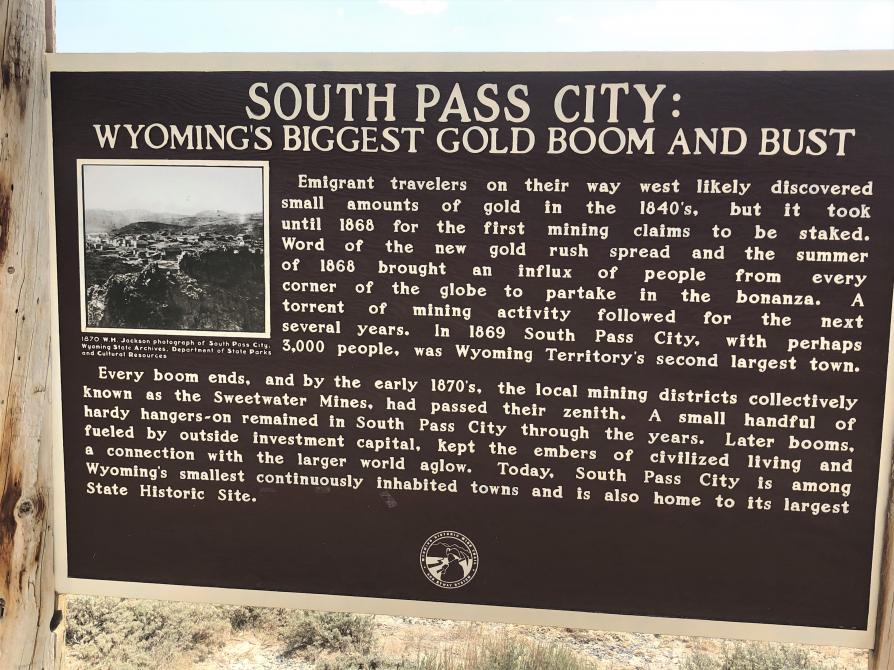
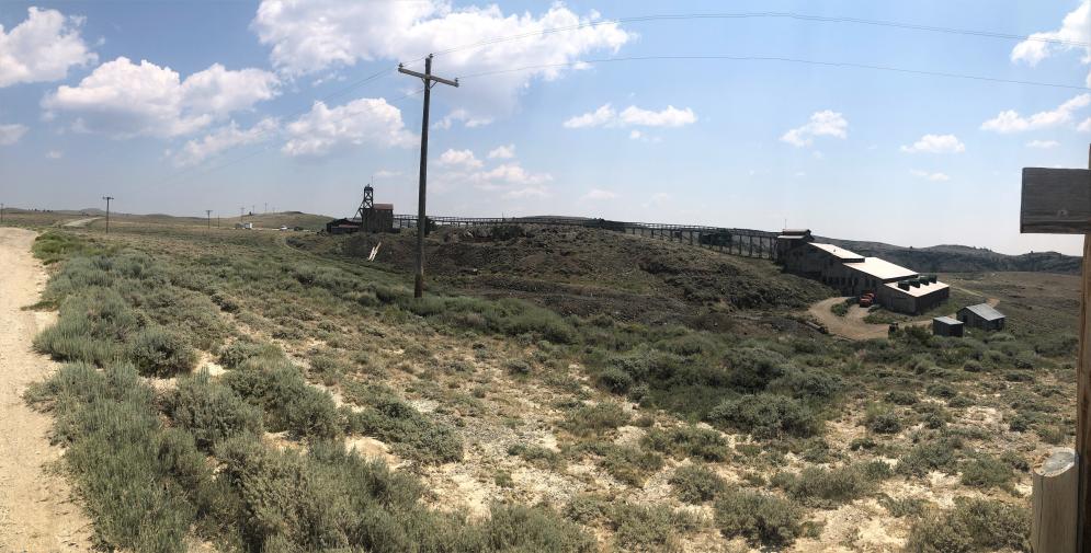
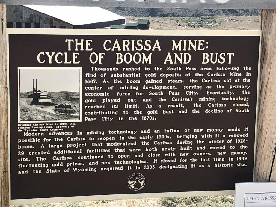
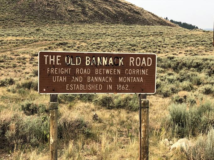
I continued on through South Pass City.
10356-albums1536-picture45573.jpg


10356-albums1536-picture45574.jpg


10356-albums1536-picture45572.jpg


10356-albums1536-picture45571.jpg


10356-albums1536-picture45570.jpg


On to Boulder, and then a short stint of pavement into Pinedale. I hadn’t expected to get this far, but the roads were generally good, and traveling alone I find I tend to press on. I really should stop and explore more, it’s not like I’m on a schedule!

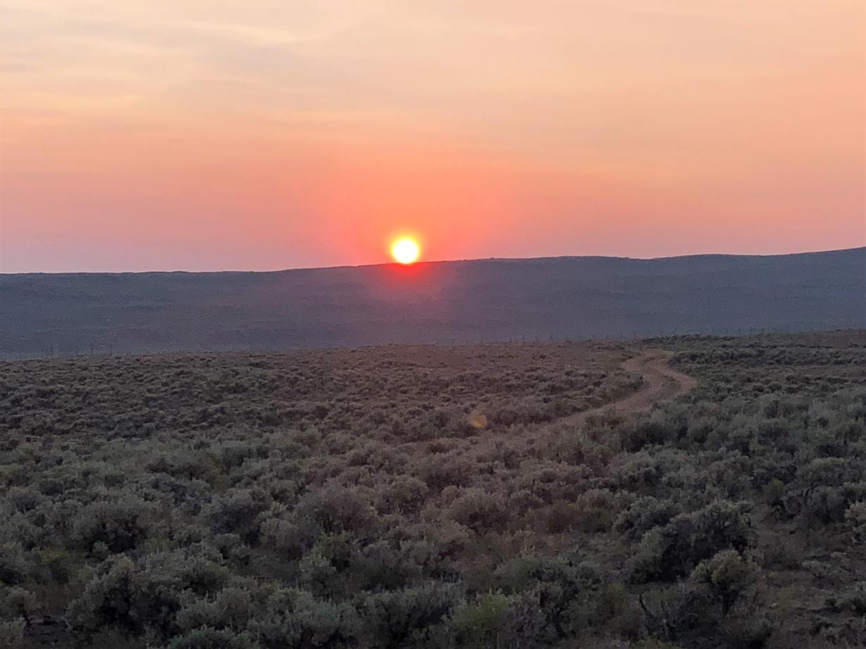
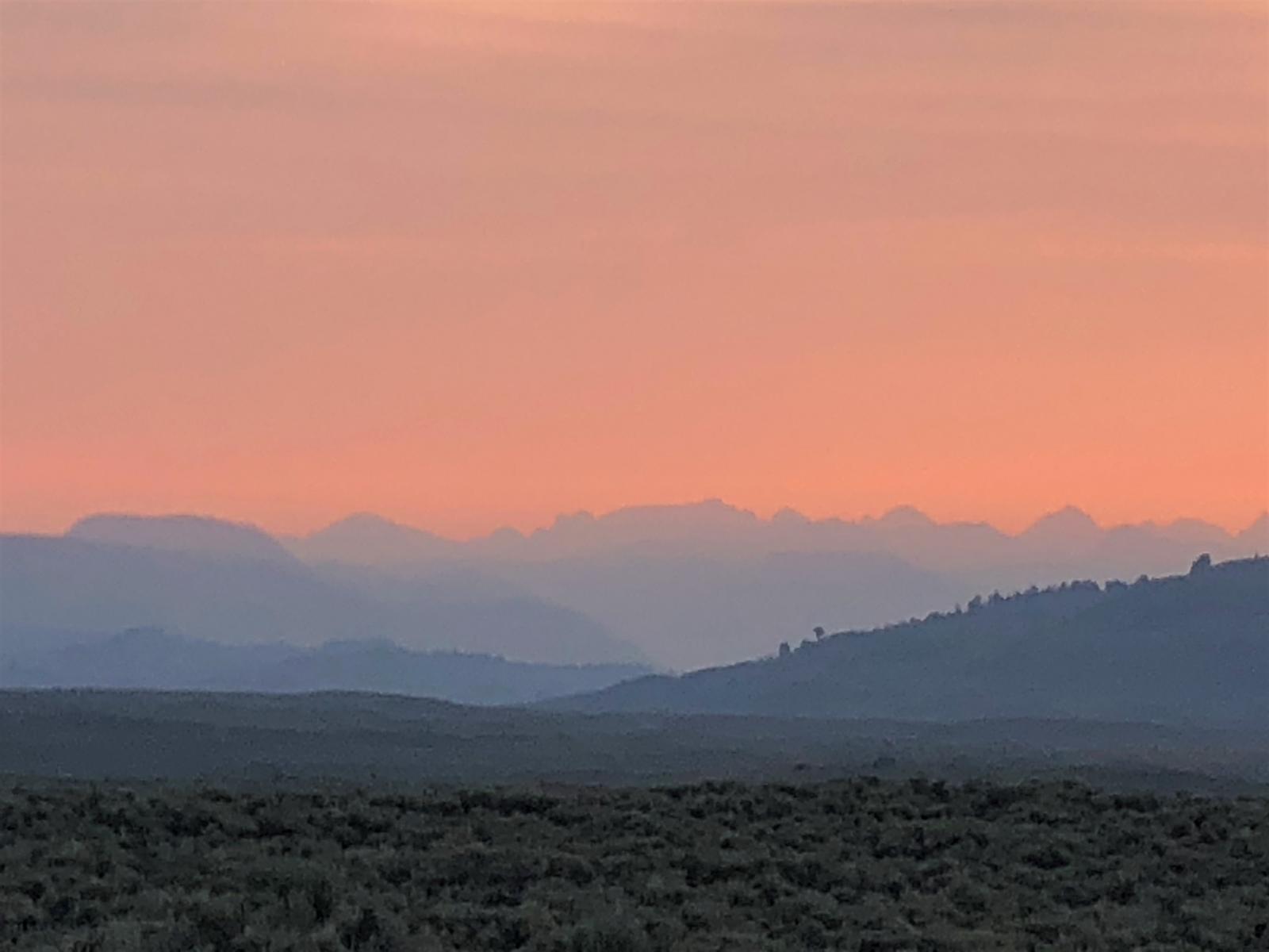
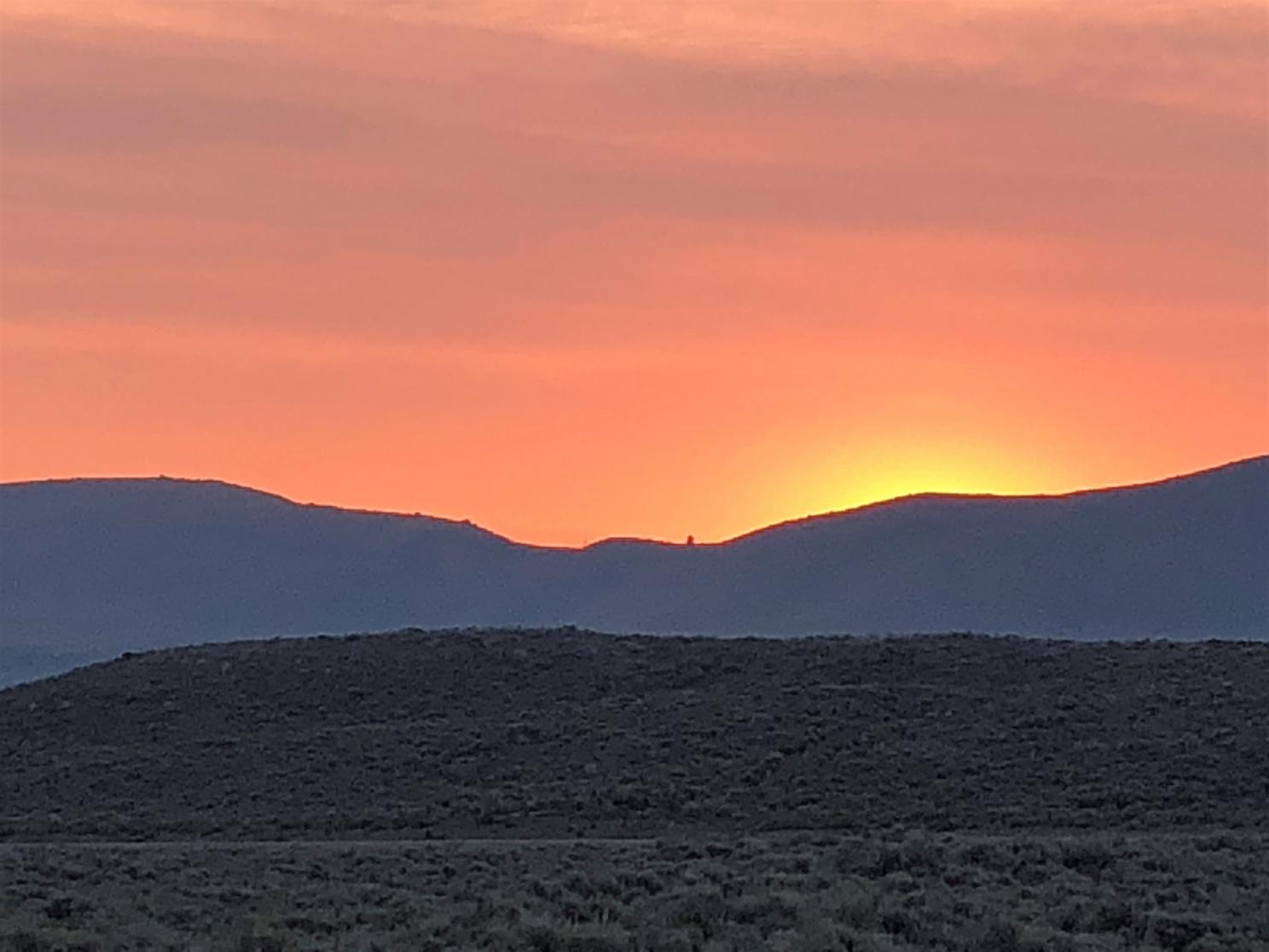
I had a good early dinner at the Wind River Brewery in Pinedale, and headed out to find a campsite. After checking several campgrounds at Fremont Lake and Half Moon Lake (all full), I returned to Pinedale and headed north into the BLM for a dispersed site. The evening was very smoky, resulting in a stunning, although somewhat disconcerting, sunset.

10356-albums1536-picture45575.jpg
 

TripLeader

Explorer
GREAT STUFF!

I love seeing Chaco Canyon and the other old dwellings.

And I would have loved to see the cyclists near the end of the Tour Divide. (There's plenty of YouTube videos about it.)
 
Its not uncommon to see an abandon vehicle sit on Forest Service land for years as the investigation process makes it way the different federal, state and local agencies. Eventually it will be towed out. I know of a Honda Element that sat for 4 years before it was removed.
 

BigBrokenZJ

Active member

10356-albums1536-picture45494.jpg


Something we’ve noticed is that the difficulty of the “expert” routes on the BDRs varies greatly. Some seem just like stretches of the regular route, and some are really, really hard.

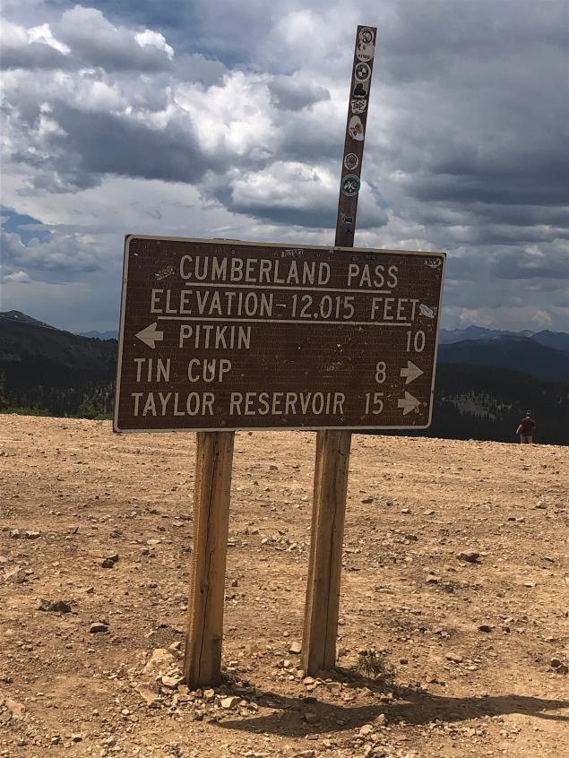
We crested Cumberland Pass (12,015 feet) and came across a Jeep XJ which had overheated coming up the opposite direction. Bill helped him out a little, and he told us that his wife had not wanted to go up the pass today, that she wanted to stay in town and do laundry. It was obvious that the overheating had not improved her attitude at all. They left and we took a few pictures, noticed the rain clouds moving in, and quickly headed down into Tin Cup.

10356-albums1536-picture45495.jpg


Loved this route when we were there in 2017, but the trip up to tincup from mirror lake was a spine-jarring, kidney bleeding, Rocky trek. Got passed by a couple bikes that looked at me like I was insane. IMG_7011.jpg


Very cool trip.
 

velo47

Member
Its not uncommon to see an abandon vehicle sit on Forest Service land for years as the investigation process makes it way the different federal, state and local agencies. Eventually it will be towed out. I know of a Honda Element that sat for 4 years before it was removed.
It's amazing that it's that slow! I would've thought they'd want to get it out of the way quicker than that.
 

velo47

Member
Day 20 – Pinedale, WY to Mesa Falls, ID – 255 miles

10356-albums1536-picture45403.png


The sun rose this morning to an even smokier sky than last evening. Again, a beautiful sunrise, but one I'd gladly forego in exchange for clear skies. The smoke would continue all day.

10356-albums1536-picture45576.jpg


10356-albums1536-picture45577.jpg


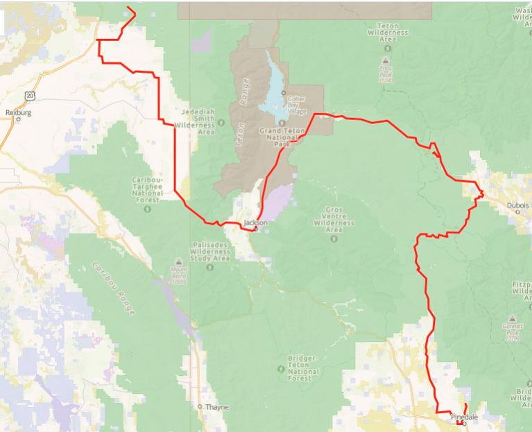
Out of Pinedale, the route follows the highway for quite a ways until it turns to Union Pass Road. The terrain changes from desert hills to wooded forest, and crosses the divide at the top of Union Pass.

10356-albums1536-picture45578.jpg


10356-albums1536-picture45579.jpg


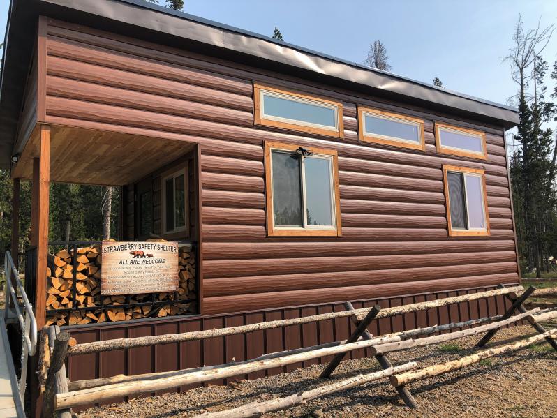
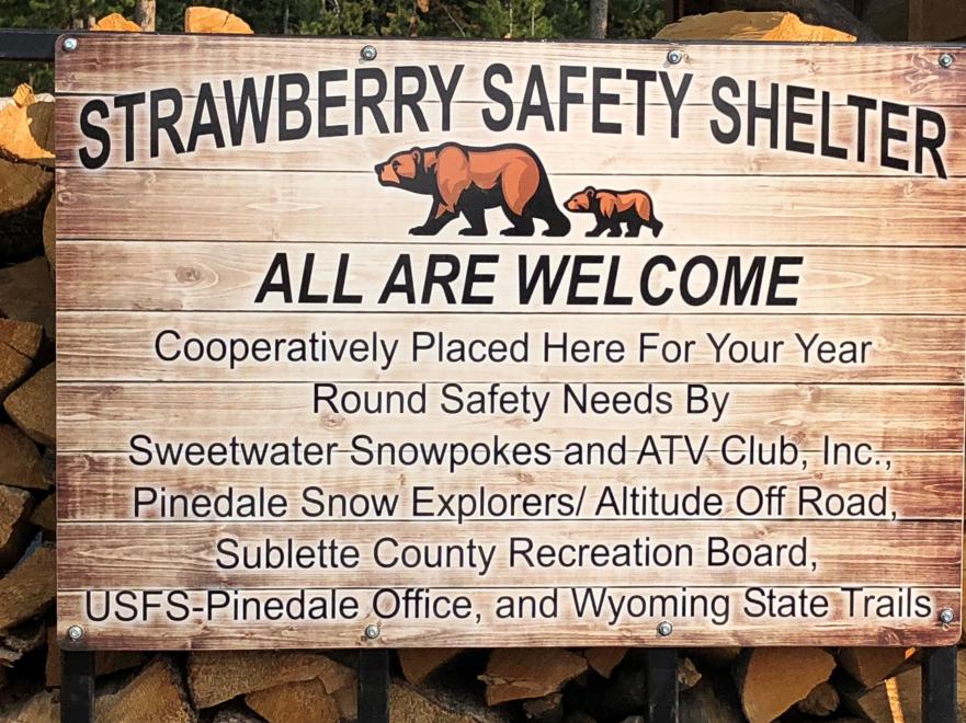
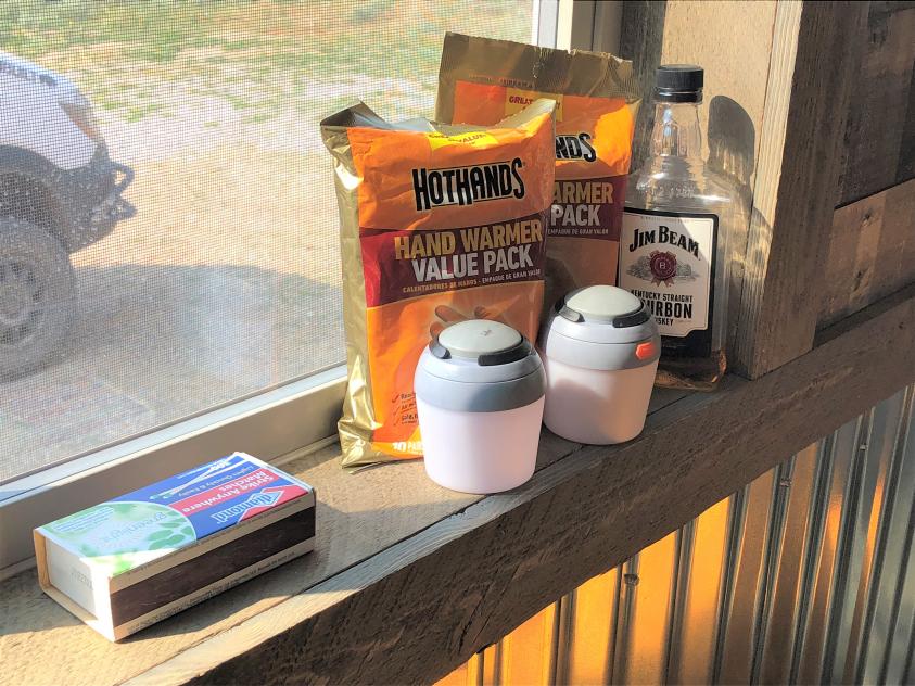
Along the way is a cabin, built specifically as a shelter for snowmobilers in the area.

10356-albums1536-picture45580.jpg


10356-albums1536-picture45581.jpg


I got a kick out the supplies that had been left inside!

10356-albums1536-picture45582.jpg


Once I neared Grand Teton National Park, all the campgrounds were full, and traffic increased substantially. At the turn into Teton at the North Park Road, traffic was so backed up I decided to go into Jackson and get a burger and a beer.

Big mistake! Traffic into Jackson from the North was at a standstill over a mile from town. There were so many tourists that you couldn’t even walk on the sidewalks! Instead of going back up to Teton, I grumped and grumbled off-route over Teton Pass into Idaho, to Ashton, disappointed that I got off track when I should have just continued on across Grand Teton Park. I'm sure it would've been more scenic and less frustrating in the end.

I got the last spot at a nice tiny campground at Lower Mesa Falls.
 

velo47

Member
Day 21 – Lower Mesa Falls, ID to Missoula, MT – 395 miles

10356-albums1536-picture45608.png


Last one, I promise.

10356-albums1536-picture45502.jpg


Intel from another forum member was that the route from Mesa Falls to Island Park terminates in an OHV area where full-size vehicles are prohibited. Not wanting to backtrack and find a way out, I stuck to the highway to north of Island Park, where I regained the route by Henry’s Lake.

10356-albums1536-picture45593.jpg


Over Red Rock Pass and into Montana, then into Red Rock Lakes National Wildlife Refuge. Living up to its billing, I saw deer, pronghorn, young sandhill cranes, and lots of waterfowl. The refuge even includes a trumpeter swan nesting area, which unfortunately was devoid of swans at the time!

10356-albums1536-picture45594.jpg


10356-albums1536-picture45595.jpg


The route then heads off into ranchland, past Lima (like the bean) Reservoir and into the town of Lima. Here I got cell service and received a text sent from Missoula the prior night. The inlaws were in town after a fishing trip to Fort Peck Reservoir with a mess of walleye, and having a fish-fry. I regretfully texted back that I wouldn’t make it, as I was still a good long way from Missoula.

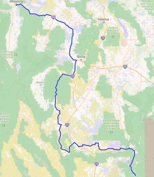
The route heads west of I-15 at Lima through Deadwood Gulch, Caboose Canyon, Four Eyes Canyon, and Pileup Canyon before spitting out into the wide open grasslands. The roads are good, and wide, and in no time I reached Bannack State Park. Then through Polaris and back up into the mountains on the Pioneer Mountains Scenic Byway which twists and turns its way north to Wise River. I had wanted to stop at the Polar Bar in Polaris, but it’s been closed for years.

10356-albums1536-picture45596.jpg


10356-albums1536-picture45597.jpg


10356-albums1536-picture45598.jpg


It was exceptionally smoky at Wise River, and there was a big fire camp there. It seemed the whole northwest must be burning.

At Wise River, the route turns up towards Fleecer Ridge. Again, advice from a forum member told me not to attempt this section in the van. Although the road looks benign in video, heading up a grassy hillside, it is in fact a 28-32% grade! I found a video of a guy trying to ride up it on a moto, over and over, and that was enough to convince to skip it.

I got to I-15 south of Butte on the CDR easy bypass along the Big Hole River and it was still early afternoon. I made a call to Missoula. Maybe I could make the fish fry after all! Aired up the tires, once the compressor decided to start compressing again, and hotshoed it into Missoula.

What a long day, but it was worth it for great food, beer, and company! Tomorrow will be a rest day!

Day 22 – Missoula, MT

Today was spent relaxing in Missoula, doing laundry, and having beers at Cranky Sam’s with Biga pizza.
 

velo47

Member
Day 23 – Missoula, MT to Granite Butte, MT – 235 miles

10356-albums1536-picture45405.png


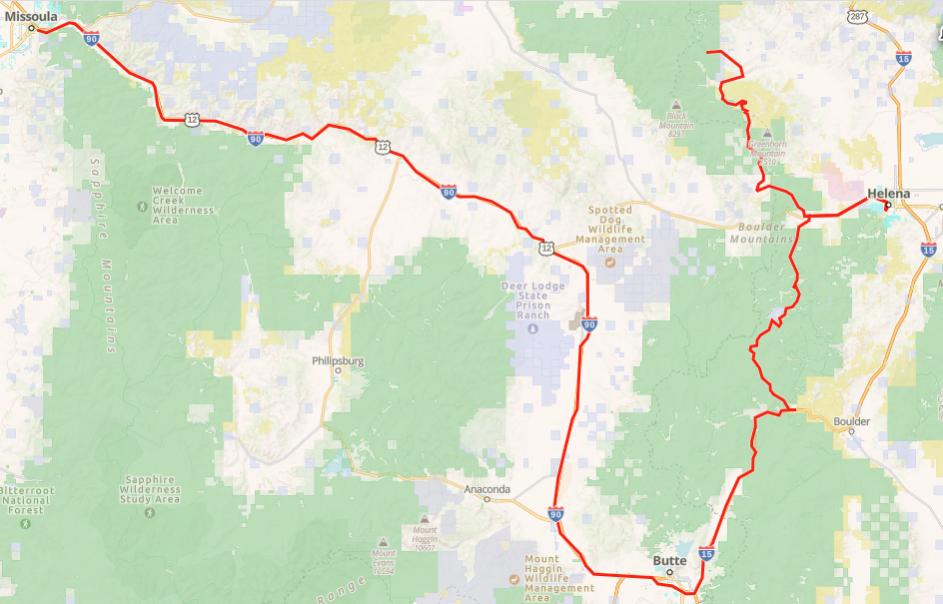
As nice as it was to relax with the kids in Missoula, I knew that I still had a ways to go. Besides, I’d be back in Missoula soon to meet up with the rest of the family for their vacation. I took I-15 to Butte and got back on the route.

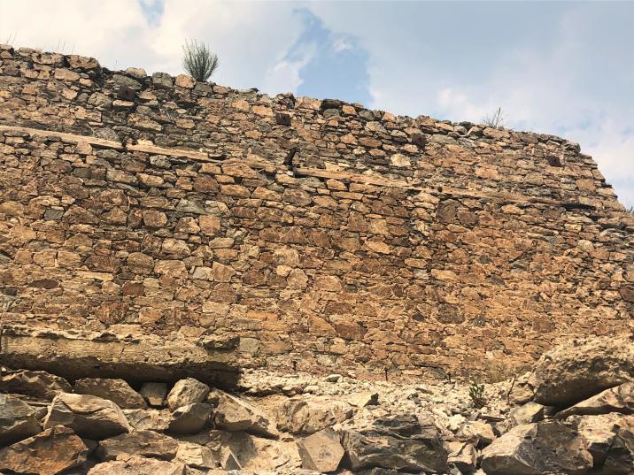
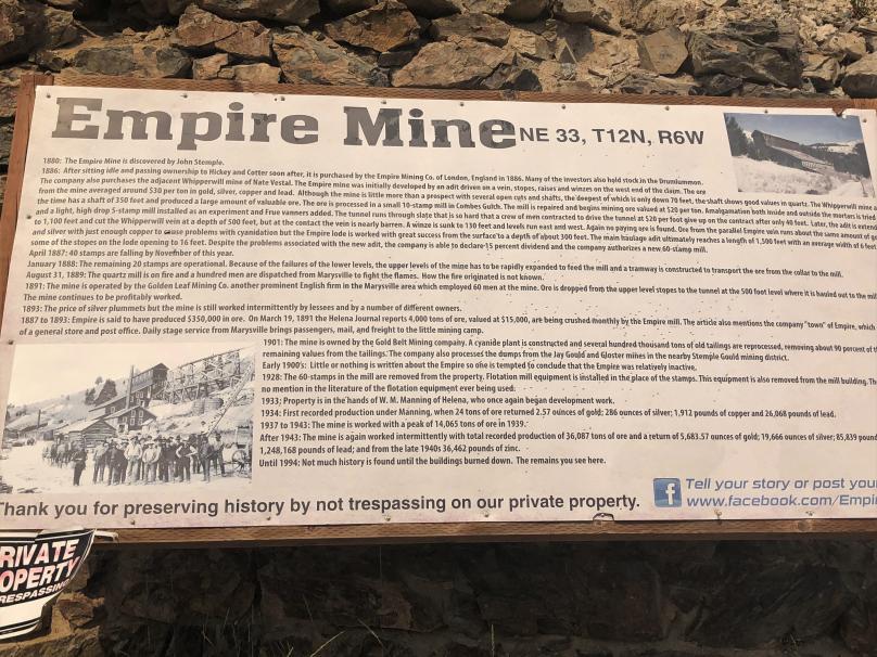
I headed up through the Helena National Forest and the Boulder Mountains. I took a detour to Helena for a beer at Blackfoot River Brewing, and then headed North, by the old Empire Mill site.

10356-albums1536-picture45599.jpg


10356-albums1536-picture45600.jpg


10356-albums1536-picture45601.jpg


10356-albums1536-picture45609.jpg


Then up Marsh Creek Road and back into the National Forest. I found a nice dispersed camp site along the creek. Got a little drizzle of rain but not much. Someone had left a bunch of firewood, but because of burn ban, there would be no campfire tonight.

10356-albums1536-picture45610.jpg


Someone must’ve been really bored sitting in camp!

10356-albums1536-picture45611.jpg


This was a high mileage day but not really that much offroad, because of all the highway miles from Missoula to get back on course.
 

velo47

Member
Day 24 – Granite Butte, MT to Columbia Falls, MT – 235 miles

10356-albums1536-picture45406.png


This morning I woke up and started making coffee, the usual morning routine. The weather was really nice, so I had the sliding door open on the van.

I thought I hears something in the brush but wasn’t sure.

Spidey senses were up, and sure enough, there was something moving through the brush down by the creek. I kept looking and saw a flash of brown, light brown…

Then, soon enough, here comes mama with 2 young’uns up from the creek right into my camp. They circled around the van and finally wandered off down the stream to harass some other campers.


10356-albums1536-picture45602.jpg


10356-albums1536-picture45603.jpg


Stupid cows.

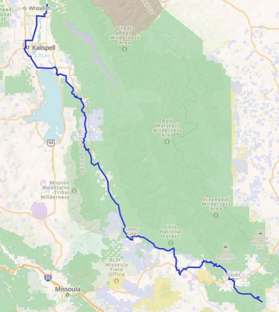
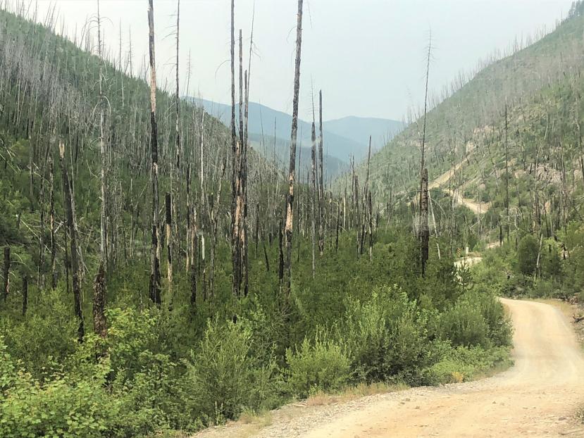
I started out northward, glad to be away from my tormenters. Up to Lincoln, over Huckleberry Pass, and on towards Ovando. A large portion of this area has been hit by wildfires, and is just starting to recover.

10356-albums1536-picture45604.jpg


On the way, I decided to stop at the Harry Morgan access sight and do a little fishing on the Blackfoot River. This site is named not for Colonel Potter, but for an early pioneer and one of the first game wardens in the Blackfoot Valley.

I got to Hwy 200 and made not one but two wrong turns before I got to the fishing access. It was hot and fishing was slow (or maybe it’s just me?) and storm clouds were looming, so after an hour or so, I packed it up and went into Ovando.

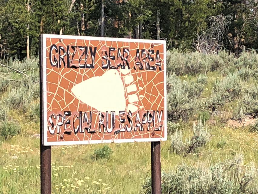
When I was in Missoula a couple days ago, my stepdaughter told me about a fatal grizzly attack that had just happened near Ovando. That and all the grizzly warning signs along the route were definitely a factor in my early morning jumpiness!

It was still early and I thought I’d continue on and find camp around Seeley or Swan Lake. This area, although very touristy, is beautiful, with Highway 83 skirting the east side of both lakes before it finally dumps out right by the giant Flathead Lake. The route goes around the west side of Seeley Lake, and was so heavily wooded that you really don’t get the great lake views you would on the highway. Still, it was a nice drive.

Back onto Hwy 83 to go to Swan Lake, where I really wanted to camp. The route again takes off to the west side of the lake, and up into the mountains, with only glimpses of the lake. The terrain was steep and wooded. Beautiful drive, but very few campsites along the way. The route finally Ts into Highway 209 right by Bigfork on Flathead Lake.

By this evening hour, of course all the campgrounds were full to the gills, and with little public land in the area, I headed to Kalispell, where you can camp at the fairgrounds. Not ideal, but better than nothing. Well, camping was closed because of a livestock show.

On to Columbia Falls, where all the campgrounds and even RV parks were full.

Finally, around dark I found a spot in the National Forest not far off Highway 486. I went farther up into the Forest looking for a more secluded site, but a couple very sketchy looking, permanent looking, drug addict looking camps had me back near the highway. The site was actually very nice and quiet and worked out just fine.
 

velo47

Member
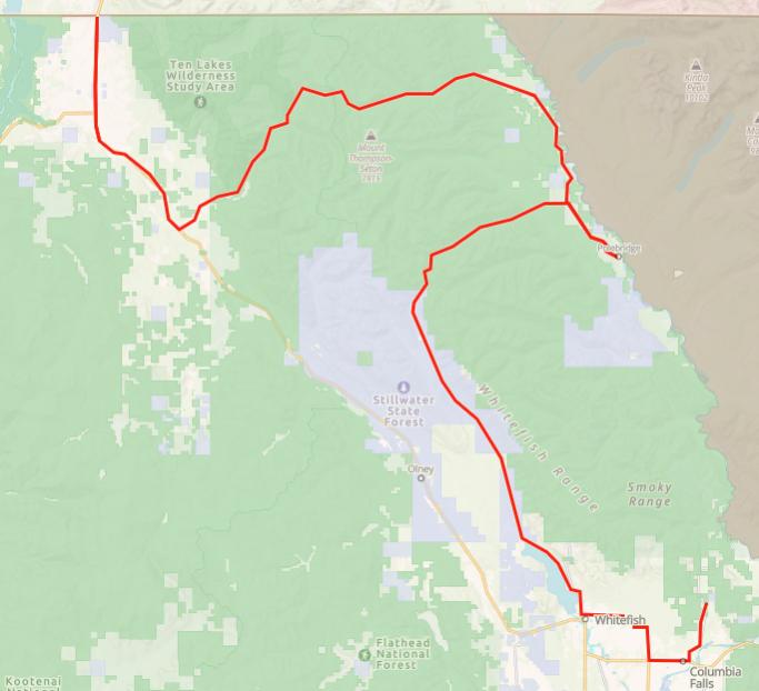
Day 25 – Columbia Falls, MT to Eureka, MT – 135 miles

10356-albums1536-picture45407.png


Although my vacation will continue for another couple weeks, today is the last day of my CDR adventure.

The Canada border is only about 135 miles away. I head to Whitefish and then up along the east edge of Whitefish Lake, by lots of expensive beautiful houses. Very affordable too. ;o)

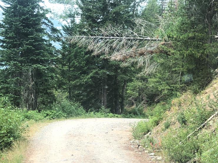
Then the road narrows and turns to dirt. There is active logging in the area, and I wish I had a CB radio, as that is what the loggers use up here. With yet another radio to supplement the HAM, GMRS, SpotX, tablet, and phone, the cockpit will look like, well, a cockpit! Outside, the van will start to look like a pin cushion with so many antennae!


Maybe 40 miles from my camp lies tiny Upper Whitefish Lake, a beautiful site with a nice campground. I really wish I knew about this before I spent a bunch of time looking for a spot farther south down by Flathead.

10356-albums1536-picture45605.jpg


I’d heard about Polebridge Mercantile several times, so when I got to North Fork Road, I detoured south to see it. I don’t know what I was expecting, but it was kinda underwhelming. Very touristy. They did have a fruit stand next door with a big sign for fresh local cherries. The Flathead area grows awesome cherries, so I thought I’d get some as a gift for my friends in Yakima. No such luck, cherry delivery was delayed until that afternoon. They did have pineapples, though, which, when quizzed, the vendor jokingly said they grew on the back 40.

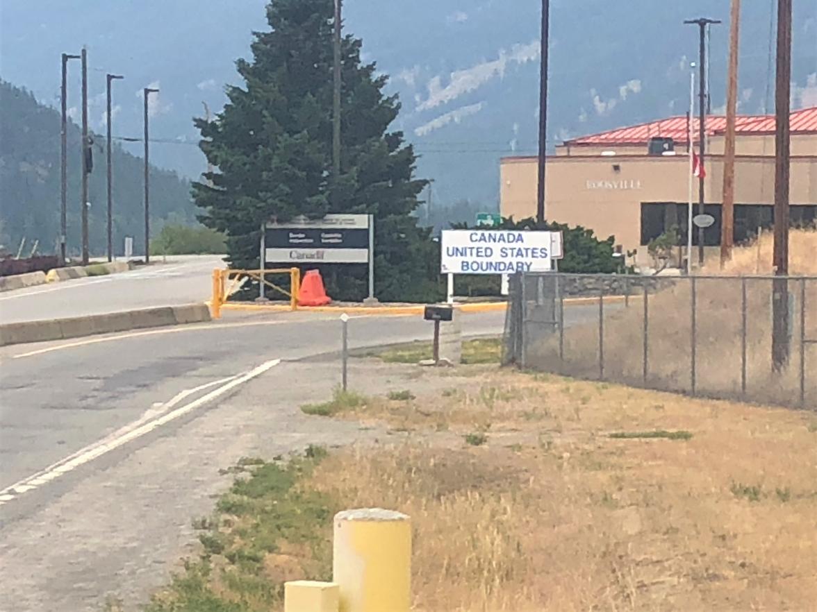
The route continues north and west through the national forest until it finally T’s into US 93 just south of Eureka. I continued up US 93 to the Canada border at Roosville. The border was still closed except for some commercial traffic, it seemed.

10356-albums1536-picture45606.jpg


Wow, that’s the end of the road!

I headed back down into Eureka and had a good late lunch at Café Jax. I toured the historic pioneer town (very cool) and decided to stay right in Eureka at the city park (suggested donation $10) right on the Tobacco River. I threw in a line, but didn’t catch anything, not that I tried very hard.
Walked up Main Street to Fire and Slice Pizza for beer and pies and AC, but the AC was lacking. The pizza and beer were good.

Eureka seems to be inhabited by more turkeys and whitetails than locals. I’ve never seen so many hens and poults in one place!


10356-albums1536-picture45607.jpg


It’s a very friendly town where you can still get free air at the gas station when your compressor finally craps out! At least it was on the last day!

VanCompass in Post Falls, ID just got a shipment of ARB Duals in! Mark and Rob are the best, and their employees are very helpful. If you ever need something for a van, they’re the place!

Final thoughts and observations coming soon.

Thanks for following along!
 

velo47

Member
Final Thoughts, in no particular order

The CDR and COBDR portion of the vacation was 25 days and about 4,250 miles from home in Albuquerque. That includes the trip down from Albuquerque down to the border, the detour to Glenwood Springs for tires, and the detour to Missoula for Walleye.

From Eureka, I drove to Yakima, WA to visit friends. Then to Missoula and Philipsburg, MT for a couple weeks relaxing with relatives. Then home to Albuquerque with my wife, stepson, and grandson. Total mileage for the 43 days was about 6,600 miles.

I thought I could get one last trip out of the front tires. This was a mistake, and I should have gotten new ones before I left.

I’m putting the new ARB twin compressor under the hood. The current single ARB is under the van and gets caked with mud. All the time. That can’t be good. Hopefully I can rebuild the single and put it in my Colorado.
Does anyone have any tips? The motor runs, it just doesn’t pump much if any air.

I’m glad I have a winch. I never used it. A pull-pal would be nice for the wide open areas in NM and WY.

I love having the SpotX. So much of this trip was out of cell service. It is layer of comfort for both me and my wife, and she and the grandson can follow my progress on the computer.

What fun it is to travel and meet new people and to travel with “old” friends! But going alone adds to the adventure, too. When I’m by myself I need to slow down and do more detours to see the sights. Or maybe just stop early and relax if I find a really nice campsite.

The van performed great. It’s big, but no longer or wider than a new full-size truck, really. It is tall, and you sit up high, so it feels even bigger. It’s got a lot of new pinstripes.

There was no instance where I was even close to getting stuck. Partly because I bypassed Fleecer Ridge in MT and some mud in NM. We didn’t do the “hard” passes in CO, but they were hard enough. There were a couple spots where I thought I was going to have a problem (like Hagerman where the Tundra was temporarily stuck in front of us), but the van handled it no problem. I only scraped the skids a few times.

Do I want to do more of the high mountain passes in CO? Not really, at least not in a big vehicle. I spent most of those days looking at the road, trying to anticipate the ever-present traffic, and a little stressed about what laid ahead. I didn’t really get to look around and see the sights except when we stopped.

Would I want to do the high mountain passes as a passenger? No way! I like being in control. Plus, you have the steering wheel to hold onto.

Traffic! Wow, there were a lot of vehicles on the passes in Colorado. It was just after 4th of July weekend, but still…

I’m more cautious by myself. I don’t want to spend a day digging out of mud by myself. Or trying to winch up or back down Fleecer Ridge. Even if I could.

It was kinda a let-down to finally get to the Canada border.

6 weeks is a long time to be away from home.

Am I glad I did it? HECK YA!

What’s next? Beats me, maybe the Mojave Road in the spring. Then the Idaho or Utah BDR. Maybe the Enchanted Rockies Trail. Maybe the Trans-America Trail? The Great Western Trail?

If anyone has any questions, comments, suggestions, fire away!
 

Forum statistics

Threads
188,360
Messages
2,903,748
Members
230,227
Latest member
banshee01
Top