DE VI - The Pony Express Trip Report

4x4x4doors

Explorer
Great report, can't wait to see the rest of it.
.
Keith did you get rid of the Little Guy in favor of an RTT?
Picked up the RTT the weekend before this trip so this was its inaugural run. Looks like the Little Guy is being replaced. Need to put the interior cabinetry back in, then take some pictures and post an ad. Have thoughts of doing a sep. thread on the whys and a comparison later on.
 

Hun

Expedition historian
Day 5 - Roads Not Maintained In Winter

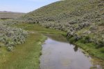
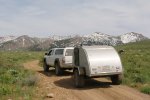
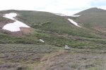
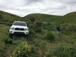
Cool morning bid us out of our teardrop to cook breakfast, pack up and find our way back to the bridge on the opposite side of Swales Mountain. Our route was sometimes elusive with even the 2-track path disappearing into the vegetation.
IMG_0008.jpg

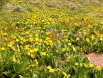
Prettiest drive ever through fields of Indian paint brush, asters, and many others too numerous to name (especially since none of us knew the floral names) - purples, pinks, yellows, and whites. We finally came upon the bridge - our starting place yesterday- some 55 miles looping around Swales mountain.
IMG_0010.jpg

IMG_0009.jpg

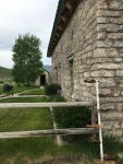
We made our way back to NV 225 and headed northbound for Dinner Station. The turn of the century house had suffered fire damage and was restored by its current day owners. Around the turn of last century, 1900, upwards of 75 people per day frequented the place for a meal and a rest for their horses. Today the beautiful stone building is occupied and is a working ranch.
IMG_0011.jpg

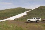
Next destination was Cornocopia mine but our trail ended in a locked gate so we headed to Humboldt National Forest to find a camp spot for the night. Climbing through the mountains on a path that the Benchmark map book cautioned "road not maintained in winter" we encountered snow and then happened upon an impassable snowbank covering the road.

IMG_0012.jpg

IMG_0013.jpg

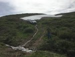
Luckily an alternate path with a muddy slide down a steep hill, across a stream and back up a steep climb and we were on the other side of the snow bank.
IMG_0015.jpg

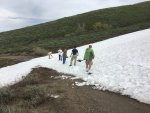
Rounding the next bend we came upon yet another snow drift, this one flatter and shallower than the previous. We pulled out the shovels and dug a trench for the right side tire path to keep the trucks from sliding down the canyon while crossing the snow drift.
IMG_0017.jpg

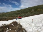
Gary was the first one to cross and while we lined up to follow, he radioed back that at the next bend, he had come upon the biggest snow drift yet which would not be passable, not in the winter, not even in June. The "roads not maintained in winter" warning which we didn't think applied to us June travelers came into play.
IMG_0019.jpg

So, after getting the trailer turned around, we made our way back down the steep descent, over the stream, and up the muddy slope with a little help from Frenchie and a trusty tow rope (and this is really important -- if one can remember -- low range can be extremely helpful in such places!).

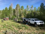
Retracing our path to a lower elevation, we found camp at an embankment near a rushing stream with snow at a safe distance away. Sipping on cranberry drinks (yes, again!), we enjoyed a hot meal of black beans, chicken and rice. The evening was short as night was upon us. Camp was at 7200', and we had traversed 45 miles.
IMG_0039.jpg
 
Last edited:

Foy

Explorer
Independence Mountains?

I'm enjoying following your trip. Interested to know if your snowbank-blocked road was in the Independence Mountains on the west side of NV 225 north of Dinner Station or on the east side of NV 225 over towards the Meadow Creek Road access to Rowland or the Charleston route to Jarbidge.

Looking forward to the remainder of the trip!

Foy
 

Hun

Expedition historian
I'm enjoying following your trip. Interested to know if your snowbank-blocked road was in the Independence Mountains on the west side of NV 225 north of Dinner Station or on the east side of NV 225 over towards the Meadow Creek Road access to Rowland or the Charleston route to Jarbidge.

Looking forward to the remainder of the trip!

Foy

We were north of Dinner Station, east of NV 225 and east of Jack's Creek Ranch.

Thanks!
 

4x4x4doors

Explorer
Foy, we had been trying to get from 226 to 225 moving west towards east on NF-473. The Google Satellite view actually shows snow.
Jack Creek North Fork Summit is where we found the route around to slippery. "A" is approximately where we dug. "B" is where Gary advised us not to bother any more. snow_blocked.jpg

ETA: You can get to this same view by moving north from Dinner Station NV on google maps.
 

gwittman

Adventurer
Keith, that is great shot of that trail. To bad we didn't have access to Google Satellite before we headed up there. Then again, we would have missed out on a good adventure if we had not tried.
.
Here is my flower shot of the day as we were leaving Swales mountain.
P1010026.jpg
.
As we climbed the trail we knew we were getting close to snow but were hoping the trail would not be blocked by snow. Here, Frenchie had no flowers to frolic in so he kept going.
P1010031.jpg
.
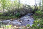
Our second camp was a great campsite. As Laura said, it was a safe distance from the snow but it was lurking just across the trail. The sound of rushing water from the stream was great to listen to at night and we slept great after a hard day of shoveling snow.
P1010033.jpg
 

Scott B.

SE Expedition Society
A view from the bridge

d5-1.jpg

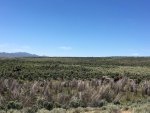
Wide open spaces....

d5-2.jpg

Remember, this is in June in the desert!

d5-3.jpg

The bypass

d5-4.jpg
 
Last edited:

Hun

Expedition historian
Day 6 - Down in the valley...

Great shots gentlemen! Love the flower pictures Gary! And Keith, thanks for marking our exact location. So handy. Okay, into the valley we go...

Fresh, hot-off-the-griddle blueberry pancakes for all started our day. The air was refreshingly cool with the view of nearby snowbanks (see Gary's previous post). After calibrating with our maps...

3maps.jpg

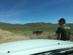
We made our way out of Humboldt National forest, through Jack Creek, south on NV 226 and back off-road onto 736 heading south for Austin NV (not TX) eventually. We passed through open ranges and coaxed the numerous cattle to free up road space so we could pass. Luckily we had the cow whisperer with us.

3cowwhisper.jpg

3cows.jpg

We happened upon one cowboy working a herd and although he was hard at work, he made for a picturesque site. Look closely and you'll spot him just below the mountain range in the left side of this shot.

cowboy2.jpeg

The ranches, spread few and far between, looked spectacular and every now and then our journey on county roads took us right into the innermost workings of some of them.

3ranch.jpg

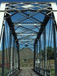
At mid day we stopped in Carlin for fuel, provisions, and a few tacos at the local Mexican restaurant. All refreshed, we headed south on NV 278 out of town back onto dirt at Palisade. Coming across a bridge built in 1902, we got out to inspect the condition of the lumber which looked to be original from last century. We could actually feel the boards give way under our feet as we walked across it.

3bridge.jpg

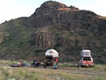
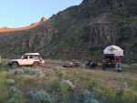
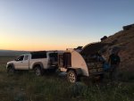
Deciding the bridge would hold every last one of us, we crossed and continued southbound into Frenchie Flat for a long straight dusty ride through the valley. Frenchie Flat felt like coming home so we found camp in Cottonwood canyon. Talk about inspirational -- nestled next to a mountain, with a running brook nearby, overlooking a valley, and mountains beyond, Frenchie treated us all to beef and bean burritos, Keith supplied the juice/spirits for the evening and we got to visit under the star-filled sky.

3campsite.jpg

3camp1.jpg

3teardrop.jpg

3sunset.jpeg

As if that were not enough, we topped off the day with warm <private> showers (in Frenchie's shower tent) washing away the day's dust and sweat leaving each of us refreshingly cool. I'm not even going to mention the pesky mosquitos, nope, not me, not a word. There was talk of a UFO siting but nothing definitive. Camp was at 5100' 200 miles traversed.
 

Foy

Explorer
Thanks!

We were north of Dinner Station, east of NV 225 and east of Jack's Creek Ranch.

Thanks!

Much appreciate the details and the satellite imagery! My 2007 edition benchmark shows the road from NV 226 in the Independence Valley over Jack Creek summit headed easterly towards NV 225 as Elko County Road 732. I recall there is considerable tension between Elko County and the Forest Service as to who owns some of the roads in the Humboldt-Toiyabe NF so maybe my Benchmark pays homage to the County primarily.

The only time I've had a shot at passing through that area was in mid-July 2011. The very high snowpack of the 2010-2011 year had resulted in runoff destruction of large segments of the Meadow Creek Road northeast of Wild Horse Reservoir and the two passes between Charleston and Jarbidge were still not passable as of the first few days of July. We instead just ran up US 93 from Wells headed for Montana, looking wistfully at the Jarbidge Mountains to our west all the way to Jackpot.

Amazing country. Thanks for sharing!

Foy
 

gwittman

Adventurer
I don't have much to ad on this part of our trip. Laura pretty much has it covered. I can say it was the warmest segment. I also found a freshly planted tick on me during my shower. I promptly removed it with the help of some equipment loaned to me by Scott.
.
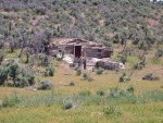
I did get a shot of this ruins built into the side of a hill. I am guessing it was the remains of a very old ranch house.
P1010034.jpg
 

Scott B.

SE Expedition Society
Early morning at camp

d6-1.jpg

More wide open spaces

d6-2.jpg

The turnoff to Jack Creek

d6-3.jpg

Fences...

d6-4.jpg

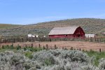
Barns...

d6-5.jpg

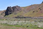
Can't forget trains...

d6-6.jpg

And the bridge...

d6-7.jpg

d6-8.jpg
 

Hun

Expedition historian
Day 7 - Gold Rush

We awoke to an already-warm sun, had scrambled eggs for breakfast, packed up, and headed back into Crescent Valley in search of Gold Acres mine. What we found instead was a large operational mine called Cortez. The gate guard gave us instructions for routing around the Cortez mine to get to Gold Acres mine but even his instructions didn't seem to lead to the ghost mine.

4valley.jpg

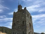
So we headed west through a couple of horse ranches in Redrock Canyon out to NV 306. Southbound on NV 306 took us to Austin NV and Nevada Route 50, dubbed the loneliest road in America. We got fuel and found a shade tree to stop for a lunch break. The dirt road past the Chevron station took us up to Stokes Castle, a three story stone structure fashioned after a castle in Rome.

4mine.jpg

4castle.jpg

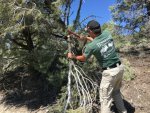
After the castle exploration, we headed west out of town some 5 miles to view a Pony Express Station and although the site was well marked we couldn't even find a rubble pile. Heading back towards Austin, we turned south onto 002 - not much more than a bike trail - heading into Humboldt Toiyabe National Forest. Scott got out his bow saw to widen the track for passage in a couple of spots.

4treetrim.jpg

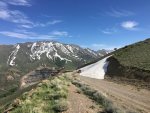
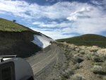
We turned east onto 125 and climbed to 8560' at which point we came upon uh-oh -- a snow bank! This one, unlike our previous encounters, had a nice berm to make it passable.

4snow.jpg

4snow2.jpg

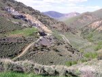
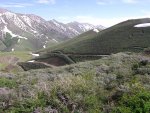
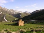
We went across the snow bank and found a plateau which we called camp. The open area overlooked a tiered mine and mountain peaks. The camp pizza was delicious and the skillet-fresh brownies afterwards were a sweet reward as we sat around Gary's welcoming campfire and viewed the night sky.

4camp.jpg

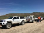
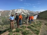
Here we all are... well, except the photographer, of course.

4crew.jpg

We anticipated a cold night as we looked upon snow covered mountains. Our day was a 140 mile run.
 

gwittman

Adventurer
Here are some examples of the meandering roads and the views on our way up to the plateau campsite.
P1010039.jpg...P1010038.jpg
.
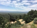
These are some inspirational views from the edge of our plateau campsite. Unfortunately, the photos don't do them justice but clicking on them to blow them up helps.
P1010040.JPG...P1010041.jpg
 

Forum statistics

Threads
189,830
Messages
2,921,405
Members
232,931
Latest member
Northandfree
Top