coastsider
Adventurer
The Route
Big Pine, Paboose Flats, Eureka Dunes, Steel Pass, Warm Springs, Saline Valley, Lippencott Grade, Racetrack, Hidden Valley, White Top Mountain, Hunter Mountain, Lees Flat, Panamint Dunes, Furnace Creek, Mammoth Lakes.
The Horizon Trailer performed flawlessly, only the cheap after market water pump broke. It can be a little heavy on loose trails but not a huge problem.
Day 1
Sat 4/2
1st camp in Inyo Mountains. N 37.09224*W 118.14324.
After a failed attempt at crossing over the Inyo range due to deep snow and a water logged trail we decided to camp on the North side of Mazurka peak and try again in the morning to reach Papoose flats. The Sierras look stunning covered in snow capped with pure white clouds. Note to self: a trailer weighing nearly 2000lbs is not easy to haul up a steep loose rock trail covered in snow. Time to deploy the bridging ladders for some traction and air down the tires.

Camp 1: Inyo Mountains by Kevin.Stokes, on Flickr

Camp 1: Inyo Mountains by Kevin.Stokes, on Flickr
Day 2
Sun 4/3
2nd camp Eureka Dunes, Death Valley. N 37.11226*W 117.66507.
After a chilly but beautifully clear night under a pristine blanket of stars we break camp and decide to try another trail to reach the flats, this time a huge fallen tree across the trail stopped us from reaching our goal, time to head to the dunes. An easy trail out across the Harkless flats allows us to pick up Death Valley road and head for the Northern most entrance to the National Park. We drop down into the spectacular Eureka valley that has the Eureka Dunes nestled in the Southernmost corner. They are breathtakingly huge, over 700ft of golden sand. We make camp at the foot of the eastern side in the shadow of the Last Chance Range where we will later pick up the trail to take us through Steel Pass. Tony and I hike half way up the dunes but have to turn back after 40 mph winds start to blast us with fine sand. The stars here are again incredibly bright. A kangaroo rat pays us a visit, checking out our campsite.

Eureka Dunes, Death Valley by Kevin.Stokes, on Flickr

Eureka Dunes, Death Valley by Kevin.Stokes, on Flickr

Eureka Dunes, Death Valley by Kevin.Stokes, on Flickr

Eureka Dunes, Death Valley by Kevin.Stokes, on Flickr
Day 3
Mon 4/4
3rd camp Eureka Dunes, Death Valley. N 37.11226*W 117.66507.
I watch the sunrise over the dunes and then turn my attention to making coffee and breakfast burritos. We all decide that we should push for the highest peak of the dunes today at just over 700ft, with the temperature climbing to 80 degrees in the shade we pack plenty of water and food and head out. It takes a couple of hours to reach our goal, the final push is really steep and with the fine dry sand it’s two steps forward and one sliding backward, it’s exhausting work. The view from the summit is phenomenal and we are treated to several super low level flying displays by F16s over the valley floor as they practice low level bombing runs. Wen makes fresh guacamole and we sit out the afternoon heat sipping beers in the shade of our trailers awning.

Eureka Dunes, Death Valley by Kevin.Stokes, on Flickr

Eureka Dunes, Death Valley by Kevin.Stokes, on Flickr
Day 4
Tues 4/5
4th camp Hidden Valley, Death Valley near White Top Mountain. N 36.74579*W 117.45273
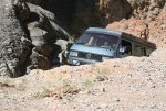
We break camp and head toward the entrance to Steel Pass. The toughest off road section of the canyon is right at the beginning of the trail. Two steep rock ledges greet us at the first turn. This is the first real test for me towing the trailer and it passes with flying colors. It’s a beautiful canyon and we have lunch just before reaching the first natural hot spring. The water smells like *** because of the high sulfur content but is awesome after the hot dusty ride in. We stop and take a look at the other hot springs on the way through The Saline Valley most of which are populated by some pretty strange looking folk. Other highlights on the way to the Lippencott Grade include the Saline Lake. The Lippencott Grade is a pretty gnarly steep rocky climb over the Southern most tip of the Last Chance Range that leads to the Race Track Playa, where the rocks move mysteriously on their own. We make camp a few miles up the canyon near White Top Mountain. The 4x4 trail to the top of White Top is phenomenal and we sit and have lunch while trying to take in the 360 degree view of the whole of Panamint Valley laid out below us.

4/5/11 10:01 by Kevin.Stokes, on Flickr

4/5/11 10:02 by Kevin.Stokes, on Flickr

4/5/11 12:50 by Kevin.Stokes, on Flickr

4/5/11 15:33 by Kevin.Stokes, on Flickr

4/5/11 15:34 by Kevin.Stokes, on Flickr

4/5/11 16:59 by Kevin.Stokes, on Flickr

4/5/11 16:21 by Kevin.Stokes, on Flickr
Day 5
Wed 4/6
5th camp Hidden Valley, Death Valley near White Top Mountain. N 36.74579*W 117.45273
Today we take the 4x4 trail to the top of White Top Mountain, which crawls along the spine of the mountain to it’s peak in the Cottonwood Range. At the top the view is sensational across the valley and we eat lunch watching more F16s practice dog fights at 40,000ft. In the afternoon we drive to the Racetrack to see the moving rocks in the afternoon light.

4/6/11 12:09 by Kevin.Stokes, on Flickr

4/6/11 12:47 by Kevin.Stokes, on Flickr

4/6/11 16:38 by Kevin.Stokes, on Flickr

4/6/11 16:16 by Kevin.Stokes, on Flickr
Day 6
Thurs 4/7
Furnace Creek, Death Valley. N 37.270378*W 116.511472
Heading for the Panamint Dunes we climb over Hunter Mountain Pass. It’s not long been open scince the winter and is really muddy in places which makes for some fun off road antics. Both trucks are now covered in red mud as well as dust. We stop to chat with a Park Ranger on Lees Flat amongst the Joshua tree forest, he warns us of high winds hitting 70mph in the valley. As we drop into the Panamint Valley we encounter those winds in the shape of an enormous dust storm. It’s near impossible to camp in this storm so we head for Furnace Creek, into the lap of luxury at the old Furnace Creek Inn.

4/8/11 06:46 by Kevin.Stokes, on Flickr

4/8/11 11:56 by Kevin.Stokes, on Flickr

4/8/11 12:09 by Kevin.Stokes, on Flickr
Day 7
Fri 4/8
Home to Montara via an overnight Mammoth Lakes (8 inches of fresh snow overnight), visit Mono Lake and head through The Carson Pass.

4/8/11 18:14 by Kevin.Stokes, on Flickr

4/9/11 09:36 by Kevin.Stokes, on Flickr

4/9/11 09:39 by Kevin.Stokes, on Flickr
Big Pine, Paboose Flats, Eureka Dunes, Steel Pass, Warm Springs, Saline Valley, Lippencott Grade, Racetrack, Hidden Valley, White Top Mountain, Hunter Mountain, Lees Flat, Panamint Dunes, Furnace Creek, Mammoth Lakes.
The Horizon Trailer performed flawlessly, only the cheap after market water pump broke. It can be a little heavy on loose trails but not a huge problem.
Day 1
Sat 4/2
1st camp in Inyo Mountains. N 37.09224*W 118.14324.
After a failed attempt at crossing over the Inyo range due to deep snow and a water logged trail we decided to camp on the North side of Mazurka peak and try again in the morning to reach Papoose flats. The Sierras look stunning covered in snow capped with pure white clouds. Note to self: a trailer weighing nearly 2000lbs is not easy to haul up a steep loose rock trail covered in snow. Time to deploy the bridging ladders for some traction and air down the tires.

Camp 1: Inyo Mountains by Kevin.Stokes, on Flickr

Camp 1: Inyo Mountains by Kevin.Stokes, on Flickr
Day 2
Sun 4/3
2nd camp Eureka Dunes, Death Valley. N 37.11226*W 117.66507.
After a chilly but beautifully clear night under a pristine blanket of stars we break camp and decide to try another trail to reach the flats, this time a huge fallen tree across the trail stopped us from reaching our goal, time to head to the dunes. An easy trail out across the Harkless flats allows us to pick up Death Valley road and head for the Northern most entrance to the National Park. We drop down into the spectacular Eureka valley that has the Eureka Dunes nestled in the Southernmost corner. They are breathtakingly huge, over 700ft of golden sand. We make camp at the foot of the eastern side in the shadow of the Last Chance Range where we will later pick up the trail to take us through Steel Pass. Tony and I hike half way up the dunes but have to turn back after 40 mph winds start to blast us with fine sand. The stars here are again incredibly bright. A kangaroo rat pays us a visit, checking out our campsite.

Eureka Dunes, Death Valley by Kevin.Stokes, on Flickr

Eureka Dunes, Death Valley by Kevin.Stokes, on Flickr

Eureka Dunes, Death Valley by Kevin.Stokes, on Flickr

Eureka Dunes, Death Valley by Kevin.Stokes, on Flickr
Day 3
Mon 4/4
3rd camp Eureka Dunes, Death Valley. N 37.11226*W 117.66507.
I watch the sunrise over the dunes and then turn my attention to making coffee and breakfast burritos. We all decide that we should push for the highest peak of the dunes today at just over 700ft, with the temperature climbing to 80 degrees in the shade we pack plenty of water and food and head out. It takes a couple of hours to reach our goal, the final push is really steep and with the fine dry sand it’s two steps forward and one sliding backward, it’s exhausting work. The view from the summit is phenomenal and we are treated to several super low level flying displays by F16s over the valley floor as they practice low level bombing runs. Wen makes fresh guacamole and we sit out the afternoon heat sipping beers in the shade of our trailers awning.

Eureka Dunes, Death Valley by Kevin.Stokes, on Flickr

Eureka Dunes, Death Valley by Kevin.Stokes, on Flickr
Day 4
Tues 4/5
4th camp Hidden Valley, Death Valley near White Top Mountain. N 36.74579*W 117.45273
We break camp and head toward the entrance to Steel Pass. The toughest off road section of the canyon is right at the beginning of the trail. Two steep rock ledges greet us at the first turn. This is the first real test for me towing the trailer and it passes with flying colors. It’s a beautiful canyon and we have lunch just before reaching the first natural hot spring. The water smells like *** because of the high sulfur content but is awesome after the hot dusty ride in. We stop and take a look at the other hot springs on the way through The Saline Valley most of which are populated by some pretty strange looking folk. Other highlights on the way to the Lippencott Grade include the Saline Lake. The Lippencott Grade is a pretty gnarly steep rocky climb over the Southern most tip of the Last Chance Range that leads to the Race Track Playa, where the rocks move mysteriously on their own. We make camp a few miles up the canyon near White Top Mountain. The 4x4 trail to the top of White Top is phenomenal and we sit and have lunch while trying to take in the 360 degree view of the whole of Panamint Valley laid out below us.

4/5/11 10:01 by Kevin.Stokes, on Flickr

4/5/11 10:02 by Kevin.Stokes, on Flickr

4/5/11 12:50 by Kevin.Stokes, on Flickr

4/5/11 15:33 by Kevin.Stokes, on Flickr

4/5/11 15:34 by Kevin.Stokes, on Flickr

4/5/11 16:59 by Kevin.Stokes, on Flickr

4/5/11 16:21 by Kevin.Stokes, on Flickr
Day 5
Wed 4/6
5th camp Hidden Valley, Death Valley near White Top Mountain. N 36.74579*W 117.45273
Today we take the 4x4 trail to the top of White Top Mountain, which crawls along the spine of the mountain to it’s peak in the Cottonwood Range. At the top the view is sensational across the valley and we eat lunch watching more F16s practice dog fights at 40,000ft. In the afternoon we drive to the Racetrack to see the moving rocks in the afternoon light.

4/6/11 12:09 by Kevin.Stokes, on Flickr

4/6/11 12:47 by Kevin.Stokes, on Flickr

4/6/11 16:38 by Kevin.Stokes, on Flickr

4/6/11 16:16 by Kevin.Stokes, on Flickr
Day 6
Thurs 4/7
Furnace Creek, Death Valley. N 37.270378*W 116.511472
Heading for the Panamint Dunes we climb over Hunter Mountain Pass. It’s not long been open scince the winter and is really muddy in places which makes for some fun off road antics. Both trucks are now covered in red mud as well as dust. We stop to chat with a Park Ranger on Lees Flat amongst the Joshua tree forest, he warns us of high winds hitting 70mph in the valley. As we drop into the Panamint Valley we encounter those winds in the shape of an enormous dust storm. It’s near impossible to camp in this storm so we head for Furnace Creek, into the lap of luxury at the old Furnace Creek Inn.

4/8/11 06:46 by Kevin.Stokes, on Flickr

4/8/11 11:56 by Kevin.Stokes, on Flickr

4/8/11 12:09 by Kevin.Stokes, on Flickr
Day 7
Fri 4/8
Home to Montara via an overnight Mammoth Lakes (8 inches of fresh snow overnight), visit Mono Lake and head through The Carson Pass.

4/8/11 18:14 by Kevin.Stokes, on Flickr

4/9/11 09:36 by Kevin.Stokes, on Flickr

4/9/11 09:39 by Kevin.Stokes, on Flickr


