TrailOps
New member
Burro Schmidt Tunnel and the El Paso Mountains
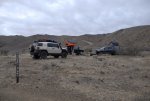
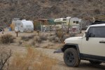
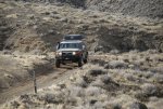
Just before New Year’s a couple of friends of mine and their young son’s headed out to the El Paso Mountains near Ridgecrest for a little camping and exploring. Our caravan consisted of two nicely equipped FJ Cruisers and one well equipped Tundra. We met up in Adelanto around 3:00 p.m. for lunch. After a quick bite to eat we got back on the 395 and headed north. We stopped in Johannesburg just as the sun was setting to top off our gas tanks and pick up a little firewood. From Johannesburg we went a few more miles up 395 and turned off on Red Rock-Ransburg Rd. and headed west. About a mile past the merge with Garlock Road we turned off onto Mesquite Canyon. I believe Mesquite Canyon Road is also marked on the trail as EP 100.
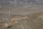
All trails large and small were marked with a trail number throughout the mountains. If the trail was closed or unauthorized there was a red marker denoting it as closed. (I wish the Mojave road was as well marked.) The only problem was none of my maps used those identifiers so they did not help me much. I took note of some but not all so I will use the trail #s when I can.
I aired down off the pavement and we started up the canyon in the darkness. Darkness was relative because the trail was well lit by my 50 inch light bar mounted on my Baja rack. We drove for a couple of miles before we stopped for our first mine which was right off the road. We hiked a few hundred yards up the canyon and found the mine. The mine was pretty unremarkable as you really could not go into it more than a few feet. I did not take any pictures here because it was dark and frankly not much to see but it did get the boy’s fired up for what was yet to come.
From there we continued up the road until we hit the turn off on the left for the Walsh cabin. I used a Dual GPS 150 connected via Bluetooth to my iPad. I was running Gaia maps and had loaded waypoints from Google Earth to help me navigate and identify possible points of interest.
Walsh cabin was in pretty rough shape. It sits on top of a peak completely exposed to the wind and elements and probably only remains there because it is tied down with thick steel cables anchored to the mountain. Of course vandals have done this cabin no favors and have contributed to its poor condition. It is a shame some people cannot just enjoy it for what it is and not feel the need to destroy everything they come in contact with. Again no pictures because it was dark and I just wasn’t thinking about it yet.
We headed back down the way we came. So far everything was done in 2 wheel drive without any difficulties. I decided to put it in 4 wheel low for the trip down so I would not need to use my brakes down the hill. Once at the bottom it was back into 2 wheel drive.
Back on Mesquite Canyon we followed it north/east to Colorado Camp. We decided to camp here for the night so we found a level spot and set up camp. After getting camp squared away and cooking up some dinner we spun the obligatory campfire yarns and then called it a night. (You do need a fire permit which you can obtain for free from the ranger station or get one online after watching a short video and taking a few question test.)

