The Gravelly Range
While hanging around the campfire I had been perusing the Delorme Montana Mapbook to plot our course ahead. There was a tantalizingly long dirt road route going up through the Gravelly Range and on to the ruby river basin so we decided to head that way. Before we left the pavement though we decided to do a small detour at the recommendation of our friend Marc. To the north east out of Ashton is the Mesa Falls Scenic Byway and it is well worth the trip. It follows the Henry's Fork River which is filled with the biggest Salmon I have ever seen. We stopped to toss them some granola bar crumbs and shoot some photos. All we got in the pics were a bunch of seagulls. Remind me to buy a real camera with a polarizing filter someday!!

The next stop was Mesa Falls. It took the cake as the nicest waterfall of the trip and with the adjoining rainbow was pretty cool!! Thanks for the tip Marc!

We then connected back up with highway 20 for a short while before taking a left towards Henry's Lake. Our proximity to Yellowstone was telling and this is mostly what the scenery in the area looked like:

No worries though as shortly we passed the lake and hit the dirt. I stopped to air down the tires before we headed over Red Rock Pass to south valley road. Taylor Mountain to the south was very rugged and made for some lovely scenery.

We headed north on Forest Road 8384 to Widgeon Pond where we stopped for lunch. It was about the perfect day with sunshine and 70 degrees. We plopped ourselves down in the grass with our binoculars and had some prime birdwatching with lunch.

After lunch the road called. As we were packing up a ranger came by and I talked to him about our planned route. I had been concerned it may be snowed in but he thought it would be open.
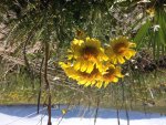
We skirted the north side of swan lake on north valley road. It was deep silty sand with tons of whoopee doos. We came across a big ranch and they were doing a cattle drive so we waited patiently for them to pass before taking a right off the main dirt road onto what could best be called a track. The gravelly Range road. It was steep and narrow and surrounded by wildflowers while offering stunning views.


After climbing forever we finally reached the ridge line. It was above the treelike and the wind was howling. We noticed a stack of rocks a ways off the road and decided to investigate. It turned out to be the grave of a shepherd. A more lovely place couldn't have been chosen.


")