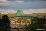
From VA to Labrador in 3 weeks, our 2011 Adventure

CLynn85

Explorer
Little late posting this but figured I'd finally sit down and do a trip report for our 2011 adventure. This year we set Atlantic Canada in our sights and also had the goal of filling in the rest of our gaps on our map of the USA in New England.

This was to be roughly our map:
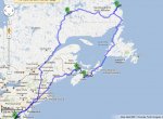
6622307427_a0ac81e8b5_b.jpg

We'd been researching this area for a long time but aside from some random posts here and a bit on the road from Quebec City to Lab City never really found a whole lot. The Lonely Planet guide for this region had a few tidbits, but quite a bit of inaccuracies as well. Map data was pretty sparse and it seems our Garmin doesn't even cover Canada, so we spent the entire trip with road maps and recommendations from locals.

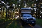
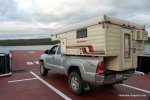
For transport we loaded up our 07 Tacoma (which has now seen every state CONUS except Nebraska) and a quickly refurb'd 1985 Skamper popup in the bed.

I apologize as some of this may be copy/pasted from our blog that we used to keep family/friends happy along the way.
 

CLynn85

Explorer
Day 1-2: Getting up there

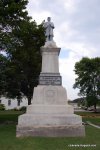
Our first day was mostly highway through areas we'd already been, with a *yuck* KOA for the night. From there we moved into slightly more unfamiliar territory. Our first fun stop was in the town of Freeport; this is the home town of L.L. Bean. Their flagship store is unbelievable, plus the town itself is worth a walk around. While in Freeport, we saw a sight that is uncommon to our Southern eyes... a Civil War memorial to the Northern soldiers.

DSC_1287.JPG

DSC_1295.JPG

DSC_1294.JPG

Our final destination for the evening was Pemaquid Point near New Harbor, ME. Our campsite is in a quaint little family run campground just one mile from the coastline and lighthouse. The staff is very friendly and the camp kids are a riot. Upon pulling up to the office they promptly greeted us with "You're camper is TINY."

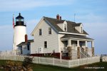
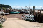
After picking our site, we set off for the Pemaquid Point lighthouse. We hiked down to the rocky shore right away. Although it was great to see our first lighthouse in Maine, the real attraction of this trip was the Seagull Gift Shop, with an accompanying restaurant. You can't beat a $10 lobster at a BYOB restaurant located right on the cliffs!
DSC_1358.JPG

DSC_1346.JPG
 
Last edited:

CLynn85

Explorer
Day 3: Still in the US

From there we headed up to Bar Harbor, our last really touristy destination for a while. Along the way we had some fun though, after a second visit to the Seagull Gift Shop for breakfast (blueberry pancakes, yum!) we explored around Pemaquid Point making stops at the harbor and the colonial town/fort.

DSC_1415.JPG

DSC_1382.JPG

DSC_1420.JPG

DSC_1426.JPG

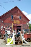
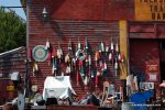
How could we not stop?!?!?! An old New England barn packed to the rafters with odds and ends.... it's amazing enough that we are not still there, even more so that we came away without some outlandish purchase. Wish I had a photo of the interior of this place.

We hit Bar Harbor/Acadia National Park. We mostly just gathered info on Acadia as it just wouldn't fit in the schedule for this trip, and plan to come back to it another day. But we did take advantage of the free bus service and spent the evening in Bar Harbor. Unfortunately, the bus ride proved to be quite a harrowing experience for the dog...
DSC_1451.JPG

After enjoying a picnic while listening to the live Jazz on the Town Green, we walked the streets and along the harbor. We were amazed at the number of people out and about. The town of Bar Harbor is basically a tourism madhouse this time of year, but we tried our best to go with the flow. Oh, and there were lots of boats....

DSC_1459.JPG

DSC_1482.JPG

DSC_1485.JPG
 

CLynn85

Explorer
Day 4: Things that end in "-og"

Fog

Bog

Dog

Fog...Fog...

That pretty much describes today.
We got up this morning to find visibility was at an all time low. We had considered spending another morning, or perhaps even another full day, on Mount Desert Island and do either some harbor tours, kayaking, hiking Acadia, or some combination there of, so we spent the morning walking around the campground, getting ready, tidying up the camper, and waiting to see what the weather was going to do. Consulting the weather and some locals, we decided that it just wasn't going to cooperate and since we had already decided we must come back and spend a couple days doing Acadia sometime in the not too distant future, we hit the road with Canada in our sights.
Leaving MDI we plotted a course along some backroads up to Highway 9, which leads straight to Calais, and more importantly, Canada. There's not much on 9 between Bangor and Calais.... so we rolled into Calais, topped off the tank with low-tax American fuel and got in the line for the border crossing. I'm not really sure what I was expecting, but this wasn't quite it, a lot less signage and organization than I thought, I suppose. Either way, they could have seemed to care less about JD, didn't even ask for his shot records, which was the greatest stress Lindy had leading up to the border crossing. They were however, quite concerned as to the type and quantity of the Blueberry wine that we picked up in Maine... go figure.

DSC_1509.JPG

DSC_1515.JPG

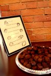
Once we were across and into St. Stephens, we hit Gonong's Chocolate, which is supposedly the company responsible for the introduction of those heart shaped boxes of chocolate that we're forced to buy every February 14th into North America. I guess I can't complain though, because their museum tour included trays of fine chocolates scattered about, with no limit on how many you could consume. I really don't recall that much else about the tour, because I was in a sugar coma for 80% of it...

DSC_1516.JPG

DSC_1519.JPG

BTW - They don't import these into the USA, but I did get their mail-order information.

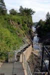
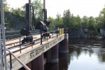
After a quick stop at the New Brunswick tourism office we hit highway 1, and after a short while pulled into St. George. There's not much there other than some entertaining old codgers in one of the town offices, but I did manage to stumble across this dam, which had a fairly elaborate fishway to allow migrating fish to continue upstream to spawn. I'm a nerd, so I thought it was cool...

DSC_1527.JPG

DSC_1529.JPG

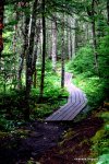
Our stop for the night was a campground at a provincial park at New River Beach. Provincial parks seem to be roughly the equivalent of our state parks, but nicer. We grabbed a site near the bath-house and setup camp, since we planned to walk across the street and hit the hiking trails before the mist set in too thick. After walking across the street, we found that there was no access to the trails there, but a mile and a half walk down the road later we were in business. Lindy had a good time, and I must admit the views and the foliage weren't terrible, but after I ran out of coordination on one of the slippery wooden boardwalks that traversed some of the wetter parts of the trail while being pulled by the dog and hit the deck, I was a bit out of sorts... (I'm guessing this was JDs payback for us making him ride the scary bus to Bar Harbor, after which he placed the blame squarely on me for some reason).

DSC_1540.JPG

DSC_1579.JPG

DSC_1598.JPG

DSC_1610.JPG
 

CLynn85

Explorer
Day 5: "There better be a moose, with puffins on its antlers, eating lobster and surfing with a whale at the end of this road"

We awoke this morning to rain, and fog, and then more rain. We end today with rain, and fog, and then more rain. Despite the damp weather conditions, we have managed to make a full day of it.

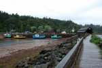
Our first stop was a drive through Saint John, New Brunswick's most populous city. There is a great deal of industry here. It is also home to the "reversing falls;" however, we did not catch the tide shift at a spectacular time. Our pictures just look like shots of water. Saint John is also home to a gang of wild elderly who seem to enjoy racing their wheelchairs though the busy city streets. Seriously, we saw at least three. After pulling out of Saint John, we tracked along the suggested Fundy Scenic Route... it did not greatly deliver (hence the title of today's post).

This was our view for most of the way:

DSC_1635.JPG

As we ran along back roads with nothing to see, we began to up the criteria for what would make this drive worth the time and gasoline. Needless to say the mythical surfing moose never arrived, but we did find some things worth taking a (not very good) picture of.

DSC_1638.JPG

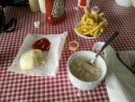
The next village to appear on our route was St. Martins. We had come to drive the Fundy Trail and hopefully do some hiking, but the weather put a damper on those plans. Still, We were able to see the huge effects of the Bay of Fundy's tidal changes, enjoyed a delightful bowl of seafood chowder at a bayside stop and trekked out to some caves just in time for another cloudburst.

DSC_1679.JPG

IMG_20110822_115830.jpg

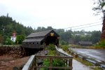
St. Martins is also, allegedly, the only place IN THE WORLD where you can see two covered bridges AND a lighthouse all in one shot....

DSC_1681.JPG

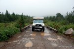
The only way to get back on the main route from St. Martins appeared to be by back tracking, and I was NOT ok with that, so we set out on the direction we wanted to go in to see what happened. Turns out you eventually end up on a huge network of logging roads, which would not have been all that exciting were it not for the typhoon that had suddenly appeared turning roads that looked like this into complete mush.

DSC_1690.JPG

We finally emerged on some improved roads remarkably close to the area we were heading towards, so we headed on to Fundy National Park. Since the weather was still not cooperating we slipped into the town of Alma for a bit to dry out and use the wifi at a local coffee shop.
 

CLynn85

Explorer
Hey we're also from the NOVA area and also planned to make this same trip last year. Unfortunately work trumped my vacations plans and we didn't get to go.
I used the trip report that Northern Explorer put together as a bit of a planning aid.
http://www.expeditionportal.com/for...dor-Highway-and-other-places-of-interest-2010

Subscribed for updates!

Sorry for the misfortune, hope you're able to do it in the future. It was definitely at or near the top of all time best trips we've done. Feel free to ask any questions you have.
 

CLynn85

Explorer
Day 6: Fundy to Five Islands pt 1

As my wife wrote:

"When we awoke this morning to a hillside view of the sunrise over the Bay of Fundy, it struck me how extraordinary a thing we were doing. Moments later when our camper was under siege with bats trying to nest, I realized what a strange thing we were doing."

DSC_1711.JPG

Some of our original plans had us pushing on past the park today and onto Prince Edward Island. Instead we were lured in to the beauty of Fundy National Park and decided to stay here and forgo the driving time and other expenses that going to PEI would entail.

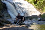
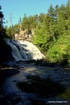
After an enthusiastic recommendation from the front desk attendant, we chose to hike the Laverty Falls trail. We were not disappointed, the falls were breathtaking and the trail leads you directly to the drop point for one of the larger parts. Of course, the rains the night before had not helped the rich earth on the trail and our footwear did suffer a bit. JD had no problems, At points he was plucking through dark mud up to his knees and enjoying every minute of it.

DSC_1797.JPG

DSC_1773.JPG

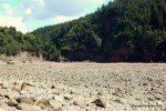
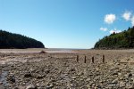
After cleaning up from the hike, we made our way over to Point Wolfe. This area of the park used to be a port area for a logging camp. There is a reconstruction of a covered bridge marking the camp's area. A short trail here takes you down to the shore. The bay of Fundy is known for its dramatic tide changes, we were close to the low tide time and were able to step out almost 1 km further on the shore than you can at high tide.

DSC_1841.JPG

DSC_1850.JPG


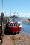
Leaving the park, we stopped in Alma, NB to see the effect of the tides. It is amazing to see huge fishing ships laid on their sides as the water rushes out. We also saw a local fishing vessel which recently brought in a 30 foot shark.

DSC_1885.JPG

DSC_1889.JPG

Reluctantly we left the area and pressed on to keep up with the schedule. While hitting the last town in NB before NS for supplies and currency we received a phone call that we had missed an earthquake back home. "Seriously?!?!?!!" An earthquake in VA... and we're in Canada, go figure....
 

CLynn85

Explorer
Day 6 Part II


DSC_1895.JPG

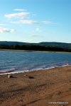
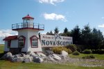
When we left NB for Nova Scotia the change was unbelievable. The first thing that hit us were the strong winds coming from the bay. We then focused on the local flora and fauna. The area were were driving in was beautiful, rural and also oddly familiar. There were times where we could have sworn we were back in Madison, VA on a Sunday Drive. After following some back roads, we made it to our final camp at Five Islands Provincial Park. We have been extremely impressed with the local park sites in Canada.

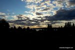
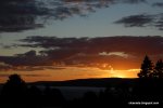
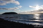
Five Islands sits out overlooking the Bay and the five islands along the shore which give the area its name. Our site looked out over the water and the view was breathtaking. After starting the day with a stunning sunrise, we finished it with an equally beautiful sunset.

DSC_1923.JPG

DSC_1906.JPG

DSC_1936.JPG

DSC_1955.JPG
 

4x4x4doors

Explorer
Excellent! I for one believe it's NEVER too late to share a great trip report.

Looks like a wonderful time was had by all. I may want to put this on my future trips list (I may need to prioritize a bit but that's another issue.)
 

CLynn85

Explorer
Day 7: Peggy's Cove

I'll spare you all Day 7, since that was mostly our ranting and rambling about our next touristy destination - Peggy's Cove. If you feel so inclined our blog post is here:

http://clcanada.blogspot.com/2011/08/day-seven-five-islands-to-fat-tourists.html

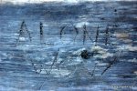
It did however have my favorite graffiti of the trip on a lonely bench away from the masses:

DSC_2250.JPG

Day 8: Kids love us, Dogs love us, Birds love us.....


We slept pretty well last night at the "Halifax" KOA, it seems like our pattern of staying at a campground with water/electric every couple nights is a good way to go since it keeps our batteries topped off and the convenience of having water inside the camper is nice. I say "Halifax" with quotes, because even though it's in the county, it's no where close to the city. We dined on pancakes since this is the first campground on this trip to have a pancake breakfast, and headed off to the capitol of Nova Scotia, armed with only a myriad of free tourist maps.

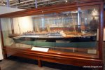
Lindy, in her week or so of Canada research, had stumbled across the Maritime Museum of the Atlantic in Halifax. Since it boasted a healthy exhibit on the Titanic, she knew I'd be game. We were pleasantly surprised too, in that it also had other well thought out exhibits on topics such as Nova Scotia shipwrecks, sailboats, goose boats, a viewable archive, and an awesome assortment of models, both contemporary and antique, of local vessels. It quickly proved itself to be one of the best museums I've ever visited outside of some of the "National" museums of Washington. If you're ever in Halifax, it's worth a couple hours of your time, especially if you're a transportation geek like me.

DSC_2253.JPG

DSC_2256.JPG

DSC_2303.JPG

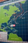
They also happened to have a tracker for Atlantic hurricanes in the lobby, convenient since we were trying to dodge our second natural disaster of the trip - Hurricane Irene!

DSC_2308.JPG

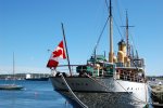
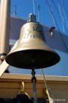
Also included in the tour was the opportunity to go out onto the pier and board the CSS Acadia, a research vessel that spent close to 30 years in service mapping out the bays and rivers vital to this region. It's amazing how well built these older ships were and how well it has held up even to this day.

DSC_2310.JPG

DSC_2322.JPG

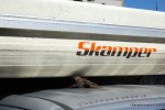
Upon returning to the public parking lot where we'd left our rig, we were greeted by another winged creature. This one, some form of local bird, took a special liking to the Skamper-ized Tacoma. We laughed about it's presence and were about to shoo it off when it hopped on the roof. As we tried to dig out the camera, it began to dine on the buffet of insects that had met their fate on the front of the camper, and by the time I was able to snap a shot, it expressed it's love for the Skamper by spreading its wings and hugging our truck, seriously, birds love us....

DSC_2373.JPG

To be continued...
 

CLynn85

Explorer
Day 8: Part II

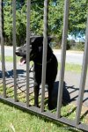
Lindy had identified the public gardens as a place she wanted to explore in the city so we hopped in the truck and wound our way up from the shore. As we hopped out and slid across the street we were greeted by a sign declaring pets to be prohibited. No worries, as this gave me an excuse not to have to stare at flowers for an hour, so I volunteered to be on dog-sitting detail and walk the dog around the outskirts of the park while she explored the gardens for a bit. We did run across each other once at the fence, we call this "Dog : Excluded".

DSC_2401.JPG

All in all, we really enjoyed our time in Halifax. It's a nice city and I can see why people would be proud to call it home, I would welcome the opportunity to return sometime in the not too distant future and spend more time exploring around.

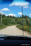
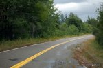
As we departed Halifax we paused to plot our route. We knew we would eventually be making our way towards North Sydney, where the ferry departs to New Foundland, and Lindy had picked out some potential campsites on the eastern side of the mainland. We had already spent a lot of time following coastal routes, and the highway route would have taken us all the way back up to Truro, but there was a network of linking secondary roads right through the heart of the province, so we thought we'd give it a shot. As we departed the highway onto the first road, things were going pretty well. The road was nice and the views were good. A couple roads later after passing through the town of Dean, we found ourselves on a well-graded gravel road to Trafalgar. No, I'm not talking about some villain from the latest Harry Potter movie, it's a real "town". After miles of gravel roads through counties and game preserves, we'd decided we'd had enough of what I've declared the "Trans-Nova Scotia Overland Route" and headed south to rejoin the coastal roads. Much to our dismay, the paved roads paled in comparison to the smoothness of the gravel roads, and for the most part, had dis-jointed bits of pavement interrupted by an abundance of tall grass. These roads seemed to link what must have been logging communities of years gone by, but the inhabitants are all gone and hardly any cars now pass by them. Below is an assortment of what we saw for the entire trip.

DSC_2465.JPG

DSC_2471.JPG

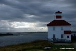
Back on the coastal roads, things were mildly better. Every once and a while we did hit a fresh strip of pavement, and since the pup had been riding in the backseat for most of the day, it was nice to have opportunities to get him out. Point Bickerton gave us the opportunity to view yet another northern Atlantic light house, and the dog as always loved the green grass. This was turning into one of our longer driving days so we hit the road once more and tore through fishing village after fishing village, and just when things were rolling good, we see signs. "Road ends 500m? What do you mean the road ends?!??!!?" We had been seeing signs for "Country Harbour Ferry" for quite some time, and wondering: "Where does that go???". It turns out, it's just a ferry across the harbor so we could continue on the same route we'd been traveling. Luckily we had timed it pretty well by shear dumb luck, and had virtually no wait for the once an hour ferry. Things like this are still commonplace in these parts, even though in our region they've long since disappeared and been replaced by bridges.

DSC_2482.JPG

DSC_2495.JPG

DSC_2511.JPG

DSC_2509.JPG

DSC_2515.JPG

Lindy had done a good job researching campsites, but at the last minute we switched up our plans to instead go to a town that had been mentioned in the Lonely Planet guide, Canso. It was described as a fishing village and the sight of a National Park and trail system. What she hadn't read were the two sentences describing the town's demise since the great northern cod stocks dried up in the early 90's and subsequent unemployment....
 

Christian P.

Expedition Leader
Staff member
Awesome. I am thinking of taking my fiance down to Sept-Iles next weekend and do part of this route...in the winter...
 

TimS

Adventurer
Glad you had a nice trip. Its funny to see pictures posted that you had taken also. We have been though New Bruswick and Nova Scotia quite a few times. It never gets old. Living here in Maine, its close and yet it seems far away. Hope you return again.
 

CLynn85

Explorer
Day 9: No Frackin' Way

When we pulled into Canso it was almost dark, so we had an idea of how deserted the town was, but didn't get to experience it. The "Campground" we stayed at was a former marina, and judging by the number of slips and amount of equipment rotting away, it must've been a pretty busy one in its day. We explored the town a bit more and learned some more about its history, but due to weather closing in again opted not to stay and take the boat ride over to the National Park island. Canso it seems, like so many other small fishing villages in the area, is doing all it can to hang on and embrace tourism as its primary source of revenue rather than fishing. Only time will tell if it has worked and whether or not this becomes a complete ghost town.

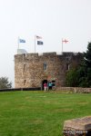
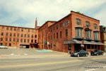
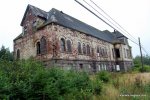
One last thing from Canso. This building was our first glace at the town. Imagine rolling into a desolate town at sundown and seeing this place. All we needed was some Halloween music and bats flying out of the rafters. On the way out of town we had to stop and get a picture. This too is a reconstruction effort, but considering it has signs on it saying “Beware of falling bricks” who knows…

DSC_2530.JPG

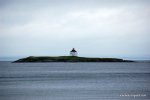
Following the coast, we set our sights on Cape Breton. Along the way we added another lighthouse spotting to the list. This one is located near Queensboro.

DSC_2531.JPG

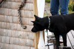
JD took some time to explore the information kiosk near the lighthouse park.

DSC_2538.JPG

By lunchtime we were on Cape Breton. Our first order of business was to find the local information center and find out the latest on hurricane Irene. Given the forecast, we decided to delay a day before taking the Ferry into Newfoundland. This meant we would have a day and a half to explore.

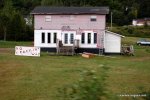
The first sight we were greeted by was a series of large signs reading “No Frackin Way” glancing over to the series of homes and outbuildings whose owners were obviously responsible for the signage we were shocked to see Homer, Bart, Marge, Lisa, baby Maggie, and the rest of The Simpsons cast. Who knew that Springfield was in Nova Scotia.

DSC_2544.JPG

DSC_2548.JPG

Taking the highway we came through the town of Baddeck. Alexander Graham Bell lived near this town for a while, and there is a national historic site/museum commemorating his work. The hillside of the museum also gives a great view of the lighthouse. The town sports a lot of nice shops, a good hardware store, and some eateries. The town is also the hq for a lot of outdoor outfitters who run tours and such.

DSC_2566.JPG

We pressed on trying to get a bit closer to our jumping-off point for the ferry to Newfoundland. We did manage to find some abandoned backroads to explore, which turned out to, according to the bloke at the campground, be the remains of the original main pass from Baddeck to Sydney. We also managed to hit another *yuck* KOA for the night, though this one was probably the exception to the rule. The staff was very friendly, and the facilities were wonderful. We joked about them being fake (or maybe real) Ozzies though, because they just happened to be in Sydney, they all looked and talked suspiciously like Crocodile Dundee, and they took a particular liking to our rig.

DSC_2571.JPG

I should note that I was anticipating being able to do more unofficial/pirate/backcountry camping on this leg of the trip than we were able to. It just seemed that no matter what there weren't many friendly looking options for places to setup for the night.
 

Forum statistics

Threads
189,797
Messages
2,920,948
Members
232,931
Latest member
Northandfree
Top