AbleGuy
Officious Intermeddler
Just came across this today. Free sounds good, doesn’t it?
 www.fs.usda.gov
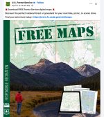
Maps | US Forest Service
We are in the process of updating our maps, which will include corrected names of some geographic locations. The links for digital, online, and Android and Apple applications will be updated as soon as possible.FREE DOWNLOADABLE MAPSLooking for a map to help plan your trip to a National Forest...
FREE DOWNLOADABLE MAPS FROM THE US FOREST SERVICE
Looking for a map to help plan your trip to a National Forest or Grassland? Click the link below to access free downloadable maps at a variety of scales to help get you started.Forest Service Digital Maps

Forest Service Digital Maps cover all lands administered by the Forest Service. There are available at a variety of scales. Maps are free as a digital download.
Download MapsInteractive Forest Visitor Map

The Interactive Forest Visitor Map is an online or mobile app that provides the public with information on Forest Service roads, trails, recreation sites,
Attachments
Last edited: