GWNF again

Status
Not open for further replies.

Clark White

Explorer
Went back to our most common of good camping places, GWNF west of Harrisonburg VA. I drove my 99 4Runner while my two room mates rode their Vstrom 650 and KLR 650.

My tent.
DSC_0006-1.jpg


Me crossing Dry River. While I have a snorkel on the truck, the power antenna is in the way and so the snorkel is not hooked up, so I just have the stock intake system in these.
DSC_0007A.jpg


DSC_0008A.jpg


DSC_0009A.jpg


DSC_0011-2.jpg


DSC_0019-1.jpg


DSC_0023.jpg


DSC_0029.jpg


Clay crossing at a shallower spot.
DSC_0036.jpg


Ed crossing the same spot.
DSC_0046.jpg
 

Clark White

Explorer
Fire!
DSC_0005.jpg


DSC_0069.jpg


DSC_0067.jpg


The Kelly Kettle.
DSC_0076.jpg


Clays exhaust. He let the bike idle for a while to warm up before we hit the trails.
DSC_0080.jpg


Starting out.
DSC_0081.jpg


Thought this looked like an ancient door...
DSC_0083.jpg


Following Clay and Ed down the HW.
DSC_0089.jpg


Carter enjoying the ride!
DSC_0091.jpg


Our parting photo. Clay and Ed had to return a day earlier then I, so they hit the interstate while I drove the Blue Ridge Parkway for the next whole day and a half.
DSC_0094A.jpg
 

Clark White

Explorer
One of the MANY awesome views along the parkway. It was still cloudy and so not good picture taking weather (too dark and gray) but was still a gorgeous drive.
DSC_0122.jpg


While driving.
DSC_0123A-1.jpg


Old barn along the parkway.
DSC_0126-1.jpg


Great sign, Clay wants to go back and take a picture with him jumping off his bike (parked of course) just like the guy on the sign.
DSC_0133.jpg


Paper mill not far from the gas station I stopped at my last night.
DSC_0138AS.jpg


Carter, the Kelly Kettle and I were quite the hit at one of the lake side rest stops the last morning when I stopped to make breakfast (these last two were taken by someone else who was kind enough to e-mail me their pictures).
CarterIV.jpg


The breakfast lake.
Lake.jpg
 
Last edited:

Roverhound

Adventurer
That is an illegal river crossing. There is only one place to cross the river and that wasn't it. I trout fish in that pool regularly. The brook trout will be spawning in the next few weeks so please stay out of the river if you return in the next couple of months. I would encourage you to tread lightly and maybe remove those pictures to give those who would close these trails less ammunition against us. Trout Unlmited and the city of Harrisonburg would like to close Dry Run Rd. That is the trail that continues after the legal river crossing. I don't want to loose access to this trail because thoughtless people can't keep from driving through the river.
 
D

DiscoD

Guest
You can't fix stupid.

This is the very reason 80% of the trails in the area have been closed down to OHV use. Thanks, guys.
 

rctr03

Adventurer
my wife calls your doorway the bridge to teribithada (spelling) that is a great view from flagpole huh?

jimmy
 

Clark White

Explorer
That is an illegal river crossing. There is only one place to cross the river and that wasn't it. I trout fish in that pool regularly. The brook trout will be spawning in the next few weeks so please stay out of the river if you return in the next couple of months. I would encourage you to tread lightly and maybe remove those pictures to give those who would close these trails less ammunition against us. Trout Unlmited and the city of Harrisonburg would like to close Dry Run Rd. That is the trail that continues after the legal river crossing. I don't want to loose access to this trail because thoughtless people can't keep from driving through the river.

You can't fix stupid.

This is the very reason 80% of the trails in the area have been closed down to OHV use. Thanks, guys.

Listen fellas, I am neither thoughtless nor stupid. Granted, I do not live up there so I do not have the daily newspaper telling the latest and greatest in local laws, but there is NO marked crossing or anything indicating legal v. illegal. Where I crossed is rocky, not muddy, so I'm not tearing up the river bottom or stirring up any more sediment then would be caused in any other crossing anywhere around there. In case you haven't noticed in your apparently many visits, I crossed from a well used road to another well used road. Where IS the legal crossing? Is it the one where you can see my friends on motorcycles crossing (I suppose you think the bikes probably destroyed all those rocks we were on huh)? Is it the one further down river from there? Both of which are no better or worse of a place to cross when your talking environmental impact to the river. I also might add that neither is marked, and they both go to other well used roads. The only thing official I saw anywhere in the last few years of driving here is the green and white street sign marking the turn off of 33 as an official county road. I pride my self on NOT tearing up the trails or surrounding areas, and can assure you my crossing there instead of 20' further down stream makes no difference in muddying the waters or what ever else you may be concerned with.

What DOES make a difference are the people I yelled at for not staying on the trail (yes, I actually did track them down and yell at them for venturing off the trail). Or the people who while staying on the trails sought out the muddiest sections and ran them over and over turning them into wallows. Or the local teens who left all their party trash for me to pick up (which I did I might add, on more then one occasion, further proving my thoughtless stupidity). Though I will admit, in reckless disregard for the forest, I opted not to cart out the MULTIPLE 55gal drums of beer cans I found while cleaning up one site as I was a little short on room from the other trash I had collected.

Clark
 

mcm4090

Explorer
That is an illegal river crossing. There is only one place to cross the river and that wasn't it. I trout fish in that pool regularly. The brook trout will be spawning in the next few weeks so please stay out of the river if you return in the next couple of months. I would encourage you to tread lightly and maybe remove those pictures to give those who would close these trails less ammunition against us. Trout Unlmited and the city of Harrisonburg would like to close Dry Run Rd. That is the trail that continues after the legal river crossing. I don't want to loose access to this trail because thoughtless people can't keep from driving through the river.

You can't fix stupid.

This is the very reason 80% of the trails in the area have been closed down to OHV use. Thanks, guys.

I don't see how being insulting is helpful. What ever happen to "hey man just so you know that spot is not legal"? Instead some people fell they need to preach and belittle others. The area is not marked and unless someone tells you there is no indication that is is off limits.
 

Clark White

Explorer
my wife calls your doorway the bridge to teribithada (spelling) that is a great view from flagpole huh?

jimmy

HAHA! The Bridge to Terabithia reference is awesome, I had to scratch my head for a minute on that one :costumed-smiley-007 Yeah, that view is beautiful! I only got to drive down to I-77, so I really want to get back and drive from 77 down to Ashville :victory:

Clark
 
D

DiscoD

Guest
Listen fellas, I am neither thoughtless nor stupid. Granted, I do not live up there so I do not have the daily newspaper telling the latest and greatest in local laws, but there is NO marked crossing or anything indicating legal v. illegal. Where I crossed is rocky, not muddy, so I'm not tearing up the river bottom or stirring up any more sediment then would be caused in any other crossing anywhere around there. In case you haven't noticed in your apparently many visits, I crossed from a well used road to another well used road. Where IS the legal crossing? Is it the one where you can see my friends on motorcycles crossing (I suppose you think the bikes probably destroyed all those rocks we were on huh)? Is it the one further down river from there? Both of which are no better or worse of a place to cross when your talking environmental impact to the river. I also might add that neither is marked, and they both go to other well used roads. The only thing official I saw anywhere in the last few years of driving here is the green and white street sign marking the turn off of 33 as an official county road. I pride my self on NOT tearing up the trails or surrounding areas, and can assure you my crossing there instead of 20' further down stream makes no difference in muddying the waters or what ever else you may be concerned with.

What DOES make a difference are the people I yelled at for not staying on the trail (yes, I actually did track them down and yell at them for venturing off the trail). Or the people who while staying on the trails sought out the muddiest sections and ran them over and over turning them into wallows. Or the local teens who left all their party trash for me to pick up (which I did I might add, on more then one occasion, further proving my thoughtless stupidity). Though I will admit, in reckless disregard for the forest, I opted not to cart out the MULTIPLE 55gal drums of beer cans I found while cleaning up one site as I was a little short on room from the other trash I had collected.

Clark

It's late and I'm tired. But rest assured I'll follow up tomorrow with pictures of the ROAD less than 20-yards from where you crossed the river.

Don't be ignorant, driving through the river is illegal. I don't care what state you're in.
 

Clark White

Explorer
It's late and I'm tired. But rest assured I'll follow up tomorrow with pictures of the ROAD less than 20-yards from where you crossed the river.

Don't be ignorant, driving through the river is illegal. I don't care what state you're in.

You make this sound like a threat? Please do as I am sure I will be up there again, and if it is illegal then obviously I will not do it. Just out of curiosity, since I'm so ignorant of the laws how DO you get to the other side when there is no bridge since it is illegal to cross a river? Teleport? It is illegal to just start randomly driving across in random places or to drive along in the river, it is NOT illegal to cross.

I will not argue whether or not that is an illegal place to cross as I really don't know. I DO know it's not illegal to drive across a river, that there are no markings on where the road goes, and that there are multiple obvious places to cross. I'm guessing your referring to where my friends crossed? 20yrds you might actually be talking about the third crossing? In order to get to the road I crossed to from there you have to drive some VERY muddy and damaged roads which would cause greater environmental impact then my crossing, part of the reason I don't use that lowest crossing. Where my friends crossed is shallower (obviously), but I don't see how it has any less impact since I am NOT blazing a new trail (which would be illegal).

For reference, here is where I was crossing from (in the series I entered where the arrow is, to the left of where my truck is in this picture). You can clearly see that I was not driving off and blazing my own trail, but rather driving across very rocky ground with no vegetation, and leaving no undue trace of my passage that would not be left at the crossing you are talking about.
Entry.jpg


Here is the road I was crossing to (again at the arrow). Don't think anyone would argue that that is not a road?
ExitI.jpg


ExitII.jpg


Here is a shot of the road I crossed to from what I assume is the road you are referring to. You can't really see the road in this one, but you can see pretty well that it is all rocky, and that I was not blazing through a wild part of the river.
ExitIII.jpg


Here is a shot looking back at what I assume is the crossing you are referring to. This is the one the bikes used, still crossing the same river, in the same water, and stirring up just as much sediment from the rocks (depth of the water has little effect on this).
Option.jpg


Clark
 

Roverhound

Adventurer
I was not being insultful.
Your "entry point" and "road I crossed to" are neither legal roads or entry points.
The legal crossing is straight with the river on your right.
Those "roads" are crossings that people have made illegally. I appreciate your trash cleaning efforts.
As far as things being not marked, that is no excuse to the forest service, Harrisonburg law enforcement or the people wanting to close access to these areas.
Driving through rivers is one thing, everyone on the East coast knows that driving in rivers is illegal.
Next time you are in the area look me up and I can show you what's legal.
For what it's worth, Dry River has the highest Native trout concentration of any Virginia stream. It is also stressed by the low flow of water this time of year and as I said, the trout are entering spawning season.
If you were there last weekend (or almost any weekend) you more then likely saw my truck parked in the area.
 
Last edited:
D

DiscoD

Guest
You've kind of struck a sore subject with me and I'll try to explain why and how.

At one time we had a lot of useful OHV trails in the area. As you probably found, there are not many noteworthy trails left open to OHV use. We know and fully understand that we're fighting a loosing battle when it comes to these OHV type trails because we do not have the time, resources, and money to fight the larger organizations looking to shut us down. All we can do is protect what we have left, and this means not giving the other guys a reason to draw attention to these trails.

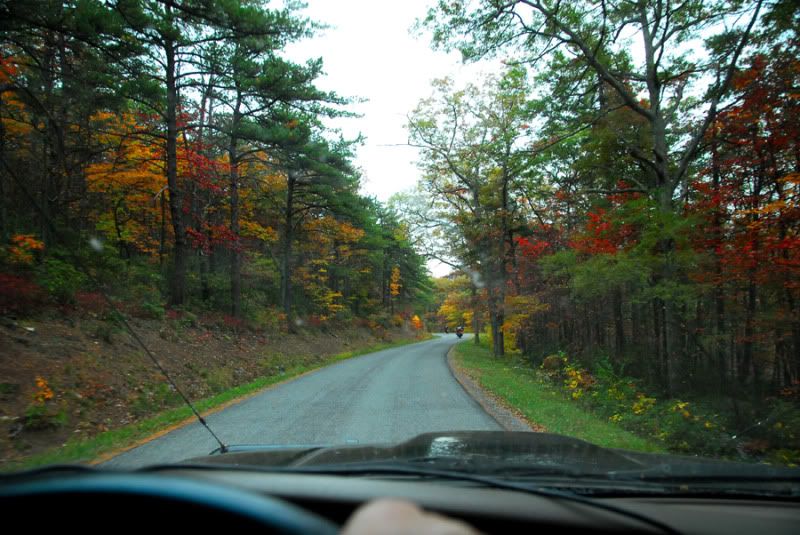
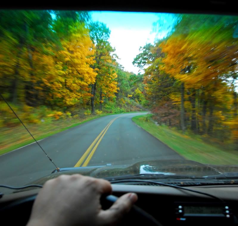
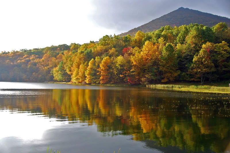
Where you took these pictures, and Dry River in general, is a hot topic right now. It has cooled a bit in the last few months, but I'm sure you noticed all the rock pilings and signs along Rt.33 3 or 4 miles prior to the entrance to Dry Run Road. Those were trail heads we just lost back in the Spring. There were a verity of reason this area was closed and anyone who's ever driven through that area would agree it was abused. Honestly, I can't say that I'm too upset about it as the area was a mess. But the straw that broke the camels back was when Trout Unlimited got involved and showed City administrators what was going on in their drinking water.

You may have also noticed Kephart Run. Kephart is a small feeder stream, or creek, that dumps into the Dry River. You crossed this stream on your way to or from Dry Run Road. There was a trail that paralleled Kephart Run for about 3 miles. This was a super cool trail because it took you almost 3-miles into the mountain with no other way in or out. There was very little traffic on this trail and you were able to get deep enough into one of the finger ridges that you could no longer hear road traffic. This trail was important because people with less capable vehicles could still get into the wilderness, away from the traffic, and camp, fish, hunt, etc...

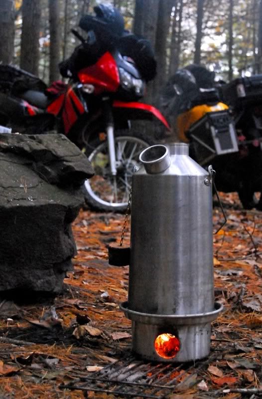
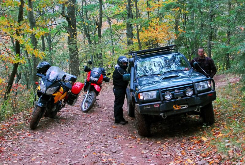
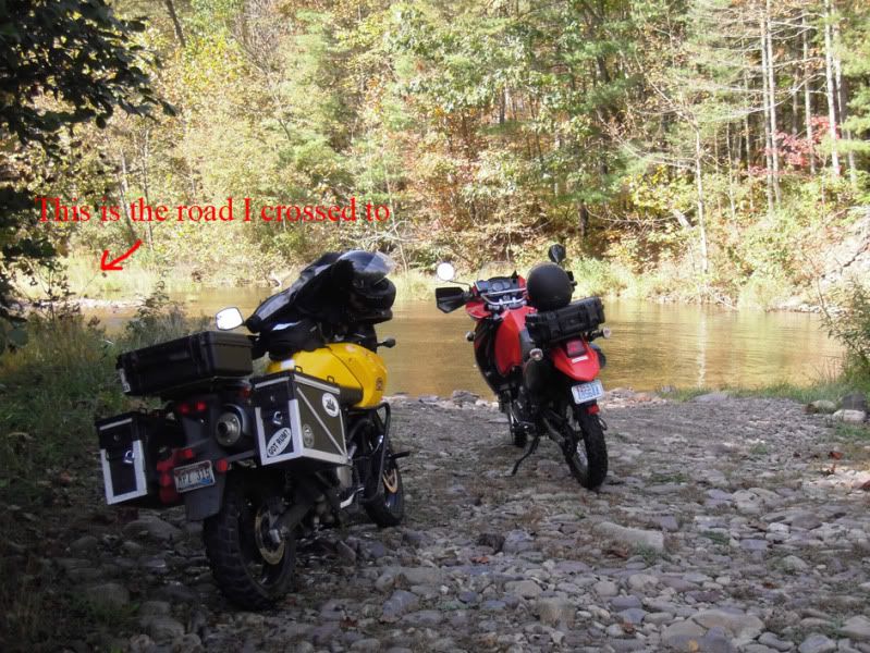
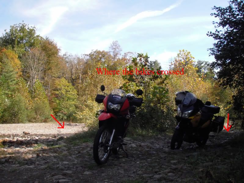
But then people started driving in the stream. Up and down and making new trails. Once it started it only became worse. Here are a few pictures just before the area got closed down:

attachment.php


attachment.php

As you can see, it damn near looks like a road in these pictures. It wasn't. These folks are driving right up the creek. And for what?? It did not go anywhere.

The Off-Camber Crawlers tried to help and adopted the trail:

attachment.php

....but it was too little too late. The damage had been done and we no longer have this nice trail. We no longer have this trail because people would not stay out of the water.

Your comments about "No Signs" really pisses me off. That's about the most rookie statement you ever hear from someone who does not want to pay attention to the law or abide by the Thread Lightly rule.

There is probably no sign in your front yard saying I can't drive through it. Does that mean it's okay to drive through your yard? Maybe go really fast and kick up some mud or something? Do you have a sign that says I can't take dump in your swimming pool?

Here's your sign

In case you do not know what Treading Lightly is, here is some information plucked right from the GWNF Forest Service web site:

Riders are encouraged to tread lightly to protect the resources and environment. Here are some tips:

* Avoid running over young trees, shrubs and grasses -- this damages and kills them.
* Stay off soft, wet trails and trails already badly rutted.
* Ford streams only at designated crossings.
* Stay on designated routes -- resist the urge to pioneer a new trail or switchback.
* Do not chase or intentionally disturb wildlife.
* Take your litter with you when you leave the national forest.
* Obey closures and regulatory signs.
* Travel at safe and reasonable speeds.

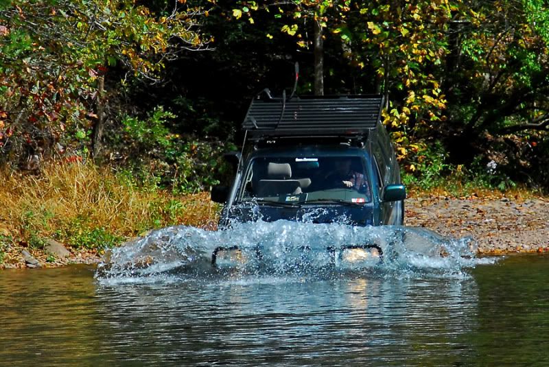
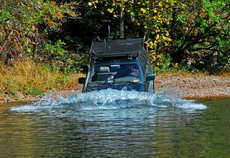
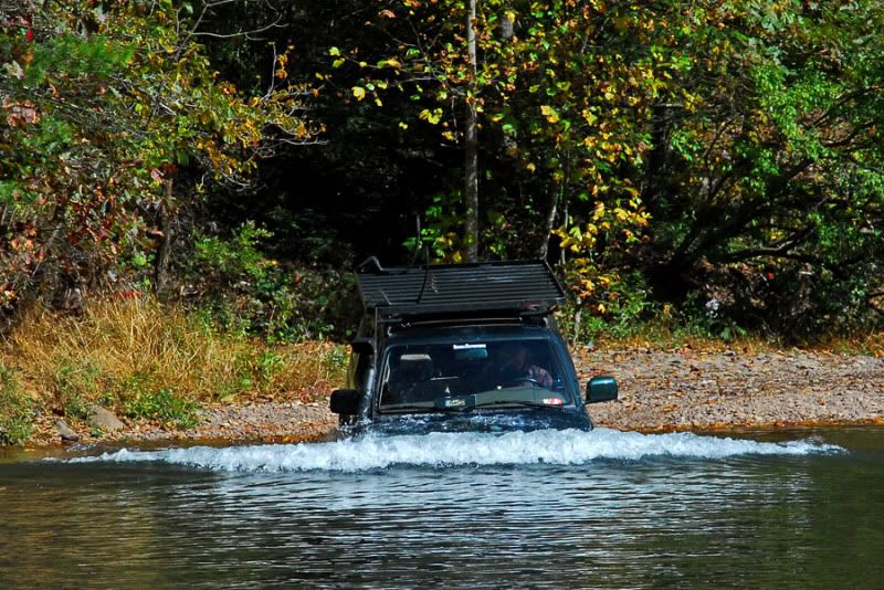
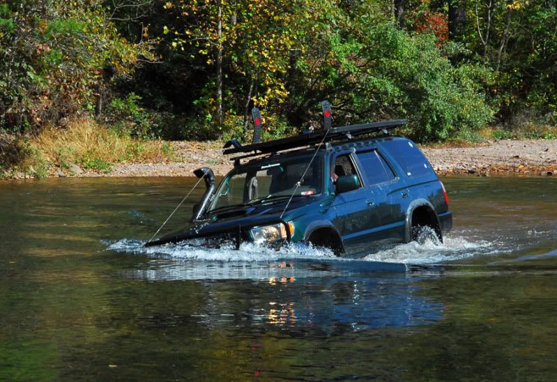
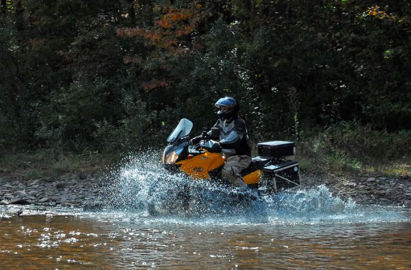
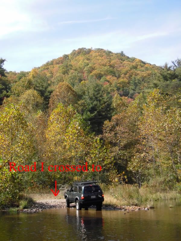
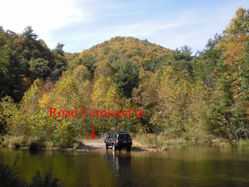
This picture here you posted really makes me wonder what goes through peoples heads sometimes.

ExitII.jpg

You crossed the river to go to an island that leads to no where. Fun. This is much like climbing one of those hills that go straight up the side of a ridge for 30-feet and stop. What's the point? You can honestly toss a rock from one side of that island to the other. You can see that from the main trail this crossing leads to nowhere.

But seriously, dude, does this honestly look like a designated stream crossing?

DSC_0011-2.jpg

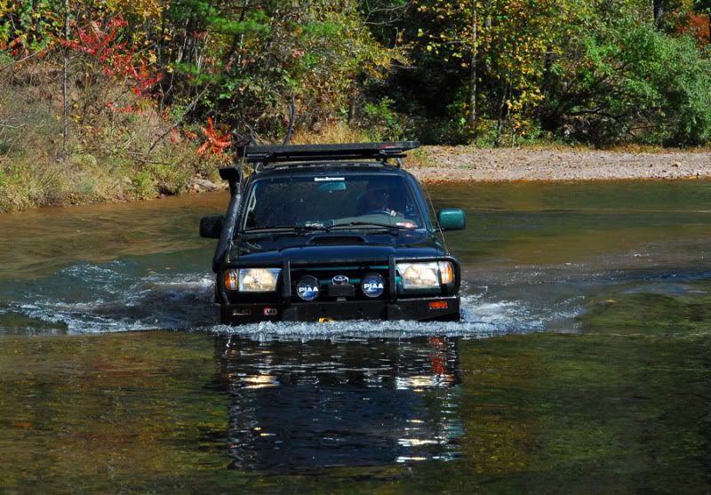
That "trail", as you call it, on that island goes right ********** dab through a blackberry patch. But I guess since there is no sign posted in the river that says "Do Not Drive Through Blackberry Patch", it must be okay.

This Dry Run area has changed drastically over the years. In fact that river has changed it's course. The river now flows about 50-feet from where it once did. This happened in 1996 when hurricane Fran came through. So, yes, you do see a lot of exposed river rock - this entire area has been underwater at some point. I can remember when you turned off Rt.33 and drove down past that little camp area on the left and hit straight on into the river. That camp area, not too long ago, was right on the water. But when Fran came through the river made a 90* right-hand turn and made a new path. The river now actually follows the old trail. At one time this WAS the designated trail. Hell, it was a road leading to the dam and at it's peak the river was 12" deep in this area.

scuba.JPG


dan2.JPG

Obviously now we have a better, safer, more civilized route we can take to get across the river to the dam. Use it.

But come on, man, use some common sense next time you're in the area. Just because it looks like someone else has driven across the river in a particular area, or because there is no sign up, does not mean it's okay to go splashing through the creeks and rivers anywhere you want. I could give two ******ts about the drinking water quality for Harrisonburg City as they're going to filter out all the bad stuff anyway and make it safe to drink. That does not mean they see it the same way as I do and they are the ones who will eventually shut this area down.

We do need to protect our water quality for the habitat, though. When you start driving through the river engine deep you're not helping a thing. There may not be a lot of sediment to kick up in that area but when the forest service or City council see's pictures of a truck sitting in the river, how does that look on the OHV community as a whole?

You've already said there is no signs in this area. We know that. So since there are no signs, is stuff like this ok to do?


Here in an entire thread that I'm sure you will end up on talking about the activity in the area. This thread is monitored by Mike Alexander, the federal police officer for the area. http://sv4w.com/cgi-bin/yabb2/YaBB.pl?num=1231373881/0

"But officer, there was no sign"

(due to picture allowance, I need to create several posts)
 
Last edited by a moderator:
Status
Not open for further replies.

Forum statistics

Threads
186,884
Messages
2,888,979
Members
227,437
Latest member
Top Jimmy
Top