BorregoWrangler
Rendezvous Conspiracy
Hidden away in a remote and rugged part of the southern end of the Anza-Borrego Desert is an engineering feat that hasn't been viewed by a large number of people. The Goat Canyon trestle was built in 1932 after an earthquake collapsed one of the tunnels of the Carrizo Gorge section of the San Diego and Arizona Railway. At 200 feet tall and 750 feet long, it remains to this day the longest, tallest curved wooden trestle ever built in the United States. Dubbed "The Impossible Railroad" by many engineers of its day due to the immense logistical challenges and ruggedness of the terrain involved, this 11-mile section through Carrizo Gorge was built from 1907 to 1919.
Despite damage to the lines from heavy rainstorms, landslides, fires, and vandalism the line stayed in operation for over 50 years. In 1976 hurricane Kathleen caused widespread flooding and damage in this area. Three trestles belonging to the San Diego and Arizona Eastern Railway were destroyed, and five others were damaged. At more than 50 other locations, tracks were buried by mudslides or had the ground under them washed away. After assessing the damage from Kathleen, the Southern Pacific Transportation Company decided in 1977 to abandon most of the SD&AE railway, but in 1978 the Interstate Commerce Commission disallowed this plan and the railway was restored.
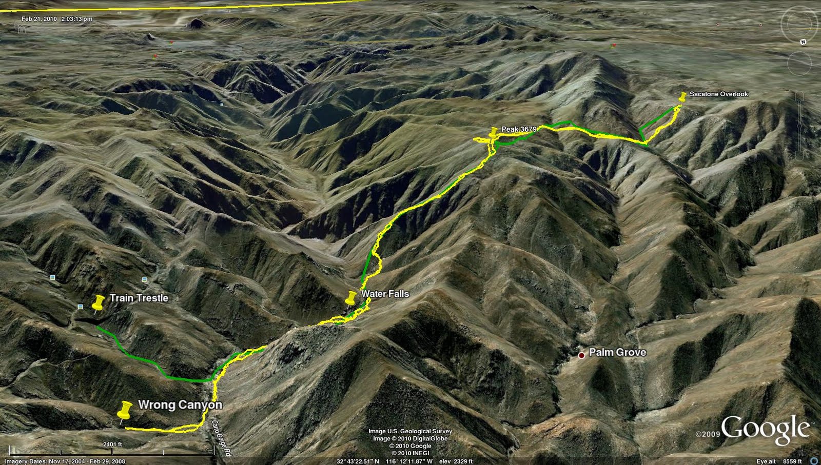
Parking at the Mortero Palms trail head, we headed up through the palms and around the boulders an up the mountain. After the trail leveled off for a bit we soon found ourselves dropping down into Goat Canyon. The hike out to the trestle is always quite an adventure. We were at the edge of the storm that was raging back in town. Although we didn't really get rained on, it was very windy with 40mph gust and a light drizzle along the way. Our biggest concerns were slippery rocks that had to be traversed on the way down into Goat Canyon. The views of the beautiful desert scenery, the trestle and surrounding area make this trip well worth the effort.
Coming into the Mortero Palms.

Looks like this would provide some shade on a sunny day.

Up the waterfall.

Break time.

Looking back down at the desert floor.

Still climbing.

Rainbow awaiting us.

Starting down into Goat Canyon.

Watch those slippery rocks!

Hope there's some gold waiting for us down there!

First glimpse!

Coming down this wasn't easy.

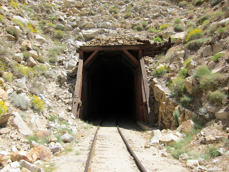
Steve gets bold and makes his way over to the old collapsed tunnel.


Doesn't look like there's any activity here with all the rock and mud slides covering the tracks.

All this was here back in April.

That had to hurt.

Looking down into Carrizo Gorge. I'd like to hike through here one day as well.


Someone had a bad day.

Big palm grove down there.


We started the hike a 8:00 and finished up around 2:30pm so we made a little better time than I had thought we would. Despite the windy conditions it was great not having the sun beat down on us along the way. Hopefully one day I'll be able to get the wife out here. Looking forward to my next outing. Until then, my sore legs are resting up.
Despite damage to the lines from heavy rainstorms, landslides, fires, and vandalism the line stayed in operation for over 50 years. In 1976 hurricane Kathleen caused widespread flooding and damage in this area. Three trestles belonging to the San Diego and Arizona Eastern Railway were destroyed, and five others were damaged. At more than 50 other locations, tracks were buried by mudslides or had the ground under them washed away. After assessing the damage from Kathleen, the Southern Pacific Transportation Company decided in 1977 to abandon most of the SD&AE railway, but in 1978 the Interstate Commerce Commission disallowed this plan and the railway was restored.
Parking at the Mortero Palms trail head, we headed up through the palms and around the boulders an up the mountain. After the trail leveled off for a bit we soon found ourselves dropping down into Goat Canyon. The hike out to the trestle is always quite an adventure. We were at the edge of the storm that was raging back in town. Although we didn't really get rained on, it was very windy with 40mph gust and a light drizzle along the way. Our biggest concerns were slippery rocks that had to be traversed on the way down into Goat Canyon. The views of the beautiful desert scenery, the trestle and surrounding area make this trip well worth the effort.
Coming into the Mortero Palms.

Looks like this would provide some shade on a sunny day.

Up the waterfall.

Break time.

Looking back down at the desert floor.

Still climbing.

Rainbow awaiting us.

Starting down into Goat Canyon.

Watch those slippery rocks!

Hope there's some gold waiting for us down there!

First glimpse!

Coming down this wasn't easy.

Steve gets bold and makes his way over to the old collapsed tunnel.


Doesn't look like there's any activity here with all the rock and mud slides covering the tracks.

All this was here back in April.

That had to hurt.

Looking down into Carrizo Gorge. I'd like to hike through here one day as well.


Someone had a bad day.

Big palm grove down there.


We started the hike a 8:00 and finished up around 2:30pm so we made a little better time than I had thought we would. Despite the windy conditions it was great not having the sun beat down on us along the way. Hopefully one day I'll be able to get the wife out here. Looking forward to my next outing. Until then, my sore legs are resting up.
Last edited:


