IntrepidXJ
Explorer
Saturday & Sunday, July 12-13, 2014
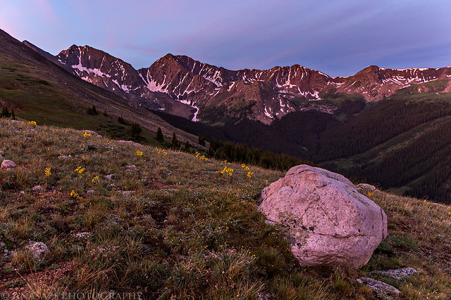
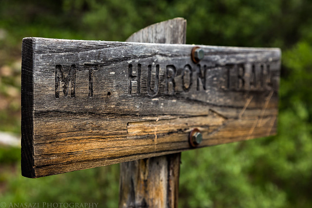
This weekend I set out to climb my first 14er of the season. I chose to try Huron Peak since it's in an area of the Sawatch Range that I haven't really spent much time in, plus it's not supposed to be too difficult of a hike which would be a good warm-up for me since I haven't hiked at this elevation since last summer. At 14,003 feet, Huron Peak is ranked 52 out of the 53 ranked peaks over 14,000 feet in Colorado. I had originally planned to climb Huron Peak over the Fourth of July weekend, but unfortunately I got a pretty bad cold that kept me home for that entire weekend, so I was looking forward to making it up this weekend.
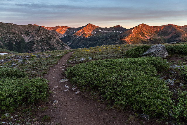
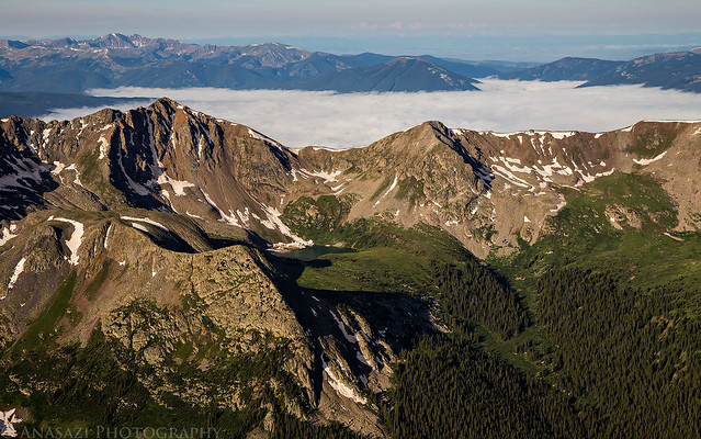
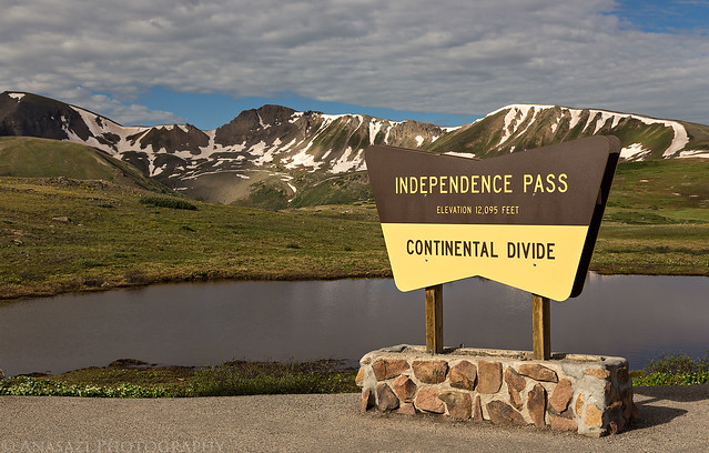
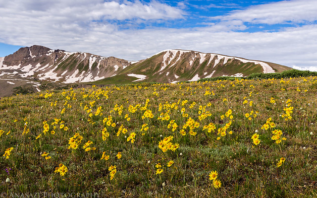
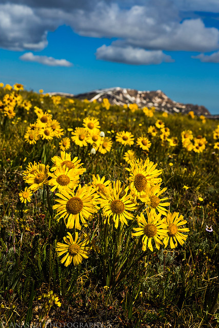
I left home early on Saturday morning with plans to hike Huron Peak by myself on Sunday morning. I drove through Glenwood Springs and Aspen so I could take Independence Pass on the way there. I decided to stop at Independence Pass so I could hike over to an unranked 13er unofficially named Igloo Peak which sits at 13,060 feet along the Continental Divide. I figured it would be an easy ridge hike from the 12,095 pass that would help me get acclimated for Huron Peak the following day. There were plenty of wildflowers and great views along the way.
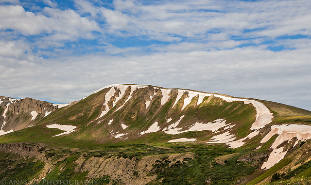
Independence Pass at 12,095 feet along the Continental Divide. Igloo Peak is the high point just left of center in the background.
Independence Pass by IntrepidXJ, on Flickr
Plenty of wildflowers along the early part of the trail near the pass.
Old Man of the Mountain by IntrepidXJ, on Flickr
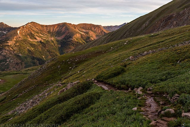
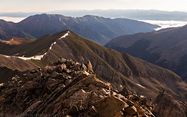
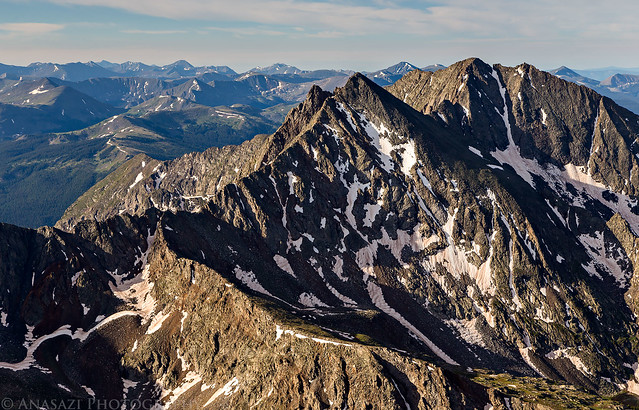
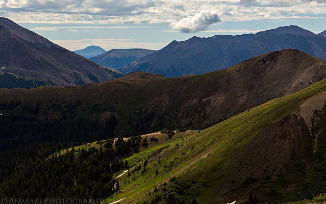
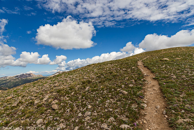
A view of part of the ridge I would be hiking across.
Ridge Hike by IntrepidXJ, on Flickr
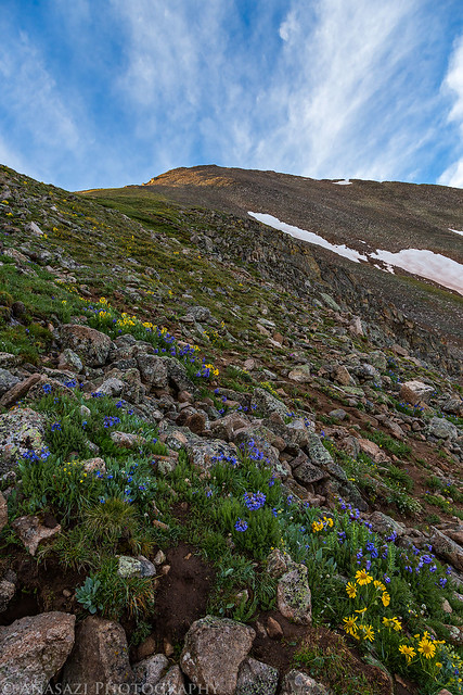
I had to stop for a few closer photos of the flowers.

Flowers by IntrepidXJ, on Flickr
Flowers II by IntrepidXJ, on Flickr
Spotlight below.
Spotlight by IntrepidXJ, on Flickr
I spotted this White-Tailed Ptarmigan on a snow drift just below the ridge. He didn't stick around long or let me get very close, so this is the best photo I got.
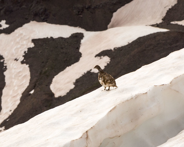
White-Tailed Ptarmigan by IntrepidXJ, on Flickr
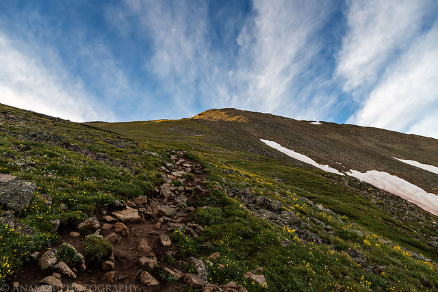
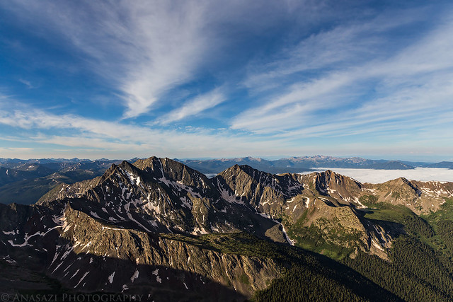
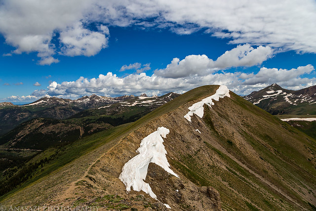
Following the well-defined trail along the Continental Divide.
Continental Divide Trail by IntrepidXJ, on Flickr
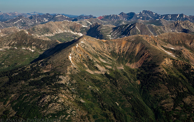
Looking back across the first high point (12,812 feet) I crossed on the way to Igloo Peak with the Geissler Mountains and Twinning Peak in the background.
Continental Divide Ridge by IntrepidXJ, on Flickr
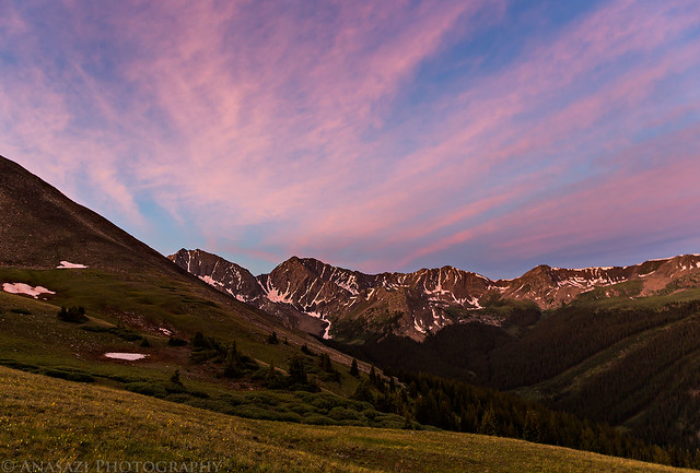
After finishing the short hike I continued my drive to Leadville where I grabbed a late lunch from High Mountain Pies before driving south to Clear Creek and then Winfield. From Winfield I took the high-clearance road up the South Fork and found a nice campsite near the old Banker Mine, which was shortly before the Huron Peak trailhead. I explored the area a little before the afternoon storms started to rain down.
On my way to find a campsite near the trailhead for Huron Peak, I passed through the old townsite of Winfield.
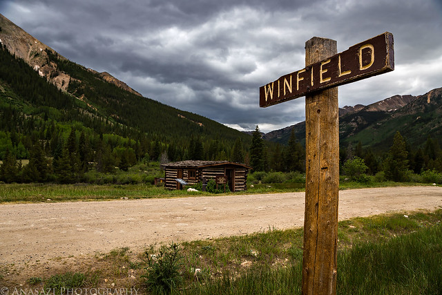
Winfield by IntrepidXJ, on Flickr
A restored cabin found here.
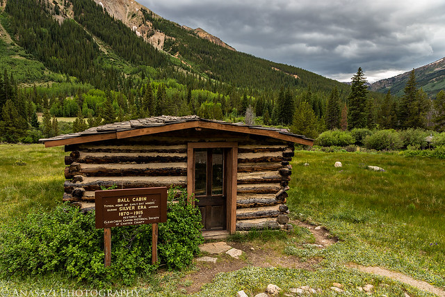
Ball Cabin by IntrepidXJ, on Flickr
The road along the South Fork of Clear Creek.
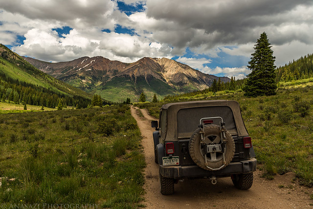
South Fork Clear Creek by IntrepidXJ, on Flickr
An old cabin at the Banker Mine near my campsite for the night.
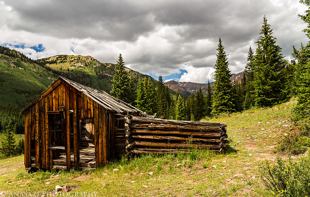
Banker Mine Cabin by IntrepidXJ, on Flickr
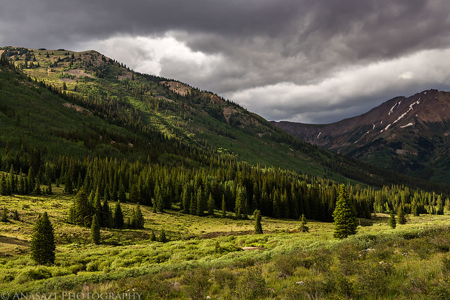
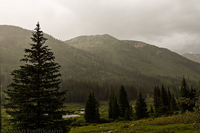
There was some nice light and clouds when the afternoon storms moved into the area.
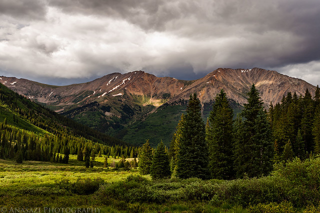
Monsoon Season by IntrepidXJ, on Flickr
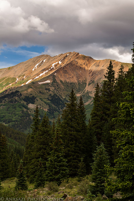
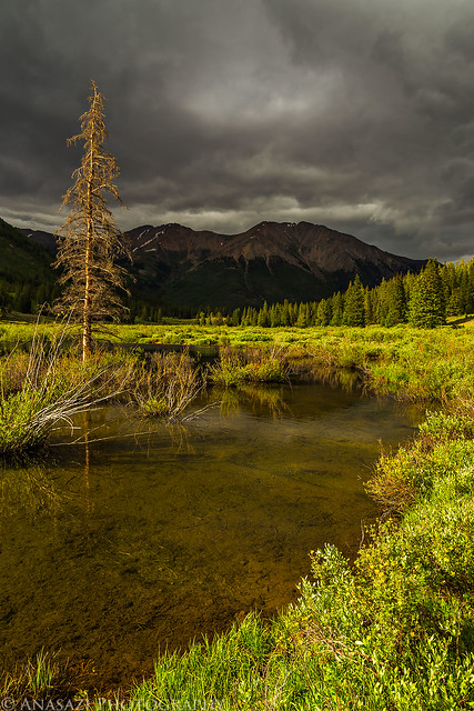
Granite Mountain (12,848 feet) over the South Fork of Clear Creek.
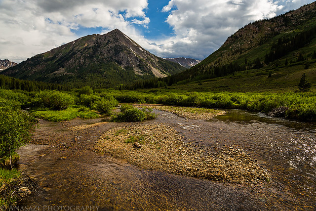
Granite Mountain by IntrepidXJ, on Flickr
Afternoon Storms by IntrepidXJ, on Flickr
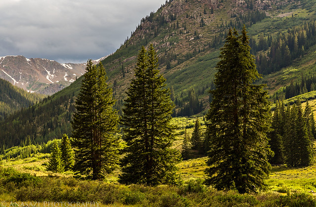
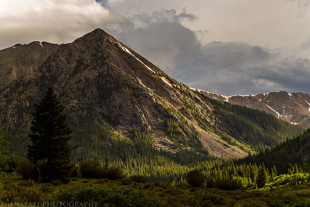
A view of Ervin Peak (13,531 feet) from my campsite.
View from Camp by IntrepidXJ, on Flickr
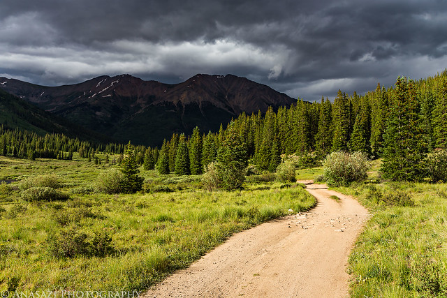
Stormy Road by IntrepidXJ, on Flickr
Storm Light by IntrepidXJ, on Flickr
Storm Light by IntrepidXJ, on Flickr
Granite Light by IntrepidXJ, on Flickr
It rained for a while later in the evening.
Waiting Out the Rain by IntrepidXJ, on Flickr
During a brief stop in the rain, I got out to photograph the low clouds on Granite Mountain.
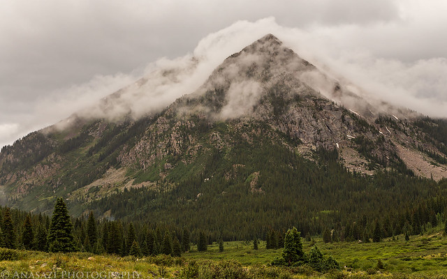
In the Clouds by IntrepidXJ, on Flickr
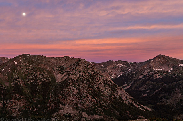
Later in the evening it looked to me like sunset was going to be a bust, so I decided to try and get to bed early since I was planning on a very early start in the morning. After laying in my tent for a while listening to the rain, it finally stopped. I decided to look outside and saw a nice sunset was starting to happen. I quickly slipped on my sandals and grabbed my camera for a few photos. When the light was gone, I got back into my sleeping bag and tried to get some sleep.
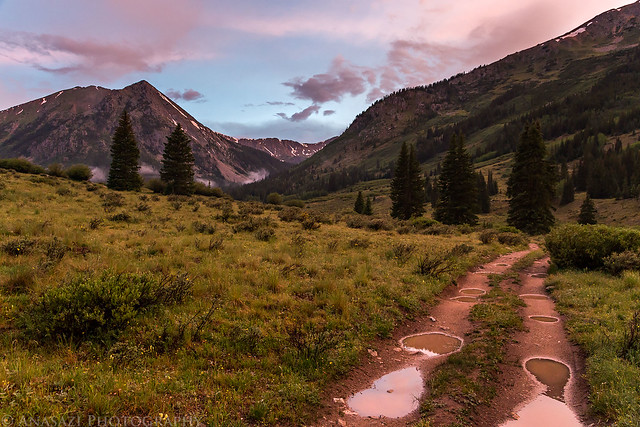
After the Rain by IntrepidXJ, on Flickr
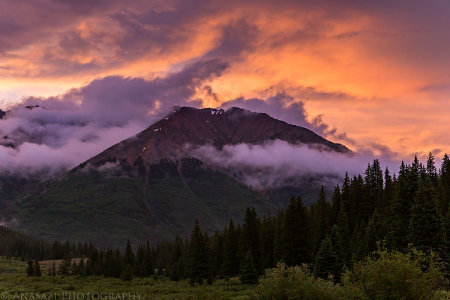
Sky On Fire by IntrepidXJ, on Flickr
This weekend I set out to climb my first 14er of the season. I chose to try Huron Peak since it's in an area of the Sawatch Range that I haven't really spent much time in, plus it's not supposed to be too difficult of a hike which would be a good warm-up for me since I haven't hiked at this elevation since last summer. At 14,003 feet, Huron Peak is ranked 52 out of the 53 ranked peaks over 14,000 feet in Colorado. I had originally planned to climb Huron Peak over the Fourth of July weekend, but unfortunately I got a pretty bad cold that kept me home for that entire weekend, so I was looking forward to making it up this weekend.
I left home early on Saturday morning with plans to hike Huron Peak by myself on Sunday morning. I drove through Glenwood Springs and Aspen so I could take Independence Pass on the way there. I decided to stop at Independence Pass so I could hike over to an unranked 13er unofficially named Igloo Peak which sits at 13,060 feet along the Continental Divide. I figured it would be an easy ridge hike from the 12,095 pass that would help me get acclimated for Huron Peak the following day. There were plenty of wildflowers and great views along the way.
Independence Pass at 12,095 feet along the Continental Divide. Igloo Peak is the high point just left of center in the background.
Independence Pass by IntrepidXJ, on Flickr
Plenty of wildflowers along the early part of the trail near the pass.
Old Man of the Mountain by IntrepidXJ, on Flickr
A view of part of the ridge I would be hiking across.
Ridge Hike by IntrepidXJ, on Flickr
I had to stop for a few closer photos of the flowers.
Flowers by IntrepidXJ, on Flickr
Flowers II by IntrepidXJ, on Flickr
Spotlight below.
Spotlight by IntrepidXJ, on Flickr
I spotted this White-Tailed Ptarmigan on a snow drift just below the ridge. He didn't stick around long or let me get very close, so this is the best photo I got.
White-Tailed Ptarmigan by IntrepidXJ, on Flickr
Following the well-defined trail along the Continental Divide.
Continental Divide Trail by IntrepidXJ, on Flickr
Looking back across the first high point (12,812 feet) I crossed on the way to Igloo Peak with the Geissler Mountains and Twinning Peak in the background.
Continental Divide Ridge by IntrepidXJ, on Flickr
After finishing the short hike I continued my drive to Leadville where I grabbed a late lunch from High Mountain Pies before driving south to Clear Creek and then Winfield. From Winfield I took the high-clearance road up the South Fork and found a nice campsite near the old Banker Mine, which was shortly before the Huron Peak trailhead. I explored the area a little before the afternoon storms started to rain down.
On my way to find a campsite near the trailhead for Huron Peak, I passed through the old townsite of Winfield.
Winfield by IntrepidXJ, on Flickr
A restored cabin found here.
Ball Cabin by IntrepidXJ, on Flickr
The road along the South Fork of Clear Creek.
South Fork Clear Creek by IntrepidXJ, on Flickr
An old cabin at the Banker Mine near my campsite for the night.
Banker Mine Cabin by IntrepidXJ, on Flickr
There was some nice light and clouds when the afternoon storms moved into the area.
Monsoon Season by IntrepidXJ, on Flickr
Granite Mountain (12,848 feet) over the South Fork of Clear Creek.
Granite Mountain by IntrepidXJ, on Flickr
Afternoon Storms by IntrepidXJ, on Flickr
A view of Ervin Peak (13,531 feet) from my campsite.
View from Camp by IntrepidXJ, on Flickr
Stormy Road by IntrepidXJ, on Flickr
Storm Light by IntrepidXJ, on Flickr
Storm Light by IntrepidXJ, on Flickr
Granite Light by IntrepidXJ, on Flickr
It rained for a while later in the evening.
Waiting Out the Rain by IntrepidXJ, on Flickr
During a brief stop in the rain, I got out to photograph the low clouds on Granite Mountain.
In the Clouds by IntrepidXJ, on Flickr
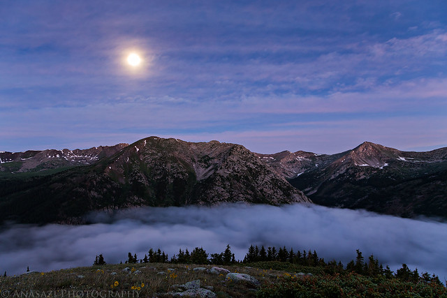
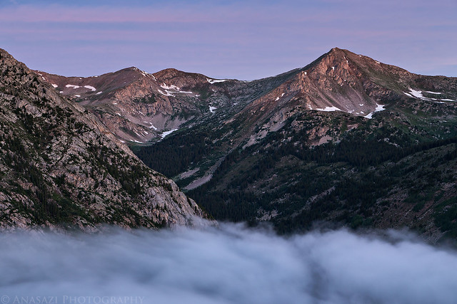
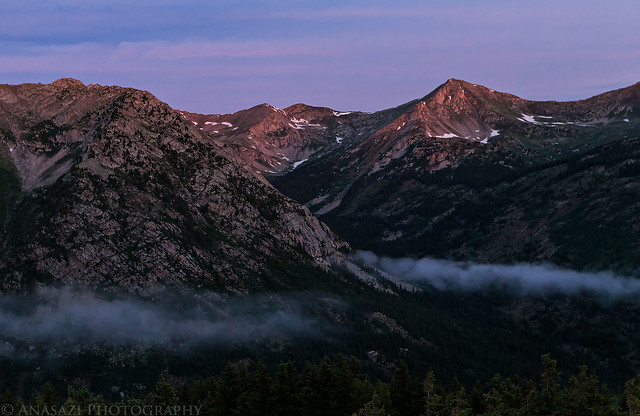
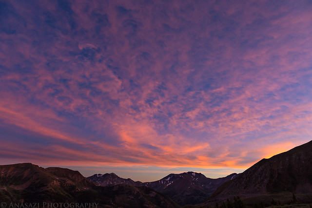
Later in the evening it looked to me like sunset was going to be a bust, so I decided to try and get to bed early since I was planning on a very early start in the morning. After laying in my tent for a while listening to the rain, it finally stopped. I decided to look outside and saw a nice sunset was starting to happen. I quickly slipped on my sandals and grabbed my camera for a few photos. When the light was gone, I got back into my sleeping bag and tried to get some sleep.
After the Rain by IntrepidXJ, on Flickr
Sky On Fire by IntrepidXJ, on Flickr