Idaho and Montana 1700 Miles Later

ttora4runner

Expedition Leader
Where to start…….….back at the beginning of the year I received a new job assignment back in Colorado Springs as the superintendent on a small electrical project, a role I didn't necessarily want and wasn't thrilled about since I just moved back from a job assignment in NE Wyoming and just moved into a new place. Plus, I would be filling (3) separate roles on the project as the Superintendent/QCM/Safety (I'm a QCM 99% of time) and electrical work scares me even more so when doing work for the Corp of Engineers. Be that it may I accepted the assignment.
Since I would be the only one from my company out in Colorado working and having a company vehicle I had to adjust my spring/summer plans (was hoping to make it to Overland Expo) and move my vacation time to the end of summer. Knowing this I started to make some plans as to where I would go before leaving for my new assignment. The obvious choice was Western Colorado but I had also wanted to hit up Morrison Jeep Trail in Wyoming and Glacier National Park again.

Well, since I was already working in Colorado I decided to make the journey back up to Glacier National Park for the second time via a side trip to Morrison.

About a week before leaving for Colorado I had a bit of a fender bender and my 4runner went into the shop while I was away (minor damage) to get repair. I wouldn't have my 4runner back till my second trip home (came home for a little less than two days once a month), so I wouldn't really have a good chance to shake out all the bugs before leaving on vacation (replaced the passenger side front LCA the weekend before leaving due to a bad vibration). Knowing this I went ahead and decided to modify my original plans and hit up Craters of the Moon in Idaho instead of Morrison Jeep trail (a little disappointed). So I began to plan accordingly.

As the end of my project neared and my much needed vacation time came ever so closer we had a hiccup with the equipment manufacturer (still do) that caused me to move my vacation 3 weeks further out to Labor Day weekend (trying to avoid this weekend and the crowds) and to temporally shut down the project while it got resolved. During which time I started another project till we got stop on that one by asbestos (differing site condition).On top of the issue above I had found out that I would be moving back to Colorado Springs for the next 18 months on a full time bases two days after my vacation to help start work on yet another project after my other 2 projects finished up.
Once the logistics of the above mess got worked out (somewhat) I headed back to Utah for a few days prior to my vacation to work out of my company's main office and to begin packing for both my vacation and my move.

By the time Wednesday morning rolled around I was ready to get out of dodge and start my vacation.

The first stop on my trip was Craters of the Moon in southern Idaho, somewhere I hadn't been since I was little kid and don't really remember visiting (my parents both insisted that we visited it though I don't recall). Regardless, since I really don't remember visiting here it was kind of an adventure to re-explore the area.

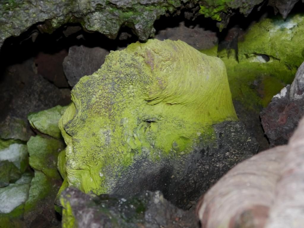
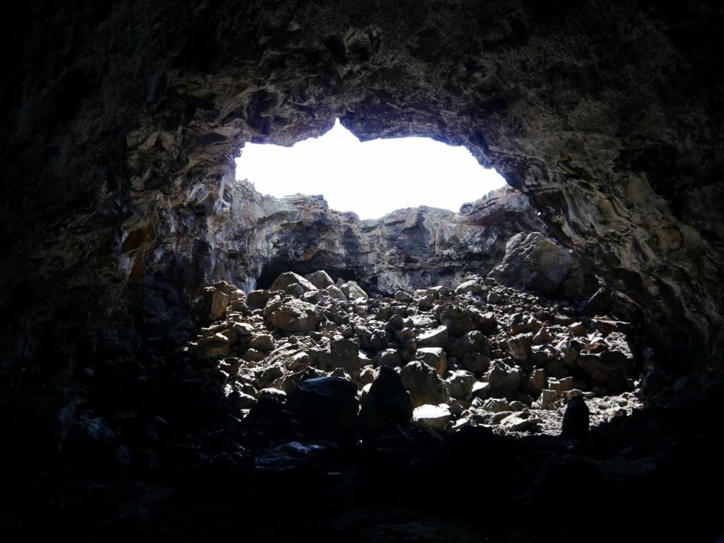
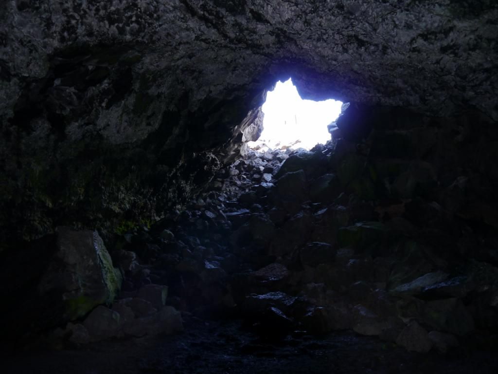
This would be my first time trying to take photo's in a cave environment.

Devil's Orchard - kind of boring area
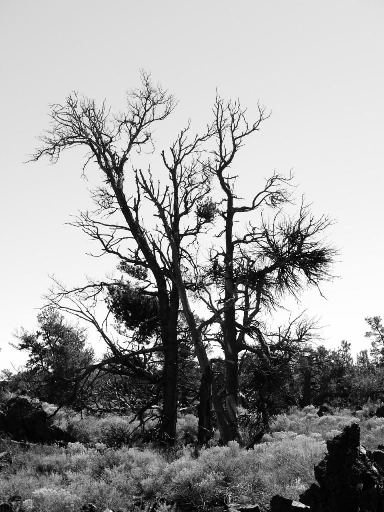
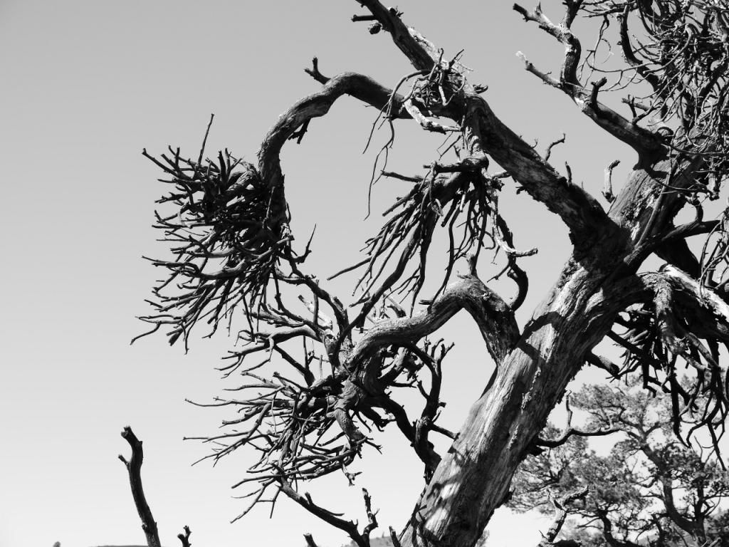
Witchbroom


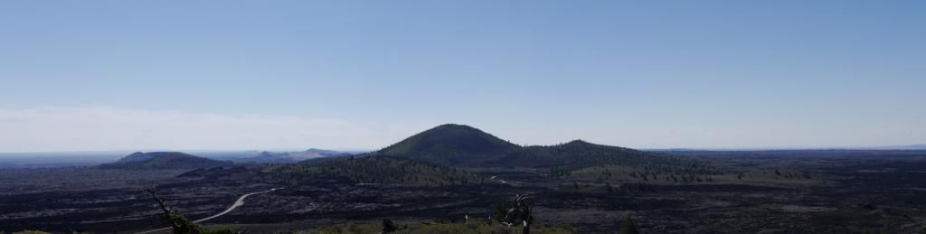
The 'Inferno Cone' overlook
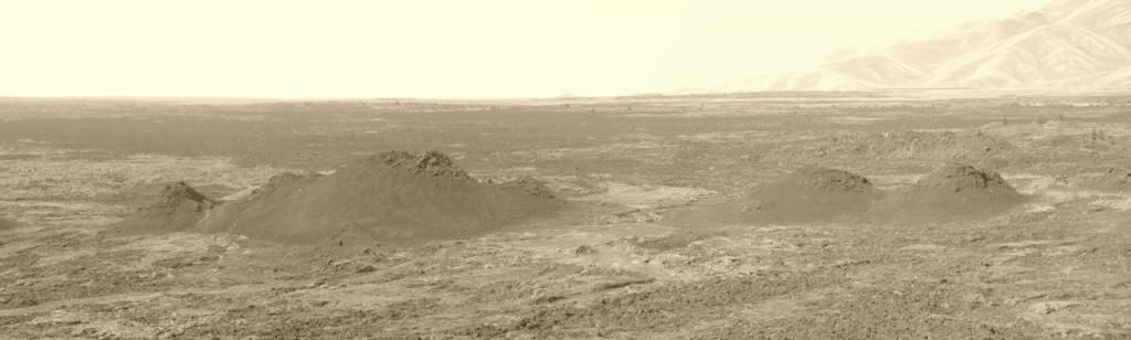
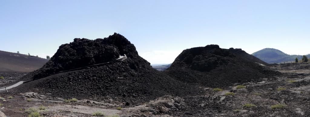


Spatter Cones


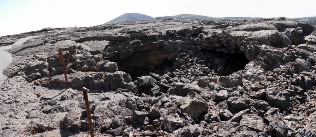
Buffalo Cave (basically all the caves in Craters of the Moon are old lava tubes from when the area was active)


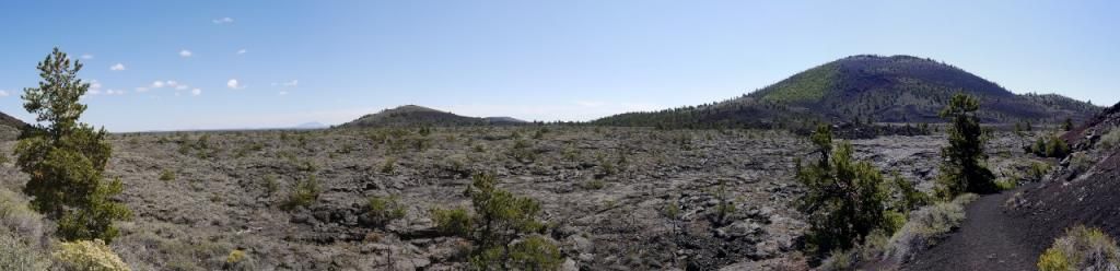
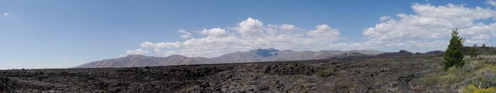
Wilderness Area Beyond (you can hike into this area via a special permit)


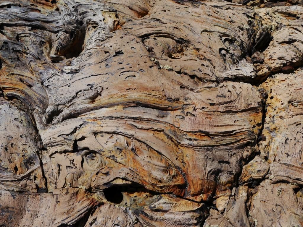
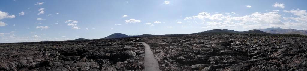
Random photos from along one of the trails


Along the 'Tree Molds' trail


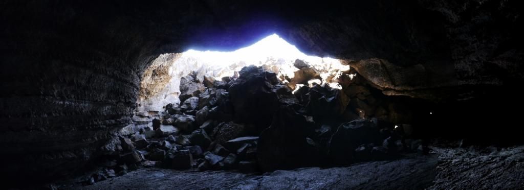
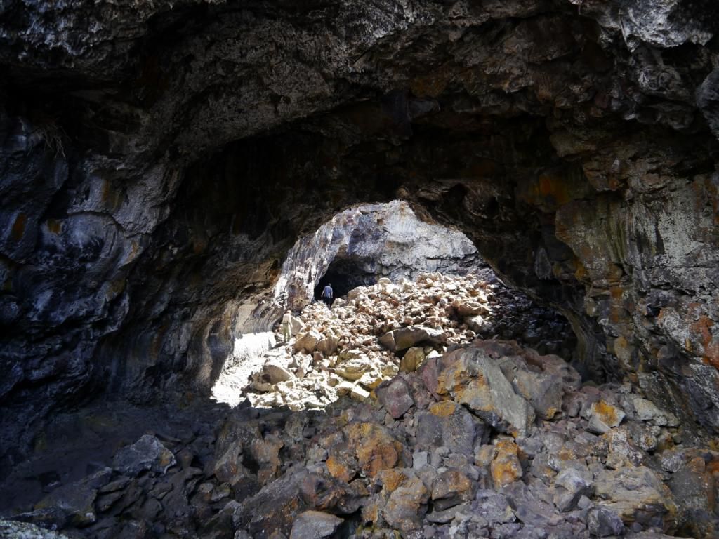
Photo's from the cave area of the park - you have to have a special permit obtain from the visitor center before you can go into the caves.

Dew Drop Cave


Indian Tunnel


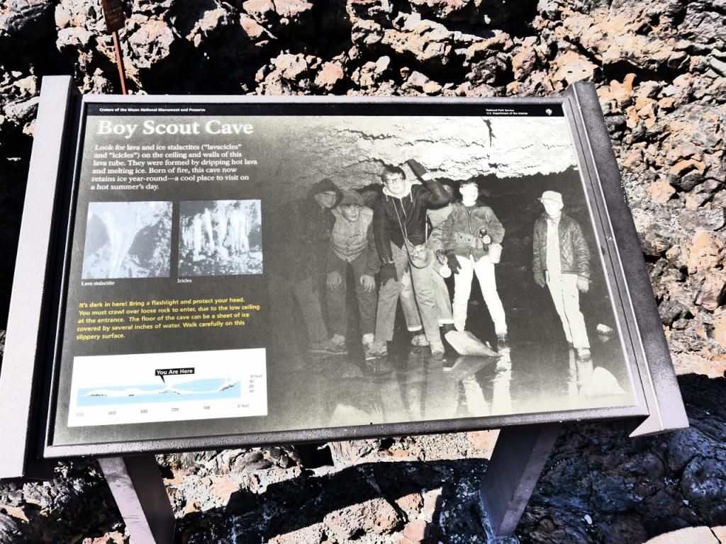
Boy Scout Cave - I did not venture in here since my flashlight was having issues.
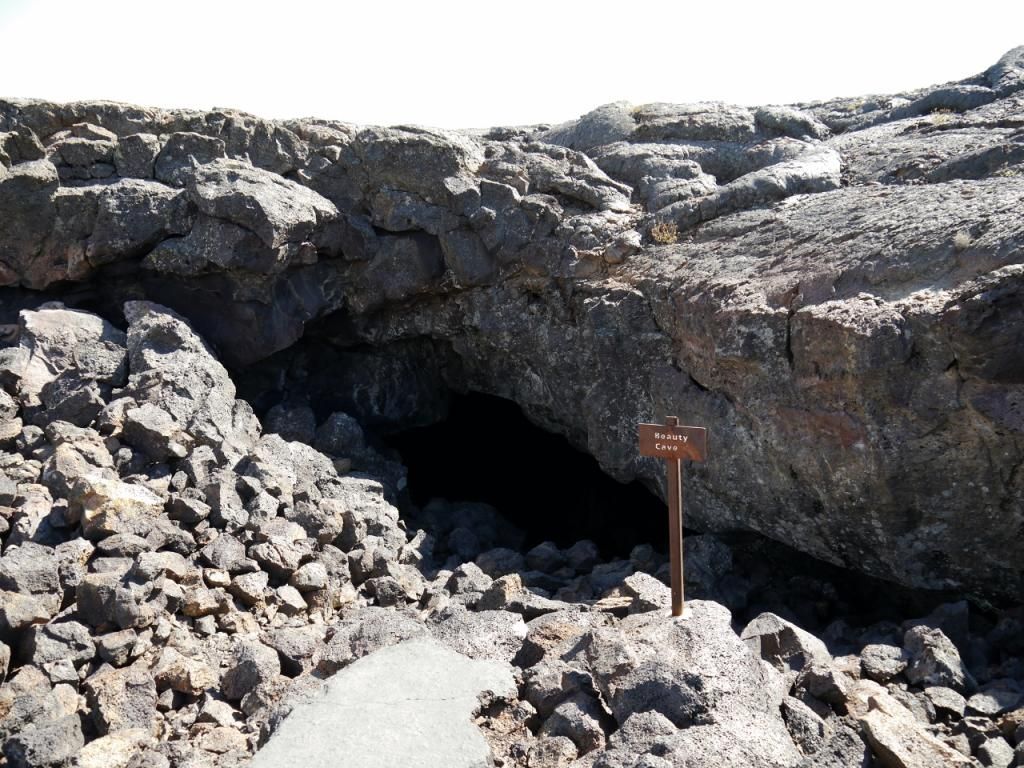

Beauty Cave


Along the trail back to my car.


Wednesday night I attended one of the ranger lead programs then headed back to camp to relax since I would be up early the next morning to start the next leg of my trip to Lion City, Montana.
 

ttora4runner

Expedition Leader
Thursday morning wake-up call would come about 500am as I would be making the longest leg of my trip from Craters of the Moon to the east-side of Glacier National Park to the KOA campground with a short stop along to visit a ghost town I’ve been meaning to get back to. So after a quick breakfast (oatmeal and hot chocolate on a cold morning) I took down my camp, loaded up and hit the road.

A little over 3 years ago I had took a trip up to Montana to visit Bannack State Park and a few other ghost town sites one of which was Lion City, Montana. Having done some research (see links below) on the area prior to going I figured it would be well worth the trip to visit. I had asked one of the rangers in Bannack if the road was open he they weren’t quite sure since no one had made a trip back there. So I decided to take a chance and see how far back I could get. Unfortunately, I had come a little too early in the season (May) and about 2 miles from the ghost town I was stop by snow. I hiked back as far as I could go without snowshoes but the snow got eventually too did and I had to turn back to try again. A few months later I moved to Colorado Springs to start a new assignment as a QC Manager so I would have to wait to try again.


Fortunately, my latest trip would fall latter in the season be it 3 years later and I would access back to the town. The first half to the road back could easily be traveled by car since it’s a gravel but one you reach the forest service that leads back to the town you’d need a high clearance vehicle – 4wd would only be needed if it was wet or snowy. Probable around half way back I would come across the only other person I would see on the trail traveling slowly on his ATV. I would eventually pass him on the trail only to meet up with him again at the town for a quick chat before he continued on his way (his first time being to the site without anyone riding with him).

After a brief chat it was time to explore.


Structure #1


Structure #2


Structure #3


The only post holding up the middle section of this structure.


Structure #4 - Mill Site


Looking on.
 

ttora4runner

Expedition Leader
Structure #5


Structure #6


Structure #7


Structure #8


By the time I finished visiting the structures I could see (more trails in the area to explore) it was nearing 11 am and I knew I had to hit road to make it to my camp for night before it got too dark. After a quick lunch I hit the trail again back to the main road to continue the drive north. While I was visiting Lion City there were a few clouds in the sky but the further north I got more clouds filled the sky and the wind had picked up. Somewhere outside of Choteau, Montana I noticed a dark, heavy clouds to the north of me a good sign of a storm raging.

As I continued to head north I was hoping that the storm wasn't over the place where I would be spending the next few nights camping but unfortunately it was.

By the time I reached Browning, Montana I knew I was in trouble the closer I came St. Mary, Montana and the KOA the clouds hung lower and a thick fog had appeared, by the time I reached the KOA it had started to sprinkle. After, checking in I quickly set-up camp and grabbed a quick bite to eat before the rain started. Not having much to do with the rain I headed to the shower facilities to clean then back to camp for bed. That night the storm would rage on for a good portion of the time raining, thundering and lighting.

All the while I wondered what would the next day hold for my trip.

Lion City, Montana links that I used for research.
http://www.ghosttowns.com/states/mt/lioncity.html
http://www.legendsofamerica.com/mt-hecla.html
http://www.treasurenet.com/forums/old-photos-montana/62249-lion-city-montana.html
http://www.glendalemontana.com/The early discovery of The Bryant Mining District.htm
 
Last edited:

ttora4runner

Expedition Leader
Still too come minor mechanical problems, 3 Days in Glacier National Park (Yogi Bear makes a brief appearance) and more ghost towns.
 

Foy

Explorer
Lion City!

ttora,

I might should be annoyed--after all, you've done gone and told the world about one of my favorite mountain ranges and favorite off-road drives in the world. But you photographed it superbly and the pics bring back fond memories of my first trip up there in the summer of 2000. Our sons were 12 and 16 and had only rarely before gone with their semi-crazy exploration geologist father on off-road traverses (both being stick-and-ball sports oriented, with most weekends dedicated to ball games). We were renting the Canyon Creek Cabin, a NF ranger station turned rental. It's just over the ridge behind Lion City. Your Structure 3 pic with your truck in the distance shows Sheriff Mountain directly over top of your truck, and Canyon Creek and the cabin are directly over the ridge behind it. From the "middle" of Lion City, we worked our way around to the left (south) on a series of two-tracks, around Keokirk Mtn, along a knife-edge separating the Trapper Creek basin from the Canyon Creek basin, across the top of the "wall" honeycombed with adits representing the Hecla Mines, to park at the base of Sheriff Mtn. It's about a 600' elevation gain scree slope scramble to the top, so we watched from the truck as the boys scrambled up. They got back down safely and we wrassled the truck back down safely, and we made it back to the cabin, all forever changed by the experience. Including the truck, a rental Durango out of the Missoula airport which we "drove like a rental" for 900 miles during our 2 weeks in Montana that summer. May she rest in peace.

I intend to try and see if that route is still passable in July/August 2015. Unless it's re-routed somewhat, I doubt my Superduty will climb it. It was pretty thoroughly rutted and very steep in places, and I'm not imagining 10,000 lbs of longbed truck is going to make it up there.

Next time you're out that way, hook a right at the Glendale smelter ruins and head up Canyon Creek. The road goes directly by some "beehive" charcoal kilns, the Canyon Creek cabin, to an road on the right named Vipond Park Rd. Climb out of Canyon Creek on the shelf road and enter as beautiful of an alpine park as there in the northern Rockies--Vipond Park. On the north side of VP, the road descends through extensive old mine workings and structures to MT 43 at Dewey. Turning left there will bring you to the village of Wise River and the Wise River Club, where a mondo cheeseburger and a cold beer await you.

But don't go telling everybody about Canyon Creek and Vipond Park, OK?

Great stuff. More, please.

Foy
 
Last edited:

ttora4runner

Expedition Leader
When I first visited Glacier NP back in 2013 I had read on a number of sites that it’s recommended to get to the trail-heads early in morning because the parking lots fill up quickly because of limited space so an early morning wake-up call was in order to the tune of 600 am. The storm from the night before stop in the wee-hours of the morning but there was still an over cast and fog loomed all around when I stepped out of my tent. I quickly checked the weather on my phone and it said partly cloudy for the days forecast. All I could think of when I saw that was ‘Ya, right’!


After grabbing a bite to eat I headed on out on the ‘Going to the Sun Road’ to drive to the top of Logan Pass and hike back to ‘Hidden Lake’ and ‘Highline Trail’. Starting out on the road the fog was still present and seemed thicker at times than in camp but the further/higher I went up the road the fog began break and I could see blue sky. Woot!


I pulled into the parking at the top of the pass around 730am to still find it fairly empty about ¼ of the way maybe and after finding a parking spot near the far/empty side of the lot I grab my gear and headed out on ‘Hidden Lake’ trail. The last time I visited this trail it was still covered in snow but since I came later in the year that snow had disappeared leaving a clear path back to the lake.


When I visited the lake back in 2013 with my brother the lower section of the trail had been closed off due to bear activity in area. Fortunately, this time around I was able to make the hike down to the lake to check it out. Unfortunately, none of those photo’s turned out expect for one photo of a flower, go figure. This little guy who walked in front of me for a good 200’ and could've cared less if I was there(I was probable a few feet from him at times).


The dork behind the camera.


This little guy who walked in front of me for a good 200’ and could've cared less if I was there(I was probable a few feet from him at times).


By the time I had made it back up to the overlook from the lower trail the crowds had started to build and I was thankful to have come early enough to avoid them and enjoy the views in relative peace (there were a few folks on the trail with me when I started). On the way back down and I’ll probable get flamed for this but I chewed out (2) different families (a younger family with kids and an older couple) for going off the trail to view something (not talking just stepping to side a little but actually going off the trail a good amount) when they have posted on the signs to stay on the trail. I know they didn’t have bad intentions but still.

As I mentioned earlier the parking lots fill up quickly with folks and when I got back to the parking lot to grab a bite to eat before heading off on the next trail such was the case. I was probable asked 3-4 times by people if I was leaving since they will drive around looking for an open space and asking folks if they are leaving. If you plan to come later in the morning it may just to best to grab one of the shuttle busses to avoid the chaos.

After lunch I set off a new to me trail ‘Highline Trail’. The trail is pretty narrow for a good part of the way as it follows along the mountain side and in most case is single file till you get further down the trail. The views along this trail were great none the less and the further you got the less people there were. I was amazed at the number of older folks hiking the trail (70’s)and it was good to see them still getting out to see the area. You’re never too old to get out.


Towards the end of the trail you can either hike to the ‘Granite Park’ chalet and then hike back or continue to Swiftcurrent Pass or take a side detour up to the ‘Grinnel Glacier’ overlook. I opted for the overlook since I would hiking Swiftcurrent Pass later in the week. The hike up to the overlook is just up a steep incline and after hiking Highland Trail you wish you’d wouldn’t have but again the views make it worth.

Granite Park Chalet


Grinnell Glacier Overlook


While tooling around up here trying to get a good photo I about lost my hat as it blew off due to the wind (a few folks up there chuckled a little when it happened) and I had to go down a little slope to retrieve it. So after getting my hat and relaxing a little I headed on back to my car and then back on to camp.

When I arrived back at camp I noticed something wet on my drivers skid plate, I had thought it was just water since I drove through a puddle left behind after a recent storm but it wasn’t. It had an oily feel and appearance to it and appeared to be coming from my steering rack. The other thing I had noticed is that my passenger shock decided to separate slightly from the top mounting plate which would explain the weird feeling my 4runner had while at Lion City the day before.
I just decided for the remainder of the trip I would keep a close eye on these two issues and would adjust my plans as if the issue got worse.

After the events of the day I was spent and grab some dinner while sitting around the camp fire followed by a nice hot shower (one benefit of staying at the KOA). Needless, to say I had no problems falling asleep this night.
 

ttora4runner

Expedition Leader
Saturday morning was a slightly later wake up time of 600 am since I was beat from the previous day hike. I had planned to just hike one trail this day then head over to the west side of the park to check out the visitor center there. Most of the trail planning I did was done at night before while sitting around the fire (I had some ideas before I came on the trip). I had figured since I visited the Grinnell Glacier Overlook the day before I would make the hike up the trail itself to check it out.

After finding a good spot near the trail head I was off.


You have to pass this little waterfall right along side the trail and it was quite amusing watching people trying not to get wet as they came up the trial.


As I neared the top I ran into really the first (2) people I really saw on the hike up (the family at the very beginning doesn't really count) observing, two big horn sheep staring each other down.After watching to see if there would be any action between the two I finished hiking up to the Glacier.


The dry overflow, would be nice to see this flowing.


After spending sometime up at the top and grabbing a snack I headed back down the trail. The (2) big horn sheep from earlier were still there and had butted heads a few times much to the amusement of a group of people who had gathered to watch these two. I had to squeeze past the group to continue on down the trail. If I had to guess I probable past around 60-70 people on the way back at various stages along the trail and every time a group past I was thankfully for coming early. During the last mile or so of the trail it had cooled off some and had started to rain and would continue to do so off and on though out the day.

Once returning to my car I grab a quick bite to eat then headed off to the west side of the park to check out the new visitor center. Let me tell you it was a disappointment as it's mainly a restroom facility and shuttle stop the few displays they inside and outside are disappointing to say the least. You're better off checking out the little shops around the area and viewing Lake McDonald.

After getting my fill it was back to camp for another night of R and R.
 
Last edited:

ttora4runner

Expedition Leader
Sunday would be my last day in the park and since I had been hiking the trails in the center section of the park I figured that I’d stay that course and hike Swiftcurrent Pass which would be the coldest hike of the three days that I was there. Plus, I had to do laundry (ya,ya so what I know it’s not very Expo like) so I kept the day short.

Again, it was an early morning to get to the parking lot to hit the trail.


This moose didn't really want to show it's face. It did later in day however as it was still the same area when I came back down (a large group of people were taking photo's of it).


Yes, another bighorn sheep.


Up at the pass. The trail splits off and you can continue down to Granite Park Chalet or hike another mile or so uphill to the overlook. I passed on the overlook. I ran into (2) different couples that warned me that they had seen a bear in the area and to keep an eye for it. Thankfully, I didn't run in 'Yogi' while up at the pass, I did warn hikers whenever I passed them to watch out for it.


Granite Park Chalet.


On the way back down the trail I ran back into the same (2) couples as they had stop due to a bear on the switchbacks further on down the trail. After we observed the bear for awhile and where watching the family just ahead of the bear we all continued on down the trail (I took the lead since they were a little scared) all the while keeping an eye on 'Yogi'. When we neared where the bear was at about 200 ft off the trail I ran into another group of hikers and warned them of the bear in which they turned around and headed back. Again, as I past hikers I warned them of the bear in the area near the switchback and eventually I would run into (2) rangers who were headed into the area to check it out.


Once back at the parking lot I got a bit to eat then back to camp for the remainder of the day.
 

Cascade Wanderer

Adventurer
Agree. Great photos. Thanks! Been there, but took few photos and they don't compare with yours!

Bears... I kind of like bears, but yeah, gotta be careful.

Regards, Guy
 

ttora4runner

Expedition Leader
Monday morning came all too soon as I wanted to get out of the park before traffic built up on the ‘Going to the Sun’ road so a 500 am wakeup call was in order to break camp and head out. As was the case with most mornings I was greeted with fog however this particular morning the fog just seemed a little denser. I was hoping the trip up over the pass would see the fog dissipate but such was not the case it got even denser till I was a little ways down the other. If you haven’t driver western half of the road it’s a narrow road with lots of curves and the cliff face would be there to greet you if you got to close. Normally, I don’t find driving this road terribly bad but with the fog it raised the pucker factor a little. Thankfully, the lower I got the fog lifted and I was greeted by overcast.

My plan for the day was too traverse Hwy 93 along Flathead Lake down to Interstate 90 then hwy 200 to hit up a couple of ghost towns I had researched before coming on the trip ‘Garnet’ and ‘Granite’ since I hadn’t seen too many trip photo’s of the areas so why not check them out. If you plan to drive Hwy 93 don’t bother with setting cruise control as you pass through numerous small towns that cause you to slow down.

A little ways down Hwy 200 you come to turn off for Garnet, Montana (marked by a brown BLM sign) the first couple of miles are a paved road that eventually turns into graded dirt road which could be easily traversed by a car in good weather (rain and snow I don’t think so). After a couple of miles you come to a fork in the road and taking the right side fork takes you to the parking area for Garnet, Montana. When I arrived there were only a few cars in the parking lot but by the time I left the lot was ¾ of the way full. Glad I came early.

Fire Warden’s Cabin


Made a quick stop at one of the viewpoints.


Garnet, Montana


Forum statistics

Threads
189,826
Messages
2,921,330
Members
232,931
Latest member
Northandfree
Top