Silver dude
Xplorer
June 17th 2013
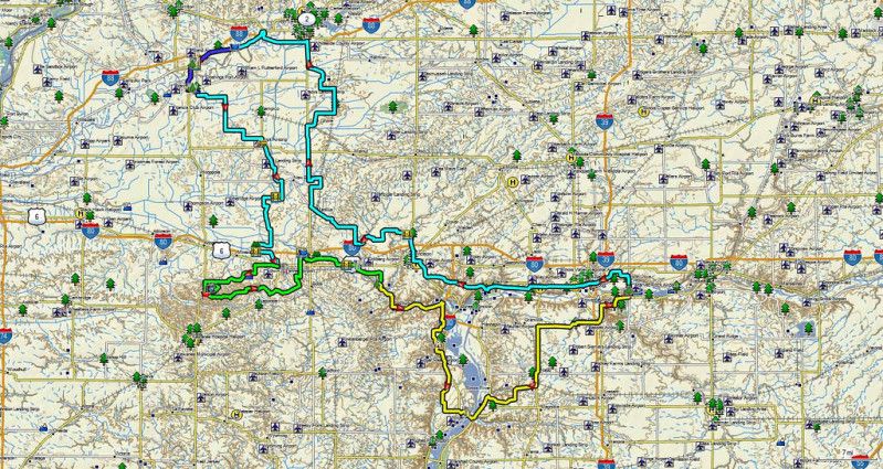
Sterling, IL and around see map below.
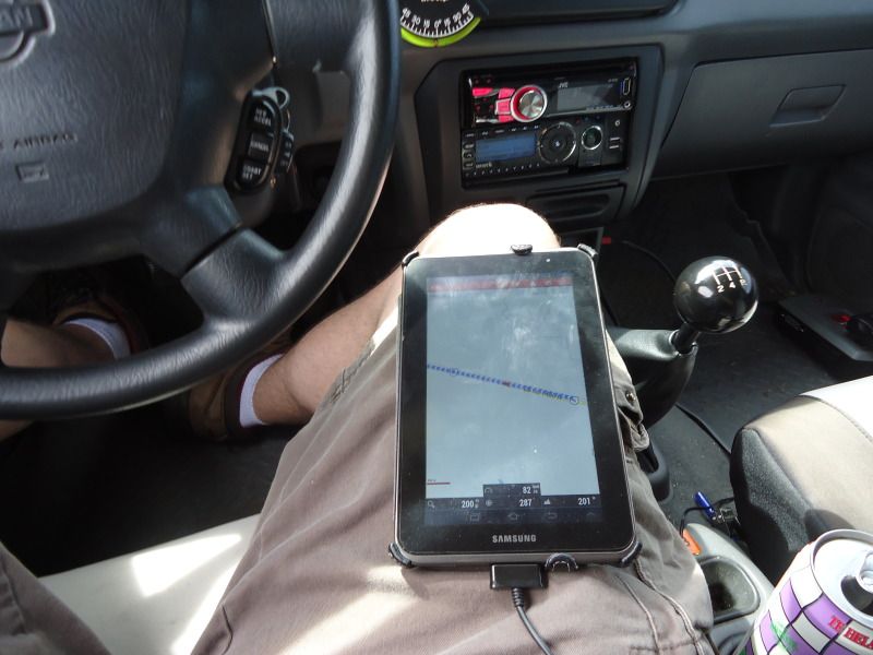
Peering from the windows of my work place at the nice weather. I had kept promising myself that I'll get away soon. With the girl beating the books studying for a nursing degree I decided it was time to try a solo adventure again. Finally, my Monday off work rolled around. The goal of the day. Relaxing drive, I said to myself windows down the whole way to get consumed in the experience. Tell no one, just wake up, toss a few cold teas in the cup holders, turn the key in the ignition and go. I also wanted to try using my new adventure toy a Samsung Galaxy tab 2 for GPS navigation and route following.
But, where? Well with one day I couldn't go far. I thought about southern Wisconsin. Perhaps scout some areas off of the Kettle moraine forest. But, I've covered so much of that the past few years. While looking online I found GPS tracks via advrider.com (A Adventure Motorcycle enthusiast site). They had listed tracks for a start point in Illinois only a hours drive away. Perfect! But, wait I hate Illinois! The state parks are awful. Take the gem known as Starved rock. Over regulated over controlled. They take the nature out of the natural environment. With hikes that consist of wood deck paths with railings on both sides fencing you in. It made me feel as though the trees were similar to zoo animals at a zoo. As if they put nature on display in a unnatural way. I might be in a forest but I don't have the natural experience of a forest. No alcohol in any park or even at camp in front of the campfire? Lame! Sacrifices to deal with over population and moron city dwellers. So I've never looked at Illinois as a option in my travels. Parks are either a lame mowed grass fields or are a over protected over crowded nightmares. Its also beyond boring to drive thru Illinois farmland. Flat as a ironing board with nothing to gaze at. But, I thought well lets just try this GPS track perhaps my opinion on Illinois will change.
Here is the route I found. Hennepin canal, with a ton of bridge crossings.
I ordered a dash mount and charge cable for the tablet of course neither came in time. Tossed the tablet on my leg used my power inverter and we're down the road.
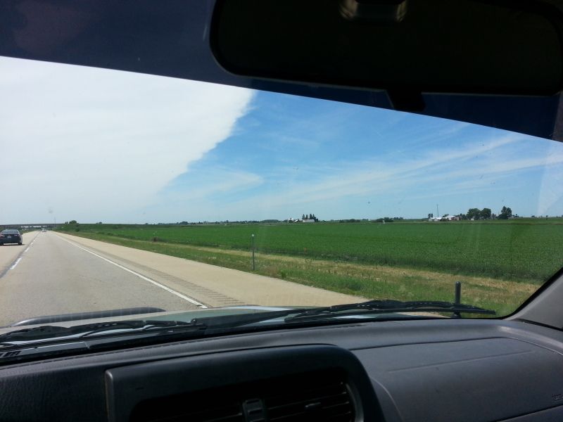
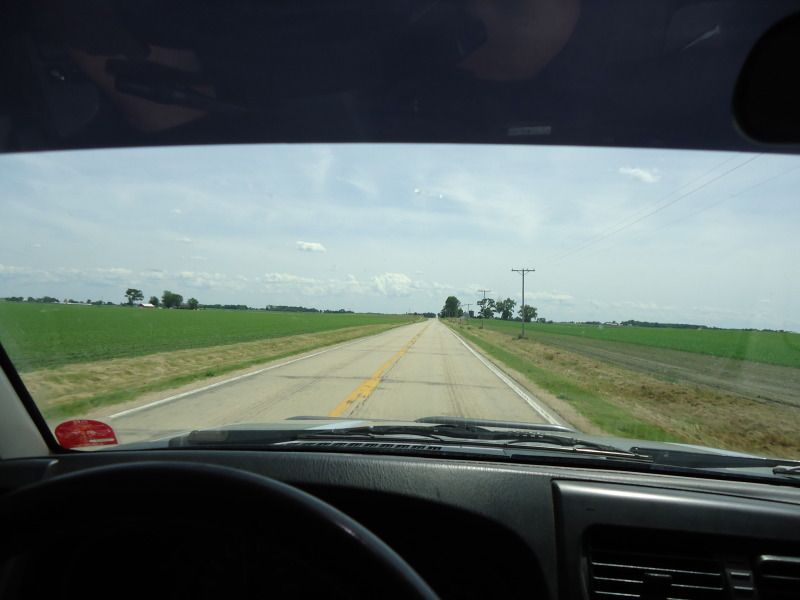
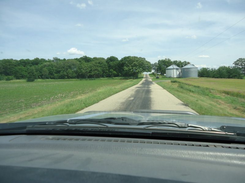
I took the slab to Sterling, IL look at that wonderful Illinois scenery! ha
The route started in Lyndon, IL then snaked thru downtown Prophetstown, IL
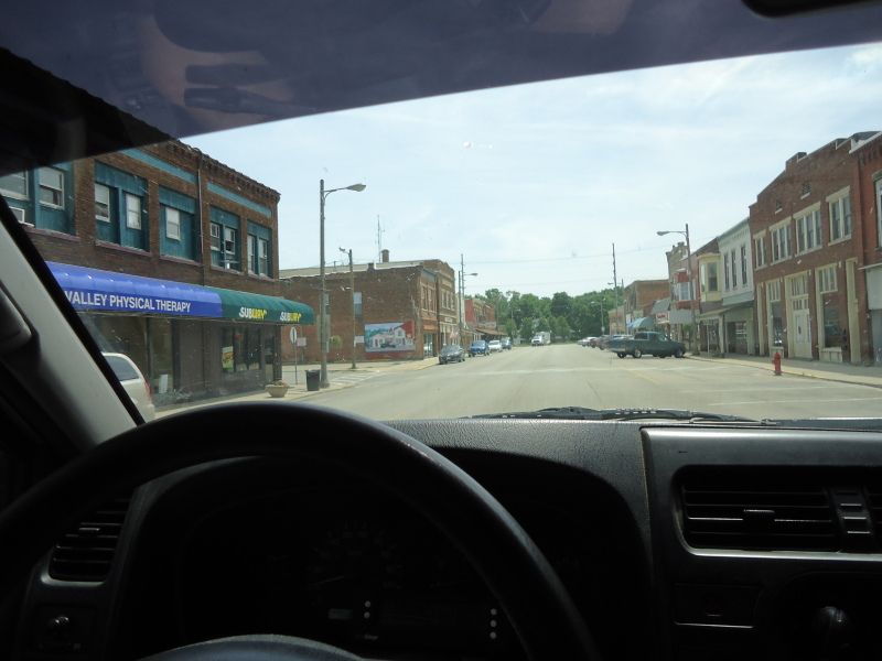
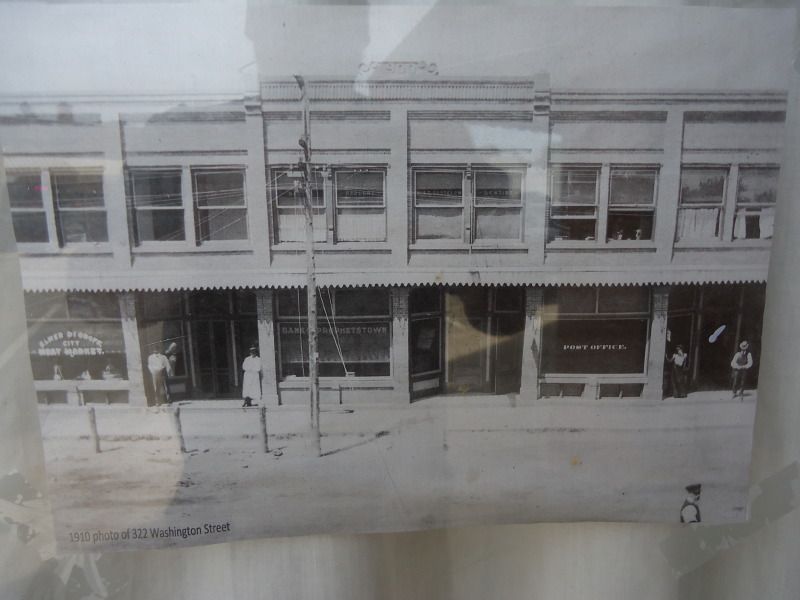
Historic old town, I had to get out to walk the streets a bit to feel invested in the streets. To perhaps feel the history as well as see it. I found this old photo in a store front window of how the town looked in 1910.
Soon I was back on the track. The rural roads were weird very narrow lanes without a shoulder.
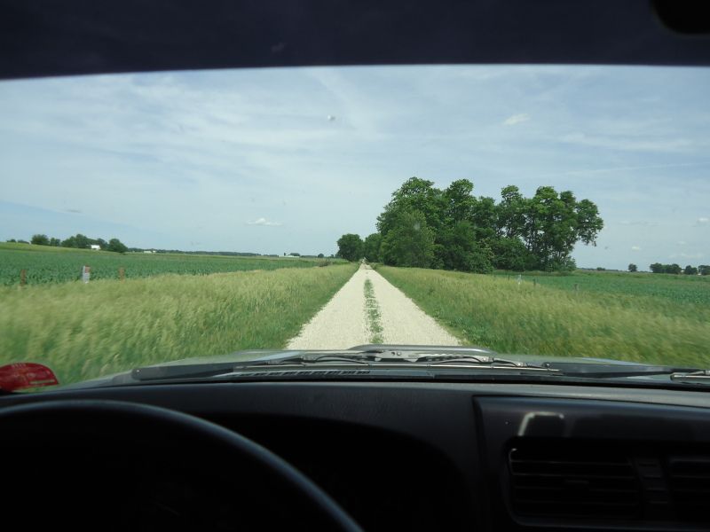
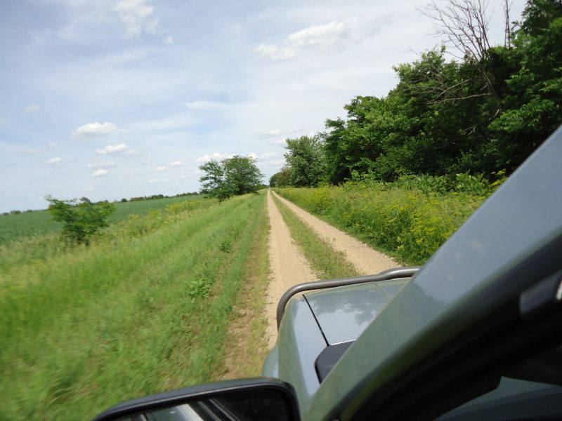
Then I turned off the pavement to a gravel road. Single lane gravel! Made me think of some of the roads I rode in the UP. Clearly the day might not be as bad as I thought it would be.
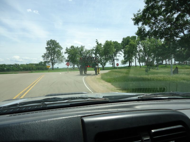
After a few miles of single track gravel I reconnected to the highway and caught up to one of the sprayer tractors. These were everywhere I saw at least 5 in the fields at this point.
Rural pavement again no stripes super narrow. If you meet another car both of you hang a tire in the grass. Fortunately its a rare occurrence.
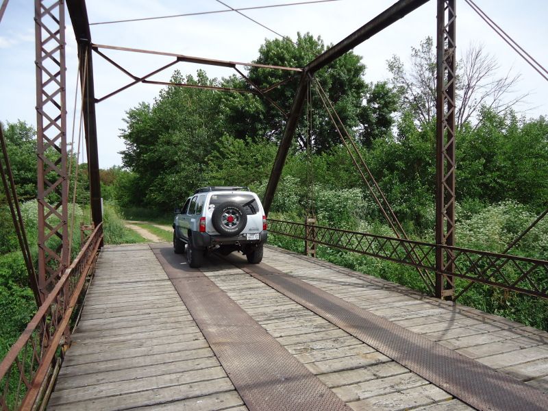
I again found myself on Single lane gravel. Clearly this road almost is never traveled. To a 1900's bridge? um awesome!
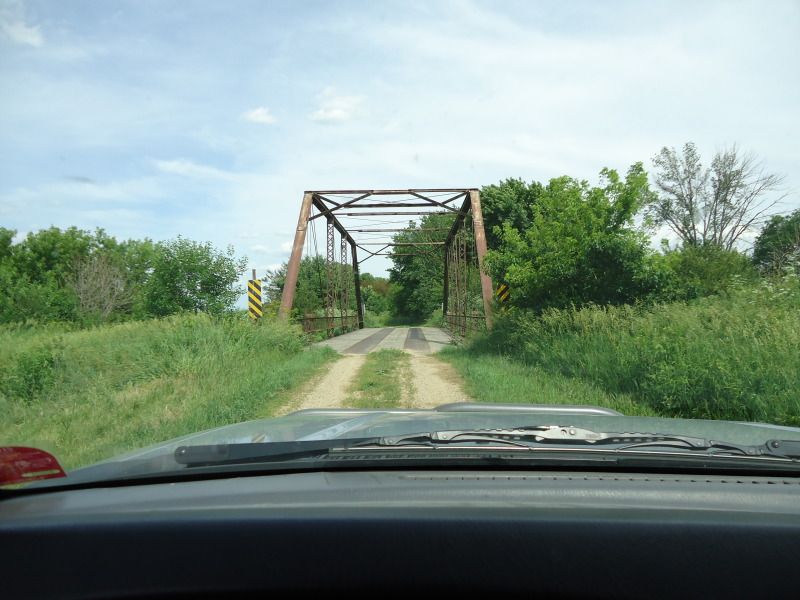
Built 1920, Pratt through truss design, Total length: 87.6 ft, Deck width: 17.7 ft.
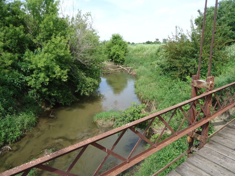
Over Coal creek.
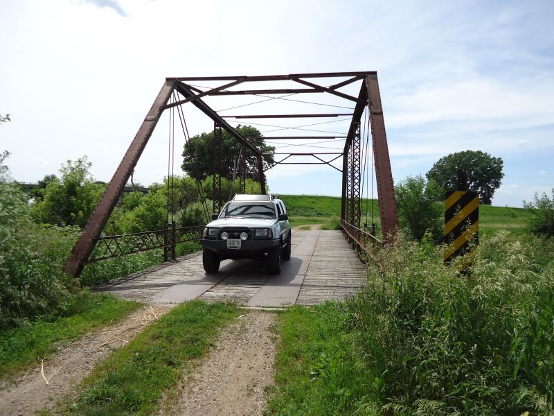
The bridge is currently listed as, Structurally deficient as well as a condition rating listed as: Serious (3 out of 9). I'm glad I was able to cross this bridge in the Xterra. It probably won't be around much longer for people to explore. Most if not all of the Pratt through truss design bridges are gone or demoted to pedestrian use. I can so vividly imagine a rattling Model T coming across the bridge back when it was first erected. Was cool to not only stand on but drive on a 93 year old piece of American history.
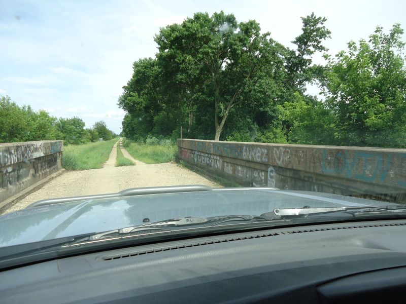
After leaving the bridge I put my truck to use. Pacing along the two track.
It wasn't long and I arrived at another bridge this time concrete and therefore not as impressive. It seemed in a rather bad state of repair. I think it shuttered slightly when my front tires rolled up. For 88 year old concrete (1925) it showed . The state rated it 4 out of 9 as far as condition. Yet another bridge that will one day disappear.
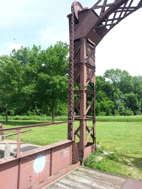
After leaving the bridges behind enjoying the history and the thrill of the drive to such remote locations. I reconnected with more narrow pavement. I then heard "camp with water" announced over the GPS. I thought I'm not gong to go camping but maybe I'll check it out to take a break get some water. As I pull in I see a lift bridge.
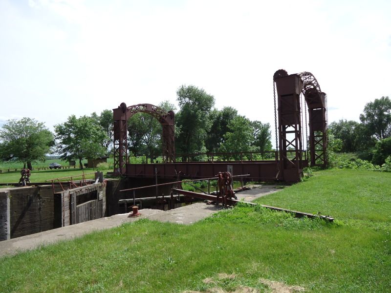
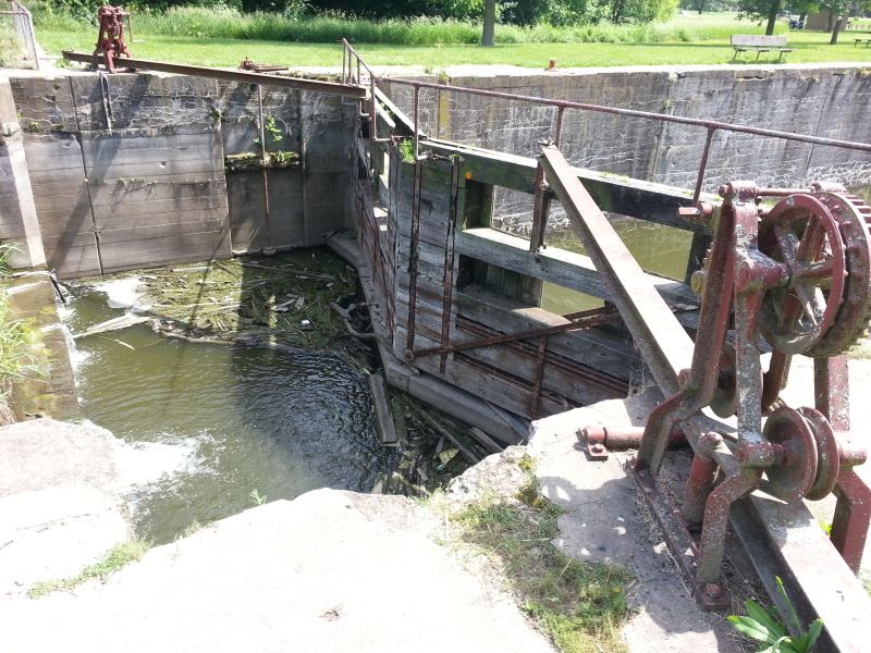
This is odd I thought. What is a lift bridge doing in the middle of nowhere Illinois over a creek?
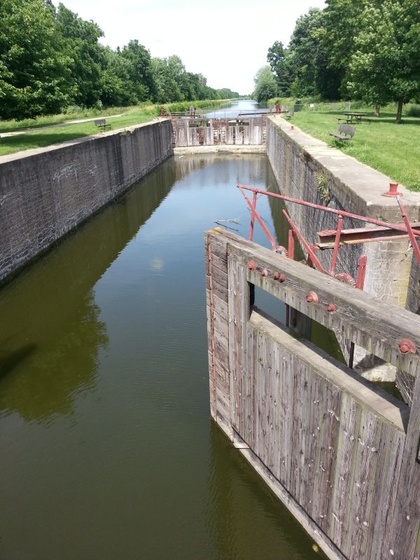
When I saw these doors I figured it out. Its a canal for shipping cargo.
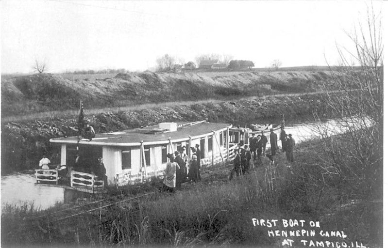
Its the Hennepin canal! The Hennepin Canal was built in order to lower freight prices. Construction began in 1892 and the first boat went through in 1907, reducing the distance from Chicago to Rock Island by 419 miles (674 km). While the canal was under construction, however, the Corps of Engineers undertook a widening of the locks on both the Illinois and Mississippi Rivers. The new locks on those rivers were twenty and forty feet wider than the canal locks, making them obsolete before their initial use. The reason it was obsolete was because with wider locks on the river larger cargo ships could be used. The canal was too small and only fit for the early days of canaling.. The Hennepin was the first American canal built of concrete without stone cut facings. Although the Hennepin enjoyed only limited success as a waterway, engineering innovations used in its construction were a bonus to the construction industry. The canal was used as a training ground for engineers that later worked on the Panama Canal.
The first steamer to use the canal was the SS Marion, carrying government officials. This was the first boat to travel the entire length of the canal. The boat left on November 8 and returned on the November 15th. The canal was not completely filled, so each section's water had to be moved with the locks for the boat to pass. The boat had to be equipped with iron guards to break the formed ice. When it reached Lock 28, it had to push the lock open. When the boat reached the last five miles (8 km) of her journey, there was still a problem with the amount of water. There was too much water, and it could not pass under the Rock Island Bridge. As a result, the first people the sailors found were asked to come aboard to make the ship sink slightly.
Strange what you can find on a drive. A true marvel of modern engineering. There are 33 locks much like this one along the canal system. I thought the lift bridge was rather clever with its weight system to assist its lift. Strange when you thing 1892.
Sterling, IL and around see map below.
Peering from the windows of my work place at the nice weather. I had kept promising myself that I'll get away soon. With the girl beating the books studying for a nursing degree I decided it was time to try a solo adventure again. Finally, my Monday off work rolled around. The goal of the day. Relaxing drive, I said to myself windows down the whole way to get consumed in the experience. Tell no one, just wake up, toss a few cold teas in the cup holders, turn the key in the ignition and go. I also wanted to try using my new adventure toy a Samsung Galaxy tab 2 for GPS navigation and route following.
But, where? Well with one day I couldn't go far. I thought about southern Wisconsin. Perhaps scout some areas off of the Kettle moraine forest. But, I've covered so much of that the past few years. While looking online I found GPS tracks via advrider.com (A Adventure Motorcycle enthusiast site). They had listed tracks for a start point in Illinois only a hours drive away. Perfect! But, wait I hate Illinois! The state parks are awful. Take the gem known as Starved rock. Over regulated over controlled. They take the nature out of the natural environment. With hikes that consist of wood deck paths with railings on both sides fencing you in. It made me feel as though the trees were similar to zoo animals at a zoo. As if they put nature on display in a unnatural way. I might be in a forest but I don't have the natural experience of a forest. No alcohol in any park or even at camp in front of the campfire? Lame! Sacrifices to deal with over population and moron city dwellers. So I've never looked at Illinois as a option in my travels. Parks are either a lame mowed grass fields or are a over protected over crowded nightmares. Its also beyond boring to drive thru Illinois farmland. Flat as a ironing board with nothing to gaze at. But, I thought well lets just try this GPS track perhaps my opinion on Illinois will change.
Here is the route I found. Hennepin canal, with a ton of bridge crossings.

I ordered a dash mount and charge cable for the tablet of course neither came in time. Tossed the tablet on my leg used my power inverter and we're down the road.

I took the slab to Sterling, IL look at that wonderful Illinois scenery! ha

The route started in Lyndon, IL then snaked thru downtown Prophetstown, IL

Historic old town, I had to get out to walk the streets a bit to feel invested in the streets. To perhaps feel the history as well as see it. I found this old photo in a store front window of how the town looked in 1910.

Soon I was back on the track. The rural roads were weird very narrow lanes without a shoulder.

Then I turned off the pavement to a gravel road. Single lane gravel! Made me think of some of the roads I rode in the UP. Clearly the day might not be as bad as I thought it would be.

After a few miles of single track gravel I reconnected to the highway and caught up to one of the sprayer tractors. These were everywhere I saw at least 5 in the fields at this point.

Rural pavement again no stripes super narrow. If you meet another car both of you hang a tire in the grass. Fortunately its a rare occurrence.

I again found myself on Single lane gravel. Clearly this road almost is never traveled. To a 1900's bridge? um awesome!

Built 1920, Pratt through truss design, Total length: 87.6 ft, Deck width: 17.7 ft.

Over Coal creek.

The bridge is currently listed as, Structurally deficient as well as a condition rating listed as: Serious (3 out of 9). I'm glad I was able to cross this bridge in the Xterra. It probably won't be around much longer for people to explore. Most if not all of the Pratt through truss design bridges are gone or demoted to pedestrian use. I can so vividly imagine a rattling Model T coming across the bridge back when it was first erected. Was cool to not only stand on but drive on a 93 year old piece of American history.

After leaving the bridge I put my truck to use. Pacing along the two track.

It wasn't long and I arrived at another bridge this time concrete and therefore not as impressive. It seemed in a rather bad state of repair. I think it shuttered slightly when my front tires rolled up. For 88 year old concrete (1925) it showed . The state rated it 4 out of 9 as far as condition. Yet another bridge that will one day disappear.

After leaving the bridges behind enjoying the history and the thrill of the drive to such remote locations. I reconnected with more narrow pavement. I then heard "camp with water" announced over the GPS. I thought I'm not gong to go camping but maybe I'll check it out to take a break get some water. As I pull in I see a lift bridge.

This is odd I thought. What is a lift bridge doing in the middle of nowhere Illinois over a creek?

When I saw these doors I figured it out. Its a canal for shipping cargo.

Its the Hennepin canal! The Hennepin Canal was built in order to lower freight prices. Construction began in 1892 and the first boat went through in 1907, reducing the distance from Chicago to Rock Island by 419 miles (674 km). While the canal was under construction, however, the Corps of Engineers undertook a widening of the locks on both the Illinois and Mississippi Rivers. The new locks on those rivers were twenty and forty feet wider than the canal locks, making them obsolete before their initial use. The reason it was obsolete was because with wider locks on the river larger cargo ships could be used. The canal was too small and only fit for the early days of canaling.. The Hennepin was the first American canal built of concrete without stone cut facings. Although the Hennepin enjoyed only limited success as a waterway, engineering innovations used in its construction were a bonus to the construction industry. The canal was used as a training ground for engineers that later worked on the Panama Canal.
The first steamer to use the canal was the SS Marion, carrying government officials. This was the first boat to travel the entire length of the canal. The boat left on November 8 and returned on the November 15th. The canal was not completely filled, so each section's water had to be moved with the locks for the boat to pass. The boat had to be equipped with iron guards to break the formed ice. When it reached Lock 28, it had to push the lock open. When the boat reached the last five miles (8 km) of her journey, there was still a problem with the amount of water. There was too much water, and it could not pass under the Rock Island Bridge. As a result, the first people the sailors found were asked to come aboard to make the ship sink slightly.

Strange what you can find on a drive. A true marvel of modern engineering. There are 33 locks much like this one along the canal system. I thought the lift bridge was rather clever with its weight system to assist its lift. Strange when you thing 1892.


