David*BJ70
Looking forward to reach the end of the world
Hi group! I am a francophone from Montreal who already has several thousand kilometers of overland to my credit! I have been a member of the forum for several years too (since 2013 !). I speak English very well, but I rarely write long text, especially at a technical level where I let people write in a more comfortable way.
Last year, I wrote a text in the Toyota Trail Magazine (Toyota Landcruiser Association) about my trip to James Bay which took place in August 2017 - https://tlca.org/toyotatrails/2018/...QCfC-tF4_Ijh-0brw1fJKwoTyw7S5Takt8fFU#page/20.
I decided to share it here with you to contribute to this forum.
It's more of a story than a technical travel report. I know that trip has already been shared by many members ... but, still here's mine ! I hope you enjoy :
----------------------------------------------------------------------------------------
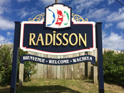
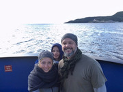
There are few places so remote that strike the imagination when you try to figure yourself over there. Such remote places exist in the province of Québec, Canada. A place, a road where, at its end, there is nothing except the infinity of the taiga. This is where our family achieved when we hit the road for an overland trip in August 2017. The James Bay Road up to Radisson, then Longue-Pointe, on the shore of the James Bay.
Radisson is located, geographically, halfway between the southern and northern most points in the province of Québec and is the only non-native towns north of the 53rd parallel in this province that can be reached by road.
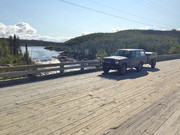
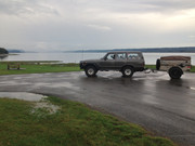
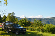
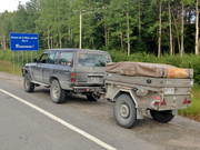
This is where me and my family decided to go, on board of our dashing 60 serie Landcruiser named Amiral (meaning Admiral in English). Very well equipped and powered by a powerful 12HT engine, the Amiral has all the ability to tow our M101 CDN trailer with its very cozy Eezi Awn RTT surmount on it.
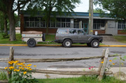
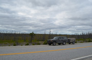
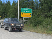
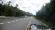
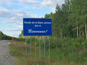
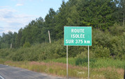
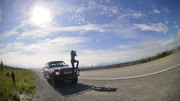
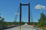
As surprising as it may seem, it took a full day to reach our «kind-of» departure point. «Kilometer 0» of the James Bay Road, at Matagami. From there, the James Bay Road runs north to Radisson, 620 km (388 miles) away. It is a very remote wilderness flat paved route winding its way through the Canadian Shield. There are no towns along this road, and only one place to fuel-up in between at kilometer 381. This 381 km (236 mile) stretch without services is the 2nd longest service-free stretch of road in Canada and it is the 3rd longest service-free stretch in North America. The longest is the road 510 between and Port Hope Simpson (410km (254 miles) and the second is the Dalton Hwy in Alaska, with is a 394 km (244 miles) stretch without services. It is useless to point out that everyone who hit this road needs to ride a vehicle in sound condition and be well aware of their mechanical skills to support any unexpected problem. Let me specify despite all the travel distance in all our northern part of our trip, the number of vehicles encountered was amazingly low.
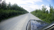
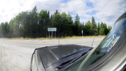
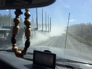
This road was built in the 1970s for a massive hydro-electric project for Hydro-Québec James Bay Project. It was built to accommodate vehicles with up to 500 tons of equipment which makes this road the toughest in the province of Québec! Despite its toughness, the age and the extreme climate of the location, it has started to show its age and several cracks and bumps have appeared along the road. The speed limit is 100km/h (60m/h) and we rapidly realized that our vehicle could not handle this speed among the bumps. I swear, once, I felt as if all my tires almost left the ground! So we slowed down, besides, we had all these stunning landscapes to enjoy.
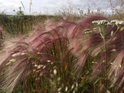
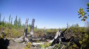
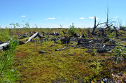
The sunlight showed us all the richness of this country. In 2013 the biggest forest fire in the history of the province of Québec consumed an immeasurable part of this fragile flora. From kilometer to kilometer, we were able to see the nature grow back between the burned trees. Out of sight, purple fireweed and burnt tree trunks surround the road.
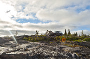
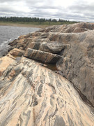
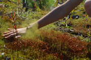
Driving up north, the James Bay Road runs through taiga, bogs, exposed rocks and where the fire did not ruin it all, spruces and jack pines. For most of the non initiated people, this place can be monotone, but for us, this place showed us the immensity of our country and gave us all the time to appreciate this unique landscape where it is impossible to conceive had we not been there. Books, pictures, videos and even my yarns cannot reveal the size and beauty of the territory we were traveling.

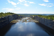
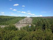
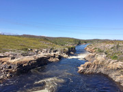
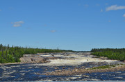
Numerous rivers were crossed but not all of them deserved to be appreciated as the impressive Rupert River. The Rupert River, which we crossed a second time later in our trip several hundred kilometers east, upstream, is one of the largest rivers in the province of Québec. Despite the fact it was diverted in 2009 to feed a hydroelectric power plant, the 50% remaining water flow was so impressive that it’s almost impossible to imagine how mighty this river could have been in the past. The Rupert is not the only great northern river that has been diverted. The Eastman river, which we also crossed which received the flow of the Rupert downstream was also diverted to feed the La Grande Rivière, where the sixth biggest hydroelectric plants of the world were built, 270km (168mi) straight north of the Rupert. The Robert-Bourassa generating station, one of our destinations.
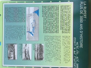
As it has been said, expect the fifteen touristic interpretation boards, boat launching ramp and other very few native people shacks along the road, there is nothing to accommodate the tourists or visitors. And this is exactly what we, overlanders, are looking for!

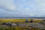
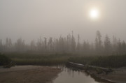
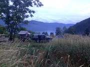
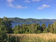
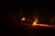
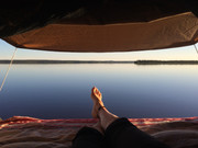
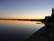
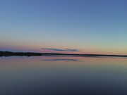
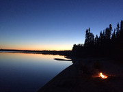
This led us to seek a camping spot by leaving the road and drive a short distance on a very rustic trail where trees were growing along it to a very pleasant lake where no wind came to bother its surface which made it like a vast mirror.
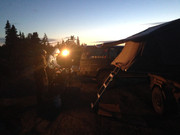
We set our camp on its narrow beach beside a Grey Jay nest which showed to be very interested in us since they perched themselves on our open doors when we were preparing dinner. One also rested on my finger that I presented as a roost! This lake was shallow and, for this reason, offered a relatively comfortable water temperature and we enjoyed swimming in it. This is something that we never really expected enjoying at this latitude.

Last year, I wrote a text in the Toyota Trail Magazine (Toyota Landcruiser Association) about my trip to James Bay which took place in August 2017 - https://tlca.org/toyotatrails/2018/...QCfC-tF4_Ijh-0brw1fJKwoTyw7S5Takt8fFU#page/20.
I decided to share it here with you to contribute to this forum.
It's more of a story than a technical travel report. I know that trip has already been shared by many members ... but, still here's mine ! I hope you enjoy :
----------------------------------------------------------------------------------------
There are few places so remote that strike the imagination when you try to figure yourself over there. Such remote places exist in the province of Québec, Canada. A place, a road where, at its end, there is nothing except the infinity of the taiga. This is where our family achieved when we hit the road for an overland trip in August 2017. The James Bay Road up to Radisson, then Longue-Pointe, on the shore of the James Bay.
Radisson is located, geographically, halfway between the southern and northern most points in the province of Québec and is the only non-native towns north of the 53rd parallel in this province that can be reached by road.
This is where me and my family decided to go, on board of our dashing 60 serie Landcruiser named Amiral (meaning Admiral in English). Very well equipped and powered by a powerful 12HT engine, the Amiral has all the ability to tow our M101 CDN trailer with its very cozy Eezi Awn RTT surmount on it.

As surprising as it may seem, it took a full day to reach our «kind-of» departure point. «Kilometer 0» of the James Bay Road, at Matagami. From there, the James Bay Road runs north to Radisson, 620 km (388 miles) away. It is a very remote wilderness flat paved route winding its way through the Canadian Shield. There are no towns along this road, and only one place to fuel-up in between at kilometer 381. This 381 km (236 mile) stretch without services is the 2nd longest service-free stretch of road in Canada and it is the 3rd longest service-free stretch in North America. The longest is the road 510 between and Port Hope Simpson (410km (254 miles) and the second is the Dalton Hwy in Alaska, with is a 394 km (244 miles) stretch without services. It is useless to point out that everyone who hit this road needs to ride a vehicle in sound condition and be well aware of their mechanical skills to support any unexpected problem. Let me specify despite all the travel distance in all our northern part of our trip, the number of vehicles encountered was amazingly low.


This road was built in the 1970s for a massive hydro-electric project for Hydro-Québec James Bay Project. It was built to accommodate vehicles with up to 500 tons of equipment which makes this road the toughest in the province of Québec! Despite its toughness, the age and the extreme climate of the location, it has started to show its age and several cracks and bumps have appeared along the road. The speed limit is 100km/h (60m/h) and we rapidly realized that our vehicle could not handle this speed among the bumps. I swear, once, I felt as if all my tires almost left the ground! So we slowed down, besides, we had all these stunning landscapes to enjoy.
The sunlight showed us all the richness of this country. In 2013 the biggest forest fire in the history of the province of Québec consumed an immeasurable part of this fragile flora. From kilometer to kilometer, we were able to see the nature grow back between the burned trees. Out of sight, purple fireweed and burnt tree trunks surround the road.
Driving up north, the James Bay Road runs through taiga, bogs, exposed rocks and where the fire did not ruin it all, spruces and jack pines. For most of the non initiated people, this place can be monotone, but for us, this place showed us the immensity of our country and gave us all the time to appreciate this unique landscape where it is impossible to conceive had we not been there. Books, pictures, videos and even my yarns cannot reveal the size and beauty of the territory we were traveling.


Numerous rivers were crossed but not all of them deserved to be appreciated as the impressive Rupert River. The Rupert River, which we crossed a second time later in our trip several hundred kilometers east, upstream, is one of the largest rivers in the province of Québec. Despite the fact it was diverted in 2009 to feed a hydroelectric power plant, the 50% remaining water flow was so impressive that it’s almost impossible to imagine how mighty this river could have been in the past. The Rupert is not the only great northern river that has been diverted. The Eastman river, which we also crossed which received the flow of the Rupert downstream was also diverted to feed the La Grande Rivière, where the sixth biggest hydroelectric plants of the world were built, 270km (168mi) straight north of the Rupert. The Robert-Bourassa generating station, one of our destinations.


As it has been said, expect the fifteen touristic interpretation boards, boat launching ramp and other very few native people shacks along the road, there is nothing to accommodate the tourists or visitors. And this is exactly what we, overlanders, are looking for!

This led us to seek a camping spot by leaving the road and drive a short distance on a very rustic trail where trees were growing along it to a very pleasant lake where no wind came to bother its surface which made it like a vast mirror.
We set our camp on its narrow beach beside a Grey Jay nest which showed to be very interested in us since they perched themselves on our open doors when we were preparing dinner. One also rested on my finger that I presented as a roost! This lake was shallow and, for this reason, offered a relatively comfortable water temperature and we enjoyed swimming in it. This is something that we never really expected enjoying at this latitude.


Last edited:

