King Range & Sinkyone - A family Adventure

john101477

Photographer in the Wild
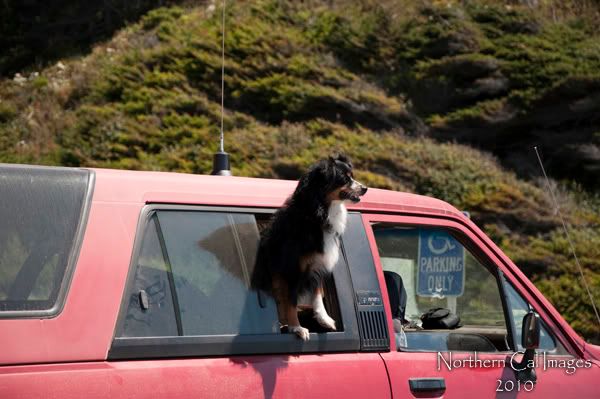
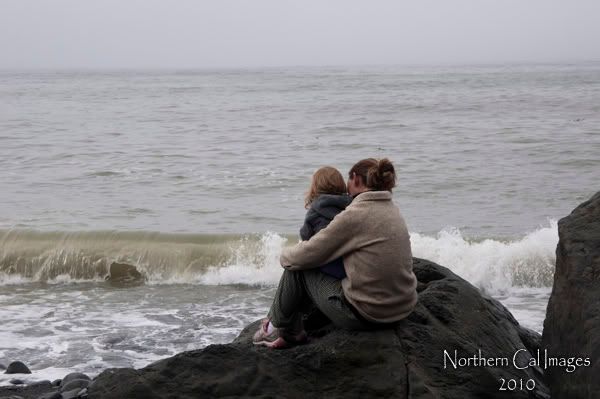
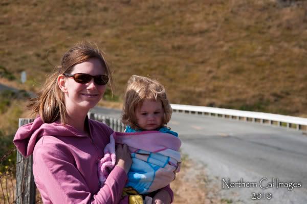
We got back Tuesday evening from a 6 day trip along the Lost Coast of Northern California. My wife Desiree, our daughter Sierra, and the dog piled into the 4runner with the thought of when we run out of food we will come home.

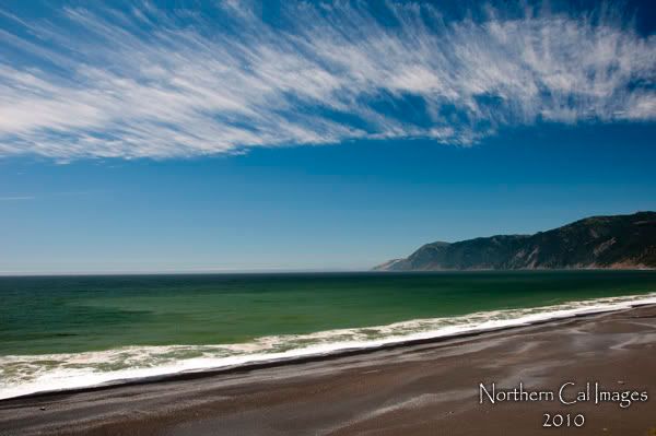
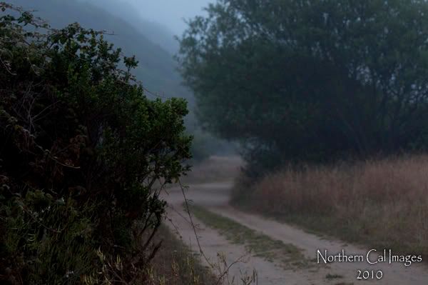
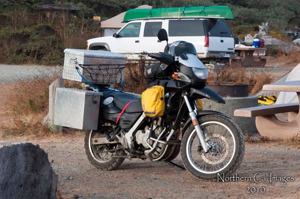
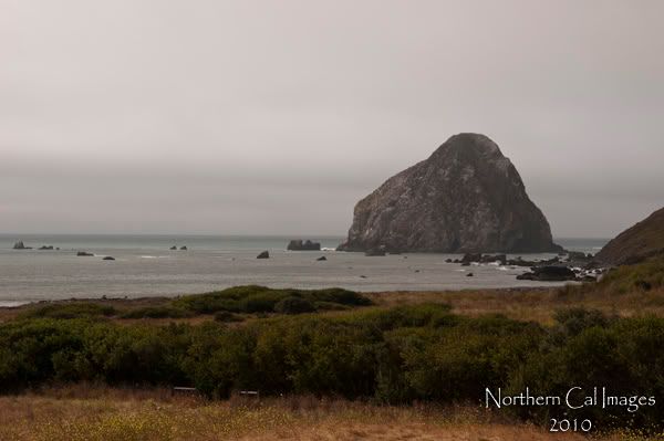
So across Hwy 36 to Fortuna Ca. a mountain road that curves its way from Red Bluff to Hwy 101. We fueled up in Fortuna and across the Eel River into Ferndale. Now for those have have never seen Ferndale thing of a throw back to the early 1900's. really a cool little town. Finding the Mattole road and up up and away we went. Literally that road while paved (kinda) just seems to climb and then turns back and drops down to sea level. A very pretty drive. We stopped for some pictures at Cape Mendocino before driving into Petrolia and our camp site at the Mattole Beach Campground. A CG that made me wonder how remote we would get. There we met some folks from Seattle with a cool newer VW camper van special and the guy one the other side rode his motorcycle to Homer alaska and was on his last days before getting home.
LostCoast001.jpg

LostCoast002.jpg

LostCoast005.jpg
 

john101477

Photographer in the Wild
Friday morning we woke up with one problem. over night desiree's bed had gone flat... back to Petrolia with high hopes for a one horse town.
On the road again we had planned to make it to Horse Mtn. that night so Mattole led us inland through a cpl of cool little towns and then we found where the pavement ended for us at the King Peak rd. and since we were on King Peak rd we might as well see what the range was named for and drive out King Range rd that goes to King Peak... yeah it is confusing, but a fun drive and a cool day for us.
We made Horse Mtn and looked around at camp sites that seemed long abandoned. We had just about settled on a spot when a truck pulls in. BLM guys with info that Tolken CG had fresh water and was a better place to stay. We have to agree and ended up staying there for 2 days. Tolken Cg is known for it's mountain bike trails and of the few that were there we were the only ones with out bikes. We did make it down to Shelter Cove though. Black sands Beach was really nice as well as the light house and sea lion covered rocks. Sierra spent her time collecting sea shells while I took pictures.
LostCoast022.jpg

LostCoast019.jpg

LostCoast038.jpg

LostCoast035.jpg
 

john101477

Photographer in the Wild
Sunday we left for our next destination, Usal Beach...
I had talked to some folks in Shelter Cove who advised me not to travel Usal Rd south with my family as it was in pretty rough shape. I may have made a mistake by listening but it worked out for the best. Out to 101 we went and a stop at Confusion Hill. A cool little tourist trap I had experienced and wish to share with my wife and kid. They got a huge kick out of it. We also visited the drive through tree before getting serious about our traveling for the day.
LostCoast039.jpg

LostCoast040.jpg

I love the signs at the Usal rd turnoff to go north. lots of warnings for people to stay away. I seen more people on that road than I did the previous 4 days combined. Usal road twists and turns through redwood groves and through areas that make a guy think of Jurassic Park. an incredible drive that i wish had less people on it.
You know that feeling when you find a place that melts all your worries away? A place where you know your at ease? The drop down into the Usal Beach area was like that for me. a bull elk munchin grass 75yds away, the ocean air, blue beautiful sky.... And then you read the sign Sinkyone Wilderness State Park - overnight primitive camping $25.... Say what? I will say we enjoyed the area for 2 days but I draw the line at paying to camp where there is nothing to warrant a charge.
LostCoast071.jpg

LostCoast079.jpg

LostCoast095.jpg

LostCoast117.jpg
 

ccarley

Adventurer
Beautiful photos!

I've been tempted to drive the road from Shelter Cove to Usal Beach, but with a large vehicle meaning we don't have a way to turn around in case things get bad, means I've been too timid to drive it yet.

A buddy of mine at work (norcalbronco?) has a Ranger that he has used to explore the areas North of Shelter Cove (I'm pretty sure). Looks like the trails can be handled well, until the rain comes again!

Clay
 

richying

New member
Great pics. I was planning to go to either Shelter Cove or Usal Beach in October. We have 2 small children also so I have the following questions: (1) was it difficult to access the beach from Shelter Cove CG - I heard the cliffs around there are pretty steep; (2) was the road in pretty rough - we may have some stock SUVs w/us; (3) was Usal Beach pretty rowdy - have heard a lot of horror stories about late night partying and guns there; (4) how was the road to get into Usal Beach; (5) how was beach access at Usal.

Many thanks in advance.
 

Regcabguy

Oil eater.
Thanks.

Thanks for sharing the photos. My wife and I travelled from San Diego to Crescent City via 101 and 1 last year beginning Sept 13. Luckily an enormous high pressure dome hovered over the west coast the entire 10 days. Campgrounds were wide open and sparsely occupied with the exception of Van Damme SP which was loaded with abalone divers for the weekend. Due to constantly stopping for yet another breathtaking sight around each corner,we didn't have time to visit Shelter Cove. I must have shifted 500 times along that route in The Beast. Sometimes an auto is nice. Boy,I'm getting homesick for that region again.
 

Forum statistics

Threads
188,533
Messages
2,906,376
Members
230,598
Latest member
Bobah
Top