OTG_1
Well-known member
The Pacific Crest Overland Route, the Continental Divide, the Trans-American Trail—most would agree, these are some of the classic long-distance overland tracks of North America. But what's North America's answer to Australia's most remote and desolate track—the Canning Stock Route? The Canning Stock Route traverses 1,150 miles of desert through the heart of the Australian outback and features a single fuel stop! One must travel 1,040 km from Wiluna to the Aboriginal community of Kunawarritji. With a population density of just 3.35 persons per sq km, Australia has 1/10th the population density of the contiguous United States (36 persons/sq km), but that doesn't mean there aren't wide-open spaces with people far and few between. One need only look at a dark sky map, and almost immediately the northern Great Basin sticks out. This region covers the Modoc Plateau on the eastern boundary of the Cascade volcanic arc, into the high deserts of central and eastern Oregon, the massive playas of northern Nevada, and the Owyhees that straddle the Oregon-Idaho border (and even some of northern NV). It's a desolate land of wide-open spaces, sky islands that rise from the desert plains, and ancient canyonlands formed from volcanism millions of years ago.
With the Canning Stock Route as the main source of inspiration, I set out with a rather grandiose idea—creating a 2,000+ mile overland track through some of the lower 48's most remote country. I'd already developed a number of tracks and found others in the public domain (like the Modoc Backcountry Discovery Trail) that I could piece together for this grand experiment. But one stubborn section connecting Klamath Falls to Bend eluded me. I searched high and low on various forums, contacted numerous locals, and even contacted a number of National Forest road engineers—all without any luck. I had managed to find the Oregon Outback Bikepacking route, but I wasn't totally keen on the path they chose, and sections of it weren't open to vehicle traffic. After plotting my proposed connector, I loaded the truck up with the dog and hit I-5 northbound on my way to Oregon.
I had planned this to be a 3-day trip, and the first day would take me from the Bay Area up to Mt. Shasta. I'd found a number of potential campsites off Hwy 97 on the north-facing flanks of Mt. Shasta. Turning off the highway, the road turned into a dusty mess of pulverized pumice that acted like fine sand. Man, this would be a total mess if it were to rain overnight, but luckily none was forecasted. I passed an old ambulance that had been outfitted into a mini-RV and continued up the mountain. Eventually, I found a relatively flat spot under a few trees and off the pumice silt, or whatever the heck this stuff is called! It was late fall, and while daytime temps were pleasant, the nighttime temps dipped once the sun disappeared behind the Klamaths on the western horizon. Shasta and I (my pup was visiting her namesake for the first time) putzed around camp, snapping photos of the rising moon and the north side of Mt. Shasta. By 8:30, we were in the truck camper and settling into our beds.
On exploration trips like this one, I'm always filled with a plethora of nervous energy. An early bedtime paired with such energy is a combination for hitting the road bright and early. We hit the 97 before the sun had peaked over the horizon. As the sun's first rays penetrated the forest, I could see the sparkle of frost that blanketed the open meadows between the forest. A low mist hovered above the open meadows, but as the temps rose, the frost and mist soon disappeared. Upon crossing into Oregon, I hit the first diesel station in search of cheap fuel (everything is cheap to us Californians, unless perhaps you're traveling in Europe!). While pumping diesel, a man walked over to me with a big grin and blurted out, "My kid loves your truck. He said, 'Dad, that's a MAAAAN's TRUCK.'" I chuckled and grinned, and retorted in a rather cheeky fashion that it could just as well be a woman's truck
Soon enough, Big Blue (that's the Ram 3500), Shasta, and I were pushing through the town of Klamath Falls. Klamath Falls has a beautiful downtown but also has a bit of a rust belt feel to it. I guess that this once booming lumber town hasn't quite recovered since logging's heyday. We'd follow a track on the outskirts of town that would take us through a beautiful valley and pop us back out onto the 97 on the shores of Klamath Lake. Here's an interesting fact for you: Did you know the Rogue and Klamath Rivers are ancient rivers that predate the upheaval of the Klamath Mountains they pass through in the west? These are the only two rivers that originate in the high desert that pass through the Klamaths and out to the sea. After a very short stint of pavement, we were climbing into the mountains on the east side of the lake. I noticed a viewpoint on my map, and so we pulled over. The view 500' above the Klamath was eons better than any view down on the highway. Up here, the Upper Klamath was an impressive azure blue, and Mt. McLoughlin proudly stood as a reminder we were now in Cascadia.
Pushing on and into the forest, we passed an old beat-up sedan. The occupants seemed to be busy participating in some sort of illicit activity with the help of a glass pipe and lighter. My guess is they had helped contribute to the trash that seemed to pervade the viewpoint we'd just visited. Luckily, that was the last person/vehicle that we'd see for several hours. The forest wasn’t dissimilar to those you’d find around Bend—a mixture of large pines and scattered shrubs. While we were in the mountains, the topography felt like we were traversing a series of hills. Most of the roads were in rather good condition, save for a few short rocky and steep portions, which a Sprinter could easily manage by driving slow.
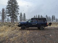
As we neared the headwaters of the Klamath River (Klamath Marsh), I pulled over to get a shot of my truck. And what do you know, the first trail traffic of the day—a fellow on a bright orange KTM zoomed by. Just a mile down the road, my track followed the pavement of Silver Lake Road for a few miles. I noticed he'd pulled over and was studying a map. I inquired if he had followed the Oregon Outback bikepacking route—to which he replied no. I told him about the endeavor I was on, and he smiled and wished me luck as we went our separate ways. Big Blue, Shasta, and I would follow the pavement for several miles before we hit the dirt again. The sky was consumed with gray, and a light breeze pushed through the trees. We stopped for lunch at one of the local campgrounds. We'd passed one truck on the way, but the campground was totally vacant and a bit eerie. Perhaps it was the gray, brooding skies. I wondered if a storm was brewing, but the weather forecast begged to differ, only calling for a slight chance of rain (20%). Lunch was rather hasty, and we were back on the trail.
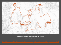
The final version of the track passes through some of the most remote regions in the lower 48.
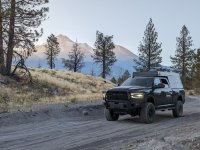
Our first night of camp, Mt Shasta looms in the distance.
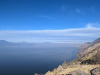
Upper Klamath Lake is soooo much prettier from above.
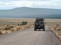
You're in the American Outback now!
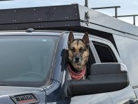
Shasta wondering what the heck I'm doing.
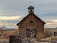
The old Church at the Fort Rock museum and village.
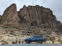
This photo only captures a small portion of the massively ring shaped Fort Rock.
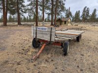
I asked for it, but all I got was this empty cart?!
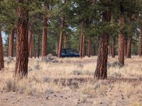
This is apparently a favorite camping location of bikepackers who flock to the region in Spring and late summer.
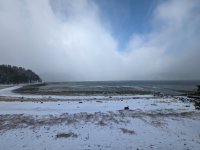
So much for that 20% chance of precipitation!
With the Canning Stock Route as the main source of inspiration, I set out with a rather grandiose idea—creating a 2,000+ mile overland track through some of the lower 48's most remote country. I'd already developed a number of tracks and found others in the public domain (like the Modoc Backcountry Discovery Trail) that I could piece together for this grand experiment. But one stubborn section connecting Klamath Falls to Bend eluded me. I searched high and low on various forums, contacted numerous locals, and even contacted a number of National Forest road engineers—all without any luck. I had managed to find the Oregon Outback Bikepacking route, but I wasn't totally keen on the path they chose, and sections of it weren't open to vehicle traffic. After plotting my proposed connector, I loaded the truck up with the dog and hit I-5 northbound on my way to Oregon.
I had planned this to be a 3-day trip, and the first day would take me from the Bay Area up to Mt. Shasta. I'd found a number of potential campsites off Hwy 97 on the north-facing flanks of Mt. Shasta. Turning off the highway, the road turned into a dusty mess of pulverized pumice that acted like fine sand. Man, this would be a total mess if it were to rain overnight, but luckily none was forecasted. I passed an old ambulance that had been outfitted into a mini-RV and continued up the mountain. Eventually, I found a relatively flat spot under a few trees and off the pumice silt, or whatever the heck this stuff is called! It was late fall, and while daytime temps were pleasant, the nighttime temps dipped once the sun disappeared behind the Klamaths on the western horizon. Shasta and I (my pup was visiting her namesake for the first time) putzed around camp, snapping photos of the rising moon and the north side of Mt. Shasta. By 8:30, we were in the truck camper and settling into our beds.
On exploration trips like this one, I'm always filled with a plethora of nervous energy. An early bedtime paired with such energy is a combination for hitting the road bright and early. We hit the 97 before the sun had peaked over the horizon. As the sun's first rays penetrated the forest, I could see the sparkle of frost that blanketed the open meadows between the forest. A low mist hovered above the open meadows, but as the temps rose, the frost and mist soon disappeared. Upon crossing into Oregon, I hit the first diesel station in search of cheap fuel (everything is cheap to us Californians, unless perhaps you're traveling in Europe!). While pumping diesel, a man walked over to me with a big grin and blurted out, "My kid loves your truck. He said, 'Dad, that's a MAAAAN's TRUCK.'" I chuckled and grinned, and retorted in a rather cheeky fashion that it could just as well be a woman's truck
Soon enough, Big Blue (that's the Ram 3500), Shasta, and I were pushing through the town of Klamath Falls. Klamath Falls has a beautiful downtown but also has a bit of a rust belt feel to it. I guess that this once booming lumber town hasn't quite recovered since logging's heyday. We'd follow a track on the outskirts of town that would take us through a beautiful valley and pop us back out onto the 97 on the shores of Klamath Lake. Here's an interesting fact for you: Did you know the Rogue and Klamath Rivers are ancient rivers that predate the upheaval of the Klamath Mountains they pass through in the west? These are the only two rivers that originate in the high desert that pass through the Klamaths and out to the sea. After a very short stint of pavement, we were climbing into the mountains on the east side of the lake. I noticed a viewpoint on my map, and so we pulled over. The view 500' above the Klamath was eons better than any view down on the highway. Up here, the Upper Klamath was an impressive azure blue, and Mt. McLoughlin proudly stood as a reminder we were now in Cascadia.
Pushing on and into the forest, we passed an old beat-up sedan. The occupants seemed to be busy participating in some sort of illicit activity with the help of a glass pipe and lighter. My guess is they had helped contribute to the trash that seemed to pervade the viewpoint we'd just visited. Luckily, that was the last person/vehicle that we'd see for several hours. The forest wasn’t dissimilar to those you’d find around Bend—a mixture of large pines and scattered shrubs. While we were in the mountains, the topography felt like we were traversing a series of hills. Most of the roads were in rather good condition, save for a few short rocky and steep portions, which a Sprinter could easily manage by driving slow.
As we neared the headwaters of the Klamath River (Klamath Marsh), I pulled over to get a shot of my truck. And what do you know, the first trail traffic of the day—a fellow on a bright orange KTM zoomed by. Just a mile down the road, my track followed the pavement of Silver Lake Road for a few miles. I noticed he'd pulled over and was studying a map. I inquired if he had followed the Oregon Outback bikepacking route—to which he replied no. I told him about the endeavor I was on, and he smiled and wished me luck as we went our separate ways. Big Blue, Shasta, and I would follow the pavement for several miles before we hit the dirt again. The sky was consumed with gray, and a light breeze pushed through the trees. We stopped for lunch at one of the local campgrounds. We'd passed one truck on the way, but the campground was totally vacant and a bit eerie. Perhaps it was the gray, brooding skies. I wondered if a storm was brewing, but the weather forecast begged to differ, only calling for a slight chance of rain (20%). Lunch was rather hasty, and we were back on the trail.

The final version of the track passes through some of the most remote regions in the lower 48.

Our first night of camp, Mt Shasta looms in the distance.

Upper Klamath Lake is soooo much prettier from above.

You're in the American Outback now!

Shasta wondering what the heck I'm doing.

The old Church at the Fort Rock museum and village.

This photo only captures a small portion of the massively ring shaped Fort Rock.

I asked for it, but all I got was this empty cart?!

This is apparently a favorite camping location of bikepackers who flock to the region in Spring and late summer.

So much for that 20% chance of precipitation!


