My Journey

ITTOG.....not exactly.....I'm Vegetarian, so not that for sure.....


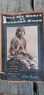
So what was I reading that day when we drove into the Navajo Nation lands ? Bury My Heart at Wounded Knee by Dee Brown.....seemed like an appropriate choice to me.....
20240320_192148_copy_1200x2570.jpg

Our next stop was in Window Rock, Arizona, north of Interstate 40, along the northwestern border of New Mexico. There was something about that name.....Window Rock.....that had caught my attention many a time while glossing over my road atlas, but I'd never traveled here, never ever before. Since this was Navajo land, I thought I'd start out at the Navajo Nation  Museum to learn more about the Navajo people.....
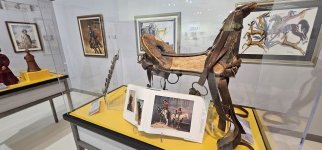
20240222_122151_copy_1600x747.jpg

20240222_122413_copy_349x747.jpg


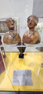
I was totally enthralled by what I saw here.....the telling of their people.....
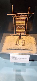
20240222_123538_copy_349x747.jpg

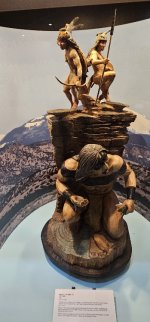
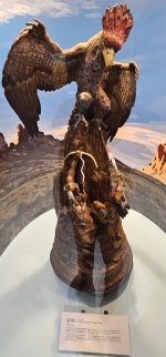
The wood carvings were top notch.....
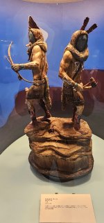
20240222_123526_copy_349x747.jpg

20240222_123604_copy_349x747.jpg

.....as each one seemed to tell their stories.....
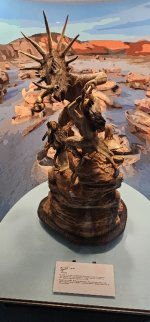
20240222_123550_copy_349x747.jpg

20240222_123640_copy_349x747.jpg

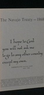
One of the original signed copies of the Treaty of 1868 was on display here but photography was not allowed.....so I took a screenshot from the internet for this post.....
Screenshot_20240320_192945_Gallery_copy_1200x2573.jpg

I think the thing that stood out the most for me while viewing these artifacts were the signatures of the 29 Navajo chiefs that signed the Navajo Treaty of 1868.....each chief signed with an "X" as they couldn't read or write English. I've read that the U.S. government honored less than 50 % of that treaty.....they have such a sad story to tell.....
20240222_123230_copy_1600x747.jpg
 
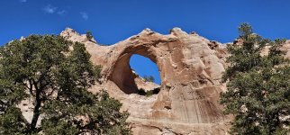
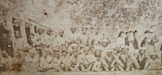
Just outside the door of the museum is the Window Rock Tribal Park.....
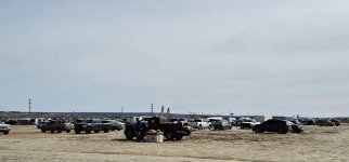
20240222_130738_copy_1600x747.jpg

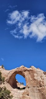
.....and not too far beyond the sign lies Window Rock.....
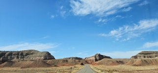
20240222_130935_copy_1600x747.jpg

20240222_130940_copy_349x747.jpg

After a few hours spent touring in Window Rock, Arizona we continued driving north, further north into the Navajo Indian Reservation.....
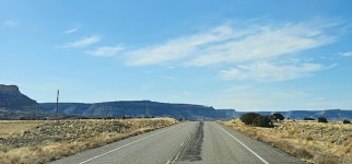
20240223_071930_copy_1600x747.jpg

My original plan was to take Indian 7.....a remote unpaved road that ran south of, and to Canyon de Chelly National Monument.....
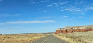
20240223_072133_copy_1600x747.jpg

The National Parks' website recommends that you not use Indian 7.....so I stopped at the service station in Sawmill, Arizona to inquire about the road conditions. They said don't take it as it was the worst time of year.....lots of deep, melting snow and mud. Rescue could take a good day or two.....
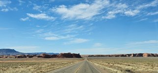
20240222_144054_copy_1600x747.jpg

Well.....I damn near tried.....but at the last second, I said no.....I bought my MaxTrax for looks.....not for mud or snow.....

20240222_144150_copy_349x747.jpg

I ended up backtracking.....

20240223_073118_copy_1600x747.jpg

And we spent the night in a parking lot.....at the Navajo Nation Museum.....

20240223_072444_copy_1600x747.jpg

.....listening to the howling coyotes.....I don't think I've ever heard so many howling coyotes in my entire life......

20240223_070458_copy_1600x747.jpg
 
Last edited:

ITTOG

Well-known member
ITTOG.....not exactly.....I'm Vegetarian, so not that for sure.....
I can't believe I mentioned meat. I know you are vegetarian. I guess I was just shocked about the liquor store because I know you don't drink. :LOL:

Well.....I damn near tried.....but at the last second, I said no.....I bought my MaxTrax for looks.....not for mud or snow.....
That line is quotable and applies to most of the people that own them.
 

ITTOG

Well-known member
Oh, and thanks for the pictures and the book. I looked it up in audible and I was able to get the book for free! Such a sad past. I do like learning about it. I grew up near the location of where the Killers of the Flower Moon occurred, and I went to a lot of Powwow's while growing up.
 

Ace Brown

Retired Ol’ Fart
I can't believe I mentioned meat. I know you are vegetarian. I guess I was just shocked about the liquor store because I know you don't drink. :LOL:


That line is quotable and applies to most of the people that own them.

Glad you said “most”. I carry four Maxtrax and had to use all of them and lots of shovel work after getting stuck on a Baja beach a few years ago. Could have used two more for my trailer.


Sent from my iPhone using Tapatalk
 

chet6.7

Explorer
As I have gotten older, the less I use the max tracks the better.
Reading some of the names of the locations, reminded me of the author Tony Hillerman.
 
ITTOG.....you probably know this by now, but Bury My Heart at Wounded Knee reads like a history book. I read it in spurts, but that's happening to me a lot these days, no matter what I'm reading. And I too love it whenever I stumble across a gathering of Native Americans.....

Ace.....for me it's like the jack or the spare tire.....not a bad idea to have one but I never want to use them.....

Chet6.7.....I had to Google the author as I'd never heard the name. Apparently he writes fiction which is something that I rarely read.....


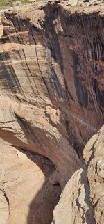
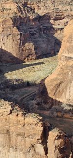
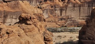
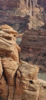
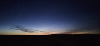
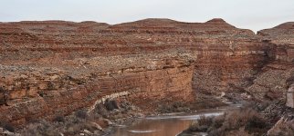
We rose early that next morning and left Window Rock, Arizona long before the sunrise.....the plan was to watch that sunrise over the canyons of the Canyon de Chelly National Monument.....

20240223_110121_copy_1600x747.jpg

20240223_093255_copy_349x747.jpg

20240223_112213_copy_349x747.jpg

We took Indian 12 out of Window Rock, Arizona.....and followed Indian 12 northward as the highway meandered in and out of New Mexico and Arizona.....we passed by the frozen over Red Lake, and then Black Lake, and finally Wheatfield Lake.....we continued north.....

20240223_092640_copy_1600x747.jpg

20240223_092752_copy_349x747.jpg

20240223_092805_copy_349x747.jpg

At Tsaile, Arizona, we hung a left at the 3 way intersection, and followed Indian 64 eastward to the canyons of Canyon de Chelly National Monument.....

20240223_110058_copy_1600x747.jpg

20240223_112156_copy_349x747.jpg

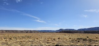
Unfortunately my planning wasn't so good that day.....we missed the planned sunrise over the canyon.....but that was just fine as the scenery after daybreak was spectacular none the less.....

20240223_111809_copy_1600x747.jpg

20240223_112548_copy_349x747.jpg
 
Last edited:
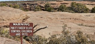
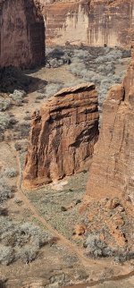
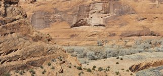
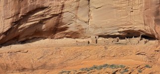
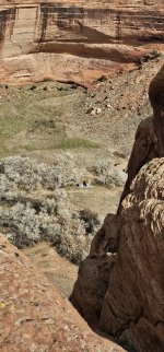
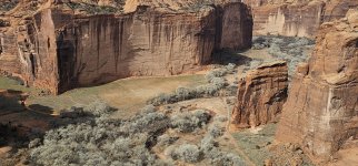
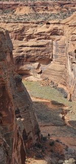
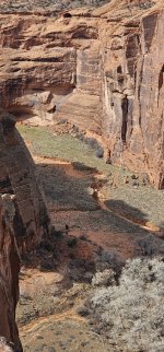
Our first stop at Canyon de Chelly National Monument was at the overlook to Mummy Cave, followed by the overlook to Massacre Cave.....

Taken from OutdoorProject.com.....

"Mummy Cave is the name of the ruin visible from the overlook. With over 80 rooms and three kivas, this is one of the largest dwelling structures in the park. It was named for two mummies that were discovered here by an archaeological expedition in 1882. There are great views both up and down the canyon from this overlook."


(this is not Mummy Cave)

20240223_105732_copy_1600x747.jpg

"Massacre Cave is named for a battle that occurred in 1805 between the Navajo people and Spanish soldiers. Over 100 Navajo were killed that day as they defended themselves in this cave. The northern canyon of the park where both caves are located is named Canyon del Muerto. Massacre Cave is visible fairly close up from the lower overlook at this site."


(this is not Massacre Cave)

20240223_105635_copy_1600x747.jpg

From there we continued west along Indian 64.....our next stop was at Antelope House Overlook.....

(this is not Antelope House)

20240223_112302_copy_349x747.jpg

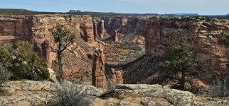
We continued westward, stopping at the Visitors Center, then taking Indian 7 eastward, stopping at numerous overlooks along the way.....

20240223_112610_copy_1600x747.jpg

20240223_112629_copy_349x747.jpg

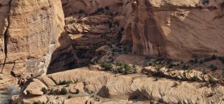
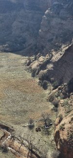
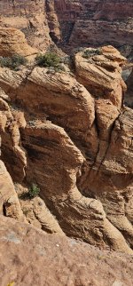
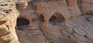
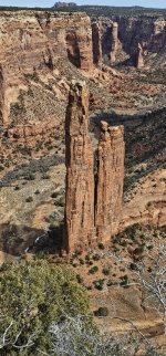
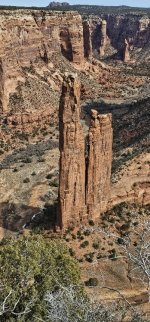
Tsegi Overlook, Junction Overlook, White House Overlook, Sliding House Overlook, Face Rock Overlook, and lastly, Spider Rock Overlook....we stopped to have a look at each and everyone.....

20240223_112559_copy_349x747.jpg

The plan was to hike down to the bottom of the canyon at the White House Trail, but the trail was closed due to recent car burglaries.....

20240223_115130_copy_349x747.jpg

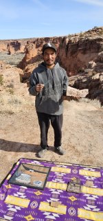
At one of the many overlooks, I met this Navajo man selling his artwork.....we talked for quite awhile, and eventually I bought this plaque from him (a gift for the teenage neighbor that's feeding my bird friends at the cabin) and he insisted that I take his photograph.....

20240223_102559_copy_349x747.jpg

Next up.....the Navajo flea market in Chinle, Arizona (a short drive from the parks' entrance).....highly recommended by my new Navajo best friend.....

20240223_115751_copy_1600x747.jpg

20240223_115130_copy_349x747.jpg
 

Ace Brown

Retired Ol’ Fart
You are probably long gone from the area now, but maybe next time. I highly recommend taking the guided tour of the inner canyon. I had a old woman guide who was around 90 years old. She not only knew the canyon intimately but she was also very entertaining. You would be able to drive your Jeep in with the guide as a passenger.

The vendor you met looks very familiar. I believe I bought something from him and had a long chat too.


Sent from my iPhone using Tapatalk
 
Last edited:

Foy

Explorer
If you enjoy nonfiction reading about Native Americans, you'd probably like the work of Vine Deloria, Jr (1933-2005), author of Custer Died for Your Sins: An Indian Manifesto (1969), God Is Red: A Native View of Religion (1973), and many other books and professional papers. God Is Red was the primary textbook for the undergraduate course Philosophy of Religion which I took as a sophomore at Appalachian State. The professor varied from the standard texts (a lot) so his aim was to teach Philosophy of Religion by comparison/contrast of Native American religion and Judeo-Christian religion. It was a great college experience and ranks as one of the most influential courses I took inasmuch as I'd read nothing of real-world Native American history prior to that. When I started regularly visiting the West a year or two later, I felt as though I had a somewhat better idea of how their then-current lives had gotten to be the way they were--and for many--still are.
 
And when the next sun rose.....it was time to hit the road again.....we continued to drive north.....

From: ArizonaHighways.com

Salt River Canyon.....


"Like a Dickens novel or a Hitchcock movie, this classic drive is one worth repeating. The route crosses the river and several life zones, and the hairpin turns will get your adrenaline moving."

View attachment 824746

"Maybe this one seems too obvious. Everyone knows about the drive through Salt River Canyon, you might be thinking. But you’d be surprised how many Arizonans have never traveled the steep, winding stretch of U.S. Route 60 between Globe and Show Low. And, unlike many lesser-known drives in the state, this one is fully paved, making it an option in any vehicle."

View attachment 824747

View attachment 824751

"The drive begins where U.S. routes 60 and 70 intersect in Globe, and you’ll head generally northeast on U.S. 60 through a rolling terrain dotted with scrub vegetation, prickly pear cactuses and assorted yuccas. Early on, you’ll pass the old Apache Drive-In on the left; this theater opened in the 1950s but shut down in 2013 as a victim of the digital age. Later, as you begin to climb, piñon pines and junipers appear before a bend in the road at Mile 12 offers a view of the Sevenmile Mountains to the east."


View attachment 824752

"Next, the road parallels a riparian area that’s rich with cottonwoods and Arizona sycamores. Past Jones Water Campground at Mile 16.2, you’ll see more sycamores on the left, below 6,060-foot Jackson Butte. You’ll then climb steeply for several miles, but keep an eye out at Mile 22.5, when a gap on the left offers a brief glimpse of the Four Peaks, a landmark well known to residents of the Phoenix area."

View attachment 824753

"You’ll soon be in a section of thick piñons and junipers, along with a few ponderosa pines. The latter disappear as your descent into Salt River Canyon begins, and you’ll leave the Tonto National Forest and enter San Carlos Apache Tribe land at Mile 29. Past the ghost town of Seneca, you’ll begin getting spectacular views into the canyon straight ahead."

View attachment 824754

"Don’t let yourself be distracted by those views, though. Instead, take advantage of the numerous pullouts along
U.S. 60 as it begins switchbacking toward the Salt River. The first of these is at Mile 35.2, and there, you’ll see the river and the stretch of road you’re about to travel beneath the canyon’s imposing cliffs. The turns in the canyon are of the hairpin variety, so low speed and attention to the road are essential. The dramatic views continue all the way to the Salt River Canyon Rest Area, which sits right along its namesake waterway."


View attachment 824779

"Here, a pair of bridges — a newer vehicle bridge, built in 1996, and the historic 1934 bridge, which now is open to pedestrians — span the river as it roars over a series of rapids. And after you cross the 1996 bridge (and cross onto White Mountain Apache Tribe land), keep an eye out for a single palm tree on the right. At this pullout, stairs lead down to an overlook with a lovely view of the river, which is a vital source of water for metropolitan Phoenix."

View attachment 824757


View attachment 824756

"If you’re pressed for time, you can turn around here and head back to Globe, but for the full experience, continue up the canyon’s north rim, where yuccas and prickly pears cling to steep south-facing walls above the road. The last major overlook is at Mile 42, and its view of the river surrounded by tall cliffs is one you won’t want to miss. Soon, you’ll be back in the piñons and junipers before crossing over Carrizo Creek at Mile 60 and transitioning into a landscape of ponderosa pines and oaks."

View attachment 824758
I was really grateful to Ram for my exhaust brake while towing our 40’ 5th wheel through Salt River Canyon. Set the cruise control and never touched the brakes all the way down.
 
Ace.....the guide you had sounds awesome. I'm always so reluctant to put myself in a situation like that. I just love going it alone.....probably to a fault.....

Foy.....it's rare that I'll read anything fiction but that being said, I struggle to really get into a book that reads like a text book. Probably explains why I was such a bad student. I mostly enjoy reading books written by adventurer type people. That's when I do my most superb daydreaming.....

ghostdancer.....yep, that was quite a steep incline.....

TripLeader.....your post took me down a rabbit hole. I clicked on the link.....never having heard the name Edward S. Curtis before. His photography is absolutely incredible. And there's a treasure trove of portraits out there that are available to view online. I absolutely loved his portraits of the Native American Indians. Thank you.....


Now I had big ideas for the Chinle, Arizona flea market.....my imagination told me that I'd be seeing beautiful works of Navajo art, possibly colorful weavings, and maybe eating some traditional Navajo dishes.....instead I found old car parts, used tires, lots of just assorted junk.....not traditional Navajo dishes but hot dogs & the like. Dang.....what a disappointment that flea market was for me.....

20240223_133406_copy_1600x747.jpg

Add to that, the wind and the cold temperatures that had moved in so suddenly.....we moved on fairly quickly. Now we headed north up Highway 191. At Many Farms, Arizona.....at the intersection with Indian 59, we took a turn to the left and drove west along seemingly deserted Indian 59.....

Screenshot_20240326_112411_Gallery_copy_1600x746.jpg

Screenshot_20240326_112545_Gallery_copy_1600x746.jpg

Screenshot_20240326_112357_Gallery_copy_1600x746.jpg

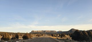
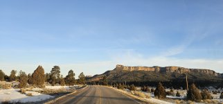
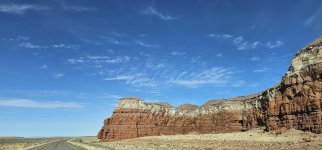
Maybe this 2 lane highway could have been named The Road Less Traveled as we saw few cars along this entire drive.....it was wonderful is an understatement.....I loved every minute along Indian 59.....

Screenshot_20240326_112339_Gallery_copy_1600x746.jpg

Screenshot_20240326_112411_Gallery_copy_1600x746.jpg

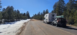
Next up for us was yet another night spent camped in a parking lot.....

20240223_150150_copy_1600x747.jpg

20240223_144801_copy_1600x747.jpg

.....this next camp was in Kayenta, Arizona.....

20240223_142835_copy_1600x747.jpg

20240223_143358_copy_1600x747.jpg
 
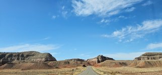
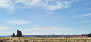
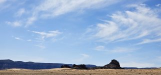
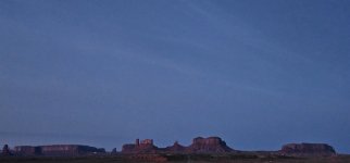
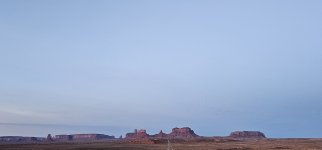
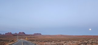
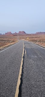
The next morning was much like the morning before.....rose early, long before the sunrise.....drove north along Highway 160.....the plan now was to catch an amazing sunrise or an amazing full moon set, from an amazing place.....Monument Valley.....

20240224_060920_copy_1600x747.jpg

We parked along the side of the highway somewhere near Forrest Gump Point.....

20240224_063056_copy_1600x747.jpg

.....and we waited for the full moon to set and for the sun to rise.....

20240224_064746_copy_1600x747.jpg

Unfortunately the sunrise was not really all that spectacular that morning.....

20240224_064915_copy_1600x747.jpg

I had hoped for the full moon setting to be more aligned with the highway.....but it wasn't.....

20240224_064840_copy_1600x747.jpg

As a matter of fact, it wasn't even close.....

20240224_064854_copy_1600x747.jpg

20240224_064846_copy_349x747.jpg

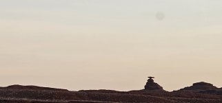
So here we were.....8:00 a.m. parked on the side of Highway 160 in Monument Valley, wondering where to go next.....we continued north.....eventually. We crossed the San Juan River.....

20240224_070155_copy_1600x747.jpg

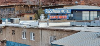
.....at Mexican Hat, Utah.....

20240224_070405_copy_1600x747.jpg

.....pulled over in town, regrouped.....drank some coffee, walked around the small town.....and began to think about going home.....a few months on the road.....was it enough.....

20240224_070210_copy_1600x747.jpg
 
Last edited:
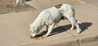
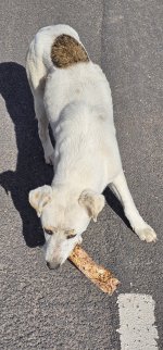
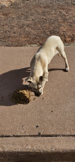
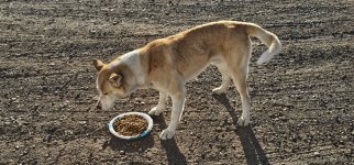
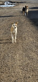
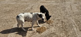
The San Juan River, which we had just crossed, & which I had just mentioned in my previous post, demarcates the northern boundary of the Navajo Indian Reservation.....so, before I move on, before I go further north in this story.....I just wanted to make a single post which brings attention to the plight of the wild dogs.....more specifically.....


The Wild Dogs of the Navajo Nation.....


20240223_100954_copy_1200x560.jpg

20240223_101217_copy_1200x2570.jpg

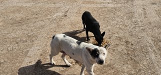
It's no secret that the Navajo Indian Reservation is overwhelmed with wild dogs running loose.....

20240223_104041_copy_1200x560.jpg

20240223_104031_copy_1200x2570.jpg


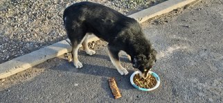
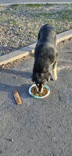
It seemed like at every stop that we made, we were approached by wild dogs. And it was impossible for me not to feed each and everyone.....

20240223_163908_copy_1200x560.jpg

20240223_163916_copy_1200x2570.jpg

I saw them at the museum.....I saw them at the Visitors Center.....I saw them at the overlooks, at the shopping centers, at the flea market.....I saw them everywhere.....

20240223_133817_copy_1200x560.jpg

20240223_133818_copy_1200x560.jpg

I don't know how I left there without rescuing at least one.....but I did.....I shouldn't have. Anyhow, I didn't want to forget the The Wild Dogs of the Navajo Nation.....they were a part of our story.....

20240223_171946_copy_1200x560.jpg

20240223_171956_copy_1200x2570.jpg
 

Forum statistics

Threads
188,219
Messages
2,903,957
Members
229,805
Latest member
Chonker LMTV
Top