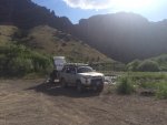
OREIDAVADAH Adventure 2015

Luckytibbs

LuckyTibbs
I'm reading this post daily. Thanks for the pictures, and the maps. If you keep posting the maps, I'm going to do this trip next year. This looks awesome and thank you!!
 

jeremyk

Adventurer
Brett-
I have just returned from the rest of my trip and am now just logging in to your report. It's still just a blur, so it's hard to tell one day from another, so I think that these are Day Four pics. First off , thanks for putting together such an awesome piece of trail - this was an amazing adventure and quite a feat of trailsmithing on your part. we were WAY out there according to a BLM employee I met on my travels, he was a wildfire specialist from the Boise area who has worked in the area for 25 years and we went places he has never heard of. He even thought that Crutcher's was no longer accessible.DSC_0180.jpgDSC_0189.jpgDSC_0206.jpgDSC_0213.jpgDSC_0221.jpgDSC_0235.jpgDSC_0257 (1).jpgDSC_0258.jpgDSC_0260.jpgDSC_0263.jpg
 

Ace Brown

Retired Ol’ Fart
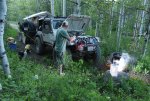
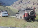
That photo of Shane strapping on to Randy's trailer is the best one so far that conveys just how steep and intimidating that hill was.
 

RandyP

Adventurer
Some day 4 photos:
My favorite day of adventure and camping spot (next th the creek, in the trees).
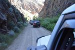
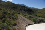
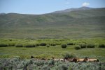
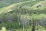
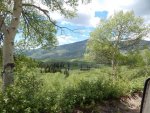
Note how green and lush the country is, premium time of year to be in Robinson Hole or anywhere in Oreidavadah.
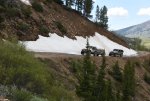
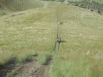
The drop into the hole is extreme (steep) and the climb out is extreme (steep and tight willows).
Thanks Brett for sharing this very special place with us.

image.jpg
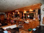
Jarbadge Cafe & Bar
image.jpg
2015 Oreidavadah logo
image.jpg
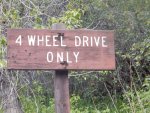
Believe the sign....
image.jpg
Dropping down into Robinson Hole
image.jpg
Ready to drop Brett's Jeep & Trailer down the first steep downhill
image.jpg
East Fork Jarbidge River at Robinson Hole
image.jpg
Robinson Hole with Cougar Point on the horizon
image.jpg
 
Last edited:

Ace Brown

Retired Ol’ Fart
Spoke with Frenchie this evening. He is having computer issues that prevents posting. He hopes to catch up when he gets a new PC fully operational.
 

driver61

Adventurer
DAY 5:

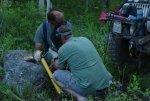
We had a great night in Robinson Hole. Many of us took the opportunity to bathe in the cold water of the East Fork of the Jarbidge River. The hot spring looked pretty dirty... We were also treated to an impromptu concert by Idaho XJ's granddaughter around the campfire. (beautiful voice!) We were loaded and ready to roll again by 8am. Crawling out of Robinson, we had the sun in our eyes and we were again treated to another great day. The road out was like going through a jungle of willow trees and quakies. The music of the limbs scratching and clawing on your paint can be a little worrysome for those in nice new 4 Runners...HAHA, sorry Ace. We chose an alternate route today, electing to for go the rough, hot, dry trip out to Arch Canyon in favor of a higher altitude route over to Pole Creek and on to Lime Creek and eventually to Oneil Basin. At one point, we made a wrong turn and we were treated to an amazing view of the country surrounding us. Oneil Basin road is a high speed gravel road and we made great time across it. Jeremy was begging for a swim break, so we stopped for a quick swim in Bois Reservoir... Leaving the res., we hit pavement for the first time in 2 days. We went north on Highway 93 for about 5 miles before turning off and back to the dirt. We stopped in a canyon where a lot of the early pioneers had left their marks on the wall. Shortly after that stop, Charlie experienced his first flat tire. It was a large gash in the sidewall that was repaired with some plugs and we were back on the road. It was getting late in the day, but it was still too hot to stop and set up camp. We pushed on to Rock Springs, an important stop for travelers on the California Trail. When we stopped, we found Old Man Crash's rear tire carrier nearly dragging the ground. We took the tire, gas can, and jack and redistributed them amongst the truck and strapped the bumper back ont the truck. We finally made camp near an old mine site, Delano, NV...
 

Ace Brown

Retired Ol’ Fart
I really liked camping right on the gravel bar at Three Forks. Best camp spot of the trip for me. Funny thing happened there. I tossed a pair of pants out in the mild current to wash. They were tied off to a bush but when I checked later; gone. Searched downstream far as I could but heavy brush stopped that. Sarah was there with mask and snorkel so I asked her to take a look. She hadn't gone 5' when she reached down and pulled them out from an eddy behind a clump of weeds. That was a big relief as I had only brought two pair. Thanks again to Sarah.
ImageUploadedByTapatalk1436392762.539541.jpg
 

RandyP

Adventurer
Day 5 pics:

Thru the willow squeeze box
image.jpg
Into the sun
image.jpg
A welcome dip in a reservoir
image.jpg
Rock Springs Trails West marker
image.jpg
Rock Springs
image.jpg
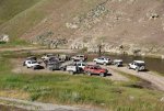
Vehicle pics at Rock springs
image.jpg
image.jpg
image.jpg
image.jpg
 

Attachments

  • image.jpg
    image.jpg
    438.2 KB · Views: 18
Last edited:

Forum statistics

Threads
188,225
Messages
2,904,090
Members
229,805
Latest member
Chonker LMTV
Top