Overland Route - Sedona Backcountry Trail

ramblinChet

Well-known member
Sedona Backcountry Trail

Part One of Two

by Chet Szymecki

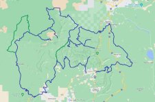
Next on the list was a trail selected by Dennis, a buddy of mine from Delaware, who I have been sharing trails around the country with for around five years. The trail he selected was the Sedona Backcountry Trail as found on Overland Trail Guides. This 250+ mile trail should take four to seven days and is composed of "graded dirt roads, and occasional rocky Jeep track." In my opinion it was a very nice trail with a mixture of conditions in addition to a wide variety of scenery.

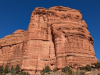
As described on OTG, "Explore the Red Rocks and allure of Sedona's canyon country. Deep into the mountains and overlooking Sedona and the Verde Valley region, the Sedona Backcountry Trail provides the perfect mix of recreation, relaxation and rejuvenation."
SED 01.jpg

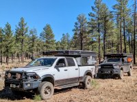
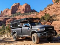
Our initial heading was east as we departed Sedona and began the rocky climb up Schnebly Hill and into the Coconino National Forest. The trail here is busy and bumpy and even aired down you are usually only moving along at 2-3 mph while dodging pink Jeeps. It was interesting to crawl behind a load of tourists and what I noticed is there always seemed to be one who was really interested in studying this AEV Prospector and Four Wheel Camper combination. Even more surprising, the majority of time it was a female. It is exciting to know that more are becoming curious of the overland lifestyle and it is my belief that the "trend" here in these United States is still in its infancy.
SED 02.jpg

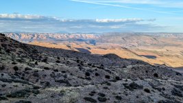
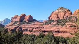
This is a majestic view of the red rocks of Sedona from an overlook near the top of Schnebly Hill. This is approximately where the pink Jeeps stop and unload before turning back down the hill. It was also a point along the trail where our pace picked up slightly. The opening of the Sedona Backcountry Trail is slow and rough so I would highly recommend airing down for comfort. I climbed out in two-wheel drive with barely a slip.
SED 03.jpg

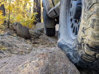
Yeah, after nearly 55,000 miles on my BF Goodrich All Terrain KO2s, I am exceptionally happy with their performance. They are a premium tire which other companies use a benchmark and after two years of use and abuse, I fully understand why. In case you are interested, during normal driving I inflate the tires to 3 atm, or 45 psi, according to the sticker placed in my door jamb by AEV. If the trail has some rocks and is occasionally rough for short sections, and there are other short sections where I will be on paved road for a few miles, I will run at 2 atm. If I find myself on a trail that is over 100 miles long and there will be extended sections where it will be rough, I run them at 1 atm.
SED 04.jpg

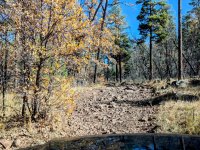
This trail may not appear to be too rough but after a dozen miles you will re-calibrate your thoughts and be happy with the flex and sidewall strength of an aired down premium tire. I would not have felt as comfortable running a cheaper tire since I would have been concerned with damaging a belt or sidewall. Select a great tire and minimize your risk on the trail.
SED 05.jpg

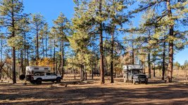
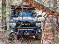
As expected, we came across a few downed trees and a few sections where the standing trees were so close together we were not able to navigate our adventure vehicles between them. Dennis and I both are comfortable with only an inch or so on each side before our campers impact the trees but some areas were just too tight. One in particular forced us to double back although we located an excellent camping site because of that.
SED 06.jpg

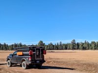
If you follow the route in an anti-clockwise direction, as designed, make sure to top off your fuel tank when crossing Interstate 17 near Kachina Village. There is only one fuel station there and it seems too early but once you begin to venture west it will be a very long time before you are anywhere near a fuel station again. It was really cool to be wandering through the mountains and then to roll into these high grasslands.
SED 07.jpg

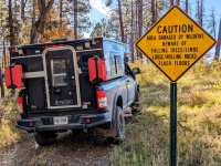
Fires are a major concern out west when compared to the forests back east. The trails were different, we were at much higher elevations (5,000-7,000 feet), and there were somewhat different concerns. All I can say is just be responsible out there, be sure you completely extinguish all fires, and pack out your trash. Burning plastics and metals in a fire is not disposing of trash in a responsible way. Many of the fire pits we came upon had garbage in them. I am not tree hugger but I don't think its asking too much to at a minimum, leave an area in the same condition as then you arrived.
SED 08.jpg

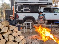
One of the nicest things was to come upon camp site surrounded with downed trees just begging to be cut up and split. We had so much firewood we left quite a bit for the next adventurer. Dennis has an electric chainsaw which I am totally sold on - maybe if they have a sale soon I will finally pick one up. After cutting the logs I took off my shirt and began grunting a performing that strange male ritual where we swing heavy things with a sharp end and make big chunks of wood into smaller pieces. It really felt good swinging my Fiskars X25 Splitting Axe and blowing apart wood.
SED 09.jpg

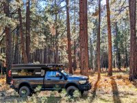
My final picture was taken at a spot where I stopped on the trail and watched Dennis and his wife disappear into the distance. First I lost sight of them, then the sounds they were making were absorbed by the silent forest, and then they were gone. It's nice to be in a group in the forest but then again, it's also nice to be alone. I enjoy stopping at a beautiful place and catching up later. This moment was so peaceful, so beautiful, so natural, so...real. The picture you see is an electronic image - it is false. The reason you will never feel the same feeling I felt when I was alone in the forest is because it is impossible. I can share pictures, tell a story, but all of that falls short.

I take these photographs and write these paragraphs to inspire others to begin truly living life. I hope my children will someday stumble upon this collection after I am long gone, and they may decide to visit the same places, and feel the same feelings. For the average person you have approximately 4,000 weeks of life to live. How many do you have left and how will you spend them?

I have decided to live life and ignore the false promises of the ruling class...
SED 10.jpg
 
Last edited:

ramblinChet

Well-known member
Sedona Backcountry Trail

Part Two of Two

by Chet Szymecki

At this point we were approximately half way through this 250+ mile trail and really enjoying the adventure. We were still in the Kaibab National Forest and it was easy to find camping spots large enough for both of our trucks and wood was plentiful. The nights were just slightly on the cool side so a fire was perfect. We had initially planned to meet in Arizona in September but my schedule forced us to slip to November which we both felt was really pushing the limits of good weather. As it turned out, the first few weeks of November were absolutely perfect temperatures during the day and night.
SED 11.jpg

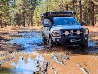
I was our lead navigator and I used Gaia GPS on my factory Uconnect 4 with 8.4" touchscreen. The map layer I use most often is the Gaia Topo and one of the details I like is the fact it shows the locations of springs. Although the trail had been dry we encountered this wet area near a spring so I took the opportunity to assess the conditions and drive through in two-wheel drive without spinning an all-terrain tire. Dennis was running a hybrid AT/MT and opted to engage his Atlas transfer case and crawl through without slipping either.
SED 12.jpg

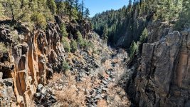
We stopped by Sycamore Falls for a short hike and sightseeing. The geological formation here was much different compared to what we had been experiencing the past several days and was a pleasant surprise. During my adventures I always make an effort to schedule in short hikes each day although I have much room for improvement. Navigating a trail for most of the day coupled with breaking down and setting up camp, add in a few meals, and maybe a stop here or there...exploring can become busy. My target goal is to incorporate a total of one hour of walking in per day.
SED 13.jpg

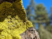
Amidst all the grey rock and brown trees was some interesting green growth on a few of the rocks in the area. It stood out to such a degree that it appeared to be out of place in the midst of everything else. With the sunlight hitting parts, this bright color was quite attractive. Again, the seemingly randomized natural beauty of nature simply can not be duplicated.
SED 14.jpg

Here was a mistake in the making. We had been on relatively flat roads for quite some time and Dennis wanted to spice things up after lunch so he selected a four-digit forest service road to have some fun on. While talking over our radios I made sure to confirm that based upon my map, this was a high-clearance 4x4 road and looking out in front of me, it was barely visible and appeared to be unused for an extended period.

I suggested Dennis lead if he wanted to tackle this trail and early on all seemed fine. It didn't take long until it began to become a guessing game of where the actual trail was and I began to feel a bit uncomfortable. A short time later Dennis halted forward progress and stepped out to scout ahead - I jumped out also and after searching high and low, it appeared that we had wandered slightly off of a seldom used trail. Dennis spotted a connecting road just a hundred meters or so away but it would be necessary to clear a path of some small trees and bushes. I strongly suggested that our best choice was to double back and get out the same way we came in. It was longer but I was against cutting or running over anything unless it was an emergency. We had made a mistake exploring this trail and it was long past the time to correcting it.
SED 15.jpg

Continuing south we dropped down into the Prescott National Forest and were simply stunned by the rapid change in scenery. Within just a few hours we went from a forested area to wide open high-desert where everything seemed to be miles away. Honestly, if you are looking for one trail which will show you the many different faces of Arizona, I would recommend the Sedona Backcountry Trail be placed on your short list. Along this part of the trail we enjoyed shelf-roads and stopping into the former mining town of Jerome complete with a nearby ghost town.
SED 16.jpg

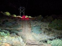
Here we are running the power lines north of Cottonwood, Arizona late at night. If you are interested in this trail I would strongly suggest you top off your tanks in Cottonwood as there no more opportunities to fuel up until you arrive back in Sedona. It was fun to travel at night and exercise our off-road lights although the reason we were traveling so late was not planned.

When we stopped to fuel up I began talking with a German family (ourlifeisaholiday) exploring these United States in a really cool vehicle. It is common for me to strike up conversations although this time was somewhat different since Dennis and his wife elected not to join in. Dennis departed after mentioning they were "heading to the first place on the right that we saw driving in" for dinner and I figured I would catch up in a few minutes. Minutes later I departed and drove to the location Dennis mentioned and they were not there so I called out on the radio and received no reply. After a few more attempts I tried calling Dennis' phone but there was no answer. I then began driving up and down the road we came into town on, stopping at every restaurant, and still was unable to find them. Finally, with very broken communication on the radio I continued to repeat "phone." Dennis had left his phone in his truck and they decided to go to a restaurant in another part of town. Dennis heard me say "phone" so he retrieved his phone, called me, and communications were reestablished.

To make the evening even more interesting, when we began to head north out of Cottonwood, all of the former disbursed campsites along the trail were marked closed along with threats of significant fines. After hours of driving we ended up parking in an approved large dirt parking lot in the middle of the desert with thirty other freedom lovers. Over the years, as this lifestyle grows, it is clear to me that our corrupt politicians and dysfunctional government bureaucrats are continually closing down camp site, access roads, and prohibiting human travel in natural areas.
SED 17.jpg

The next day most the trails were sandy and fun - we could tell we were closing in on Sedona when we began to see those beautiful red rocks, pink Jeeps, side-by-sides, etc. A nice place to stop for lunch was the Honanki Heritage Site which was more or less stones piled up near a mountain. While reading the descriptions of these "complex societies," I often consider other advancements in other areas of the world such as mechanical clocks, massive churches with stained glass, books, etc. What's so complex with regards to stacking stone and packing them with mud?
SED 18.jpg

As we closed in on Sedona there was an optional spur for high-clearance 4x4 vehicles called Devil's Bridge that ended at Vultee Arch. It was a fun trail but keep in mind that since it is close to Sedona there are many other users to include pink Jeeps, side-by-sides, hikers, etc. The trail was busy and although it was fun, it was a bit too crowded for my taste. Of course, the more crowded a trail is, the more dust there is and with the sun setting, vision can be obscured. Mix that with folks on vacation renting a side-by-side and you can see where I am going - it's a tough call but I ran with my lights on and kept a slow pace.
SED 19.jpg

We successfully completed the Sedona Backcountry Trail in four days which I consider an absolute minimum. Six or seven days would have been perfect although Dennis only had a few weeks and we wanted to knock out a number of trails together in Arizona. If you have a 4x4 vehicle you should be fine on 99% of the trail and if you come to an area that is too challenging, there is often a go-around. I must admit, it was quite fun driving an AEV Prospector into old mining towns along the way.
SED 20.jpg
 
Last edited:

Forum statistics

Threads
188,341
Messages
2,905,776
Members
229,959
Latest member
bdpkauai
Top