Paper 2.0

Photobug

Well-known member
I am not sure where to put this since the only navigation subforums are in regards to navigating with computers either software or hardware. Even though I like to carry redundant pieces of hardware with redundant software, I have had numerous failures of electronic equipment in the past, so always like to have a paper backup of some sort.

I have a number of state atlases for every I have been or go on a regular basis, although this starts to add up. What is recommended for backup to electronic navigation?
 

roving1

Well-known member
I have a milk crate full of dog eared Gazetteers for 2/3 of the country. I have 2 others filled with USGS quads and other trail maps and books. While I am attached to them sentimentally they just are not worth bringing anymore. Even my faithful US interstate atlas hasn't made a trip with me in years. The only paper map I have used in forever is an atlas of Mexico since I don't have as good a base level spatial relationship in my head like I do for the US and Canada.

My non-answer answer is more redundancy as used cell phones are dirt cheap and having an obsolete phone with google maps and a gps app on it banging around a glovebox is a million times better map than anything on paper. I also have a cheap old Nuvi gps that came with just a street basemap loaded up with free topo maps for every state. Again more redundancy.

My actual on topic answer I guess would be the Gazetteers you already mentioned. They are they only thing that is all encompassing yet with enough granular detail to actually still be able to be useful off road.

If you know where you are going and you are not leaving a small area USGS topo maps are great as are National Geographic maps. But unless you are going to one specific place it's impossible to have enough pertinent maps and state wide maps are useless unless they are a Gazetteer type thing.

Sometimes I will print a high zoom Gaia layer just to have as a quick reference of the lay of the land and also print that to a pdf to use in case the app itself is not working.

I have seen useful paper maps of Australia and Africa but they just have these gigantic areas with only a few tracks, roads and features so the detail on the map is useful. If you try that here there is too much info to convey meaningfully on one map so you need dozens and dozens of maps or have maps with so much info omitted they are useless. For the lower 48 especially I don't see any real value to lugging around a significant amount of paper maps anymore.
 
Last edited:

pluton

Adventurer
Agree that the gazetteer-sized atlases are the only thing that's practical without knowing the specific small area one is going to. For huge areas in maximum detail, nothing beats multiple electronic devices. A second smartphone like roving mentioned, or a mapping GPS w/ maps installed like the Garmin Montana I have. (tho my 2011 Montana's touch screen is now starting to fail after 9 years.)
 

Photobug

Well-known member
A second smartphone like roving mentioned, or a mapping GPS w/ maps installed like the Garmin Montana I have. (tho my 2011 Montana's touch screen is now starting to fail after 9 years.)

Yep that sounds like a plan. I am uber paranoid because I have had failures of all kinds but in situations where both a GPS and a map (chart were critical). This is not the case when driving off road. As long as one of the sources has at least one of the maps working then I should have a way to navigate back to a paved road and a gas station.

What would be a good up to date electronic map source to back up Gaia installations?
 

roving1

Well-known member
What would be a good up to date electronic map source to back up Gaia installations?

You can use this link to download all of these free topo maps and follow the instructions to add to Garmin's mapsource. Then you can also sync these maps to a Garmin GPS device. I have a super cheap old nuvi with every state topo map downloaded to it via SD card. Its not searchable like it would be on a Garmin Topo device like a Montana or something but I can switch to a detailed map that has my current location on it which is good enough. Plus hard to beat free plus the cost of a cheap used street or topo GPS if you do not have one.

It takes a bit of effort to figure it out and download everything but once you have the files you can back them up and transfer at will to a lifetime of devices for offline use.


Photobug

Well-known member
You can use this link to download all of these free topo maps and follow the instructions to add to Garmin's mapsource. Then you can also sync these maps to a Garmin GPS device. I have a super cheap old nuvi with every state topo map downloaded to it via SD card.


That is a great idea a completely second set of hardware and software source for maps from my primary pad. The Nuvis are starting at less than $100.
 

DaveInDenver

Middle Income Semi-Redneck
I still bring and use Gazetteers and paper maps. Haven't had one corrupt its SD card so far and they're all still on the same set of batteries they came with originally.
 

Photobug

Well-known member
I still bring and use Gazetteers and paper maps. Haven't had one corrupt its SD card so far and they're all still on the same set of batteries they came with originally.

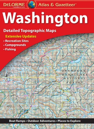
I generally have 3 or more independent nav sources with me. The one time I went without paper almost proved disastrous because of very high end corrupt software. I currently have a collection of Delorme and Benchmark atlases for my local areas. Staring at the Gaia for days in a row trying figure it out makes me forget how much more satisfying a real map is. Even better than an atlas is a big chart/map you can roll out on a table and study the area, routes and options of places to go.
 

DaveInDenver

Middle Income Semi-Redneck
I generally have 3 or more independent nav sources with me. The one time I went without paper almost proved disastrous because of very high end corrupt software. I currently have a collection of Delorme and Benchmark atlases for my local areas. Staring at the Gaia for days in a row trying figure it out makes me forget how much more satisfying a real map is. Even better than an atlas is a big chart/map you can roll out on a table and study the area, routes and options of places to go.
It's a tiered system for me, too. I have GPS receivers, I personally don't care for touchscreens of phones and we don't own any tablets. Yup, they're indispensable in their role. But there's no substitute for a large printed map or atlas to give context and overview. Even with a large screen it's hard to find the right zoom and detail to figure out if a trail goes anywhere and especially when you're sitting there on the ground trying to decide to go left or right.

Just my observation here but most navigation with handhelds ends up just being following tracks instead of exploring. I know a lot of people here do their homework and the tracks are researched ahead of time but generally the 4x4 community seems to just download GPX tracks from a handful of sources and are running down a check list of trade routes. Actually, that's not just 4x4 but MTBs and hikers do that, too.
 

Photobug

Well-known member
It's a tiered system for me, too. I have GPS receivers, I personally don't care for touchscreens of phones and we don't own any tablets. Yup, they're indispensable in their role. But there's no substitute for a large printed map or atlas to give context and overview. Even with a large screen it's hard to find the right zoom and detail to figure out if a trail goes anywhere and especially when you're sitting there on the ground trying to decide to go left or right.

Just my observation here but most navigation with handhelds ends up just being following tracks instead of exploring. I know a lot of people here do their homework and the tracks are researched ahead of time but generally the 4x4 community seems to just download GPX tracks from a handful of sources and are running down a check list of trade routes. Actually, that's not just 4x4 but MTBs and hikers do that, too.

I thought I was old school because I want to carry a map just in case. You use maps as your primary source for navigating.

So I took a look at my collection of atlases and would want large scale maps if I was going to use paper as my primary nav source. As much as I like actual maps I still see using my pad as primary nav source just because the simplicity of carrying so much information in one thin pad.
 

1Louder

Explorer
I haven't had a hardware failure in a very long time. Other than with cheap Android tablets. My Apple stuff and name brand Android stuff has worked fine. I have a messenger bag full of maps. It is a nice backup and is not my primary source for data. Many of the paper maps I have are available electronically.

Delorme Map books are available in Avenza $19.99 a piece or $.99 per page if you don't need the whole book.
Butler Maps ( BDR route maps) are available in Avenza
Nat Geo Maps are available in Gaia GPS with a premium subscription and Avenza on a per map purchase basis. Gaia being the much cheaper route for this data
Local PDF Maps - For example the Barry Goldwater Range maps for the El Camino Del Diable. These are GEO Referenced. Meaning with the right app you can see yourself on the map. An Avenza Pro subscription supports this feature. $29.99

While Gaia is my go to app. I use Avenza as required for PDF imports.
 

Forum statistics

Threads
188,024
Messages
2,901,302
Members
229,352
Latest member
Baartmanusa
Top