Here is a link to an excellent map with additional links and details of the trails in the Silverton area. You will recognize may of their photographs from my photographs. I have done all of the trails except Poughkeepsie Gulch in a 4x4 but I have even done that trail on a motorcycle. Looking at this map, Using the link below, I think I have pictures from the following trails, 2,3,7,8,9,13,14,17,18,19, and 21. If you find my other thread of our pictures from our 2008 Trip, I posted pictures from most the other trails on this map.
We do not like to go on 4x4 trails without any prior knowledge unless we are wheeling with local people. What we have done is purchase excellent books on the 4x4 trails of Colorado and Utah. We have several books now but here is the one we use the most.
This book covers all the trails we have done for the most part in Colorado. It will also cover the areas around Tin Cup, and Cripple Creek. We also make a point to stop at the forest service offices to find out if there are any new developments such as washouts or dangers in the area. They always have great advice and suggestions as well as additional maps of the area. Some trails have one way sections so you need to plan your loop trail rides accordingly.
Wow! I think that I know where I may be vacationing this year. I've only been to Silverton in the dead of winter and spent most of my time trying not to freeze to death.
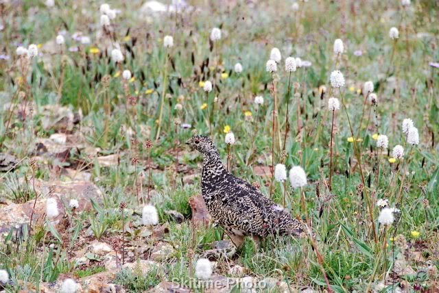
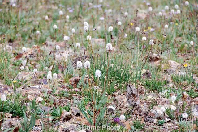
Here is a ptarmigan I found. At first I could not understand why it did not fly away. Then I saw the chicks, they were impossible to see if they stopped moving. Even now I only see one but I know there were about 6.
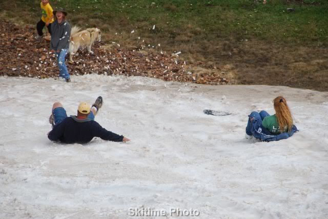
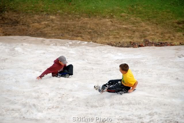
We found a safe snowy slope to play on. It took the kids big and small about an hour to have enough of the fun. It sure is fun in the middle of July.
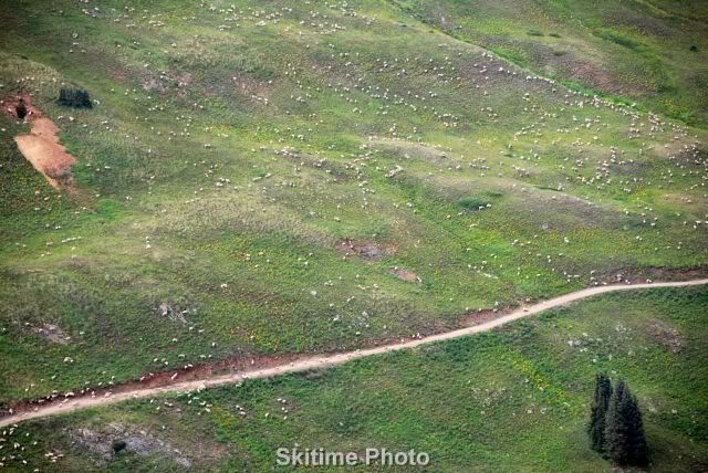
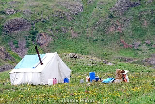
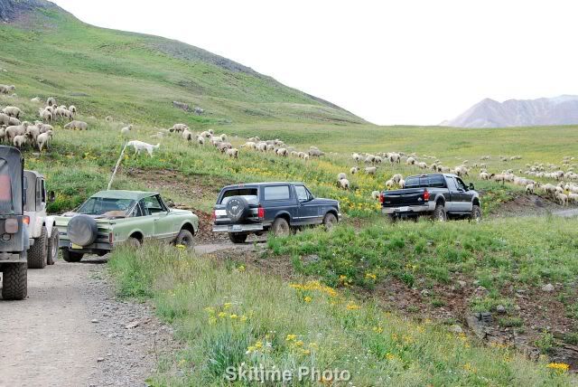
The area above tree line are often leased to sheep herders who bring in their sheep to graze. The sheepherder live in tents or shepard's wagons and move with the sheep as needed. We often see the flocks and the guard dogs but rarely the sheepherders.
Here you can see the sheepdog that guards the sheep day and night. They are amazing to watch. The dog seen here was very upset at our vehicles disturbing the sheep.
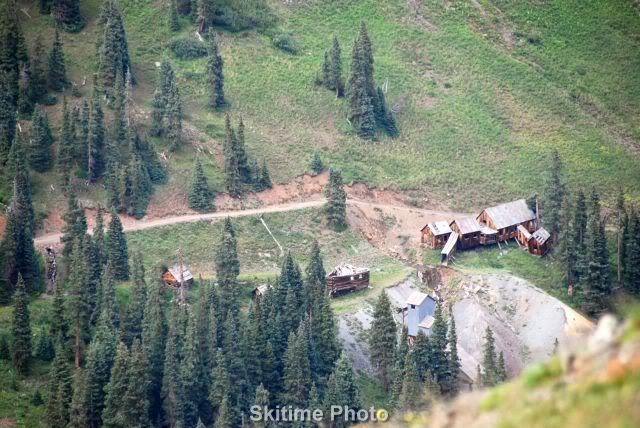
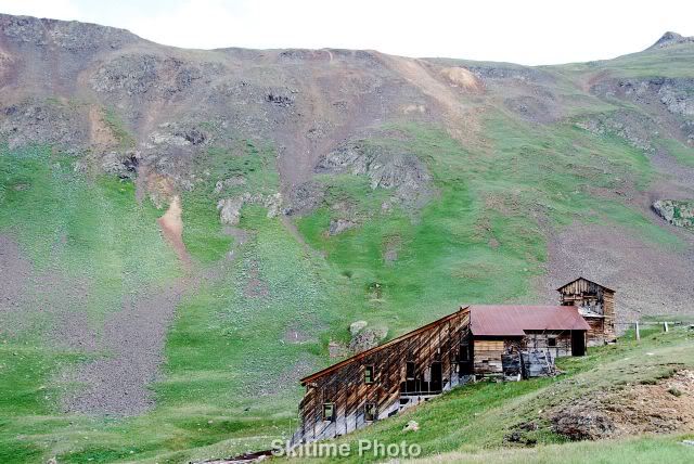
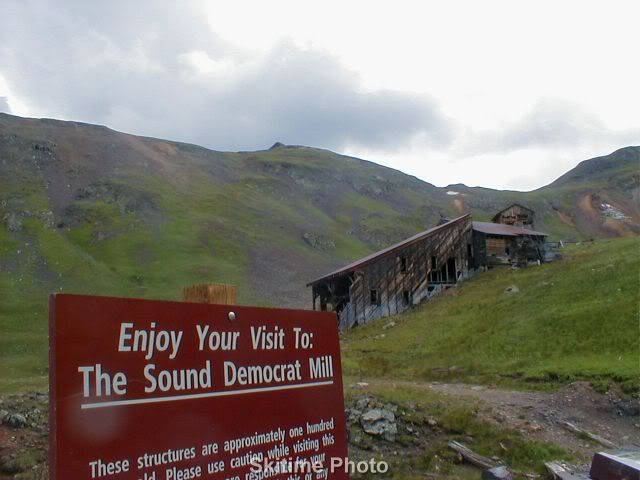
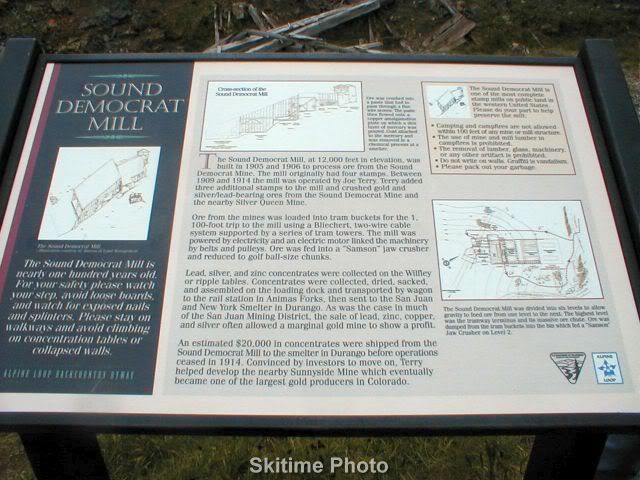
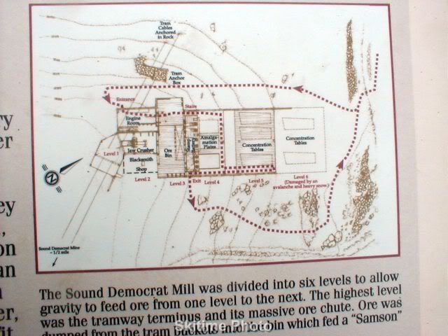
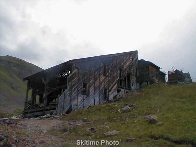
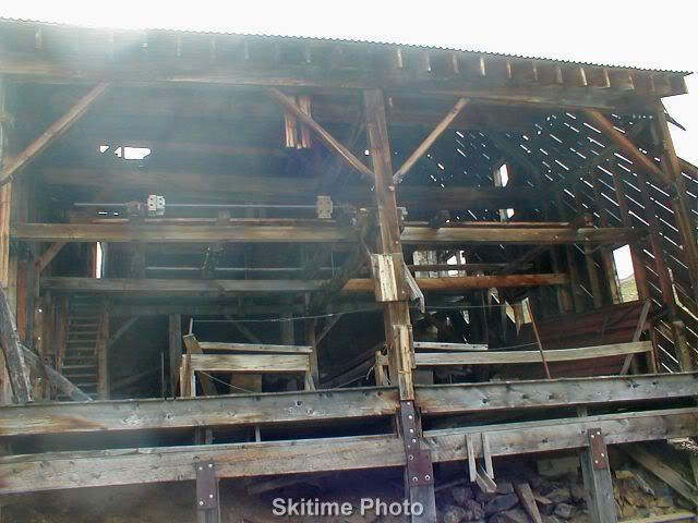
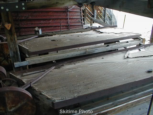
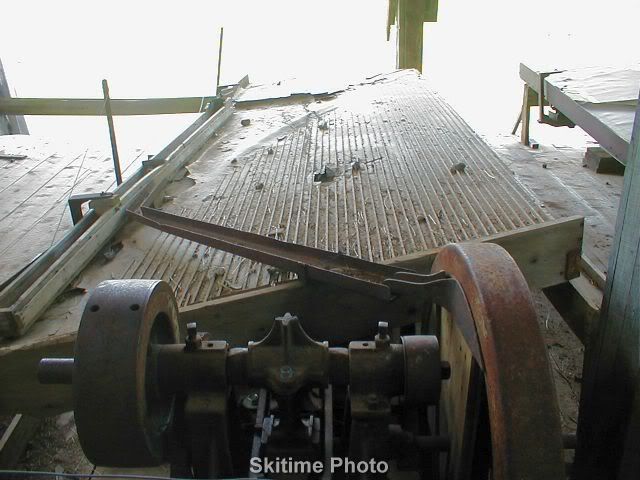
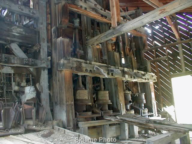
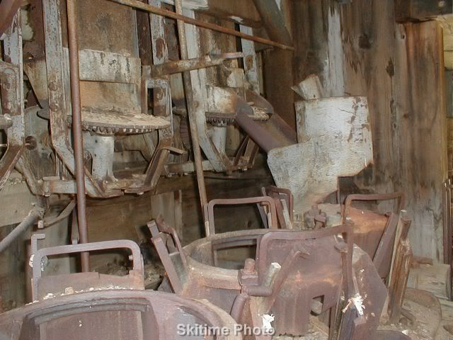
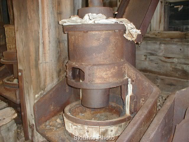
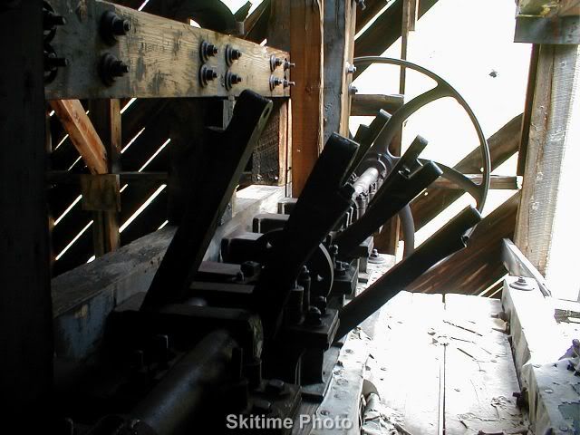
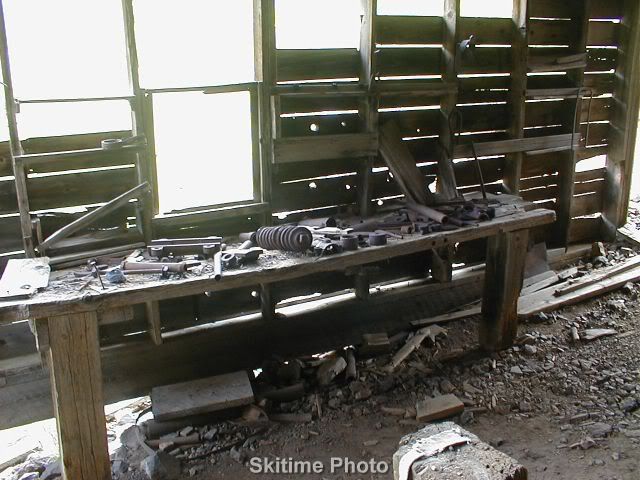
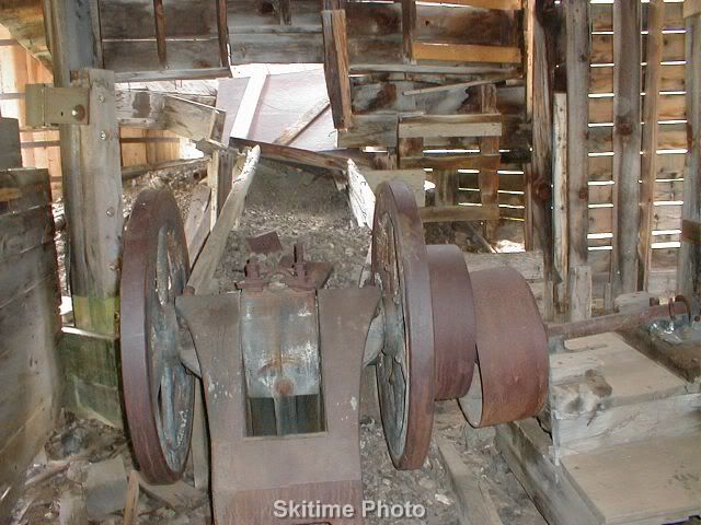
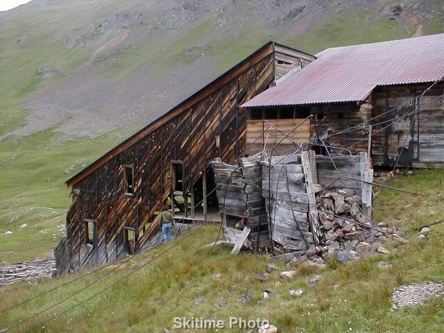
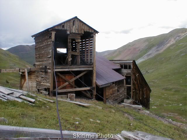
This is a stamping mill that is about the most intact mill you can find. It definitely is a must see if you would like to understand what happened after they get to gold and silver ore out of the mountains.
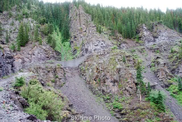
That is the Sound Democrat Mill in Placer Gulch. See trail # 13 on the map link I posted earlier. The preferred route is north to south because the last 1/2 mile is very steep so you should do it downhill especially if it has rained recently.
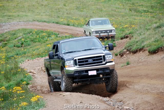
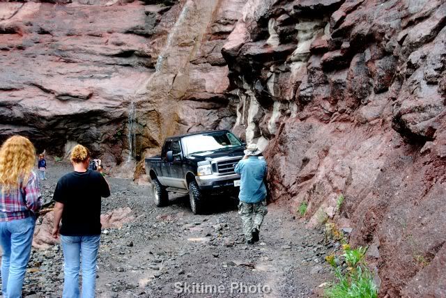
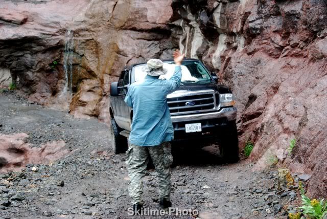
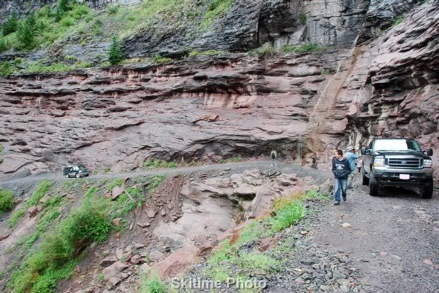
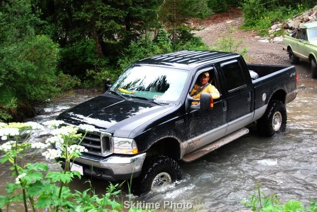
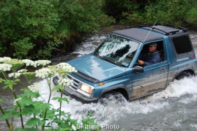
It did amazingly well although it was not stock. It first hauled a large camping trailer out to Silverton from Illinois. It has both a suspension lift and a body lift if I remember correctly and of course larger wheels and tires. I think only limited slip differential in the rear but I am not 100% sure if it even had that. In this first picture he was actually stuck and had to take a couple of trys because one front and one rear wheel was getting up in the air and killing his momentum. It had a hard time on hairpin mountain roads but I was amazed how well he managed. I would never suggest such a large vehicle for trail riding but he went on most trail rides. We had one scary situation on Imogene trail where there was a washout along a cliff. He got the kids and wife out and his dad directed him though it. His truck was tight against the wall and the cliff side tire was extremely close to sliding off the cliff. It was tense for a while. Because of my camera angle, my pictures do not do justice to how close this was to a disaster. In the third pictures you can see his rear tire within 4-5 inches of sliding off. That tan rock was the edge. I was the lead vehicle and I was worried even driving a Geo Tracker across this washout so when I got past the washout and immediately stopped the group because of the danger. Personally I would of never tried the maneuver in that truck. This was on a rainy day and on this trail there could of been a worse washout ahead and then he would of had to back down the same trail because this stretch of trail has no where he could turn around with his length of vehicle.
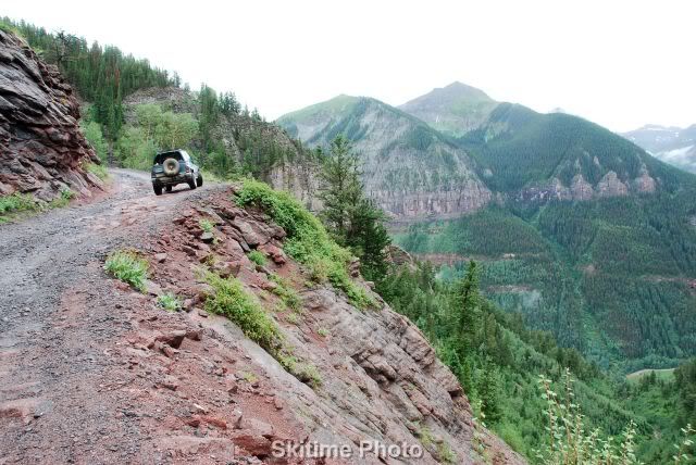
This was my rig stopped ahead to give you an idea of the cliff involved.
There are some advantages to the his rig as seen here.
This site uses cookies to help personalise content, tailor your experience and to keep you logged in if you register.
By continuing to use this site, you are consenting to our use of cookies.