upcruiser
Perpetual Transient
The leaves are gone, the air practically crackles in the morning with the cold air and smell of damp earth and forest. The sunny days are becoming fewer and fewer, replaced now with the menacing and often cold steel-grey skies and wet weather. Winter is just around the corner and the comfortable weather of late summer and early fall is long gone from the Upper Peninsula. The weather can vary widely with heavy snow or with a late indian summer, it is unsettled as is the mother lake, Lake Superior. Sounds awful, no? Well, outside of having a bit more tolerance for the more severe elements, late October has its own pleasures as well. Despite some pretty abysmal weather forecasts, I was bound and determined to squeeze a 4 day trip in while home for a short spell between work trips.
I am no stranger to what most folks would refer to as "bad weather" in fact, for my job I chase what the grand majority of folks would consider "bad weather" around the world. Spending 6 hours on the top of a mountain somewhere, enduring temperatures in excess of -30 degrees Fahrenheit is pretty trying no matter how much you love winter. A guy I worked with once told me, "There is no such thing as bad weather, just bad clothing choices." Spoken like a true Norwegian right? Fact is though, I can get pretty comfortable in super cold conditions, but what I find really tough are temperatures in the low 30's with rain. That is the real deal, and coincidentally, pretty much the forecast I was staring at for my foray.
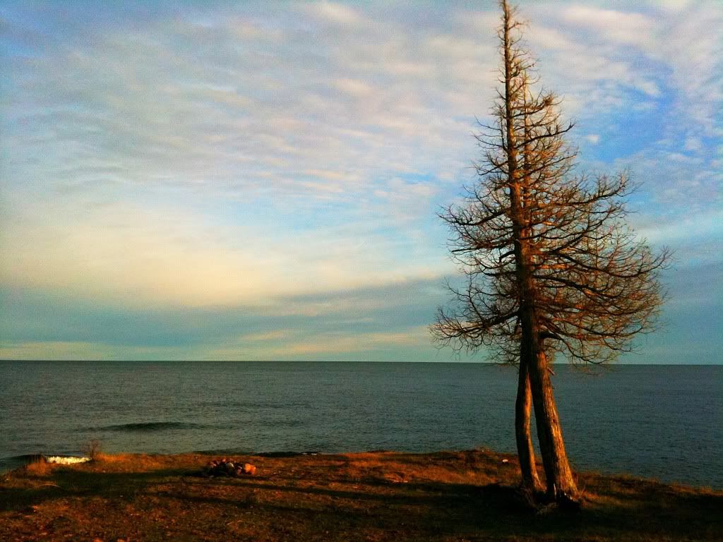
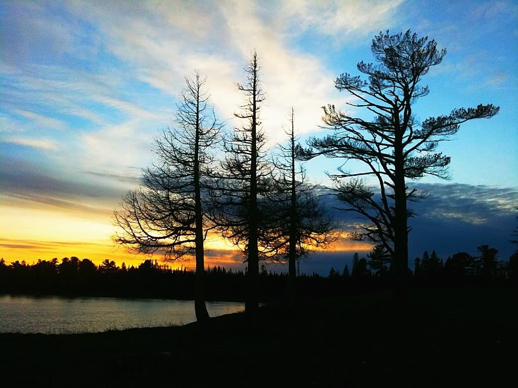
October 26th 2010 brought the passing of a record low through the upper Great Lakes region. Sustained winds at 70mph, it was referred to as the Midwestern cyclone. It brought 25 foot waves to Northern Lake Michigan, and just shy of 30 footers to the eastern Canadian shores of Lake Superior. It was the real deal. Tuesday and Thursday's winds battered the region thoroughly and caused swollen rivers and creeks with the heavy downfall of rain. The ground is usually pretty soggy this time of year anyway but now it was really a mess.
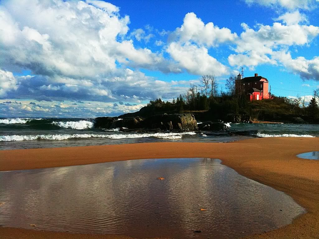
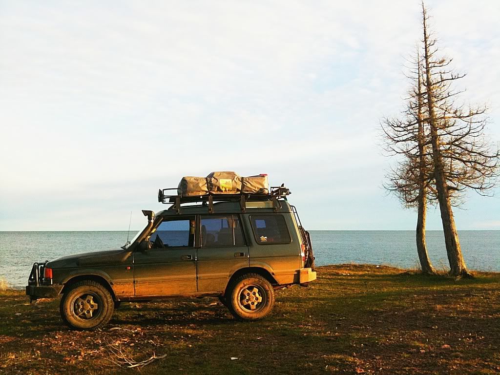
Shot of the light house in Marquette as the system started to ramp up on the 26th of October.
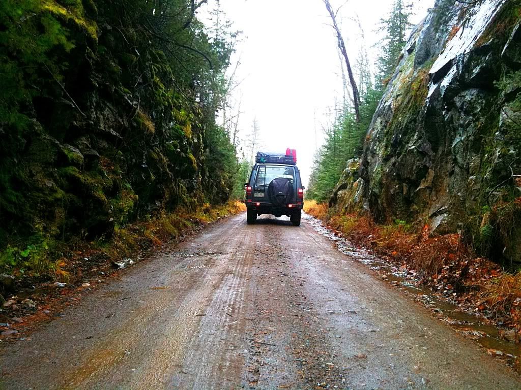
I had laid out a route that I wanted to cover over the next four days. It travelled through areas I hadn't been as well as some areas I had been. My goals were to see as much new stuff as possible including, historical sites, hiking trails, water falls, views, and take some photos along the way. I would traverse across the southern side of the Yellow Dog Plains and work my way west towards the Sturgeon River Gorge Wilderness then head north from there, up and around the Keweenaw Peninsula before exploring around the Lanse area crossing back over to Marquette via the Yellow Dog Plains area.
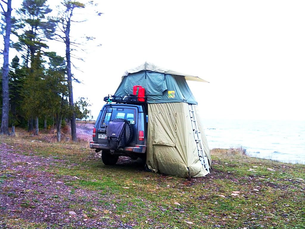
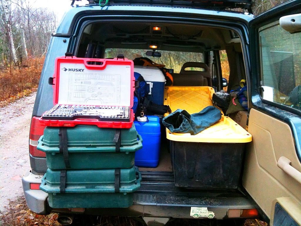
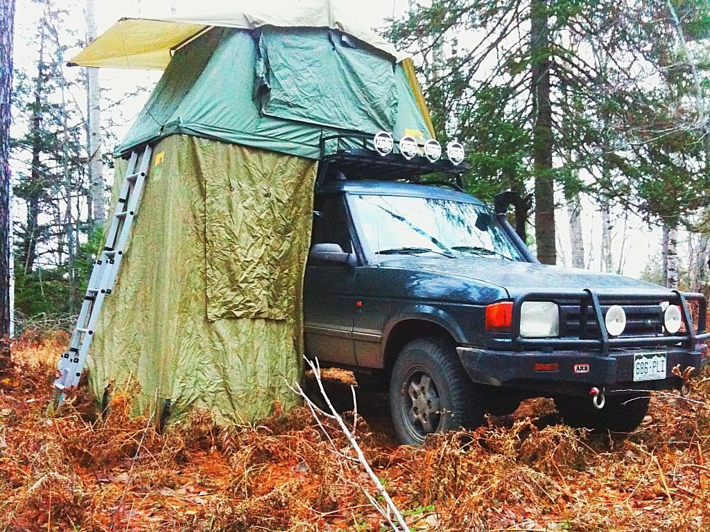
I had the Land Rover mostly loaded up Thursday evening, as the storm was just starting to show signs of winding down. All of the usual gear was there with the addition of my chain saw which I expected to be putting to use over the weekend as downed trees were practically everywhere and much of my proposed route was heavily forested and quite thick at times. This was going to be a good time!
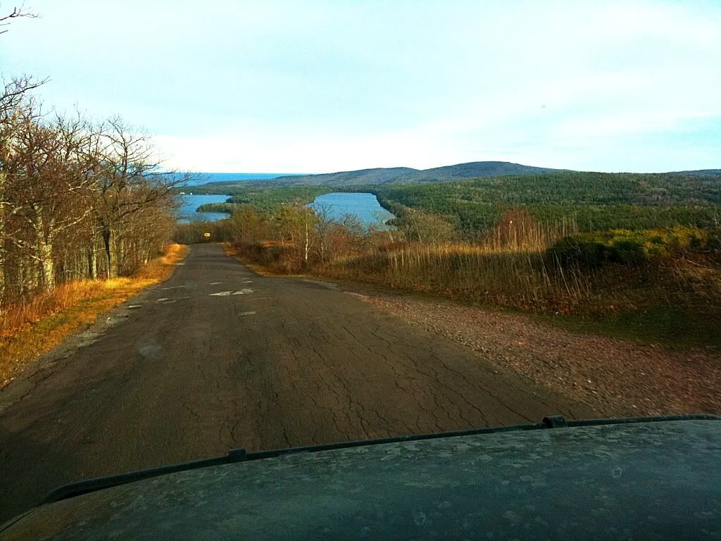
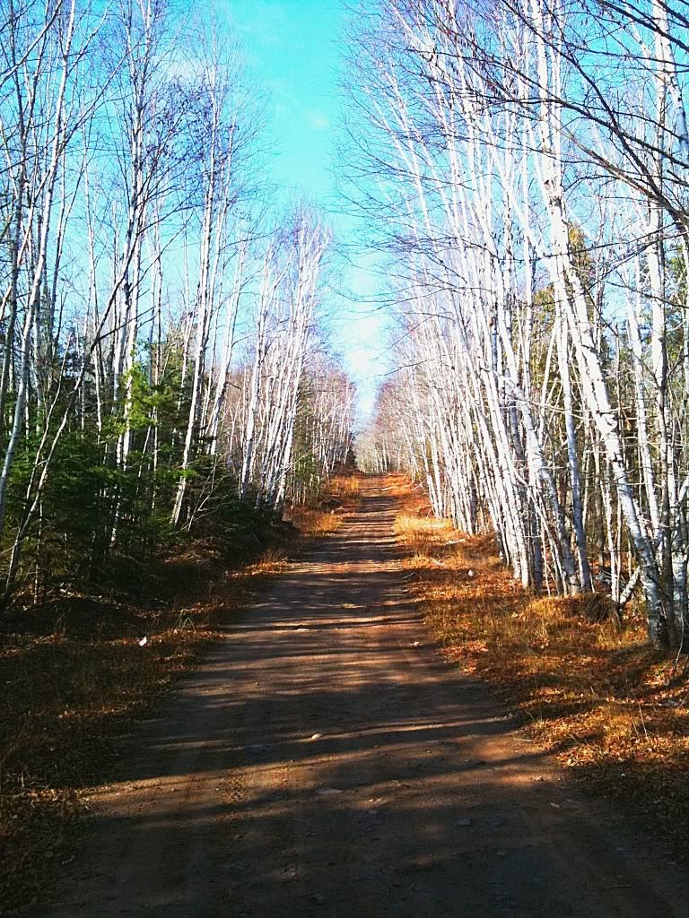
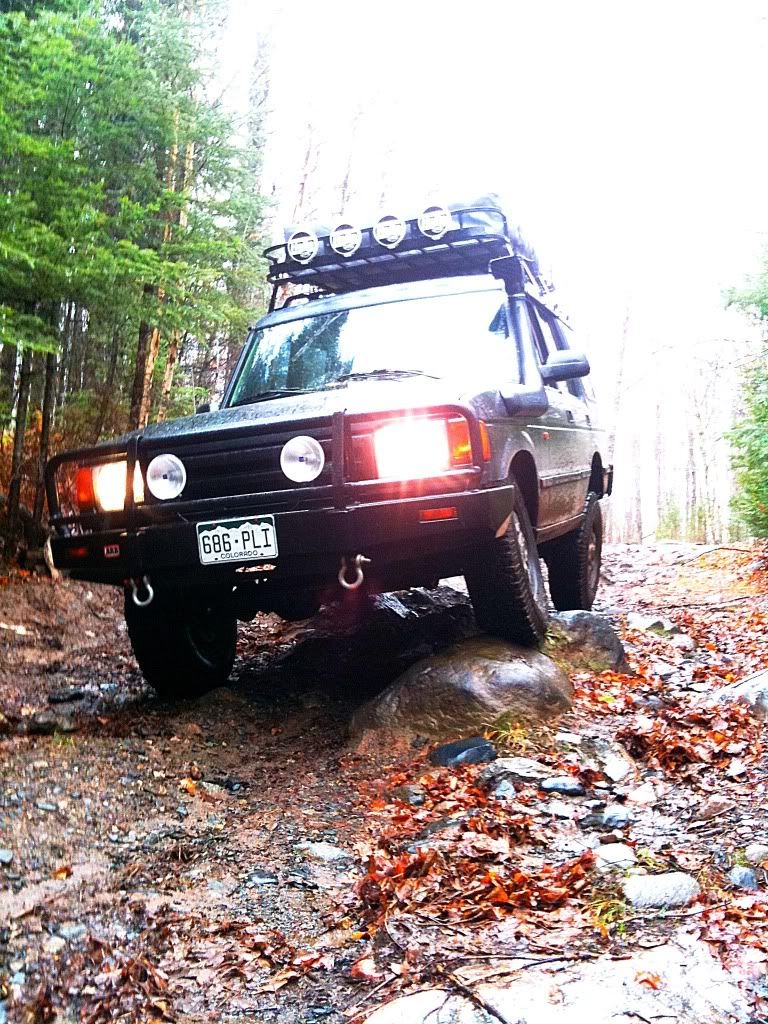
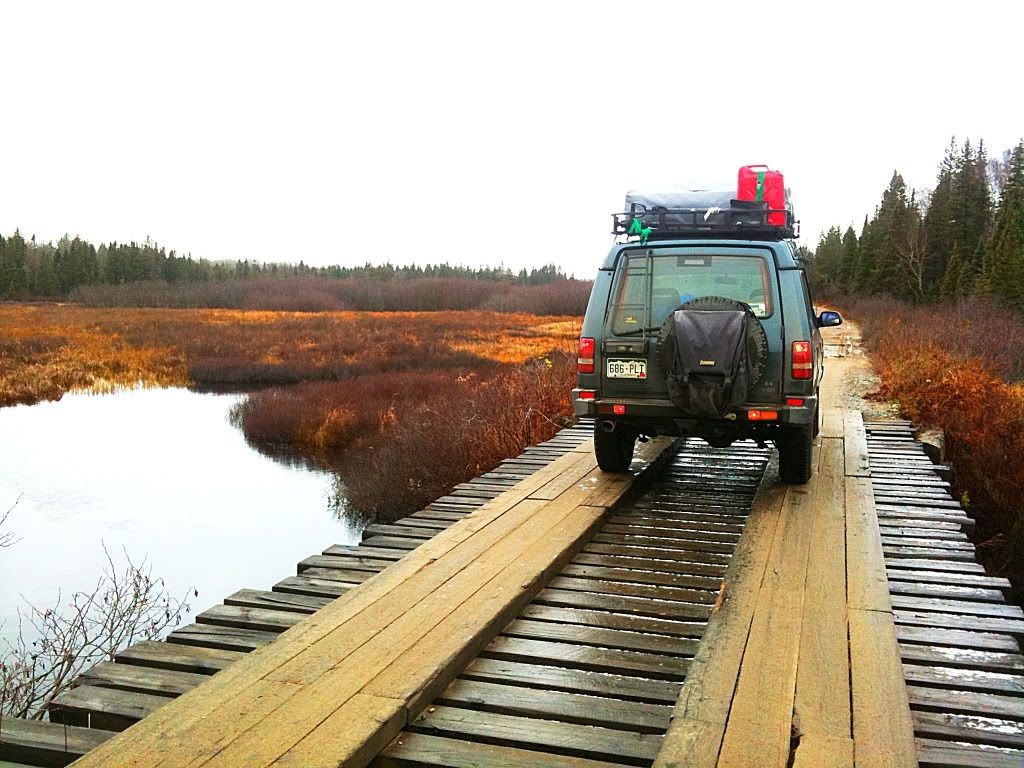
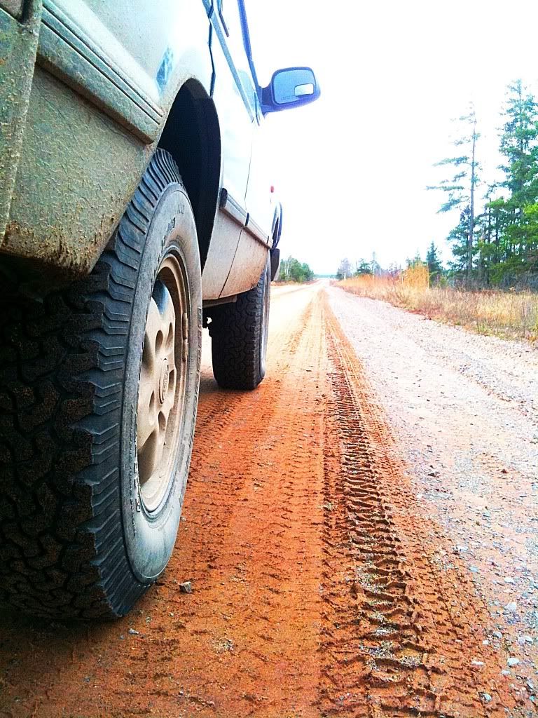
As I rolled out of Marquette, the frigid rain turned to wet snow/sleet, the forecast was holding and temps were dropping as cold air moved into the region. I rolled out on country road 510 which is the main connector from the town of Negaunee to Big Bay, the end of the road northwest of Marquette. It is a mostly unpaved road, a dirt highway if you will that saves a long detour down into Marquette and around county road 550. I worked my way up to the Red Road which would start me across towards Silver Lake and skirt the northern side of the Dead River Storage Basin. This is a major dirt road also. It is wide and well maintained but due to the recent weather the sandy surface was extremely soft and rutted. It started to make me wonder just exactly what this route had in store for me if such a major road was in such poor condition.
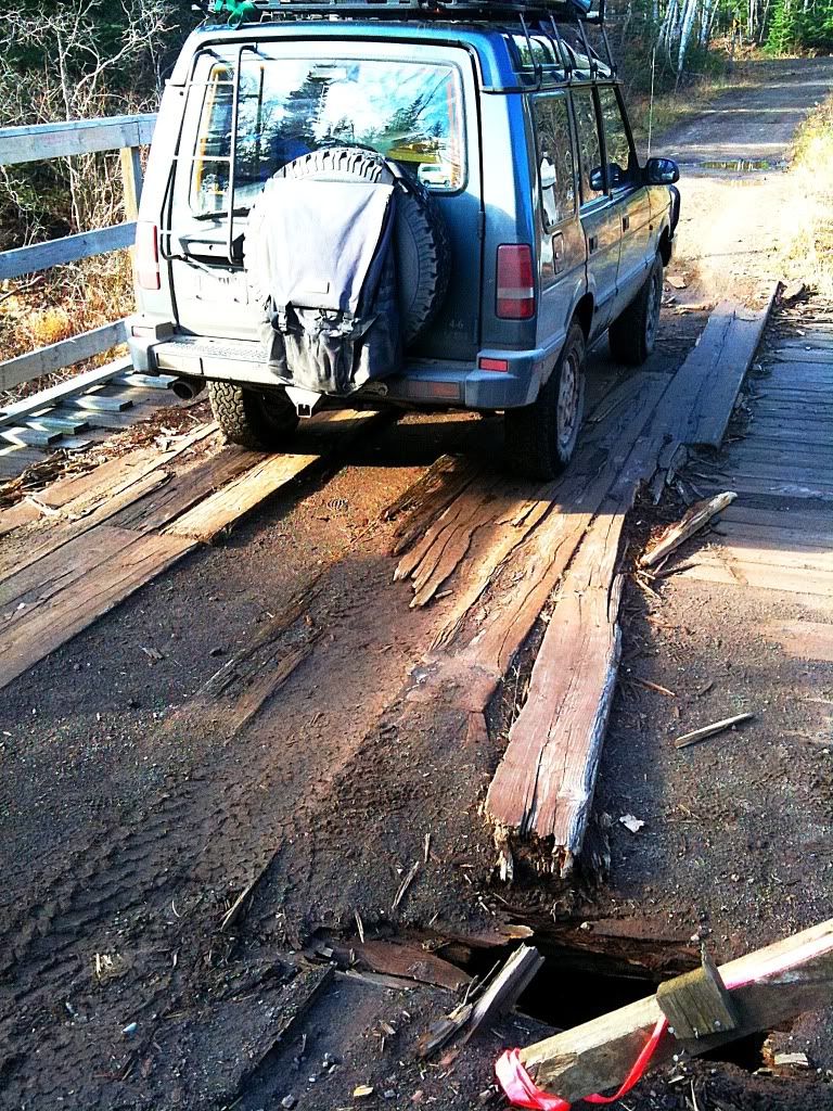
I began working my way west and on the south side of the Silver Lake Basin. I was headed for Wolf Lake, then continuing on to the Peshekee Grade. The route consisted of a series of dirt roads, some nicer than others as well as some two tracks and less developed trails. Immediately upon getting onto a narrower road I came across down trees.
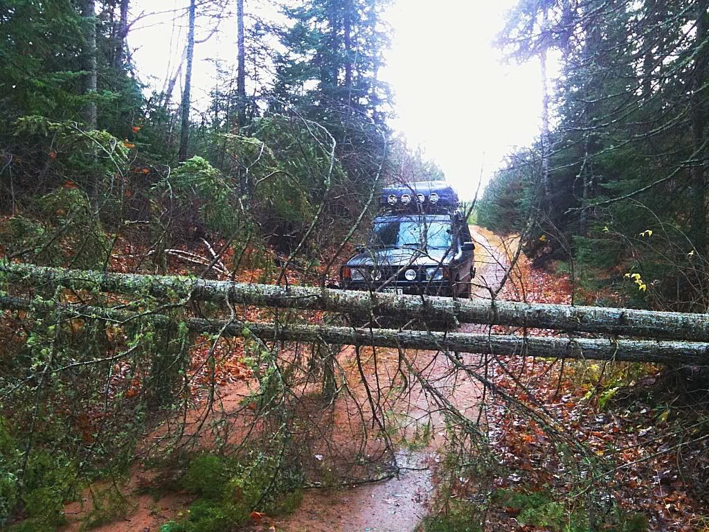
I was going to have to earn it on this one as they say. Luckily the saw was packed in an easily accesible spot (luck or just great planning and foresight?) and it made short work of the obstacle with four quick cuts and a bit of dragging. Snow showers were coming in intermittently and with the smell of two stroke on me and cut pine I realized, yeah, this is what fall is all about in the north country.
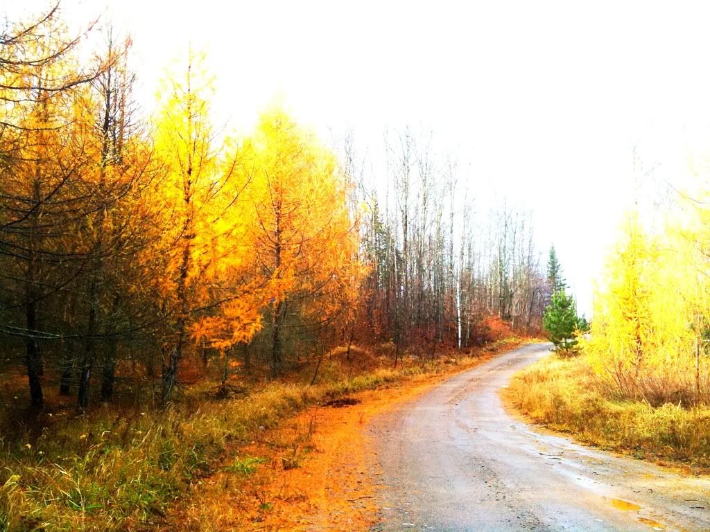
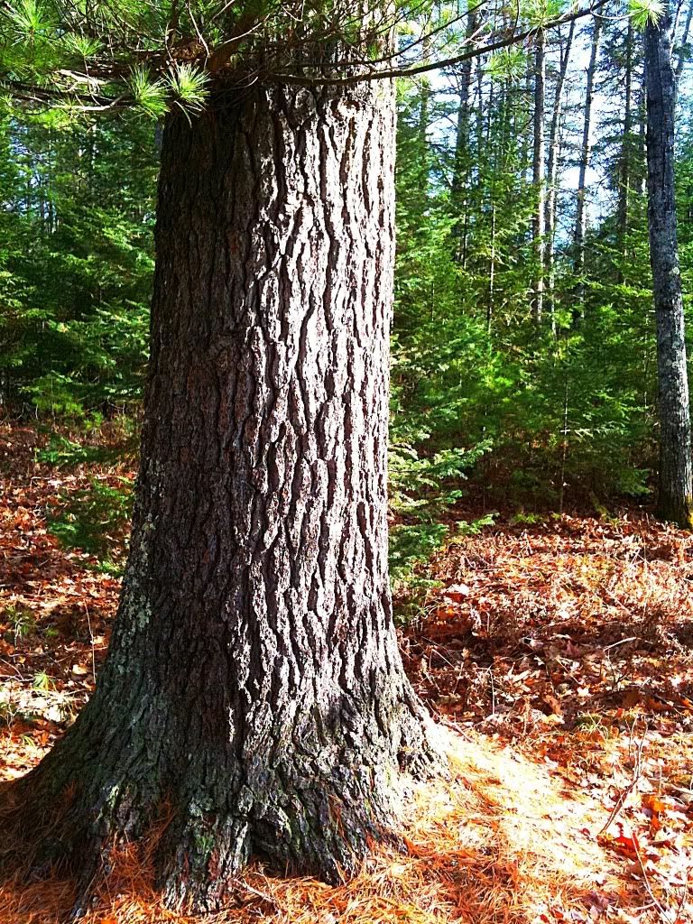
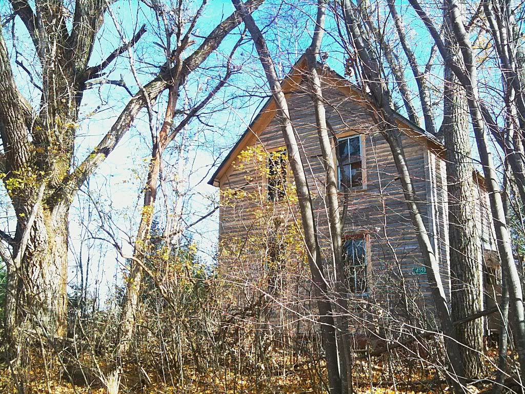
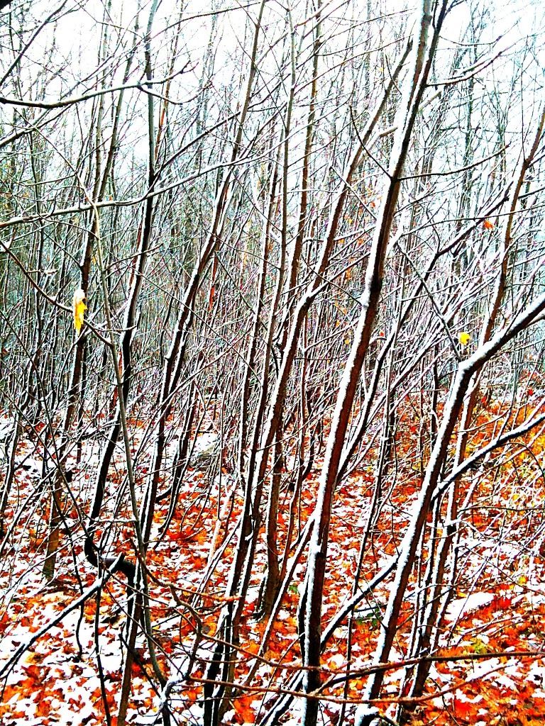
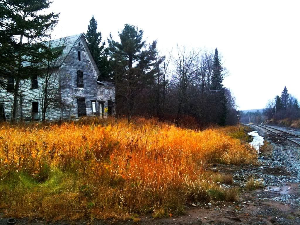
Even with the hardwoods having long shed their leaves, there is still plenty of color left in the woods as seen by these Tamaracks. The region I was crossing is mostly undeveloped with a random camp here or there and logging operations underway in places. I guess I should back up and explain the term "camp." In the UP camp refers to a range of things from your vacation cottage on Lake Superior to your rustic cabin, perhaps a glorified shack out on some acreage in the boonies. If it isn't your primary residence, it is your camp. Obviously, these weren't your fancy vacation cottages out this way, these were hunting camps, devoid of electricity or modern amenities, more of what people might picture when they hear the word.
The route finding is always interesting in these out of the way areas too. I was using a Michigan Gazeteer and a Delorme GPS system, neither of which ever fully agree with each other and often, both are not correct as to what the roads and trails really look like. Combined with my two navigational aids I typically have to make educated guesses as to how to proceed when either a. the trail doesn't exist or b. other roads and trails are there that clearly are on neither map. Using this method I found Wolf Lake then proceeded around the southern side of it and worked west towards the Peshekee Grade
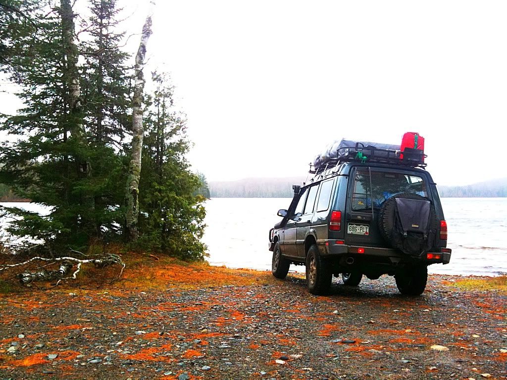
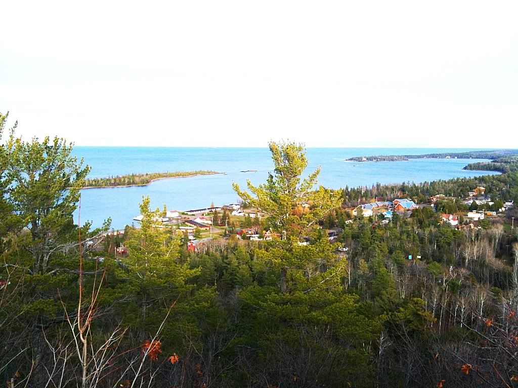
Wolf Lake
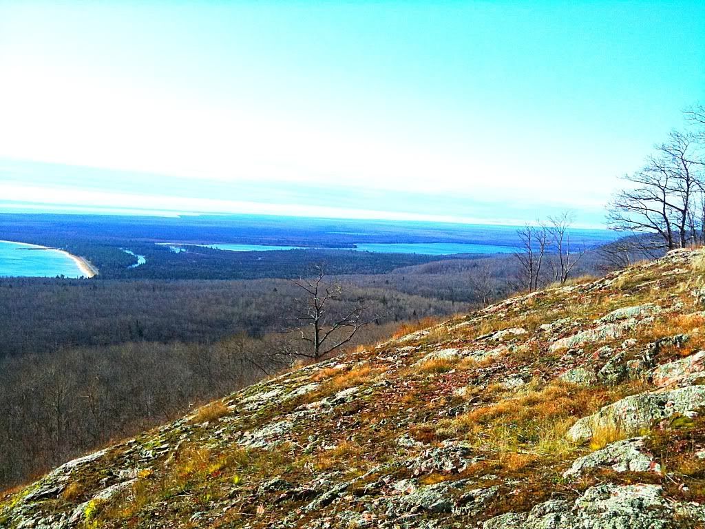
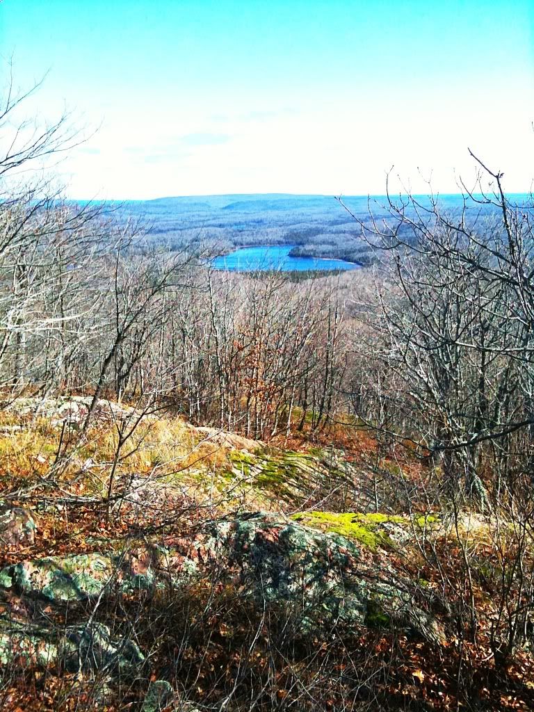
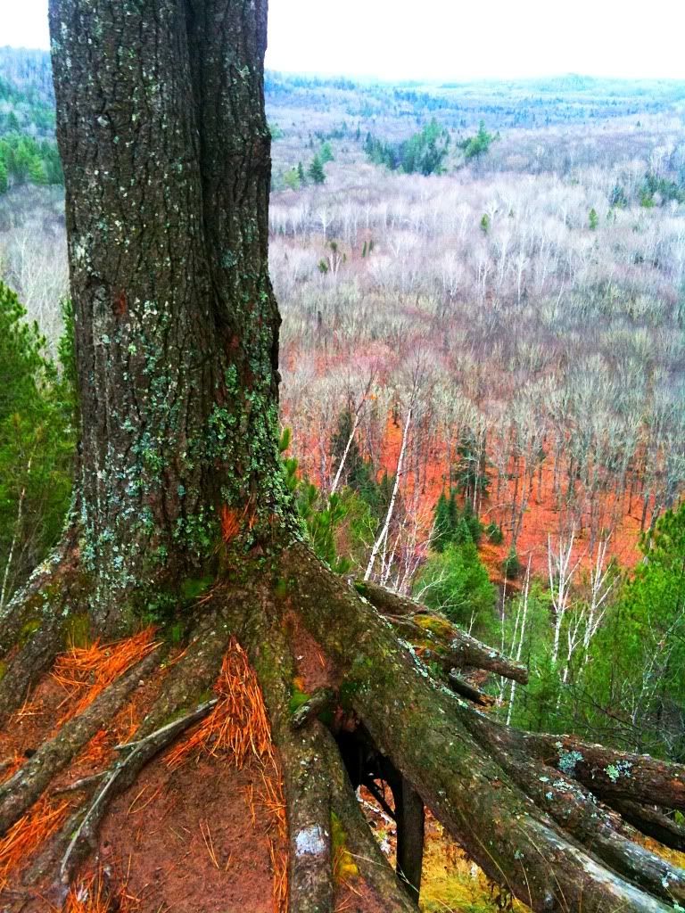
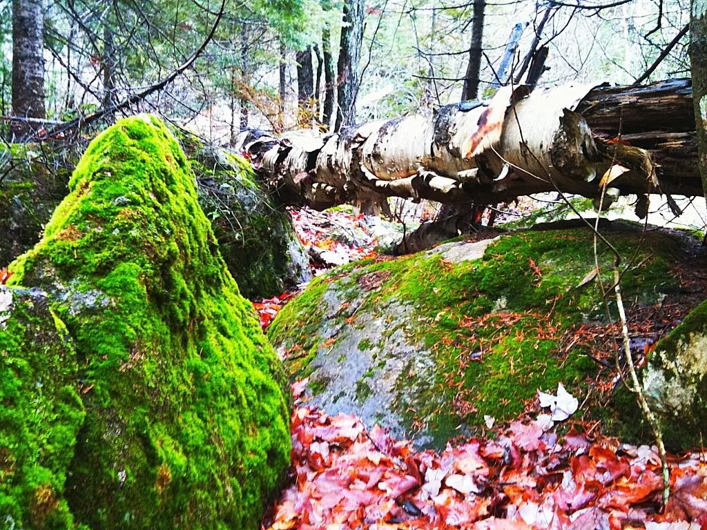
The route got narrow and a bit more rugged as I passed Wolf Lake. Eventually I connected with the Peshekee Grade, a road which should be all the motivation needed to convince anyone that sometimes dirt roads are better than poorly maintained paved ones. To say the Peshekee is a rough ride on its old, broken asphalt is an understatement. It is a suspension worker thanks to years and years of frost freeze cycles, heavy logging operations using it, and just the topography it is laid on. The Peshekee Grade was originally an old rail line built in the 1800's that connected the town of Michigamme to Huron Bay and Lanse. It is a beautiful drive and winds along the Peshekee River most of the way. Eventually it turns to a dirt road as it reaches it's elevation max and starts the decent down near Mt Arvon towards Skanee and Huron Bay.
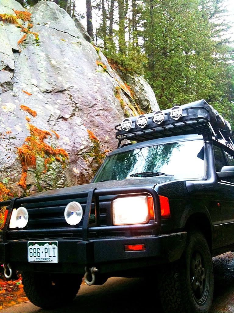
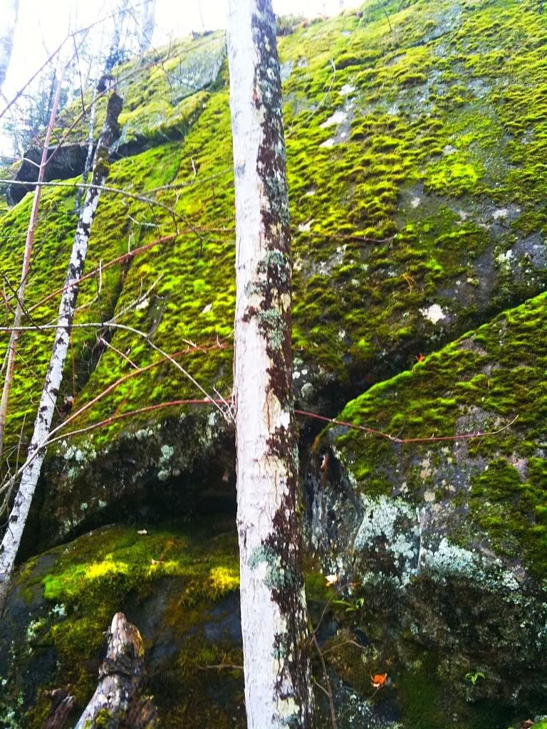
An old rock cut along the Peshekee Grade
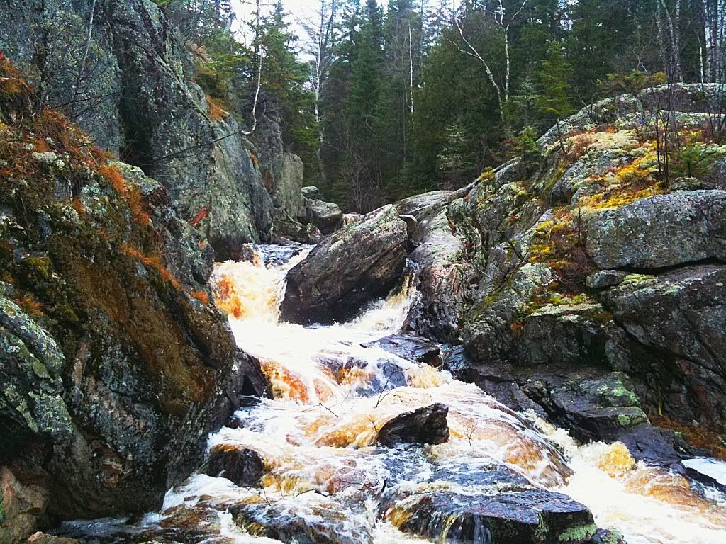
Just past the rock cut is a nice set of falls on the river, it can be found by a small pull out on the right with a visible foot trail.
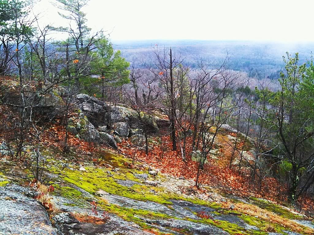
As you get up closer to the headwaters of the river more open marshy areas are crossed. Prime moose country. I talked to a guy who was going out to his hunting spot and had just come across two large bull moose standing in the road, they scurried down into swamp and disappeared. Would have been a great photo op and I was bummed to have missed it.
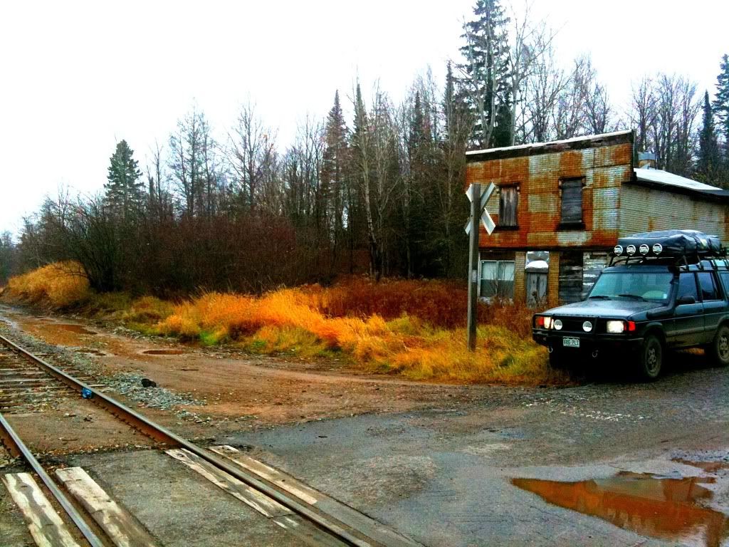
On the way down the grade towards Mt Arvon I realized that the burdened roof basket had some loose bolts that were making noise. It was a good opportunity to stop and make some lunch and tighten things up. The rough roads and terrain will take a toll on things if they aren't snug. After the break I crossed into the Keweenaw tribe's reservation lands on a series of nice and smooth dirt roads working my way towards the old, mostly abandoned town of Herman.
To be continued....
I am no stranger to what most folks would refer to as "bad weather" in fact, for my job I chase what the grand majority of folks would consider "bad weather" around the world. Spending 6 hours on the top of a mountain somewhere, enduring temperatures in excess of -30 degrees Fahrenheit is pretty trying no matter how much you love winter. A guy I worked with once told me, "There is no such thing as bad weather, just bad clothing choices." Spoken like a true Norwegian right? Fact is though, I can get pretty comfortable in super cold conditions, but what I find really tough are temperatures in the low 30's with rain. That is the real deal, and coincidentally, pretty much the forecast I was staring at for my foray.
October 26th 2010 brought the passing of a record low through the upper Great Lakes region. Sustained winds at 70mph, it was referred to as the Midwestern cyclone. It brought 25 foot waves to Northern Lake Michigan, and just shy of 30 footers to the eastern Canadian shores of Lake Superior. It was the real deal. Tuesday and Thursday's winds battered the region thoroughly and caused swollen rivers and creeks with the heavy downfall of rain. The ground is usually pretty soggy this time of year anyway but now it was really a mess.
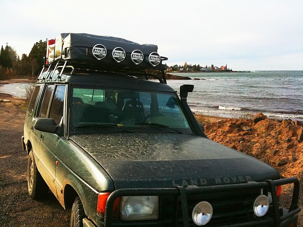
Shot of the light house in Marquette as the system started to ramp up on the 26th of October.
I had laid out a route that I wanted to cover over the next four days. It travelled through areas I hadn't been as well as some areas I had been. My goals were to see as much new stuff as possible including, historical sites, hiking trails, water falls, views, and take some photos along the way. I would traverse across the southern side of the Yellow Dog Plains and work my way west towards the Sturgeon River Gorge Wilderness then head north from there, up and around the Keweenaw Peninsula before exploring around the Lanse area crossing back over to Marquette via the Yellow Dog Plains area.
I had the Land Rover mostly loaded up Thursday evening, as the storm was just starting to show signs of winding down. All of the usual gear was there with the addition of my chain saw which I expected to be putting to use over the weekend as downed trees were practically everywhere and much of my proposed route was heavily forested and quite thick at times. This was going to be a good time!
As I rolled out of Marquette, the frigid rain turned to wet snow/sleet, the forecast was holding and temps were dropping as cold air moved into the region. I rolled out on country road 510 which is the main connector from the town of Negaunee to Big Bay, the end of the road northwest of Marquette. It is a mostly unpaved road, a dirt highway if you will that saves a long detour down into Marquette and around county road 550. I worked my way up to the Red Road which would start me across towards Silver Lake and skirt the northern side of the Dead River Storage Basin. This is a major dirt road also. It is wide and well maintained but due to the recent weather the sandy surface was extremely soft and rutted. It started to make me wonder just exactly what this route had in store for me if such a major road was in such poor condition.
I began working my way west and on the south side of the Silver Lake Basin. I was headed for Wolf Lake, then continuing on to the Peshekee Grade. The route consisted of a series of dirt roads, some nicer than others as well as some two tracks and less developed trails. Immediately upon getting onto a narrower road I came across down trees.
I was going to have to earn it on this one as they say. Luckily the saw was packed in an easily accesible spot (luck or just great planning and foresight?) and it made short work of the obstacle with four quick cuts and a bit of dragging. Snow showers were coming in intermittently and with the smell of two stroke on me and cut pine I realized, yeah, this is what fall is all about in the north country.
Even with the hardwoods having long shed their leaves, there is still plenty of color left in the woods as seen by these Tamaracks. The region I was crossing is mostly undeveloped with a random camp here or there and logging operations underway in places. I guess I should back up and explain the term "camp." In the UP camp refers to a range of things from your vacation cottage on Lake Superior to your rustic cabin, perhaps a glorified shack out on some acreage in the boonies. If it isn't your primary residence, it is your camp. Obviously, these weren't your fancy vacation cottages out this way, these were hunting camps, devoid of electricity or modern amenities, more of what people might picture when they hear the word.
The route finding is always interesting in these out of the way areas too. I was using a Michigan Gazeteer and a Delorme GPS system, neither of which ever fully agree with each other and often, both are not correct as to what the roads and trails really look like. Combined with my two navigational aids I typically have to make educated guesses as to how to proceed when either a. the trail doesn't exist or b. other roads and trails are there that clearly are on neither map. Using this method I found Wolf Lake then proceeded around the southern side of it and worked west towards the Peshekee Grade
Wolf Lake
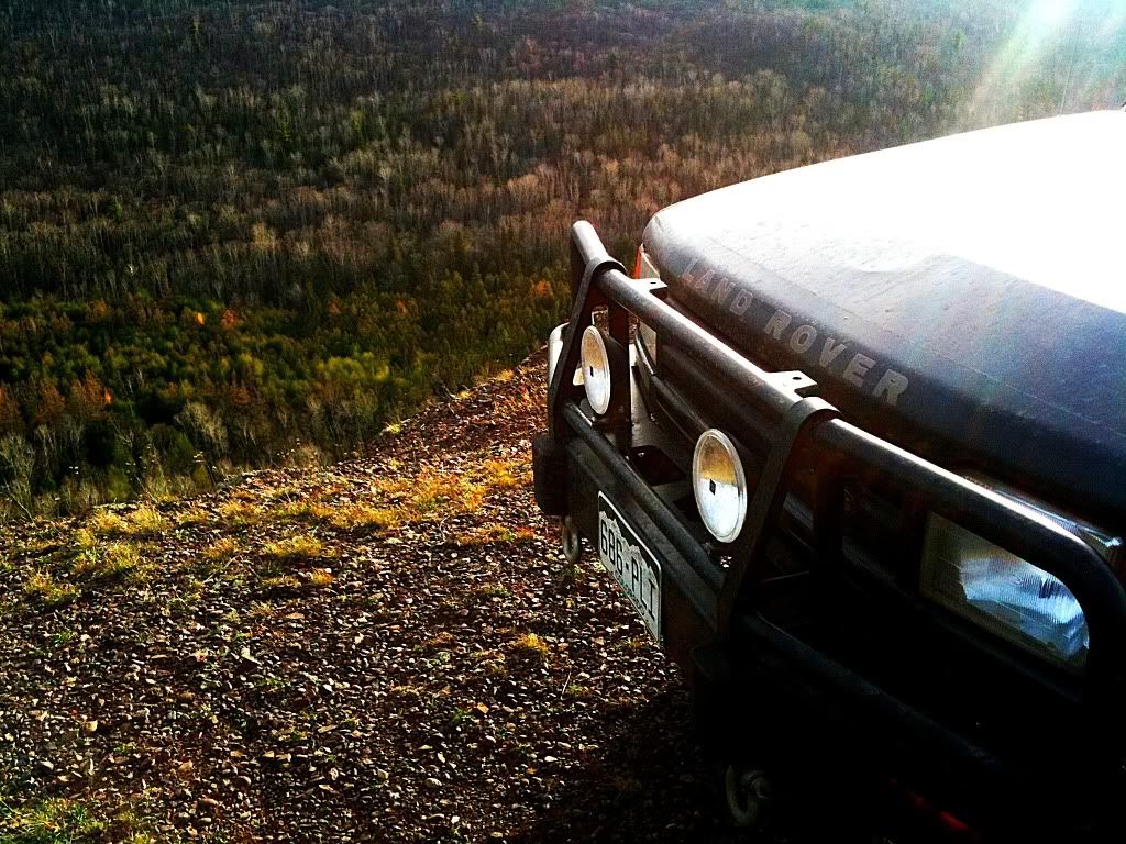
The route got narrow and a bit more rugged as I passed Wolf Lake. Eventually I connected with the Peshekee Grade, a road which should be all the motivation needed to convince anyone that sometimes dirt roads are better than poorly maintained paved ones. To say the Peshekee is a rough ride on its old, broken asphalt is an understatement. It is a suspension worker thanks to years and years of frost freeze cycles, heavy logging operations using it, and just the topography it is laid on. The Peshekee Grade was originally an old rail line built in the 1800's that connected the town of Michigamme to Huron Bay and Lanse. It is a beautiful drive and winds along the Peshekee River most of the way. Eventually it turns to a dirt road as it reaches it's elevation max and starts the decent down near Mt Arvon towards Skanee and Huron Bay.
An old rock cut along the Peshekee Grade
Just past the rock cut is a nice set of falls on the river, it can be found by a small pull out on the right with a visible foot trail.
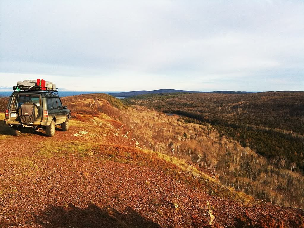
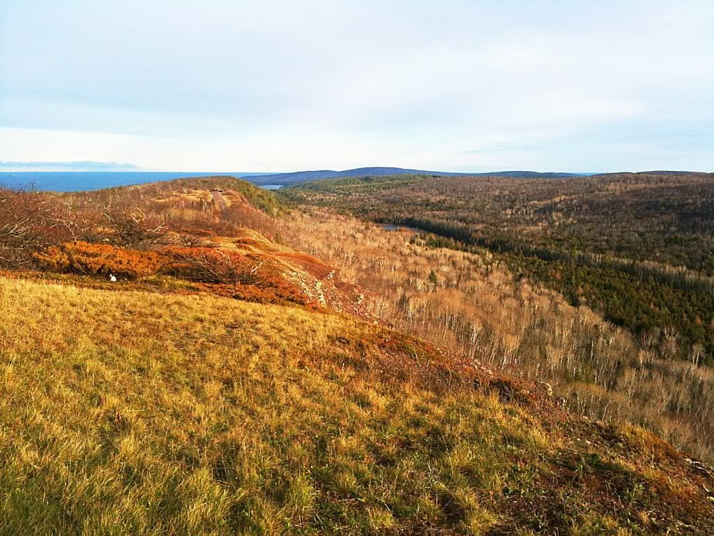
As you get up closer to the headwaters of the river more open marshy areas are crossed. Prime moose country. I talked to a guy who was going out to his hunting spot and had just come across two large bull moose standing in the road, they scurried down into swamp and disappeared. Would have been a great photo op and I was bummed to have missed it.
On the way down the grade towards Mt Arvon I realized that the burdened roof basket had some loose bolts that were making noise. It was a good opportunity to stop and make some lunch and tighten things up. The rough roads and terrain will take a toll on things if they aren't snug. After the break I crossed into the Keweenaw tribe's reservation lands on a series of nice and smooth dirt roads working my way towards the old, mostly abandoned town of Herman.
To be continued....
")