DVD
Adventurer
The sun rose over Leyva Canyon but hadn’t yet hit our campsite. The December chill was still in the air, so we carried our chairs and coffee mugs to a nearby hill in the sun. Enjoying the hot coffee on a cold morning, Laurie mimicked the line from MASH, and I played along:
“Listen, do you hear that?”
“What? I don’t hear anything.”
“Yes, let’s enjoy it.”
We spent the next 15 minutes in silence, sipping coffee, taking turns looking at the countryside through binoculars, listening to birds and insects, and enjoying the profound solitude of Big Bend Ranch State Park in Texas.

Beautiful sunrise at Yedra 2 campsite
Our first visit to the Big Bend area had it all: beautiful scenery, the unique border flavor of the Rio Grande, great trails for hiking and offroad travel, and immense solitude.
Of course, a trip like this always involves trade-offs and balances. You want solitude, but the National Park was developed to afford access to the masses, so you have to put up with some crowds to see the major attractions. You want to get to know the area in detail, but the size is immense, and you only have a week, so you have to miss interesting places. But all in all, it was a great trip.
We arrived at Big Bend National Park (BBNP) around 10 a.m. during the holiday week and dealt with the crowds, which seemed to be lingering in the visitor center to avoid the cold, blustery weather outside--we're talking low 40s and strong winds. We had to wait over ½ hr to acquire a backcountry permit--short line, but the people in front seemingly went through 50 permutations of their plans before finalizing their permits. Eventually, with permit in hand and fees paid, we started our journey into BBNP.
I prepared detailed plans for this first phase of the trip. We wanted to get a good flavor of BBNP in 2 days but only spend one night there due to campfire prohibition and cold winter nights. So I planned daily routes, with GPX files and preferred campsite locations. It must be a little bit like planning for a battle - as soon as things get started, the plans go out the window and you adapt to circumstances.
I had planned to acquire the backcountry permit at the Persimmon entrance station, but the ranger said that due to holiday volume, all backcountry permits were being processed further down the road at the main Panther Junction station. This meant that we had to stay on the paved park road all the way to the Rio Grande, rather than following my GPX route, which had us jumping onto offroad trails and getting away from the pavement and traffic and RVs as soon as possible.
But the weather cleared up a bit, traffic cleared out, and we were soon enjoying the beautiful sights of the Chisos Mountains.

Low clouds moving through the Chisos Mountains to dramatic effect
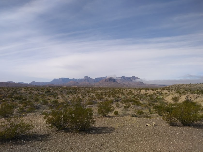
Another view of the Chisos with lingering low clouds
The border aspect of the Rio Grande is a defining characteristic--2 countries sharing the same aquifer--and we wanted to get a sense of that. For $5 roundtrip you can take an international rowboat trip across the river, from BBNP to the little village of Boquillas, Mexico. Ready for adventure, we passed through the tiny US border station (1 agent and kiosks to scan your passport upon return) and followed a hiking trail down to the river.

Rowboat across the Rio Grande

On the Mexican side of the Rio Grande

Exploring Boquillas
In Boquillas, we had a very good lunch at Falcons and cold cervezas. They offered a limited menu: quesidilla plate, chicken tamale plate, and goat taco plate.

Great lunch in Boquillas

Crossing back to the USA
Back in the national park, we finally hit the dirt trails, heading west on the River Road trail. We wanted to get to camp by late afternoon, which meant not necessarily hurrying, but passing by some interesting side trails and exploration opportunities. But we did have time to make a few stops along the trail.
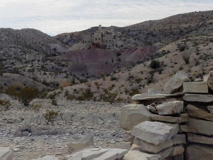
Exploring Mariscal mine ruins

Whoever lived here had a nice view
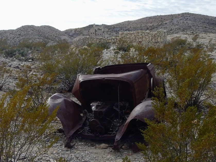
Mariscal mine ruins, including this old car hulk
Keeping with the international theme, our campsite this night was right on the Rio Grande. We arrived early enough to set up camp and explore the area, hiking along the river. The Rio makes a big 270-deg loop here such that the campsite is on the south side of the river, and we look north into Mexico as a peninsula, and then the Chisos Mountains in the US are further beyond.

The Loop campsite is on a little plateau above the Rio Grande--we slept in the back of the vehicle, looking out over the river
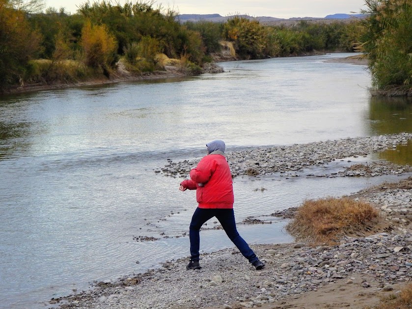
We'll know we're old when we no longer feel compelled to skip a nice, flat stone
Because it was a bit chilly, Laurie had the idea that it would be warmer to sleep in the back of the LR3. Typically, we’d have dinner and spend the evening around the fire. Unfortunately, ground fires are prohibited in the national park, so we set up the tent as an escape from the wind and ate dinner and read in there, eagerly waiting until it was late enough to get into the sleeping bags.

Not the most pleasant evening, huddled next to the little propane heater
As an aside, our investment in an insulated sleep pad last year really paid dividends on some of the cool evenings on this trip, and we slept warmly and well. When we first arrived at the Loop campsite, we could see a vehicle and camping gear a good distance upstream at Loop Camp 1, but with the falling temps at sunset, they packed up and left.
For the trip overall, we lucked out with weather, and the next day dawned calm and clear, and we enjoyed clear weather and moderate temps the rest of the trip.

Ahh, coffee is nearly ready - just a thin film of ice at the top of the water bottle

Nice breakfast view!
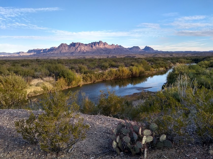
A final view from Loop campsite before hitting the trail for the day's adventures
Today we would explore the western side of BBNP, proceeding to Big Bend Ranch State Park (BBRSP) in the late afternoon. After breaking camp, we continued along River Road, checking out sights along the way.

Westbound and down on River Road trail, with Sierra Ponce in the distance
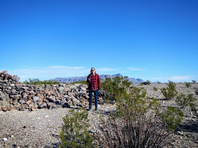
Johnson Ranch ruins

The mighty Cerro Castellan
We proceeded to Santa Elena Canyon, where the Rio Grande cuts through the landscape forming canyon walls up to 1500 ft above the river.

Northern face of Santa Elena Canyon
Next: Part II - Big Bend Ranch State Park
“Listen, do you hear that?”
“What? I don’t hear anything.”
“Yes, let’s enjoy it.”
We spent the next 15 minutes in silence, sipping coffee, taking turns looking at the countryside through binoculars, listening to birds and insects, and enjoying the profound solitude of Big Bend Ranch State Park in Texas.
Beautiful sunrise at Yedra 2 campsite
Our first visit to the Big Bend area had it all: beautiful scenery, the unique border flavor of the Rio Grande, great trails for hiking and offroad travel, and immense solitude.
Of course, a trip like this always involves trade-offs and balances. You want solitude, but the National Park was developed to afford access to the masses, so you have to put up with some crowds to see the major attractions. You want to get to know the area in detail, but the size is immense, and you only have a week, so you have to miss interesting places. But all in all, it was a great trip.
We arrived at Big Bend National Park (BBNP) around 10 a.m. during the holiday week and dealt with the crowds, which seemed to be lingering in the visitor center to avoid the cold, blustery weather outside--we're talking low 40s and strong winds. We had to wait over ½ hr to acquire a backcountry permit--short line, but the people in front seemingly went through 50 permutations of their plans before finalizing their permits. Eventually, with permit in hand and fees paid, we started our journey into BBNP.
I prepared detailed plans for this first phase of the trip. We wanted to get a good flavor of BBNP in 2 days but only spend one night there due to campfire prohibition and cold winter nights. So I planned daily routes, with GPX files and preferred campsite locations. It must be a little bit like planning for a battle - as soon as things get started, the plans go out the window and you adapt to circumstances.
I had planned to acquire the backcountry permit at the Persimmon entrance station, but the ranger said that due to holiday volume, all backcountry permits were being processed further down the road at the main Panther Junction station. This meant that we had to stay on the paved park road all the way to the Rio Grande, rather than following my GPX route, which had us jumping onto offroad trails and getting away from the pavement and traffic and RVs as soon as possible.
But the weather cleared up a bit, traffic cleared out, and we were soon enjoying the beautiful sights of the Chisos Mountains.
Low clouds moving through the Chisos Mountains to dramatic effect
Another view of the Chisos with lingering low clouds
The border aspect of the Rio Grande is a defining characteristic--2 countries sharing the same aquifer--and we wanted to get a sense of that. For $5 roundtrip you can take an international rowboat trip across the river, from BBNP to the little village of Boquillas, Mexico. Ready for adventure, we passed through the tiny US border station (1 agent and kiosks to scan your passport upon return) and followed a hiking trail down to the river.
Rowboat across the Rio Grande
On the Mexican side of the Rio Grande
Exploring Boquillas
In Boquillas, we had a very good lunch at Falcons and cold cervezas. They offered a limited menu: quesidilla plate, chicken tamale plate, and goat taco plate.
Great lunch in Boquillas
Crossing back to the USA
Back in the national park, we finally hit the dirt trails, heading west on the River Road trail. We wanted to get to camp by late afternoon, which meant not necessarily hurrying, but passing by some interesting side trails and exploration opportunities. But we did have time to make a few stops along the trail.
Exploring Mariscal mine ruins
Whoever lived here had a nice view
Mariscal mine ruins, including this old car hulk
Keeping with the international theme, our campsite this night was right on the Rio Grande. We arrived early enough to set up camp and explore the area, hiking along the river. The Rio makes a big 270-deg loop here such that the campsite is on the south side of the river, and we look north into Mexico as a peninsula, and then the Chisos Mountains in the US are further beyond.
The Loop campsite is on a little plateau above the Rio Grande--we slept in the back of the vehicle, looking out over the river
We'll know we're old when we no longer feel compelled to skip a nice, flat stone
Because it was a bit chilly, Laurie had the idea that it would be warmer to sleep in the back of the LR3. Typically, we’d have dinner and spend the evening around the fire. Unfortunately, ground fires are prohibited in the national park, so we set up the tent as an escape from the wind and ate dinner and read in there, eagerly waiting until it was late enough to get into the sleeping bags.
Not the most pleasant evening, huddled next to the little propane heater
As an aside, our investment in an insulated sleep pad last year really paid dividends on some of the cool evenings on this trip, and we slept warmly and well. When we first arrived at the Loop campsite, we could see a vehicle and camping gear a good distance upstream at Loop Camp 1, but with the falling temps at sunset, they packed up and left.
For the trip overall, we lucked out with weather, and the next day dawned calm and clear, and we enjoyed clear weather and moderate temps the rest of the trip.
Ahh, coffee is nearly ready - just a thin film of ice at the top of the water bottle
Nice breakfast view!
A final view from Loop campsite before hitting the trail for the day's adventures
Today we would explore the western side of BBNP, proceeding to Big Bend Ranch State Park (BBRSP) in the late afternoon. After breaking camp, we continued along River Road, checking out sights along the way.
Westbound and down on River Road trail, with Sierra Ponce in the distance
Johnson Ranch ruins
The mighty Cerro Castellan
We proceeded to Santa Elena Canyon, where the Rio Grande cuts through the landscape forming canyon walls up to 1500 ft above the river.
Northern face of Santa Elena Canyon
Next: Part II - Big Bend Ranch State Park
Last edited:
