Baja - Hwy 5 South of San Felipe to Hwy 1 (Puertecitos - Bahia Gonzaga - Chapala)
The Highway 5 connection south from San Felipe through Bahia San Luis Gonzaga then across the mountains to the Hwy 1 intersection at Chapala is referred to by the locals as the ‘Camino del Infierno'… translated as ‘Road from Hell'.
Gringos simply refer to it as the ‘Bad Road'.
Over the past few years the road has been paved all the way from San Felipe to Bahia Gonzaga (~150 kms), leaving only the final 60 km that reaches west over the mountains from the Sea of Cortez to the Hwy 1 intersection.
For days I debated our route plan and searched around online knowing that if the road was too bad we'd have to back-track over 400kms north to make the connection over to Highway 1.
Any predispositions about the conditions of this road were reinforced by someone or another on the interwebs with a strong enough opinion to have stated in some forum it for all to see. The online opinions range from ‘never do this road if you don't absolutely have to' to ‘it's an absolute must do'.
So, in the face of my Captain Safety tendencies we said ‘why not?' and opted to give the final unpaved stage of the Camino del Infierno a go.


(This map isn't great as it doesn't show detail, but it gives a general sense of how we were trying to connect back to the main highway system)
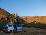
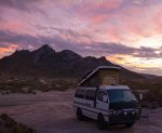
We drove into San Luis Gonzaga the day before we were to attempt the ‘bad road' and spent the night at ‘Papa Fernandez' before an early departure the next morning. We paid $7 US had this gated camping area to ourselves…

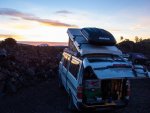
I arose before dawn the next morning to snap some shots and saw a pod of dolphins in the distance which I took as a positive sign for the day ahead.
After leaving Bahia Gonzaga the dirt road weaves alongside the newly-laid pavement for around 15 kms and we passed small road-crew camps set-up along the way. At one point we passed a group of workers shoveling ashphalt and a young guy stopped us looking for a drink of agua - which he was super grateful for after sucking back a large glass in one pull.
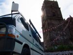
The road wasn't so bad for the first 30 kms from Bahia Gonzaga to Coco's Corner; there was some washboard as shown in the intro photo and a few sections of washout, but on the whole it was a breeze and nothing more serious than any typical BC Forest Service Road.
Coco's Corner is a famed watering-hole deserving of a stop from every-one that passes by.
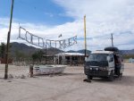
Coco has had both legs amputated at the knees and lives here with his 12 cats. As far as we can tell he earns his living by the 15 peso mark-up on Pacificos that he sells out of a well-stocked ice-box in the back.
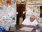
Coco has lived here since the early 1990s and he estimates that over 80,000 people have been through to sign his guest-books since then. He will draw a little cartoon of your mode of transportation and then leave some space for you to sign your names or leave a note. This book has been collecting names since the start of 2014 and it appeared to us that he averages around 3-5 groups passing through per day.

In addition to photos and memorabilia tacked on the wall in Cocos there are dozens of womens undies ranging from mini-skivies to did-she-come-from-the-sea sizes. When Coco pressed my wife with the question of whether to pin up her undies or a business card she didn't waste a moment reaching into her pants to find her proof of being an Tax Accountant.
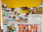
(Spot the AltaGas Card…. no I didn't bring any business-cards, nor did he want my undies

The road worsens after Coco's corner into a embedded-rock base with much of the sand fill having been washed or blasted away by tires. We learnt that the Baja 1000 rally race came through the section after Coco's a few years back and the result was that the road took a solid beating. Coco told us to drop down to 20 psi but I only took it down to 28-30 psi in Van Halens BF Goodrich ATs and we didn't have any issues with flats. (In fact, we haven't had a flat since these tires were put on back in June and we've driven over 4,000 kms of dirt tracks).
I wish I'd taken some photos of the road surface but as happens I was too focused on following the best line to stop and pull out the camera. Here's a poached photo showing the typical surface (source:
http://www.advrider.com/forums/showthread.php?t=784894. Great write-up. Worth a read!)
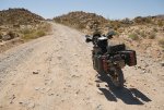
The road really wasn't so bad. Should anyone looking to do the road catch this blog:
give it a chance while you still can! if you have good tires and you go slowly, there should be no problem.
On a more pressing matter: on the drive in to the mountains to visit the mission San Javier (near Loreto) today we came across two small pups on the side of the road. Both were tiny, super dirty and had broken twine twisted around their necks. My wife lives for dogs and there was no way we were leaving these two just sitting there.. We drove to all the farms surrounding and they just told us people sometimes come up from Loreto to discard them on the side of the road.
We lucked out and found an awesome couple from Vancouver Island in the RV park we stayed at in Loreto that were looking for another dog as their old fella recently passed away.. they took the wee female and named her Chloe.

As far as we can tell the shelters on the Baja are full-up so you need to foster (which is tough for us as we are on the move with two dogs already) .. his temporary name is Javier. He's a nice little guy and looks to be in decent shape after a bath, meal and a sleep.
We are looking for suggestions or ideas for the second one - anyone in, or know, someone on or near the Baja looking for a pup?? .

