Sad End to This Cautionary Tale, As Folks Start to Head Back Out Into the Wilds, Pls Be Careful

Kmrtnsn

Explorer
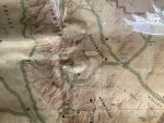
Wait, Gold Valley Road doesn't connect to Badwater Road? I'd been looking for Gold Valley Road and hadn't found it yet. So it's on the east side of the mountains by Badwater Road and doesn't connect? Then why in the hell try to hike through the mountains versus go back out the road? Are there good hiking trails that start at the end of Gold Valley Road and go through the mountains down to Badwater Road? Again, I hope the survivor shares what their plan was and what happened.

I recently got the most up to date version of the California Gazetteer from DeLorme, this is what it shows,
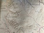
55461ADB-5589-48FC-9690-D2F0CB6B8E12.jpeg
 

BigDawwg

-[Gettin-it Done]-
Ok,,,,,, Nice Map for getting the lay of the land, and the existing Road's and Connection Points, but that's about it,,,,,, this is the Type of Map that will get the In-Experienced Traveler in Trouble,,,,,, as you look at where they were at on Gold Springs Road, ie... towards the end as I understand it,,,, this Map shows it's just a Hop-Skip & a Jump over to Mormon-Point,,,,, NOT SO,,,,,, what this Map tells me, and I can't see what the Contour-levels are, but this Map tells me Mountaineering Skills and Gear would be needed to make this Trek, this is what got those folks in TROUBLE,,,,, not understanding the Map, and the Terrain..... :cry:
BD in Alaska....
 

Kmrtnsn

Explorer
Ok,,,,,, Nice Map for getting the lay of the land, and the existing Road's and Connection Points, but that's about it,,,,,, this is the Type of Map that will get the In-Experienced Traveler in Trouble,,,,,, as you look at where they were at on Gold Springs Road, ie... towards the end as I understand it,,,, this Map shows it's just a Hop & a Skip over to Mormon-Point,,,,, NOT SO,,,,,, what this Map tells me, and I can't see what the Contour-levels are, but this Map tells me Mountaineering Skills and Gear would be needed to make this Trek, this is what got those folks in TROUBLE,,,,, not understanding the Map, and the Terrain..... :cry:
BD in Alaska....

Go to the link I posted a few pages back and zoom in to get a real idea of the topography!

The first map I posted was from the Harrison map of Death Valley, the $9.95 maps commonly sold at REI.

Somewhere around here I have a Nat Geo map, like the ones sold at the Parks gift shops. When I find it I’ll post that one.

The Gazetteer books are what we’ve used for hunting my whole life. Theyre fairly detailed and adequate for planning but that’s about it.
 

Porkchopexpress

Well-known member
Ok,,,,,, with all the "********" you guys buy for your Overlanding Adventures,,,,, a Sat-Phone can be used with a plan that does "NOT" have to be "Turned-on" all year,,,, you can activate when needed,,,, Easy-Peasy,,,,, I've been doing it for years,,,,, and you don't have to Buy one either, you can Rent for what ever time you need, and the Rental Fee will in-clude Air-time as well, So,,,,,,, what's your Life Worth, and or your Loved ones that maybe with you on this Adventure,,,,,,,, think about it. :unsure:
BD in Alaska
One caution on SAT phones, I have been in remote locations and couldn't get a connection. It was probably user error because I don't use them often but if they are your emergency plan, figure it out at home before you need it. Same for radios. I know of a guy who was treading water for 3 hours at night because he couldn't turn his radio on in the dark. Luckily he had pencil flares and heard a boat nearby.

Edit: Also a good idea to check your emergency equipment before each trip for battery charge ect.
 

Kmrtnsn

Explorer
Here’s the Nat Geo map. Compare the depictions of the Willow Creek Trail, Gold Valley and Gold Valley Road between the three.5C88F1EA-253A-4839-8566-A2EA4C8B868F.jpeg
 

chet6.7

Explorer
having spent a bit of my life sitting in the open door of a helicopter or pressed against a bubble window looking down at things there two things that fit in a pack, take little room, and make finding you so much easier. One is modern version of the old panel marker. ITS Tactical makes some nice, small, lightweight versions that pack tiny. Nothing stands out in a sea of tan, brown, green, blue or white like fluorescent pink or orange. The other is a combination of a foil rescue blanket and a strobe. Neither weigh much, nor do they take much space. Want to make the strobe more effective? Place it in the middle of a spread foil rescue blanket.
Is this worth carrying? Any other suggestions? Thanks.
Leland Reacue Tools 01 Emergency Strobe Light
61yG3gl6f6L.__AC_SX300_SY300_QL70_ML2_.jpg
 
Last edited:

Porkchopexpress

Well-known member
Is this worth carrying? Any other suggestions? Thanks.
Leland Reacue Tools 01 Emergency Strobe Light
I can't speak to that specific model but strobe lights work great as night signal devices.

For reference, military pilots typically carry locator beacons, (GPS based similar to SPOT or InReach), radios with emergency preset frequencies, strobe lights, signal mirrors, flares, smoke, sea dye and other stuff more survival related. You can probably skip the smoke and sea dye but everything else on the list is pretty accessible.

Edit: forgot space blanket. Almost weightless and cheap.
 
Last edited:

BigDawwg

-[Gettin-it Done]-
One caution on SAT phones, I have been in remote locations and couldn't get a connection. It was probably user error because I don't use them often but if they are your emergency plan, figure it out at home before you need it. Same for radios. I know of a guy who was treading water for 3 hours at night because he couldn't turn his radio on in the dark. Luckily he had pencil flares and heard a boat nearby.

Edit: Also a good idea to check your emergency equipment before each trip for battery charge ect.
Ok,,,,, if you took Notice in my 1st Post on this subject of Sat-Phones, you will see I said I use an Iridium 9555 Sat-Phone,,, ie... all Sat-Phones are not Created-Equal..... see attachment, and I've NEVER had a connection Problem anywhere, L48 and or Especially here in Alaska, where Global-Star and others DON'T WORK PERIOD..... make a note about this......
BD in Alaska.... :cool:
 

Attachments

  • Screenshot 2021-04-11 123036.png
    Screenshot 2021-04-11 123036.png
    608.9 KB · Views: 33

Porkchopexpress

Well-known member
Ok,,,,, if you took Notice in my 1st Post on this subject of Sat-Phones, you will see I said I use an Iridium 9555 Sat-Phone,,, ie... all Sat-Phones are not Created-Equal..... see attachment, and I've NEVER had a connection Problem anywhere, L48 and or Especially here in Alaska, where Global-Star and others DON'T WORK PERIOD..... make a note about this......
BD in Alaska.... :cool:
I was using Iridium. Like I posted, it was probably user error. The instructions had confusing codes that didn't work for me. I'm sure they are a great product if you figure it out at home before you need it.
 

rruff

Explorer
They probably thought about going west to hit Badwater Road for the shorter distance. Rather than stay with car or backtrack, it seems they chose to go into the unknown (to them).

A sensible plan. I don't see any other making better sense. 3 days worth of water and a 5 mile hike. Earlier I speculated that they might have had a 10 mile hike, but that's still short. Sounds very conservative.

Maybe I was extra lucky (doubt it)... but I've spent a few thousand days camping in terrain like this in the winter, and I considered it a site failure if I encountered other humans. I went on hikes longer than that over terrain that was "unknown" all the time. Usually I was alone... no cell, no beacon, nobody knew where I was, minimal gear, minimal water, etc. I would have been buzzard food for sure if I'd been unable to make it back to my vehicle. I just don't think this sort of thing is that dangerous... but sure, you can die doing anything.

It's possible that they encountered big dropoffs on their route (like Rallyroo's photos above). That would have made progress slow. Or they tried to get through a tricky area and suffered a fall. Or got bit by a rattlesnake coming out of hibernation. Hope we find out eventually.
 

Kmrtnsn

Explorer
Is this worth carrying? Any other suggestions? Thanks.
Leland Reacue Tools 01 Emergency Strobe Light
61yG3gl6f6L.__AC_SX300_SY300_QL70_ML2_.jpg

Pelican makes some small battery powered strobes geared around diving that are nice and inexpensive. I’d also check Streamlight and Surefire. Search “helmet strobe Velcro” and you should get some results for a few different compact strobes too.

Cheap, tiny, micro-lite! https://www.thefirestore.com/store/...MIqNn4sor37wIV6v_jBx0wIAloEAQYCSABEgLaRfD_BwE


AbleGuy

Officious Intermeddler
Regarding signal lights, etc...there have been some good rescue reminders/advice posted here, stimulated by the discussion of how to avoid being a statistic.

If you’re stuck in the remote wilds and have already changed out a flat, and you don’t have or can’t use a tire repair kit on the damaged tire, remember that you now have one pretty worthless tire you can set on fire to create a very noticeable plume of thick, black smoke and also some flames visible hopefully in the dark. Just try not to set the woods, etc., on fire too.
 

jhmoore

Well-known member
Pelican makes some small battery powered strobes geared around diving that are nice and inexpensive.

I'm a diver and actually have a Pelican strobe in a bin somewhere... don't use the thing because it's too damn annoying underwater and I can always signal my buddy where I am by waving around my primary or secondary light. Unless, you know, both fail... which has happened and makes things more fun! :) But I wouldn't want to use a Pelican diving strobe for above-water signaling. Have a hard time imagining it being strong enough. Who know, though, I'll dig it out, put some batteries in, and give it a shot.
 

Forum statistics

Threads
188,027
Messages
2,901,344
Members
229,411
Latest member
IvaBru
Top