woodwizard
Observer
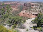
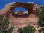
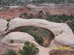
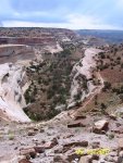
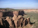
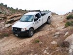
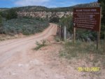
View attachment 7997Based in Denver but working on the Western Slope of Colorado allows me quick access to the start of the spectacular slick rock canyons just west of Grand Junction. Scott and I caught up Friday and dialed in our plan to visit some of these less traveled gems. The loop started in Fruita, the mountain biking capitol of the Western Slope and the start of the 125 mile Kokopelli trail to Moab. We headed south in the company’s F150 4X4 to the entrance to the Colorado National Monument. A brief conversation at the entrance station with the ranger about our destination, the Arches of Rattlesnake Canyon, allowed us a free pass through. She stuck her head out of the entrance shack looking at the truck stating that we needed a rugged, high clearance 4X4 to just get to the parking area (park speak). With a serious look on her face, we answered “perfect” and took off. View attachment 7998The road climbs up Rim Rock Drive and provides some of the same “next to the edge of the canyon” experience as the White Rim. As you wind around the outstanding views are to the north, through the canyons, over the town of Fruita and to the Book Cliffs that extend west, past the turn off for Moab. View attachment 7999Once on the rim, the turn off for the Glade Park Store leads you to the start of the dirt road for the arches. View attachment 8000The last 2 miles of the road adds some wheeling interest. Approximately 10 miles later places you in the parking lot of the trail head. From the parking lot the views in the distance are looking down into Ruby’s and Horse Thief Canyons. View attachment 8001View attachment 8002The flatter loop trail is 3 miles long with not much elevation change. The best part is the exit up through the last arch. People unfamiliar with the properties of slick rock find this part intimidating. That in turn adds to the high level of interest as a spectator sport… asses sticking out, knees, elbows, toes, groping for non-existent hand holds. If people would only trust their shoes, they could just walk up.View attachment 8003
View attachment 8004
View attachment 8005
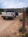
View attachment 8006Our goal was to camp somewhere to the west, along the Colorado River on Saturday night. Back out the dirt road, through the monument and down to I-70, we headed west to the Rabbit Valley exit. Rabbit Valley is the first exit in Colorado and extends to the south of I-70. The BLM office in Grand Junction provides the best map of the area (still far from complete). Everything else is sketchy. One of the unfortunate aspects of BLM property is its high use of everything with wheels. ATV’s, dirt bikes, the biggest 4X4’s pulling 5th wheels, horse trailers and toy trailers full of everything mechanical. Not a quarter of a mile from the exit, the absolute maze of trails in every direction rendered any map trash (we used it later to start our camp fire). Main road- good. We encountered markers for the Kokopelli Trail as we worked our way south.View attachment 8007Every developed and back country campsite was full. We just kept heading south towards the river. All the maps we looked at had the road ending short of the river- we knew better. Finally coming to the view of the river, we had multiple routes off the bench to the water in the distance. Working our way to a spot we identified (adding some pin striping through the tamarisk), camp was deserted. Right on the river, the steaks and beer couldn’t have tasted better. That night I slept with my glasses on so when I woke in the middle of the night I could see the billion stars all around.View attachment 8008
View attachment 8009The following day started with a discussion, over coffee, of our route for the day. We would return to the bench, find a Kokopelli marker and follow them to the west and work our way to the Westwater Ranger Station in Utah. The trail would eventually veer north and we believed there would be another trail heading more west, following the river. We broke camp, adding more pin striping before gaining the bench. As we found the marker, we were over taken by 6-8 ATV’s. The 1” of silty dust filled the air. Stopped, we let them get way in front of us. The rest of the day was spent deciding on which fork to take and working our way from view to view. When we left the Kokopelli Trail the route became more interesting. For the most part the trail is a 2. However there are a few steps and break overs that I had to look at before driving through. It would be hard explaining how I high centered the company truck in the middle of nowhere. After a couple of wrong turns, we felt confident that we would make it to Westwater. Sure enough, when the trail came to the river there was only 1 way to go. Down along the tracks in the extremely rutted road we would get glimpses of the river and the boat put in. Minutes later we were having lunch with all the rafters busy around us. The camp ground at Westwater looked like it could be a party center the night before a launch. Even as we walked over to the ranger’s residence for some local information, the BLM’s equipment garage had it share of empty Fat Tire’s lay around. We took the slower Highway 6 back to Fruita to the beginning of our loop, reflecting the entire way. Yep, more of this.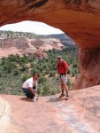


