IntrepidXJ
Explorer
Tuesday & Wednesday, July 29-30, 2014
The Decalibron is a name given to a route in the Mosquito Range that allows you to summit four of Colorado's 58 named 14ers in one 7-mile loop; Mount Democrat (14,148 feet), Mount Cameron (14,238 feet), Mount Lincoln (14,286 feet) and Mount Bross (14,172 feet). Some people do not count Mount Cameron as an official 14er because it is not ranked (the saddle between Cameron and Lincoln does not drop below the 300 feet required), but I have decided that I am going to try and complete the list of named 14ers and am going to count it (why short myself some Colorado high points?). Since my goal for the year is to summit five 14ers, I figured that this hike would be a good way to reach that goal after hiking Huron Peak a few weeks ago. Since this route is very popular and closer to the Front Range (Denver area), it can be very busy on the weekends. I decided to avoid the crowds by taking a day off from work in the middle of the week to attempt this hike.
I left work before lunch on Tuesday morning with weather forecasts of heavy rain and thunderstorms for the rest of the day and the following day, including flash flood warnings throughout the state. I wasn't sure if I'd even be able to make the climb in this weather, but I thought I'd still drive down there and hope for the best the following morning since the forecasts have certainly been wrong in the past.
After lunch in Breckenridge I drove over Hoosier Pass to Alma and then followed Buckskin Creek up to Kite Lake where I would setup camp for the night just above 12,000 feet.
Mount Bross on the left and Mount Lincoln on the right from just below Hoosier Pass on this cloudy afternoon.
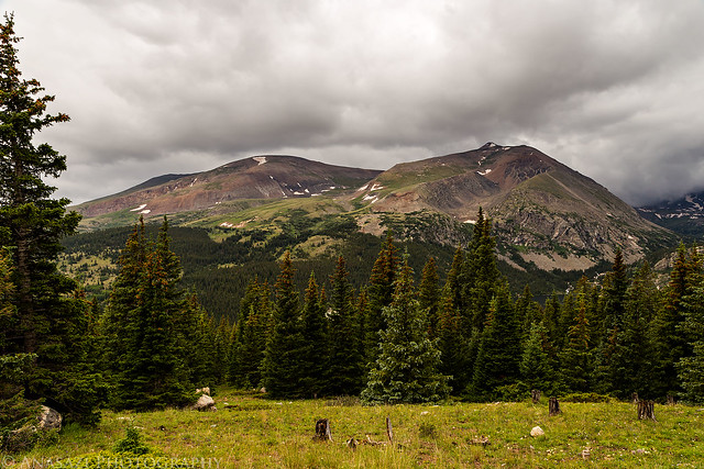
Bross & Lincoln by IntrepidXJ, on Flickr
A different view of Mount Bross.
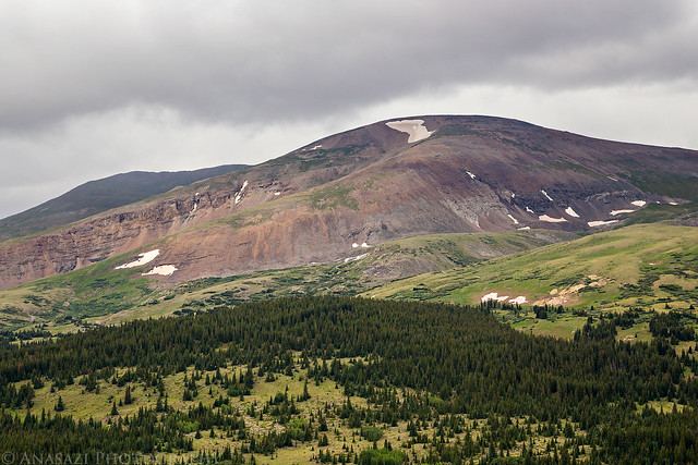
Mount Bross by IntrepidXJ, on Flickr
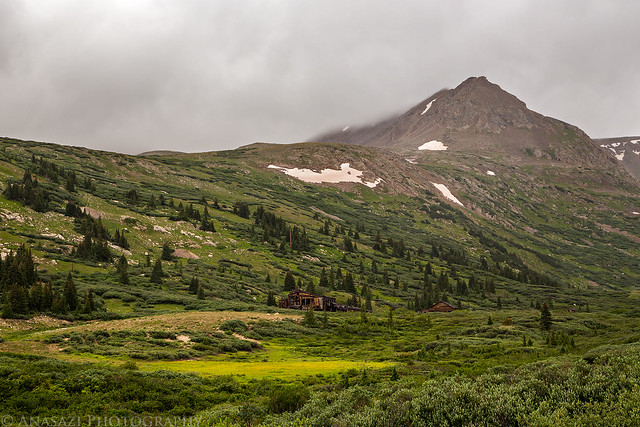
My tentcot setup near Kite Lake below Mount Democrat in the clouds.
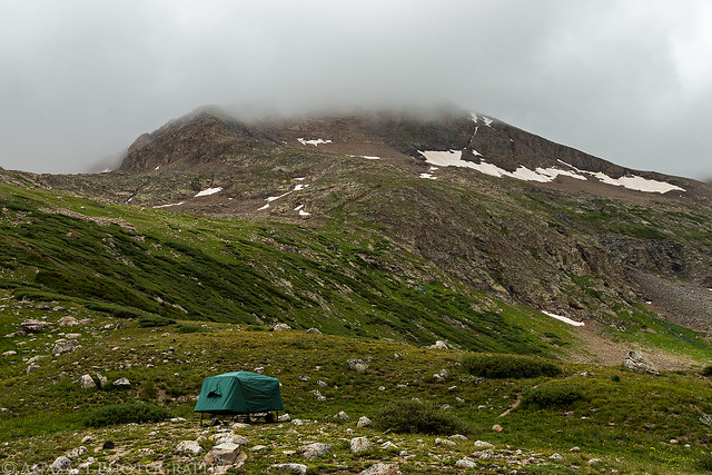
Kite Lake Camp by IntrepidXJ, on Flickr
My Jeep at the trailhead below Mount Democrat. I never would get a good look at the summit of this mountain on this trip as it would be in the clouds the whole time.
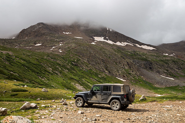
Below Mount Democrat by IntrepidXJ, on Flickr
After setting up camp I still had a few hours to kill before sunset, so I decided to drive over to nearby Mosquito Pass and see if I could get any views that weren't in the clouds.
A small insignificant peak in the spotlight along the Mosquito Pass Road.
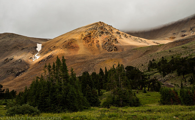
In the Light by IntrepidXJ, on Flickr
Mosquito Peak (13,781 feet) in the clouds.
Mosquito Peak by IntrepidXJ, on Flickr
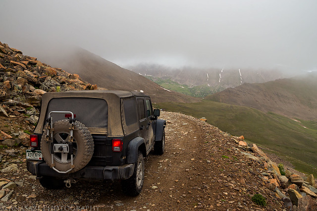
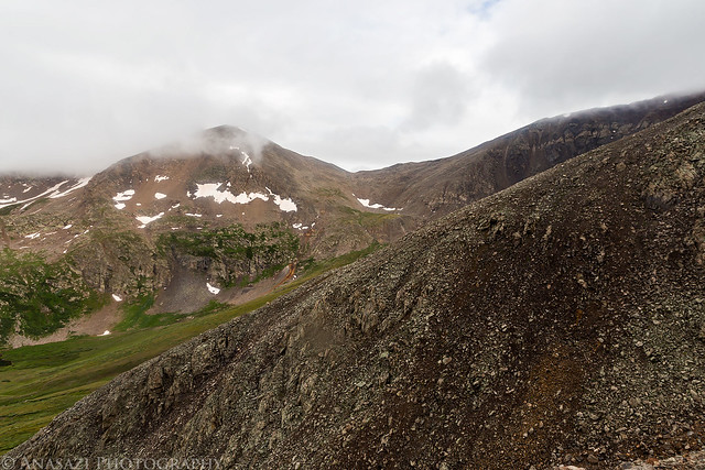
Clouds cover the peaks above the basin behind me.
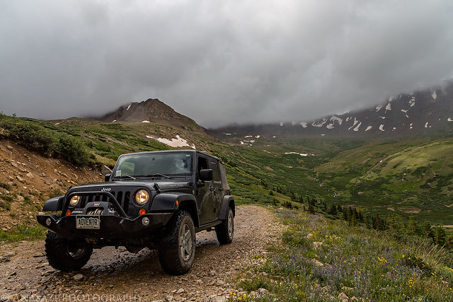
Under Low Clouds by IntrepidXJ, on Flickr
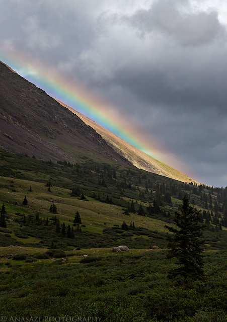
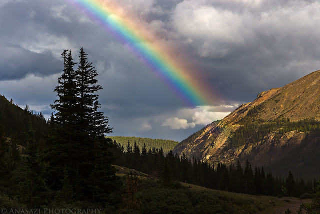
A rainbow appears next to London Mountain (13,194 feet).
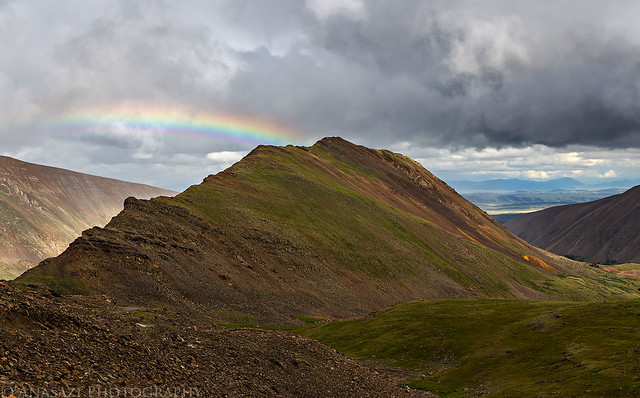
London Mountain by IntrepidXJ, on Flickr
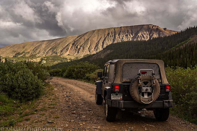
My Jeep below the rainbow on my drive up to Mosquito Pass.
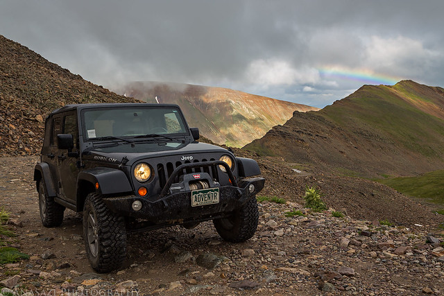
Mosquito Pass Rainbow by IntrepidXJ, on Flickr
Nice light over American Flats with another faint rainbow to the right of London Mountain.
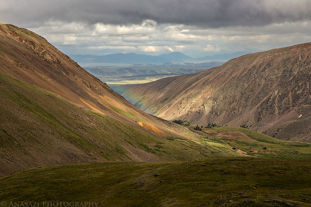
Gulch Light by IntrepidXJ, on Flickr
Light on the ridge above the Mosquito Pass Road I was driving up.
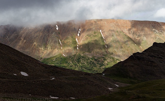
Mount Buckskin Ridge by IntrepidXJ, on Flickr
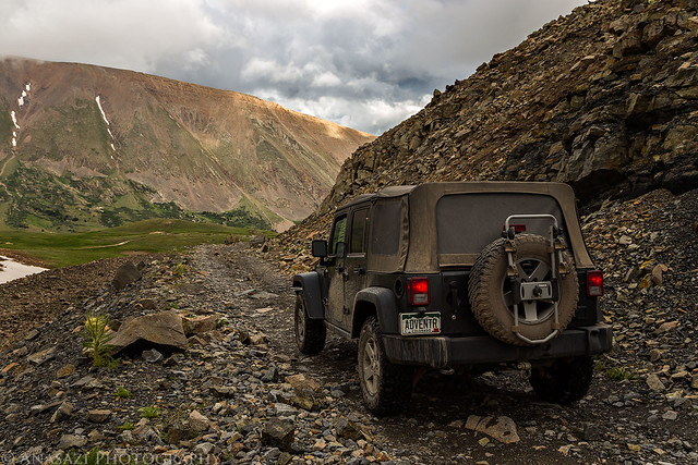
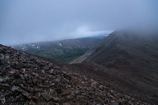
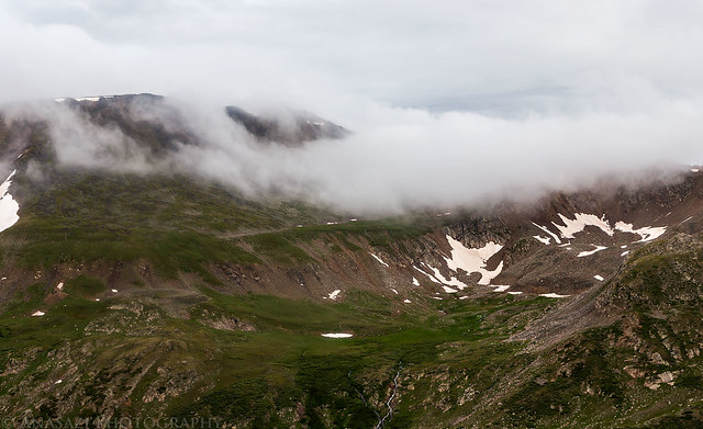
Low clouds over American Flats below.
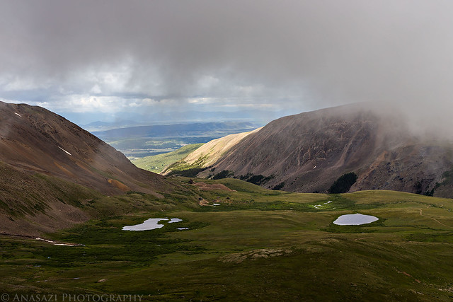
Moving Clouds by IntrepidXJ, on Flickr
Almost to the pass, which means I'd be driving through the clouds the rest of the way.
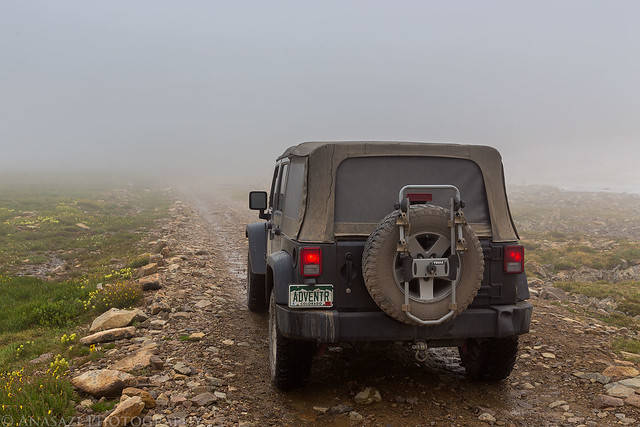
In the Clouds by IntrepidXJ, on Flickr
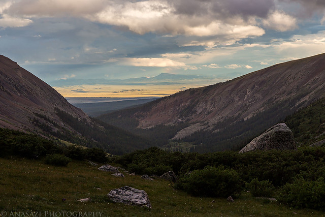
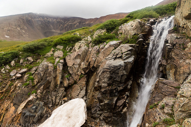
Nice view through a gap under the clouds and nice light on the distant landscape.
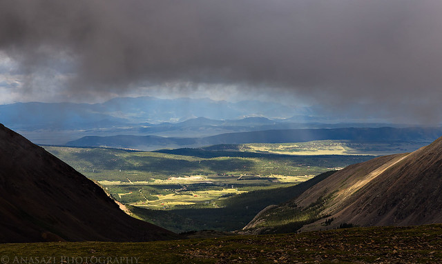
Below the Clouds by IntrepidXJ, on Flickr
Finally at Mosquito Pass, the highest drivable pass in Colorado at 13,185 feet. It was pretty windy up here.
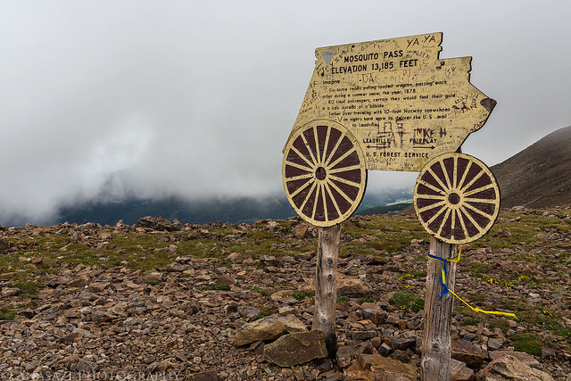
Mosquito Pass by IntrepidXJ, on Flickr
The Decalibron is a name given to a route in the Mosquito Range that allows you to summit four of Colorado's 58 named 14ers in one 7-mile loop; Mount Democrat (14,148 feet), Mount Cameron (14,238 feet), Mount Lincoln (14,286 feet) and Mount Bross (14,172 feet). Some people do not count Mount Cameron as an official 14er because it is not ranked (the saddle between Cameron and Lincoln does not drop below the 300 feet required), but I have decided that I am going to try and complete the list of named 14ers and am going to count it (why short myself some Colorado high points?). Since my goal for the year is to summit five 14ers, I figured that this hike would be a good way to reach that goal after hiking Huron Peak a few weeks ago. Since this route is very popular and closer to the Front Range (Denver area), it can be very busy on the weekends. I decided to avoid the crowds by taking a day off from work in the middle of the week to attempt this hike.
I left work before lunch on Tuesday morning with weather forecasts of heavy rain and thunderstorms for the rest of the day and the following day, including flash flood warnings throughout the state. I wasn't sure if I'd even be able to make the climb in this weather, but I thought I'd still drive down there and hope for the best the following morning since the forecasts have certainly been wrong in the past.
After lunch in Breckenridge I drove over Hoosier Pass to Alma and then followed Buckskin Creek up to Kite Lake where I would setup camp for the night just above 12,000 feet.
Mount Bross on the left and Mount Lincoln on the right from just below Hoosier Pass on this cloudy afternoon.
Bross & Lincoln by IntrepidXJ, on Flickr
A different view of Mount Bross.
Mount Bross by IntrepidXJ, on Flickr
My tentcot setup near Kite Lake below Mount Democrat in the clouds.
Kite Lake Camp by IntrepidXJ, on Flickr
My Jeep at the trailhead below Mount Democrat. I never would get a good look at the summit of this mountain on this trip as it would be in the clouds the whole time.
Below Mount Democrat by IntrepidXJ, on Flickr
After setting up camp I still had a few hours to kill before sunset, so I decided to drive over to nearby Mosquito Pass and see if I could get any views that weren't in the clouds.
A small insignificant peak in the spotlight along the Mosquito Pass Road.
In the Light by IntrepidXJ, on Flickr
Mosquito Peak (13,781 feet) in the clouds.
Mosquito Peak by IntrepidXJ, on Flickr
Clouds cover the peaks above the basin behind me.
Under Low Clouds by IntrepidXJ, on Flickr
A rainbow appears next to London Mountain (13,194 feet).
London Mountain by IntrepidXJ, on Flickr
My Jeep below the rainbow on my drive up to Mosquito Pass.
Mosquito Pass Rainbow by IntrepidXJ, on Flickr
Nice light over American Flats with another faint rainbow to the right of London Mountain.
Gulch Light by IntrepidXJ, on Flickr
Light on the ridge above the Mosquito Pass Road I was driving up.
Mount Buckskin Ridge by IntrepidXJ, on Flickr
Low clouds over American Flats below.
Moving Clouds by IntrepidXJ, on Flickr
Almost to the pass, which means I'd be driving through the clouds the rest of the way.
In the Clouds by IntrepidXJ, on Flickr
Nice view through a gap under the clouds and nice light on the distant landscape.
Below the Clouds by IntrepidXJ, on Flickr
Finally at Mosquito Pass, the highest drivable pass in Colorado at 13,185 feet. It was pretty windy up here.
Mosquito Pass by IntrepidXJ, on Flickr