The Map is Not the Territory: A Northern Maine Adventure

epicxcrider

Observer
The Map is Not the Territory


pubimage


ad·ven·ture/adˈvenCHər/

Noun: An unusual and exciting, typically hazardous, experience or activity.
Verb: Engage in hazardous and exciting activity, esp. the exploration of unknown
 

epicxcrider

Observer
The Men

Nick C - Trip Leader From: Southern NH

IMAG0452-1.jpg

Nick B - Photographer From: North Jersey

pubimage


Chirp - Adventure Dog From: North Jersey

IMAG0542.jpg

Jason G - Local Man of Mystery From: ?

pubimage

Josh L - Driver / Engineer From: Seacoast Region NH
IMAG0455.jpg

Kevin J - Scientist From: Some Lonley Island

IMG_7548-1.JPG

Erek J - Chef / Adventurer From: Seacoast Region NH

IMG_7645.JPG
 
Last edited:

epicxcrider

Observer
The Means

pubimage


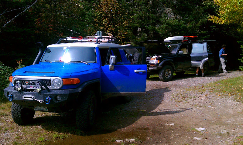
2007 FJ Cruiser: Lifted, Rear Locked, 33” MT’s, Winch
1997 Lexus LX-450: Lifted, Fully Locked, 33” AT’s, Winch

pubimage


epicxcrider

Observer
The Mission:

I had never been to the North Maine Woods. I'd always heard it was a place where you saw more moose than people, where you could drive for days on endless dirt roads. Roads where overloaded & speeding log trucks set the rules. They made the roads, they own the roads, and they will run you off them if you don't move out of the way.
But there had to be more up North... some natural beauty in the relatively untouched lakes and rivers of the Alligash waterway. The mission was to explore the North country of New Hampshire and Maine and discover what I had been missing all these years.

pubimage

Planning the trip was quite an undertaking - it took a long time to find published points of interest. I decided there would be three main destinations that would guide the rest of the route.
The Two Trains - There are two abandoned steam locomotives in the North Maine Woods, and we would try to find them
Gulf Hagas - The Grand Canyon of Maine - 5 mile long gorge strewn with waterfalls
The B-52 Crash Site - A mountain in Maine where a Boeing B-52 crashed, the wreckage remains
The rest of the route was determined by the desire to make the trip entirely on dirt roads - The Harder & More Wild the Better.
 

epicxcrider

Observer
Ok, updates may be slow because I'm still writing and editing this... but here's the first day :)

DAY ONE- Thursday 9.22.11 155 Miles

After hurriedly packing the FJ with Nick B and Jason, we were on the road at 5:00 PM headed for Concord. I would be driving for the whole trip since Nick B doesn't drive stick and well... Jason has crashed more vehicles than I've owned.

packing.jpg

In the spirit of the trip we decided not to take the highway and instead rode back roads to get there. After a short stop in Concord (so I could buy jeans and underwear since I had been too busy to do any laundry before the trip) we headed to our first dirt road of the trip: Sandwich Notch Road.

Sandwich Notch Road winds North into the White Mountains offering little challenge, though at night it is relatively untraveled. The road had previously been closed due to flooding so we were happy to find that it had been repaired and open. At this point we made contact with Josh in the LX - they were on the way from Rochester,NH and needed food. What better place to eat when you're in the area than The Common Man?!

First we had to walk Adventure Dog and with the leash in New Jersey I found a suitable replacement...

Tree%252520Strap%252520Leash.jpg

Tree Saver Leash​

Introductions were made, beer and burgers were consumed, then we were off to Sandwich Notch Road.

cman.jpg

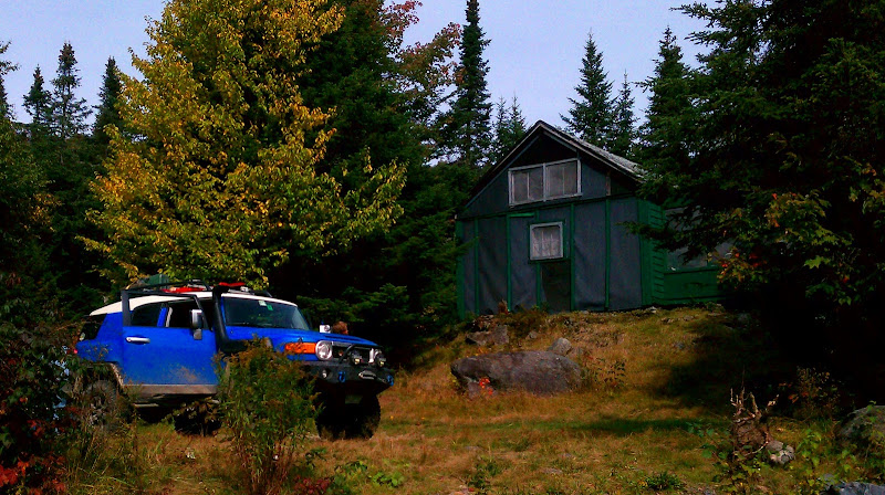
We made camp for the night in a cul-de-sac at the end of an old logging road, outside the State Forest land. Erek set up a pretty cool hammock with rain fly, the rest of us were in tents. It was misty and late, nobody felt like making a fire so we made do.

Night%2525201%252520Camp.jpg


josh%252527s%252520driving.jpg

It was a good chance to get to know each other, everyone sat around the fire (lantern) drinking more beers and telling various college drinking tales and other fish-tales:p
 

epicxcrider

Observer
Maybe this should be moved to completed adventures as it's a 5 day trip... a mod mind passing judgement here?
 
Last edited:

epicxcrider

Observer
DAY TWO - Friday 9.23.11
224 Miles

Tunes for the day: Bill Cosby Standup​
Day two began at 7 AM with coffee and oatmeal for breakfast and an early (kind of) start to the day. It was still misty and we had to pack up wet sleeping gear in the hopes that it would dry later in the day.

IMAG0404.jpg


pubimage


Josh had discovered the secret to oatmeal was piling as many other sweet things on top of it as possible. Mmmm Pumpkin.

IMG_7429-1.JPG


pubimage

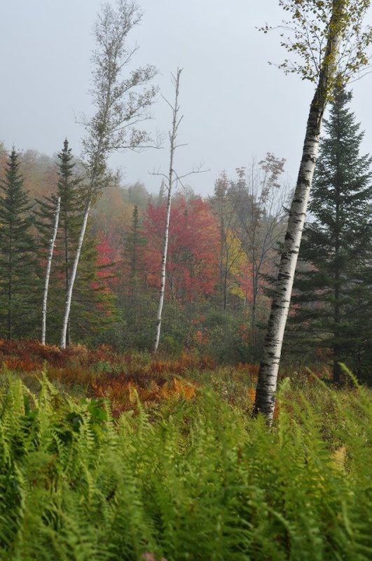
Sandwich Notch Road (Class V - Maintained Dirt) is a nice scenic and hilly drive, so we took it slow and enjoyed the start of the fall foliage. Leaving the state forest there is a clearing and a house, which offered a few good photo ops. Foliage was at peak and pictures simply cannot illustrate the view we had through the mist that morning.

pubimage


sandwich%2525203.jpg


6xYBm02ewOb6aZoHK4pHkHpf74UeiW5EDlVcOR5SCijxzPik7WknwN1RTVf-bu_BFYCMnM7H9KOYsiaOh0Ugnl-Z7gG0GlVRbyMfCLaZM1IhjTm9GK4


A5HHA5UwpUDBw5UaH4BSA7nRYFBBv7IOXjb2qdb_32Yo08FFTtJDddyjYuyWHBtBgJW43ZPwndQwh1iXUAI7f7rJZUD1-wM-g2xK9hXnf491kTo_F_8

After Sandwich notch we cruised by Waterville Valley on Tripoli Road, which is another seasonal Class V dirt road. Foliage abounded casting the whole crew into a good mood. Tripoli Rd was considerably better than the highway and happened to be in good condition, covered a good distance at a good pace.

68hwIkzcHrYrsQ7fVHKDEyTY0bfifcmOoOUSD7FbcemtlWLR3Yt-P0H3plhCmeBlqgO84SHliH8kFf8qWRQlbrXPsd_rH9UWynTQF1-0o2W3DRij2dA

The original plan was to then take the Kancamagus highway to Bear Notch Road to Jefferson Notch Road (All class V). To make up some time - and because Jefferson Notch Road was closed due to flooding - we chose to take 93 to RT 3 to get to Groveton, NH where our next dirt trail would be.

franconia%252520notch.jpg


IMG_7461-1.JPG
 
Last edited:

epicxcrider

Observer
The Old Man​

Almost to Groveton we passed a man standing on the side of the road smoking a pipe. He had long hair and a long nicotine yellow-grey beard. All of his clothes were worn thin, the once red undershirt almost the same color as the blue jeans. Nick B - the photographer - stopped the convoy and sprinted back up the road to grab a portrait of this guy.

WIrc8GAw9XGZ4Exh4dSQVgPRQtu9Nbh3UMxKTDtLopWj2NwjRFawFrJ9NMAd2WjX_DHFJermJg4Taur4tlk6WrdnL_Jt8Rtqvy-D3WONFWu_elbsNTU

Nick sprinted back and we all crowded around his camera to get a closer look at the guy. One of his eyes was missing, his skin was the color of his clothes. Nick learned he had lived in the house by himself since 1955.

I'll have more on this from Nick B later

We jumped back in the trucks to get to Groveton to pick up some grub. I hadn’t prepared for the rest of the weekend so Nick B and I picked up some supplies while Josh’s crew prepared their exhaust manifold burrito cooker. Our beer supply had also mysteriously run low so we re-stocked the cooler.
 

epicxcrider

Observer
Back on the dirt we started up E. Nash Stream Rd in Nash Stream State Forest. By this time I was getting the hang of the overloaded handling of the FJ, though something would have to be done about the front wheels bouncing off the ground while climbing hills. We turned East off Nash Stream and began to climb. The road was steep and windy, a 2nd and sometimes 3rd gear climb up into the mountains. The road was fun and we made good time to our lunch spot on Little Bog Pond.

IMAG0425.jpg


IMAG0426.jpg


IMAG0423.jpg

Lunch was pre-cooked chicken we made into sandwiches, reminding me of the Bill Cosby joke about an American being able to turn anything into a sandwich with two pieces of bread :p

Engine%252520Burrito.jpg

Josh’s crew enjoyed (tolerated?) their manifold-warmed burritos.


IMG_7463.JPG

Erek explains the workings of the universe to Nick and Chirp


There were a few camps on the pond but the place was utterly deserted while we were there. By the looks of the camps and the number of propane tanks outside, most of them are winter use only by snowmobiles.

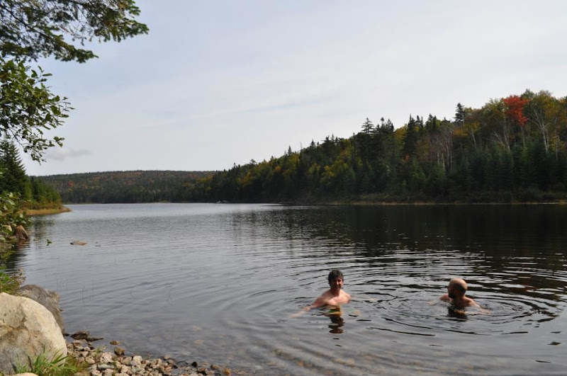
swim%252520day%2525202.jpg

Why not take a swim?

We explored a bit, I found an outhouse -and used it- and Josh found some old couch springs to try and tie up his busted exhaust. More on this later. (The exhaust not the outhouse)

fix%252520exhaust.jpg


IMG_7465-1.JPG

Little Bog Pond

Now the route had called for us to backtrack to Nash Stream Rd and continue north to RT 26.....


Forget the route. Trio Pond Rd looked like the road less travelled so we went East...
 

epicxcrider

Observer
Trio Pond Road - Class unknown - led us up a steep and rough gravel road. I put the FJ in 4-Low to keep the bumping down, it bottomed out too easily with all the extra weight. Cresting the hill we reached Trio Ponds, on which there were a few more camps. We approached a 3 way split in the road with no clear marking. We were off the GPS now, and the trail was not on the atlas.

I hoped it was the usual two dead end roads must meet somewhere in the middle situation...


IMAG0427.jpg


day%2525202%252520trail.jpg


IMAG0430.jpg


I jumped out to scout ahead a bit and Nick got out to shoot some photos. I decided to go straight and pass between the pond and the cottages - it looked someone's yard, but the road continued and wound North back into the woods.
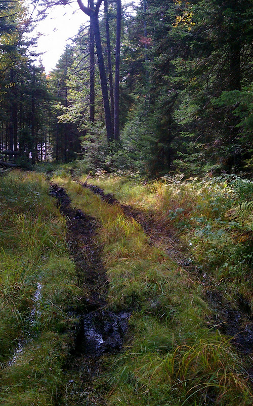
On the Northwest side of the lake, grass grew tall in the road and the roadbed was covered in moss. Nobody had driven a wheeled vehicle here in a long time. I kept the FJ in 4-Low and moved forward up the slight incline until I started getting the sinking feeling - so I went for it....
 

epicxcrider

Observer
With a little throttle and some clever steering I made it through the 8” boggy surface uphill to a firmer area, warned Josh over the CB and ran back to guide him through. The road had looked great on the surface but there were two brown-black sunken tracks down the middle, it was clear that nobody had driven this way in quite some time.

IMAG0435.jpg

Since the the tires on the LX were all terrains we decided Josh should follow inside my tracks to get through. He goosed it and with surprisingly little wheel-spin was quickly in line behind the FJ.

IMAG0434.jpg

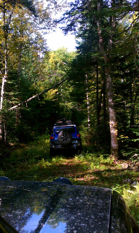
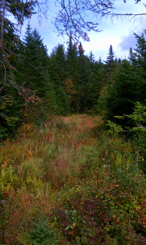
Things started to level out and firm up - but the challenge wasn’t over. Again the grass had grown up into the road enough to cover most of the obstacles so I crept along feeling my way though waiting for a tire to drop or rise.


7cSDPe2SE0jcTpgopZQBAjIf7hfEoEw85Ig1iEoizuTf28rbRuEIaICseQumVSVwPnXITp5u_uO4owibIPonWqvPsrFP-AhSGwzpYj5hVVMfrpvEerw


IMG_7471-1.JPG


IMG_7467-1.JPG


IMG_7475-1.JPG

The real challenge was determining if we were on the right trail, where it would end up, and if there would be a gate on the other end...

IMG_7477.JPG

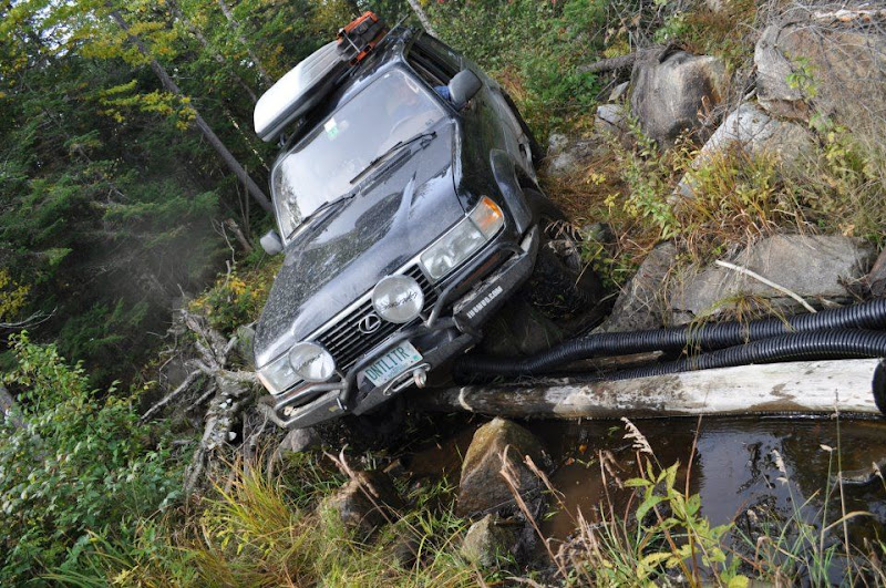
As we continued down Trio Pond Rd there was nothing out of the ordinary Class VI road - downed tree here, soft spot there, big rock to negotiate - until we came across another culvert that had washed out.

IMAG0436.jpg
 

epicxcrider

Observer
Night owl update :)

IMAG0432.jpg

Airing Down - I should stop here to mention something about airing down on an exploratory trip.
I’ve found that if you air down early, you’ll be thinking “why did I bother” at the end of the easy dirt road as you dig around in the back for the compressor.
If you wait, however, you’ll end up stuck between a rock and a log wondering why the ____ you didn’t air down earlier as you kneel in the mud to let some air out of your tires.

302607_939820739651_11014177_43716046_1431609518_n.jpg

Josh, Erek, and I cleared away all the nail-filled boards that had been tossed in the newly formed ditch and proceeded. With some careful spotting and driving both vehicles made it through with a few too many scrapes and bangs. (remember about airing down?)


The trail here sort of disappeared into a bog, so I sent Jason and Nick out ahead to scout the trail. Jason returned in a matter of seconds (Nick seemed to be distracted by a photo opportunity) so I quickly re-dispatched Jason to run ahead until the trail intersected with another trail.

IMAG0437.jpg

This is a trail? Sweet.​

Josh and I continued through the undulating rocky and boggy swamp overgrown with prickers until we both got hung up good on rocks. We could not move forward or backwards. (That airing down thing again)

I should take an aside here - there are a lack of photos.. This trail was NOT easy, grass covered all obstacles entirely and you would fall into holes walking down it. We had not gone so far we couldn't turn around... but there was at least 1.5 hours invested in this trail so far.

So.... while we were both kneeling in the (smelly) mud airing down Jason returned with the good news - there was an intersection about ¼ mile ahead. Nick B was nowhere to be seen but nevertheless we saddled up and moved forward with our newly found traction. Of course because we had just aired down, we came back out on to a mild dirt logging road - the challenging sections behind us - for now..
 

Forum statistics

Threads
187,898
Messages
2,899,647
Members
229,072
Latest member
fireofficer001
Top