You are using an out of date browser. It may not display this or other websites correctly.
You should upgrade or use an alternative browser.
You should upgrade or use an alternative browser.
Wind River Ranging
- Thread starter TripLeader
- Start date
TripLeader
Explorer
Part 22 [The Second Storm of the Day]
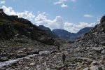
We moved past Alpine Lakes and started toward Camp Lake. There was an uncharted pass to Lake 10,787 we had the option to take as a shortcut. We did not have any information on it, other than we knew it was possible to traverse. It had a steep and loose appearance. Another group, the only other humans we would see in a 36 hour stretch, took it. We declined to follow.

Then the hail came.

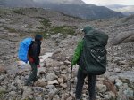
There was no shelter, so we just kept moving.

We moved past Alpine Lakes and started toward Camp Lake. There was an uncharted pass to Lake 10,787 we had the option to take as a shortcut. We did not have any information on it, other than we knew it was possible to traverse. It had a steep and loose appearance. Another group, the only other humans we would see in a 36 hour stretch, took it. We declined to follow.

Then the hail came.


There was no shelter, so we just kept moving.

Last edited:
TripLeader
Explorer
Part 23 [Bushwhacking]
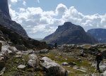
The weather passed on. We had a view of where we needed to go. We just had to find the best way among the willows to get there.
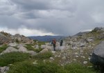
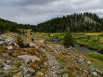
We dropped down by an unnamed lake just before Camp Lake. We picked up a faint trail for a quarter of a mile. It faded out and left us in the rocks and small trees.
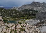
We found our way to Camp Lake, but not without quite the jaunt through the woods above it. The trail had played peek-a-boo with us again. We managed to find our way to the outlet below Camp Lake. An old wooden footbridge had washed out and was in pieces. Luckily there was a crossing nearby over some rocks.
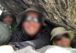
We found a trail along Camp Lake that took us to the inlet. Then the trail gave out again. We studied the terrain and our maps. We unknowingly picked the wrong line. We climbed up the rocks. We spied that the trail had re-emerged from the vantage point of our new position. But it was not where we had anticipated it would be. The below body language looking out over Camp Lake was "disappointed exhaustion." We had selected a harder route than necessary and cost ourselves more time.
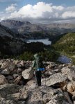
The weather passed on. We had a view of where we needed to go. We just had to find the best way among the willows to get there.

We dropped down by an unnamed lake just before Camp Lake. We picked up a faint trail for a quarter of a mile. It faded out and left us in the rocks and small trees.

We found our way to Camp Lake, but not without quite the jaunt through the woods above it. The trail had played peek-a-boo with us again. We managed to find our way to the outlet below Camp Lake. An old wooden footbridge had washed out and was in pieces. Luckily there was a crossing nearby over some rocks.
We found a trail along Camp Lake that took us to the inlet. Then the trail gave out again. We studied the terrain and our maps. We unknowingly picked the wrong line. We climbed up the rocks. We spied that the trail had re-emerged from the vantage point of our new position. But it was not where we had anticipated it would be. The below body language looking out over Camp Lake was "disappointed exhaustion." We had selected a harder route than necessary and cost ourselves more time.

TripLeader
Explorer
Part 24 [Lake 10,787]
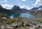
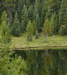
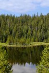
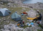
We hiked up from Camp Lake to Lake 10,787. It was time to stop for the day. We went and scouted for a campsite.
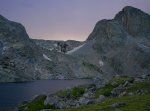
We chose a rocky site protected from the wind.
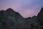
The light was majestic.

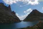
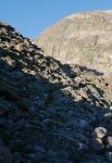
The shortcut pass we did not take to get here. We would have been caught in rain and hail had we taken it. We learned more about it the following day from some other hikers. They pointed out a specific line that we would have not likely found.
We hiked up and away the next morning.
We hiked up from Camp Lake to Lake 10,787. It was time to stop for the day. We went and scouted for a campsite.

We chose a rocky site protected from the wind.

The light was majestic.

The shortcut pass we did not take to get here. We would have been caught in rain and hail had we taken it. We learned more about it the following day from some other hikers. They pointed out a specific line that we would have not likely found.

We hiked up and away the next morning.

Last edited:
ramblinChet
Well-known member
Amazing story and great pictures. Please share more!
TripLeader
Explorer
Amazing story and great pictures. Please share more!
Thanks. The rest of the story is coming, albeit slowly.
And... For anyone that enjoys trucks and trip reports, they should check out your thread. I'm a fan.

2021 RAM 3500 Tradesman | AEV Prospector | FWC Grandby
Dropped down into Durango and spent some time enjoying this western city. I crossed paths with Chris Shontz from Venture4WD at Fired Up Pizza and was planning to thank him for his inspirational videos. Although we were a few feet away, we were both busy, and the timing was just not right...
 www.expeditionportal.com
To keep this post visually interesting, here's a view of a snack break back in Indian Basin.

TripLeader
Explorer
Part 25 [Hay Pass, or: How I Learned to Stop Worrying and Love the WRHR]
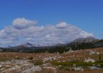
Hiking down to Upper Golden Lake.
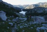
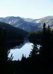
Looking back at the Golden Lakes and Lake Louise was another fine view. There were some sporadic footpaths around, but no established trails. Just beyond this basin, we were going to make a change. This was when our new route planning was to take effect.

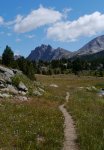
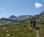
The route up Hay Pass was to be a gentle one up another patchy footpath. Dennis Lake was a waypoint that told us we were getting close.

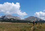
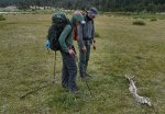
Hay Pass, at somewhere around 10,960', took us to the next part of the hike. It would be a place with trails; a place where we could attain our mileage goals and complete our hike in a new way.
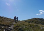
This new route would parallel the WRHR. But, of course, it would come at a cost. We would no longer hike and sleep among the high craggy peaks. We would not get within Cirque of the Towers. That was a brutal deprivation to the trip. But we were happy to do it. We had aimed too high and now had figured out how to hit the final target of the Big Sandy Trailhead.

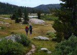
Hiking down to Upper Golden Lake.


Looking back at the Golden Lakes and Lake Louise was another fine view. There were some sporadic footpaths around, but no established trails. Just beyond this basin, we were going to make a change. This was when our new route planning was to take effect.

The route up Hay Pass was to be a gentle one up another patchy footpath. Dennis Lake was a waypoint that told us we were getting close.

Hay Pass, at somewhere around 10,960', took us to the next part of the hike. It would be a place with trails; a place where we could attain our mileage goals and complete our hike in a new way.

This new route would parallel the WRHR. But, of course, it would come at a cost. We would no longer hike and sleep among the high craggy peaks. We would not get within Cirque of the Towers. That was a brutal deprivation to the trip. But we were happy to do it. We had aimed too high and now had figured out how to hit the final target of the Big Sandy Trailhead.


TripLeader
Explorer
Part 26 [To Pipestone Lakes]
It was mid-afternoon on Day 5. Our goal had remained to hike as many miles as we could each day. That meant at least 15 now that we had trails.
The stream flowing into Victor Lake.

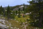

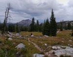


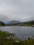
The end of the day on Fremont Trail landed us at a campsite at Pipestone Lakes for the evening. The mental stress of a questionable finish was over. We would hit Big Sandy Trailhead on schedule.
It was mid-afternoon on Day 5. Our goal had remained to hike as many miles as we could each day. That meant at least 15 now that we had trails.
The stream flowing into Victor Lake.


The end of the day on Fremont Trail landed us at a campsite at Pipestone Lakes for the evening. The mental stress of a questionable finish was over. We would hit Big Sandy Trailhead on schedule.

TripLeader
Explorer
TripLeader
Explorer
Last edited:
TripLeader
Explorer
Part 29 [On the Outside, Looking In]
The next view of those mountains came about. Pingora, Wolfs Head, Sharks Nose, Block, Pylon, Warrior, War Bonnet. Cirque of the Towers!


We had not been expecting this. We had no previous knowledge of the Fremont Trail. We had not anticipated being here one week earlier.

We were miles out. But the impression of these congregated mammoths could be felt down to the bone.

This was the answer to why we were here. There was no pain along this piece of the trail. Feet didn't hurt. Backs didn't ache. There was no psychological pressure to produce miles.

The next view of those mountains came about. Pingora, Wolfs Head, Sharks Nose, Block, Pylon, Warrior, War Bonnet. Cirque of the Towers!


We had not been expecting this. We had no previous knowledge of the Fremont Trail. We had not anticipated being here one week earlier.
We were miles out. But the impression of these congregated mammoths could be felt down to the bone.

This was the answer to why we were here. There was no pain along this piece of the trail. Feet didn't hurt. Backs didn't ache. There was no psychological pressure to produce miles.

Last edited:
TripLeader
Explorer
Part 30 [Marms Lake]
We ultimately had to keep moving and left our overlook of Cirque. We came to a fork in the trail, made another water crossing, and projected that we would stop for the night at Marms Lake at 9878'.
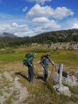
We found Marm's to be the best camping we had of the entire trip. It was a silent, blissful, forested place; perfect for our last night in the Winds.
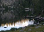
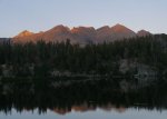
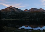
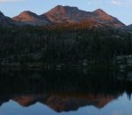
Sunset light on Cirque of the Towers from Marms Lake.
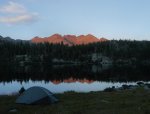
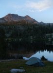
Marms treated us to some more sunset light once the mountains went dark.


We ultimately had to keep moving and left our overlook of Cirque. We came to a fork in the trail, made another water crossing, and projected that we would stop for the night at Marms Lake at 9878'.

We found Marm's to be the best camping we had of the entire trip. It was a silent, blissful, forested place; perfect for our last night in the Winds.


Sunset light on Cirque of the Towers from Marms Lake.

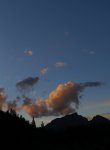
Marms treated us to some more sunset light once the mountains went dark.


Last edited:
TripLeader
Explorer
TripLeader
Explorer
Part 32 [Big Sandy Trailhead]
We made it. We located the spot where the shuttle driver had left our Nissan.

We had made plans along the trail to get in and drive to somewhere in Northern Colorado and then find a hotel room, with lunch somewhere along the way. I couldn't wait that long for a shower. I found a spot in the nearby Big Sandy River and cleaned up.
We saw a sign just past the trailhead advertising lunch at the Big Sandy Lodge. We were there in less than a mile. We had giant hamburgers all around.

We spent the next hour-and-a-half driving on dirt roads through the high Wyoming desert.

The last view of the Winds came over dirty backpacks and through a dusty rear windshield.

We made it. We located the spot where the shuttle driver had left our Nissan.

We had made plans along the trail to get in and drive to somewhere in Northern Colorado and then find a hotel room, with lunch somewhere along the way. I couldn't wait that long for a shower. I found a spot in the nearby Big Sandy River and cleaned up.
We saw a sign just past the trailhead advertising lunch at the Big Sandy Lodge. We were there in less than a mile. We had giant hamburgers all around.

We spent the next hour-and-a-half driving on dirt roads through the high Wyoming desert.

The last view of the Winds came over dirty backpacks and through a dusty rear windshield.

Last edited:
TripLeader
Explorer
Part 33 [Wind River Ranging]
It was a hard trip. But it was a great trip, challenging in many ways. We had set out for 80 miles over 7 days. I know we hit 7 days. I still haven't calculated the miles. Part of me is very curious. Part of me never wants to know.
It ended and all the Winds left me with was dirty gear, amateur photos, blistered feet, and enormous memories.
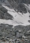
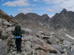
One day I hope to properly add Cirque of the Towers to this report.
Thanks for reading. The End.
It was a hard trip. But it was a great trip, challenging in many ways. We had set out for 80 miles over 7 days. I know we hit 7 days. I still haven't calculated the miles. Part of me is very curious. Part of me never wants to know.
It ended and all the Winds left me with was dirty gear, amateur photos, blistered feet, and enormous memories.


One day I hope to properly add Cirque of the Towers to this report.
Thanks for reading. The End.
Similar threads
- Replies
- 3
- Views
- 1K
- Replies
- 0
- Views
- 513
