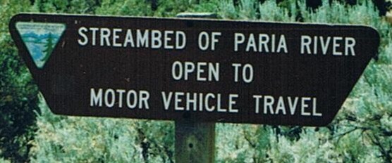
...On my visit, I hit up the BLM office, got some good travel advice, checked my maps and was on my way to good times. Reading posts about this on various forums makes the BLM sound like a bunch of evil zombies bent on closing access to all. The hate speech directed at the BLM in regard to this specific issue is pretty bad (again, on other forums, not here). Makes it kind of hard for a guy like me who works with the gov to sign a petition like that...
I can definitely agree on that point. I've worked
with the BLM on many land access projects and value the relationship I have with our local office. Issues like this are hard to tip-toe around without offending one side or the other. I think the actual on the ground BLM reps in this area would likely be in support of leaving the route open, I've called and talked to them about the route in the past (before our 2006 trip for example) and I gathered that it was stressing them out as much as the next.
..However, the issue is important, so I'de like to know more. What is the legal history of the access? What is the legal history of the road? Is this information cataloged on another website? The parties affected by this closure, seeking support from the overland community, should have a detailed fact sheet which describes the issues to people who are simply out of the loop, but interested in supporting access...
Up until the creation of the monument it was open to travel, dating back nearly 100 years according to Kanab locals. I can't verify that, but I can verify its been open since the late 80's when folks I know started traveling it. Digital cameras, online blogs and trip report sites have really change the face of documentation over the past few years, this is a time where I wish we had them earlier.
FWIW from ~99
...I don't see the road you mention in my Benchmark, USGS topo, or the book "Hiking & Exploring the Paria River". All sources at my disposal indicate a short road from Hwy 89 to old Paria/Pahreah on the south end, and nothing heading north from there. What past maps does this route appear on? If it's been a legal access for around 100 years, there's gotta be some evidence of it you guys can use right? I'm interested from a historical perspective as well...why did the road exist? I was hoping to get up that way again this summer...yeah, I'm a gluten for punishment.
This is a major issue. Much of Southern Utah's public lands were "open cross-country travel" or "limited to existing routes" up until the recent RMP changes. Many find it astonishing to thing it was not only doable, but completely legal to push a trail anywhere you wanted in these areas. Obviously not the case of this trail after the monument, but before the monument the area and the wash were open to cross-country travel. I think a major reason no route is shown on common newer maps is the face that the trail follows the meandering river and in the dry times of the year it was in the river bed the entire time. There are trail segments on the sides of the wash, but its fair to say that 1/2 of the trail is in the wash bottom proper. Again up until the monument, the BLM did consider the route open, thus the county wasn't putting much effort into trying to legitimize it as nobody figured it would be lost.
...It's unclear from the petition posts and newspaper articles exactly what the issue is besides State Rights vs Fed. That newspaper article really paints the planned activity in a negative light. But then again, the promotional materials project an interesting message as well. I'm a lover of the S.UT landscape, not so much the politics as it turns out. Educate us a bit and perhaps more support will won.
take it easy,
The issue is access. One by one historically accessed routes are being closed to motorized and mechanized travel. These are roads the counties maintain as their own under RS2477 (meaning pre-76' trails). Not only are they important as transportation routes and recreation access points, but to tourism and their local economies too. The Paria River Trail has been a major draw for many to the area, while the area isn't going to fall flat on its face without it, one by one things will change. Again this is happening all over Southern Utah, Devils Racetrack, Eva Connover, Eagle Canyon, Canaan Mountain, all historic & existing routes with a proven history, being closed by federal level designation despite the well wishes of residents and counties.

