FortyMileDesert
Adventurer
I almost posted this on the Toyota FJ section as it is as much about my impressions of what an FJ can do on a trail as much as it is about the trek itself - - And this is a Toyota-centric website. Anyway, here it is. Enjoy:
LR Trek 153 – 13 June 2009 – Breaking New Trails South of Black Rock
-Or- Training the Toyota FJ and its handler.
0715 – Chris and I meet for breakfast at Chukars Sports Casino at the west end of Fernley. The chatter is Land Rovers, computers, the economy and the weather. We’ve had below normal temperatures and off and on thunderstorms for the past three weeks and it rained most of the night here in town. The forecast is for sixty percent chance of rain and thunderstorms up in the area of Gerlach and the Black Rock. Great; more Toyo Open Country tire testing!
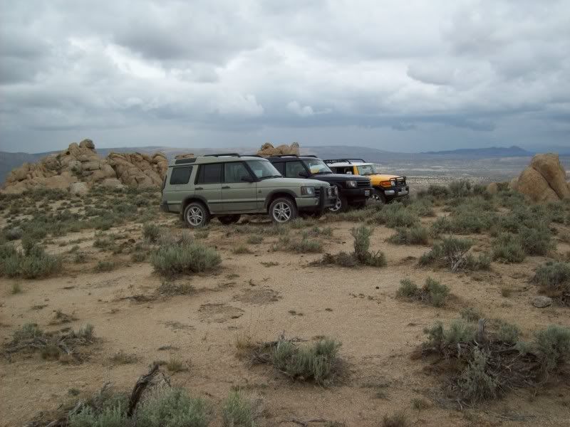
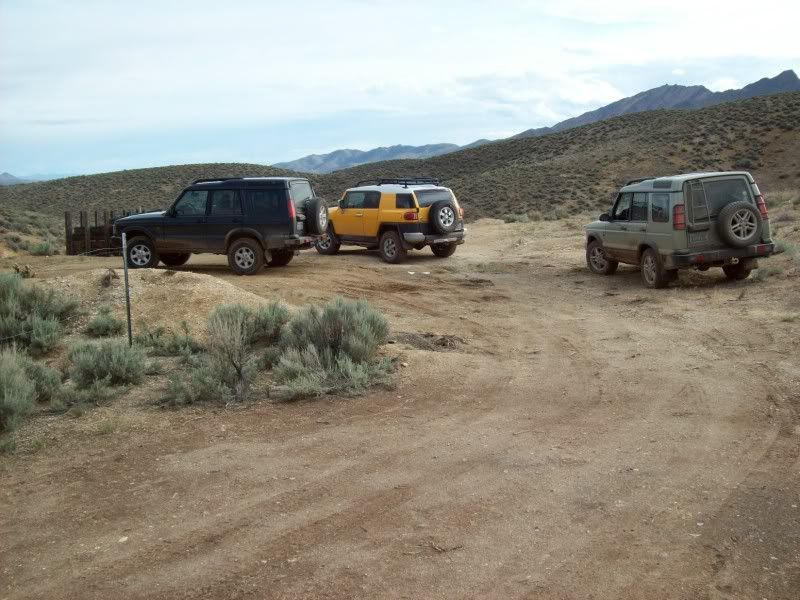
0755 – Tony, Chris’ friend arrives and we head out to the trucks. I wait at the side of the road while Tony and Chris top up on fuel. We will top up again in Gerlach, but as getting fuel up there is sometimes unpredictable and way more expensive, we want to be prepared. In fact I’m carrying two five gallon jerry cans of fresh 92 octane in the back. FWIW: This is two ’04 Land Rover Discovery’s escorting a newbie in an ’07 Toyota FJ Cruiser.
0805 – Underway north through Wadsworth and Nixon and on our way towards Gerlach. It’s sprinkling a bit and the road is wet. We can see a big dark storm ahead so there surely shouldn’t be much dust today! We stop for a photo of the three trucks near needle rock alongside Winnemucca Lake. We have caught up with the storm and it’s raining.
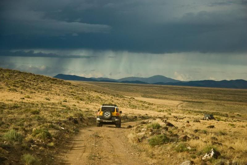
Tony’s truck is a 2007 FJ Cruiser with the optional part time 4 wheel drive system and the off-road package. The package gives him a number of skid plates, the BFG T/A-KO 265/75R-16 tires, a five speed auto, the A-TRAC 4 wheel traction control system and a lockable rear axle. By the way: Tony has never ever done any off-roading; we get to train him, while promising tongue-in-cheek, that we will not get any scratches on the shiny bright yellow paint.
1040 – We arrive in Gerlach and stop at the Shell Station. Yes it’s open, they have premium and it’s about $.75 higher than what we paid in Fernley! Thankfully, we all require less than five gallons. We backtrack about 4 miles and finally turn off onto non-paved road. This is a graded (but only every 2 or 3 years) road that follows along the south side of the Black Rock Playa and the Western Pacific tracks.
For comfort, and later for traction, we drop our tire pressures down to about 24 pounds. The road is wet but firm; there are big puddles here and there, but the potholes are not near as bad as when I was here last about three years ago.
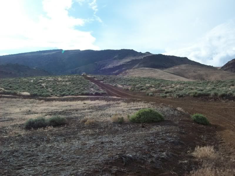
1130 – Note: times are approximate as I didn’t write them down. However, I had told Chris that we would try to reach Lovelock by 1700 (5:00pm). From here to Seven Troughs about half of the trails we will be travelling on I have not covered before so there’s a bit of unknown exploring plus the weather factor. Anyway, we turn of the “sometimes-graded” road onto a real trail just west of Pahsupp Mountain where we will go around its south side and hopefully intersect the trail along Lava Beds Creek that will take us south.
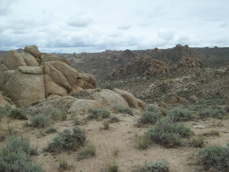
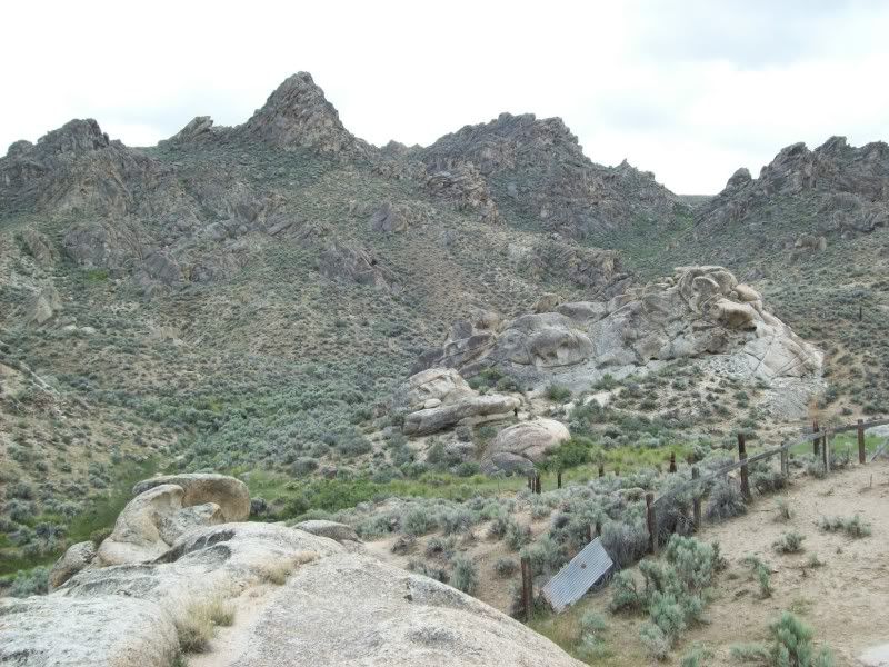
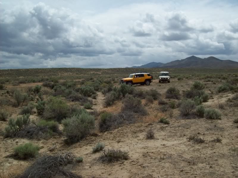
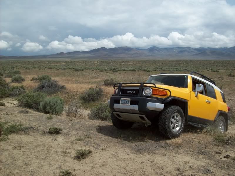
The trail is sandy but mostly firm due to the recent rains (in fact it’s sprinkling now). There is abundant sage brush on both sides but it’s far enough apart that we’re not harming that virgin Toyota yellow paint (yet). I’m advising Tony over the radio when he should be I low range. I’m not yet familiar with what kind of set-up Toyota uses on the FJ, but we will be learning more later on. We stop at some scenic granite cliffs and get a couple poser photos of the FJ. As it turns out I wind up taking a lot of photos of the FJ throughout the day. Hopefully, they got a few of me. As it turned out Tony and Chris seem to be avid shutter-bugs, so I’m expecting hundreds of photos from them.
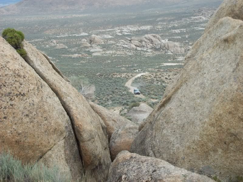
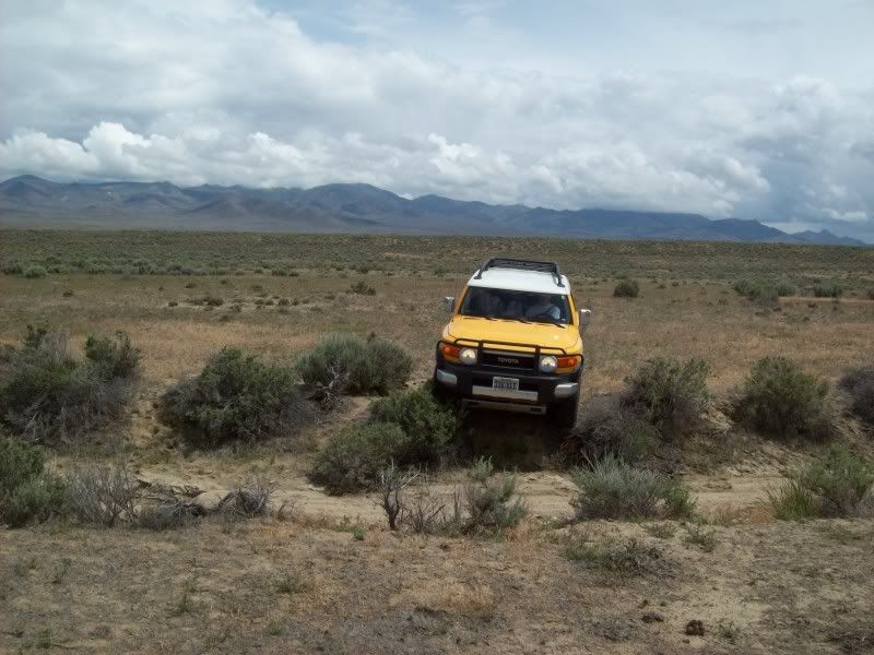
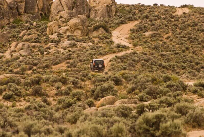
A bit further along we come to a mild squeeze through some granite boulders and a little climb over a mild bedrock boulder. I spot Tony through it while Chris takes “documentary photos”. The Toyota has very steep approach and departure angles so that isn’t a problem but we get a bit of high-center scraping from underneath. It’s the center cross-member/skid-plate set-up that passes under the transmission and transfer box. The advertised ground clearance for the truck is 9.5 inches but that must not count the optional skid-plates. I find that the clearance under the front skid is about 7 inches; under the center skid about 9 inches and the 9.5 inches only occurs under the rear differential.
Eventually, we intersect the Lava Beds Creek Trail and head south; arriving near Lava Beds Camp at a bit after 1200. Tony has had a bit of experience now so I put him to the test. There is a very steep 250 foot climb up sand covered granite with some boulders near the top. I tell him to watch me and after I’m at the top to follow me up with his truck in low range, first gear and the differentials locked (I find out that in low range his center differential is always locked and the “lock” button on the console locks his rear axle. I also warn him that the climb will be puckery but that I guarantee that his truck is capable of it. He does fine!
The three of us spend some time at the top of the ridge taking pictures and then I explain to both Tony and Chris how to get back down the puckery hill. With that, I drive down to the Lava Beds Camp and let them fend for themselves for a bit. I do monitor the radio just in case they have troubles.
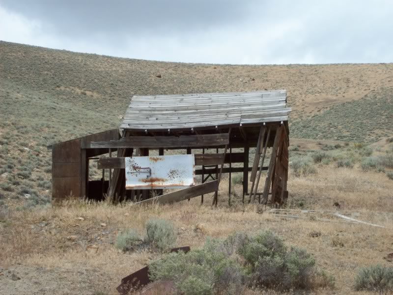
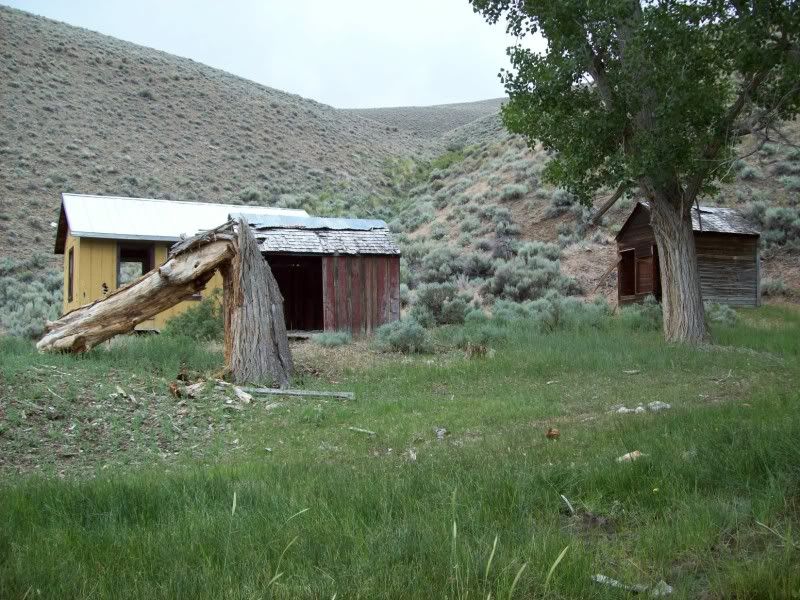
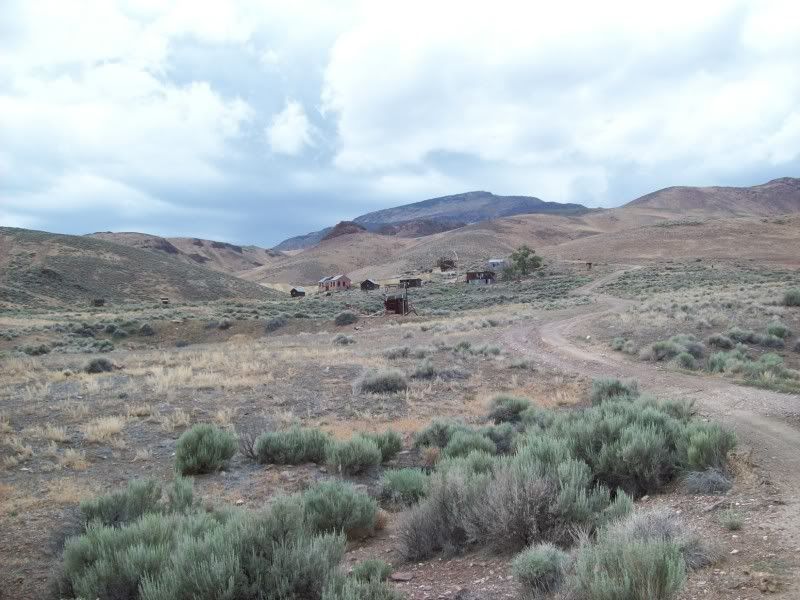
1230 – I arrive at the camp and wander around taking pictures and snacking while waiting for the other two to arrive. The camp is a cattle round-up site with a cabin, a shed, several corrals and cattle loading chutes nestled in a granite surrounded box canyon with a lush (for Nevada) year round spring. After the guys explore the camp a bit we are headed back onto the trail.
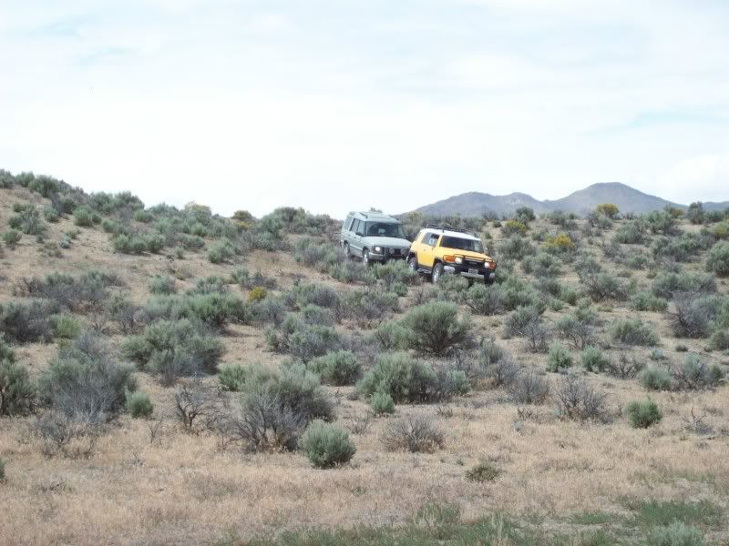
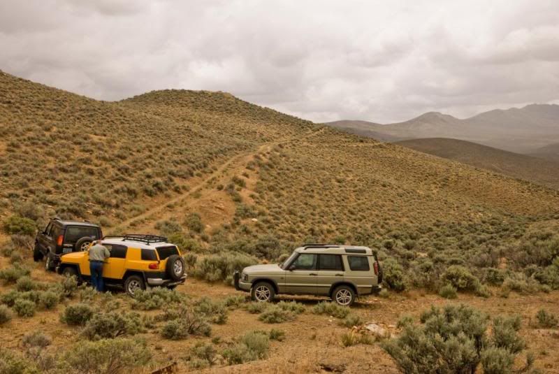
We retrace our route north a bit and then head south-east towards the Garret and Windy Hill Mines. Tony is asking me questions about his four wheel drive system over the radio and I figure it’s about time that I find out more about it. I decide to stop at Windy Hill and read some of his owner’s manual.
I find out that he has two wheel drive most of the time; he can shift into four-wheel high or four wheel low and that any time he is in a four wheel drive mode he has a locked transfer case. When he engages his “lock” button it is actually locking his rear axle. I believe that this should only be used at less than five miles per hour. The truck has a Stability Control System which is sort of like mild traction control that is on all of the time. Then he also has an optional A-TRAC System that appears to be much like the Land Rover 4ETC. When the A-TRAC is engaged it turns off the Stability Control. That makes sense; they are most likely different software mapping programs for the same system. Anyway, I’m pretty impressed with the set-up and the only thing that he doesn’t have is HDC. However, his low range and first gear ratios are so low that he descended the steep hill without having to touch his brakes and the truck never exceeded 3 miles per hour. I did the same descent without brakes or HDC and kept at about 4 miles per hour.
Other than his lack of ground clearance, I like this FJ Cruiser more and more.
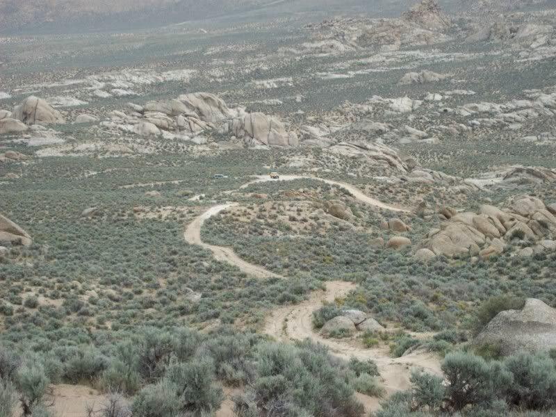
About two miles east of Windy Hill we’ve got a choice to make; we either take a primitive trail to the south-east that I have travelled once before or an even more primitive trail, marked on the map as “4WD” that may or may not go through to Granite Spring Wash. I put it to the troops: You want the sure thing or are you up for a bit of fun? Evidently, Tony’s “paint saving” reserve has been forgotten and the testosterone and over-confidence in his abilities is coming to the surface. We go the hard way!
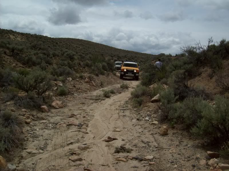
For the first few hundred yards I can actually see a pair of tire tracks wandering through the brush (just barely) then we drop into the bottom of a wash and it’s alternatively rocks, sand, rocks with the brush on the side of the “trail” rubbing the sides of the trucks (No complaints from Tony). After ¾ of a mile we are on an alluvial fan with the creek spreading out into several channels, the brush grown over any sign that there was ever a trail here and the only way I know that we are on or near the trail is by the GPS. Sometimes it says I’m on the trail, sometimes 40 or 50 feet north or south of it.
Now I’m just pushing through three or four foot high sage brush with Tony and then Chris following the path I’m making. The alluvial fan delta has now become a labyrinth of 10 to 30 foot wide gullies anywhere from 5 to 15 feet deep. We cross a bunch of them. I don’t know what the guys are thinking, but they keep following me. In fact it’s now a bit of jabbing between Chris and Tony about which one is going to get stuck and the shame of having to get pulled out by the other. Nobody gets stuck!
We finally reach Granite Spring Creek, cross it and then continue east on a much more well defined trail. After a quarter mile Tony calls for a halt to investigate the scraping noises from under his truck. We crawl around looking for the culprit and I eventually find a branch of brush stuck on top of his transfer case that is rubbing the top of the universal joint that drives his front differential. This was where I got to see what the real grounds clearance was compared to advertised data. There were a lot of other small bits and pieces crammed between the complicated cross-members and brackets that are under the truck but I left them there as they weren’t bothering any moving parts and his exhaust was hot.
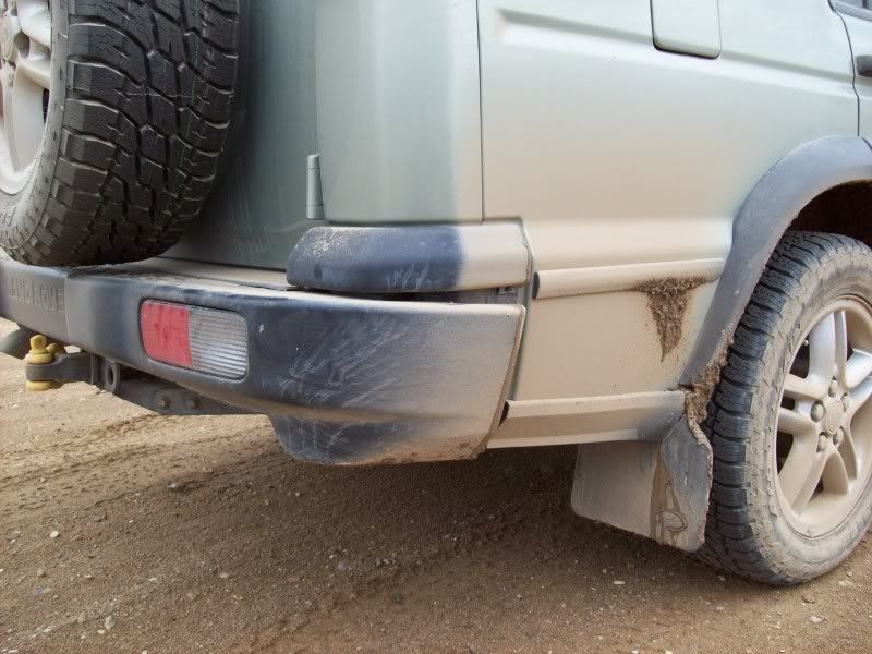
Also while investigating Tony’s problems we take some pictures of the damage to Chris’s rear bumper. The right corner is twisted up a bit, the left lamp assembly is protruding out of its hole and some of the fasteners along the bottom aren’t anymore. Well, I guess he will either need one of those $1000 plus items or build a Douglas fir jewels like mine.
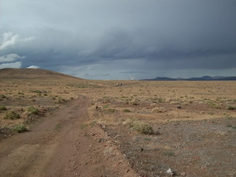
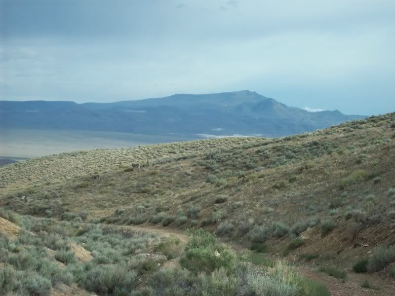
Heading towards the north end of the Seven Troughs Range ahead of us we can see a large black storm on top wetting everything down. We’ll just have to see hat conditions are when we get there.
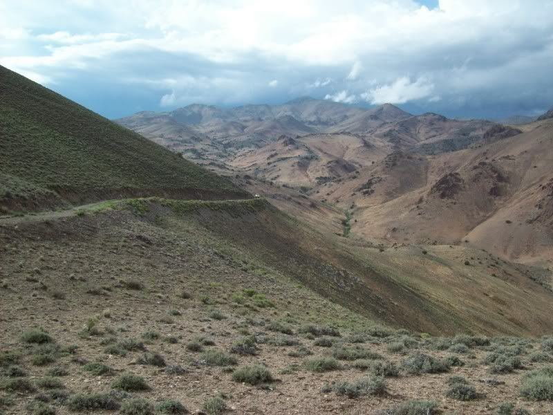
Somewhere between Willow Creek and Juniper Canyon (Wow, two spots on the maps that actually have names!) I find myself going the wrong direction on the wrong trail. We backtrack about a half mile and recover. It has been so long since any USGS maps of the area have been updated that some of the trails are a bit different. Near Corral Spring there is another optional, barely visible “4WD” trail but I decide to not take this one as its approaching 1500 and we still have a lot to see before getting to Lovelock at 1700.
On the graded road that runs between Placeritas and Sage Valley we are able to make pretty good time doing about forty miles per hour along the muddy road. That storm wetted it down pretty well. Finally, we come out of Rocky Canyon and I stop at the turn off to the trail that goes up to the site of Farrell for a little confab.
1545 – If we head straight to Lovelock now, we can get there just before 1700, but we won’t be able to investigate Farrell, Burnt Canyon, Mazuma, Seven Troughs, Signal Peak, Fairview, Portland Mine, Vernon or Tunnel Camp. The guys decide that some more exploring would be better than watching some play-off ball game on TV.
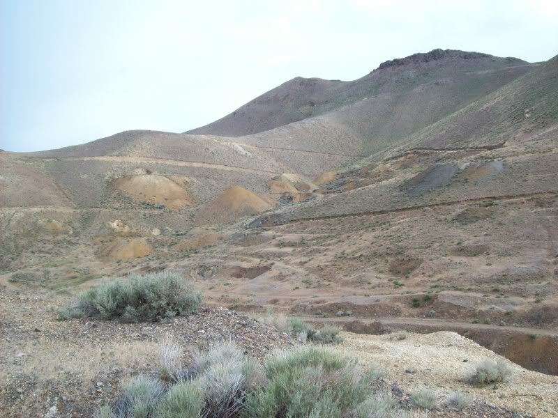
At the foot of the canyon at Farrell there are some 30-ish and 40-ish wrecks of pickup trucks; a Dodge, a Chevy, a Ford and something I can’t identify from the drivers seat. Any sign of the town is completely gone. About a mile up-canyon we pass an old cabin and barn in disrepair and then come to a fork. I take the right fork, jump a few antelope and come to a small scale ore mill. It’s a homebuilt contraption that was powered by an old International Harvester four cylinder diesel engine. Nearby is an upside-down Toyota pickup wreck. Tony and Chris make some humorous photos which I’ll see for the first time after they’re posted.
Running south again, I turn into an un-named canyon that looks as if it might have a trail over a saddle that might intersect the trail running up Burnt Canyon. There is no trail on the map but when I looked the area over on Google it looked as if there was a hint of a trail. We’ll see.
As it turns out, I still don’t know if the trail goes through. We came to a couple of muddy creek crossings that Tony and I experimented with crossing a couple of times. We were successful and I’m even more impressed with the FJ. Chris took pictures. The FJ has very good approach and departure angles, excellent traction, very good articulation, and did not spin any tires at all in the mud. He had everything locked and loaded and it worked very well. I had left my center diff unlocked and I think spun one tire for an instant before the 4ETC kicked in.
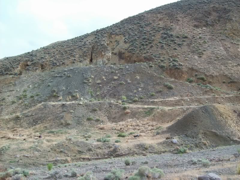
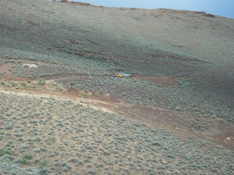
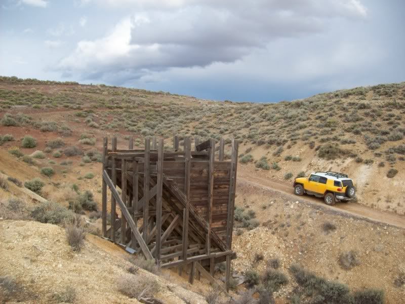
1630 – Into Seven Troughs Canyon, passing the site of Mazuma, stopping for a few pictures at the Seven Troughs Mines and then after checking things out I decide that we can probably get up the shelf road, even though it’s a bit muddy. Off we go! The three of us stay much spread out so that some photos of each other can be taken. I didn’t take many but the shutter-bugs were several minutes getting to the top behind me, so they must have gotten quite a few.
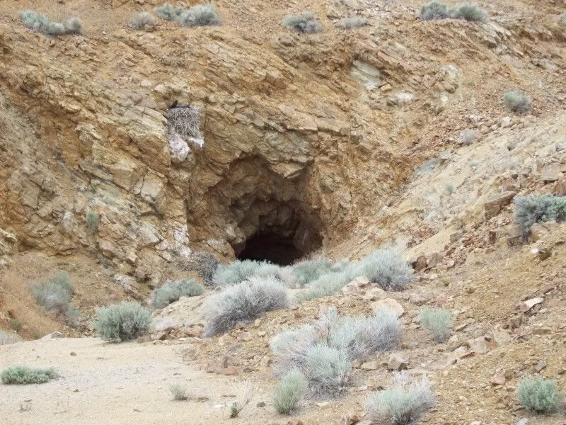
1645 to 1730 – We spend a lot of time going down the south side of the mountain. The trails are very muddy going down. The Toyo tires prove to be excellent in this kind of mud. I reach the mines and ore chute at the Portland Mines about 15 minutes ahead of Tony and Chris so I suspect that some very good photos will be coming from them playing in the mud. Chris’s truck was covered, even the roof!
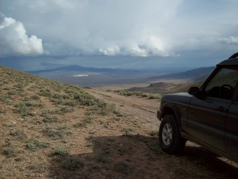
Finally we skirt the south-east corner of the mountain and arrive at Tunnel Camp. I relax and air up my tires while Chris gives Tony the tour of the site including sliding down the tailings piles at the back of the site. We air up the rest of the tires to avoid having to do it in the dark when we reach pavement.
Upon arrival at the paved road at the top of Trinity Pass we discover that we’ve done a bit more than 106 miles since leaving Gerlach. All of us have a bit more than half a tank of fuel left (according to the gages). Since Tony’s tank only holds 16 gallons while ours are almost 24 he wins the fuel economy contest. We got about 10 while he got about 13.
We stay together the rest of the way to Lovelock and then it was every man for himself. I got back to Fernley at about 2100. 13 hours and 259 miles.
The Toyota FJ is an excellent off-roader except for needing a few more inches of ground clearance. Was it the equal of a Discovery? Not quite. Would I trade my Discovery for an FJ? No way. If I had a choice between an FJ and a Land Rover LR3 (Discovery3) which would I take? The Toyota….Just one mans opinion.
LR Trek 153 – 13 June 2009 – Breaking New Trails South of Black Rock
-Or- Training the Toyota FJ and its handler.
0715 – Chris and I meet for breakfast at Chukars Sports Casino at the west end of Fernley. The chatter is Land Rovers, computers, the economy and the weather. We’ve had below normal temperatures and off and on thunderstorms for the past three weeks and it rained most of the night here in town. The forecast is for sixty percent chance of rain and thunderstorms up in the area of Gerlach and the Black Rock. Great; more Toyo Open Country tire testing!
0755 – Tony, Chris’ friend arrives and we head out to the trucks. I wait at the side of the road while Tony and Chris top up on fuel. We will top up again in Gerlach, but as getting fuel up there is sometimes unpredictable and way more expensive, we want to be prepared. In fact I’m carrying two five gallon jerry cans of fresh 92 octane in the back. FWIW: This is two ’04 Land Rover Discovery’s escorting a newbie in an ’07 Toyota FJ Cruiser.
0805 – Underway north through Wadsworth and Nixon and on our way towards Gerlach. It’s sprinkling a bit and the road is wet. We can see a big dark storm ahead so there surely shouldn’t be much dust today! We stop for a photo of the three trucks near needle rock alongside Winnemucca Lake. We have caught up with the storm and it’s raining.
Tony’s truck is a 2007 FJ Cruiser with the optional part time 4 wheel drive system and the off-road package. The package gives him a number of skid plates, the BFG T/A-KO 265/75R-16 tires, a five speed auto, the A-TRAC 4 wheel traction control system and a lockable rear axle. By the way: Tony has never ever done any off-roading; we get to train him, while promising tongue-in-cheek, that we will not get any scratches on the shiny bright yellow paint.
1040 – We arrive in Gerlach and stop at the Shell Station. Yes it’s open, they have premium and it’s about $.75 higher than what we paid in Fernley! Thankfully, we all require less than five gallons. We backtrack about 4 miles and finally turn off onto non-paved road. This is a graded (but only every 2 or 3 years) road that follows along the south side of the Black Rock Playa and the Western Pacific tracks.
For comfort, and later for traction, we drop our tire pressures down to about 24 pounds. The road is wet but firm; there are big puddles here and there, but the potholes are not near as bad as when I was here last about three years ago.
1130 – Note: times are approximate as I didn’t write them down. However, I had told Chris that we would try to reach Lovelock by 1700 (5:00pm). From here to Seven Troughs about half of the trails we will be travelling on I have not covered before so there’s a bit of unknown exploring plus the weather factor. Anyway, we turn of the “sometimes-graded” road onto a real trail just west of Pahsupp Mountain where we will go around its south side and hopefully intersect the trail along Lava Beds Creek that will take us south.
The trail is sandy but mostly firm due to the recent rains (in fact it’s sprinkling now). There is abundant sage brush on both sides but it’s far enough apart that we’re not harming that virgin Toyota yellow paint (yet). I’m advising Tony over the radio when he should be I low range. I’m not yet familiar with what kind of set-up Toyota uses on the FJ, but we will be learning more later on. We stop at some scenic granite cliffs and get a couple poser photos of the FJ. As it turns out I wind up taking a lot of photos of the FJ throughout the day. Hopefully, they got a few of me. As it turned out Tony and Chris seem to be avid shutter-bugs, so I’m expecting hundreds of photos from them.
A bit further along we come to a mild squeeze through some granite boulders and a little climb over a mild bedrock boulder. I spot Tony through it while Chris takes “documentary photos”. The Toyota has very steep approach and departure angles so that isn’t a problem but we get a bit of high-center scraping from underneath. It’s the center cross-member/skid-plate set-up that passes under the transmission and transfer box. The advertised ground clearance for the truck is 9.5 inches but that must not count the optional skid-plates. I find that the clearance under the front skid is about 7 inches; under the center skid about 9 inches and the 9.5 inches only occurs under the rear differential.
Eventually, we intersect the Lava Beds Creek Trail and head south; arriving near Lava Beds Camp at a bit after 1200. Tony has had a bit of experience now so I put him to the test. There is a very steep 250 foot climb up sand covered granite with some boulders near the top. I tell him to watch me and after I’m at the top to follow me up with his truck in low range, first gear and the differentials locked (I find out that in low range his center differential is always locked and the “lock” button on the console locks his rear axle. I also warn him that the climb will be puckery but that I guarantee that his truck is capable of it. He does fine!
The three of us spend some time at the top of the ridge taking pictures and then I explain to both Tony and Chris how to get back down the puckery hill. With that, I drive down to the Lava Beds Camp and let them fend for themselves for a bit. I do monitor the radio just in case they have troubles.
1230 – I arrive at the camp and wander around taking pictures and snacking while waiting for the other two to arrive. The camp is a cattle round-up site with a cabin, a shed, several corrals and cattle loading chutes nestled in a granite surrounded box canyon with a lush (for Nevada) year round spring. After the guys explore the camp a bit we are headed back onto the trail.
We retrace our route north a bit and then head south-east towards the Garret and Windy Hill Mines. Tony is asking me questions about his four wheel drive system over the radio and I figure it’s about time that I find out more about it. I decide to stop at Windy Hill and read some of his owner’s manual.
I find out that he has two wheel drive most of the time; he can shift into four-wheel high or four wheel low and that any time he is in a four wheel drive mode he has a locked transfer case. When he engages his “lock” button it is actually locking his rear axle. I believe that this should only be used at less than five miles per hour. The truck has a Stability Control System which is sort of like mild traction control that is on all of the time. Then he also has an optional A-TRAC System that appears to be much like the Land Rover 4ETC. When the A-TRAC is engaged it turns off the Stability Control. That makes sense; they are most likely different software mapping programs for the same system. Anyway, I’m pretty impressed with the set-up and the only thing that he doesn’t have is HDC. However, his low range and first gear ratios are so low that he descended the steep hill without having to touch his brakes and the truck never exceeded 3 miles per hour. I did the same descent without brakes or HDC and kept at about 4 miles per hour.
Other than his lack of ground clearance, I like this FJ Cruiser more and more.
About two miles east of Windy Hill we’ve got a choice to make; we either take a primitive trail to the south-east that I have travelled once before or an even more primitive trail, marked on the map as “4WD” that may or may not go through to Granite Spring Wash. I put it to the troops: You want the sure thing or are you up for a bit of fun? Evidently, Tony’s “paint saving” reserve has been forgotten and the testosterone and over-confidence in his abilities is coming to the surface. We go the hard way!
For the first few hundred yards I can actually see a pair of tire tracks wandering through the brush (just barely) then we drop into the bottom of a wash and it’s alternatively rocks, sand, rocks with the brush on the side of the “trail” rubbing the sides of the trucks (No complaints from Tony). After ¾ of a mile we are on an alluvial fan with the creek spreading out into several channels, the brush grown over any sign that there was ever a trail here and the only way I know that we are on or near the trail is by the GPS. Sometimes it says I’m on the trail, sometimes 40 or 50 feet north or south of it.
Now I’m just pushing through three or four foot high sage brush with Tony and then Chris following the path I’m making. The alluvial fan delta has now become a labyrinth of 10 to 30 foot wide gullies anywhere from 5 to 15 feet deep. We cross a bunch of them. I don’t know what the guys are thinking, but they keep following me. In fact it’s now a bit of jabbing between Chris and Tony about which one is going to get stuck and the shame of having to get pulled out by the other. Nobody gets stuck!
We finally reach Granite Spring Creek, cross it and then continue east on a much more well defined trail. After a quarter mile Tony calls for a halt to investigate the scraping noises from under his truck. We crawl around looking for the culprit and I eventually find a branch of brush stuck on top of his transfer case that is rubbing the top of the universal joint that drives his front differential. This was where I got to see what the real grounds clearance was compared to advertised data. There were a lot of other small bits and pieces crammed between the complicated cross-members and brackets that are under the truck but I left them there as they weren’t bothering any moving parts and his exhaust was hot.
Also while investigating Tony’s problems we take some pictures of the damage to Chris’s rear bumper. The right corner is twisted up a bit, the left lamp assembly is protruding out of its hole and some of the fasteners along the bottom aren’t anymore. Well, I guess he will either need one of those $1000 plus items or build a Douglas fir jewels like mine.
Heading towards the north end of the Seven Troughs Range ahead of us we can see a large black storm on top wetting everything down. We’ll just have to see hat conditions are when we get there.
Somewhere between Willow Creek and Juniper Canyon (Wow, two spots on the maps that actually have names!) I find myself going the wrong direction on the wrong trail. We backtrack about a half mile and recover. It has been so long since any USGS maps of the area have been updated that some of the trails are a bit different. Near Corral Spring there is another optional, barely visible “4WD” trail but I decide to not take this one as its approaching 1500 and we still have a lot to see before getting to Lovelock at 1700.
On the graded road that runs between Placeritas and Sage Valley we are able to make pretty good time doing about forty miles per hour along the muddy road. That storm wetted it down pretty well. Finally, we come out of Rocky Canyon and I stop at the turn off to the trail that goes up to the site of Farrell for a little confab.
1545 – If we head straight to Lovelock now, we can get there just before 1700, but we won’t be able to investigate Farrell, Burnt Canyon, Mazuma, Seven Troughs, Signal Peak, Fairview, Portland Mine, Vernon or Tunnel Camp. The guys decide that some more exploring would be better than watching some play-off ball game on TV.
At the foot of the canyon at Farrell there are some 30-ish and 40-ish wrecks of pickup trucks; a Dodge, a Chevy, a Ford and something I can’t identify from the drivers seat. Any sign of the town is completely gone. About a mile up-canyon we pass an old cabin and barn in disrepair and then come to a fork. I take the right fork, jump a few antelope and come to a small scale ore mill. It’s a homebuilt contraption that was powered by an old International Harvester four cylinder diesel engine. Nearby is an upside-down Toyota pickup wreck. Tony and Chris make some humorous photos which I’ll see for the first time after they’re posted.
Running south again, I turn into an un-named canyon that looks as if it might have a trail over a saddle that might intersect the trail running up Burnt Canyon. There is no trail on the map but when I looked the area over on Google it looked as if there was a hint of a trail. We’ll see.
As it turns out, I still don’t know if the trail goes through. We came to a couple of muddy creek crossings that Tony and I experimented with crossing a couple of times. We were successful and I’m even more impressed with the FJ. Chris took pictures. The FJ has very good approach and departure angles, excellent traction, very good articulation, and did not spin any tires at all in the mud. He had everything locked and loaded and it worked very well. I had left my center diff unlocked and I think spun one tire for an instant before the 4ETC kicked in.
1630 – Into Seven Troughs Canyon, passing the site of Mazuma, stopping for a few pictures at the Seven Troughs Mines and then after checking things out I decide that we can probably get up the shelf road, even though it’s a bit muddy. Off we go! The three of us stay much spread out so that some photos of each other can be taken. I didn’t take many but the shutter-bugs were several minutes getting to the top behind me, so they must have gotten quite a few.
1645 to 1730 – We spend a lot of time going down the south side of the mountain. The trails are very muddy going down. The Toyo tires prove to be excellent in this kind of mud. I reach the mines and ore chute at the Portland Mines about 15 minutes ahead of Tony and Chris so I suspect that some very good photos will be coming from them playing in the mud. Chris’s truck was covered, even the roof!
Finally we skirt the south-east corner of the mountain and arrive at Tunnel Camp. I relax and air up my tires while Chris gives Tony the tour of the site including sliding down the tailings piles at the back of the site. We air up the rest of the tires to avoid having to do it in the dark when we reach pavement.
Upon arrival at the paved road at the top of Trinity Pass we discover that we’ve done a bit more than 106 miles since leaving Gerlach. All of us have a bit more than half a tank of fuel left (according to the gages). Since Tony’s tank only holds 16 gallons while ours are almost 24 he wins the fuel economy contest. We got about 10 while he got about 13.
We stay together the rest of the way to Lovelock and then it was every man for himself. I got back to Fernley at about 2100. 13 hours and 259 miles.
The Toyota FJ is an excellent off-roader except for needing a few more inches of ground clearance. Was it the equal of a Discovery? Not quite. Would I trade my Discovery for an FJ? No way. If I had a choice between an FJ and a Land Rover LR3 (Discovery3) which would I take? The Toyota….Just one mans opinion.


")