So after reading a multitude of GPS/Mapping setup threads I can say I have learned a great deal from this forum. However, when it finally comes time to put together my setup is still have many questions.
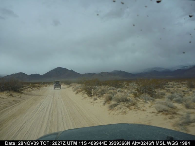
My goal is to have topo or satalite maps to document the offroad trails I am taking on our travels. I would like to be able to tie the video and photos that I take to the waypoints on the trail through time stamps or other means. This way when I send the files to family or friends they can see where exactly during our travels the images were taken.
I am not opposed to having a mount and computer in the FJ for the travels, but if I do go this route I probably would also get a back up handheld GPS. This would be a safety measure in case the laptop failed for whatever reason and also would enable us to travel away from the FJ and camp on hikes. I already have an old magellen unit for on-road use which is sufficient for my needs.
I'd appreciate it if you could help me in coming up with a system that meets my above requirements. I'd rather purchase the appropriate equipment once and have it last 3-5 years than have to buy redudant items because one of my purchases did not suit my needs.
Here is what I initially had come up with...
Fujitsu T4310 Convertible PC - Multi-Touch
http://store.shopfujitsu.com/fpc/Ecommerce/buildseriesbean.do?series=T4310&var=e
or
Fujitsu T4410 Convertible PC - w Multi-Touch
http://store.shopfujitsu.com/fpc/Ecommerce/buildseriesbean.do?series=T4410
]
^I'm not sure if a slightly smaller laptop or netbook would be better. This will be the first time I've used a computer in my vehicle for mapping, so I appreciate your thoughts.
Tied to
GPS Puck
http://www.semsons.com/glbuusbgpsre.html
And running either Overland Navigator or Delrome Topo USA 8.0 (I would need to verify that both of these are compatible with Windows 7)
I would then probably go with a handheld unit like the PN-40
Thanks in advance for the response and feedback.