Feedback on Mapping/GPS setup for Expedition Travel

soonenough

Explorer
yes it uses low resolution topo data. You get $100 worth of free downloads including downloading the hi-res topo data...

I think you may be confused about this... the TOPO software is vector-based data for the entire US, includes land cover, contours, routable roads, hydro, POI, etc... It's not low res.
The $100 download certificate (or $40 certificate, or the annual Map Library subscription for $29.95) gets you supplemental data, like color imagery, black and white imagery, scanned USGS TOPO quads, or NOAA charts... There is no "hi res" topo data.
Yes, he is incorrect about that part. There is no "high res topo data" created by DeLorme. There is only one version/resolution of DeLorme's topo map, and it's the one that's included with their Topo USA software. You can download the following additional types of maps & images from DeLorme's map library (look here for more info), which can then be used in leiu of (or layered over) their included base map:

USGS 1:24,000 scanned topographic maps (this may be what he's calling "high res topo data"?)
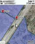
Color Aerial Imagery
Black & White Aerial Imagery
Color Satellite Imagery
NOAA Nautical Charts
1:50,000 Canadian topographic maps (recently added)
 
Last edited:

fishbum

Observer
Thank you, that has to be what he means.
The other advantage to the vector data is try zooming in further with the USGS 1:24K maps and you get bigger pixels.
Here is a PN-40 screenshot of a place I'll be flagging trails tomorrow, with a GIS parcel layer overlaid on the imagery so we keep it legal!
 

Attachments

  • screencap-2009-10-16--10-10-10smudge.jpg
    screencap-2009-10-16--10-10-10smudge.jpg
    13 KB · Views: 16

FJLED

Adventurer
Thanks everyone for all the feedback. I pulled the trigger today on a Fujitsu T4410 Convertible PC (multi touch w/ 128GB SSD). It was more than I had planed on spending, but it gives me flexibility to use it for gps/mapping and also be my primary laptop for when I start my MBA next semester. Gf dropped my xps m1330 a while ago, so it will be handed over to her and she can enjoy the cracked screen lol.

I'll probably go with a gps puck for the time being until I'm 100% sold on what software I want to go with. If it turns out to be Topo USA 8.0 then I'll pick up a PN-40

I know Delrome is compatible with Windows 7 based on the reviews I have seen, but I'm not sure about overland navigator? It definitely appears to have a more friendly touchscreen interface, but doesn't list compatibility with Windows 7.
 

Forum statistics

Threads
189,533
Messages
2,917,979
Members
232,442
Latest member
rumpityz28
Top