Question for GIS people

nvprospector

Adventurer
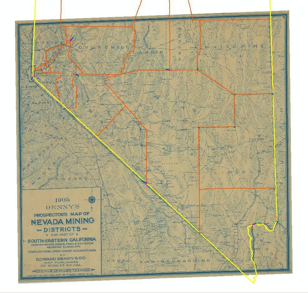
I have a map that I am importing into Oziexplorer and I am having a few issues with the Datum Shift. The map was published in 1905 and it does not have a Map Projection. I do have a Lat/Long grid and a distance scale on the map. Because of the year of the map, I don't have any clear reference on which datum was used. So I am trying to calculate a Datum Shift to WGS84.

So far I have tried the Bursa-Wolfe using all 7 parmeters and just tried this evening Molondensky with 7 parmeters. I have been thinking about trying the Inverse Molodensky, if I can find better documentation, but I don't like being limited to a max of 3 reference points.

With what I have tried thus far I have been able to get my points on the map within a 1/2 inch north of the map point, so I am close. East-West is right on. I was wondering if any GIS people have any ideas on what to try next?

-Tim-
 

craig

Supporting Sponsor, Overland Certified OC0018
When you do the registration, ignore the lat/lon lines completely. Find another map with a known projection of the same area. Find features on both maps and use the coordinates/projection off of the second map.

Craig
 

nvprospector

Adventurer
When you do the registration, ignore the lat/lon lines completely. Find another map with a known projection of the same area. Find features on both maps and use the coordinates/projection off of the second map.

Craig

Thank you for the reply. The issue with using another map is this map nearly takes up the whole state of Nevada. This brings to light the issue when this map was created geodesy still was only able to determine the datum for a relatively small area for the local origin on the surface. Maps that have projections on the collars for the same year have different aspects depending on which area of the state they where created, and who the surveyor was. Another issue I have encountered with this map is you can tell there is distortion of area between the globe and the map. So the a and b orientations are a little off. I have been able to correct this by adjusting the angular deformation. This is why I was able to pretty much get the map into Ozi. Now if the darn track points will lay correctly across the whole map instead of some areas being way off the mark.

Maybe it is time to sit down and read the book I have for North American Datum’s and formulas that where used before NAD27 was introduced.

-Tim
 

nvprospector

Adventurer
Should of read my emails first. A member of OGC is going to take a look at the map. I loaded it into GRASS GIS and it was sent to him with a pretty pink bow. He said from my description it sounds like the map is using multiple projections and I might have to split the map into three parts in order to create a datum that will work.

-Tim
 

craig

Supporting Sponsor, Overland Certified OC0018
Thank you for the reply. The issue with using another map is this map nearly takes up the whole state of Nevada. This brings to light the issue when this map was created geodesy still was only able to determine the datum for a relatively small area for the local origin on the surface. Maps that have projections on the collars for the same year have different aspects depending on which area of the state they where created, and who the surveyor was. Another issue I have encountered with this map is you can tell there is distortion of area between the globe and the map. So the a and b orientations are a little off. I have been able to correct this by adjusting the angular deformation. This is why I was able to pretty much get the map into Ozi. Now if the darn track points will lay correctly across the whole map instead of some areas being way off the mark.

Maybe it is time to sit down and read the book I have for North American Datum’s and formulas that where used before NAD27 was introduced.

-Tim

Glad to hear you are getting it worked out. Your problem is much more complex than what was described in your initial question.
 

nvprospector

Adventurer
Your right, I did not explan it to well. Re-reading the question it almost sounds like I could not import the map as opposed to creating a custom datum to use with the map.

Playing with the map I can see what the GIS pro was saying, I can see the distortion in the map at a few levels. I really want this map in Ozi. It shows all the stage, wagon and freight routes as of 1905 with in the state of Nevada and Eastern California. This map will really help with my research.

Again, thank you for your reply.

-Tim
 

DaveM

Explorer
It sounds like you are trying to do a datum shift on import rather than registering the image itself which, I believe, requires the original to have used a set datum (listed or not). Are you sure your map was created with a datum at all or is it possibly a "map graphic" using a fictional flat model of the earth? A lot of older maps (and even some modern road maps) don't use a datum or projection but simply scale out from one point and manipulate the coverage to match.

If that's the case a datum shift may never work to properly fit your map, you will have to rubber sheet it. Prominent marked points on the map and the lat long line intersections should give you a good number of registration points to use.

What format is your map image in? Can you post an image of the map here?
 

DaveM

Explorer
He said from my description it sounds like the map is using multiple projections and I might have to split the map into three parts in order to create a datum that will work.

-Tim

This sounds like what I am talking about in terms of a "map graphic" or fictional projection model. I'd think that the easiest way forward here is the rubber sheeting method as opposed to trying to actually determine the datums that may have been in the original source material used to create your map.
 

DaveM

Explorer
Click here to download the map in tiff format.

sheet 54 x 59 cm; Scale: [ca: 1:950, 400]
(W120°00-W114°00/N40°00--N36°00)

Rubber sheeting would work. I already used 9 calibration points for the map. I know that you can add many more if you edit the map file directly. I will have to give that a try.

Thanks

Cool map. Any chance you have a .tfw (tiff world file) to go with this image? I'd like to load this into a GIS base of Nevada and see what it looks like, how it sits under modern data.
 

nvprospector

Adventurer
This map is from my personal collection and I had it scanned at a place that has a deck scanner large enough for maps. So there is no tfw for the file. The only other place that has this map is the Univeristy of Reno and no one has georef the map yet.

If this map peaks your interests, I also have one that I just got back from the scanning company today that shows all of the military roads listing all minor camps, water points, large camps and forts for Nevada and California that is dated 1873. It also lists places that a unit can fortify if the need arises. What is nice about this new map is it was done by a military surveyor so the datum shift was easy to calculate. Plus, this is not the first map I have worked with from this surveyor so I already have the datum shift programed into Oziexplorer.
 

winkosmosis

Explorer
I just downloaded the file. I really don't think datums have any relevance here-- it's just a map, not a high precision plat. For example you can tell by looking at it that the roads were hand drawn. You just need to georeference it with a some good points and find a polynomial warp that makes it match the current features. You'll never get it more precise than the scale and the original mapping precision allows.

I'd georeference it for you but I don't have any Nevada data. I'll see if I can find some tomorrow. Can Ozi read projection files or does the whole thing have to be resampled to a geotiff?
 
Last edited:

craig

Supporting Sponsor, Overland Certified OC0018
This sounds like what I am talking about in terms of a "map graphic" or fictional projection model. I'd think that the easiest way forward here is the rubber sheeting method as opposed to trying to actually determine the datums that may have been in the original source material used to create your map.

That's what I was suggesting too, with one caveat.

The datum will become a problem if the lat/lon lines on the original map are used because those lines are tied to a datum. If map features other than the lat/lon grid are located on the original map are identified on a second map where the datum is known, he can rubber sheet to the datum/projection of the known map.

Craig
 
Last edited:

DaveM

Explorer
That's what I was suggesting too, with one caveat.

The datum will become a problem if the lat/lon lines on the original map are used because those lines are tied to a datum. If map features other than the lat/lon grid are located on the original map are identified on a second map where the datum is known, he can rubber sheet to the datum/projection of the known map.

Craig

Yeah, I like your method. I was just separating out the registration operation into it's simplest form, no need for a referenced 2nd map. Simply find co-ordinates on the map with known points and use a GIS package to rubber sheet them into correct alignment with each other. In looking at his map (the scale, extent and precision) I don't see that much more would be gained by going beyond a simple rubber sheeting.
 

winkosmosis

Explorer
How's this? I georeferenced with county and state boundaries. As you can see, the points don't really match up. I've georeferenced a lot of old maps and that's just the way it goes. I didn't do 2nd or 3rd degree polynomial transformations (what craig and DaveM call rubber sheeting I think) because there was too much distortion.

I can send you the JPG with the georeferencing file, assuming Ozi can use that data

nevadageoref.jpg
 
Last edited:

Forum statistics

Threads
189,789
Messages
2,920,882
Members
232,931
Latest member
Northandfree
Top